Olana Historic Site

Download a High Resolution JPEG Image of the Olana Historic Site or an Adobe Acrobat Printable PDF of the Olana Historic Site.
About Map: Olana Historic Site ....
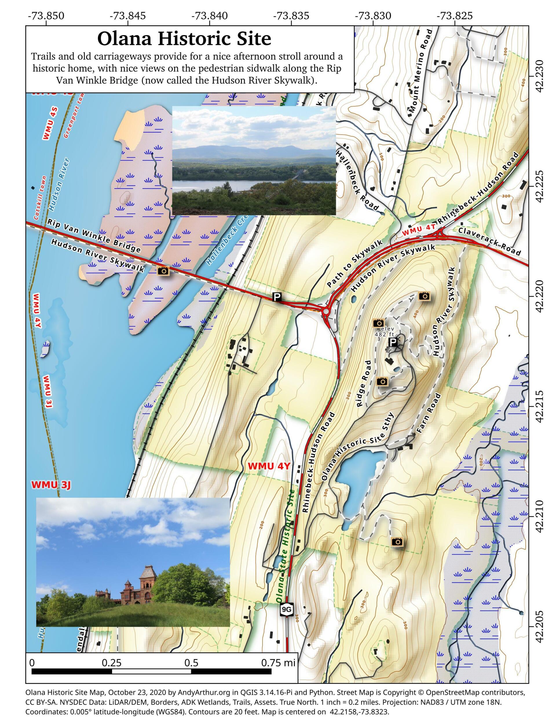
Olana State Historic Site was the home of Frederic Edwin Church (1826–1900), one of the major figures in the Hudson River School of landscape painting. The centerpiece of Olana is an eclectic villa composed of many styles, difficult to categorize, which overlooks parkland and a working farm designed by the artist. As well, the residence has a wide view of the Hudson River valley, the Catskill Mountains and the Taconic Range. Church and his wife Isabel (1836–1899) named their estate after a fortress-treasure house in ancient Greater Persia (modern-day Armenia), which also overlooked a river valley.


Bookmark my free Interactive GPS Map for your phone:
https://andyarthur.org/ny
... shows your location as a blue dot in relationship to campsites, trails, state land. This online map requires cell service, won't work in remote country, so also bring a paper map.
Free Download of New & Historical USGS 1:24k Topograpic Maps
Interactive maps with backcountry and roadside camping: New York, Pennsylvania, West Virginia & Vermont. List of NYS DEC Lean-Tos and Firetowers.
Google Spreadsheet with Roadside, Primitive and Pay Campsites
More about Olana...
Olana State Historic Site was the home of Frederic Edwin Church (1826–1900), one of the major figures in the Hudson River School of landscape painting. The centerpiece of Olana is an eclectic villa composed of many styles, difficult to categorize, which overlooks parkland and a working farm designed by the artist. As well, the residence has a wide view of the Hudson River valley, the Catskill Mountains and the Taconic Range. Church and his wife Isabel (1836–1899) named their estate after a fortress-treasure house in ancient Greater Persia (modern-day Armenia), which also overlooked a river valley.
Download the PDF Map Pack with All Maps from Olana.


