June 23, 2020 Morning
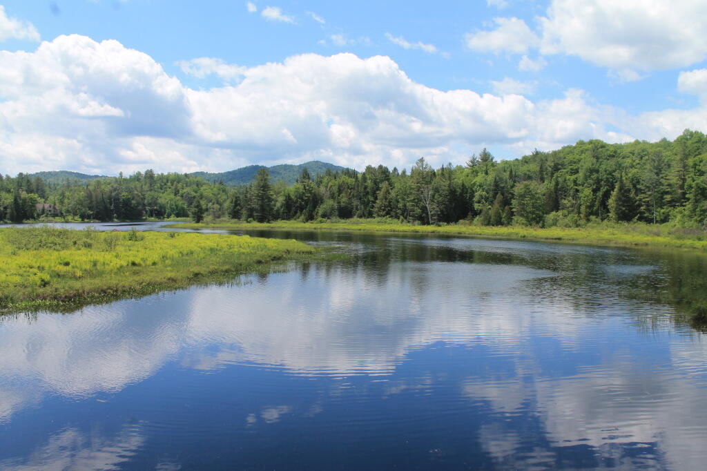
Good morning! Happy Primary Day 🗳️! I hope you had a chance to vote or better yet voted by absentee. Partly sunny and 71 degrees at the Horseshoe Lake. There is a south breeze at 5 mph. 🍃. The dew point is 64 degrees. Going to be another hot day. Maybe stormy later.
Woke up early because lately I’ve been getting up early ☺ as lately its been the nicest part of the day and the sun rises so early.
Going for a short kayak ride this morning 🚣 then down to work. 📝 Going to be a busy day at work as today is primary day but it will get done.
Today will have showers and thunderstorms likely, mainly between 2pm and 3pm. Some of the storms could produce small hail, gusty winds, and heavy rain. Partly sunny 🌧, with a high of 85 degrees at 2pm. Five degrees above normal. Maximum dew point of 67 at 9am. South wind 5 to 11 mph, with gusts as high as 21 mph. Chance of precipitation is 60%. New rainfall amounts of less than a tenth of an inch, except higher amounts possible in thunderstorms. A year ago, we had mostly sunny skies. The high last year was 84 degrees. The record high of 96 was set in 1888.
Solar noon 🌞 is at 1:01 pm with sun having an altitude of 69.2° from the due south horizon (-0° vs. 6/21). A six foot person will cast a 2.3 foot shadow today compared to 2.2 feet on the first day of summer. The golden hour 🏅 starts at 8:02 pm with the sun in the west-northwest (297°). 📸 The sunset is in the borthwest (305°) with the sun dropping below the horizon at 8:46 pm after setting for 3 minutes and 36 seconds with dusk around 9:22 pm, which is 8 seconds later than yesterday. 🌇 At dusk you’ll see the Waxing Crescent 🌒 Moon in the west-northwest (286°) at an altitude of 16° from the horizon, 233,720 miles away. 🚀 The best time to look at the stars is after 10:11 pm. At sunset, look for rain 🌧 and thunderstorms 🌩 and temperatures around 74 degrees. The dew point will be 64 degrees. There will be a south breeze at 7 mph. Today will have 15 hours and 30 minutes of daytime, a decrease of 10 seconds over yesterday.
Tonight will have a chance of showers and thunderstorms before 1am, then showers likely and possibly a thunderstorm between 1am and 5am, then a chance of showers and thunderstorms after 5am. Some of the storms could produce small hail, gusty winds, and heavy rain. Increasing clouds 🌧, with a low of 65 degrees at 6am. Six degrees above normal. Maximum dew point of 65 at 11pm. South wind around 8 mph. Chance of precipitation is 70%. New rainfall amounts between a quarter and half of an inch possible. In 2019, we had mostly clear skies in the evening, which became partly cloudy by the early hours of the morning. It got down to 56 degrees. The record low of 44 occurred back in 1932.
Cloudy and rainy this weekend although Sunday will be better. 😞 Saturday, showers likely, mainly after 2pm. Mostly cloudy, with a high near 77. Southeast wind 5 to 9 mph. Chance of precipitation is 70%. Maximum dew point of 59 at 4pm. Sunday, a 40 percent chance of showers. Partly sunny, with a high near 78. Calm wind becoming northwest 5 to 9 mph in the afternoon. Maximum dew point of 61 at 8am. Typical average high for the weekend is 81 degrees.
Looking ahead, there is a contrast. 19 weeks until Election Day 2020 🗳️ when the sun will be setting at 4:44 pm with dusk at 5:14 pm (Standard Time). On that day in 2019, we had partly sunny skies, rain showers and temperatures between 53 and 30 degrees. Typically, the high temperature is 53 degrees. We hit a record high of 75 back in 1990.