Overlook Mountain Trail
Download a High Resolution JPEG Image of the Overlook Mountain Trail or an Adobe Acrobat Printable PDF of the Overlook Mountain Trail.


Bookmark my free Interactive GPS Map for your phone:
https://andyarthur.org/ny
... shows your location as a blue dot in relationship to campsites, trails, state land. This online map requires cell service, won't work in remote country, so also bring a paper map.
Free Download of New & Historical USGS 1:24k Topograpic Maps
Interactive maps with backcountry and roadside camping: New York, Pennsylvania, West Virginia & Vermont. List of NYS DEC Lean-Tos and Firetowers.
Google Spreadsheet with Roadside, Primitive and Pay Campsites
More about Overlook Mountain...
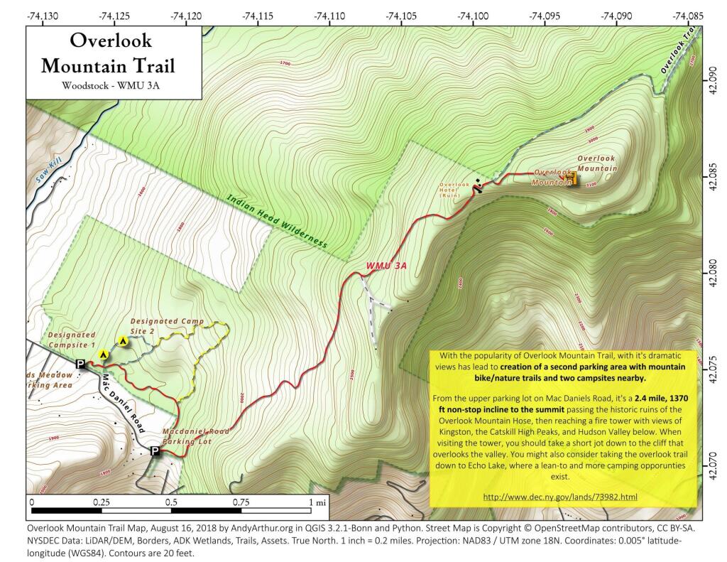
Overlook Mountain is the southernmost peak of the Catskill Escarpment in the central Catskill Mountains near Woodstock, New York. Centerpiece of the 590-acre (239 ha) Overlook Mountain Wild Forest area of Catskill Park, the mountain is the site of one of the remaining five Catskill Mountain fire towers and the Overlook Mountain House, a hotel which was built at a higher elevation than any other in the range.
http://en.wikipedia.org/wiki/Overlook_Mountain
Download the PDF Map Pack with All Maps from Overlook Mountain.


