Skip to the content
Andy Arthur.org
Super Duty dreams and off-grid schemes.
Skip to Content
Site Navigation ▼
Search for:
NYS Campsites
NYS Lean-Tos
NYS Firetowers
Places to Camp, Hunt, Hike
Find Property Owners, School Districts
The Off-Grid Future
Planning a Trip to Upper Peninsula Michigan
The F-350 SuperDuty
Remembering Big Red
Living Healthy in My Forties
Silly Business of Politics
Climate Change & Greenies
Computers, Programming and Open Source Software
Neat Things You Can do With Public Data
Privacy Policy
Why Ads?
Moose River Plains
Piseco-Powley
Finger Lakes NF
Burnt-Rossman Hills
Charles Baker SF
East Branch Sacandaga
Pine Hollow Arboretum
Normanskill West Preserve
Five Rivers Environmental Education Center
Bennett Hill Preserve
Empire State Plaza
Politics
Changes
Albany County Rail Trail
Bender Mellon Preserve
Black Creek Marsh Wildlife Management Area
Hollyhock Hollow Sanctuary
Keleher Preserve
Weather
Elm Avenue Town Park
Albany County Cooperative Extension Gardens
New Scotland
Bozenkill Preserve
Day:
May 9, 2026
💾
🖼️
Photos
Bovina Mountain
Andy
|
May 9, 2026
Palantir Technologies Explained Like You’re 5
Andy
|
May 9, 2026
Rudd Pond
Andy
|
May 9, 2026
Monument Mountain Reservation
Andy
|
May 9, 2026
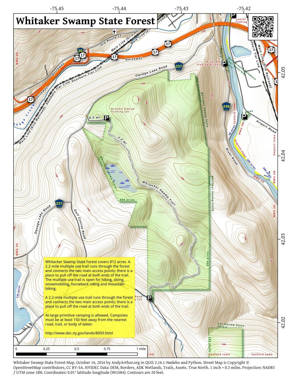
Whitaker Swamp State Forest
Andy
|
May 9, 2026
Posts navigation
←
older
newer
→