Rockwood State Forest
Download a High Resolution JPEG Image of the Rockwood State Forest or an Adobe Acrobat Printable PDF of the Rockwood State Forest.

Bookmark my free Interactive GPS Map for your phone:
https://andyarthur.org/ny
... shows your location as a blue dot in relationship to campsites, trails, state land. This online map requires cell service, won't work in remote country, so also bring a paper map.
Free Download of New & Historical USGS 1:24k Topograpic Maps
Interactive maps with backcountry and roadside camping: New York, Pennsylvania, West Virginia & Vermont. List of NYS DEC Lean-Tos and Firetowers.
Google Spreadsheet with Roadside, Primitive and Pay Campsites
More about Rockwood State Forest...
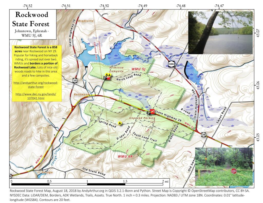
Rockwood State Forest is 867 acres of Fulton County Upland, located between the triangle that is NY 29, NY 10A, and NY 10. There are dozen miles of horse and ski trail, that wander through upland woods. It's most notable feature is Rockwood Lake.


No Comments
thank you mr. arther your maps and narratives have been quite helpful in my exploring trips