Day: January 1, 2023πŸ’Ύ

πŸ—ΊοΈ Maps πŸ–ΌοΈ Photos πŸ“½οΈ Videos

Bender Mellon

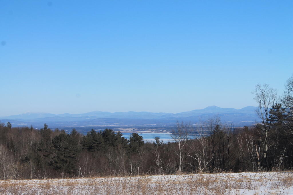
Been out exploring the Bender Mellon Preserve on this first day of 2023🚢 🍈 πŸ—»

Trails are kind of wet and the sun is rapidly setting but it’s going to be great once the ground freezes and I can bring some skis. I’m a bit disappointed by the views from the preserve but it’s kind of a muddy and gray day, and the area with the best views is off limits right now due to the abandoned buildings. Not that it’s likely to stop anyone, doubt there’s many game cops out here patrolling. But much too muddy.

It’s a bit noisy from NY 85 and 85A but that’s to be predicted for a suburban preserve. It’s currently a mixed habitat, with only the upper acres brush hogged so it’s full of wildlife like deer, geese and squirrels. Come the right season and I’m sure it would be packed with birds. I’m just glad it’s within a short – two or three mile walk from home, especially in these inflationary times when motor vehicle travel is so expensive.

I’m glad it’s preserved as I need more nature near where I live to explore, as I get tired of Five Rivers Environmental Education Center and this place in the winter on the rail trail is very skiable from home.

Map: St. Regis River Reservior

Bombay – Brasher State Forests

North of the Adirondack Park lays a mixture of farm country and sand plains. Some of the land is fertile and used for dairying and other crop growing, but much of it is pretty shallow and easily damaged by the destructive practices of the iron industry, which burned much of the forests at one point for making iron.

Nowadays much of this land is part of State Forest system set into place when Franklin Roosevelt was Governor of New York, Brasher State Forest (St. Lawrence County; lands to the east) and Bombay State Forest (Franklin County; lands to east). Switch to the OpenStreetMap or USGS Topo DRG layers for more information about the forest or browse the blog in category below for more maps.

It is crossed by two major rivers - the Saint Regis River and Deer River. Camping is a popular activity at Walter Pratt Camping Area, a free-campground on Redwater Pond.

http://history.rays-place.com/ny/brasher-ny.htm

I had a North Country colleague from years ago. They said it was pronounced "bra-ah-shere" or something like that. Not brash-er, as I would call it.

Map: Severence Hill Trail