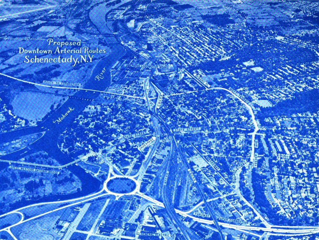
Proposed Aerterials in Schenectady, 1947
The yet to be built Interstate 890 took a similar route, but ended up in a large traffic circle at Erie Boulevard in the 1947 Proposed Downtown Arterial Routes study. The Route 50 Connection also was never built, with most traffic continuing to use the Great Western Gateway Bridge or Freeman's Bridge.