
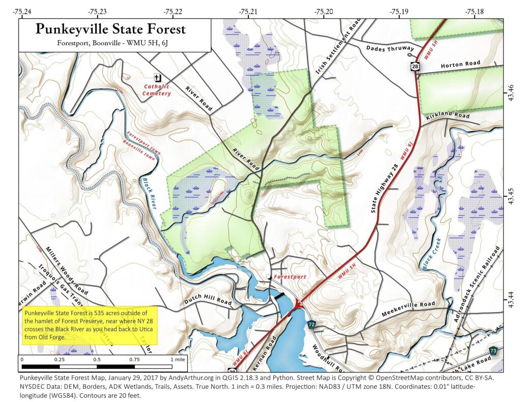
Map: Punkeyville State Forest 📍

The 518-acre Punkeyville State Forest was purchased in 2012, making it the newest state forest in the region. It received its name through a contest in which students from Forestport Elementary School submitted potential names. Punkeyville was an early name for the area that is now Forestport. This was also the site of a commercial trout farm years ago. Some of the rearing ponds and raceways are still evident. There are no developed facilities except for the roads that cross these lands.

http://www.dec.ny.gov/lands/107771.html

🗺️ Maps
Map: Town of the Tug Hill Region of New York State

Forestport 1897

Even by the late 1800s, they were calling Forestport by that name. Still old topographic maps are fun to study!

Map: Battery Diagram