![Untitled [Expires March 14 2025]](https://andyarthur.org//data/photo_017471_large.jpg)
Public Lands Policy 📍
📽️ Videos

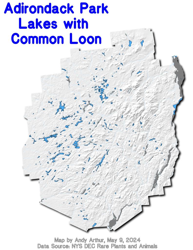

Northville To West Stoney Creek – NPT
The first wilderness part of the Northville Placid Trail is remarkably steep for this part of Adirondacks, climbing 700 feet over a ridge on the first mile, then dropping down 100 feet to Mud Lake over a half mile, then over the next four miles you lose about 550 feet elevation until you reach West Stoney Creek and the lean-to.
http://andyarthur.org/shaker-mountain
https://www.dec.ny.gov/lands/100874.html

You know, I do think a carrying capacity study would be worthwhile for the Adirondacks, especially in context of new UMPs
You know, I do think a carrying capacity study would be worthwhile for the Adirondacks, especially in context of new UMPs. I think it’s worthwhile to consider inducted when adding new facilities and expanding or improving existing ones. Often I see that as a topic that is glanced over with UMP documents.
That said, truth be told I don’t follow them as carefully as I once did because it’s not my issue, and I’m less invested in New York State then I once was with other places to go and no long term plans to stay forever. There are other wild lands in other parts of country.
Sheely Mountain