Adirondack Forest Preserve
Here is an updated interactive KMZ (Google) Map of the Adirondack Forest Preserve, with updates through November 2019, the last time the NYS DEC released this data.
Here is an updated interactive KMZ (Google) Map of the Adirondack Forest Preserve, with updates through November 2019, the last time the NYS DEC released this data.

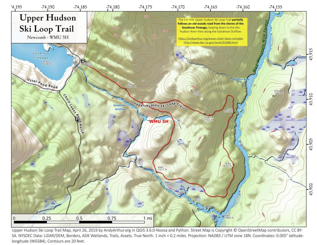
The Upper Hudson Ski Loop trail is 4.2 miles and parallels the Goodnow River (north-side) to the Hudson River. The trail heads north along the Hudson for a short distance before looping back and reconnecting with itself 0.5 mile from the trailhead

![Untitled [Expires June 26 2024]](https://andyarthur.org//data/photo_007271_large.jpg)