
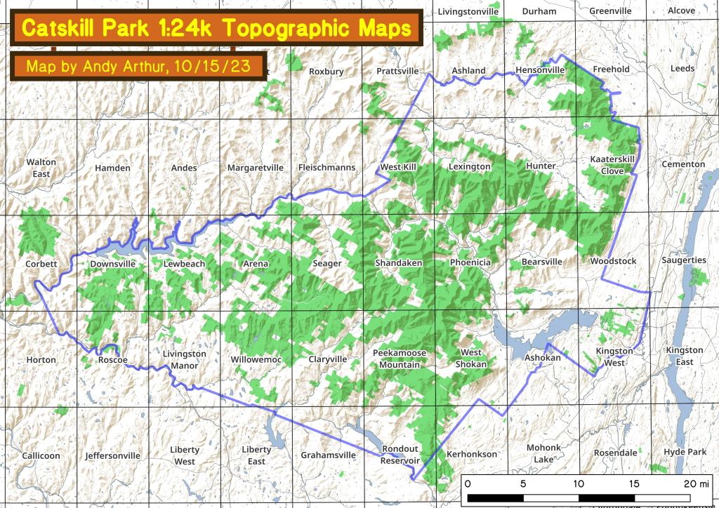
Catskill Park 1:24k USGS Topographic Map Index
This index map shows all of the USGS Topographic Maps that cover the Catskill Park.
You can get these topographic maps for free here.

Lanesville, NY
Lanesville is a quiet, picturesque hamlet in the Town of Hunter, nestled within the Greene County portion of New York’s Catskill Mountains. Located along the scenic Mountain Cloves Scenic Byway, it sits between the popular destinations of Phoenicia and Hunter, offering a secluded retreat characterized by its "back-to-nature" atmosphere. The area is defined by its rugged, mountainous terrain, including the majestic Devil’s Path Range and the narrow Stony Clove Notch.
Historically a 19th-century logging and tanning center, Lanesville has evolved into a destination for farm-to-table dining, local craft breweries like West Kill Brewing, and rustic vacation rentals. It remains a "hidden gem" for those seeking the wild, "forever wild" charm of the Catskill Forest Preserve.

Walton 1948
Before the Pepacon and Walton reserviors in the Western Catskill Mountains.