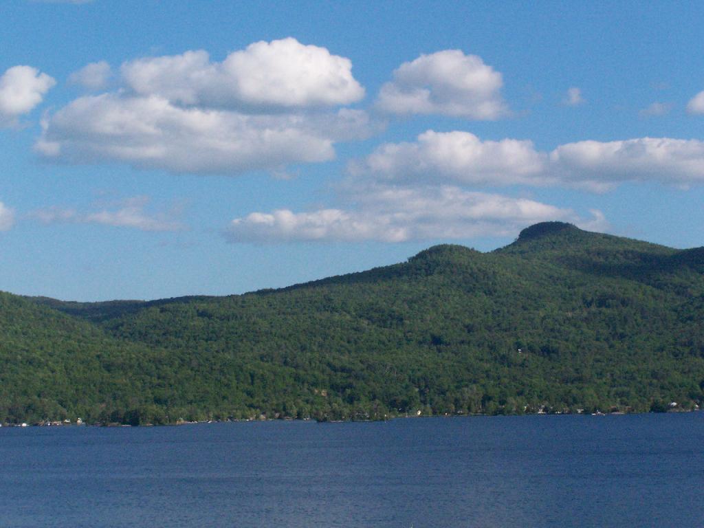
Spruce and Hogback Mountains
Taken off Route 9N as entering Sabbath Day Point near Deer Jump.
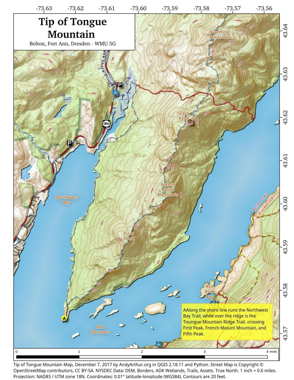
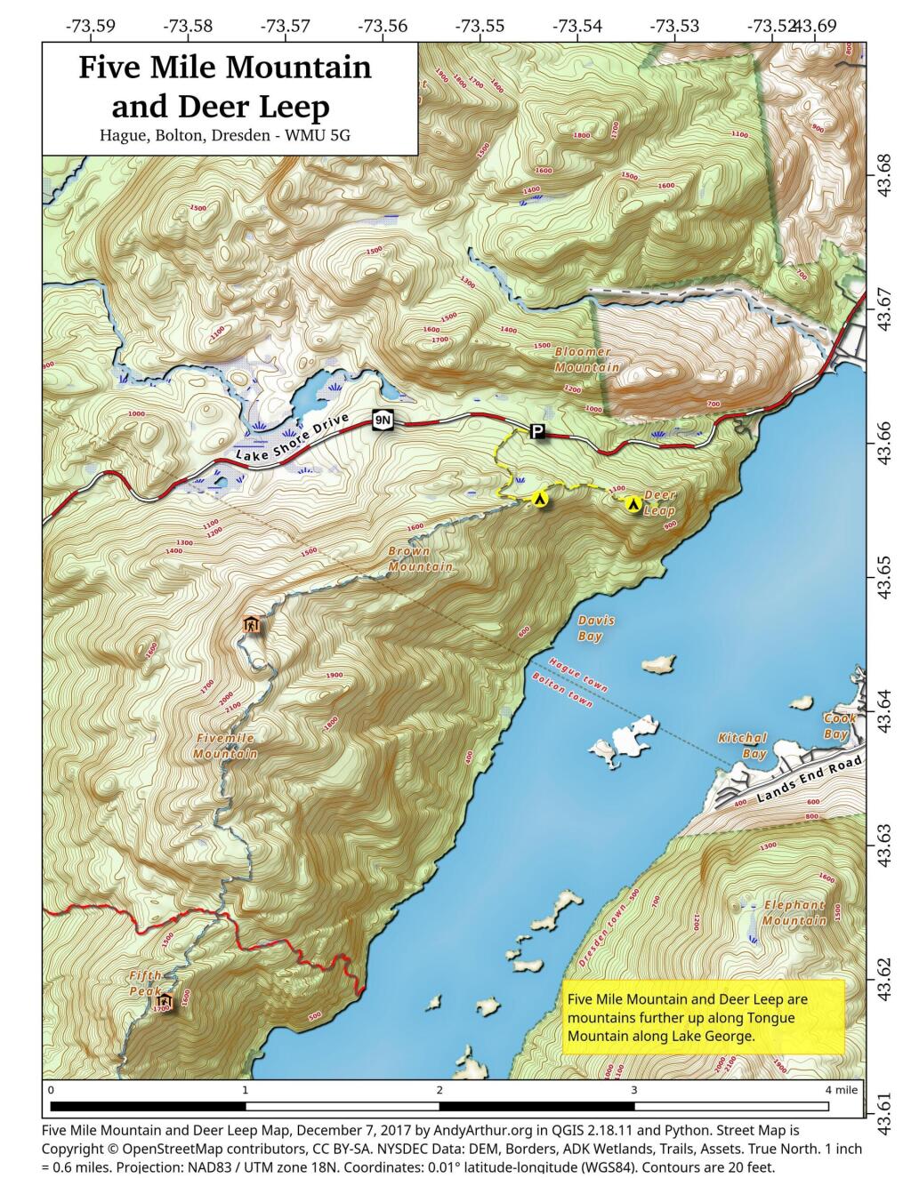
Saturday May 30, 2009 — Tongue Mountains — Five Mile Mountain And Deer Leep 🗺 — Tip Of Tongue Mountain 🗺— PDF with All Maps 📚
Taken off Route 9N as entering Sabbath Day Point near Deer Jump.
Saturday May 30, 2009 — Tongue Mountains — Five Mile Mountain And Deer Leep 🗺 — Tip Of Tongue Mountain 🗺— PDF with All Maps 📚

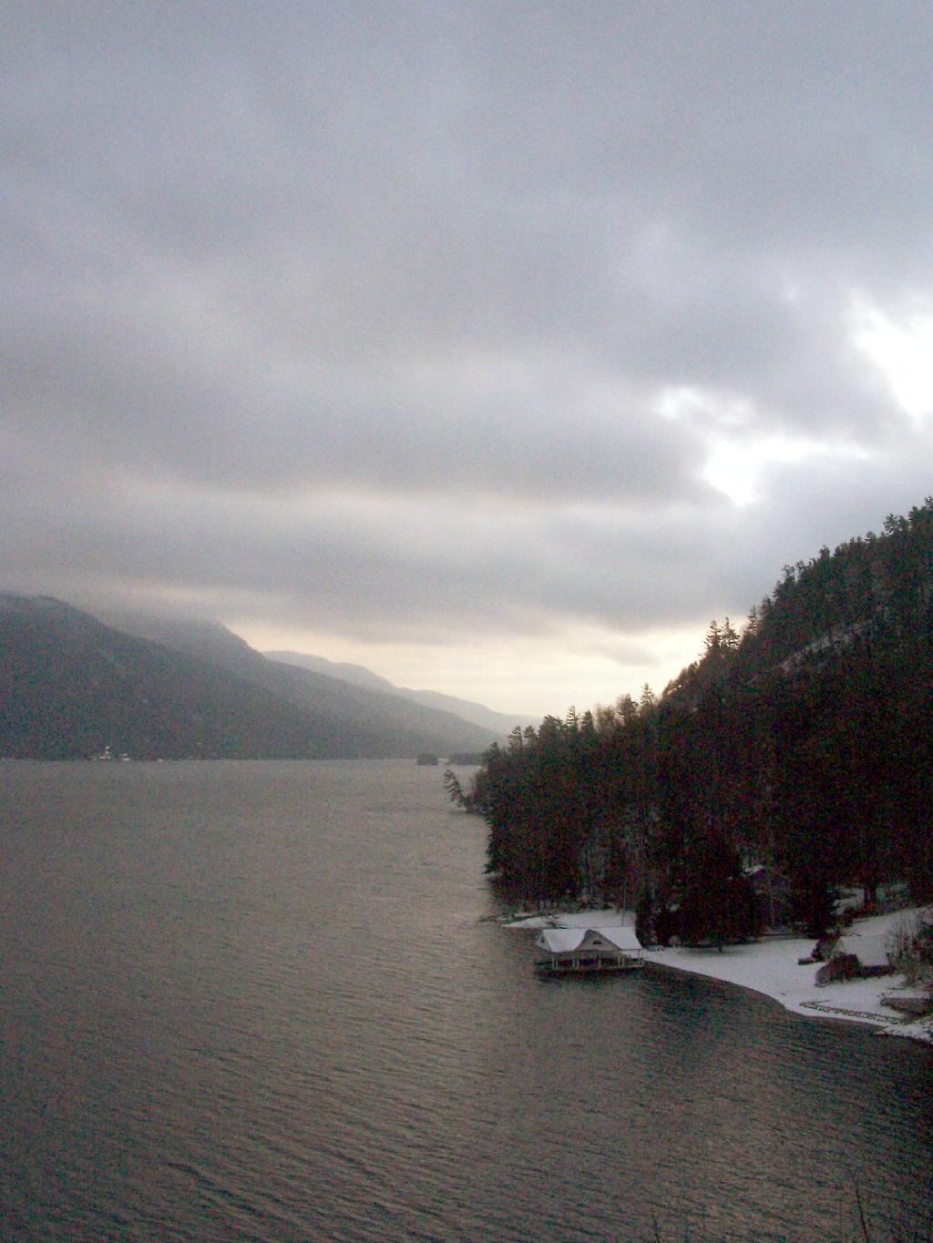
From Route 9N.
Sunday December 19, 2010 — Tongue Mountains — Five Mile Mountain And Deer Leep 🗺 — Tip Of Tongue Mountain 🗺— PDF with All Maps 📚