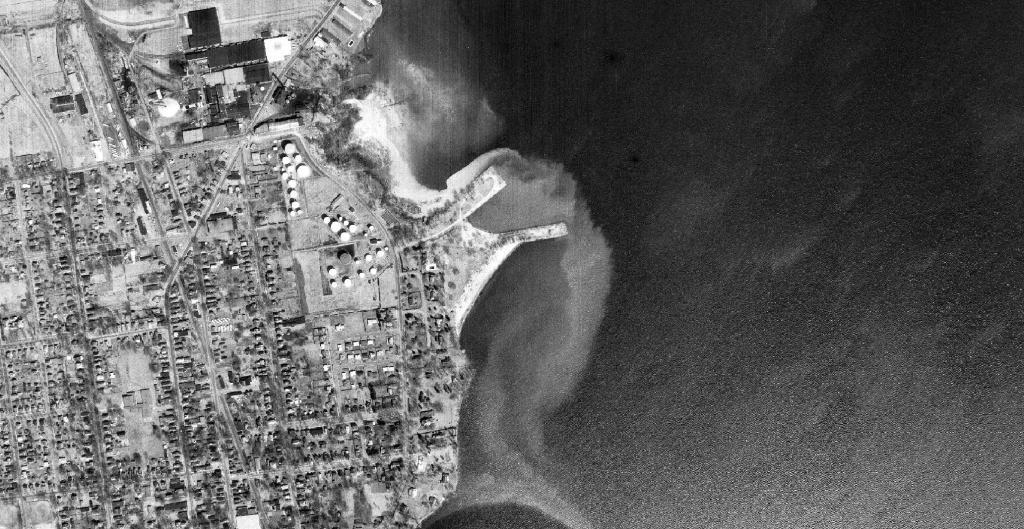
Plattsburgh 📍

Scenic Clinton County is located in the Northeast corner of New York State, bordering on beautiful Lake Champlain. With the majestic Adirondack Mountains and numerous lakes, rivers and tributaries, it is an ideal place to live, work or visit. Enjoy fishing, skiing, swimming, boating, hiking, camping or virtually any outdoor activity in our County.

http://www.clintoncountygov.com/

🖼️ Photos
Map: Green Mountain National Forest North

Imperial Mills Dam and Ruger Woods

Now state forest, I used to enjoy wandering back on the trails and fishing 🎣 the Saranac River behind the dam back when I was a student at Plattsburgh State.

Thematic Map: Highest Populated Places in New York
Map: Shelving Rock Road and Dacy Clearing Road

Plattsburgh Exit 38 Cloverleaf

This cloverleaf on the north-side of city seems much overscaled, but probably the land was poor and polluted here, and it made sense to provide arterial access to Dannemora and points to the north and west, I guess.

Map: Green Mountain National Forest North

Dead Creek

The Dead Creek is located to the north of the City of Plattsburgh and extends out from Lake Champlain under bridges where US 9 and Adirondack Northway runs to the fertile farmland of Beekmantown.

Map: Tug Hill State Forest (Inman Gulf Area)