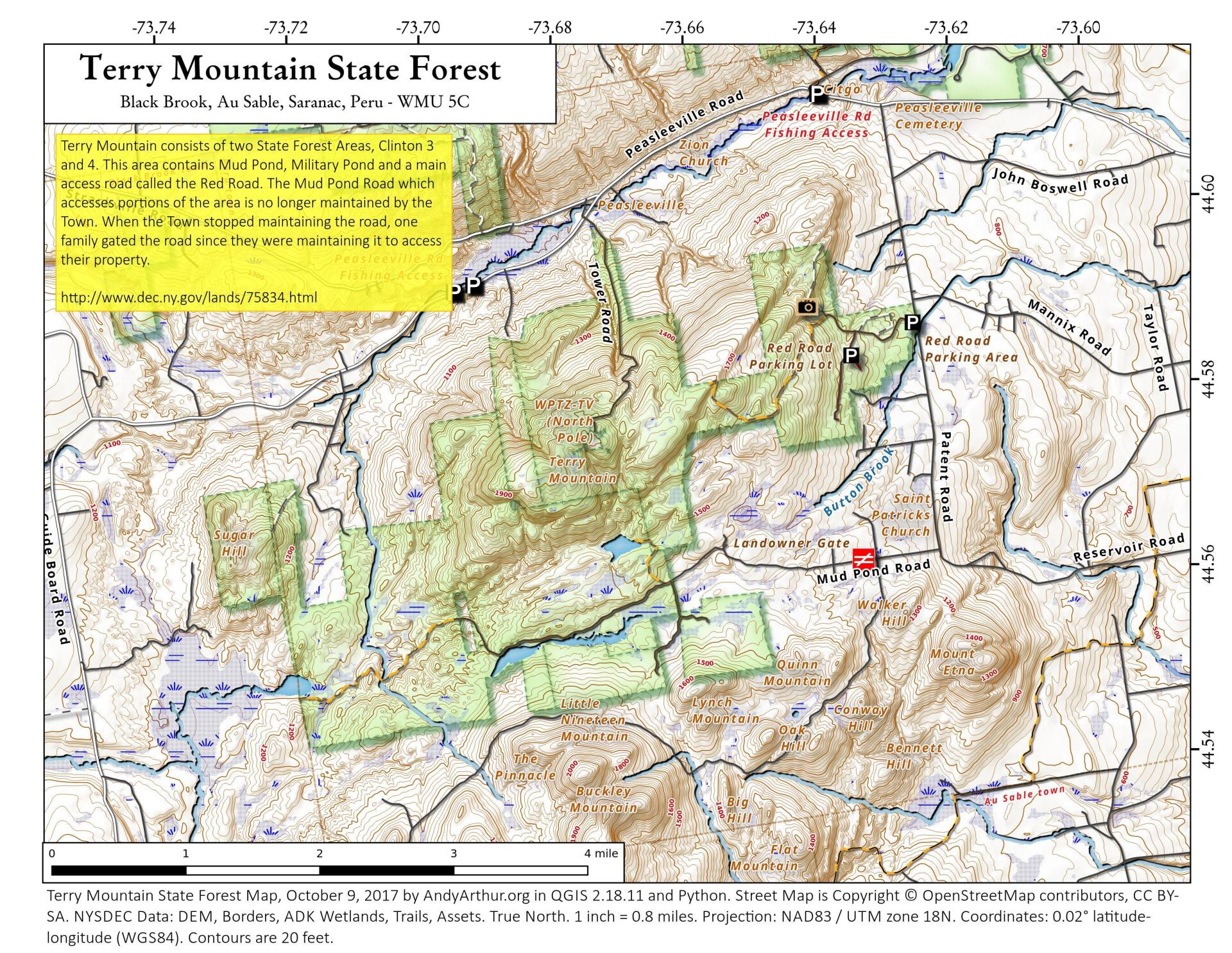
Terry Mountain State Forest

Download a High Resolution JPEG Image of the Terry Mountain State Forest or an Adobe Acrobat Printable PDF of the Terry Mountain State Forest.


Bookmark my free Interactive GPS Map for your phone:
https://andyarthur.org/ny
... shows your location as a blue dot in relationship to campsites, trails, state land. This online map requires cell service, won't work in remote country, so also bring a paper map.
Free Download of New & Historical USGS 1:24k Topograpic Maps
Interactive maps with backcountry and roadside camping: New York, Pennsylvania, West Virginia & Vermont. List of NYS DEC Lean-Tos and Firetowers.
Google Spreadsheet with Roadside, Primitive and Pay Campsites
More about John Boyd Thacher State Park...
John Boyd Thacher State Park, is situated along the Helderberg Escarpment, one of the richest fossil-bearing formations in the world. Even as it safeguards six miles of limestone cliff-face, rock-strewn slopes, woodland and open fields, the park provides a marvelous panorama of the Hudson-Mohawk Valleys and the Adirondack and Green Mountains. The park has volleyball courts, playgrounds, ball fields and numerous picnic areas with nine reservable shelters. Interpretive programs are offered year-round, including guided tours of the famous Indian Ladder Trail. There are over 25 additional miles of trails for summer hiking and mountain biking, and winter cross-country skiing, snowshoeing, hiking, and snowmobiling.
http://nysparks.com/parks/128/
 at John Boyd Thacher Park")


