Labrador Hollow Unique Area
Download a High Resolution JPEG Image of the Labrador Hollow Unique Area or an Adobe Acrobat Printable PDF of the Labrador Hollow Unique Area.


Bookmark my free Interactive GPS Map for your phone:
https://andyarthur.org/ny
... shows your location as a blue dot in relationship to campsites, trails, state land. This online map requires cell service, won't work in remote country, so also bring a paper map.
Free Download of New & Historical USGS 1:24k Topograpic Maps
Interactive maps with backcountry and roadside camping: New York, Pennsylvania, West Virginia & Vermont. List of NYS DEC Lean-Tos and Firetowers.
Google Spreadsheet with Roadside, Primitive and Pay Campsites
More about Labrador Hollow Unique Area...
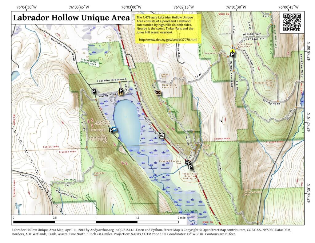
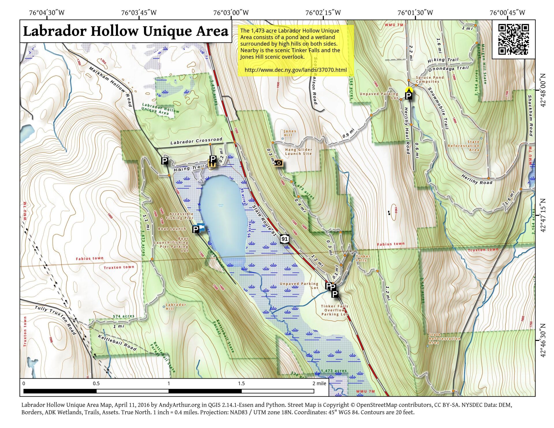
Labrador Hollow Unique Area encompasses 1,474 acres and is located in the towns of Fabius and Truxton on the borders of Onondaga and Cortland County. It is well known for its diverse recreational activities, some of which include hiking, fishing, hunting, trapping, bird watching, nature viewing, canoeing, and even hang gliding. Labrador Hollow includes a number of unique resources including an accessible trail into a waterfall, an accessible boardwalk of nearly 2000 feet in length and a picturesque pond with accessible access for canoes, or row boats.
http://www.dec.ny.gov/lands/37070.html


