
Tupper Lake 1907
Back when the village was a bit smaller and the current alignment NY 30 down to Long Lake didn't really exist in the current form.

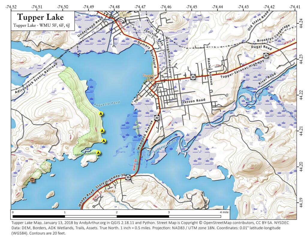
Tupper Lake (North)
This map shows the northern portion of Tupper Lake near the village. There are a handful of campsites on state land along the west shore of the lake, along with some along the south shore of the lake (not shown).
Four Mile Meadow
Ever since college I've been fascinated by the section of the Adirondack Northway that goes through a valley known as the Four Mile Meadow by Lincoln Pond, as seen on the 1953 Elizabethtown topographic map. While little signs of the Meadow exist anymore, I wonder if it was a natural meadow or due to logging. This section of the Northway really cut through the wilderness when it was built.
Pharaoh Lake Trail
43.77418022914859,-73.64566515243904
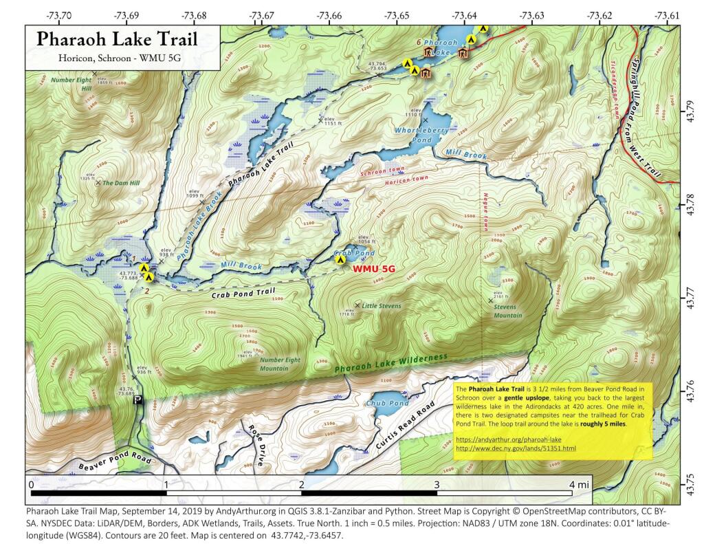
The Pharoah Lake Trail is 3 1/2 miles from Beaver Pond Road in Schroon over a gentle upslope, taking you back to the largest wilderness lake in the Adirondacks at 420 acres. One mile in, there is two designated campsites near the trailhead for Crab Pond Trail. The loop trail around the lake is roughly 5 miles.
https://andyarthur.org/pharoah-lake
http://www.dec.ny.gov/lands/51351.html