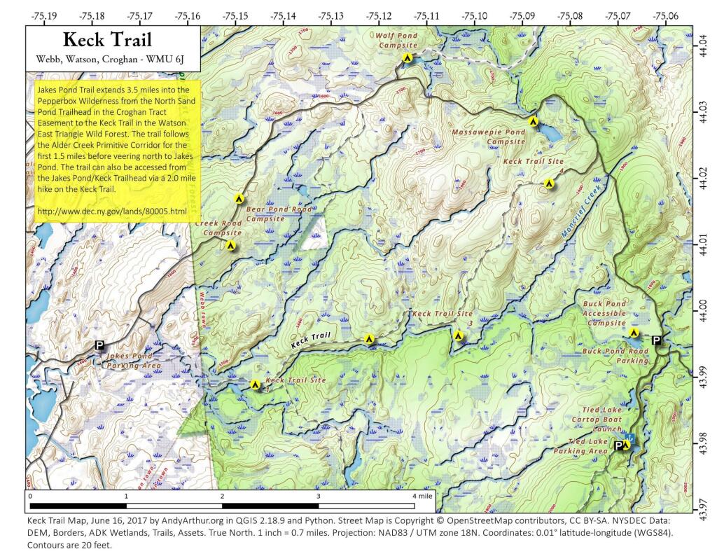
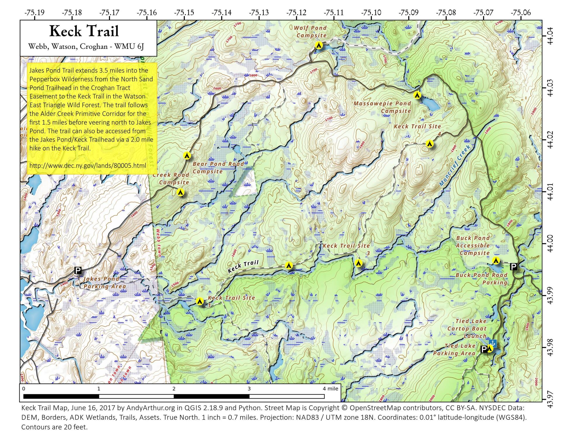
Keck Trail
Download a High Resolution JPEG Image of the Keck Trail or an Adobe Acrobat Printable PDF of the Keck Trail.


Bookmark my free Interactive GPS Map for your phone:
https://andyarthur.org/ny
... shows your location as a blue dot in relationship to campsites, trails, state land. This online map requires cell service, won't work in remote country, so also bring a paper map.
Free Download of New & Historical USGS 1:24k Topograpic Maps
Interactive maps with backcountry and roadside camping: New York, Pennsylvania, West Virginia & Vermont. List of NYS DEC Lean-Tos and Firetowers.
Google Spreadsheet with Roadside, Primitive and Pay Campsites
More about Watsons East Triangle Wild Forest...
The Watson's East Triangle Wild Forest Unit is located on the western edge of the Adirondack Forest Preserve in the towns of Croghan, Diana, and Watson in Lewis County and the town of Webb in Herkimer County. The Unit consists of 13,229 acres of State Forest Preserve lands, and is bounded on the west by the Adirondack Park Blue Line, on the east by the Five Ponds and Pepperbox Wilderness Areas, on the north by the Aldrich Pond Wild Forest and on the south by the Beaver River.
Download the PDF Map Pack with All Maps from Watsons East Triangle Wild Forest.
")


