Wakely Dam Campsites
Download a High Resolution JPEG Image of the Wakely Dam Campsites or an Adobe Acrobat Printable PDF of the Wakely Dam Campsites.


Bookmark my free Interactive GPS Map for your phone:
https://andyarthur.org/ny
... shows your location as a blue dot in relationship to campsites, trails, state land. This online map requires cell service, won't work in remote country, so also bring a paper map.
Free Download of New & Historical USGS 1:24k Topograpic Maps
Interactive maps with backcountry and roadside camping: New York, Pennsylvania, West Virginia & Vermont. List of NYS DEC Lean-Tos and Firetowers.
Google Spreadsheet with Roadside, Primitive and Pay Campsites
More about Cedar River Flow...
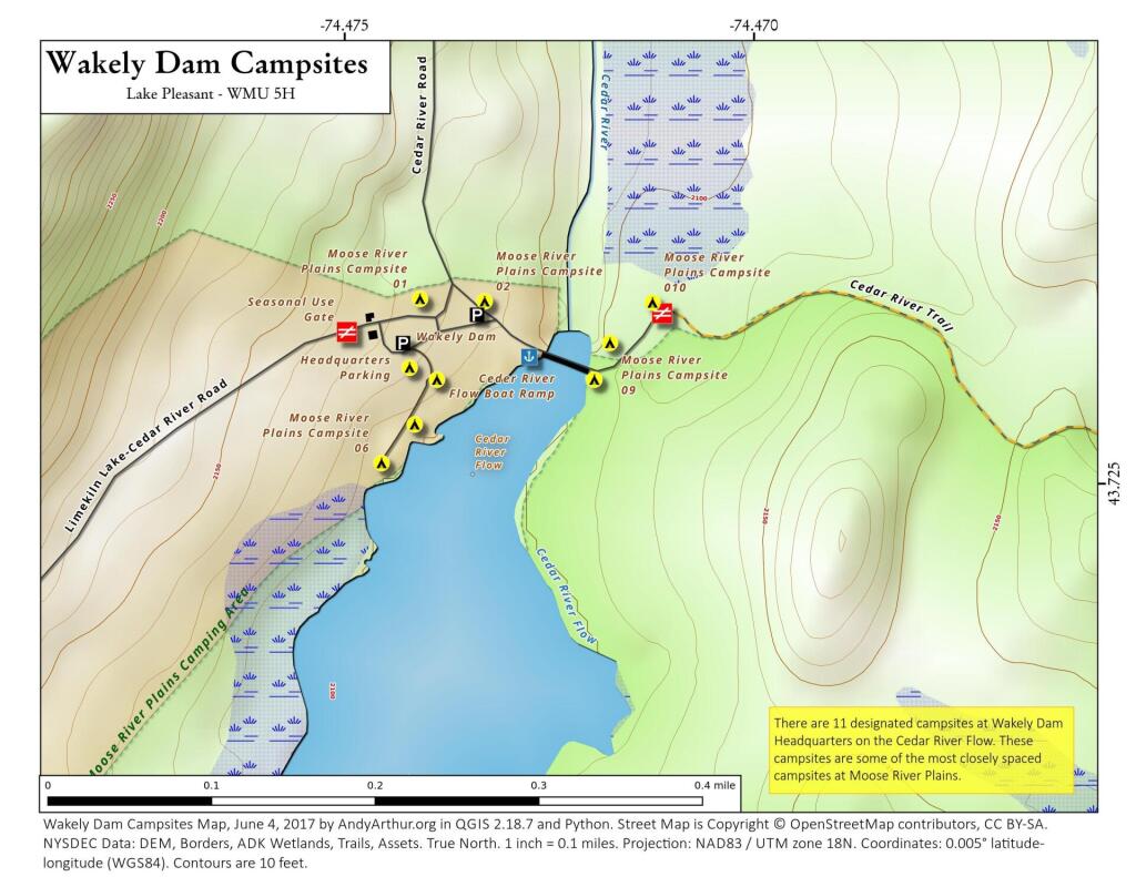
The Cedar River Flow is a remote 640-acre (2.6 km2) shallow lake, created by the Wakely Dam, where there are 10 campsites accessible via a gravel road, 14 miles (23 km) from Indian Lake or 23 miles (37 km) from Inlet. This area is also known as the Cedar River Entrance, and beyond it is the 150 campsites of Moose River Plains.
More campsites are accessible via canoe, around the Flow. It lies on the border between the Moose River Plains Wild Forest and the West Canada Lake Wilderness Area.
You can paddle up the Cedar River, above Cedar River Flow to the first Lean-To. Shortly thereafter, water levels are too low for paddling.


