Normans Kill Ravines Preserve

Download a High Resolution JPEG Image of the Normans Kill Ravines Preserve or an Adobe Acrobat Printable PDF of the Normans Kill Ravines Preserve.


Bookmark my free Interactive GPS Map for your phone:
https://andyarthur.org/ny
... shows your location as a blue dot in relationship to campsites, trails, state land. This online map requires cell service, won't work in remote country, so also bring a paper map.
Free Download of New & Historical USGS 1:24k Topograpic Maps
Interactive maps with backcountry and roadside camping: New York, Pennsylvania, West Virginia & Vermont. List of NYS DEC Lean-Tos and Firetowers.
Google Spreadsheet with Roadside, Primitive and Pay Campsites
More about Normanskill Ravines Park...
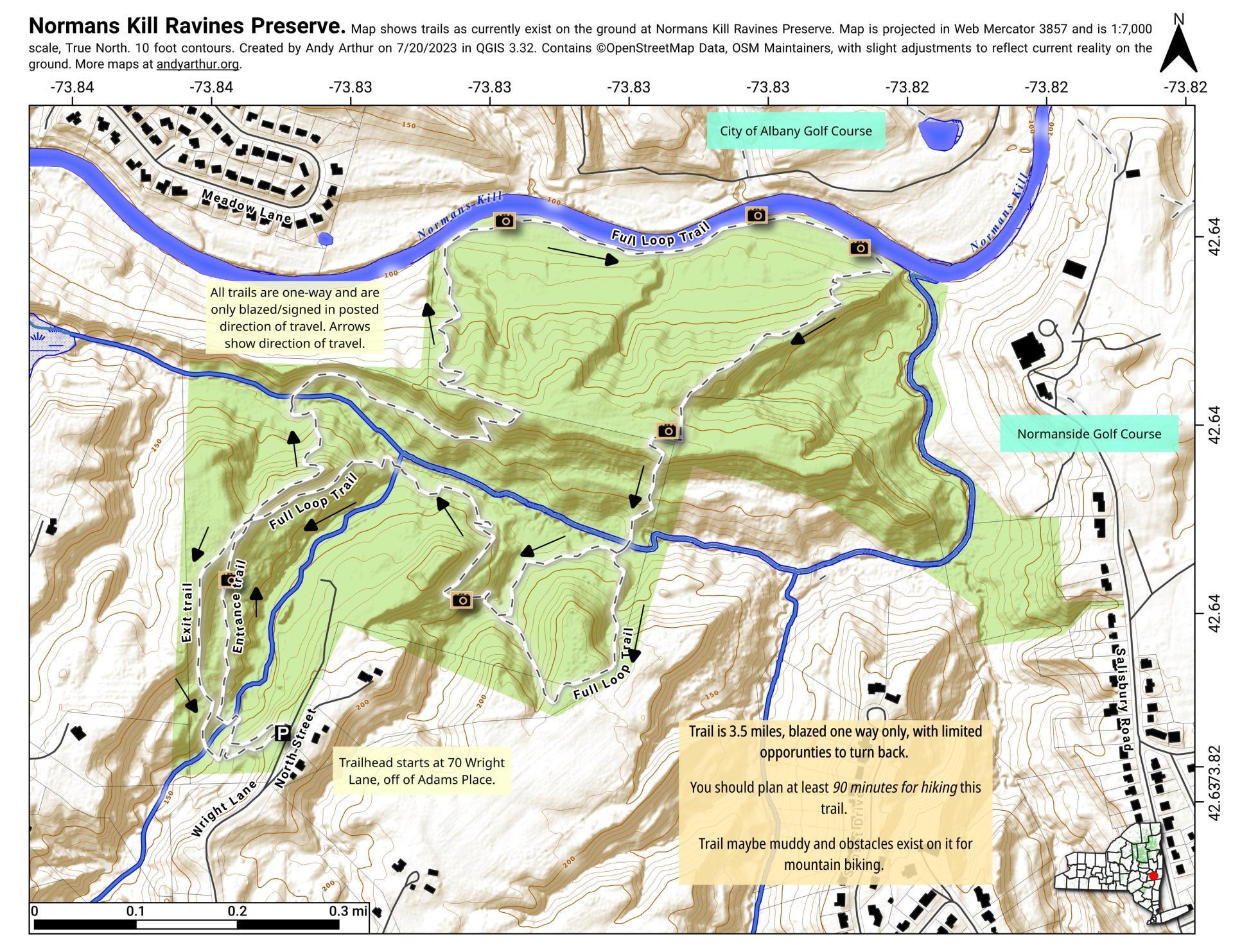
The Normans Kill Ravines Park's address is 70 Wright Lane in Delmar, off Adams Place near the Four Corners. It is home to a rough 3.5 mile mountain bike trail that traverses up and down several ridges and swampy areas and follows roughly 250 feet of the Normans Kill. You should plan on at least 1 1/2 hours to hike this trail, as many of the inner connections (shortcut) trails are overgrown and unmarked, while the outer trail is designated "one way" and blazed only in the clockwise fashion (north -> east -> south -> west -> south).
https://www.townofbethlehem.org/893/Normans-Kill-Ravines-Park
http://walkingman247.blogspot.com/2021/06/normans-kill-ravines-parkdelmar-town-of.html
https://www.alltrails.com/trail/us/new-york/normans-kill-ravines-full-loop-trail


