The reality of our landscape

The reality of our landscape 🐄 🌽 🌳 🌳 🌱 🐷

Farm crops and pasture represent roughly 1 out of four acres in New York State, only exceeded by forested acerage which is roughly 2/3rds of the state’s land cover.

While a lot of the forested acerage is Forest Preserve and park, a significant portion of the remaining acerage is farm woodland in support of farm operations – timber used to heat farm houses and make hot water for milk houses, milled in support of farm construction, used to provide hunting grounds, and sold as an additional income stream to the farm.

Map: Land Resource Regions (Agriculture)
Map: Major Land Resource Regions
Map: Major Land Resource Regions with Major Dense Cities Overlayed
SVGZ Graphic: 2012 Plant Hardiness Zones in NYS
SVGZ Graphic: Agricultural Land Cover by NYS Watershed Subregion
SVGZ Graphic: Agriculture, forestry, and fishing, value added (% of GDP)
SVGZ Graphic: Change in Agricultural Land Use, 2001-2019
SVGZ Graphic: Change in Plant Hardiness Zones, 2012 to 2023 in New York State
SVGZ Graphic: How Much of a State's Land is Farmed?
SVGZ Graphic: Plant Hardiness Zones 2023
SVGZ Graphic: Square Miles, Cultivated Crops
SVGZ Graphic: US Turkey Production
Thematic Map: 2020 Major Farm Crops Grown in New York
Thematic Map: 2022 Lands Planted with Corn in NYS
Thematic Map: Agriculture in New England
Thematic Map: Agriculture in New York
Thematic Map: Farm Land by New York State County in 2021
Thematic Map: Farmland in NY
Thematic Map: Forest Cover of Moose River Plains
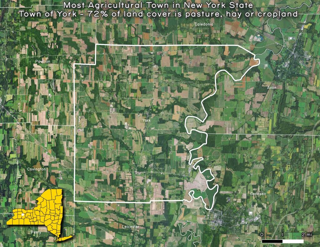
Thematic Map: Most Agricultural Town in New York State
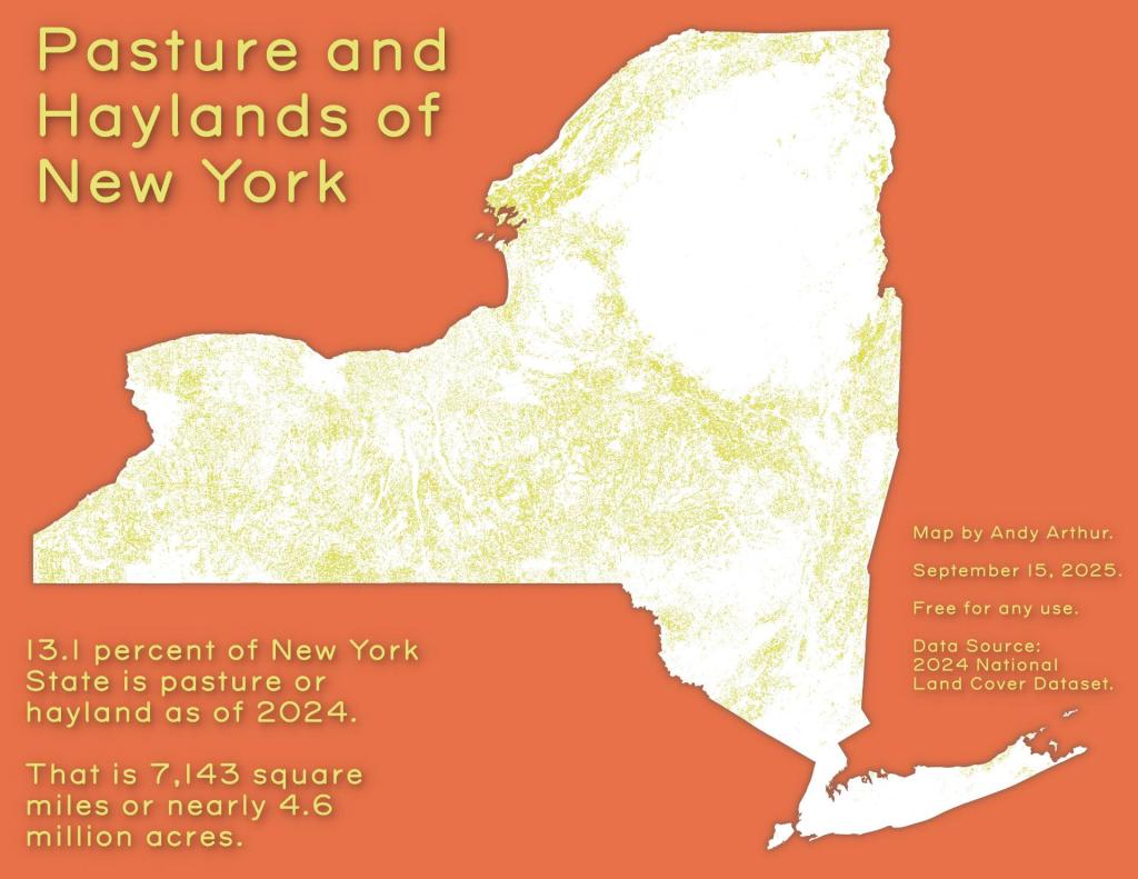
Thematic Map: Pasture and Haylands of New York
Thematic Map: Percent of Town Landmass Used for Agriculture
Thematic Map: Percent of Town Landmass Used for Crops
Thematic Map: The Barns of Schoharie County
Thematic Map: The fertile lands of the Black River Valley are Surounded by Tug Hill and Adirondacks
Thematic Map: Town Landmass Used for Pasture and Hay

Leave a Reply

Your email address will not be published. Required fields are marked *