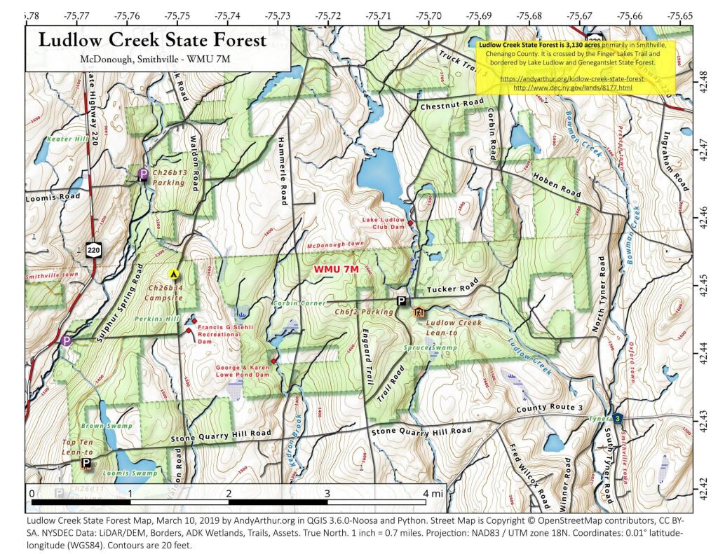
Ludlow Creek State Forest
Download a High Resolution JPEG Image of the Ludlow Creek State Forest or an Adobe Acrobat Printable PDF of the Ludlow Creek State Forest.


Bookmark my free Interactive GPS Map for your phone:
https://andyarthur.org/ny
... shows your location as a blue dot in relationship to campsites, trails, state land. This online map requires cell service, won't work in remote country, so also bring a paper map.
Free Download of New & Historical USGS 1:24k Topograpic Maps
Interactive maps with backcountry and roadside camping: New York, Pennsylvania, West Virginia & Vermont. List of NYS DEC Lean-Tos and Firetowers.
Google Spreadsheet with Roadside, Primitive and Pay Campsites
More about Delmar, New York...
Delmar is a hamlet in the Town of Bethlehem, in Albany County, New York, United States. It is a suburb of the neighboring city of Albany. The community is bisected by NY Route 443 (Delaware Avenue), a major thoroughfare, main street, and route to Albany.
A census-designated place (CDP) has been established since 1980 by the U.S. Census Bureau for tabulating the population of what the census has defined as the boundaries of the urbanized area in and around Delmar. The population was 8,292 at the 2000 census, but it was not included as a CDP in the 2010 census.
In 2005, CNN/Money Magazine named the Delmar ZIP Code (an area larger than the Delmar hamlet or CDP) as one of the "Best Places to Live" in America, rating it the 22nd best place to live among what it called "Great American Towns.
http://en.wikipedia.org/wiki/Delmar,_New_York


