Auger Falls 📍

This 40 foot falls is at the beginning of a series of drops, plunges and cascades totaling over 100 feet though this narrow gorge lined with Hemlocks on the Sacandaga River. Many potholes can be seen along the edge of the gorge when the water level is low.

5.0 miles N. of Wells. From Wells, drive N on Rte 30 to the junction of Rte 30 & Rte 8. Continue another 1.7 miles on Rte 30 & turn right into a dirt parking area. Park and walk back towards Rte 30, and follow the old dirt road to the left, which parallels Rte 30. At the end of the road, look for the DEC register, marking the beginning of the trail. Follow the colored DEC trail markers for 0.3 mile to the top of the falls. You’ll hear the roar of the falls shortly after you start the hike.

http://www.adirondackexperience.com/recreation/hiking/auger-falls

🗺️ Maps 🖼️ Photos 📽️ Videos

Below NY 8 Bleeds

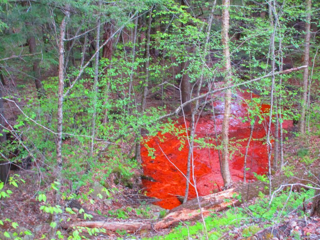
I noticed that the hillside below the modern NY 8 cut and fill near Auger Falls is bleeding red. I assume it's iron eating bacteria, from cutting and filling in part of the hillside as part of the 1968 bypass of Old Route 8A. Too red to be acid mine drainage, which is uncommon in Adirondacks unlike Appalachia.
Monday May 17, 2021 — Auger Falls
Map: Goldsmith Road
Map: Ketchumville State Forest
Interactive Map: PFAS Contamination Crisis: New Data Show 1,398 Sites in 49 States
Thematic Map: Percentage of Municipality Forested
Thematic Map: Agriculture in New York

Foam

Foam from Auger Falls churning away below.

Sunday April 19, 2020 — Auger Falls
Terrain Map: Mahanoy Mountain
United Steaks of America map: If each state could have only one meat, what would it be?