Counties: Albany to Delaware / Dutchess to Livingston / Madison to Otsego / Putnam to Suffolk / Sullivan to Yates
Browse Topographic Maps: Full State / Historical USGS Topographic Maps
Counties: Albany to Delaware / Dutchess to Livingston / Madison to Otsego / Putnam to Suffolk / Sullivan to Yates
Browse Topographic Maps: Full State / Historical USGS Topographic Maps
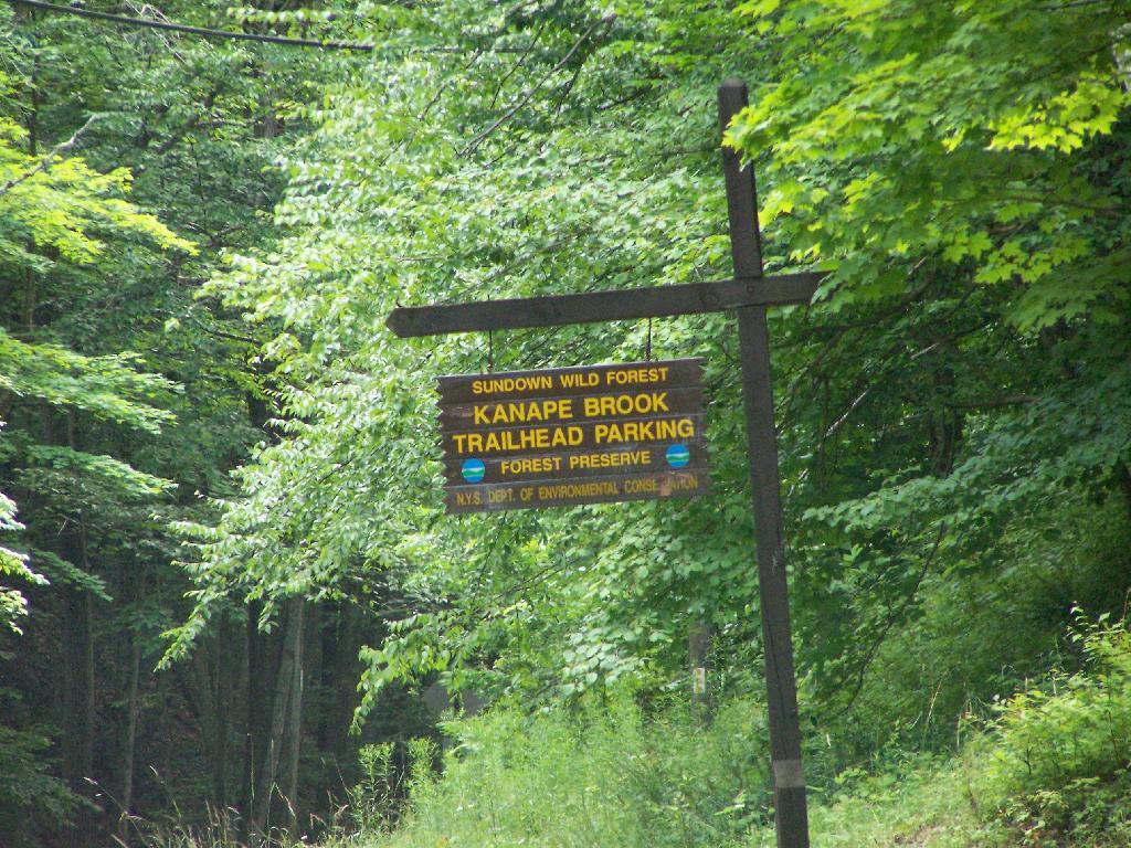
You can get a downloadable, more detailed map with campsites, lean-tos, scenic vistas and trails.
Note: This list is sorted from North to South, and West to East in New York, therefore the farthest North Lean-To in NY State is in the Debar Mountain Wild Forest, and the farthest south one is in David A. Sarnoff Pine Barrens Preserve in Long Island. Location links take you to aerial photos of the Lean-Tos on the free ACME Mapper.
Download or View this Chart on Google Sheets
| State Forest Land | Name | Type | Description | Location |
|---|---|---|---|---|
| Debar Mtn. Wild Forest | Debar Mountian Lean-To | Lean-To | 44.598926, -74.228592 | |
| Debar Mtn. Wild Forest | Grass Pond Lean-To | Lean-To | 44.493389, -74.251194 | |
| Taylor Pond Wild Forest | North Shore Taylor Pond Lean-To | Lean-To | Managed By Operations | 44.4897, -73.861427 |
| Taylor Pond Wild Forest | South East Taylor Pond Lean-To | Lean-To | Managed By Operations | 44.482888, -73.853777 |
| Taylor Pond Wild Forest | Northwest Shore Taylor Pond Lean-To | Lean-To | Managed By Operations | 44.477689, -73.881283 |
| Taylor Pond Wild Forest | Poke-O-Moonshine Summit Lean-To | Lean-To | 44.399797, -73.514557 | |
| Saint Regis Canoe Area | Fish Pond Campsite 2 | Lean-To | 44.396133, -74.370421 | |
| Saint Regis Canoe Area | Fish Pond Campsite 5 | Lean-To | 44.391301, -74.365807 | |
| Saint Regis Canoe Area | St. Regis Pond South Shore Lean-To | Lean-To | Within The Adopt A Lean-To System | 44.380642, -74.320299 |
| Saint Regis Canoe Area | St. Regis Pond Campsite 19 | Lean-To | 44.380626, -74.320423 | |
| Wolf Lake State Forest | Beaver Flow Lean-To | Lean-To | 44.357822, -75.316001 | |
| Mckenzie Mtn. Wilderness | Loch Bonnie Lean-To | Lean-To | 44.347347, -73.995669 | |
| Mckenzie Mtn. Wilderness | White Face Brook Lean-To | Lean-To | 44.344217, -73.928647 | |
| Wolf Lake State Forest | Wolf Lake Lean-To | Lean-To | 44.336323, -75.313886 | |
| Saranac Lakes Wild Forest | Lake Placid Campsite 3 | Lean-To | 44.332595, -73.95668 | |
| Saranac Lakes Wild Forest | Lake Placid Campsite 2 | Lean-To | 44.332296, -73.956626 | |
| Wolf Lake State Forest | Moon Pond Lean-To | Lean-To | 44.332276, -75.321172 | |
| Saranac Lakes Wild Forest | Follensby Clear | Lean-To | 44.325095, -74.349897 | |
| Wolf Lake State Forest | Huckleberry Lake Lean-To | Lean-To | 44.324272, -75.333738 | |
| Mckenzie Mtn. Wilderness | Placid Lean-To | Lean-To | 44.321456, -74.030786 | |
| Saranac Lakes Wild Forest | Lean-To | 44.309124, -74.18053 | ||
| Saranac Lakes Wild Forest | Lean-To | 44.302887, -74.302634 | ||
| Saranac Lakes Wild Forest | Lean-To | 44.289835, -74.216869 | ||
| Saranac Lakes Wild Forest | Lean-To | 44.286942, -74.289775 | ||
| Saranac Lakes Wild Forest | Lean-To | 44.286657, -74.162602 | ||
| Saranac Lakes Wild Forest | Lean-To | 44.271712, -74.273283 | ||
| Saranac Lakes Wild Forest | Lean-To | 44.265599, -74.24293 | ||
| Hurricane Mountain Primitive Area | Lost Pond/Biesemeyer | Lean-To | 44.26073, -73.710011 | |
| Hurricane Mountain Primitive Area | Gulf Brook Lean-To | Lean-To | 44.253097, -73.71796 | |
| Saranac Lakes Wild Forest | Lean-To | 44.228772, -74.375533 | ||
| High Peaks Wilderness | Lean-To | 44.198805, -74.31831 | ||
| Horseshoe Lake Wild Forest | Eagle Landing Lean-To | Lean-To | 44.19683, -74.512309 | |
| High Peaks Wilderness | Lean-To | 44.177317, -74.321808 | ||
| Giant Mountain Wilderness | Giant Mtn. Lean-To | Lean-To | 44.175641, -73.722171 | |
| Giant Mountain Wilderness | Giant Mtn. Lean-To | Lean-To | 44.175641, -73.722171 | |
| Horseshoe Lake Wild Forest | Lean-To | 44.158907, -74.560725 | ||
| High Peaks Wilderness | Lean-To | 44.15683, -74.313308 | ||
| Cranberry Lake Wild Forest | Lean-To | 44.1534, -74.884029 | ||
| High Peaks Wilderness | Lean-To | 44.147236, -74.318105 | ||
| Dix Mountain Wilderness | Bouquet Lean-To | Lean-To | 44.110904, -73.774043 | |
| High Peaks Wilderness | Lean-To | 44.105829, -74.312037 | ||
| Sargent Ponds Wild Forest | Lean-To | 44.102744, -74.321863 | ||
| Sargent Ponds Wild Forest | Lean-To | 44.082504, -74.333915 | ||
| Sargent Ponds Wild Forest | Lean-To | 44.081407, -74.335829 | ||
| High Peaks Wilderness | Lean-To | 44.065927, -74.326697 | ||
| Dix Mountain Wilderness | Lilian Brook Lean-To | Lean-To | 44.058989, -73.806533 | |
| Dix Mountain Wilderness | Slide Brook Lean-To | Lean-To | 44.044126, -73.805858 | |
| High Peaks Wilderness | Lean-To | 44.042977, -74.349335 | ||
| High Peaks Wilderness | Lean-To | 44.041409, -74.350149 | ||
| High Peaks Wilderness | Lean-To | 44.02862, -74.366763 | ||
| High Peaks Wilderness | Lean-To | 44.002655, -74.38648 | ||
| William C. Whitney Wilderness | Lake Lila # 7 | Lean-To | 44.002145, -74.775682 | |
| High Peaks Wilderness | Lean-To | 43.998164, -74.392741 | ||
| Independence River Wild Forest | Trout Pond Lean To | Lean-To | 43.928489, -74.94487 | |
| Independence River Wild Forest | Trout Pond Lean To | Lean-To | 43.928489, -74.94487 | |
| Sargent Ponds Wild Forest | Deerland Carry Lean-To 2 | Lean-To | Fair Condition | 43.926218, -74.475396 |
| Sargent Ponds Wild Forest | Deerland Carry Lean-To 1 | Lean-To | Fair Condition | 43.925781, -74.475846 |
| Sargent Ponds Wild Forest | Pinebrook Lean-To | Lean-To | Fair Condition | 43.906646, -74.50259 |
| Sargent Ponds Wild Forest | Lean-To | 43.902847, -74.548063 | ||
| Blue Mountain Wild Forest | North End Tirrel Pond Lean-To | Lean-To | 43.887378, -74.377739 | |
| Sargent Ponds Wild Forest | Lean-To | 43.879414, -74.606052 | ||
| Blue Mountain Wild Forest | O’neil Lean-To | Lean-To | 43.875096, -74.367316 | |
| Sargent Ponds Wild Forest | Lean-To | 43.871006, -74.628108 | ||
| Sargent Ponds Wild Forest | Lean-To | 43.870772, -74.628507 | ||
| Sargent Ponds Wild Forest | Lean-To | 43.87072, -74.629172 | ||
| Sargent Ponds Wild Forest | Lower Sargents Pond Lean-To | Lean-To | Fair Condition | 43.859331, -74.562695 |
| Blue Ridge Wilderness | Boulder | Lean-To | 43.841564, -74.472689 | |
| Sargent Ponds Wild Forest | Lean-To | 43.836898, -74.535266 | ||
| Moose River Plains Wild Forest | Lean-To | 43.831671, -74.661756 | ||
| Moose River Plains Wild Forest | Lean-To | 43.831605, -74.661511 | ||
| Moose River Plains Wild Forest | Lean-To | 43.831434, -74.660902 | ||
| Blue Ridge Wilderness | Cascade Pond Lean-To | Lean-To | 43.829744, -74.436618 | |
| Independence River Wild Forest | Panther Pond Lean-To | Lean-To | 43.823535, -75.169312 | |
| Blue Ridge Wilderness | Wilson Pond | Lean-To | 43.820192, -74.46868 | |
| Blue Ridge Wilderness | Stephens Pond | Lean-To | 43.818674, -74.420524 | |
| Blue Ridge Wilderness | Stephens Pond | Lean-To | 43.818674, -74.420524 | |
| Blue Ridge Wilderness | Stephens Pond | Lean-To | 43.818674, -74.420524 | |
| Blue Ridge Wilderness | Stephens Pond | Lean-To | 43.818674, -74.420524 | |
| Blue Ridge Wilderness | Stephens Pond | Lean-To | 43.818674, -74.420524 | |
| Blue Ridge Wilderness | Stephens Pond | Lean-To | 43.818674, -74.420525 | |
| Sargent Ponds Wild Forest | Lean-To | 43.817134, -74.64378 | ||
| Sargent Ponds Wild Forest | Lean-To | 43.81709, -74.643251 | ||
| Sargent Ponds Wild Forest | Lean-To | 43.8162, -74.644668 | ||
| Blue Ridge Wilderness | Blue Ridge Lean-To | Lean-To | 43.80014, -74.610139 | |
| Moose River Plains Wild Forest | 8thlake East Shore Lean-To | Lean-To | 43.789783, -74.698592 | |
| Moose River Plains Wild Forest | 8th Lake North Shore Lean-To | Lean-To | 43.780115, -74.704439 | |
| Moose River Plains Wild Forest | 8th Lake Island Lean-To | Lean-To | 43.779025, -74.704429 | |
| Moose River Plains Wild Forest | Lean-To | 43.75639, -74.717817 | ||
| Moose River Plains Wild Forest | Lean-To | 43.750767, -74.734643 | ||
| Moose River Plains Wild Forest | Lean-To | 43.747805, -74.744199 | ||
| Independence River Wild Forest | Pine Lake Lean-To | Lean-To | 43.708394, -75.146453 | |
| Haderondah | Middle Branch Lake | Lean-To | 43.702926, -75.096002 | |
| Siamese Ponds Wilderness | Hour Pond Lean-To | Lean-To | 43.70112, -74.158221 | |
| Haderondah | Cedar Pond Lean To | Lean-To | 43.69597, -75.082602 | |
| Haderondah | Middle Settlement Lake | Lean-To | 43.685949, -75.098614 | |
| West Canada Lakes Wilderness | Colvin Brook Lean-To | Lean-To | 43.652414, -74.49038 | |
| Lake George Wild Forest | Five Mile Mountain Lean-To | Lean-To | Lean-To W/ Privy And Firering | 43.647336, -73.574534 |
| Black River Wild Forest | Remsen Falls Lean-To | Lean-To | 43.629925, -75.036288 | |
| Lake George Wild Forest | Fifth Peak Lean-To | Lean-To | Lean-To W/ Privy And Firering | 43.619313, -73.584112 |
| Black River Wild Forest | Woodhull Lake Lean-To | Lean-To | 43.599885, -75.020382 | |
| Lake George Wild Forest | Black Mountain Ponds Lean-To | Lean-To | Lean-To With Privy And Firering | 43.59966, -73.533064 |
| West Canada Lakes Wilderness | Pillsbury Lake Lean-To | Lean-To | 43.596898, -74.531665 | |
| Lake George Wild Forest | Lean-To | Campsite With Lean-To 13-27 | 43.595821, -73.517951 | |
| Lake George Wild Forest | Lean-To | Campsite With Lean-To 5-10 | 43.587168, -73.527759 | |
| Lake George Wild Forest | Greenland Pond Leanto | Lean-To | Leanto With Privy, Picnic Table And Fire Ring | 43.577804, -73.51684 |
| Lake George Wild Forest | Fishbrook Pond North Leanto | Lean-To | Leanto With Privy, Picnic Table And Fire Ring | 43.576039, -73.536103 |
| Lake George Wild Forest | Fishbrook Pond South Leanto | Lean-To | Leanto With Privy, Picnic Table And Fire Ring | 43.573872, -73.538477 |
| Black River Wild Forest | Sand Lake Falls Lean-To | Lean-To | 43.558914, -75.003058 | |
| Black River Wild Forest | Gull Lake Lean-To | Lean-To | 43.553747, -75.059378 | |
| Black River Wild Forest | Chub Pond Lean-To #2 | Lean-To | 43.529823, -75.042494 | |
| Black River Wild Forest | Chub Pond Lean-To #1 | Lean-To | 43.524598, -75.043801 | |
| West Canada Lakes Wilderness | T Lake Leant-To | Lean-To | 43.452718, -74.582282 | |
| Silver Lake Wilderness | Hamilton Lake Stream Lean-To 1 | Lean-To | 43.39716, -74.455046 | |
| Silver Lake Wilderness | Hamilton Lake Stream Lean-To 2 | Lean-To | 43.397156, -74.455065 | |
| Cobb Brook State Forest | Leanto | Lean-To | 43.344545, -75.67222 | |
| Silver Lake Wilderness | Mud Lake Lean-To | Lean-To | 43.342671, -74.456291 | |
| Deruyter State Forest | Deruyter Lean-To | Lean-To | 42.820185, -75.859105 | |
| Morgan Hill State Forest | Morgan Hill Lean-To | Lean-To | 42.767202, -76.011256 | |
| Perkins Pond State Forest | Flt Lean-To | Lean-To | 42.642307, -75.743766 | |
| Dutch Settlement State Forest | Lean-To | Lean-To | 42.629438, -74.267543 | |
| Whaupaunaucau State | Leanto | Lean-To | 42.606063, -75.467114 | |
| Burnt-Rossman Hills State Forest | Eminence Lean-To | Lean-To | 42.543304, -74.488595 | |
| Clapper Hollow State Forest | Clapper Hollow Lean-To | Lean-To | 42.528201, -74.642004 | |
| Tuller Hill State Forest | Tuller Hill Lean-T0 | Lean-To | Rebuilt In 2002 From Local State Forest Red Pine, Built By Volunteers From Suny Cortland | 42.512201, -76.120824 |
| Kennedy State Forest | Foxfire Leanto | Lean-To | 42.472853, -76.178732 | |
| Ludlow Creek State Forest | Ludlow Creek Lean-To | Lean-To | 8′ X 10′ | 42.445802, -75.701507 |
| Genegantslet State Forest | Top Ten Lean-To | Lean-To | 20′ X 20′ | 42.422887, -75.767435 |
| Robinson Hollow State Forest | Kimme Lean-To | Lean-To | 42.390596, -76.271801 | |
| Sugar Hill State Forest | Vanzandt Lean-To | Lean-To | 42.389935, -76.972601 | |
| Sugar Hill State Forest | The Twin Lean-To’s | Lean-To | Two Lean-To At This Location | 42.382253, -77.00268 |
| Sugar Hill State Forest | Templar Rd Lean-To | Lean-To | 42.373082, -76.95548 | |
| Sugar Hill State Forest | Parks Hollow Lean-To | Lean-To | 42.369463, -77.012608 | |
| Huntersfield State Forest | Lean-To | Lean-To | 42.355041, -74.346067 | |
| Beebe Hill State Forest | Beebe Hill Lean-To | Lean-To | 42.335425, -73.484181 | |
| Shindagin Hollow State Forest | Shindagin Lean-T0 | Lean-To | Scheduled For Replacement In 2004 | 42.327644, -76.329036 |
| Danby State Forest | Bald Hill Lean-To | Lean-To | 42.327042, -76.490061 | |
| Danby State Forest | Travor Rd Lean-To | Lean-To | 42.317642, -76.422544 | |
| Harvey Mountain State Forest | Harvey Mountain Lean-To | Lean-To | 42.313988, -73.441495 | |
| Burt Hill State Forest | On Finger Lake Trail Lean-To | Lean-To | 42.313213, -77.566373 | |
| Elm Ridge Wild Forest | On Elm Ridge Trail Lean-To | Lean-To | 42.306134, -74.173598 | |
| South Bradford State Forest | Moss Hill Lean-To | Lean-To | 42.289116, -77.118881 | |
| Windham Blackhead Range Wilderness | Batavia Kill Lean-To | Lean-To | 42.278839, -74.102579 | |
| Rusk Mountain Wild Forest | John Robb Leanto Lean-To | Lean-To | 42.189374, -74.238696 | |
| Rusk Mountain Wild Forest | Diamond Notch Lean-To | Lean-To | 42.16917, -74.256848 | |
| Hunter-West Kill Mountain Wilderness | Devil’s Acre Lean-To | Lean-To | Good Condition | 42.165955, -74.229624 |
| Arctic China State Forest | A-40 Lean-To | Lean-To | 42.158491, -75.362027 | |
| Barbour Brook State Forest | A-41 Lean To | Lean-To | 42.152807, -75.31021 | |
| Lean-To | 42.135655, -74.16269 | |||
| Dry Brook Ridge Wild Forest | German Hollow Road Lean-To | Lean-To | 42.134527, -74.616198 | |
| Lean-To | 42.119518, -74.086575 | |||
| Lean-To | 42.117719, -74.503199 | |||
| Lean-To | 42.115031, -74.49075 | |||
| Lean-To | 42.102787, -74.394826 | |||
| Lean-To | 42.098467, -74.09079 | |||
| Big Indian Wildernes Area | Rider Hollow Lean-To | Lean-To | 42.092012, -74.505713 | |
| Lean-To | 42.082185, -74.586611 | |||
| Big Indian Wildernes Area | Mckinly Hollow Lean-To | Lean-To | 42.075339, -74.485857 | |
| Lean-To | 42.071935, -74.28035 | |||
| Lean-To | 42.069751, -74.287449 | |||
| Lean-To | 42.067368, -74.586988 | |||
| Lean-To | 42.066913, -74.654635 | |||
| Big Indian Wildernes Area | Shandaken Brook Lean-To | Lean-To | 42.050274, -74.5106 | |
| Delaware Wild Forest | Campbell Mountain Trail Lean-To | Lean-To | 42.048989, -74.927363 | |
| Lean-To | 42.048641, -74.645056 | |||
| Lean-To | 42.039437, -74.594017 | |||
| Lean-To | 42.027316, -74.335645 | |||
| Delaware Wild Forest | Trout Pond Trail North Lean-To | Lean-To | Built For Ada | 42.012942, -74.946392 |
| Delaware Wild Forest | Trout Pond Trail South Lean-To | Lean-To | Built For Ada | 42.011758, -74.947566 |
| Big Indian Wildernes Area | Biscuit Brook Lean-To | Lean-To | 42.009105, -74.483852 | |
| Delaware Wild Forest | Pelnor Hollow Trail Lean-To | Lean-To | 42.005744, -74.867403 | |
| Big Indian Wildernes Area | Fall Brook Lean-To | Lean-To | 41.998075, -74.560392 | |
| Lean-To | 41.959182, -74.406877 | |||
| Lean-To | 41.94006, -74.632055 | |||
| David A. Sarnoff Pine Barrens Preserve | Interior Lean- To | Lean-To | 40.89774, -72.660615 |

Bridge day down in West Virginia where they have that big party on the expressway bridge over the New River Gorge. Locally though the colors are good but already fading especially in the hills.
Partly sunny and 58 degrees at the Five Rivers Environmental Education Center. ☀ There is a south breeze at 9 mph. 🍃. The dew point is 45 degrees. Temperatures will drop below freezing at Thursday around 6 am. ☃️
You know my reaction is basically where has the year gone. 🗓 In many ways I want these turbulent years to come and go in my life, my investments and savings to grow so I can have my own land. I want the recession and inflation to be over, but at the same time things are going by too fast. ⏳ And I feel like I go less and less every day.
Out to Five Rivers Environmental Education Center 🌲for a while just to observe nature 🐿️ and get my steps 👣 in for the day. I didn’t get an early start earlier as the morning was dark with a lot of fog. 🌫 Colors are already fading, they were so nice when I was at Rennselearville State Forest that very cold and windy Columbus Day Weekend 🍂 last week.
After I get home and have lunch 🍔 going to shower 🚿 and head over to John Wolcott apartment in Colonie. I haven’t seen him since June and while he speaks few words at this point its good to visit while I still can. It’s a pretty good trip up there but I’ll combine it with an evening 🌃 walk in the Pine Bush.
Well I hope the Easter bunny doesn’t freeze off you know what today. That wind and clouds just makes it feels cold. And I could be camping in this weather. Did I mention the Adirondacks might get a half foot of snow tomorrow? Mid April 😂.
Cloudy and cold around 40 degrees in Delmar, NY. 🌫️ Breezy, ️16 mph breeze from the northwest 🌬 . Temperatures will drop below freezing at tomorrow around 3 am. ☃️
Easter is late this year but spring didn’t beat it. 🌸 Of course hitting eighty degrees last week on the day I was busy with work didn’t help much. Good Friday was nice but I was tired 😴 and didn’t get out to enjoy Five Rivers as much as I wanted.
Yesterday afternoon and evening absolutely poured 🌧️ so I never made it to the library 📚 as planned but the cans and bottles ↘ got recycled and I had a nice walk 🚶 at Hollyhock. 🐦 It was cold damp and windy so not a lot of birds. Tossed in a fishing 🎣 line for a bit.
While I took tomorrow off, 🗻 having stayed in town this weekend I think I’ll just go into the office 🏢 downtown. Save the day for nicer weather, maybe in May.
Easter dinner with the folks this evening 🍲 and then I’m thinking of hiking Blodgett Hill this evening. Officially the trail is closed due to logging but there won’t be any logging on Easter 🎋and it would be interesting to see what trees are being cut and if the state foresters are taking steps to minimize harm. I’m hoping to see them doing more mechanical removal to reduce the fuel load and be preparing for another controlled burn of the scrub oak pitch pine ecosystem up top.
Next weekend I have a family 👪 gathering so I can’t head out of town but maybe the following weekend. Who knows after tomorrow their might be a ton of snow 🌨 up north although I can’t imagine it will last. I’m hoping that last weekend of April to get out of town. ⛺
Below is a listing of DEC parking areas in the Catskill Park with coordinates and addresses, nearby trails and the roads they are located on.
| Trail | Road | Name | Notes | Street | City | St | ZIP | Latitude | Longitude |
| Ashokan High Point | Watson Hollow Road | Kanape Valley Parking Lot | 826 Watson Hollow Rd | West Shokan | NY | 12494 | 41.9357923141228 | -74.3281141901214 | |
| Beaverkill Road | Beaverkill Road | Beaverkill Road Parking Lot | 2795 Beaverkill Rd | Livingston Manor | NY | 12758 | 42.0117166110155 | -74.6223767934834 | |
| Beaverkill Road | Turnwood Road | Beaverkill Road Parking Lot | 2952 Beaverkill Rd | Livingston Manor | NY | 12758 | 42.0233290355646 | -74.5995306115641 | |
| Becker Hollow Trail | Lane Road | Becker Hollow Parking Lot | 6 Vehicle Capacity | 3940 Route 214 | Elka Park | NY | 12427 | 42.1816084527769 | -74.1969812784753 |
| Bengle Hill Trail | Peekamoose Road | Eastern Upper Field Parking Lot | 359 Peekamoose Rd | Grahamsville | NY | 12740 | 41.9166423616552 | -74.4377863112221 | |
| Bengle Hill Trail | Peekamoose Road | Lower Field Parking Lot | 194 Peekamoose Rd | Grahamsville | NY | 12740 | 41.9101942400042 | -74.452852499381 | |
| Bengle Hill Trail | Peekamoose Road | Middle Field Parking Lot | 304 Peekamoose Rd | Grahamsville | NY | 12740 | 41.9158997405029 | -74.443422031256 | |
| Bengle Hill Trail | Peekamoose Road | North Middle Field Parking Lot | 304 Peekamoose Rd | Grahamsville | NY | 12740 | 41.9164180048779 | -74.4416441135141 | |
| Bengle Hill Trail | Peekamoose Road | Trailer Feild Parking Lot | 359 Peekamoose Rd | Grahamsville | NY | 12740 | 41.9162603251141 | -74.4346555497984 | |
| Bengle Hill Trail | Peekamoose Road | Western Upper Field | 359 Peekamoose Rd | Grahamsville | NY | 12740 | 41.9169982073948 | -74.4396463051141 | |
| Big Pond – Alder Lake | Barkaboom Road | Barkaboom Road Parking Lot | Located On Barkaboom Road, 6 Cars | 288 Barkaboom Rd | Andes | NY | 13731 | 42.0426860004001 | -74.7267519998891 |
| Big Pond – Alder Lake | Cross Mountain Road | Alder Lake Parking Lot | 2 Cross Mountain Rd | Livingston Manor | NY | 12758 | 42.0497953211373 | -74.6827571604492 | |
| Black Dome Trail | Big Hollow Road | Big Hollow Road Parking Lot | 7 Vehicle Capacity | 947 Route 56 | Maplecrest | NY | 12454 | 42.2889033425096 | -74.1151262941519 |
| Campbell Mountain Trail | Cat Hollow Road | Route 206 Parking Lot | 5 Vehicle Capacity | 1611 County Road 7 | Roscoe | NY | 12776 | 42.051659649187 | -74.9147231839428 |
| Cic – Esopus Trail | State Route 28 | Parking Area For Esopus Creek Fishing Access | Parking Area For Esopus Creek Fishing Access – Cic | 5067 Route 28 | Mount Tremper | NY | 12457 | 42.0254799892217 | -74.2717292519349 |
| Cic Hill Trail | Wittenberg Road | Wittenberg Road Parking Lot | 1298 Wittenberg Rd | Mount Tremper | NY | 12457 | 42.0279684988885 | -74.2620571929729 | |
| Colgate Lake Trail To Dutcher Notch | Colgate Road | Colgate Lake Lower Parking Lot | 50 Vehicle Capacity | 525 Colgate Rd | East Jewett | NY | 12424 | 42.2384696568264 | -74.1233979344461 |
| Colgate Lake Trail To Dutcher Notch | Colgate Road | Colgate Lake Parking Lot | 2 Vehicle Capacity | 524 Colgate Rd | East Jewett | NY | 12424 | 42.2385040003097 | -74.1206960003026 |
| Colgate Lake Trail To Dutcher Notch | Colgate Road | Colgate Lake Trail Parking Lot | 8 Vehicle Capacity | 653 Colgate Rd | East Jewett | NY | 12424 | 42.2384599994304 | -74.1163269993959 |
| Condon Hollow Rd. | Condon Hollow Road | Condon Hollow Road Parking Lot | 3 Vehicle Capacity | 139 Condon Hollow Rd | West Kill | NY | 12492 | 42.2161010059593 | -74.4163349850283 |
| Condon Hollow Rd. | Elk Creek Road | Elk Creek Road Parking Lot | 5 Vehicle Capacity | 734 Elk Creek Rd | Fleischmanns | NY | 12430 | 42.1996047835286 | -74.4451315908425 |
| Condon Hollow Rd. | South Beech Ridge Road | Beech Road Parking Lot | 4 Vehicle Capacity | 291 S Beech Ridge Rd | West Kill | NY | 12492 | 42.2139020709257 | -74.4012095700882 |
| Condon Hollow Rd. | State Highway 42 | Rte 42 Parking Lot | 3 Vehicle Capacity | 1088 Route 42 | Shandaken | NY | 12480 | 42.1851525975488 | -74.4149115068685 |
| Denman Mountain Snowmobile Trail | Glade Hill Road | Denman Parking Lot | 327 Glade Hill Rd | Grahamsville | NY | 12740 | 41.8853341886314 | -74.5320280123605 | |
| Denman Mountain Snowmobile Trail | Moore Hill Road | Hogs Roack Plot Parking Lot | 578 Alpha Rd | Grahamsville | NY | 12740 | 41.9003387815796 | -74.5274487605523 | |
| Devil’s Path | Broadstreet Hollow Road | Broadstreer Hollow Parking Lot | 2 Vehicle Capacity | 619 Broadstreet Hollow Rd | Shandaken | NY | 12480 | 42.1394450770105 | -74.3308357356817 |
| Devil’s Path | Spruceton Road | Spruceton Road Parking Lot | 5 Vehicle Capacity | 1518 Spruceton Rd | West Kill | NY | 12492 | 42.1920191641918 | -74.3238474073796 |
| Devil’s Path | Prediger Road | Prediger Road | 75 Prediger Rd | Elka Park | NY | 12427 | 42.1338909995054 | -74.1042720006852 | |
| Diamond Notch Trail | Diamond Notch Road | South Diamond Notch Parking Lot | 2 Vehicle Capacity | 508 Diamond Notch Rd | West Kill | NY | 12492 | 42.147861770123 | -74.2646596008456 |
| Diamond Notch Trail | Spruceton Road | Diamond Notch Parking Lot | 8 Vehicle Capacity | 2778 Spruceton Rd | West Kill | NY | 12492 | 42.1823740001994 | -74.2695430002389 |
| Dry Brook Ridge Trail | Mill Brook Road | Dry Brook Ridge Parking Lot | 12 Balsam Mountain Camp Rd | Margaretville | NY | 12455 | 42.0715022570921 | -74.5738756337513 | |
| Dry Brook Ridge Trail | South Side Spur | North End Of Dry Brook Ridge Parking Lot | 301 Southside Spur | Margaretville | NY | 12455 | 42.1446292458628 | -74.649333317932 | |
| Elm Ridge Trail | Peck Road | Peck Road Parking Lot | 10 Vehicle Capacity | 189 Peck Rd | Maplecrest | NY | 12454 | 42.2965789997488 | -74.1693680002929 |
| Fluggertown Road Long Pond Trail | Fluggertown Road | Flugertown Road Parking Lot | 191 Flugertown Rd | Livingston Manor | NY | 12758 | 41.9347657909639 | -74.649696950272 | |
| Flynn Trail | Mongaup Road | Mongaup Road Parking Lot | 1 Beech Mountain Rd | Livingston Manor | NY | 12758 | 41.9467974587868 | -74.7052771774711 | |
| Giant Ledge-Panther Mountian-Fox Hollow Trail | Fox Hollow Road | Fox Hollow Road Parking Lot | 67 Mountain Dr | Shandaken | NY | 12480 | 42.1008382907335 | -74.3904559601097 | |
| Giant Ledge-Panther Mountian-Fox Hollow Trail | Peck Hollow Road | Peck Hollow Road Parking Lot | 254 Peck Hollow Rd | Shandaken | NY | 12480 | 42.1357649784827 | -74.3712920364471 | |
| Giant Ledge-Panther Mountian-Fox Hollow Trail | Peck Hollow Road | Esopus Creek Fishing Access (Upper) | Gravel | 7019 Route 28 | Pheonicia | NY | 12464 | 42.1065553340012 | -74.3519924442835 |
| Giggle Hollow Trail | NY 23 – Belleayr | Belleayre Day Use Parking Lot | 33 Friendship Manor Rd | Pine Hill | NY | 12465 | 42.1256810090987 | -74.4731178408634 | |
| Harding Road Spur Trail | Whites Road | Whites Road Parking Lot | 4 Vehicle Capacity | 274 White Rd | Palenville | NY | 12463 | 42.1823951680298 | -74.0261906353256 |
| Harding Road Trail | Harding Road | Harding Road Parking Lot | 5 Vehicle Capacity | 3525 Route 23A | Palenville | NY | 12463 | 42.1762358120255 | -74.0304949714876 |
| Huckleberry North Trail | Hill Road | Hill Road Parking Lot | 4 Vehicle Capacity | 1209 Hill Rd | Margaretville | NY | 12455 | 42.1166129796449 | -74.6486105632054 |
| Huckleberry North Trail | Huckleberry Brook Spur Road | Huckleberry Brook Road Parking Lot | 6 Vehicle Capacity | 1613 Huckleberry Brook Rd | Margaretville | NY | 12455 | 42.1130238724914 | -74.6515523618233 |
| Huckleberry South Trail | Huckleberry Brook Spur Road | Huckleberry Road Parking Lot | 5 Vehicle Capacity | 1073 Huckleberry Brook Rd | Margaretville | NY | 12455 | 42.1152546105706 | -74.6636037740616 |
| Huckleberry South Trail | Hull Road | Ploutz Road | 4 Vehicle Capacity | 1634 Ploutz Rd | Margaretville | NY | 12455 | 42.0938719675255 | -74.6204457323272 |
| Huggins Lake Trail | Berry Brook Road | Huggins Lake Road Parking Lot | 4 Vehicle Capacity | 2414 Holiday And Berry Brook Rd | Roscoe | NY | 12776 | 42.0157959909969 | -74.8436914198853 |
| Jockey Hill Bicycle Trail | Wood Road | Wood Road Parking Lot | 334 Woods Rd | Kingston | NY | 12401 | 41.9777439980953 | -74.0501113306995 | |
| Kaaterskill Falls Trail | State Highway 23a | Molly Smith Parking Lot | Dot Facility, 20 Vehicles | 4729 Route 23A | Elka Park | NY | 12427 | 42.1898508772368 | -74.074111945438 |
| Kaaterskill Rail Trail | Laurel House Rd | Laurel House Rd | 103 Laurel House Rd | Tannersville | NY | 12485 | 42.1956250050266 | -74.063093393786 | |
| Kelly Hollow Long Loop Trail | Mill Brook Road | East Kelly Hollow Parking Lot | 5163 Mill Brook Rd | Margaretville | NY | 12455 | 42.078800277463 | -74.6497556922038 | |
| Kelly Hollow Long Loop Trail | Mill Brook Road | West Kelly Hollow Parking Lot | 5163 Mill Brook Rd | Margaretville | NY | 12455 | 42.0795848697519 | -74.6545040693769 | |
| Long Path | Steenburg Road | Steenburgh Road | 2425 Platte Clove Rd | Elka Park | NY | 12427 | 42.1337889994516 | -74.0819709994867 | |
| Long Path | Route 23 | Route 23 Parking Lot | 20 Vehicle Capacity | 3 Cross Rd | Windham | NY | 12496 | 42.312706999584 | -74.1904309994766 |
| Long Pond South Loop | Willowemock Road | Wild Meadow Road Parking Lot | 136 Round Pond Rd | Claryville | NY | 12725 | 41.9435338737706 | -74.5864488816452 | |
| Lost Clove Trail | Lost Clove Road | Lost Clove Parking Lot | 343 Lost Clove Rd | Big Indian | NY | 12410 | 42.1054379266455 | -74.4700849794812 | |
| Mary Smith Trail | Holliday Brook Road | Holiday And Berry Brook Road Parking Lot | 5 Vehicle Capacity | 3851 Holiday And Berry Brook Rd | Roscoe | NY | 12776 | 42.0386999995498 | -74.8473909994493 |
| Mckinley Hollow Trail | Mc Kinley Hollow Road | Mckinly Hollow Parking Lot | 200 McKinley Hollow Rd | Big Indian | NY | 12410 | 42.0704132895809 | -74.4740296153462 | |
| Mckinley Hollow Trail | Rider Hollow Road | Rider Hollow Parking Lot | 12 Warren Todd Subdivision Dr | Arkville | NY | 12406 | 42.1018368545182 | -74.5170339246663 | |
| Mckinley Hollow Trail | Burnham Hollow Road | Burnham Hollow Parking Lot | 17 Sagmore Trl | Big Indian | NY | 12410 | 42.05564157218 | -74.4669789486585 | |
| Middle Mountain Trail | Mary Smith Hill Road | Mary Smith Hill Road Parking Lot | 3 Vehicle Capacity | 865 Mary Smith Hill Rd | Andes | NY | 13731 | 42.0401290003224 | -74.8089319993063 |
| Mink Hollow Trail | Mink Hollow Road | Lake Hill | 599 Mink Hollow Rd | Bearsville | NY | 12448 | 42.1051314008054 | -74.1735651990356 | |
| Mount Pleasant-Romer Mountain | State Highway 28 | Sawmill Lot | 50×50 Parking Area – Trailless | 6331 Route 28 | Phoenicia | NY | 12464 | 42.1008585056075 | -74.3445327399439 |
| Mud Pond Trail | County Road 179a | Old Rte 17 Fishing Access | 6 Vehicle Capacity | 6175 State Route 17 W | Roscoe | NY | 12776 | 41.9497668355721 | -74.9281906252666 |
| Mud Pond Trail | Horton Brook Road | Little Fuller Brook Parking Lot | 6 Vehicle Capacity | 845 Horton Brook Rd | Roscoe | NY | 12776 | 42.0159481159029 | -74.9790550095988 |
| Onteora Lake Parking Access | State Highway 28 | Onteora Lake Trailhead Upper Lot | 881 Route 28 | Kingston | NY | 12401 | 41.9807660434687 | -74.0853059041223 | |
| Onteora Lake Yellow Tral | NY 23 | Onteora Lake Parking | 960 Route 28 | Kingston | NY | 12401 | 41.9840941553893 | -74.0827910535657 | |
| Overlook Spur Trail Extension | Macdaniiel Road | Meads Meadow Parking Area | 452 MacDaniel Rd | Bearsville | NY | 12409 | 42.0756312690235 | -74.1276188121255 | |
| Overlook Trail | Meads Mountain Road | Overlook Mountain Trailhead | 334 Meads Mountain Rd | Woodstock | NY | 12498 | 42.0710794980857 | -74.1224765106456 | |
| Peekamoose-Table Trail | Peekamoose Road | Peekamoose Road Parking Lot | 415 Peekamoose Rd | Grahamsville | NY | 12740 | 41.9233895882109 | -74.4128616227944 | |
| Peekamoose-Table Trail | Peekamoose Road | Peekamose Mountian Trail Head Parking Lot | 415 Peekamoose Rd | Grahamsville | NY | 12740 | 41.9149365156904 | -74.4289858455429 | |
| Pelnor Hollow Trail | Beaver Kill Road | Waneta Lake Parking Lot | 732 Beaverkill Rd | Livingston Manor | NY | 12758 | 41.9676202925977 | -74.8292314401778 | |
| Phoenicia East Branch Trail | Denning Road | Denning Road Parking Lot | 3381 Denning Rd | Claryville | NY | 12725 | 41.9690314347788 | -74.4486958819482 | |
| Phoenicia East Branch Trail | Oliverea-Slide Mountain Road | Oliverea Road North Parking Lot | 1453 Oliverea Rd | Big Indian | NY | 12410 | 42.0265659167754 | -74.4038665935078 | |
| Phoenicia East Branch Trail | Oliverea-Slide Mountain Road | Oliverea Road South Parking Lot | 19 Shandaken Rod Gun Clb | Big Indian | NY | 12410 | 42.0078280894865 | -74.4268762683237 | |
| Phoenicia Trail | Plank Road | Tremper Mountain Parking Area | Gravel Lot | 5636 Route 28 | Phoenicia | NY | 12464 | 42.0705625579484 | -74.3024012416267 |
| Pine Hill West Branch Trail | West Branch Road | Biscuit Brook Parking Lot | 1886 Frost Valley Rd | Claryville | NY | 12725 | 41.990833872737 | -74.4845571593918 | |
| Powerline | Beech Ridge Road 1 | Vinegar Hill Parking Area | 1060 N Beech Ridge Rd | Prattsville | NY | 12468 | 42.2449000123037 | -74.4075985539776 | |
| Red Hill Fire Tower Trail | Red Hill Road | Red Hill Fire Tower Parking Lot | 129 Coons Rd | Claryville | NY | 12725 | 41.9302938486155 | -74.5073498606472 | |
| Roaring Kill Trail | Dale Lane | Roaring Kill | 6 Vehicle Capacity | 155 Roaring Kill Rd | Elka Park | NY | 12427 | 42.1511360000949 | -74.1310779997324 |
| Rochester Hollow | Shaft Road | Shaft 6 Parking | 20 Vehicle Capacity | 73 Shaft Rd | Shandaken | NY | 12480 | 42.166173156258 | -74.4083342114093 |
| Rochester Hollow | Spisak Way | Rochester Hollow Parking Lot | 51 Matyas Rd | Big Indian | NY | 12410 | 42.1179698674129 | -74.4517651458059 | |
| Seager Big Indian Trail | Dry Brook Road | Seager Parking Lot | 5672 Dry Brook Rd | Arkville | NY | 12406 | 42.0578836653667 | -74.5396998623234 | |
| Spencer Road | Trails End Road | Trails End Parking Lot | 197 Trails End Rd | Kerhonkson | NY | 12446 | 41.8835868385135 | -74.3594081701432 | |
| Spruceton Trail | Spruceton Road | Spruceton Trail Parking Lot | 20 Vehicle Capacity | 2628 Spruceton Rd | West Kill | NY | 12492 | 42.1846329998217 | -74.2719879999707 |
| Touch-Me-Not-Trail | Barkaboom Road | Big Pond Parking Lot | Located Off Barkaboom Road, 6 Cars | 366 Barkaboom Rd | Andes | NY | 13731 | 42.0433679998314 | -74.7277000006876 |
| Touch-Me-Not-Trail | Beech Hill Road | Beech Hill Road Parking Lot | 3 Vehicle Capacity | 2054 Beech Hill Rd | Andes | NY | 13731 | 42.0506230001697 | -74.7789470006467 |
| Touch-Me-Not-Trail | Deerlick Brook Road | Deerlick Road Parking Lot | 3 Vehicle Capacity | 1553 Deerlick Brook Rd | Andes | NY | 13731 | 42.0814567992576 | -74.7365160981546 |
| Touch-Me-Not-Trail | Barkaboom Road | Forest Preserve Access Parking | East Of Barkaboom Road 3 Cars | 1954 Barkaboom Rd | Andes | NY | 13731 | 42.0655363440977 | -74.7284401046935 |
| Trout Pond Access Route | Russell Brook Road | Russell Brook Road Parking Lot | 10 Vehicle Capacity | 4348 Russell Brook Rd | Roscoe | NY | 12776 | 41.9943949997582 | -74.941432999876 |
| Trout Pond Trail | Campbell Brook Road | Campbell Brook Road Parking Lot | 4747 Campbell Brook Rd | Downsville | NY | 13755 | 42.0306374772623 | -74.9384473452279 | |
| Trout Pond Trail | Campbell Mountain Road | Campbell Mountain Road Parking Lot | 5 Vehicle Capacity | 3693 Campbell Mountain Rd | Downsville | NY | 13755 | 42.0433291750688 | -74.9358959381363 |
| Vernooy Kill Falls Snowmobile Trail | Dymond Road | Dymond Road Parking Lot | 498 Yeagerville Rd | Napanoch | NY | 12458 | 41.8792625226568 | -74.4012606035291 | |
| Vernooy Kill Falls Snowmobile Trail | Upper Cherrytown Road | Upper Cherry Town Road Trail Head Parking Lot | 559 Upper Cherrytown Rd | Kerhonkson | NY | 12446 | 41.8643822024537 | -74.3454535201223 | |
| Willow Trail | Abbey Road | Mount Toblas Parking Lot | 439 Abbey Rd | Mount Tremper | NY | 12457 | 42.0537752508176 | -74.2306894602594 | |
| Willow Trail | Jessup Road | Willow Trailhead Parking | 6 Vehicle Capacity | 218 Jessop Rd | Willow | NY | 12495 | 42.078213053797 | -74.2442314353898 |
Only one more really cold day or so we tell ourselves. Things should moderate tomorrow with rain coming in.
Partly sunny and 16 degrees in Delmar, NY. ⛅ There is a northwest breeze at 11 mph. 🍃. The current wind chill is 3. Things will start to thaw out at around 2 pm. 🌡️
Kind of cold and raw for the morning walk 🚶 but it’s clear and the sun is rising. ☀ April is around the corner 🌷 so even a cold morning isn’t that cold. Red winged Black Birds don’t seem to mind the cold though. No mourning doves around though. 🕊️
Yesterday was a busy day at work 💼 but I kept things moving as more things piled up in the queue. It was a cold day yesterday both for the evening walk and when I got home, though under the covers with the electric blanket and lights out at eight o’clock it was comfortable and I got a good night’s sleep 😴.
Riding the bus home last night, ⛪ I passed a large event packing town hall. Getting home 🏡 I was reading on the Facebook it was a hearing about some large suburbanite development off of Elsmere Avenue heading out towards the Delmar bypass and Wally World. You know the type with the chemically treated lawns, poly vinyl chloride siding and colored televisions 📺. You think I would think it was a cause I would care about but not really. With such massive industrial solar and wind being built, the suburbanite developers are small fish 🐠.
I’m just more focused on making money 💵, and I’m busy and not really interested in politics and all that the time and money it takes to going to public hearings and protests. I don’t consider New York to be my home 🏡, just a place to make some money before leaving for good. I’m well aware of the directions things are going. 🌲 Fighting development in the Pine Bush is a cause I’m into but for everything else I’m mostly just focused on the future 🔮.
I was also reading 📖 an article on NPR about the increasingly radical climate change activists 🌎 which want to site massive industrial solar and wind facilities without serious review of environmental impacts. Solar developers increasingly are ignoring impacts to endangered species, wetlands and prime farm land – and the toxic materials their panels and turbines are made out of. They feel like the climate benefits exceed all others. Maybe the one benefit is they are continuing to drive down the price of solar and supporting equipment – which will be good when I build my own homestead. 🚜
Probably the good news 📰 is that communities are increasingly speaking up against industrial renewable facilities ✊✊🏻✊🏼✊🏿 and some states are passing laws to rein in the abuses and scams of the renewable industry that threaten hundreds of square miles of forest and farm land. People are taking developers to court, fighting for their rights. ⚖ I see renewable energy as the next big fight 🌎 – they are in many ways like the highway developers of the 1960s and the nuclear power ⚛ plants of the seventies. Renewable energy will create this generations Jane Jacobs fighting the power brokers.
Notes on the Re-Run for Tuesday, December 6th.
— Andy
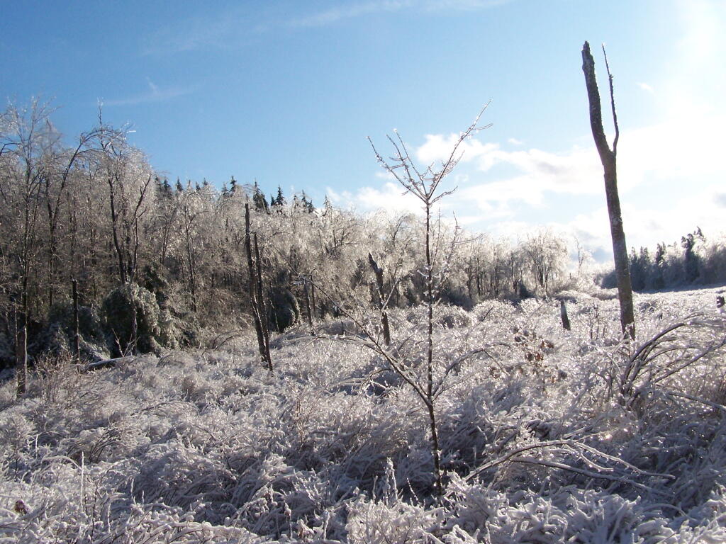
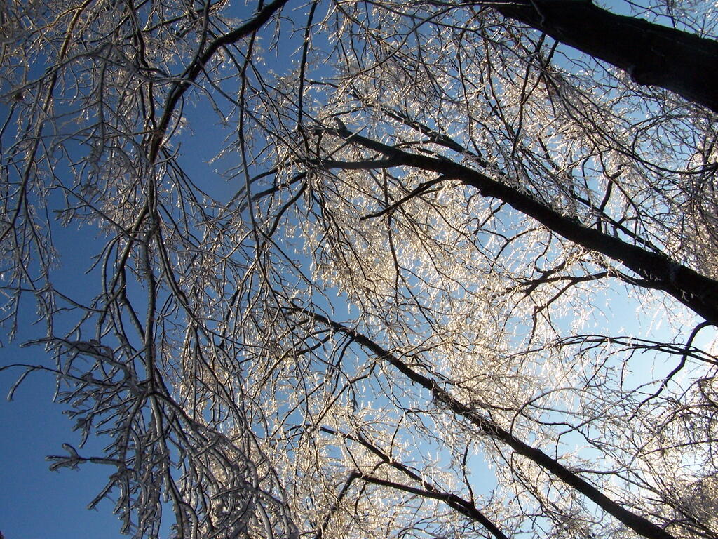
Throughout Friday, freezing rain, sleet, and snow came down, covering the State Capitol and surrounding building with a layer of ice.
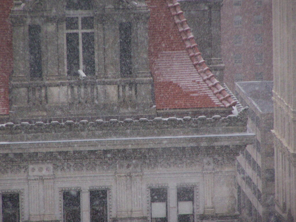
The ice weighted down trees and made everything look “wet”, but it did not pile up all fluffy like we think of snow being.
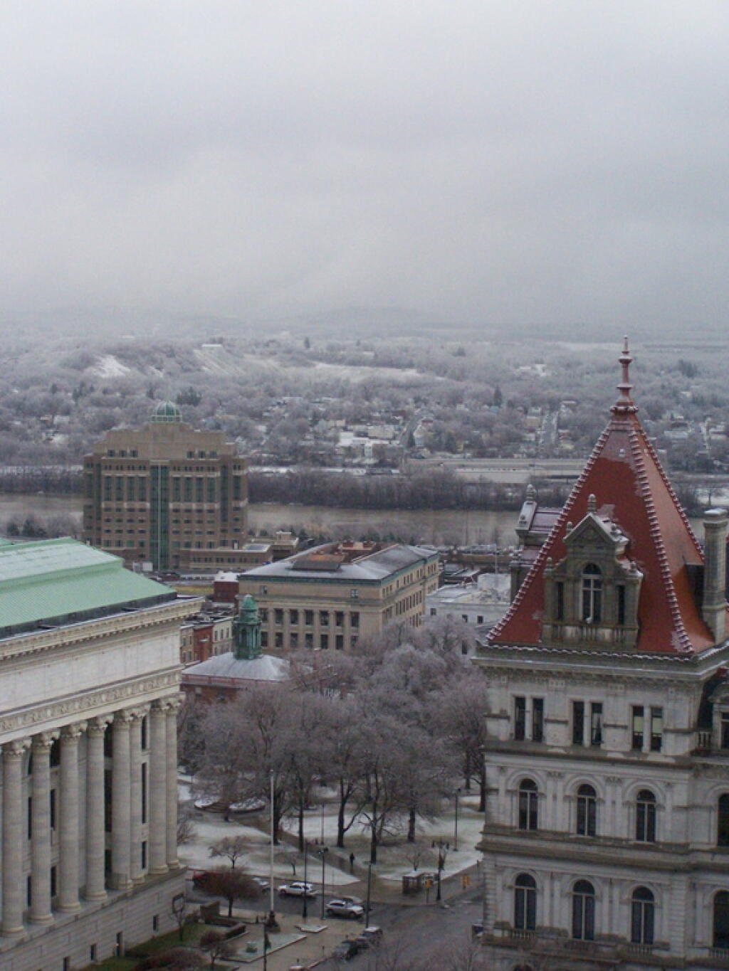
Here are the Heldeberg Mountains covered with ice and beauty.
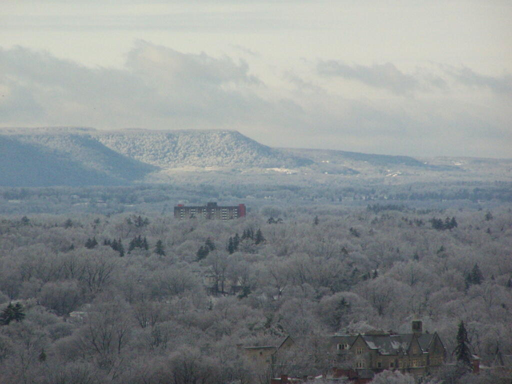
The next morning walking through the woods, covered with ice and beauty at Cole Hill State Forest.
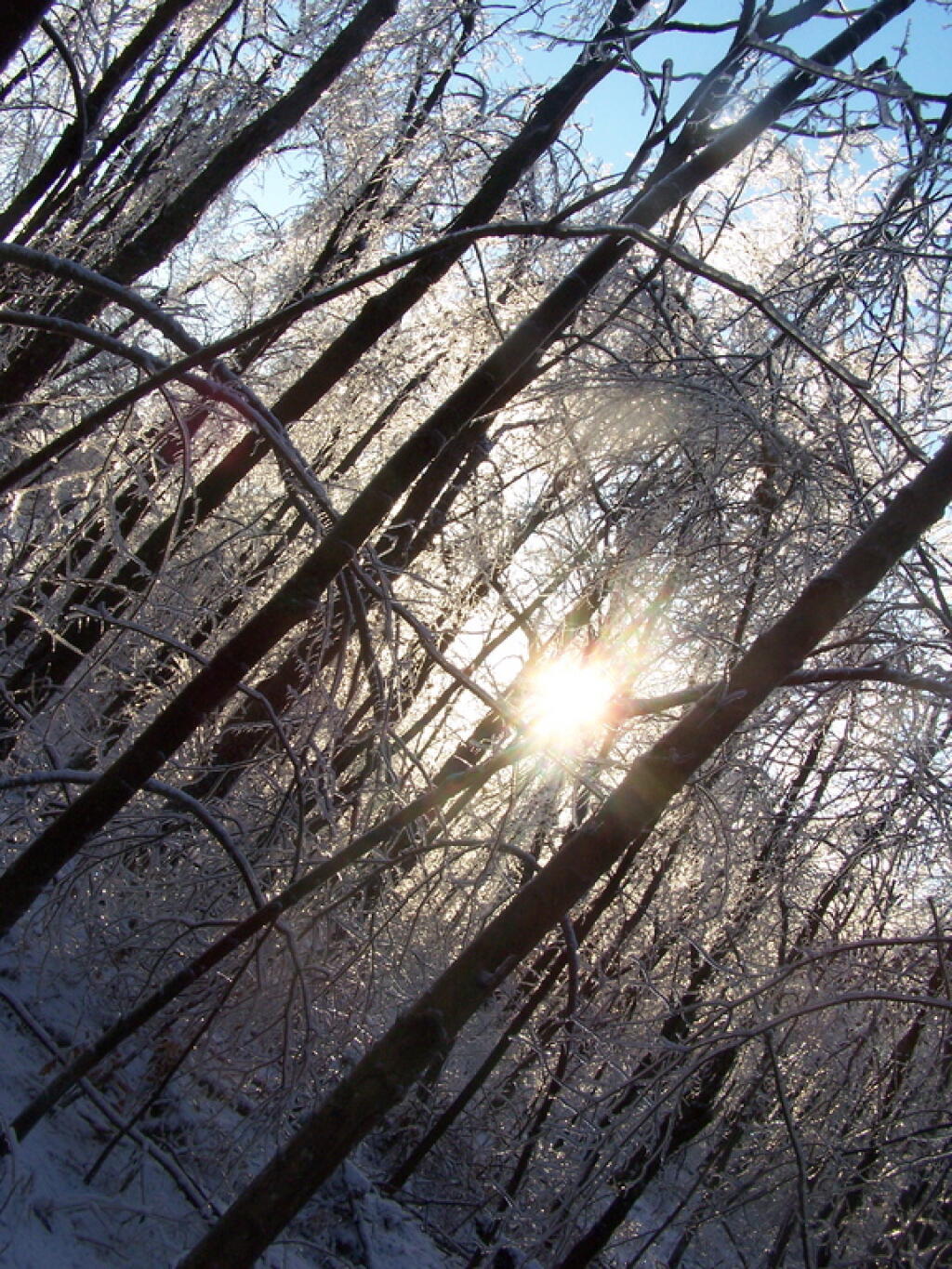
The swamp at Cole Hill was just shimmering in light.
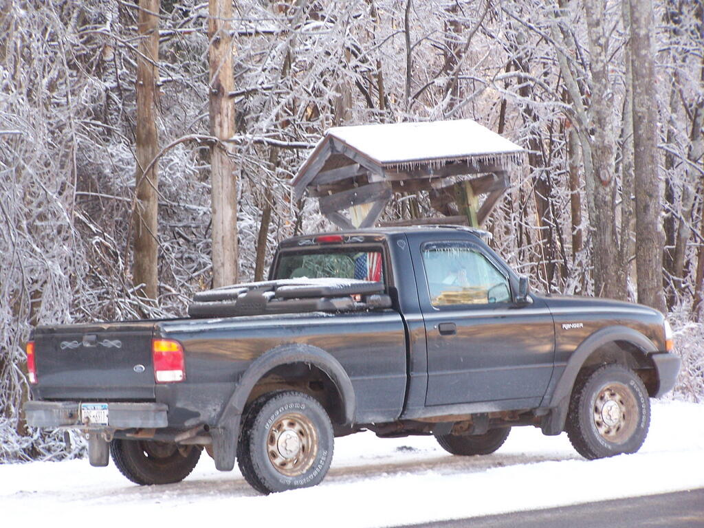
While driving the pickup for a while got the ice melted off the doors, it kept freezing shut, and I had to keep cracking the ice off the doors.
Ice on a Pine Tree at Thatcher Park.
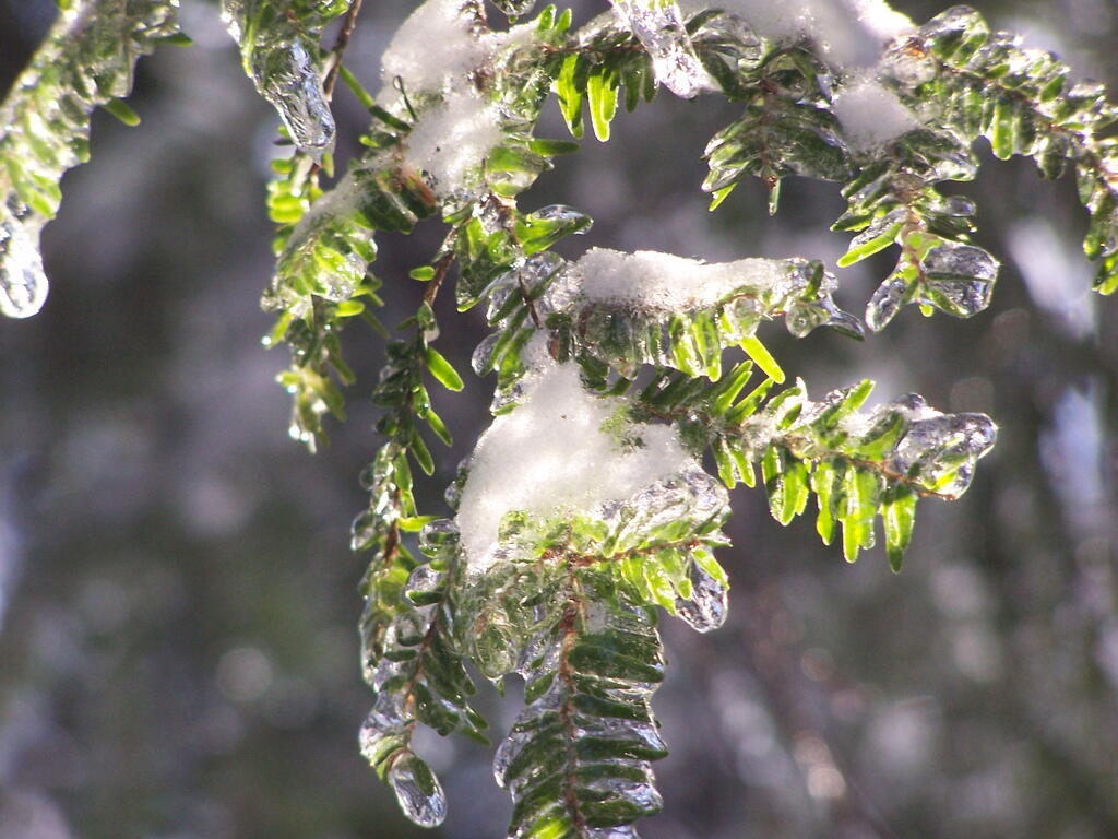
Branches covered with ice where so pretty.
Even when it was on the power lines and knocked out power to thousands.
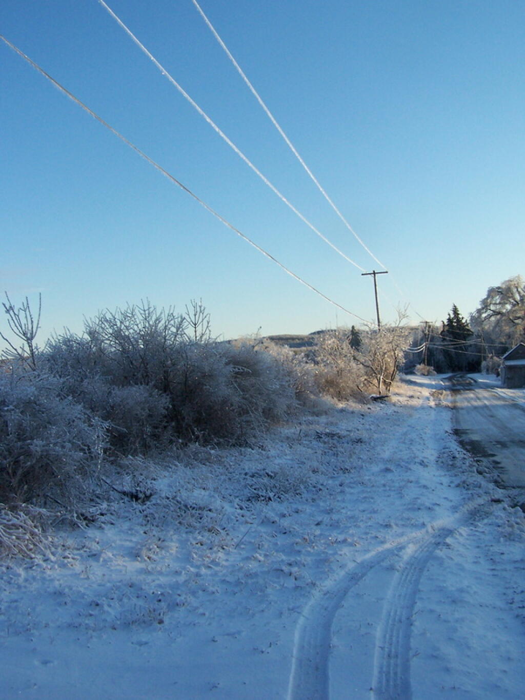
The Ice Storm of 2008 was so beautiful, even if it did knock out power and close down roads.


