Search Results for: South Valley State Forest

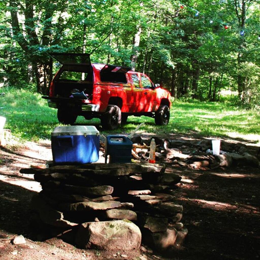
Camping on McCarthy Hill Road

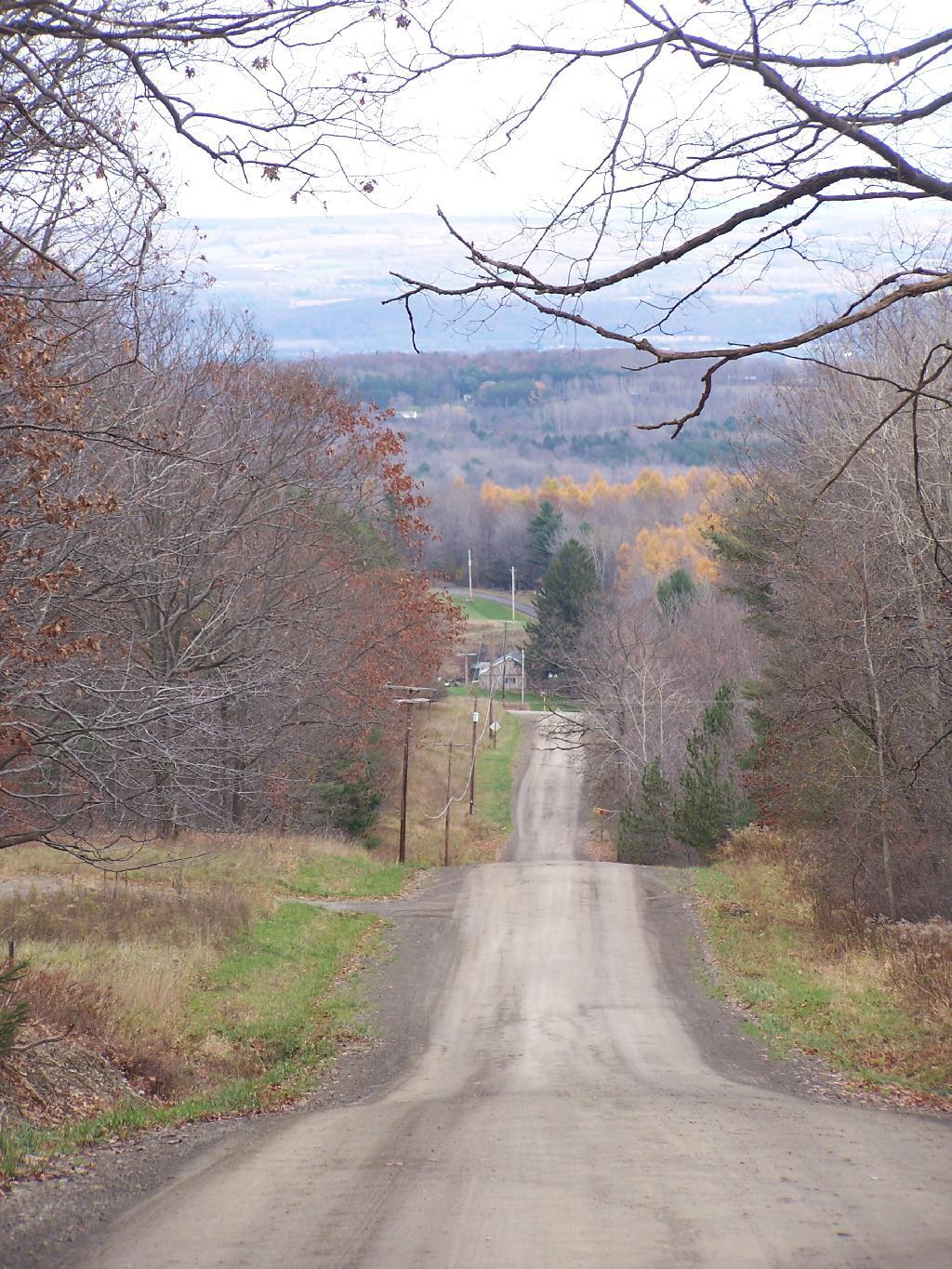
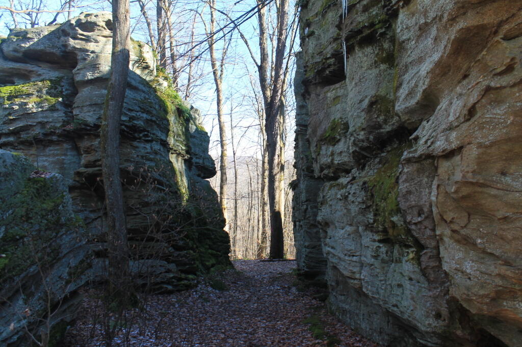
Last November, I spent two rather cold nights right before southern zone hunting season camping on McCarthy Hill Road near Ellicotville in CattaraugusΒ County. Located about 1/2 mile from Little Rock City, a popular place for hiking and exploring various “buildings” which are actually just very large, square rocks, left from the glaciers.

Exploring Rock City

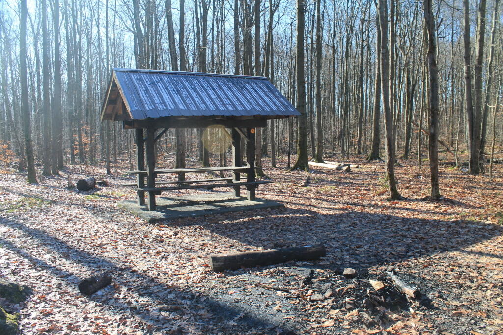
The campsites near Little Rock City have little pavilions.

Tent Camping Pavlion

The campsites along McCarthy Hill Road are simple roadside sites, with little more then stone campfire rings and a “Camp Here” sign nailed to the trees.

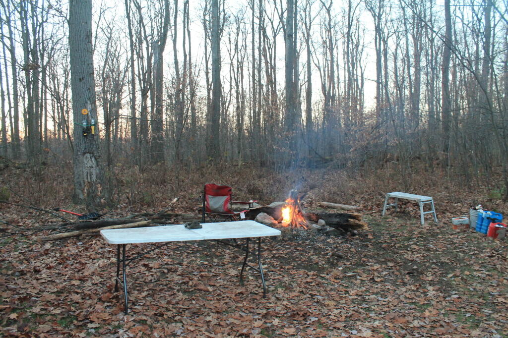
Final Campfire

Up here, you are camping on a mountain, or at least a fairly large hill, so it’s pretty cold especially on the first day of southern zoning hunting season.

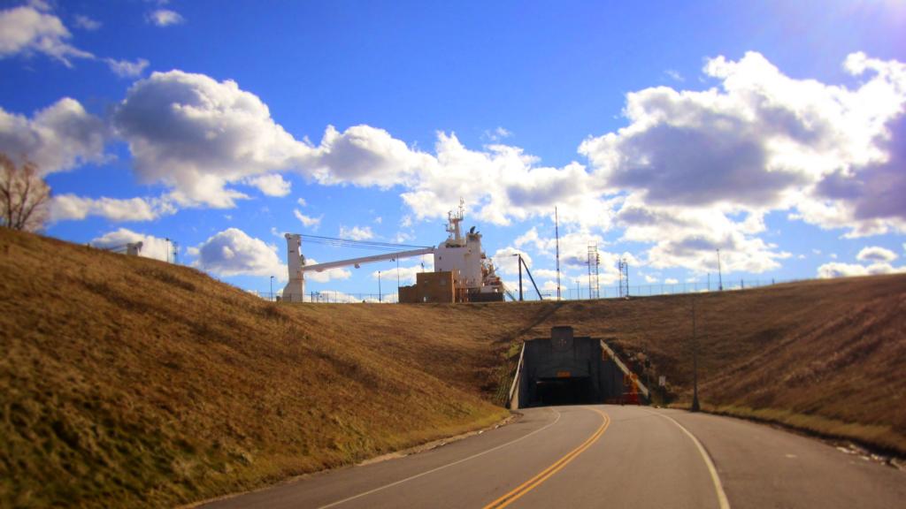
Have you ever driven under a 28,500 ton Seawaymax ship?

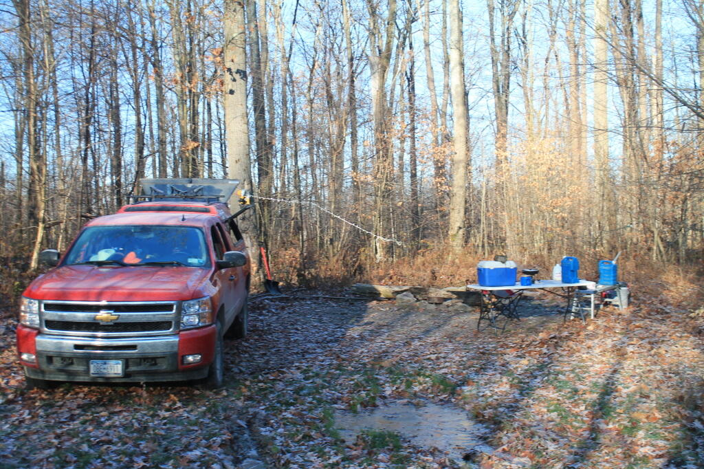
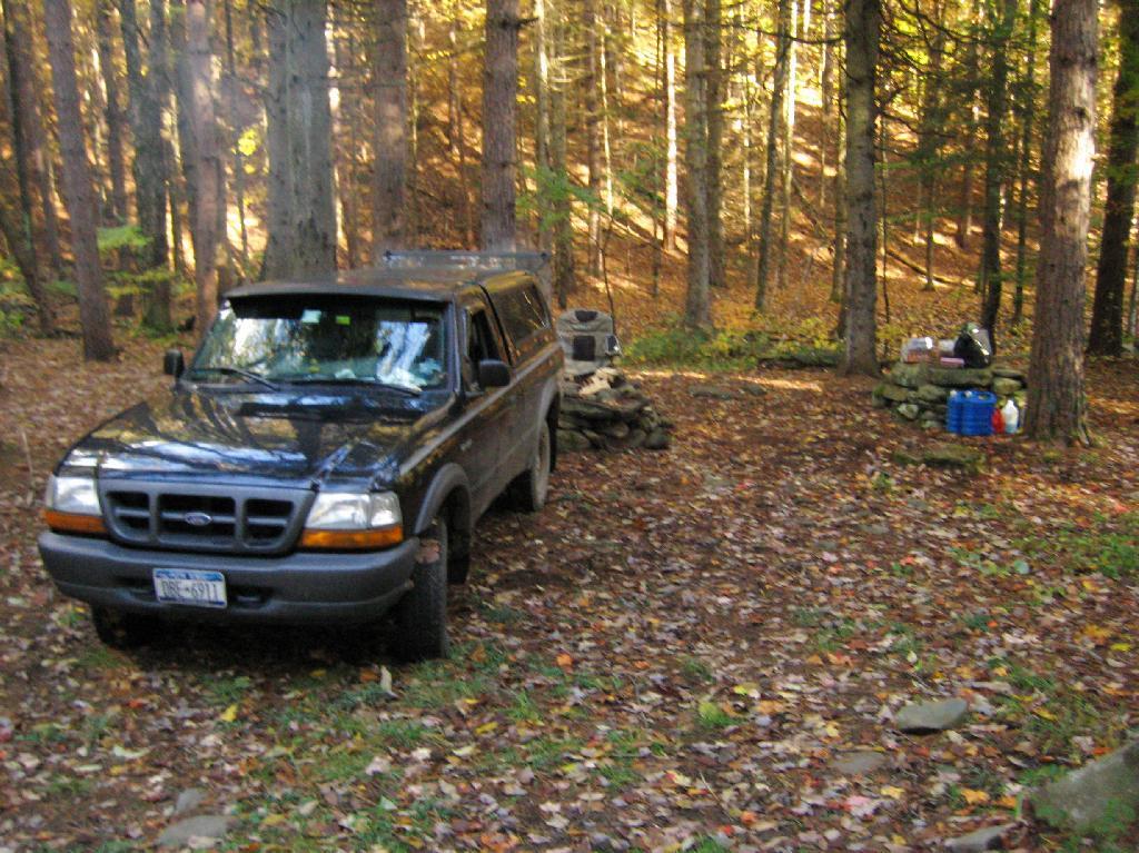
But some nice warm coffee can help things out a lot, even when the themometer in your pickup truck says it’s only 19 degrees. Plus a good breakfast made on the campstove.

19 degree at Camp

15 miles to the south is Allegany State Park. 40 miles will get you to the Allegheny National Forest in Pennsylvania. Likewise, Jamestown is about 40 miles to the west. I’ve heard it’s popular in the summer. 15 miles to the north is Zoar Valley Unique Area, a great gorge where the Cattaragus Creek runs, and 50 miles northeast is Letchworth State Park.


View Larger Map

There is good cell service and 4G wireless internet service. Bring your own electricity.

Untitled [Expires September 23 2024]

Here’s a map.

Betty Brook North Campsites

There are two campsites on the northern portion of Betty Brook Road, along the Betty Brook. They are usually accessed via Rossman Hill Road, although you can access them from southern end of Betty Brook Road where it hits West Kill Road, if you take a rough truck trail several miles.

Located on a small stream known as Betty Brook, they are located in a fairly deep valley, with private in-holdings on both sides of the valley.

Rankings: Campsites are ranked from 0 to 10, based on the described attributes.

Overall 9 Lack of Enforcement Presence 8
Scenic Beauty 8 Facilities 5
Cleanliness 8 On-Site Attractions 3
Privacy 9 Nearby Attractions 5
Layout 9 Cellphone and Data Services 0

Campsite

Location:
  • Roughly 1.3 miles south of Rossman Hill Road, Fulton, NY on Betty Brook Road.
  • When you proceed down Betty Brook Rd, hang a right at the split where the arrow signs point you away from the “Posted” driveway.
  • 15.7 miles south-east of Cobelskill
  • 6.4 miles north-west of Blenhium
  • N 42.52809 W 74.51415
Cost:
  • No charge
  • 3-nights maximum stay at this site except by FREE camping permit for up to 2-weeks which can be obtained from Forest Ranger Tom EdmundsΒ 518-827-6565, Cell: 518-505-4070 (more info).
Facilities:
  • 1 small campsite, big enough for small car and a tent
  • 1 large campsite in a field with trees, good for mid-size campers
  • Large campsite – large stone ring fireplace, Small campsite – stone fireplace
  • Stone tables at both campsite
  • No outhouses.
  • No cellphone service
  • Limited radio reception
Vehicles:
  • Large trailer or tent (southern site)
  • Tent or small truck with camper stop (north site)
Attractions on Site:
  • Betty Brook for water
Attractions Nearby:
  • Looking Glass Pond – Fishing – 3 miles north-east on Rossman Hill Road in Fulton
  • NY Power Authority Visitors Center – 8 miles south-west on NY 30 in Blenhium
  • Mine Kill State Park (fee) – 9 miles south-west on NY 30 in Blenhium
  • Mine Kill Falls (south of the park – FREE) – 10 miles south-west on NY 30 in Blenhium
  • Max Shaul Farm Market – 10 miles north-east on NY 30 in Fultonham
Sanitation:
  • Water from Betty Brook – Boil before drinking or cooking
  • No outhouses – Dig hole in woods away from creek, burn toilet paper
  • Burn combustible garbage, take cans home for recycling
  • Make sure firepits and campsite are clean before leaving
Restrictions on Use:
  • 3-nights maximum stay at this site.
  • Except by FREE camping permit for up to 2-weeks which can be obtained from Ranger Tom EdmundsΒ 518-827-6565, Cell: 518-505-4070 (more info).
  • Seasonal use road, the last 1/8 mile from Number Four Road.

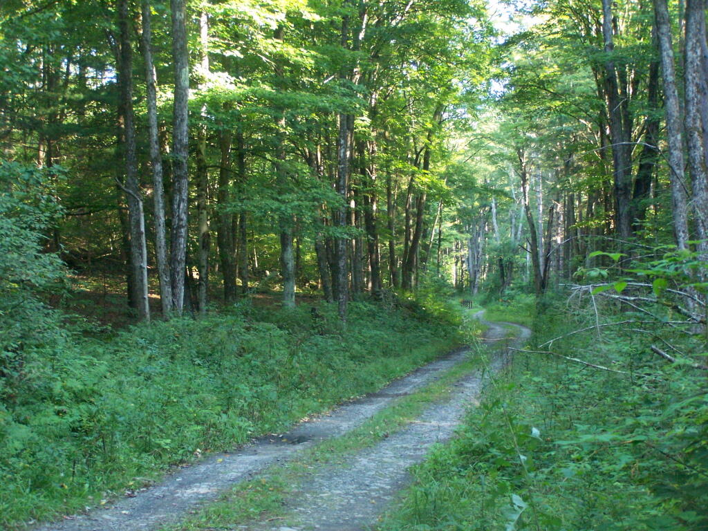
Betty Brook Road

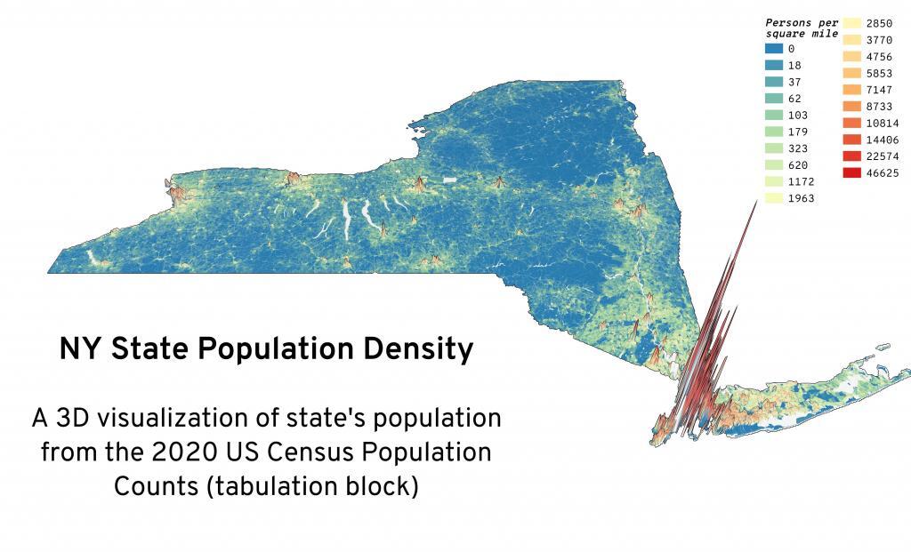
New York State Population Density

That November 2012 Trip

I have been toying around in mind what I want to do in mid-November as I take a week off from work to travel. While there is two big ifs in my mind — the exact amount of time I will have off and the cost of gasoline — the later being a big expensive question, I have already been thinking what I want to do.

Coon Hollow

Traveling in November can be tricky. You get up before sunrise, or near it. You have to rush around all day, knowing you have to locate a campsite by 3 PM or so, and be well on your way of setting up camp by 4 PM, because it will be dark out at 5 PM, and you will want to have firewood and a fire started by dusk. The long evenings are not much of a problem, as I have lighting powered by the deep cycle battery in my pickup, but still daylight limits day time activities. The potential for snow and hunting season are other constaining factors. Cold can be bad, but at least with my current set up with the truck, having a dead battery is not a real risk.

I have three different trip options in mind:

  • Tug Hill/Northern Tier/Adirondack Trip
  • Southern Tier/Western NY/Northern Tier of PA Trip
  • Wayne National Forest and Monongahela National Forest Trip

The Tug Hill/Northern Tier/Adirondack Trip would take me up through the Tug Hill checking out Whetstone State Park, maybe Moose Plains or Independence River Wild Forest, Brasher-Bombay State Forest near Massena, and then maybe somewheres around St Regis Canoe-area. Would have to worry more about snow, and it would be big game season, but its the shortest and most economic trip especially if gas prices are high.

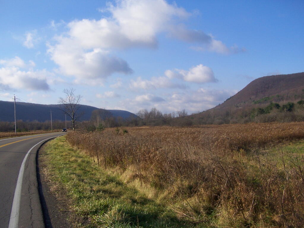
Tower Hill Road

The Southern Tier/Western NY/Northern Tier of PA Trip would have me going out US 20, probably camping at Stony Pond Campground, then out to East Otto State Forest or maybe Sugar Hill in between. I would check out Zoar Valley, and then probably drive down to Chautauqua County and ultimately to Allegheny National Forest. Probably stay there a couple of days, then head back east on US 6, through the Endless Mountains, and return through Binghamton. That said, this is somewhat repeative of the mid-summer trip, so I don’t know if I want to do it again.

First Day of Snow at the Albany Airport, Past 30 Years

Then there is the trip I really want to take, which is to Coal Country Ohio and West Virigina, and the Wayne National Forest and Monongahela National Forest. It would be a delightful trip, even if it was kind of a lng trip. But that is dependent on gas prices, and if I can get a week plus off to make it all happen. But I have truck and gear, so it could be really awesome trip if I could make it happen. I want to travel to new frontiers, and I am ready to make that happen.

What Does 100 Miles from the Rapp Road Landfill Look Like?

About a year ago, in the Capital Region Solid Waste Plan, the City of Albany proposed creating a mega-solid waste authority to manage the Solid Waste for most of the Eastern Half of New York State. The plan specifically called for creating a regional authority — to service up to nine counties, and cover an area of 100 miles from the center point of the Rapp Road Landfill.

So I decided to make a map, and run some numbers…

Along the Lake

100 square miles equals roughly 30,500 square miles, with 21,500 sq miles in New York State and 9,000 sq miles out of State — primarily Southern Vermont, but also most of Western Massachussets, roughly 3/4th of Connecicut, and part of Pennsylvania in the Poconos.

In contrast to 30,500 square miles, Adirondack Park “Blue Line” covers roughly 9,100 sq miles in NY State and the Catskill Park “Blue Line” covers roughly 1,100 sq miles. That includes all land within those parks, publicly and privately owned.

That area, within NY State, covers an area were 2,957,993 persons reported residing in the 2010 census.

That is 2.95 million people, or almost 3 million people, a population greater then Manhattan at 1.5 million persons, and even Brooklyn at 2.5 million.

While no one town or city in the proposed in Authorty is particularly large — the City of Albany is the largest population center at 97,856 followed by Colonie at 81,591, the reality is those numbers add up, when you include the 406 towns and cities in NY State that fall within the 100 mile distance from the Rapp Road Landfill.

Large Cities and Towns in Proposed Authority.

Town /City Population
Albany city 97,856
Colonie town 81,591
Schenectady city 66,135
Utica city 62,235
Troy city 50,129
Poughkeepsie town 43,341
Cortlandt town 41,592
Monroe town 39,912
Clifton Park town 36,705
Yorktown town 36,081
Guilderland town 35,303
Carmel town 34,305
Rome city 33,725
Bethlehem town 33,656
Poughkeepsie city 32,736
Warwick town 32,065
Newburgh town 29,801
Glenville town 29,480
Rotterdam town 29,094

All Towns and Cities in NY State within 100 miles of Rapp Road Landfill.

Here is entire list of towns partially or wholely contained in the proposed jurisdiction of the Albany Solid Waste Authority (including large cities and towns listed above)…

Town /City Population Area (sq mi) Pop sq/mi
Albany city 97,856 21 4659.8
Colonie town 81,591 57 1431.4
Schenectady city 66,135 10 6613.5
Utica city 62,235 16 3889.7
Troy city 50,129 11 4557.2
Poughkeepsie town 43,341 31 1398.1
Cortlandt town 41,592 49 848.8
Monroe town 39,912 21 1900.6
Clifton Park town 36,705 50 734.1
Yorktown town 36,081 39 925.2
Guilderland town 35,303 58 608.7
Carmel town 34,305 40 857.6
Rome city 33,725 75 449.7
Bethlehem town 33,656 50 673.1
Poughkeepsie city 32,736 5 6547.2
Warwick town 32,065 105 305.4
Newburgh town 29,801 46 647.8
Glenville town 29,480 50 589.6
Rotterdam town 29,094 36 808.2
East Fishkill town 29,029 57 509.3
Newburgh city 28,866 4 7216.5
Middletown city 28,086 5 5617.2
Queensbury town 27,901 64 436.0
Wallkill town 27,426 62 442.4
Wappinger town 27,048 28 966.0
Saratoga Springs city 26,586 28 949.5
New Windsor town 25,244 36 701.2
Kingston city 23,893 8 2986.6
Peekskill city 23,583 5 4716.6
Montgomery town 22,606 51 443.3
New Hartford town 22,166 25 886.6
Fishkill town 22,107 32 690.8
Niskayuna town 21,781 15 1452.1
Hyde Park town 21,571 39 553.1
Halfmoon town 21,535 33 652.6
Somers town 20,434 32 638.6
Saugerties town 19,482 67 290.8
Whitestown town 18,667 27 691.4
Amsterdam city 18,620 6 3103.3
Milton town 18,575 35 530.7
Southeast town 18,404 34 541.3
Blooming Grove town 18,028 35 515.1
East Greenbush town 16,473 24 686.4
Wilton town 16,173 35 462.1
Cohoes city 16,168 4 4042.0
La Grange town 15,730 40 393.3
Gloversville city 15,665 5 3133.0
Beacon city 15,541 4 3885.3
Thompson town 15,308 87 176.0
Stony Point town 15,059 31 485.8
Malta town 14,765 31 476.3
Moreau town 14,728 43 342.5
Glens Falls city 14,700 3 4900.0
Beekman town 14,621 30 487.4
Shawangunk town 14,332 56 255.9
New Paltz town 14,003 34 411.9
Oneonta city 13,901 4 3475.3
Goshen town 13,687 44 311.1
Kent town 13,507 43 314.1
German Flatts town 13,258 34 389.9
Wawarsing town 13,157 133 98.9
Fallsburg town 12,870 79 162.9
Schodack town 12,794 63 203.1
Kingsbury town 12,671 40 316.8
Cornwall town 12,646 28 451.6
Highlands town 12,492 33 378.5
Lewisboro town 12,411 29 428.0
Ulster town 12,327 28 440.3
Mamakating town 12,085 98 123.3
North Greenbush town 12,075 18 670.8
Patterson town 12,023 32 375.7
Chester town 11,981 87 137.7
Chester town 11,981 25 479.2
Brunswick town 11,941 44 271.4
Putnam Valley town 11,809 42 281.2
Catskill town 11,775 64 184.0
Oneida city 11,393 22 517.9
Woodbury town 11,353 37 306.8
Red Hook town 11,319 40 283.0
Lloyd town 10,863 33 329.2
Plattekill town 10,499 35 300.0
Kirkland town 10,315 33 312.6
Watervliet city 10,254 1 10254.0
Herkimer town 10,175 32 318.0
Liberty town 9,885 80 123.6
Ballston town 9,776 30 325.9
Pleasant Valley town 9,672 33 293.1
Philipstown town 9,662 51 189.5
Rensselaer city 9,392 3 3130.7
Crawford town 9,316 40 232.9
Lenox town 9,122 36 253.4
Esopus town 9,041 41 220.5
Marcy town 8,982 33 272.2
North Elba town 8,957 156 57.4
Coxsackie town 8,918 38 234.7
Marlborough town 8,808 26 338.8
Johnstown city 8,743 4 2185.8
Dover town 8,699 56 155.3
New Scotland town 8,648 57 151.7
Sand Lake town 8,530 36 236.9
Kinderhook town 8,498 32 265.6
Pawling town 8,463 45 188.1
Waterford town 8,423 7 1203.3
Stillwater town 8,287 43 192.7
Deerpark town 7,901 67 117.9
Greenfield town 7,775 67 116.0
Schaghticoke town 7,679 51 150.6
Frankfort town 7,636 36 212.1
Rhinebeck town 7,548 39 193.5
Coeymans town 7,418 53 140.0
Rochester town 7,313 89 82.2
Wawayanda town 7,266 35 207.6
Norwich city 7,190 2 3595.0
Johnstown town 7,098 71 100.0
Mount Hope town 7,018 25 280.7
Hoosick town 6,924 63 109.9
Hudson city 6,713 2 3356.5
Hamilton town 6,690 41 163.2
Cairo town 6,670 60 111.2
Granville town 6,669 56 119.1
Cobleskill town 6,625 30 220.8
Corinth town 6,531 58 112.6
Mayfield town 6,495 64 101.5
Lee town 6,486 45 144.1
Fort Edward town 6,371 27 236.0
Hurley town 6,314 35 180.4
Verona town 6,293 69 91.2
Windsor town 6,274 93 67.5
Fort Ann town 6,190 111 55.8
Westmoreland town 6,138 43 142.7
Duanesburg town 6,122 71 86.2
Rosendale town 6,075 20 303.8
Claverack town 6,021 47 128.1
Woodstock town 5,884 67 87.8
Sidney town 5,774 50 115.5
Pittstown town 5,735 64 89.6
Gardiner town 5,713 43 132.9
Saratoga town 5,674 42 135.1
Marbletown town 5,607 55 101.9
Greene town 5,604 75 74.7
Walton town 5,576 97 57.5
Amsterdam town 5,566 30 185.5
Hamptonburgh town 5,561 26 213.9
Vienna town 5,440 95 57.3
Vernon town 5,408 37 146.2
Ghent town 5,402 45 120.0
Broadalbin town 5,260 39 134.9
Eaton town 5,255 45 116.8
Colesville town 5,232 79 66.2
Oneonta town 5,229 33 158.5
Mechanicville city 5,196 0
Delhi town 5,117 64 80.0
North Salem town 5,104 22 232.0
Northumberland town 5,087 32 159.0
Ticonderoga town 5,042 88 57.3
Little Falls city 4,946 3 1648.7
Greenwich town 4,942 44 112.3
Union Vale town 4,877 37 131.8
Moriah town 4,798 71 67.6
Nassau town 4,789 45 106.4
Washington town 4,741 58 81.7
Boonville town 4,555 72 63.3
Poestenkill town 4,530 32 141.6
Trenton town 4,498 43 104.6
Minisink town 4,490 23 195.2
Amenia town 4,436 43 103.2
Olive town 4,419 65 68.0
Paris town 4,411 31 142.3
Unadilla town 4,392 46 95.5
Minden town 4,297 51 84.3
Deerfield town 4,273 33 129.5
Bethel town 4,255 90 47.3
Greenport town 4,165 20 208.3
Charlton town 4,133 32 129.2
Chatham town 4,128 53 77.9
Warrensburg town 4,094 64 64.0
Athens town 4,089 28 146.0
Sherburne town 4,048 43 94.1
Whitehall town 4,042 58 69.7
Norwich town 3,998 42 95.2
Oxford town 3,901 60 65.0
Otsego town 3,900 59 66.1
Mohawk town 3,844 35 109.8
Stanford town 3,823 50 76.5
Floyd town 3,819 34 112.3
Argyle town 3,782 57 66.4
Rockland town 3,775 95 39.7
Middletown town 3,750 97 38.7
Middleburgh town 3,746 49 76.4
Greenville town 3,739 39 95.9
Greenville town 3,739 30 124.6
Canajoharie town 3,730 43 86.7
Livingston town 3,646 38 95.9
Perth town 3,646 26 140.2
Tuxedo town 3,624 49 74.0
Copake town 3,615 42 86.1
Neversink town 3,557 86 41.4
Galway town 3,545 45 78.8
Lake George town 3,515 32 109.8
Schuyler town 3,420 40 85.5
New Baltimore town 3,370 43 78.4
Westerlo town 3,361 58 57.9
White Creek town 3,356 48 69.9
Lake Luzerne town 3,347 54 62.0
Manheim town 3,334 29 115.0
Bainbridge town 3,308 34 97.3
Palatine town 3,240 41 79.0
Hancock town 3,224 161 20.0
Schoharie town 3,205 29 110.5
Otego town 3,115 45 69.2
Shandaken town 3,085 120 25.7
Sherrill city 3,071 2 1535.5
Callicoon town 3,057 48 63.7
Milford town 3,044 47 64.8
North East town 3,031 43 70.5
Annsville town 3,012 60 50.2
Madison town 3,008 41 73.4
Davenport town 2,965 52 57.0
Guilford town 2,922 61 47.9
Stephentown town 2,903 58 50.1
Afton town 2,851 46 62.0
Stockport town 2,815 13 216.5
Berne town 2,794 64 43.7
Hunter town 2,732 90 30.4
Durham town 2,725 49 55.6
Salem town 2,715 52 52.2
Florida town 2,696 51 52.9
Knox town 2,692 41 65.7
New Berlin town 2,682 46 58.3
Delaware town 2,670 35 76.3
Northampton town 2,670 34 78.5
St. Johnsville town 2,631 17 154.8
Green Island town 2,620 0
Richmondville town 2,610 30 87.0
Russia town 2,587 60 43.1
Sangerfield town 2,561 30 85.4
Brookfield town 2,545 78 32.6
Highland town 2,530 52 48.7
Glen town 2,507 39 64.3
Roxbury town 2,502 87 28.8
Pine Plains town 2,473 31 79.8
Lumberland town 2,468 49 50.4
Laurens town 2,424 42 57.7
Franklin town 2,411 81 29.8
Sanford town 2,407 91 26.5
Johnsburg town 2,395 206 11.6
Richfield town 2,388 32 74.6
Milan town 2,370 36 65.8
Easton town 2,336 63 37.1
Bolton town 2,326 90 25.8
New Lebanon town 2,305 35 65.9
Newport town 2,302 32 71.9
Hartford town 2,269 43 52.8
Stamford town 2,267 48 47.2
Worcester town 2,220 46 48.3
Marshall town 2,131 32 66.6
Grafton town 2,130 45 47.3
Princetown town 2,115 24 88.1
Middlefield town 2,114 63 33.6
Hartwick town 2,110 40 52.8
Stockbridge town 2,103 31 67.8
Winfield town 2,086 23 90.7
Colchester town 2,077 142 14.6
Esperance town 2,076 20 103.8
Hadley town 2,048 41 50.0
Stuyvesant town 2,027 26 78.0
Crown Point town 2,024 81 25.0
Cambridge town 2,021 36 56.1
Augusta town 2,020 27 74.8
Lincoln town 2,012 25 80.5
Providence town 1,995 45 44.3
Nelson town 1,980 44 45.0
Clermont town 1,965 19 103.4
Salisbury town 1,958 108 18.1
Germantown town 1,954 13 150.3
Western town 1,951 54 36.1
Carlisle town 1,948 34 57.3
Remsen town 1,929 36 53.6
Hillsdale town 1,927 48 40.1
Oppenheim town 1,924 56 34.4
Maryland town 1,897 51 37.2
Watson town 1,881 116 16.2
Berlin town 1,880 59 31.9
Morris town 1,878 39 48.2
Hebron town 1,853 56 33.1
Sharon town 1,846 39 47.3
Rensselaerville town 1,843 62 29.7
Edmeston town 1,826 44 41.5
Webb town 1,807 484 3.7
Plymouth town 1,804 42 43.0
Jackson town 1,800 37 48.6
Butternuts town 1,786 53 33.7
Leyden town 1,785 33 54.1
North Norwich town 1,783 28 63.7
Seward town 1,763 36 49.0
Fenner town 1,726 31 55.7
Root town 1,715 51 33.6
Deposit town 1,712 44 38.9
Canaan town 1,710 36 47.5
Windham town 1,703 45 37.8
Ashland town 1,695 25 67.8
Ephratah town 1,682 39 43.1
Kortright town 1,675 62 27.0
Gallatin town 1,668 39 42.8
Coventry town 1,655 48 34.5
Schroon town 1,654 141 11.7
Austerlitz town 1,654 48 34.5
Fairfield town 1,627 41 39.7
DeRuyter town 1,589 31 51.3
Little Falls town 1,587 22 72.1
Columbia town 1,580 35 45.1
Harpersfield town 1,577 42 37.5
Ancram town 1,573 42 37.5
Wright town 1,539 28 55.0
Forestport town 1,535 78 19.7
Meredith town 1,529 58 26.4
Petersburgh town 1,525 41 37.2
West Turin town 1,524 102 14.9
Bridgewater town 1,522 23 66.2
Tusten town 1,515 48 31.6
Litchfield town 1,513 30 50.4
Fulton town 1,442 65 22.2
Jefferson town 1,410 43 32.8
Horicon town 1,389 71 19.6
Lewis town 1,382 65 21.3
Charleston town 1,373 42 32.7
Cochecton town 1,372 37 37.1
Pittsfield town 1,366 38 35.9
Springfield town 1,358 45 30.2
Indian Lake town 1,352 266 5.1
Lebanon town 1,332 43 31.0
Smithville town 1,330 50 26.6
Hamden town 1,323 60 22.1
Masonville town 1,320 54 24.4
Westport town 1,312 66 19.9
Taghkanic town 1,310 40 32.8
Gilboa town 1,307 59 22.2
Andes town 1,301 112 11.6
Smithfield town 1,288 24 53.7
Smyrna town 1,280 42 30.5
Tompkins town 1,247 104 12.0
Lyonsdale town 1,227 70 17.5
Cherry Valley town 1,223 40 30.6
Thurman town 1,219 92 13.3
Edinburg town 1,214 67 18.1
Caroga town 1,205 54 22.3
Greig town 1,199 94 12.8
Elizabethtown town 1,163 83 14.0
Summit town 1,148 37 31.0
Warren town 1,143 38 30.1
Burlington town 1,140 45 25.3
New Lisbon town 1,114 44 25.3
Keene town 1,105 156 7.1
Steuben town 1,100 42 26.2
Otselic town 1,054 38 27.7
Preston town 1,044 35 29.8
Danube town 1,039 29 35.8
Fremont town 1,008 51 19.8
Ohio town 1,002 307 3.3
Exeter town 987 32 30.8
Columbus town 975 37 26.4
Georgetown town 974 40 24.4
Broome town 973 48 20.3
Jewett town 953 50 19.1
Hampton town 938 22 42.6
Plainfield town 915 29 31.6
Kingston town 889 7 127.0
McDonough town 886 39 22.7
Westford town 868 33 26.3
Day town 856 69 12.4
Forestburgh town 819 56 14.6
Minerva town 809 160 5.1
Lexington town 805 79 10.2
Pitcher town 803 28 28.7
Lake Pleasant town 781 198 3.9
Stony Creek town 767 83 9.2
Norway town 762 35 21.8
Stark town 757 31 24.4
Clinton town 737 38 19.4
Conesville town 734 40 18.4
Long Lake town 711 449 1.6
Roseboom town 711 33 21.5
Prattsville town 700 19 36.8
Hague town 699 80 8.7
Ava town 676 37 18.3
Wells town 674 177 3.8
Dresden town 652 54 12.1
Bovina town 633 44 14.4
Stratford town 610 76 8.0
Putnam town 609 35 17.4
Pharsalia town 593 39 15.2
Denning town 551 105 5.2
Bleecker town 533 59 9.0
Newcomb town 436 233 1.9
Hope town 403 41 9.8
Lincklaen town 396 26 15.2
Blenheim town 377 34 11.1
Decatur town 353 20 17.7
Inlet town 333 66 5.0
Arietta town 304 329 0.9
Halcott town 258 23 11.2
North Hudson town 240 185 1.3
Hardenburgh town 238 80 3.0
Benson town 192 83 2.3
Morehouse town 86 194 0.4
Total 2,957,993 21,462 386.0

Campsites and Lean-Tos in DEC Region 7 (Central NY)

Today we look at Campsites and Lean-tos and other “developed” camping opporunties in DEC Region 7, which consists of lands in Central NY Counties of Broome, Cayuga, Chenango, Cortland, Madison, Onondaga, Oswego, Tompkins and Tioga, and is based on data in Region 7 Recreation Master Plan.

Rhododendrons

Current 85 Designated Campsites/Lean-Tos.

  • Balsam Pond State Forest (Chenango 17) – 1 campsite at Baker’s pond
  • Balsam Pond State Forest (Chenango 34) – 9 campsites 3
  • Beaver Creek State Forest (Madison 12) – 2 campsites at the assembly area 4
  • Charles E. Baker State Forest (Madison 1) – 14 campsites at Moscow Hill 4
  • Charles E. Baker State Forest (Madison 1) – 2 lean-tos
  • Charles E. Baker State Forest (Madison 1) – 8 campsites at Cherry Ridge 3
  • Danby State Forest (Tompkins 1) – 2 lean-tos (Finger Lakes Trail)
  • Gee Brook State Forest (Cortland 17) – 6 campsites at Calico Pond
  • Long Pond State Forest (Chenango 35) – 8 campsites
  • Ludlow Creek State Forest (Chenango 6) – 1 lean-to (Finger Lakes Trail)
  • Mariposa State Forest (Chenango-Madison 1) – 1 lean-to (Finger Lakes Trail)
  • McDonough State Forest (Chenango 1) – 3 campsites at Whaley Pond
  • Morgan Hill State Forest (Cortland 4) – 1 lean-to
  • Morgan Hill State Forest (Onondaga 1) – 9 campsites at Spruce Pond 1
  • New Michigan State Forest (Chenango 5) – 1 lean-to (Finger Lakes Trail)
  • Robinson Hollow State Forest (Tioga 3) – 1 lean-to
  • Shindagin Hollow State Forest (Tompkins 3) – 1 lean-to (Finger Lakes Trail)
  • Stoney Pond State Forest (Madison 13) – 12 campsites 2
  • Taylor Valley State Forest (Cortland 2) – 12 campsites 5
  • Tuller Hill State Forest (Cortland 9) – 1 lean-to
  • Whaupaunaucau State Forest (Chenango 31) – 1 lean-to
  • Wiley Brook State Forest (Chenango 7) – 1 campsite

1 DEC Camping permit required. Call (607) 674-4036 to have a permit mailed to you.

2DEC Camping permit required from April 15-October 15th. Call (607) 674-4036 to have a permit mailed to you.

3 Vehicle accessible.

4Horse Assembly and Camping-area.

5 Currently undesignated sites (lacks “Camp Here Markers”) on an old loop road that was part of CCC Camp in Taylor Valley.

Related Maps.

Reed Hill

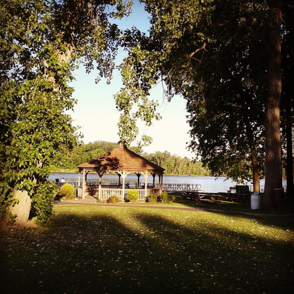
Pavilion

Morning shadows

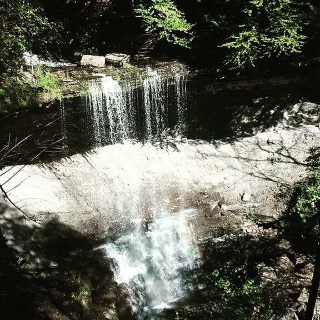
Waterfall on the Long Path

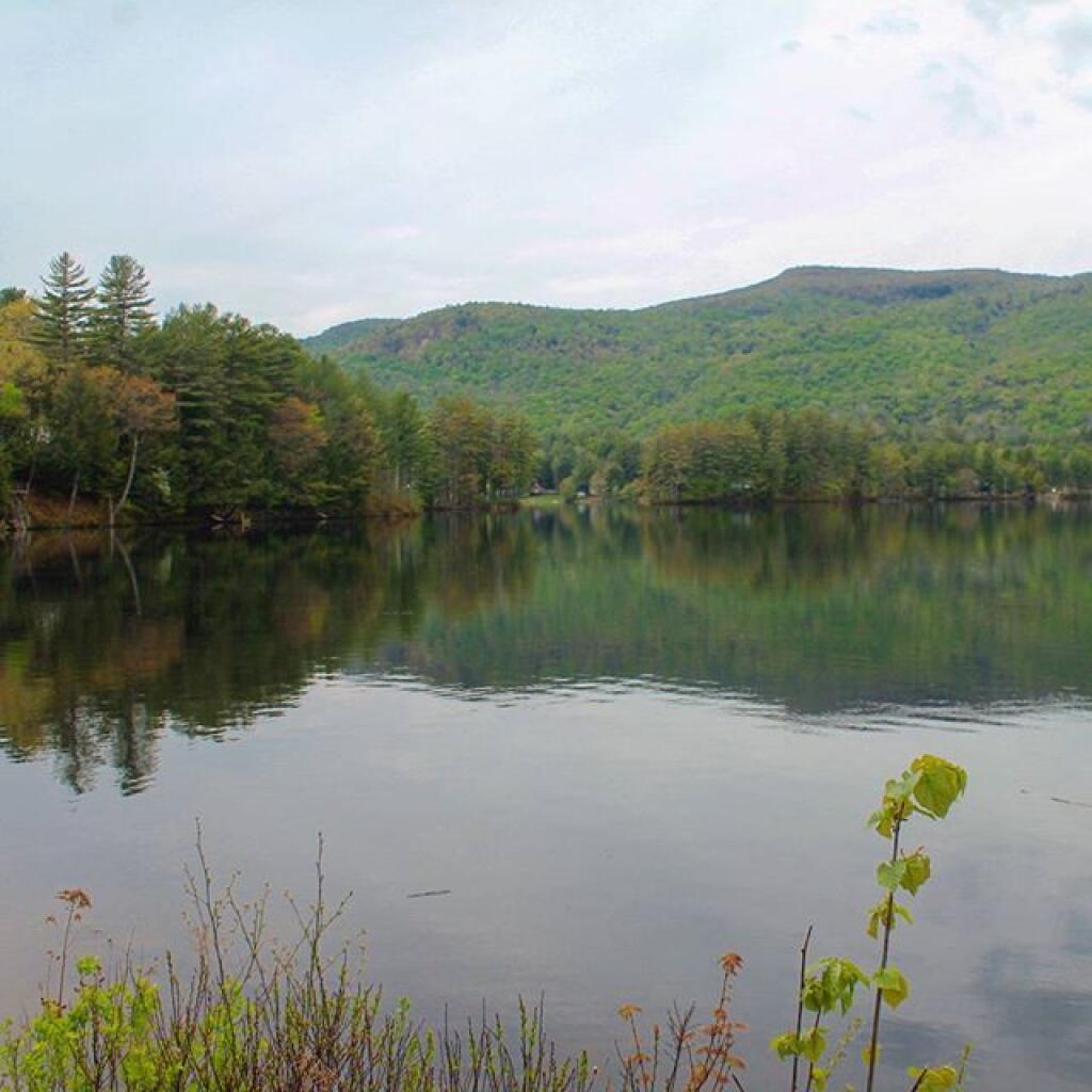
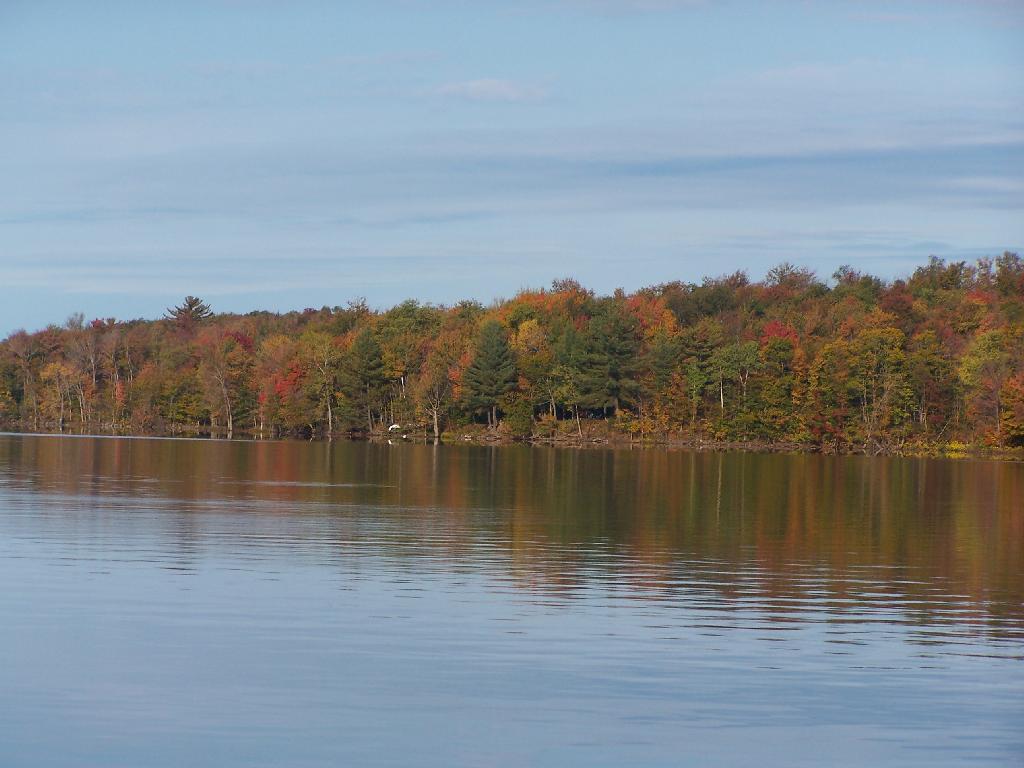
Shoreline

DEC’s Future Plans for Region 7

1. Develop 31 additional campsites in Region 7. Twenty-eight of these will be open campsites and three will be lean-tos. A portion of the new campsite development will occur on Hall Island State Forest (Oswego 10), as noted in items b and c. The Department will consider the option of permanently closing any or all of the Island campsites if patrol or enforcement problems become an issue. Fiscal constraints and public demand will determine if any additional campsites are to be developed within the Region.

a. Development of the new campsites will be in compliance with the guidelines for access by people with disabilities.

b. Develop 12 to 15 open campsites on Hall Island State Forest (Oswego10). These campsites will be located on the south side of the Salmon River Reservoir and will only be accessible by water. A permit will be required to occupy these sites. Three of these sites will be developed for people with disabilities . c. On Hall Island State Forest (Oswego 10), upgrade two designated campsites on Burdick Island and two campsites on Huckleberry Island in the Salmon River Reservoir. A permit will be required to occupy these sites. Two of these sites will be developed for people with disabilities.

Households That Make Less then $30k

d. Develop one lean-to campsite along the Finger Lakes Trail on Perkins Pond State Forest (Chenango 22) in the Town of Otselic.

e. Develop two open campsites on the Marsh Pond State Forest (Broome 4) near the pond. One of these sites will be developed for people with disabilities.

f. Develop three campsites on Robinson Hill State Forest (Tioga 3) near Tricounty Pond. The exact number of sites will be determined from local demand. One or two of these sites will be developed for people with disabilities. Install kiosk and develop area brochure.

g. Develop one lean-to on the Genegantslet State Forest with access from Creek Road. The access trail to the lean-to will be approximately 0.7 miles of hiking trail.

h. Develop an open campsite in stand C-7 on Long Pond State Forest (Chenango 35) designed for access by canoe or boat.

i. Develop three open campsites on Oakley Corners State Forest (Tioga 2). One of these sites will be developed for people with disabilities. Use of these sites will be by permit only.

j. Upgrade and designate three formal sites on the Salmon River State Forest (Oswego 8). A permit will be required to occupy these sites.

k. Rebuild the lean-to along the trail on Chateaugay State Forest (Oswego 4 & 5).

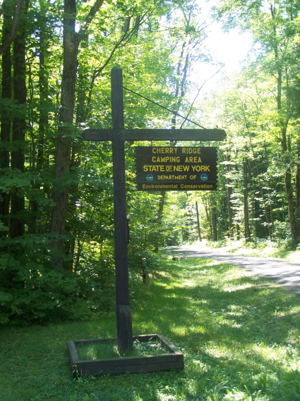
Cherry Ridge Camping Area Sign

l. Build one lean-to on Cuyler Hill State Forest (Cortland 6).

m. Inspect and, if necessary, repair or replace lean-tos on the Finger Lakes Trail.

2. Propose a change to the current regulations to address the conflicts encountered with camping within 150 feet of a road.

a. Propose a change to the current regulation that prohibits camping within 150′ of any road. The intent of this proposal is to accommodate the style of camping that is common during hunting season.

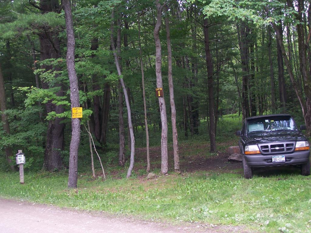
Number 1

3. Provide camping opportunities on State Forests for people with disabilities. These ADA compliant facilities will be distributed throughout the Region. Most of the designated campsites will have fire rings and several of the sites will have picnic tables. Fire rings, picnic tables and benches will be of Universal Design. Accessible latrines will be located at areas with several campsites, such as Long Pond, Stoney Pond and Charles E. Baker State Forests. All camping areas that can be driven to will have at least one accessible parking space. a. Make alterations to the Moscow Hill campsites on the Charles E. Baker State Forest (Madison 1 & 4) so that at least four of the sites are accessible by people with disabilities.

Hunting Camps Along Reservoir

4. Designate 14 campsites at Moscow Hill, Madison 1, camping area.

5. Maintain 85 existing campsites.

6. Propose a regulation to prohibit camping at Nanticoke Lake Multiple-Use Area and Redfield Island Day-Use Area

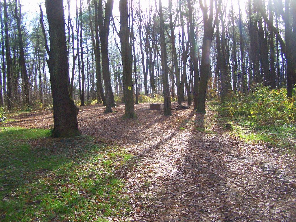
Campsite 8

7. Remove the lean-to on New Michigan State Forest (Chenango 5) This lean-to is structurally poor and is no longer located on an active trail. The lean-to proposed in 1. d will replace this lean-to.

Road Trip to Dimock PA

Roughly 30 miles south of Binghamton, NY is Dimock, PA. I wanted to visit Dimock for some time, because I wanted to see up close the impacts of natural gas drilling in Pennsylvania. Dimock is particularly infamous for a couple of tragic accidents caused by faulting casing in gas wells causing poisonous hydrocarbons to leak out into the surrounding area. Dimock is also the home of Cabot Oil and Gas, one of the most controversial drilling companies in Pennsylvania due to their awful track record with certain wells.

NY 29 to Montrose.

I’d didn’t stop and take any pictures, but I’m including some images from Google Maps, and you’ll just have to imagine the rest from my words.

Dimock is an easy drive to get to from New York State – just take NY Route 7 south from Binghamton (you can access it from I-81 Exit 1 South of Binghamton), and NY Route 7 becomes PA Route 29 as you cross the state border. PA 29 is a very narrow and slow road, going through many hamlets, and the road is in serious need of repairs – although it was in awful shape the last time I drove it in 2008, prior to the big gas boom. Normal commercial and agricultural traffic has long made this road need of a rebuild and widening heading to the Capitol of Susquehanna County. The additional drilling related traffic hasn’t helped this road, as it ages long beyond, it’s time for widening and replacement.

PA 29 is the main road from Binghamton to Montrose. It has for a long time been congested with traffic heading to and from the capital of Susquehanna County. For most part the traffic is to be expected on a rural arterial – lots of folks in pickup trucks, beat up cars, milk trucks, grain trucks, pickups towing horse and cattle trailers. There are also traffic related to gas drilling, such as fresh water haul trucks used for fracking, and residual waste trucks hauling away condensate from gas well. I saw a pickup truck with a goose-neck trailer with drilling bits on it. For the most part traffic was free flowing.

There are small cattle farms in valley below PA 29, and some of the mountains above the road show quarrying activity for Blue Stone and possibly also coal. Nothing too obvious from the roads, but in one or two places, it’s obvious there is some mountains being mined for their products.

Busy Montrose on Saturday.

Eventually you real reach the borough of Montrose. This small city was very busy, but that’s to be expected of the only city in the region on a Saturday. People go to city to pick up groceries, shop, and fill up at the gas station. Walmart – on the outskirts of the city – was particularly crazy there.

There was a mix of truck traffic from different sources – some agricultural, some oil and gas related, some other for other businesses like grocery stores. Busy, but certainly not grid lock. Montrose is a pretty gritty little city, much like other cites in Twin Tier region, with lot of folks in big jacked up pickup trucks with gun racks. It’s certainly not an urban area by any extent of the imagination. Traffic in Montrose reminded me much of busy nature of Wellsboro PA or Watkins Glen NY.

South of Montrose.

South of Montrose is where the country starts to open up along NY 29. There is some rural houses on large lots on NY 29, but it’s mostly farm country. Traffic is very light south of Montrose. There are many farms on hilltops and across the landscape. Just past Dimock Post Office, and a few houses, there is Cabot Oil and Gas offices. Cabot Oil and Gas’ Dimock Headquarters is a one-story ranch-style building, that appears to be formally a rural doctors office or other small business office. It’s not a new building. The parking lot has been expanded with gravel – it’s obvious that once the gas wells are completed in this area, Cabot probably will be closing out this regional office.

This is where you first start to see first gas wells, one right beyond the Cabot Oil and Gas Office, and one on a farm field to the left of the road. This gas well is completed, although there are two condensate tanks on the roughly 4-acres pad. The pad is large, when viewed up close from the road, but there are no equipment on the pad except for the tanks. There is no reason why they could not remove the pad now, except for the access road to condensate tanks for occasional pumping. Farming activity is going up and around the well pad, with alfalfa currently planted around the pad, for the dairy farm on which it is located. Well pads are located on farms that are roughly 250 acres in size on steeply rolling country, so their impact both on farms and landscape is minimal. Spacing requirements limit well pads to one per 160 acres – but realistically terrain and gas fields expand things out further then that.

For the next three miles, as you go up and down several hills, there is no well pads thats can be seen, until one pops up in the distance on right. This well doesn’t produce any condensate or was abandoned, so there are no tanks or equipment above around. From there, it’s kind of hilly, with a lot of forested brush lands, in areas not economical to farm, mostly used for residents in fall to harvest wood for heating, and hunting in fall.

Lemon to Nicholson.

When I got down to an unmarked hamlet known as Lemon, I took a left onto State Route 1006, and started winding around farm country. Climbing out of valley, up towards Seely Hill, there where many well manicured farms, that obviously where well capitalized, professionally run operations without a lot of junk in their yards. None of farms where particularly large, as this area lacks the soils to sustain CAFO-sized farms, but with beautiful old farm houses painted white, and barns painted red. Cows where grazing around, corns, alfalfa, hay, and soybeans where planted following the landscape. Atop some of the hills, you could see for miles.

Not everything was picture perfect. It was a working landscape, and some farms where more messy then other. Passed a junkyard, and some trailers and houses. Almost everybody had burn barrels or pits for trash. Many had targets and stuffed deer statues in their backyards used for plinking. There where some abandoned houses, and grown up fields. It was very much a rural landscape – a bit a beautiful, wild and free landscape. There was rural poverty. It is a scene not unfamiliar to a New Yorker, something not far from one’s imagination, although due to the more southernly latitude allows farming on many hilltops unlike NY State.

You would climb one steep hill, and descend another, and you might see an gas well. After a while of winding on some back road, I saw a gas well under construction. Drilling rigs are big and tall, and there is a lot of trucks holding water, flowback water, chemicals, and drilling bits. I noticed quite a bit of particulate laden steam / smoke from one of compressor rigs – a potential problem – although it seems government regulation to reduce pollution from oil and gas industry will further clean the air. Such minor and localized pollution wasn’t everywhere.

Many places didn’t have any gas drilling activity underway. The further south or west you got from Dimock, and further you got from the gas field around Dimock, and the fewer wells you would see, until you see no more wells dotting the landscape. After a while, there was no more drilling activity going on.

Eventually I ended up in Nicholson, and took US 11 back to New York. The archways of the Lackawanna Railroad Viaduct are quite remarkable as the soar high above this town. US 11 is a delightful road, following a narrow valley along the deep valley of the Martin Creek, until one eventually reaches Great Bend on Susquehanna River and I-81 back to NY State.

Conclusions I Draw from My Trip.

Dimock is one small hamlet across Pennsylvania. It is a pocket of some of the most intense natural gas drilling in Pennsylvania. Gas drilling is not without impacts, but it is not the industrialization or utter destruction of rural life. Farms continue after gas drilling, and modest rural housing continues to exist. Small towns continue to be small towns, even if there is a benefit of greater employment and higher standard of living in these small towns.

Dimock is still primarily about farming and rural life – it is not suburban – but enjoys the boost that gas drilling gives to the town. Gas drilling does not urbanize rural areas or turn them into industrial wastelands, but instead provides

… do take this trip on your own. It’s not that long of a drive from Albany, and it’s a very interesting and beautiful drive for sure.
Lack of Agriculture Defines the Adirondacks

Often people think of the Adirondack Park as being the Adirondack Mountains, a very rugged and mountainous area. But as one would see from exploring much of the Southern and Western Adirondacks, a lot of the Adirondack Park is relatively flat. Not flat like Kansas, but with peaks who elevation change rival other portions of the state not in the Adirondack Park.

Hot evening walking along the Catharine Creek Marsh

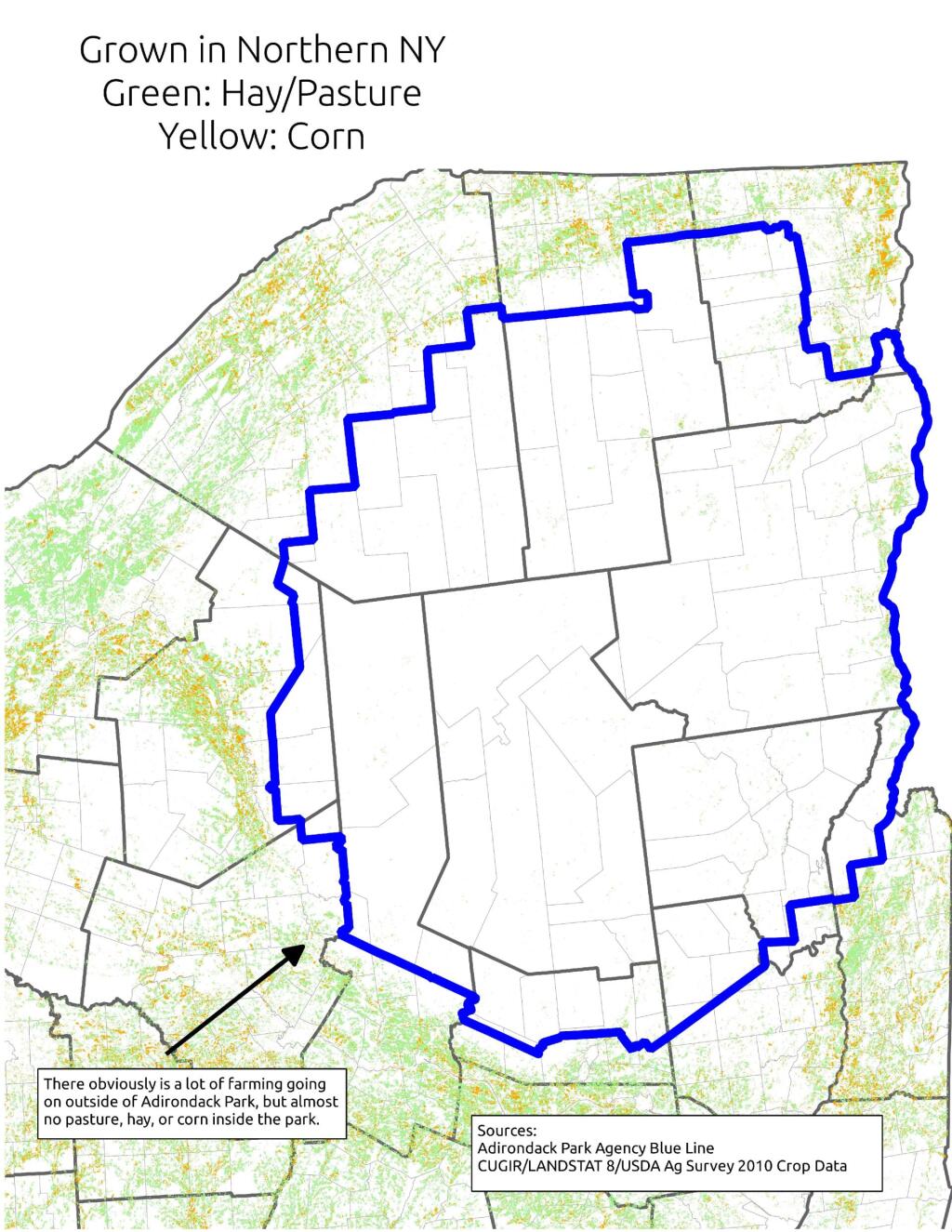
Most of NY State east or south of Finger Lakes is not flat. There can be significant rise in hills in these area, but we don’t consider such regions to be portions of Adirondack Park or even Catskill Park. Those lands are un-designated and not managed on a regional basis. They aren’t called a park. But what makes the Adirondack Park a cohesive unit is lack of agriculture occurring on it. Few portions of the Adirondack Park have a growing season long enough to support corn farming.

Farms in North Country

Corn is the basis of much contemporary and historical agriculture. It primarily is grown in NY State to feed dairy cattle. Dairy cattle are important, because they can provide a year round income for a farm family in form of milk sales throughout the year. Where corn can grown, silage can be made, and dairy farms can be sustained. Where there are dairies in NY State, their often is an agricultural support system that allows other farms to exists. Moreover, dairy farming is typically a mark of land able to sustain some kind of farming — if you can’t raise corn on a piece of land nearby, it’s unlikely that it would allow fruit or vegetable growing.

 The Catskills

Moreover, without an agricultural base, their is little reason historically for people to move to Adirondack Park. People traditionally where reliant on local food supplies. Little food could be grown in the park. Even if people could import food into the park, their historically was few jobs outside of logging and mining — occupations that could only support a limited number of workers. Without an agricultural basis, few cities could spring up within the park.

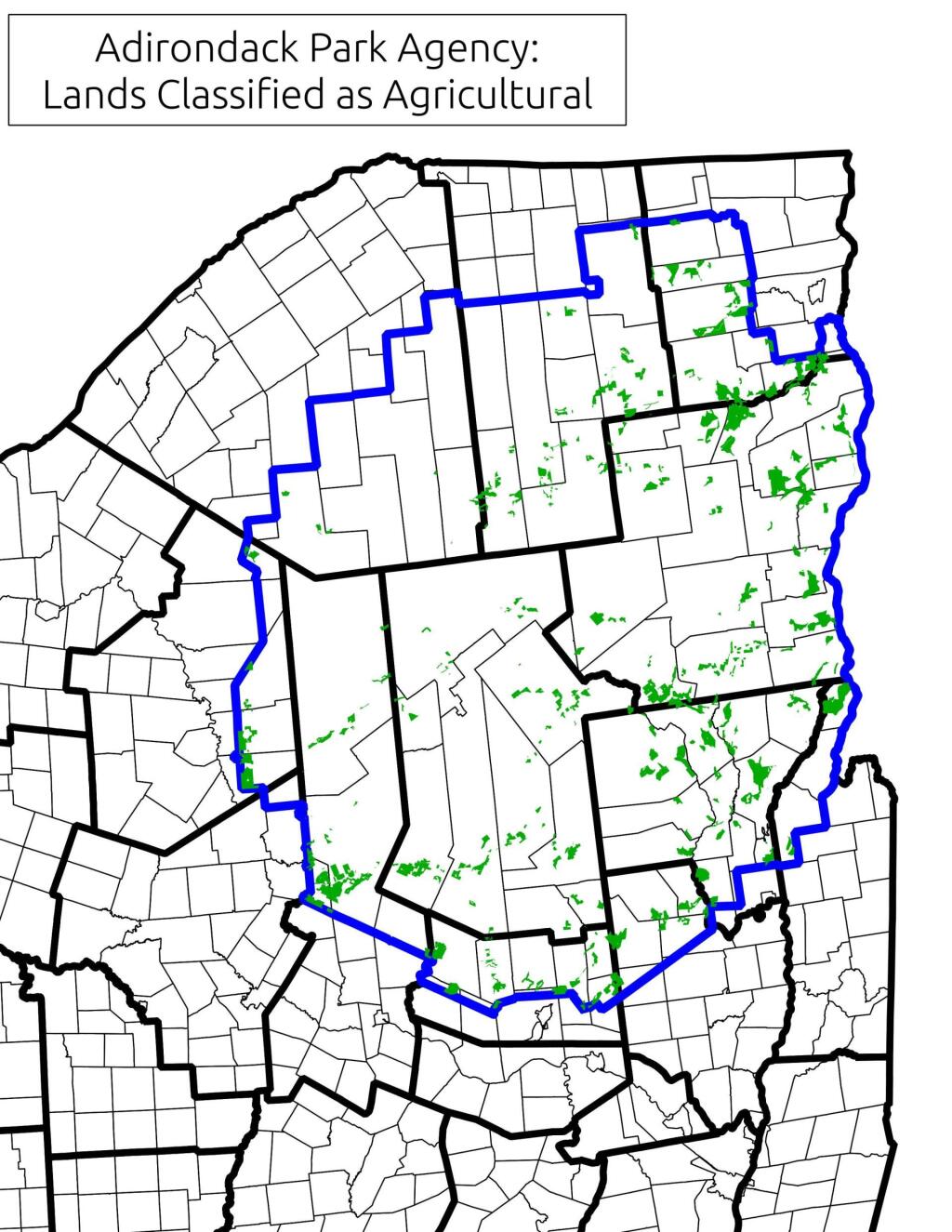
Lands Classified as Agricultural By Adirondack Park Agency

Most of the land in the Adirondack Park historically was logged or mined. Logging operations are a long-term investment, with many species of trees taking 30-50 years to grow to a profitable size. Many loggers historically stripped the land of it’s trees, and then abandoned the land or otherwise turned it over to the state. That’s how the state ended up with so much land in the park. If it had been productive farm land, much if it would still be in agricultural production, with remaining lands being converted into rural residential lands, or smaller privately owned forests.

Distance to State Parks

It wasn’t an act of the legislature that prevented the Adirondack Park from becoming too developed. It was a lack of corn and cattle based agriculture, as the elevation way too high to support such farming. No farms meant no civilization, and most of the park remaining timberlands, much abandoned to state use. If Adirondack Valleys where low enough to support some agriculture, their would have been much more development and civilization, then the largely wild and undeveloped Adirondack Park of today.

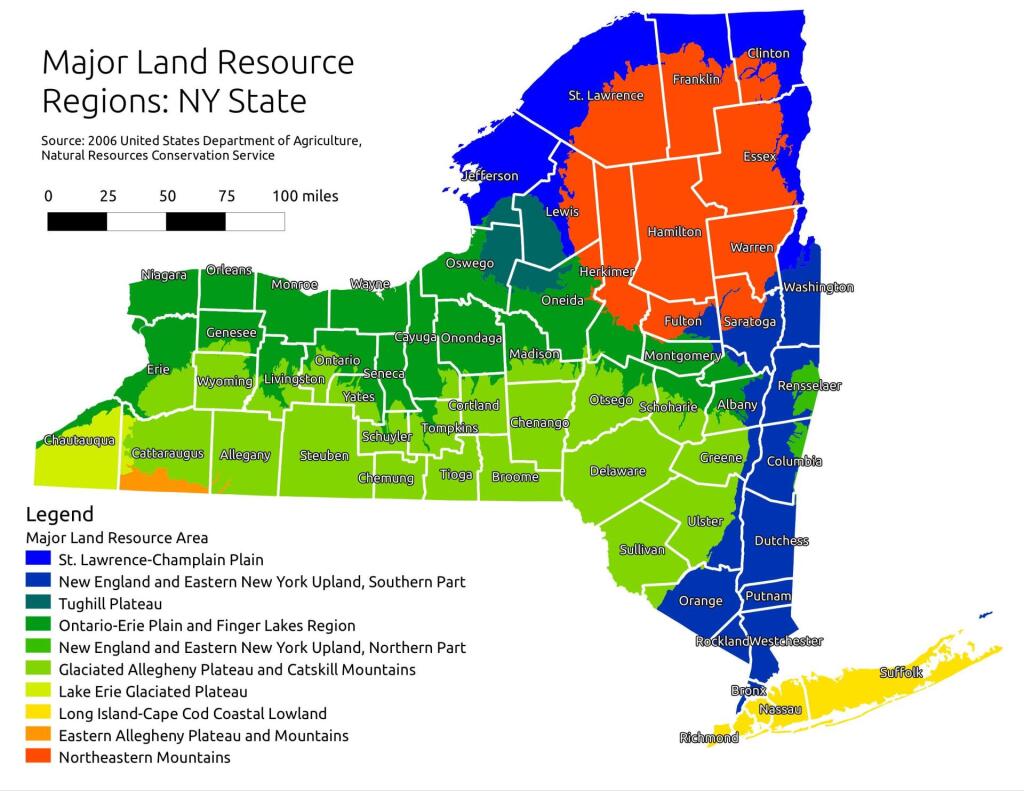
Major Land Resource Regions