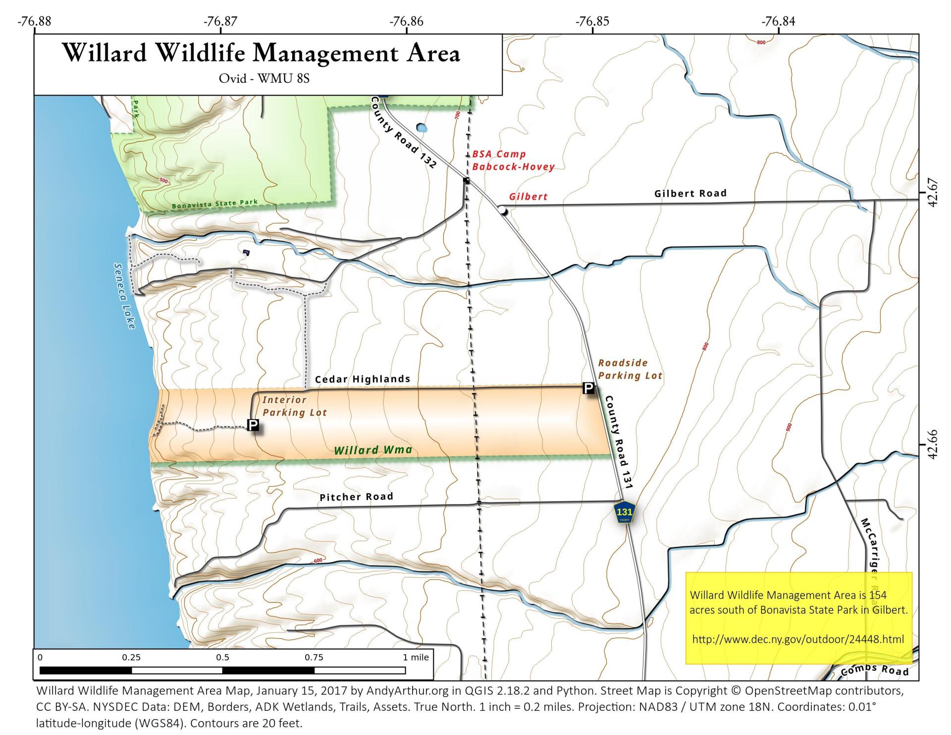
Map: Willard Wildlife Management Area

Download a High Resolution JPEG Image of the Willard Wildlife Management Area or an Adobe Acrobat Printable PDF of the Willard Wildlife Management Area.

Bookmark my free Interactive GPS Map for your phone:
https://andyarthur.org/ny
... shows your location as a blue dot in relationship to campsites, trails, state land. This online map requires cell service, won't work in remote country, so also bring a paper map.
Free Download of New & Historical USGS 1:24k Topograpic Maps
Interactive maps with backcountry and roadside camping: New York, Pennsylvania, West Virginia & Vermont. List of NYS DEC Lean-Tos and Firetowers.
Google Spreadsheet with Roadside, Primitive and Pay Campsites
More about Willard Wildlife Management Area...
The Willard Wildlife Management Area was originally a part of the Willard State Hospital lands used in its farm operations. Farm operations were discontinued in 1963 and the land was transferred to New York State Department of Environmental Conservation for hunting, fishing, and recreational use. This WMA consists of 135 acres of cropland and 23 acres of woodland which borders on Seneca Lake.
http://www.dec.ny.gov/outdoor/24448.html
... photos, maps and other content from from Seneca County.