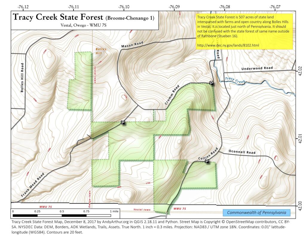
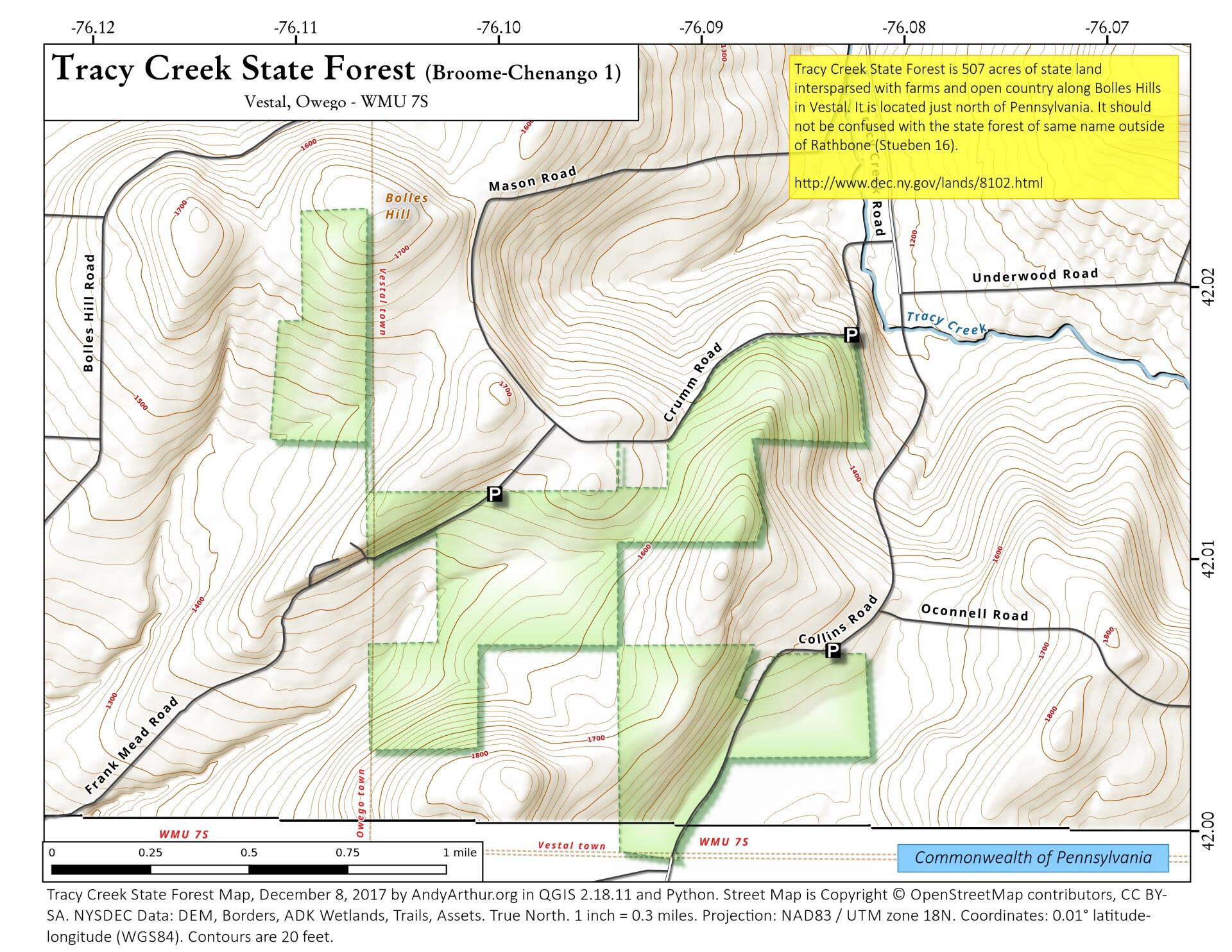
Map: Tracy Creek State Forest (Broome-Chenango 1)
Download a High Resolution JPEG Image of the Tracy Creek State Forest (Broome-Chenango 1) or an Adobe Acrobat Printable PDF of the Tracy Creek State Forest (Broome-Chenango 1).

Bookmark my free Interactive GPS Map for your phone:
https://andyarthur.org/ny
... shows your location as a blue dot in relationship to campsites, trails, state land. This online map requires cell service, won't work in remote country, so also bring a paper map.
Free Download of New & Historical USGS 1:24k Topograpic Maps
Interactive maps with backcountry and roadside camping: New York, Pennsylvania, West Virginia & Vermont. List of NYS DEC Lean-Tos and Firetowers.
Google Spreadsheet with Roadside, Primitive and Pay Campsites
More about Tracy Creek State Forest (Broome-Chenango County 1)...
Tracy Creek State Forest (Broome-Chenango County 1) was purchased in 1933 from several different landowners and covers 512 acres. It is located in the town of Vestal in Broome County and the town of Owego in Tioga County. The forest is named for Tracy Creek which flows north from nearby the forest, to the Susquehanna River. Although no formal trails exist on the forest, access through the woods is good due to extensive trails created by firewood cutters. For over twenty years, the upland hardwoods have been thinned by firewood sales to promote timber growth. Now these trails are used for hiking, skiing, horseback riding and mountain biking. It should not be confused with the state forest of the same name (Stueben 16) in Rathbone, Stueben County.
http://www.dec.ny.gov/lands/8102.html
... photos, maps and other content from from Broome County.