Thatcher Park

A Hot and Humid Sunday at Thacher Park

On June 20, prior to going out to the folks house, I decided to go for a little walk at the OSI Parcel of Thacher Park, from Carrick Road down to High Point, then to Hang Gliders’ Point. While very hazy, it still was a beautiful day.

Parked at the old Blue Stone Mining Pit, with the “Stone Sculptures”.

At the 3 Mile Ski Trail Loop Intersection.

Hiking down an old-woods road that I accidentially followed too far and went right past High Point.

Unmarked Woods Road

I ended up in this big hay field bordering the OSI Parcel that has a trail running through it via a landowner easement.

Hay Field

And I finally found my way to the High Point Overlook, in the haze.

Looking Off High Point

Looking down over the Altamont Fair Grounds.

Truck Trail 3

You could see the corn just starting to pop up along Brandle Road in Altamont from the overlook.

Freshly Planted Corn

And where a farmer had just cut some fresh hay below.

Drying Hay Field

A pretty cloud.

 Thunderhead Over Guilderland

Looking off High Point onto land below.

Looking Down

Hiked over to Hang Gliders’ Cliff.

Hang Gliders Cliff

View from the unmarked trail to Hang Glider’s Cliff.

Broken Views Climbing Wakely

A Hang Gliders’ Cliff.

Careful Running, The Cliff Drops Off

Low clouds hung out and over Settles Hill.

Settles Hill

Somebody had hung a flag at Hang Gliders Cliff.

Flag on Hang Gliders Cliff

Hiking back to the pickup truck saw this cute little flower.

Daisy

It was hot! Yet, it was nice to at least get out and do a lot of hiking during this very hot and humid weekend.

Here is a map of the hike.


View Thacher Park 6-20-10 in a larger map

Snowshoeing at Thatcher Park/OSI

The Thatcher Park OSI Parcel with High Point and Hang Gliders Cliff have rapidly become one of my favorite local places to visit. It has replaced Partridge Run as a personal favorite, mainly because in addition to interesting woods to explore, it also has the Escarpment to look off.

Albany County Presidential Vote, through the Years

The day when I went out hiking I had previously gone to the doctor with a horrible sinus infection. I was feeling pretty sick, but the bright blue skies just beckoned me to go outside and get some fresh air. So I donned my beat up old cowboy hat, took some Zyrtec and my antibiotics, and off I went.

Looking Off High Point

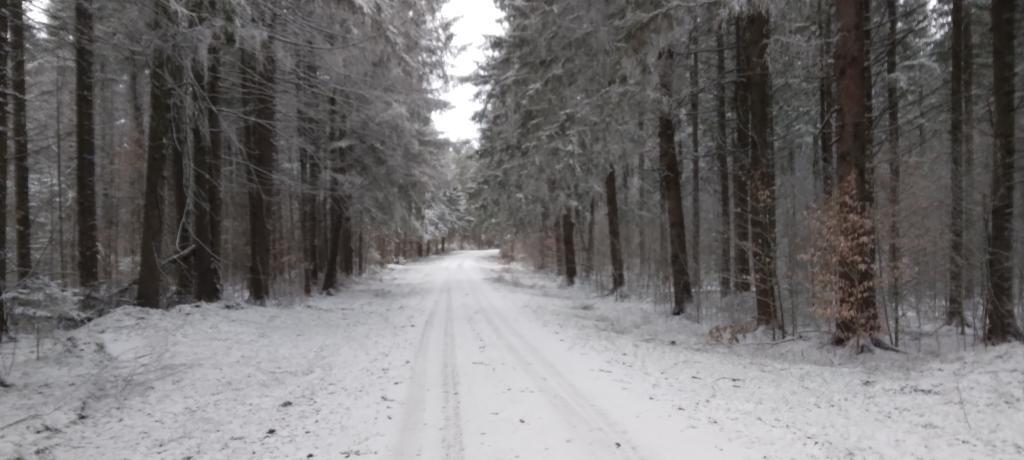
I didn’t plan on snowshoeing too far, so I decided to park up at the old Bluestone Quarry off of Carrick Road. Carrick Road was a sheet of ice, with about 2 inches of packed snow on it. Fortunately the Quarry had an area that was well plowed and it was a perfect place for me to park and not worry about getting my pickup stuck. Even with 4×4, I am so paranoid about such things these days.

Non-Icy Parking Spot

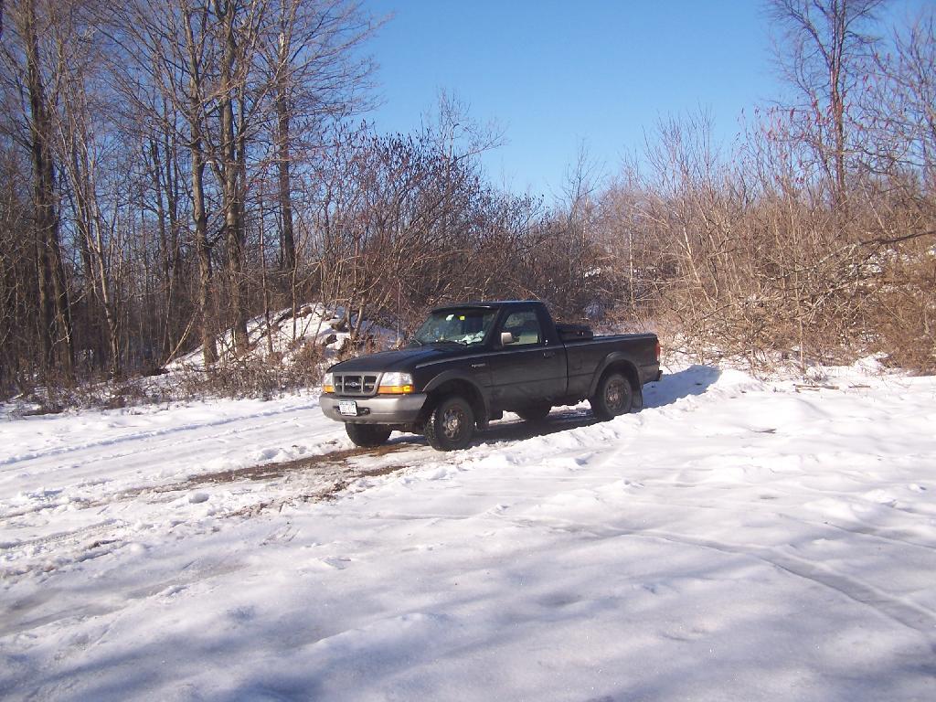
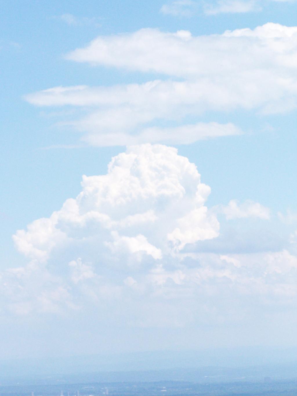
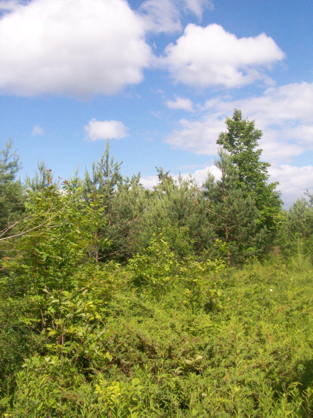
The bright sun and the blue skies were so delightful. In winter, it seems like gray snowy weather is always the norm, and it’s rare to get a truly nice day for snowshoeing. On this particular day, there was not a cloud in the sky, and it could almost not have been much nicer.

Blue Stone Mine on Carrick Road

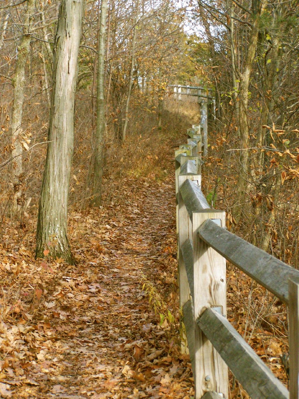
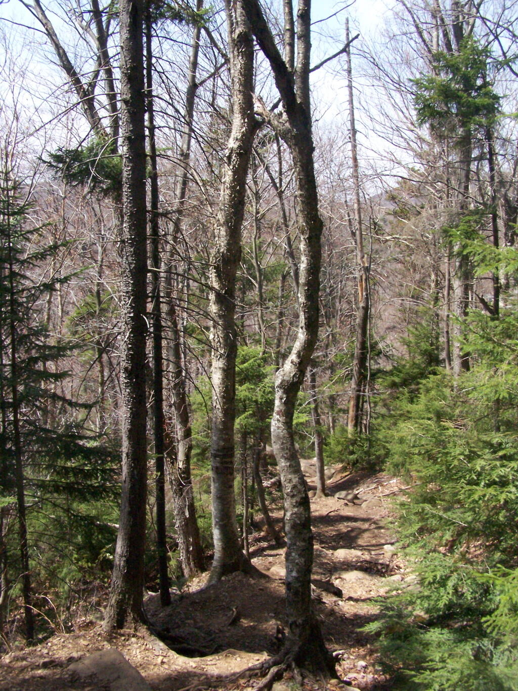
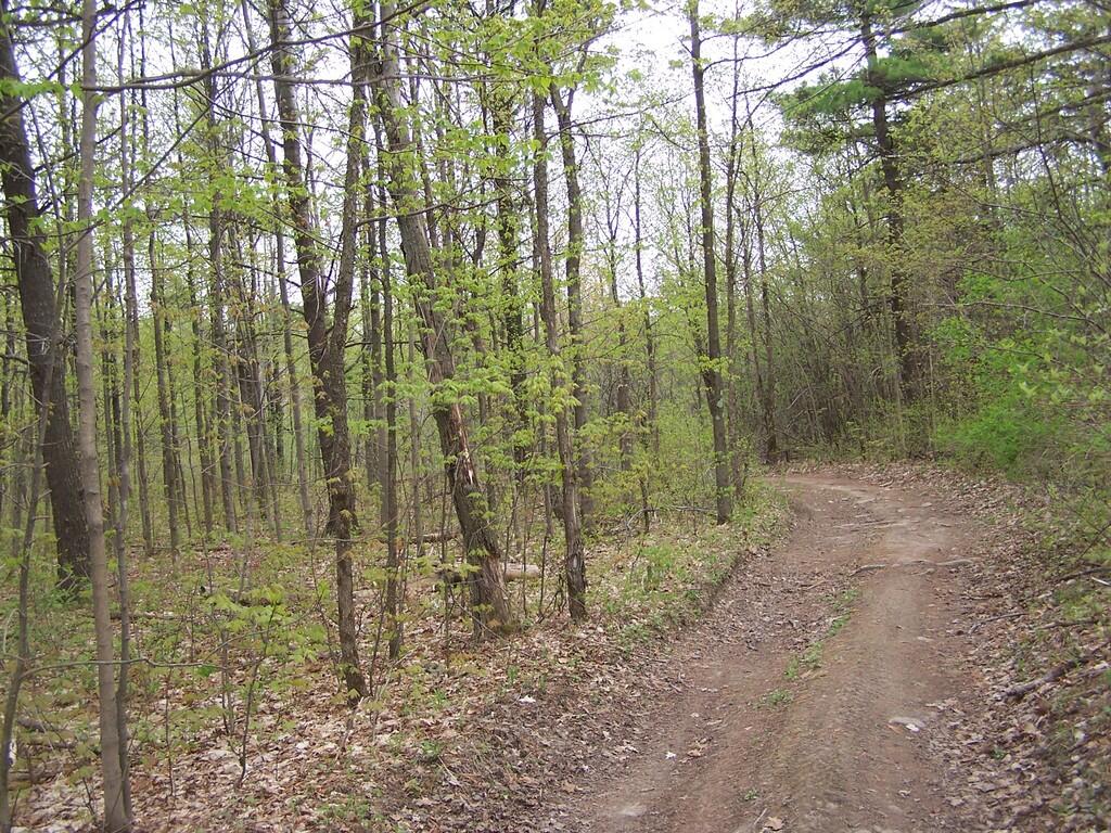
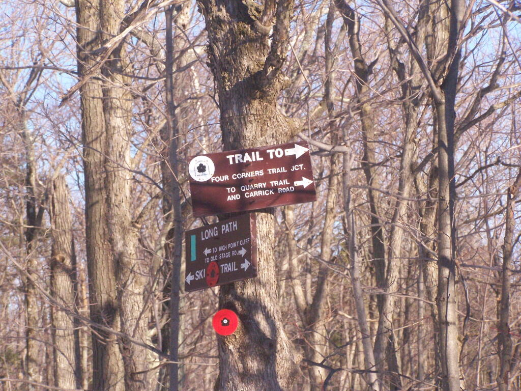
Here is the junction of the White Connector Trail and the Red Ski Loop which is multiplexed with the Long Path. This is only a short distance from High Point. The light and the weather was just so amazing on this afternoon.

Trail Junction

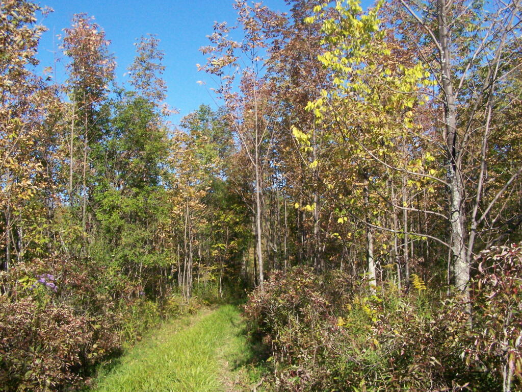
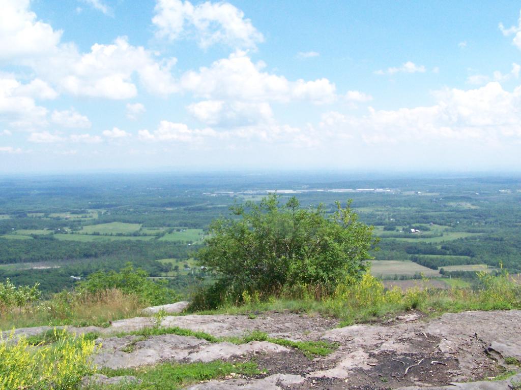
I hopped off the Red Ski Trail and took an old woods road to High Point. I had never been over this way before, and when I reached High Point from this angle, I almost didn’t even realize it was High Point, looking out through a clearing.

Hoye-Crest, Highest Location in Maryland

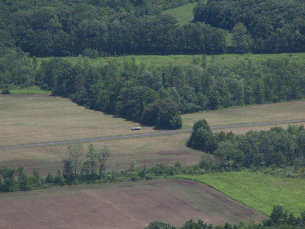
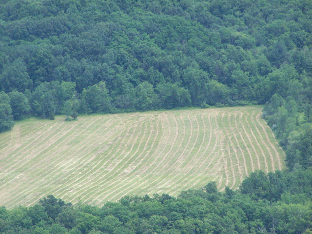
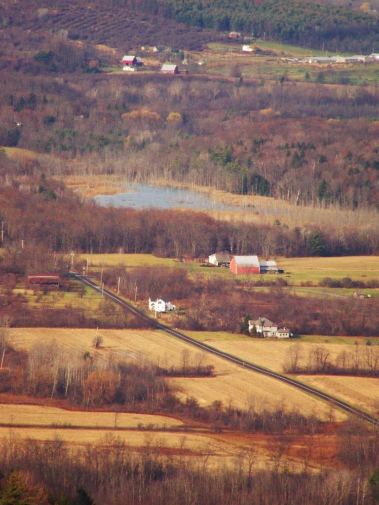
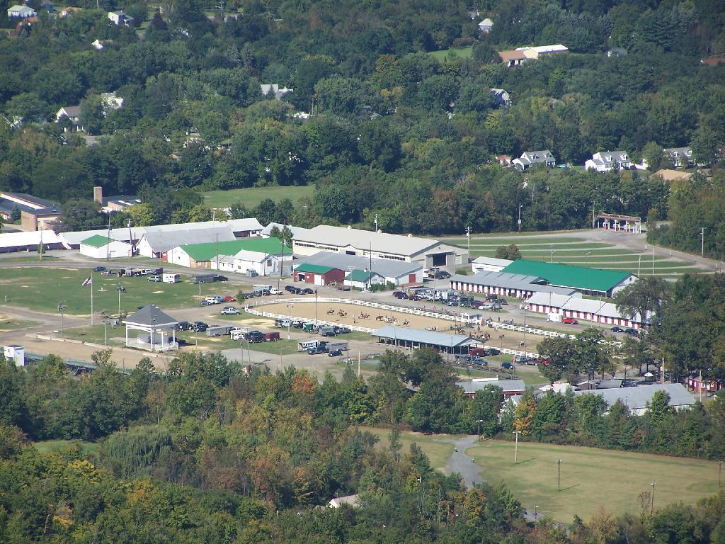
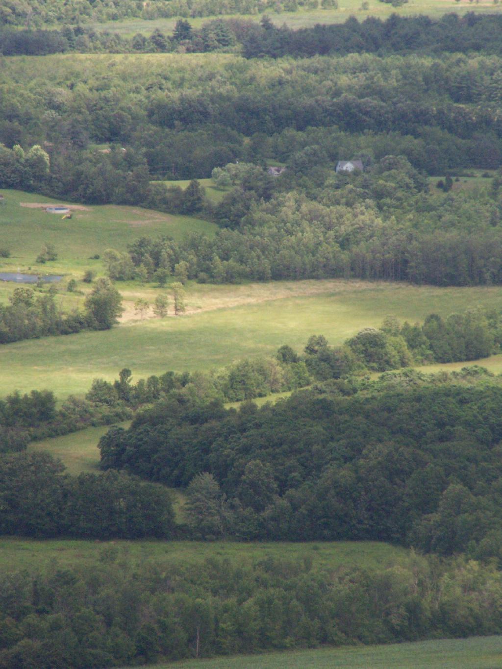
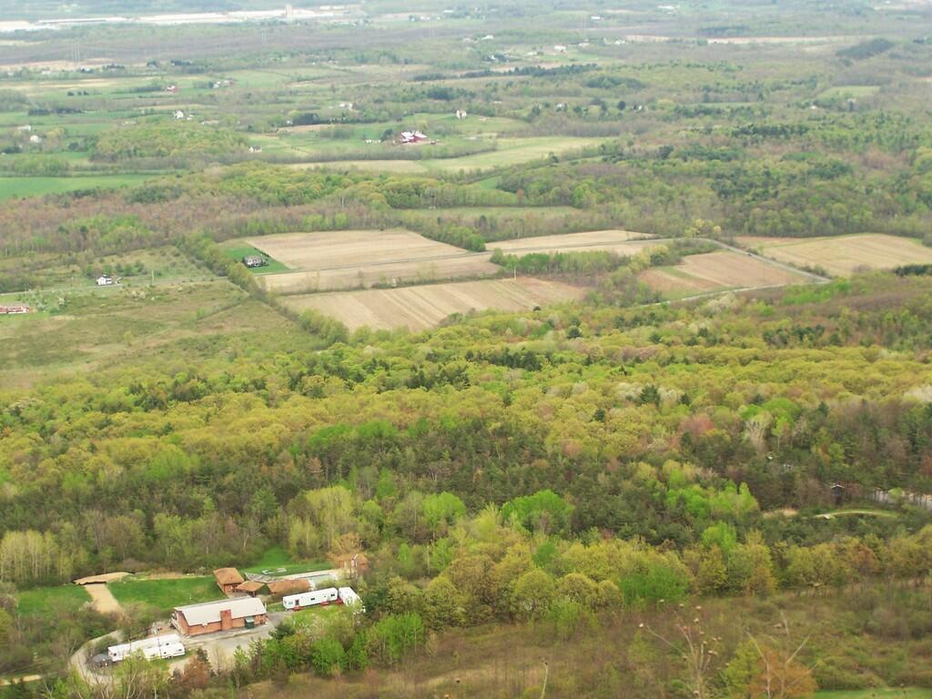
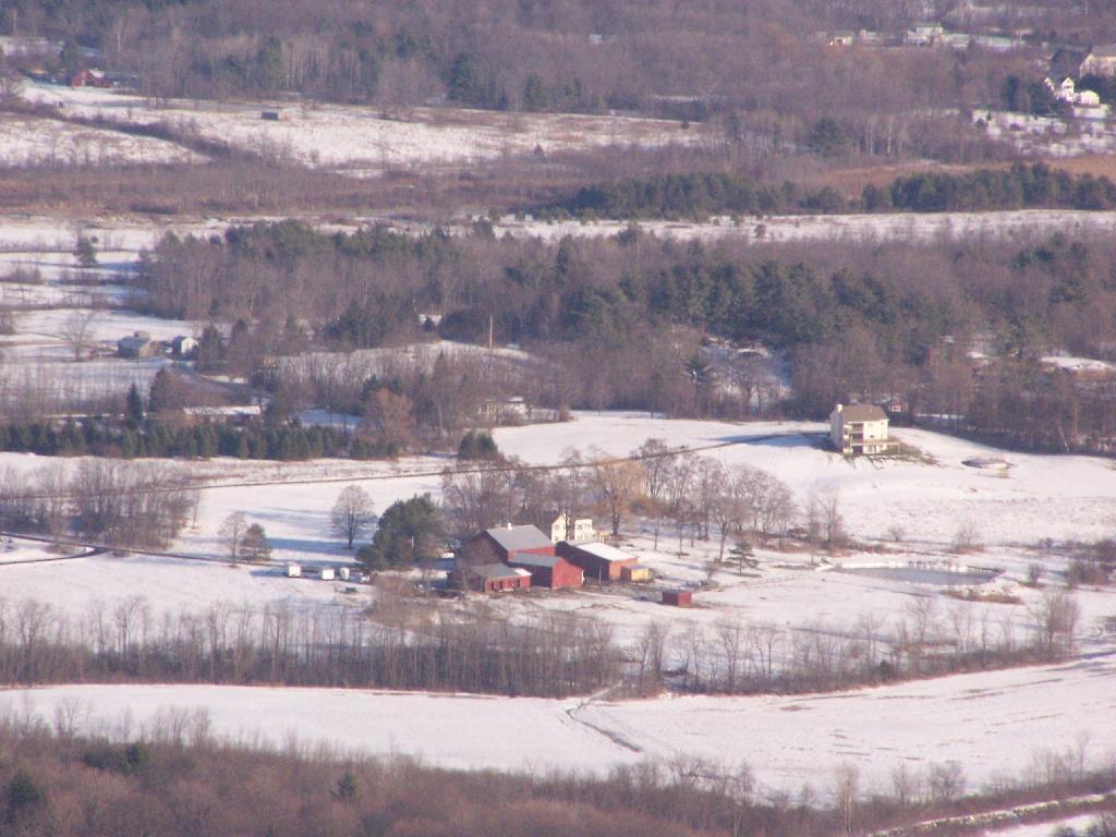
While I go up to High Point quite a bit, it is the first time I really noticed this classic looking farm in Guilderland with the barns and the house. Obviously, you can’t tell what kind of livestock they raise from this picture, but it is a very classic old farm house and old barns, probably from back when it was a dairy operation some time ago.

Cute Little Farm

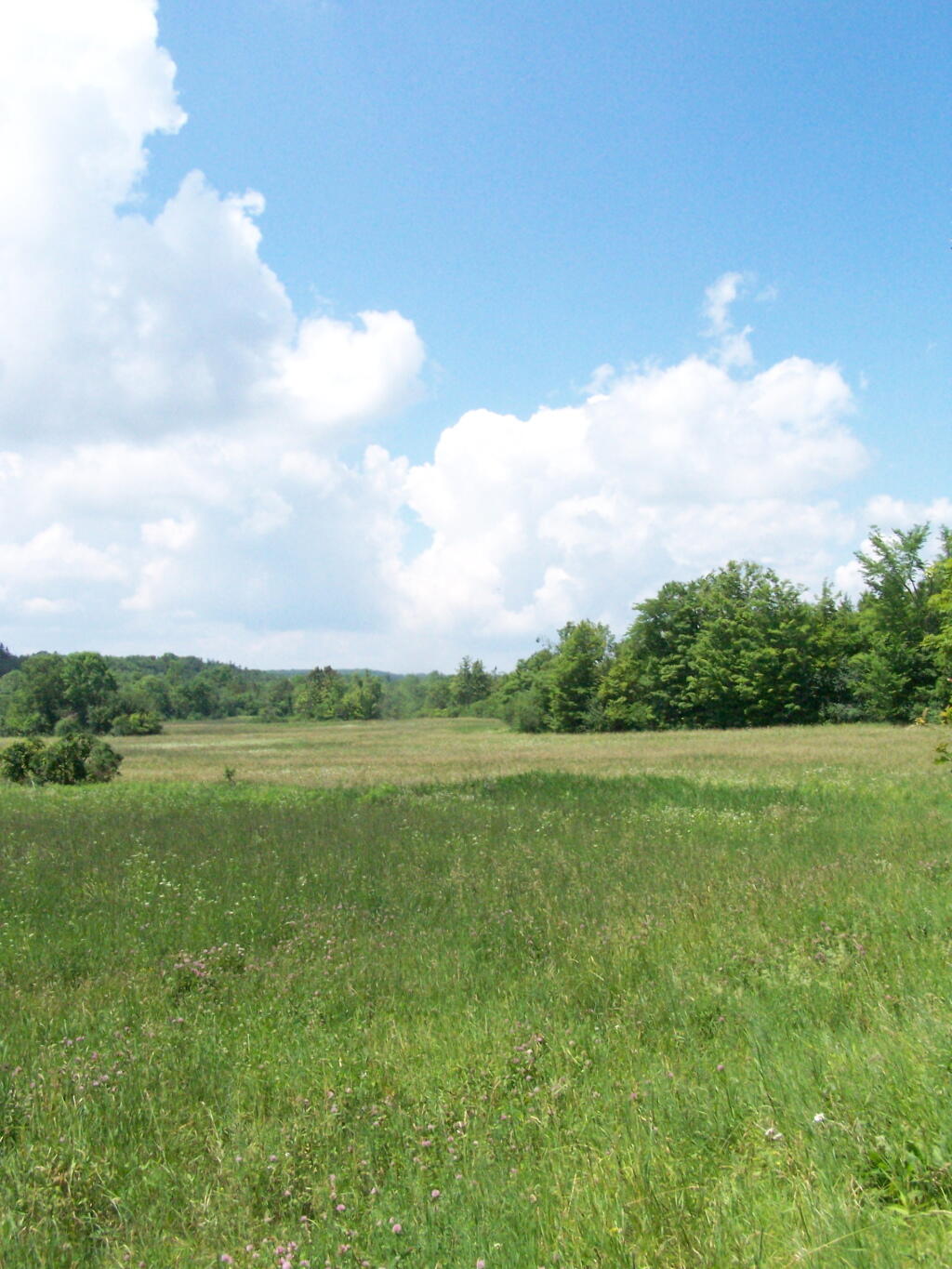
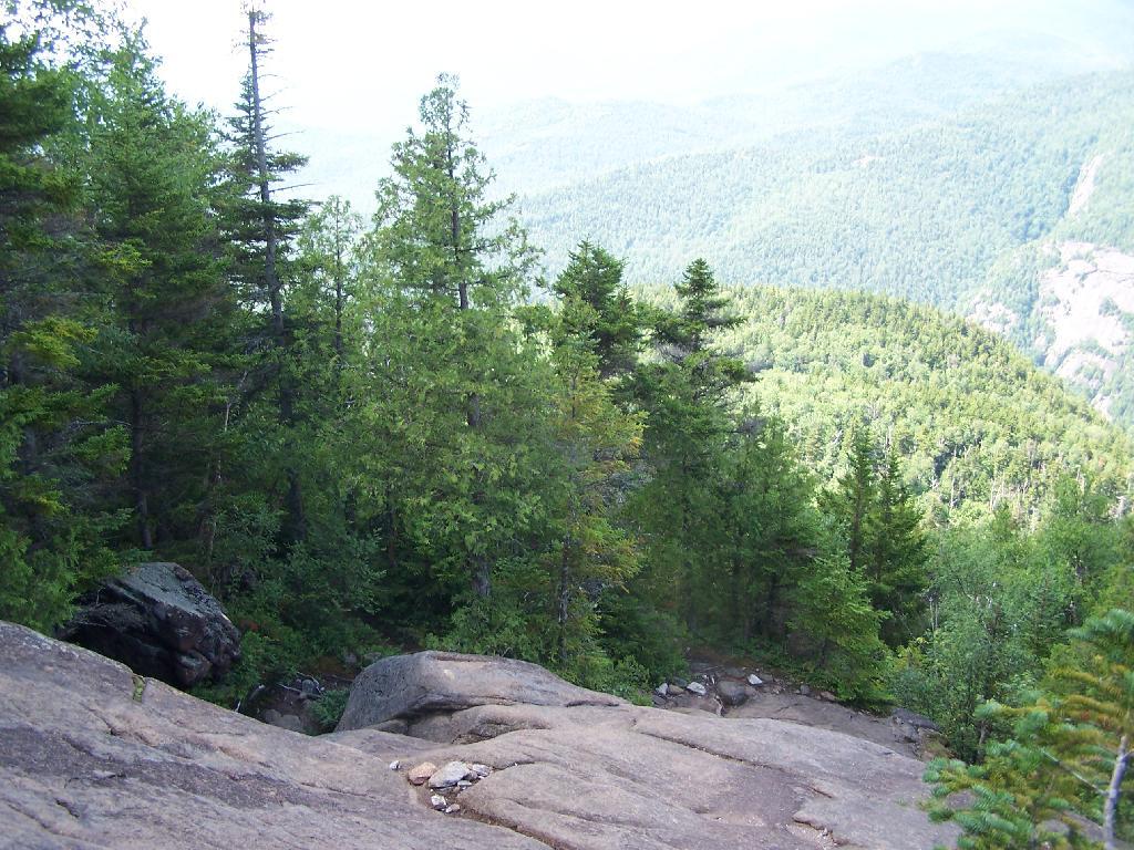
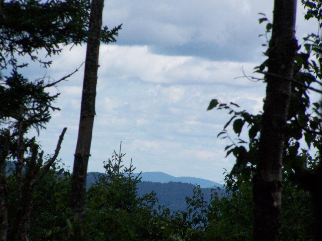
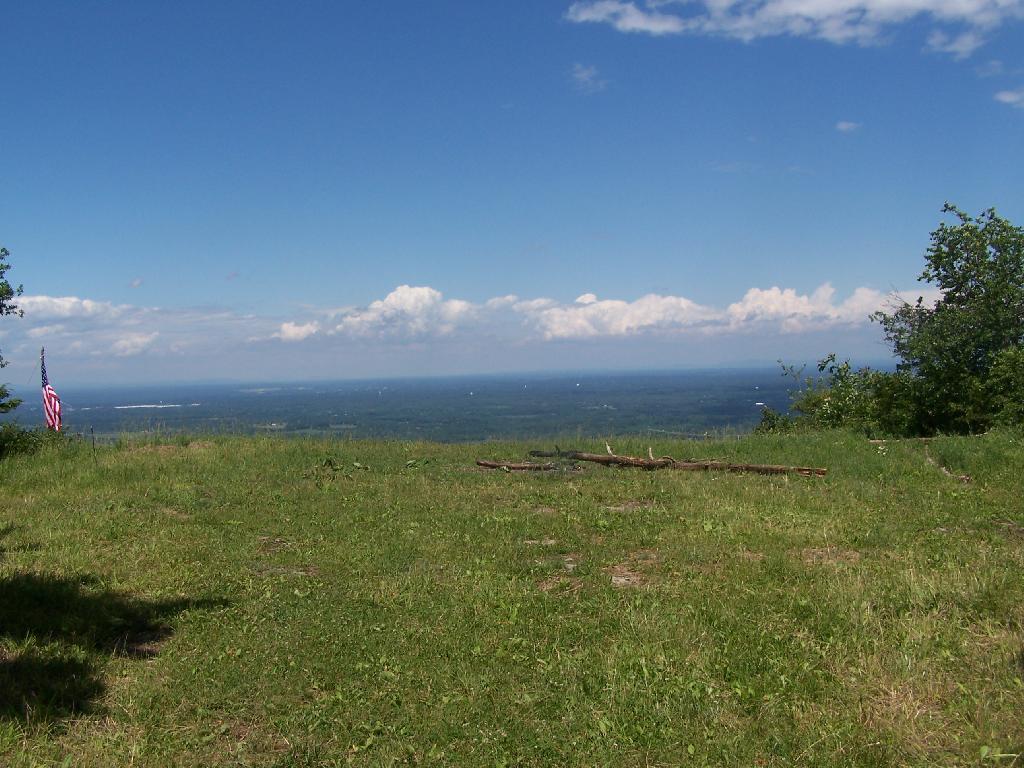
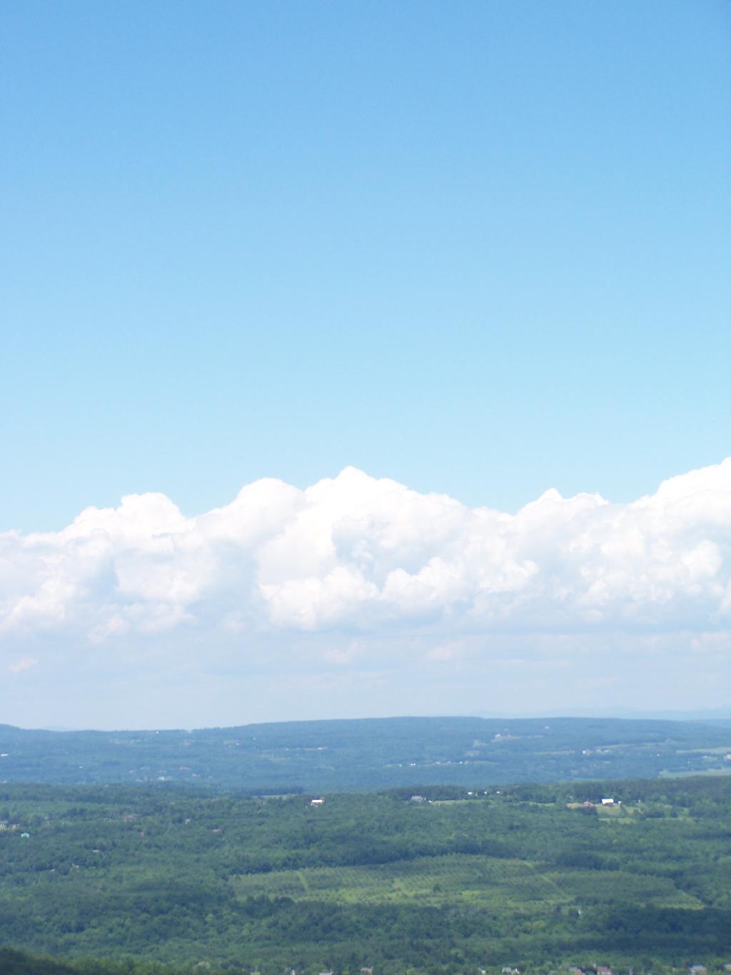
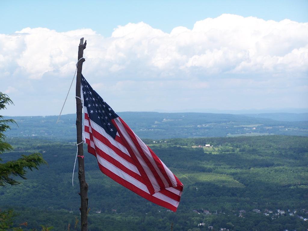
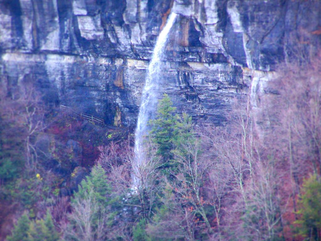
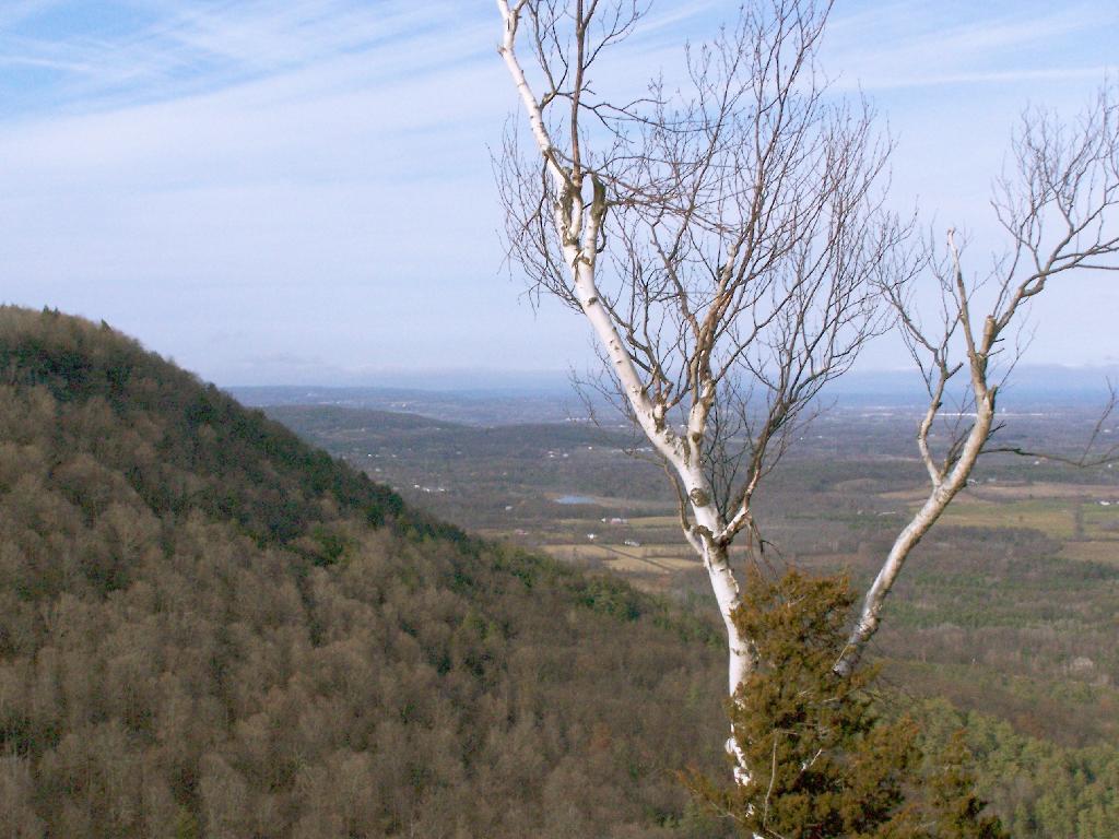
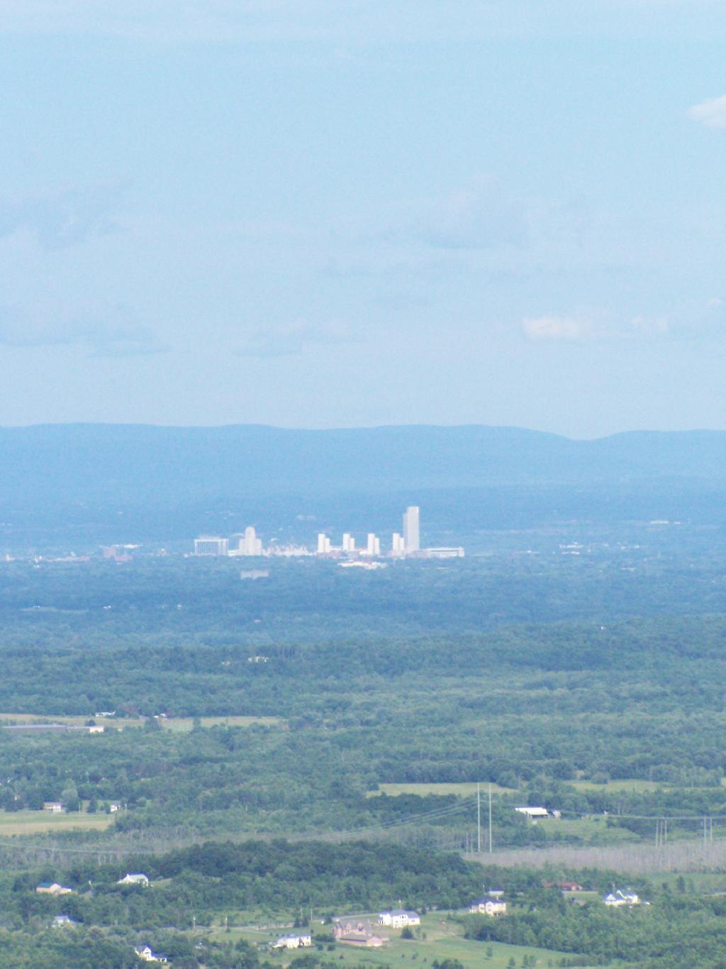
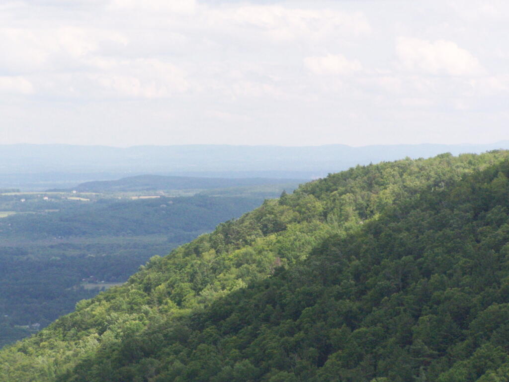
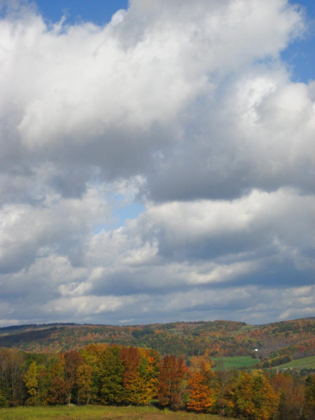
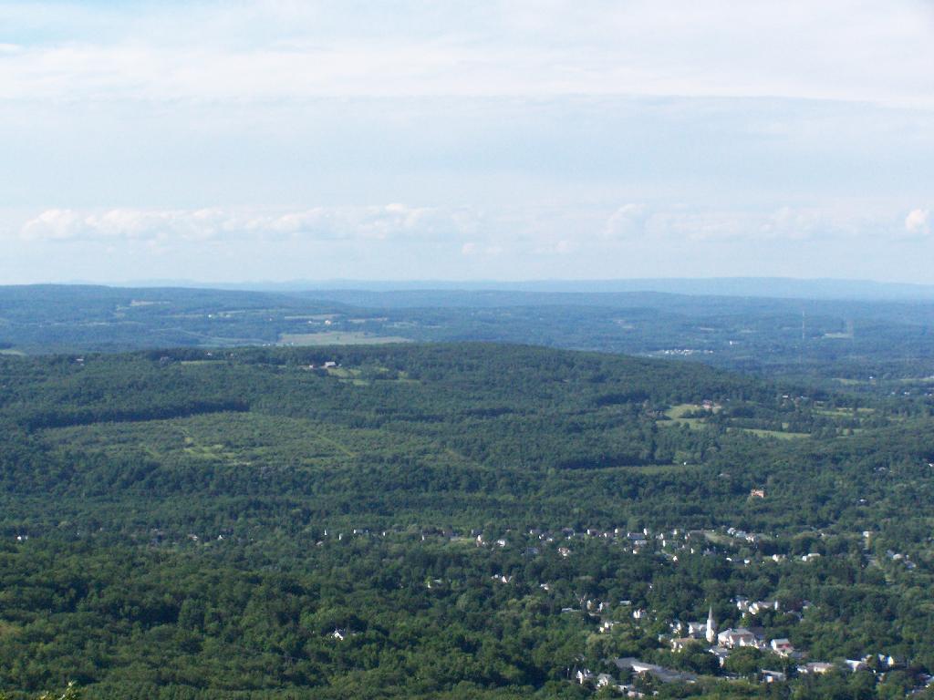
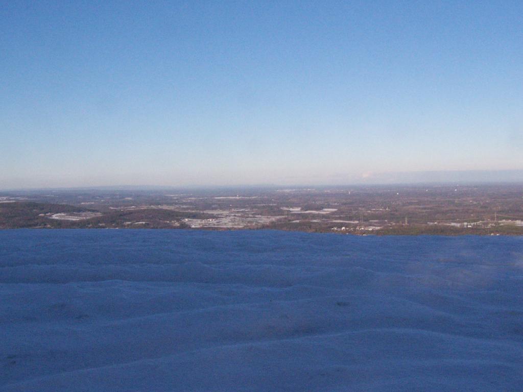
All of the sun and fresh air made me start to feel better so I snowshoed on south to Hang Gliders cliff. While I usually would take the unmarked escarpment trail all the way on over in the summer, I took for the first part the Long Path and cut over to the unmarked trail, to avoid the section that runs right along the edge. Here we are looking off Hang Gliders cliff, down into the valley.

 Hang Gliders Cliff

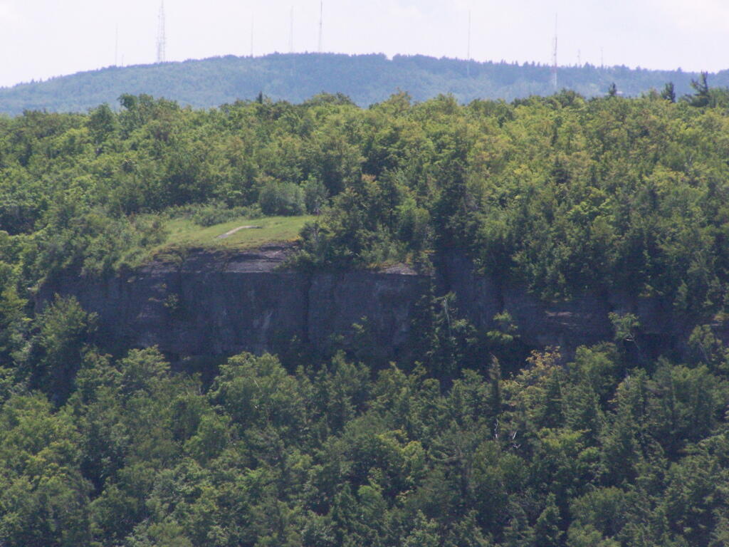
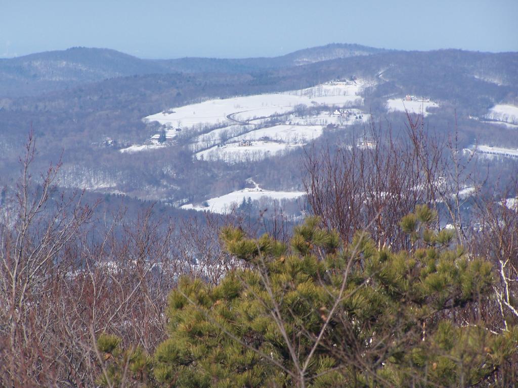
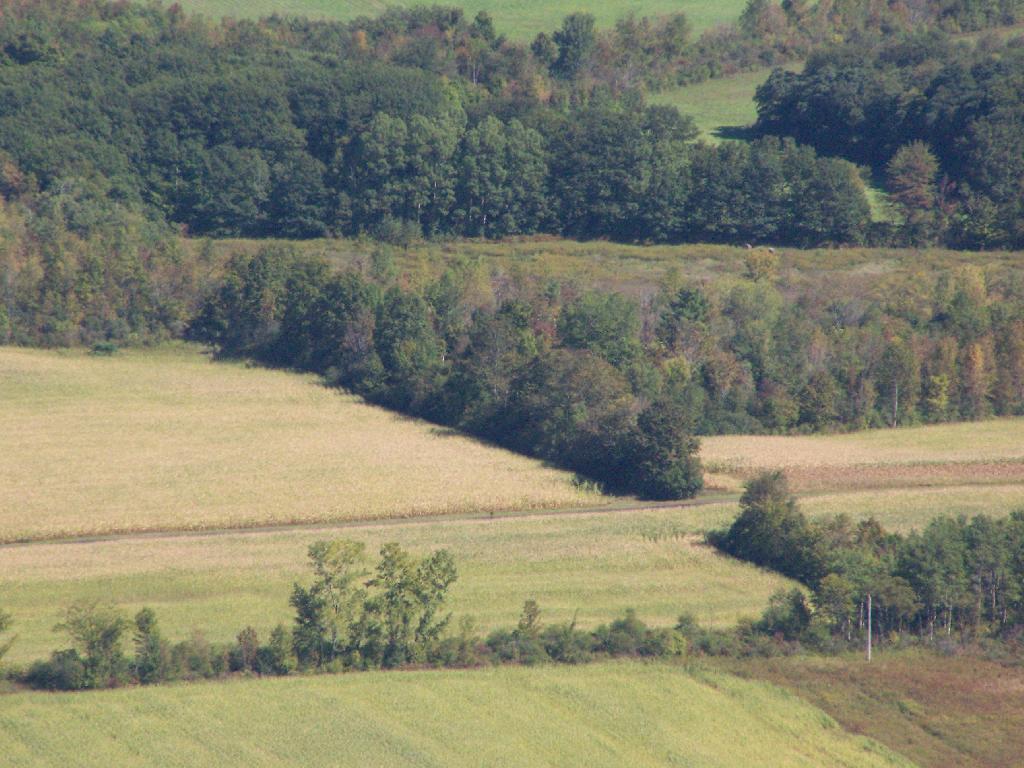
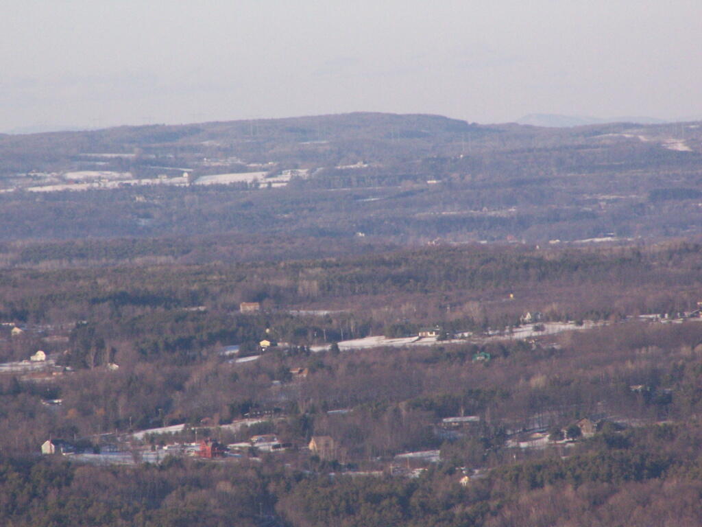
Settles Hill can viewed from Hang Gliders Cliff quite well. I have always loved the look Settles Hill if only for it’s rolling nature and all of beautiful small farms up on it. Most of this country is still in the Town of Guilderland, although some is in Princetown.

Settles Hill

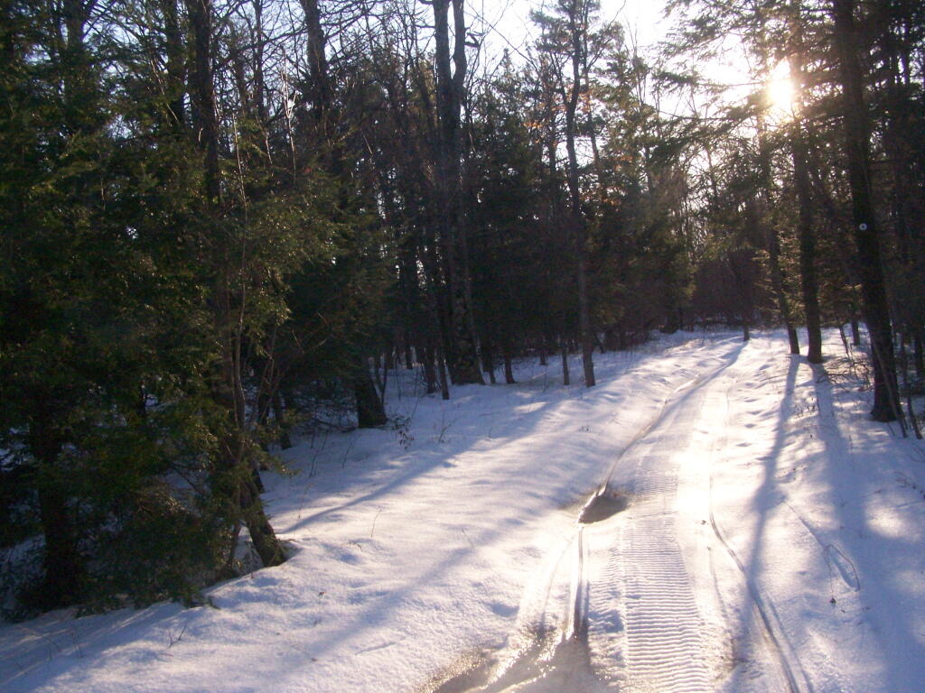
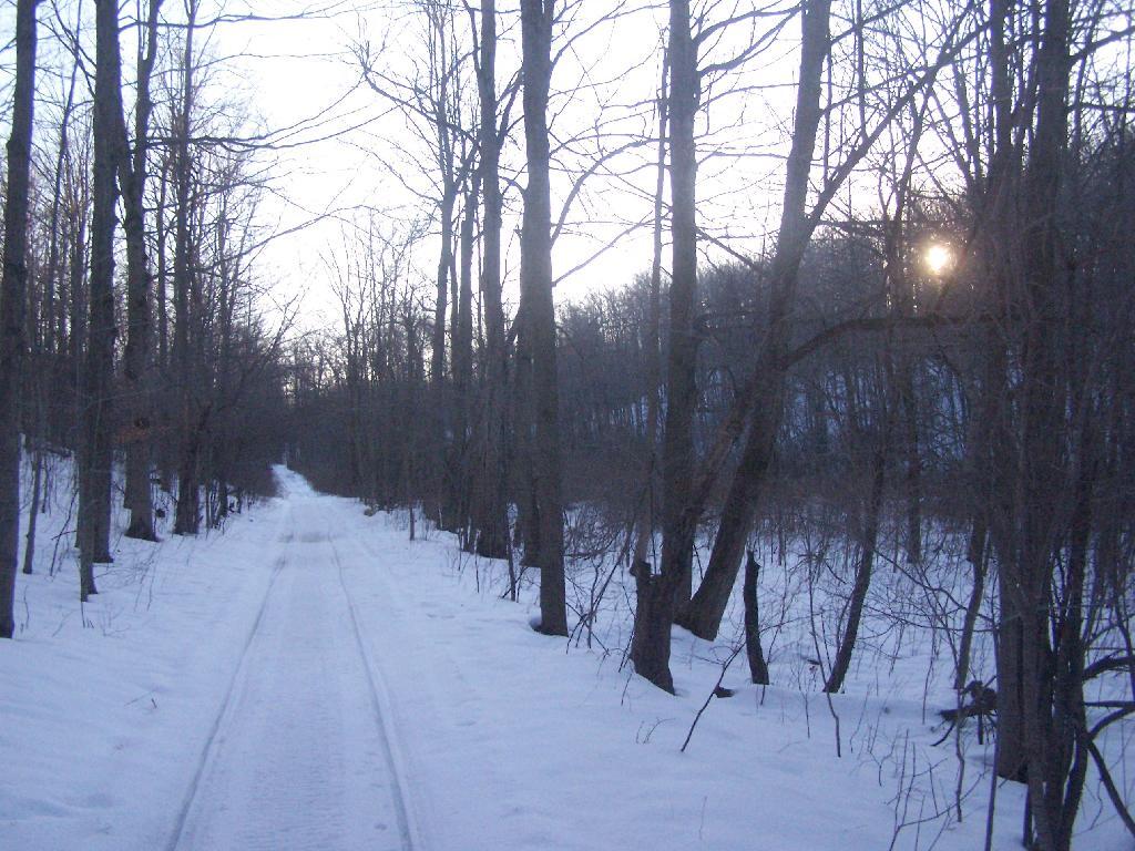
Snowshoeing along Hang Gliders Road. There was some icy patches and I passed a group of young kids snowmobiling, probably from one of the neighboring farms.

Along Hang Gliders Cliff Road

One of the things I don’t like about this time of year is the days are so short. That said, each and every day is getting a little longer, and twilight is now around 5 PM every night. In a month, the twilight will be much closer to 6 PM. Sunset was about 4:30 PM.

Setting Sun

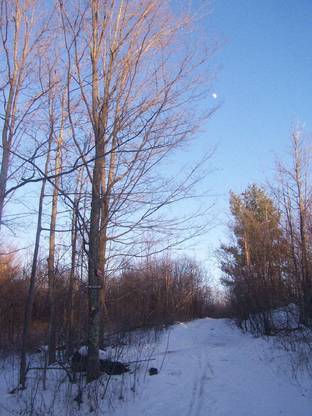
There was waxing crescent moon hiking back to the truck. Quite beautiful, as the sun set in the opposite direction. It made for a beautiful hike on back to my pickup, as I headed home for the day on this wonderful day.

Almost Full Moon

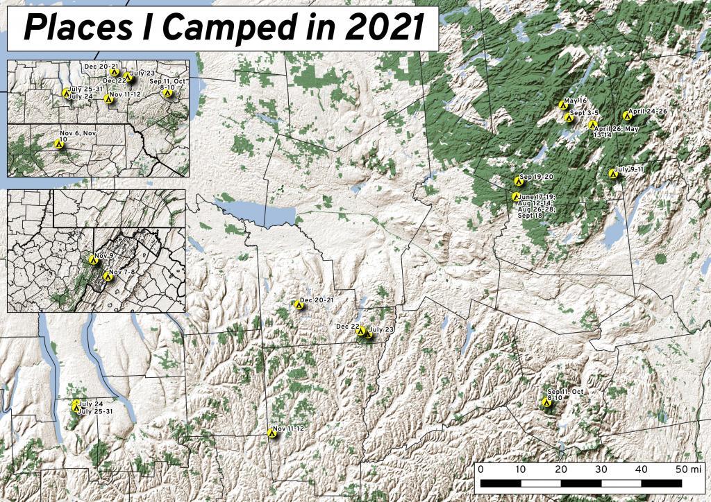
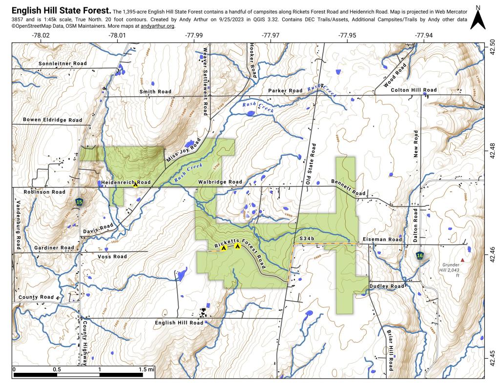
The route I took is in green.

Thatcher Park in November

For my Sunday afternoon walk this afternoon I went up to Thatcher Park. It was 60 degrees out, and quite nice weather for late November. The previous day it had rained quite hard and water was coming out quite intensively from the Horseshoe Falls.

Mine Lot Falls

Walking along the fence line above the Escarpment on Horseshoe Clove.

Fenceline

Looking south and at rather gray landscape off Thatcher Park.

Hillside

Farms outside of Altamont in the fall without the leaves.

 New Asphalt

A stream of water coming north out of an upper clove.

Stream of Water

Birch along the edge of the path.

Birch

Hunter Scofield Monument

Hiking at Thacher Park/OSI Parcel, Sept ’09

Notes on the Re-Run for Monday, September 13th.

Two years ago, I went for a hike up at Thacher Park’s OSI Parcel. As a kid, I never was a big fan of Thacher Park, but I’ve fallen in love with the more wild areas, where one can go up and explore for free. Manicured parks, roamed by jack-booted thugs, aren’t my thing but the views from the OSI Parcel are amazing.

— Andy

I went out hiking with my dog on this Sunday afternoon. I parked at the Carrick Road Old Querry. There where several other cars parked there. Here is a map of the Thacher Park OSI Parcel with all of the many different trails that criss-cross these lands. You can click on this map to download it for printing.

Artificial fireflies

By September 20th, there where a few early signs of color, including this somewhat sickly looking Sugar Maple about a quarter mile from the query.

One Percent - A Visualization

From High Point on the Thacher Park Cliff it was as clear out there as it gets in the summer.

2022 Governor\'s Race in Albany County

With the cattle corn ready to harvest…

More Corn

A toad sat out sunning on the rocks of High Point.

Toad on Edge

As a horse show was going on down at the Altamont Fairgrounds.

Horse Show

And Albany sat in mild haze, below the Taconic Range, with Berlin Mountain towering above, from Hang Gliders Cliff.

Albany in July

Looking at Horseshoe Clove and all that lies beyond in the distance. A little bit of fall color, but still a bit to go.

Physiographic divisions of NY

Walking along the Yellow Trail out to Whipple Road. A few signs of color along here.

Filling in Meadow

The Yellow Trail is a snowmobile trail in the winter. This sign was installed by the local snowmobile club, and is kind of unusual for a hiking trail.

Twisty Trail

The Beaver Dam in the pond off the Red Trail from Whipple Road to Carrick Road.

Beaver Dam

… Thacher Park is not the Adirondacks or Green Mountains. It’s not the most remote parcel in the world, but it is close to Albany, offers some excellent views of the escarpment, and if you explore the OSI parcel to the north of main portion of park, it’s free to park and undeveloped and beautiful lands.

Revisting High Point

On July 4th, I decided to go for a walk up to Thatcher Park/OSI parcel to check out the cliffs once again now that we are fully in the summer season with all of the grass out a bright green color.

The Trail

High Point and Beyond.

Beyond the Escarpment

Corn growing along Gardner Road.

Places I Camped in 2021

Light and dark landscapes off High Point.

Light and Dark

The trail passes several meadows and open areas.

Meadow

The old query with some interesting rocks stacked up.

English Hill State Forest

The trail when it follows hedgerows in farm fields.

Clouds


View Hikes of 2009 in a larger map

Thatcher Park

The Experience.

Nice Sunday afternoon. A bit cloudy, but warmish out. Decided to hike on OSI Preserve parcel as on May 1 they had already started to charge to parking at Thatcher Park. This area in many open fields and nice places for hiking, and indeed the start of the hike was quite enjoyable.

 Trail to Hanger Glider Cliff

I was quite surpised on how there where many new trails now open in the OSI preserve, including trails to both High Point and Hang Glider’s Point. High Point previously was privately owned, but was purchased by OSI.

Both points had great views of Altamont and towards Schenectady, which was drowned in haze.

Altamont

These crosses where at Hang Glider’s Point. Sad. Who died here? Why? Suicide? I’m sure somebody will write about the tragic story.

Crosses

The trails are all well labeled, escape for an unmarked, but well maintained trail along the edge of the Escarptment, which you can see I took from High Point to Hang Glider’s Cliff. That escarpment trail was close to the edge in many places, but perfectly safe to watch.

It was raining in Albany.

More about these these beautiful lands.

The Route.

Parked at trail head on Ryan Rd. Hiked via. Yellow Trail to Carrick Road. Took Hang Glider Rd along with White Trail to Long Path. Took Long Path north to Red Trail. To Red Trail to Escarpment. Took Unmarked Escarpment Trail to High Point. Took Long Path to Red Trail. Took Red Trail back to Escarpment. Took Unmarked Escarpment Trail to Hang Glider’s Cliff. Took Hang Glider Road to Carrick Road to Yellow Trail to Ryan Road trail head.

Flyover

The Map.

Hikers – Carrick Road Trailhead
Red Balloons – Overlooks
Red Trail – Hike on May 3, 2008


View Thatcher Park OSI Hike in a larger map