free camping

Aldrich Pond Wild Forest

The Aldrich Pond Wild Forest Wild Forest Unit Management Plan mentions the following about Roadside Camping in the area…

“Most of the camping on this area occurs during the hunting season and much of this is along the Streeter Lake Road. Sixteen campsites have been designated along this corridor and two pit privies established to accommodate this use.”

— NYSDEC Aldrich Pond Wild Forest UMP.

Roadside Campsite.

Road Number of Sites
Streeter Lake Rd. 16

More Resources…


View Street Lake Campsites in a larger map

Jessup River Wild Forest

Jessup River Wild Forest is a parcel of lands surrounding the International Paper’s Perkins Clearing Timberlands and Speculator Tree Farm. There are about a dozen informal campsites along Mason Pond on Perkins Clearing Road that are popular, with about 6 of them with direct road access for a small vehicle like a pop-up trailer or a pickup truck with a cap. Only a few of the sites are clearly designated as such, but they all are very well used.

Cleaning Up Site

Significant noise pollution from NY 30 can be heard at some of the sites. There are no outhouses, although there are five gallon buckets people use for toilets. Besides the sites on Perkins Clearing Road in Jessup River Wild Forest, there are also eight designated road-side sites in International Paper Timberlands known as Perkins Clearing, just south of Jessup River Wild Forest.

Marsh and Pillsbury Mountain

The following changes are proposed in the Jessup River Wild Forest Unit Managemen Plan.

“Close Undesignated Campsites and /or Restrict Type of Camping. This alternative would propose the removal of user created primitive tent sites within 150 of water or road for environmental or social reasons. Camping structures would be restricted by regulation to “tents, tarps and lean-to’s as required by the APSLMP, thereby eliminating use of travel trailers, “pop-up” style campers, tent trailers, or structures of similar fashion. This option would eliminate opportunities for individuals seeking an easily accessible camping site close to a lake or road. Current regulations allow for camping anywhere in the JRWF as long as the 150 foot set back requirement is met. People would probably still park by the road and camp further in without any controls. This alternative would also restrict opportunities for mobility impaired individuals to access the lake and/or camp on JRWF lands. Therefore, this alternative will not be supported by this UMP.”

“The preferred alternative is to designate sites taking into consideration day use of the area, appropriate existing sites, APSLMP spacing guidelines, and terrain constraints. Because of their anticipated popularity, permits to stay for more than three nights will not be issued for sites in heavy demand during the core camping season. The camping areas at the northwest end of the lake will be closed due to conflicts with day users and environmental constraints. Other sites that are unsuitable or too close to the water will be closed and revegetated.”

“The closure of fourteen sites along with official designation of 10 suitable sites will reduce the amount of camping the area is currently experiencing. When all sites have been occupied, users will be directed to camp elsewhere. The opening of the adjacent IP lands to camping under the conservation easement will accommodate overflow camping. Use levels and site impacts will be closely monitored on the designated sites. If LAC standards are exceeded, the individual site will be closed and/or rehabilitated.”

β€” NYSDEC Jessup River Wild Forest UMP.

Confirmed Roadside Campsites.

Road Number of Campsites
Perkins Clearing Road
at Mason Lake
6 drive-in sites
4 tent sites

Maps.

Jessup River Road

Map of Jessup River Wild Forest. Inset is Perkins Clearing and Speculator Tree Farm Easements. Campsites do not appear on these maps, but they give a general overview of the area.

 Some Ice On The Hudson

Map of Perkins Clearing and Speculator Tree Farm. There are 10 campsites designated on these parcels, drive around to find them. Campsites do not appear on this map.

More Resources…

Campsite with a View

Another Island on Mason Lake

Saranac Lakes Wild Forest

Camping Only At Designated Sites

There are 16 designated campsites along Floodwood Road. Of those sites, one is located on Middle Pond, five densely spaced on Poliwog Pond, 10 others spread out along the road, approximently 1/4 mile apart. There has been discussion of closing and/or relocating some of the five designated campsites on Poliwog Pond. They literally are spaced within 10 feet of each other, with no buffers. The other sites are nicer along Floodwood Road. Note that there is an aggressive enforcement presence on Floodwood Road, so if you are going here just to hang out, be aware State Forest Rangers may be checking for compliance with law (camping in designated locations only, staying less then 3 nights without a permit, not being too noisey or disruptive).

The SUNY ESF/APA Roadside Camping in Adirondack Park Study also mentions 3 campsites on Hoel Pond Road which is just off Floodwood Road, and 9 campsites on Fish Hachery Road, just off of NY 30. The Unit Management Plan is not online, and they do not appear on State Land Interactive Mapper, so I can not confirm the current existence of these sites, so they are not included in the list.

Sarnac Lakes Wild Forest Map.

Please be aware that this map does not indicate campsite locations.

Confirmed Roadside Campsites.

Road Number of Campsites
Floodwood Road 16

More Resources…

Campsite on Polliwog Pond

Middle Pond

Vanderwhacker Mountain Wild Forest

The Vanderwhacker Mountain Wild Forest Unit Management Plan mentions the following about Roadside Camping in the area…

“The area has a diverse mix of camping options available to visitors. There are designated interior camping facilities at Stony Pond, Cheney Pond, 29th Pond, and Newcomb Lake. There are also many Vanderwhacker Mountain Wild Forest roadside locations used seasonally by hunters and during the summer by others along the Northwoods Club Road, the Moose Pond Road, State Route 28N and at other locations. There is generally an increasing in camping in VMWF during the regular big game season.”

— NYSDEC Vanderwhacker Mountain Wild Forest UMP.

Current Campsites Map.

Vanderwhacker Wild Forest

Roadside Campsites Designated in UMP.

Road Number of Campsites
Boreas Road 1
Moose Pond Road 3
North Woods Road 3
NY 28N at Boreas River 1

More Resources…

Wilcox Lake Wild Forest

The Wilcox Lake Wild Forest Unit Management Plan mentions the following about Roadside Camping in the area…

“The APSLMP also allows for small groupings of primitive tent sites in Wild Forest units that are designed to accommodate a maximum of 20 people under group camping conditions. Individual campsites within the small grouping do not need to meet the separation distance guidelines that primitive tent sites are generally subjected to. These small groupings of campsites must be widely dispersed (generally a minimum of 1 mile apart), and located in such a manner as to blend in to the surrounding environment and have a minimum impact on the wild character of the unit. Currently, no such small groupings have been designated in the WLWF.”

“Fireplaces have been provided at a number of the primitive tent sites in the WLWF. Inventory data indicate the presence of fireplaces at 17 designated campsites. The APSLMP allows the maintenance and rehabilitation of fireplaces to the extent essential to the administration and/or protection of state lands or to reasonable public use thereof but new construction will not be encouraged. Therefore, although fireplaces are currently present in the unit, no future efforts are anticipated to provide these structures at designated campsites.”

“Over the years, local forest rangers have made significant efforts to eliminate campsites not in compliance with the APSLMP separation distance guidelines. For example, Forest Ranger S. Ovitt has closed over half of the campsites along Route 8, concentrating use at the best and most environmentally resilient locations while simultaneously providing adequate spacing between the remaining sites. However, several areas in the unit still have designated campsites that do not meet the general APSLMP sight and sound separation requirements and have not been designated as small groupings of primitive tent sites. Locations where primitive tent sites are not currently meeting separation distance guidelines include Bakertown Road, Hope Falls Road, Middle Lake, Fox Lair, Kibby Pond, Crane Mountain Pond, Garnet Lake, Garnet Lake Road, Murphy Lake, Little Joe Pond, and Wilcox Lake.”

“Provide additional individual and group camping opportunities within the WLWF, and designate these camping areas as per criteria outlined in the APSLMP.”

β€” NYS DEC Wilcox Lake Wild Forest UMP.

Current Campsites Map.

Wilcox Lake Wild Forest

Roadside Campsites Designated in UMP.

Road Number of Sites
Bakertown Road 5
Garnet Lake Road 3
Hope Falls Road 3
Pumpkin Hollow Road 2
State Route 8 (between NY 30 and NY 28) 12
River Road 2
West Stoney Creek 12

More Resources…

CCC Road

Camping

Brasher Falls State Forest

There are two camping areas in Brasher Falls: The Tri-Town Equestrian Assembly-area (field camping) off Truck Trail 901, north of DEC Maintenance Garage, and a 21-site Drive-in Camping Area known as the CC Dam Association / Walter F Pratt Memorial Forest at Redbrook River Dam. The CC Dam Association area is maintained by a group of local volunteers, and offers many amenities not found at most primitive camping areas. It also staffed by volunteers on weekends.

Brasher Falls Sign

Like Moose River Plains, all of the sites are hardened with gravel, have picnic tables, and outhouses. They are a short walk from a man-made lake, consisting of the Redwater Brook (red from iron in water), which was damned up by the Civilian Conservation Corps. Swimming is allowed. There is a horseshoe pit. There is a hand pump for water, although it says “Non-Potable Water”, so boil first. Many of the sites are pretty close together (25 sites on 1/2 mile of road, only one side), with somewhat limited screening. On weekdays in summer, when I camped there, it was little used.

Campsite 21

Nearby there are dozens of miles of truck trail, hiking, and horse trail to explore, and while not-officially sanctioned by the DEC are also used for riding ATVs. ATV use on roads were allowed prior to Court-case prohibiting on-road use of ATVs except to access trails.

“The Walter Pratt Memorial Park features two accessible camp sites [ed note: and 19 other sites that can accommodate trailers/RV/trucks] designed for use with camper trailers. Each site has an accessible picnic table and a shared privy. There are also two accessible picnic sites and a privy located in the day use section of the park, the picnic tables overlook the impoundment at Redwater Dam. The park is open from mid-May to October, for camping and picnicking.”

— NYSDEC Brasher/Bombay State Forest

Roadside Campsites.

Road Number of Sites
Walter Pratt Memorial Forest
At the Redwater River Dam
21
Tri-town Horse Camp (Field Camping)

Walter Pratt Memorial Forest.

Tri-Town Horse Camp Assembly Area (Truck Trail No. 901)

More Resources…

C.C. Dam

Camping

Entering the Campground

Horseshoe Pit

Moose River Plains

Moose River Plains is the largest roadside camping area in the Adirondacks. It has also been called the largest roadside camping area in the United States, at least with entire road system, considered as a single consolidated unit of 175 campsites. In recent years, a number of sites have been abandoned or closed to protect environmental resources, however the supply of campsites usually exceeds even peak usage on holidays, so finding a good spot is never hard.

Campsite on Moose River Plains road

In Fall 2010, a new Unit Management Plan was adopted in Moose River Plains. It made the following major changes to the area:

  • Reduced Drive-in Campsites At Wakley Dam to 5. A couple additional tent sites will remain. The Wakely Dam will prohibit motor vehicles crossing it except snowmobiles.
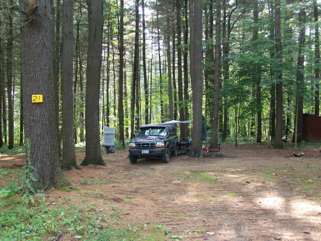
  • New “Intensive Use” Area Was Created to Allow for Up to 150 drive-in campsites (tent or RV or truck camper) to remain along Moose River Plains Road, Helldiver Road, Lost Ponds Foad, Loop Road, Red Dam Road, and other Camping Spurs with spacing less then 1/4 mile. There is no charge to use these sites, you just need a permit if you stay more then 3 days.
  • Campsites Along Otter Brook and Indian Lake Roads will be spaced a 1/4 mile apart, and avoid sensetive areas, such as closing the sites right along the Moose River. These sites will be primarily tent sites during the summer, but during Big Game Season, RVs and truck campers will be allowed.

The recently adopted Moose River Plains Unit Management Plan discusses some of the chnages to Roadside Camping in the area…

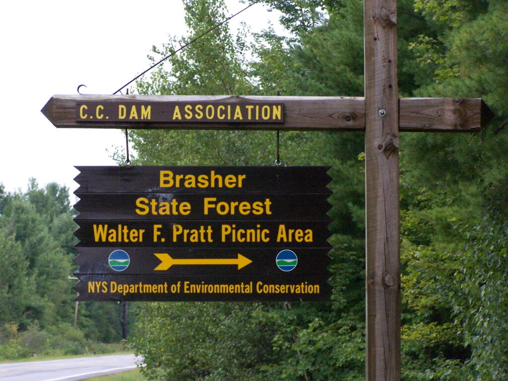
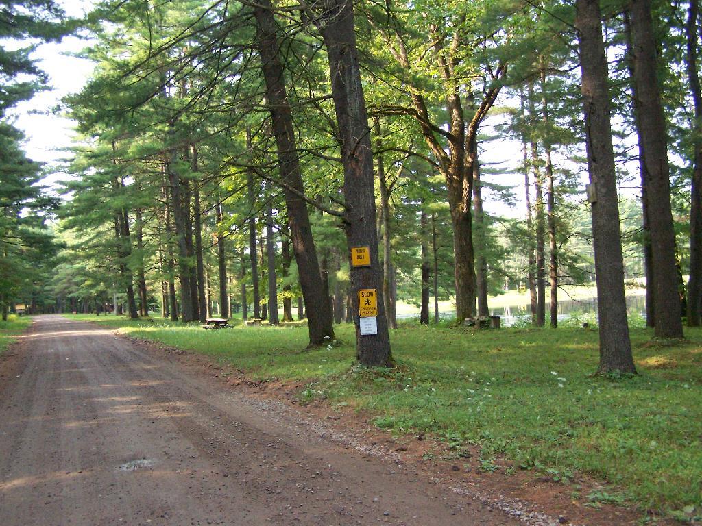
“The creation of the MRPCA will create some challenges in educating the public as to what to expect within the area. As the area will not charge fees, nor will reservations be taken, users will be arriving at the area without the benefit of knowing what site they may be camping at. Users will need to drive through the area and locate a site that is suitable for their needs. In the unlikely case that no sites are available, users will need to be educated as to what alternatives exist in the general area. Providing information at the two entrance points, Cedar River Flow and Limekiln Lake, will be an important part of informing users of the type of opportunity available in the MRPCA. It will also provide an opportunity to provide information on alternative locations should the MRPCA not meet their expectations.”

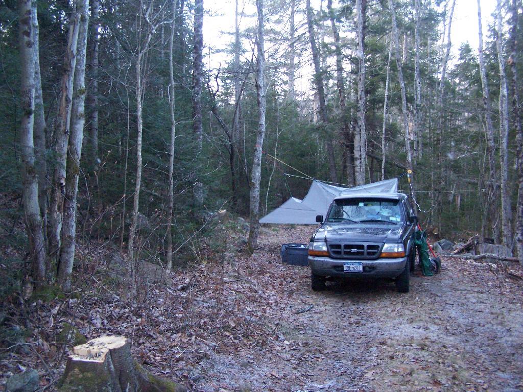
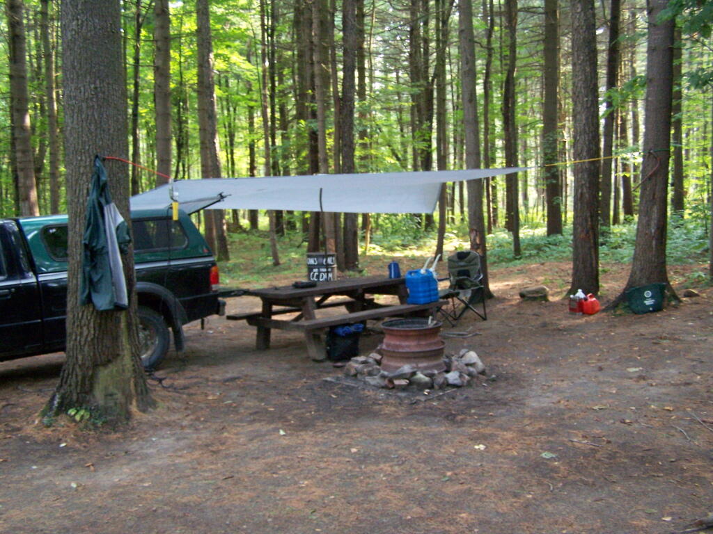
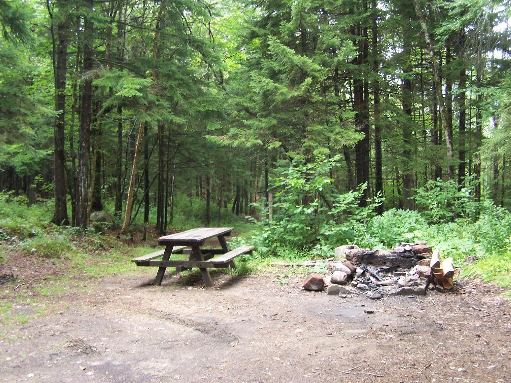
“Unlike other intensive use area campgrounds in the Park, amenities such as bath houses, playgrounds, and paved drives are not ever going to be considered for the MRPCA. Pursuant to APSLMP guidelines for newly created intensive use areas, the MRPCA will only contain up to 150 roadside campsites along approximately 20 miles of roads. These sites will have fire rings, pit privies and picnic tables as their only amenities. Some of these sites will remain relatively close to the road, while others will remain several hundred feet back, accessed by short driveways. A majority of these sites will be comprised of existing sites, some fairly well separated from other sites and some clustered in small groups. This will provide for a variety of camping opportunities depending on what users are seeking. Existing sites that are very close to the road may be relocated to a location that provides better screening or may be converted to parking areas with a walk‐in site located a short distance from the parking area. Any newly constructed sites will be located in a manner to provide vegetative screening between the site and the road.”

— NYSDEC Moose River Plains UMP.

Map of Moose River Plains.

There are no campsites shown on the map, and as listed below both the Intensive Use Area and other portions of Moose River Plains will continue to allow camping as listed below.

Moose River Plains Overview

Roadside Campsites, Post UMP Changes.

These are based on the UMP proposal not implemented yet. This is considered the minimum number of sites under the new plan, the Moose River Plains Camping Area, may increase form 112 to 150 sites in the future, depending on the demand. The DEC plans to limit Otter Brook/Indian Lake Roads to tent only sites during summer season has not be finalized.

Road Number of Sites Site Types
At Wakley Dam:
Cedar River Road
5 Tent (plus others) or Vehicle
Moose River Plains Camping Area Roads:
Moose River Plain Road
Campsite Loop
Helldiver Pond Road
Lost Ponds Road
Loop Road
Rock Dam Road
112 Tent or Vehicle
Otter Brook Road 14 Tent, Vehicles Allowed During Big Game Season
Indian Lake Road 5 Tent, Vehicles Allowed During Big Game Season

More Resources…

Camping Down By Otter Brook

Kayak Tying Down Tarp

Site 57 in the Plains

Campsite 55