forest

DEC Commissioner Policy #38 – Forest Preserve Roads

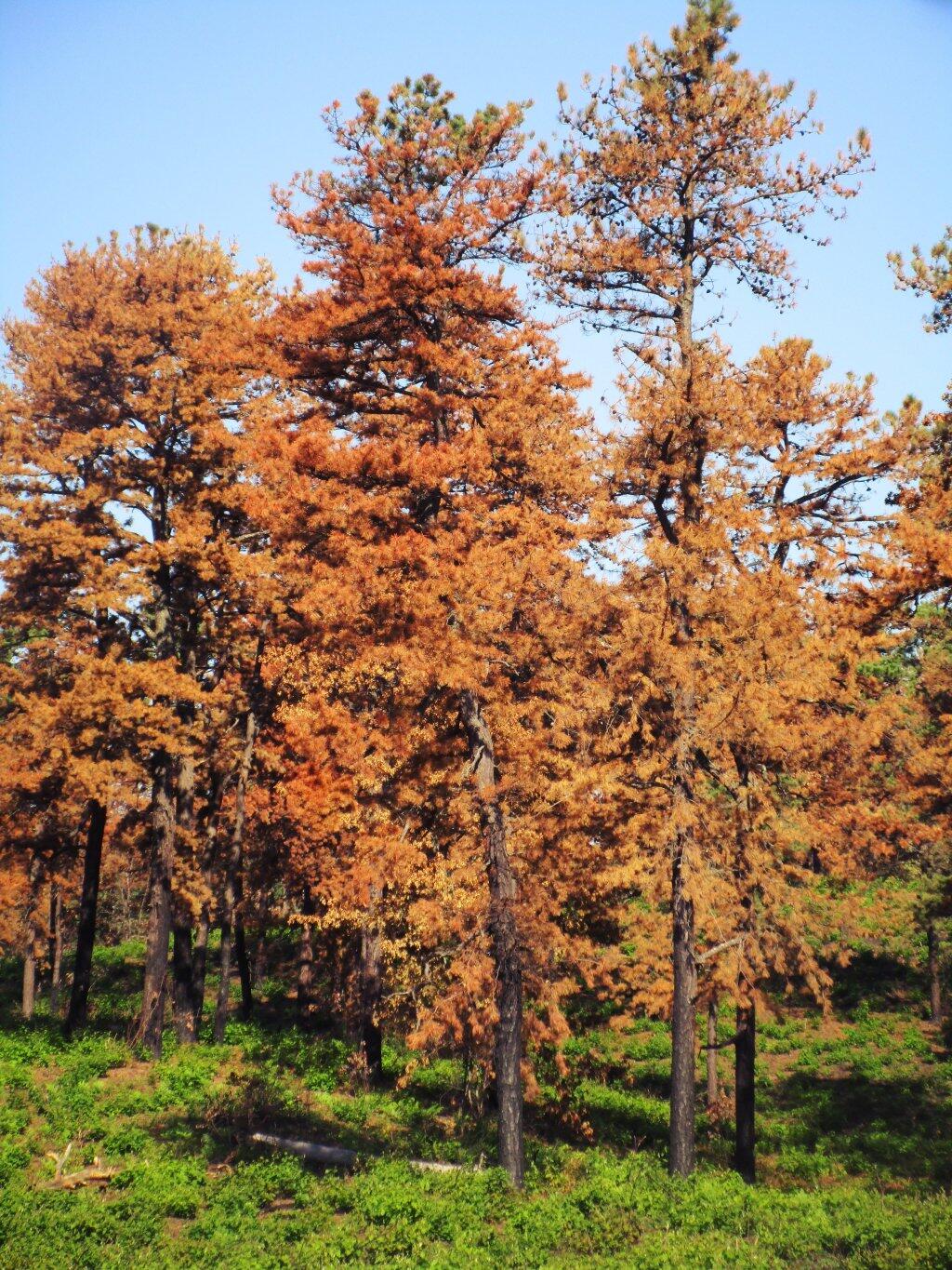
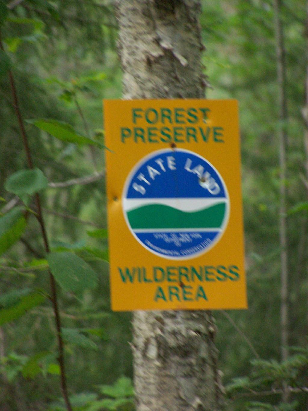
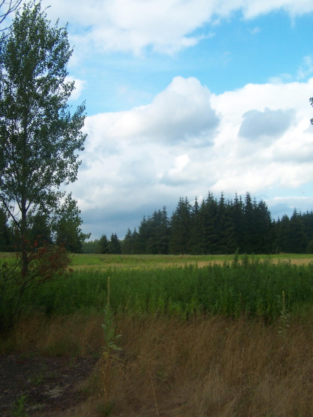
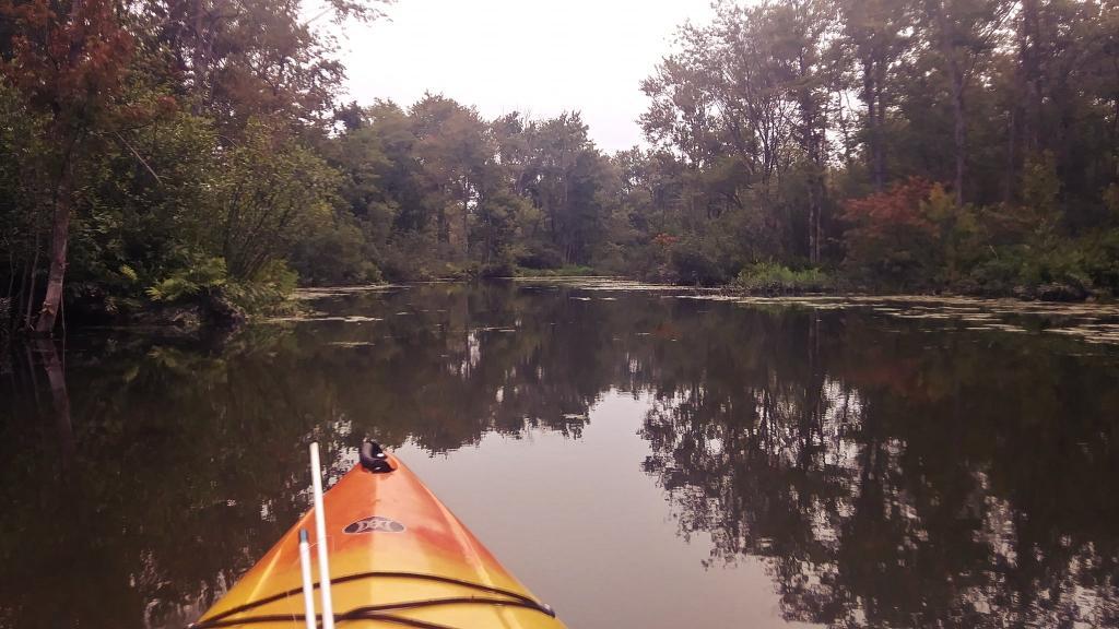
For today’s fodder, we take a look at the policies relating to the development and maintenance of the forest preserve system of roads. In March 2006, DEC Commissioner Denise M. Sheehan issued this policy based on a lawsuit by the Residents Committee to Protect the Adirondacks, that allows for limited road maintenance and development, consistent with the Adirondack and Catskill Unit Management Plans.

While any road in a Adirondack or Catskill Park is bound to be controversial, there is a need to make some portions of the backcountry accessible to the general public. This policy attempts to balance constitutional restraints with the desire of the public to have access to parts of Adirondack and Catskill Park, that might otherwise be unaccessible.

Note: These requirements do not apply to roughly 800,000 acres of public lands outside of the Adirondack and Catskill Park on State Forests, Wildlife Management Areas and other areas. They also do not apply to intensive use areas.

New Bridge Over Bradley Brook

I. Summary

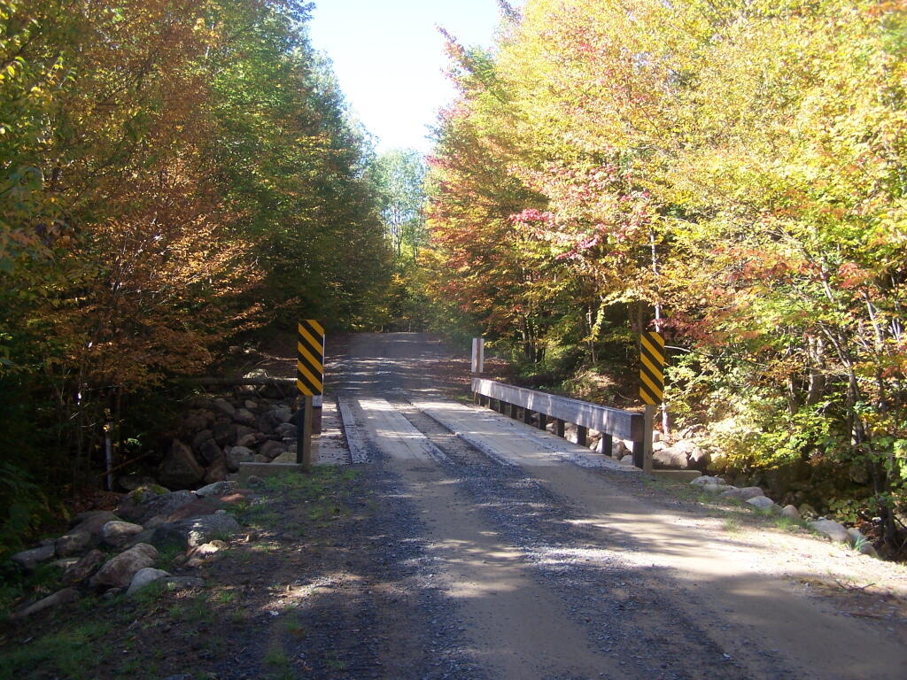
This policy establishes procedures and protocols for the maintenance, rehabilitation, relocation, and, when authorized by the State Constitution, widening and new construction of roads and state truck trails under Department of Environmental Conservation (“Department”)jurisdiction in the Forest Preserve which are situated in units classified by the Adirondack Park State Land Master Plan (“APSLMP”) as Wild Forest, Primitive or Canoe Area or classified by the Catskill Park State Land Master Plan (“CPSLMP”) as Wild Forest. This policy pertains to all such roads and state truck trails on Forest Preserve lands whether or not they are open for public motor vehicle use, except it does not pertain to roads or state truck trails in Intensive Use Areas and Administrative Areas. Further, this policy establishes that generally Forest Preserve roads are low maintenance seasonal roads which are narrow, surfaced with gravel, suitable for low speeds, lightly traveled by the public, and partially or fully shaded by tree canopy. Such roads are further constructed and maintained to the minimum standard necessary to provide passage by appropriate motor vehicles in a manner which protects the environment.

Less Muddy Section of Moose Club Way

II. Policy:

It is the policy of the Department to ensure that comprehensive and consistent procedures are applied to all maintenance, rehabilitation, widening and construction of roads and state truck trails (roads) in the Forest Preserve to ensure that such activities minimize the impacts on the environment and maintain the wild forest character of the road and state truck trail corridors.The 2003 Memorandum of Understanding Between the Adirondack Park Agency and theDepartment of Environmental Conservation Concerning Implementation of the State LandMaster Plan for the Adirondack Park (MOU) provides guidance concerning ordinary maintenance, rehabilitation and minor relocation of conforming structures and improvements on Forest Preserve lands in the Adirondack Park, including whether consultation between the two agencies is required. This policy is intended in part to build upon the MOU and provide additional direction and clarification on coordination of road work in the Adirondack Forest Preserve. This Policy takes precedence over previously existing authority, guidelines, andpolicies.

This policy does not include standards for determining if a road has become legally abandoned. Determinations of road abandonment will be made on a case by case basis inc onsultation with the Division of Legal Affairs.

1 The following definitions, guidelines, responsibilities and procedures shall govern work to be done on roads and state truck trails being carried out on lands of the Forest Preserve which are classified by the APSLMP or CPSLMP as Wild Forest, Primitive, or Canoe.

A. Definitions:

1.Brushing means cutting of woody vegetation less than 3 inches in diameter at breast height (d.b.h.).

2. Ditch means an excavated drainage structure situated adjacent and generally parallel to the driving surface and shoulder of a road or truck trail, designed to convey water away from the driving surface.

3. Ditchline means the low point or centerline of the ditch.

4. Drainage structure means a device which drains water off or away from the road. Drainage structures include such structures as water bars, ditches, French drains,culverts and underdrains.

5. Driving Surface means that portion of the road surface which is designed for vehicles to travel on.

6. Footprint means the limits of disturbance of the road. The foot print includes the driving surface, shoulders, drainage structures, and side slopes. The Original Footprint is the limit of disturbance of the road at the time that it was initially constructed. The currently maintained or existing foot print means areas of the footprint not currently occupied by trees greater than 3″ dbh.

7. French drain means a subsurface drain consisting of a trench backfilled with porous soil or loose stone and covered with earth or other appropriate surface material.

8. Minor relocation of a road or state truck trail means the relocation of a short segment of a road in order to avoid drainage, wetlands, safety, or other site specific problems which cannot otherwise be adequately addressed. A minor relocation shall be the minimum length of new road required to avoid or lessen the site specific problem, but shall not exceed 300 feet in length.

9. Mowing means cutting of non-woody vegetation and woody vegetation less than 3feet in height.

10. Ordinary maintenance means activities within the currently maintained footprint of the road which are needed to keep the road in good working order and which overtime do not materially change the use or appearance of the land or the vegetation thereon from its current use and appearance, including the maintenance or in-kind replacement of road appurtenances and work to address public health and safety issues where such maintenance or activities periodically occur on an as-needed basis. For purposes of this policy, ordinary maintenance includes the following activities when carried out within the currently maintained footprint:

i. pothole filling;

ii. blowdown clearing;

iii. grading of driving surface;iv. bridge repair and maintenance;

v. bridge replacement with a bridge of the same design and of similar dimensions and which is constructed of similar materials;

vi. culvert maintenance, or replacement with a culvert of a length not to exceed the existing foot print and the same nominal height as the culvert being replaced in the same location, provided that the culvert does not involve a freshwater wetland;

vii. drainage structure maintenance, or replacement with a structure in the same location with the same design and similar dimensions and which is constructed of similar materials;

viii. cleaning of existing ditches and culverts that do not impact fresh waterwetlands;

ix. mowing and brushing routinely maintained roads up to four feet beyond theshoulder or ditchline to maintain existing sight lines, road shoulders, andditches;

x. resurfacing of driving surface, with similar material as currently used on theroad, provided that such resurfacing will not likely facilitate levels of public motor vehicle use which significantly exceed existing levels of such use;

xi. limited rock removal that does not require blasting;

xii. trimming select individual tree branches that impede vehicular traffic, obscure sight lines, and hide roadside hazards; and

xiii. cutting select individual dead or hazardous trees pursuant to Lands and Forests Policy 91-2, Cutting and Removal of Trees in the Forest Preserve.

11. Rehabilitation means work that does not occur on a routine basis within the currently maintained footprint of the road which is essential to address environmental impacts, improve safety, or to restore the road or truck trail to a usable condition. It includes the construction of new road appurtenances or work outside of the currently maintained foot print of a road, but within the original footprint of the road. Rehabilitation includes but is not limited to the following activities:

i. placing culverts at new locations;

ii. replacing existing culverts with culverts that have a nominal height greaterthan the nominal height of the existing culvert;

iii. constructing new ditches or drainage structures;

iv. widening existing ditches;

v. cutting trees other than dead or hazardous trees pursuant to Lands and ForestsPolicy Lands and Forests Policy 91-2, Cutting and Removal of Trees in theForest Preserve;

vi. brushing in areas which have not been routinely maintained;

vii. resurfacing the driving surface where such resurfacing will likely facilitate levels of public motor vehicle use which significantly exceed existing levels of such use;

viii. resurfacing of the driving surface with material that is different from the material which currently covers the surface of the road when there is a clear determination that this measure is necessary to protect the natural resources of the Forest Preserve adjoining the road corridor by controlling erosion or runoff; and

ix. regrading of side slopes.

12. Road means motorized transportation corridors that include both roads and state truck trails as defined in the Catskill and Adirondack Park State Land Master Plans, unless the context indicates otherwise.

Road (APSLMP definition): The APSLMP defines “road” on page 18-19 as “an improved or partially improved way designed for travel by automobiles and which may also be used by other types of motor vehicles except snowmobiles, unless the way is a designated snowmobile trail; and is, either maintained by a state agency or a local government and open to the general public maintained by private persons or corporations primarily for private use but which may also be open to the general public for all or a segment thereof; or maintained by the Department of Environmental Conservation or other state agency and open to the public on a discretionary basis.

Road (CPSLMP definition): The CPSLMP defines “road” in Appendix C as “an improved way designed for travel by automobiles and which may also be used by other types of motor vehicles except snowmobiles, unless the way is a designated snowmobile trail; and is, either maintained by a state agency or a local government and open to the general public; or maintained by private persons or corporations primarily for private use but which may also be open to the general public for all or a segment thereof; or, maintained by the Department of Environmental Conservation or other state agency and open to the public on a discretionary basis; or, maintained by the Department of Environmental Conservation for its administrative use only.”

13. Road work means any physical alteration of a road including ordinary maintenance, minor relocation, rehabilitation, widening and new construction as defined in this policy.

14. Shoulder means a transition zone between the driving surface and the road edge or the ditchline. In general, a wheel of a motor vehicle is not on the shoulder unless the motor vehicle is parked or pulled over to let another car pass.

15. Side slope means that area outside of the ditch or road shoulder that is graded to a uniform slope in order to stabilize the soil between the ditch or shoulder and the native, undisturbed ground.

16. State truck trail:

i. State truck trail (APSLMP definition). The APSLMP on page 19 defines “state truck trail” as an improved way maintained by the Department ofEnvironmental Conservation for the principal purpose of facilitatingadministration of state lands or of allowing access for fire fighting equipment and not normally open for public use of motorized vehicles.

ii. State truck trail (CPSLMP definition). “State truck trail†is defined in Appendix C of the CPSLMP as “an improved way maintained by the Department of Environmental Conservation for the principal purpose offacilitating administration of state lands or to allow access for fire fighting equipment and not normally open to the public for motorized vehicle use.

17. Trimming means the removal of lateral branches or leaders of a tree or shrub, that does not sever the plant from its roots.

18. Underdrain means a perforated culvert in porous fill for drawing off subsurface water from the soil.

19. Widening means a lateral expansion of the currently maintained footprint, or lateral expansion of the driving surface of the road. Widening includes the clearing of trees and other vegetation from areas of the existing footprint that are not currently so maintained to restore the opening of the original footprint.

20. Work plan means a detailed description of work to be performed, the Best Management Practices that will be used in performance of the work, and the desired final condition of the road and surrounding area.

B. Guidelines for roads subject to this Policy

1. Determination of Road Width, Driving Surface and Desired Condition. The width, existing condition and desired condition of all roads will be addressed in Unit Management Plans (“UMPs”).. 2. Relocation, rehabilitation, widening or construction of roads. Any road work, except for ordinary maintenance, not authorized in a UMP may not be performed until it is determined whether or not a UMP amendment may be required. This determination will be made by the Director of the Division of Lands and Forests in consultation with APA after a work plan has been developed. Ordinary maintenance of existing roads does not require UMP authorization. Roads designated as closed in a UMP may not be maintained.

3. Work plans. All rehabilitation, relocation (including minor relocation), widening and new construction of roads in the Adirondack Park and the Catskill Park will be done in accordance with a written work plan. Work plans will detail the work to be performed and the Best Management Practices that will be used in performance of the work and the desired final condition of the road and surrounding area. In both the Adirondack Park and Catskill Park, ordinary maintenance of a road requires approval from the Regional Forester in the form of a written work order or an approved “Requests for Routine Maintenance Projects on Forest Preserve Lands.All work plans will describe the work to be performed, including any tree cutting, in relation to a linear distance from the projectâ’ starting point. Markers corresponding to the work described in the work plan shall be placed at the work site. Work plans should include photographs taken at representative locations along with location by location descriptions of the road condition, driving surface and width.

5 All work plans in the Adirondack Park will be developed in consultation with APA as per the MOU and must be approved by the Regional Director and the Director of the Division of Lands and Forests or their designees. If a work plan for a project in the Adirondack Park indicates that the proposed work may materially change the appearance of the land or vegetation thereon or use of the road, then the Director of the Division of Lands and Forests or the Director’s designee shall consult with APA staff to determine whether such work must first be authorized by an approved UMP or UMP amendment. If a work plan for a project in the Catskill Park indicates that the proposed work may materially change theappearance of the land or vegetation or use of the road, then the Director of the Division of Lands and Forests shall determine whether such work must first be authorized by an approved UMP or UMP amendment.

4. Best Management Practices. All work on roads shall be done in accordance with Best Management Practices (BMPs). The New York State Forestry Best Management Practices for Water Quality, BMP Field Guide shall serve as a reference for developing BMPs.

5. Approvals and Consultation

i. Ordinary Maintenance. Ordinary maintenance of a road in the Adirondack Park does not require either APA consultation or UMP authorization, except that, as per the MOU, APA consultation is required if wetlands might be impacted. Ordinary maintenance of a road in the Catskill Park does not require UMP authorization, except that consultation with the Department’s Division Fish, Wildlife and Marine Resources Freshwater Wetlands Manager is required if wetlands might be impacted. In both the Adirondack Park and Catskill Park, ordinary maintenance of a road requires approval from the Regional Forester in the form of a written work order or an approved “Requests for Routine Maintenance Projects on Forest Preserve Lands.”

ii. Rehabilitation. Rehabilitation of roads has the potential to impact the wild forest character of the road, cause significant environmental impacts and facilitate additional public use. For these reasons, rehabilitation of roads inthe Adirondack Park requires a written work plan and consultation with the APA. Depending upon site specific considerations, rehabilitation may require authorization by an approved UMP or UMP amendment. This determination requires approval from the Director of the Division of lands and Forests and will be made in consultation with APA.

ehabilitation of roads in the Catskill Park requires approval from the Director of the Division of Lands and Forests or the Director’s designee and, depending upon site specific considerations, may require authorization in an approved UMP or UMP amendment.

iii. Minor relocation . Minor relocation of roads in the Adirondack Parkrequires a written work plan, approval from the Director of the Division of Lands and Forests and consultation with the APA, and may require a UMP or UMP amendment. Minor relocation of roads in the Catskill Park requires a written work plan and approval from the Director of the Division of Lands and Forests, or the Director’s designee, and requires authorization in an approved UMP or UMP amendment. Relocation of portions of roads or state truck trails that are greater than 300 feet, or any or relocation that may have significant environmental impacts will be considered as constituting new road construction and must follow the procedures and protocols on new road construction set forth subsequently in this document.In the Adirondack Park, the determination of whether a particular road relocation project constitutes a minor relocation will be made by the Director of the Division of Lands andForests or the Director’s designee in consultation with the APA. In theCatskill Park, the determination of whether a particular road relocation project constitutes a minor relocation will be made by the Director of the Division of Lands and Forests or the Director’s designee.

iv. Road widening and new road construction on roads in units classified as Wild Forest. As noted above, the widening of existing state truck trails and roads and the construction of new state truck trails and roads on lands classified as Wild Forest under the APSLMP and the CPSLMP, must be authorized by the State Constitution.

Supplementing this constitutional requirement is the APSLMP’s requirement that “No new roads will be constructed in wild forest areas nor will new state truck trails be constructed unless such construction is absolutely essential to the protection or administration of an area, no feasible alternative exists and no deterioration of the wild forest character or natural resources quality of the area will result.

The CPSLMP requires that, in Wild Forest, “No new roads will beconstructed. No new state truck trails will be constructed unless suchconstruction is absolutely essential to protect or administer an area and there will be no material adverse effect on the wild forest character of the area by the proposed construction. Further, the APSLMP and the CPSLMP require that such work must be authorized by an approved UMP. To ensure that such work is authorized by the State Constitution and that environmental issues are identified and fully addressed, widening and new construction of roads in the Adirondack Park must be authorized by an approved UMP or UMP amendment, and require a written work plan and consultation with the APA as per the MOU.

Widening and new construction of roads in the Catskill Park must be authorized by an approved UMP or UMP amendment, and require a written work plan which must be approved by the Regional Director and the Director of the Division of Lands and Forests, or their designees.

Road Wandering Up Back Side of Sturges Hills

III. Purpose and Background:

Forest Preserve roads, which are generally low maintenance seasonal roads, are a means of providing the public with access to recreational programs on Forest Preserve lands.

Although design, maintenance and rehabilitation standards for these roads must provide for the health and safety of users, such roads must be consistent with the “wild forest” character of the Forest Preserve and comply with the requirements of the APSLMP or the CPSLMP, as applicable. Thus, proposals for road work in the Forest Preserve must be carefully scrutinized to ensure that health and safety goals are accomplished in a manner which maintains the existing wild forest character of the road corridors and otherwise complies with applicable law.

Article XIV, Section 1 of the New York State Constitution, the paramount legal authority with respect to Forest Preserve land management, provides in relevant part:

“The lands of the state, now owned or hereafter acquired, constituting the forest preserve as now fixed by law, shall be forever kept as wild forest lands. They shall not be leased, sold or exchanged, or be taken by any corporation, public or private, nor shall the timber thereon besold, removed or destroyed. (Emphasis added).”

All road work for roads in the Forest Preserve must be consistent with the directives contained in this constitutional provision. Case law interpreting this provision has held that an immaterial amount of tree cutting does not violate this clause when done in furtherance of one of the purposes for which the Forest Preserve was created, namely, watershed protection and public recreation in a forever wild forest setting. See The Association for the Protection of the Adirondacks v. MacDonald, 253N.Y. 234 (1930); Balsam Lake Anglers Club v. Department of Environmental Conservation, 199 A.D. 2d 852, 605 N.Y.S. 2d 795 (App. Div., Third Department, 1993); Helms v. Reid, 90 Misc. 2d 583 (Hamilton County Supreme Court, 1977), and Flacke v. Town of Fine 113 Misc. 2d 56 (St. Lawrence County Supreme Court, 1982).

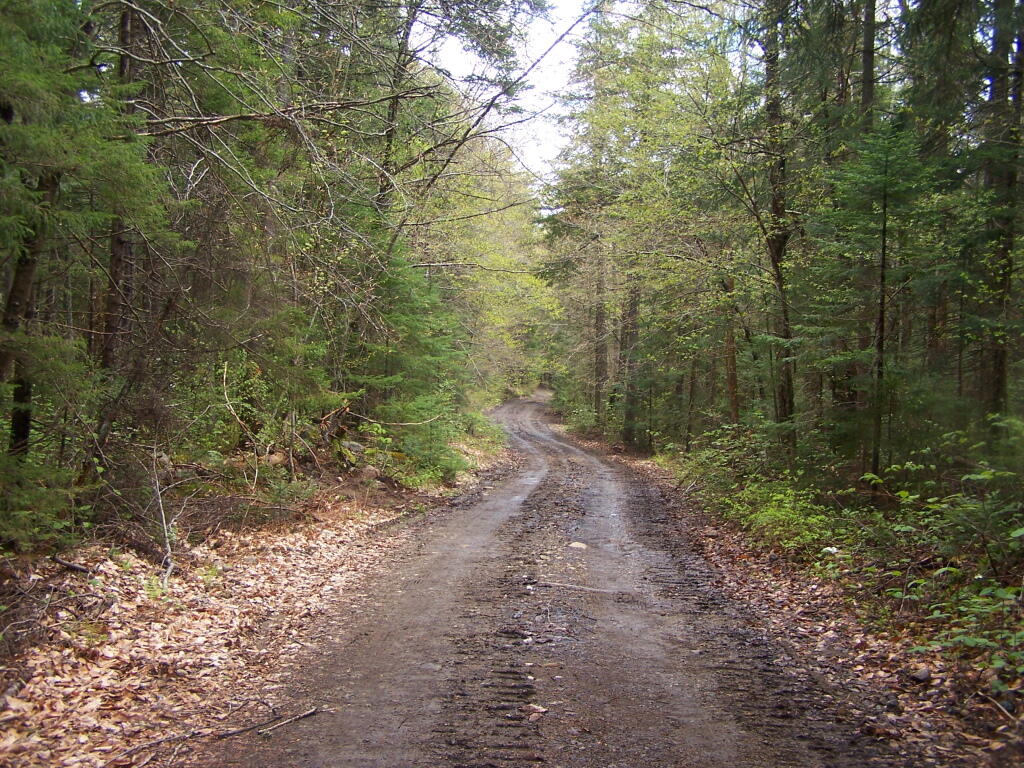
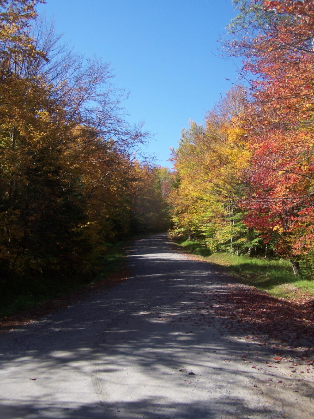
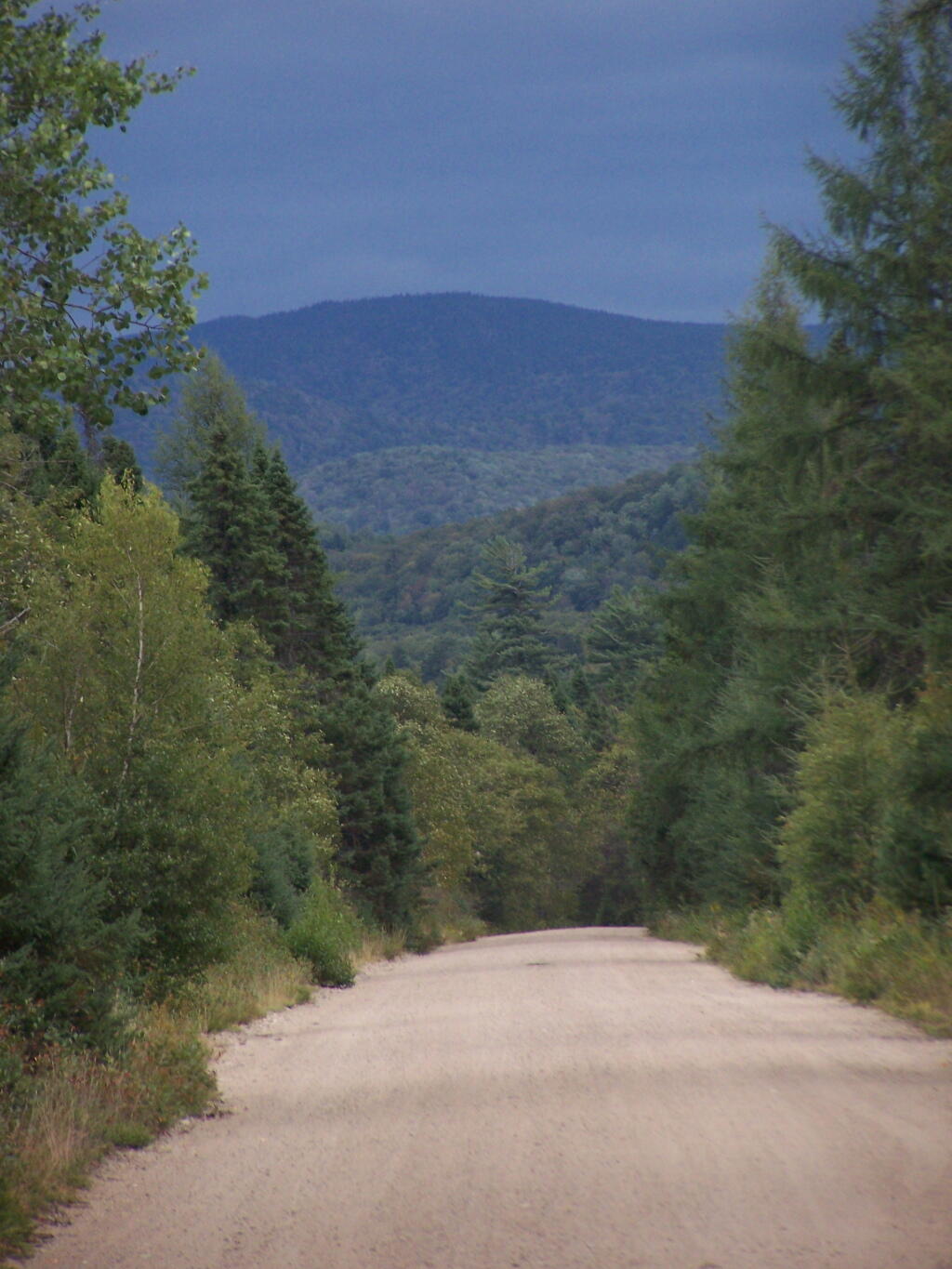
Under the rationale set forth in these cases, Forest Preserve road corridors should maintain a wild forest character, with minimal tree cutting. Thus, the current character of Forest Preserve roads should not be changed, and such roads should continue to have narrow driving surfaces, be surfaced with gravel, be suitable for low speeds only, and be shaded by tree canopy.

Roads and state truck trails are nonconforming in areas classified by the APSLMP and CPSLMP as Wilderness. Therefore, there shall be no maintenance, rehabilitation, relocation, widening, or new construction of roads or state truck trails in Wilderness areas.

In areas classified as Primitive by the APSLMP, existing roads and state truck trails may be maintained, rehabilitated or relocated only if the road or truck trail was in existence when the land was classified as Primitive and the road or truck trail is used by administrative personnelto reach and maintain structures and improvements whose removal cannot be effected by a fixed deadline or whose presence is of an essentially permanent character.

In addition, existing roads in areas classified as Primitive may be maintained, rehabilitated or relocated if the roads are open for public use at the Department’s discretion pending wilderness classification. There may be no widening or new construction of roads or state truck trails in Primitive Areas.

In areas classified as Canoe by the APSLMP, the use of roads is prohibited and therefore such roads may not be maintained, rehabilitated, relocated, widened or constructed. Existing state truck trails in areas classified as Canoe may be maintained, rehabilitated or relocatedwhere the truck trails are being used by administrative personnel for purposes designed to preserve or enhance the water or fishery resources of the area as specified in UMPs. The widening or new construction of truck trails is prohibited in Canoe areas.

In areas classified as Wild Forest by the APSLMP, existing roads and state truck trails which are used solely by administrative personnel to reach, maintain and construct permitted structures and improvements may be maintained, rehabilitated, and relocated, but may not be widened. New roads and state truck trails to be used solely for these purposes may not be constructed. Existing public roads open to the public for motor vehicle use in APSLMP Wild Forest areas may be maintained, rehabilitated and relocated. Existing public roads maybe wide ned only if authorized by Article XIV, Section 1 of the New York State Constitution.

No new roads or state truck trails will be constructed in APSLMP Wild Forest areas unless such construction is authorized by Article XIV, Section 1 of the New York State Constitution and such construction is absolutely essential to the protection or administration of the area, no feasible alternative exists and no deterioration of the wild forest character or natural resource quality of the area will result. In addition, such construction is allowed only if it will not result in a material increase in the cumulative mileage of roads open to motorized use by the public in Adirondack Park Wild Forest units.

In areas classified as Wild Forest by the CPSLMP, existing roads and state truck trails which are used by administrative personnel to reach, maintain and construct permitted structures and improvements, to conduct approved fish and wildlife research and management projects, for rescues, or for other appropriate law enforcement and general supervision of public use may be maintained, rehabilitated, and relocated, but may not be widened.

New roads and state truck trails to be used solely for these purposes may not be constructed. Existing public roads open to the public for motor vehicle use in CPSLMP Wild Forest areas may be maintained, rehabilitated, and relocated. Existing roads and state truck trails may be widenedonly if authorized by Article XIV, Section 1 of the New York State Constitution. No new roads or new state truck trails will be constructed in CPSLMP Wild Forest areas unless such construction is authorized by Article XIV, Section 1 of the New York State Constitution and such construction is absolutely essential to protect or administer the area and there will be no material adverse effect on the wild forest character of the area by the proposed construction.

In addition, such construction is allowed only if it will not result in a material increase in the cumulative mileage of roads open to motorized use by the public in the Catskill Park Wild Forest units. This policy is intended to ensure that road work in the Forest Preserve is in compliance with constitutional and APSLMP and CPSLMP directives. Thus, this policy will ensure that all road and state truck trail maintenance, rehabilitation, relocation, widening and construction projects will be properly authorized and that work plans will be developed and appropriately approved prior to the commencement of such work. This policy will enable staff to determine whether such work: requires approval by the Regional Forester and the Director of the Division of Lands and Forests or the Director’s designee; requires consultation with the Adirondack Park Agency; and requires authorization by an approved UMP or UMP amendment

The policy also will enable staff to determine whether a work plan is needed, and, if so, what it must contain and who must approve it.

Little Moose Mountain

IV. Responsibility:

It shall be the responsibility of all Department divisions and staff to implement the guidelines and procedures of this policy.

It shall be the responsibility of the Forester assigned as the land manger of a management unit to prepare work plans for the unit in consultation with the Division of Operations. It shall be the responsibility of the Regional Forester to review and approve work plans for road work and ensure that work plans are developed for all road work as required by this policy. The Regional Forester shall ensure work plans are in compliance with UMPs and that current best management practices are utilized and any associated impacts on the environment are minimized. It shall be the responsibility of all Department staff involved in road work projects in the Forest Preserve to ensure that all work authorized and is carried out in accordance with the approved work plan and to ensure that any tree cutting complies with policy Lands and Forests Policy 91-2, Cutting and Removal of Trees in the Forest Preserve.It shall be the responsibility of the Regional Director and the Division Director or their designees to review and approve any work plans for road work involving maintenance, relocation, rehabilitation, widening, and new construction proposed under this policy and to assign staff to coordinate with the APA where such coordination is appropriate under thispolicy.

It shall also be the responsibility of the Director of the Division of Lands and Forests to periodically review the provisions of this policy and recommend amendments, where necessary.

Dry Grass at Hang Gliders Cliff

V. Procedure:

The management and actions taken regarding road maintenance, rehabilitation, widening, relocation, and construction on Adirondack Forest Preserve lands shall be in accordance with the above stated policy and the following procedure:

1. Regional staff shall consult with Regional Forester to determine if a proposed project is ordinary maintenance, rehabilitation, minor relocation, relocation other than minor relocation, widening or new construction.

2. APA consultation is required if wetlands in the Adirondack Park might be impacted as required per the MOU. Depending on the scope of the work, an APA Jurisdictional Inquiry Form and Application for Wetlands General Permit, 2005G-1, may be required.

3. Ordinary maintenance of roads may be carried out with the approval of the Regional Forester. At the Regional Forester’s discretion, a work plan may be required for ordinary maintenance. Such work plans must be approved by the Regional Forester and the Director of the Division of Lands and Forests or their designees.

4. All rehabilitation, minor relocation, widening and new construction of roads in the Adirondack Park will be done in accordance with a written work plan prepared by DEC staff in consultation with the APA as per the MOU. All relocation projects should be forwarded to the Director of the Division of Lands and Forests for consultation with APA to determine if the project is considered a minor relocation. Projects that are not part of an approved UMP or UMP amendment and are not minor relocations will be referred to the Director of the Division of Lands and Forests forconsultation with APA to determine if an approved UMP or UMP amendment isrequired for the project.

5. The Regional Forester will ensure that the work plan details the work to be performed, the BMPs that will be used in performance of the work, and the desired final condition of the road and surrounding area. All work plans must describe the work to be performed, including any tree cutting, in relation to a linear distance from the project’s starting point. Markers corresponding to the work described in the work plan shall be placed at the work site. Work plans should include photographs taken at each station and at representative locations along with station by station descriptions of the road condition, driving surface and width.

The Regional Forester will forward work plans approved by the Regional Director or the Regional Director’s Designee to the Director of the Division of Lands and Forests. The Division Director or the Division Director’s designee will notify the Regional Forester of approval or denial of the work plan.

The management and actions taken regarding road maintenance, rehabilitation, minor relocation, relocation, widening and construction on Catskill Forest Preserve lands shall be in accordance with the above stated policy and the following procedure:

1. Regional staff shall consult with the Regional Forester to determine if the proposed project is ordinary maintenance, rehabilitation, minor relocation, relocation other than minor relocation, widening or new construction.

2. Consultation with the Department’s Division of Fish, Wildlife and Marine Resources Freshwater Wetlands Manager is required if wetlands might be impacted.

3. Ordinary maintenance of roads may be carried out with the approval of the Regional Forester.

4. All rehabilitation, minor relocation, widening and new construction of roads in the Forest Preserve will be done in accordance with a written work plan prepared by Department staff. All relocation projects should be forwarded to the Director of the Division of Lands and Forests to determine if the project is considered a minor relocation. Projects that are not part of an approved UMP or UMP amendment will be referred to the Director of the Division of Lands and Forests to determine if an approved UMP or UMP amendment is required for the project.

5. The Regional Forester will ensure that the work plan details the work to be performed and the Best Management Practices that will be used in performance of the work and the final condition of the road and surrounding area. All work plans must describe the work to be performed, including any tree cutting, in relation to a linear distance from the project’s starting point. Markers corresponding to the work described in the work plan shall be placed at the work site.

The Regional Forester will forward work plans approved by the Regional Director or the Regional Director’s Designee to the Director of the Division of Lands and Forests. The Division Director or the Division Director’s designee will notify the Regional Forester of approval or denial of the work plan.

Sunny Morning at Powley Place Bridge

Related References:

Adirondack Park State Land Master Plan (APSLMP), Adirondack Park Agency, June 2001

Catskill Park State land Master Plan (CPSLMP), NYSDEC, 1985

New York State Forestry, Best Management Practices for Water Quality, BMP Field Guide,NYSDEC, January 2000

Lands and Forests Policy 91-2, Cutting and Removal of Trees in the Forest Preserve

2003 Adirondack Park Agency/Department of Environmental Conservation Memorandum ofUnderstanding

Classification and Acres

An overview of the amount of land in each classification of the Adirondack Park. Here are a summary of the meanings of the various land classifications.

CLASS Acres Percent
PRIMITIVE CORRIDOR 292 0.01%
UNCLASSIFIED 365 0.01%
ADMINISTRATIVE 391 0.02%
HISTORIC 531 0.02%
CANOE AREA 18,989 0.74%
INTENSIVE USE 23,382 0.91%
PRIMITIVE 46,647 1.83%
WILDERNESS 1,160,125 45.39%
WILD FOREST 1,305,233 51.07%
TOTAL ADIRONDACK FOREST PRESERVE 2,555,955 100.00%

After The Fire

A look at each facility (e.g. campground, wild forest, wilderness area), sorted by size, ascending.

FACILITY Acres Percent
SIGNAL BUOY ISLAND 0.1 0.0%
NORTH CREEK PARKING FISHING ACCESS 0.2 0.0%
MILL CREEK PARKING AREA 0.2 0.0%
SAINT REGIS MOUNTAIN HISTORIC AREA 0.2 0.0%
HURRICANE MOUNTAIN HISTORIC AREA 0.2 0.0%
SHEEPSHEAD ISLAND 0.4 0.0%
MILL CREEK FISHING ACCESS 0.5 0.0%
GARDEN ISLAND 0.5 0.0%
GOOSENECK POND PRIMITIVE AREA 0.6 0.0%
COLE ISLAND 0.9 0.0%
FORTH LAKE BOAT LAUNCH 1.1 0.0%
TAHAWAS PRIMITIVE AREA 1.6 0.0%
LAKE COLBY ENVIRONMENTAL EDUCATIONAL CAMP 1.8 0.0%
MIRROR LAKE BOAT LAUNCH 1.9 0.0%
SPOON ISLAND PRIMITIVE AREA 1.9 0.0%
GREENE ISLAND MAINTENANCE FACILITY 1.9 0.0%
LAKE FLOWER BOAT LAUNCH 2.1 0.0%
PORT DOUGLASS BOAT LAUNCH 2.4 0.0%
UPPER CHATEAUGAY LAKE BOAT LAUNCH 2.4 0.0%
WILMURT CLUB ROAD 2.9 0.0%
GREAT SACANDAGA LAKE BOAT LAUNCH 3.0 0.0%
TUPPER LAKE BOAT LAUNCH 3.2 0.0%
SARANAC LAKE BOAT LAUNCH 3.3 0.0%
WESTPORT BOAT LAUNCH 3.9 0.0%
PORT HENRY BOAT LAUNCH 4.3 0.0%
STILLWATER BOAT LAUNCH 4.3 0.0%
SOUTH BAY STATE BOAT LAUNCH 4.8 0.0%
CRANBERRY LAKE BOAT LAUNCH 5.1 0.0%
RAQUETTE RIVER BOAT LAUNCH 6.3 0.0%
PRIMITIVE AREA 6.6 0.0%
MIDDLE SARANAC LAKE BOAT LAUNCH 6.8 0.0%
LAKE GEORGE FOREST PRESERVE 7.2 0.0%
SACANDAGA PRIMITIVE AREA 7.2 0.0%
WANAKENA PRIMITIVE CORRIDOR 7.5 0.0%
NORTHVILLE-SUB-OFFICE 7.9 0.0%
WILLSBORO BAY BOAT LAUNCH 8.0 0.0%
FULTON CHAIN BOAT LAUNCH 9.1 0.0%
TIED LAKE PRIMITIVE CORRIDOR 9.8 0.0%
SARANAC LAKE ISLANDS CAMPGROUND 9.9 0.0%
HURRICANE MOUNTAIN PRIMITIVE AREA 11.2 0.0%
LOWER SARANAC LAKE BOAT LAUNCH 13.6 0.0%
BEAR POND PRIMITIVE CORRIDOR 14.1 0.0%
FORKS MOUNTAIN PRIMITIVE CORRIDOR 14.7 0.0%
BROADALBIN BOAT LAUNCH 15.7 0.0%
MOSSY POINT STATE BOAT LAUNCH 16.8 0.0%
ALICE BROOK PRIMITIVE AREA 18.8 0.0%
SACANDAGA RIVER STATE BOAT LAUNCH 19.9 0.0%
LONG LAKE STATE BOAT LAUNCH 20.2 0.0%
EAGLE POINT CAMPGROUND 21.0 0.0%
ALDER CREEK PRIMITIVE CORRIDOR 23.0 0.0%
SUNY ATMOSPHERIC SCIENCES RESEARCH CENTER 23.1 0.0%
RAVEN LAKE PRIMTIVE AREA 24.7 0.0%
POPLAR POINT CAMPGROUND 32.8 0.0%
LAKE GEORGE BATTLEGROUND CAMPGROUND 33.5 0.0%
CAMP SANTANONI 36.1 0.0%
TIOGA POINT CAMPGROUND 36.2 0.0%
ALGER ISLAND CAMPGROUND 37.6 0.0%
PARTLOW LAKE PRIMITIVE CORRIDOR 39.0 0.0%
PRIMITVE AREA 45.4 0.0%
BUCK POND PRIMITIVE CORRIDOR 47.8 0.0%
CAROGA LAKE CAMPGROUND 49.1 0.0%
DUG MT. PRIMITIVE AREA 49.7 0.0%
LEWEY LAKE CAMPGROUND 53.4 0.0%
LITTLE SAND POINT CAMPGROUND 66.5 0.0%
CROWN POINT CAMPGROUND 73.6 0.0%
ADIRONDACK FISH HATCHERY 74.1 0.0%
POINT COMFORT CAMPGROUND 75.0 0.0%
LAKE GEORGE BATTLEFIELD DAY USE AREA 81.3 0.0%
BOQUET RIVER PRIMTIVE AREA 85.5 0.0%
NEHASANE PRIMITIVE CORRIDOR 87.6 0.0%
SUCKER LAKE WATER ACCESS 90.6 0.0%
FIRST BROTHER PRIMITIVE AREA 91.4 0.0%
HEARTHSTONE POINT CAMPGROUND 97.4 0.0%
GOLDEN BEACH CAMPGROUND 98.6 0.0%
INDIAN LAKE ISLANDS CAMPGROUND 102.1 0.0%
JOHN BROWNS FARM HISTORIC SITE 104.6 0.0%
SACANDAGA CAMPGROUND 116.8 0.0%
MEADOWBROOK CAMPGROUND 117.8 0.0%
WILMINGTON NOTCH CAMPGROUND 119.7 0.0%
LINCOLN POND CAMPGROUND 134.1 0.0%
JOHNS BROOK PRIMITIVE AREA 146.6 0.0%
TAYLOR POND CAMPGROUND 146.8 0.0%
LAKE EATON CAMPGROUND 152.1 0.0%
CAMP GABRIELS 158.0 0.0%
SCHUYLER ISLAND PRIMITIVE AREA 167.3 0.0%
CATHEAD MTN. PRIMITIVE AREA 172.9 0.0%
SHARP BRIDGE CAMPGROUND 192.9 0.0%
NORTHAMPTON BEACH CAMPGROUND 219.2 0.0%
WAKELY MOUNTAIN PRIMITIVE AREA 224.1 0.0%
LAKE HARRIS CAMPGROUND 233.4 0.0%
SCAROON MANOR DAY USE AREA 240.2 0.0%
EIGHTH LAKE CAMPGROUND 242.0 0.0%
AUSABLE POINT CAMPGROUND 259.5 0.0%
CRANBERRY LAKE CAMPGROUND 264.2 0.0%
LIMEKILN LAKE CAMPGROUND 266.0 0.0%
BROWN TRACT POND CAMPGROUND 272.9 0.0%
POKE-O-MOONSHINE CAMPGROUND 274.1 0.0%
LAKE DURANT CAMPGROUND 276.4 0.0%
PARADOX LAKE CAMPGROUND 287.8 0.0%
BUCK POND CAMPGROUND 302.3 0.0%
ROGERS ROCK CAMPGROUND 307.7 0.0%
FORKED LAKE CAMPGROUND 346.8 0.0%
MEACHAM LAKE CAMPGROUND 359.6 0.0%
UNCLASSIFIED 364.7 0.0%
MOFFITT BEACH CAMPGROUND 386.0 0.0%
CROWN POINT HISTORIC AREA 389.9 0.0%
AMPERSAND PRIMITIVE AREA 423.5 0.0%
ROLLINS POND CAMPGROUND 518.9 0.0%
BALD LEDGE PRIMITIVE AREA 556.5 0.0%
FISH CREEK POND CAMPGROUND 560.1 0.0%
HINCKELY RESERVOIR DAY USE AREA 568.7 0.0%
LAKE GEORGE ISLANDS CAMPGROUND 593.5 0.0%
NICKS LAKE CAMPGROUND 699.6 0.0%
PUTNAM POND CAMPGROUND 850.1 0.0%
LUZERNE CAMPGROUND 853.2 0.0%
VALCOUR ISLAND PRIMITIVE AREA 956.9 0.0%
PROSPECT MOUNTAIN 1,001.7 0.0%
DEAD CREEK PRIMITIVE AREA 1,134.9 0.0%
MT. VAN HOEVENBERG SPORTS FACILITY 1,476.6 0.1%
DEER RIVER PRIMITIVE AREA 1,870.0 0.1%
EASTERN FIVE PONDS ACCESS PRIMITIVE AREA 1,907.8 0.1%
MOOSE RIVER PLAINS CAMPING AREA 2,907.1 0.1%
WHITEFACE MTN. SKI CENTER 3,015.9 0.1%
WEST CANADA MTN. PRIMITIVE AREA 3,137.5 0.1%
RAQUETTE RIVER WILD FOREST 3,550.2 0.1%
SPLIT ROCK WILD FOREST 3,662.5 0.1%
GORE MTN. SKI CENTER 3,783.7 0.1%
MADAWASKA FLOW – QUEBEC BROOK PRIMITIVE AREA 6,035.6 0.2%
JAY MTN. WILDERNESS 7,892.3 0.3%
WHITE HILL WILD FOREST 9,640.6 0.4%
ROUND LAKE WILDERNESS 11,426.7 0.4%
LITTLE MOOSE MOUNTAIN WILDERNESS 12,277.8 0.5%
RAQUETTE-JORDAN BOREAL PRIMITIVE AREA 12,437.4 0.5%
GRASSE RIVER WILD FOREST 13,172.6 0.5%
WATSON EAST TRIANGLE WILD FOREST 13,424.3 0.5%
HURRICANE MOUNTAIN WILDERNESS 13,986.7 0.5%
PEPPERBOX WILDERNESS 14,580.0 0.6%
FULTON CHAIN WILD FOREST 15,948.9 0.6%
HORSESHOE LAKE WILD FOREST 17,139.7 0.7%
HUDSON GORGE PRIMITIVE AREA 17,161.8 0.7%
WILMINGTON WILD FOREST 17,493.2 0.7%
SAINT REGIS CANOE AREA 18,989.0 0.7%
WILLIAM C. WHITNEY WILDERNESS 19,273.7 0.8%
GIANT MTN. WILDERNESS 23,460.5 0.9%
SENTINEL RANGE WILDERNESS 23,991.8 0.9%
HA-DE-RON-DAH WILDERNESS 25,788.3 1.0%
CRANBERRY LAKE WILD FOREST 25,897.3 1.0%
ALDRICH POND WILD FOREST 26,179.6 1.0%
MCKENZIE MTN. WILDERNESS 37,464.1 1.5%
BLUE MTN. WILD FOREST 38,394.3 1.5%
HOFFMAN NOTCH WILDERNESS 38,497.6 1.5%
TAYLOR POND WILD FOREST 39,134.9 1.5%
SHAKER MOUNTAIN WILD FOREST 41,360.7 1.6%
SARGENT PONDS WILD FOREST 43,532.3 1.7%
DIX MTN. WILDERNESS 44,753.8 1.8%
HAMMOND POND WILD FOREST 45,907.0 1.8%
PHARAOH LAKE WILDERNESS 46,071.3 1.8%
BLUE RIDGE WILDERNESS 47,297.2 1.9%
CHAZY HIGHLANDS WILD FOREST 47,855.6 1.9%
JESSUP RIVER WILD FOREST 48,228.7 1.9%
PIGEON LAKE WILDERNESS 50,390.5 2.0%
MOOSE RIVER PLAINS WILD FOREST 66,624.9 2.6%
LAKE GEORGE WILD FOREST 71,157.1 2.8%
DEBAR MTN. WILD FOREST 75,893.9 3.0%
SARANAC LAKES WILD FOREST 77,726.8 3.0%
INDEPENDENCE RIVER WILD FOREST 79,096.6 3.1%
VANDERWHACKER MTN. WILD FOREST 83,986.5 3.3%
SILVER LAKE WILDERNESS 108,848.6 4.3%
SIAMESE PONDS WILDERNESS 114,923.8 4.5%
WILCOX LAKE WILD FOREST 125,839.3 4.9%
BLACK RIVER WILD FOREST 127,156.6 5.0%
FIVE PONDS WILDERNESS 139,228.7 5.4%
FERRIS LAKE WILD FOREST 147,184.3 5.8%
WEST CANADA LAKE WILDERNESS 174,292.4 6.8%
HIGH PEAKS WILDERNESS 205,772.7 8.1%
TOTAL ADIRONDACK FOREST PRESERVE 2,555,955.4 100.0%

South Over Cedar River Flow

Now each class of land, broken down by Class, Unit, Facility, Acreage, and Percent.

CLASS UNIT FACILITY Acres Percent
ADMINISTRATIVE DEBAR MTN. CAMP GABRIELS 158.0 0.0%
FERRIS LAKE FERRIS LAKE WILD FOREST 3.3 0.0%
GRASSE RIVER GRASSE RIVER WILD FOREST 7.4 0.0%
LAKE GEORGE GREENE ISLAND MAINTENANCE FACILITY 1.9 0.0%
SARANAC LAKES ADIRONDACK FISH HATCHERY 74.1 0.0%
SARANAC LAKES WILD FOREST 35.8 0.0%
WILCOX LAKE NORTHVILLE-SUB-OFFICE 7.9 0.0%
WILLIAM C. WHITNEY WILLIAM C. WHITNEY WILDERNESS 79.4 0.0%
WILMINGTON SUNY ATMOSPHERIC SCIENCES RESEARCH CENTER 23.1 0.0%
TOTAL ADMINISTRATIVE 391.0 0.0%
CANOE AREA SAINT REGIS SAINT REGIS CANOE AREA 18,989.0 0.7%
TOTAL CANOE AREA 18,989.0 0.7%
HISTORIC HAMMOND POND CROWN POINT HISTORIC AREA 389.9 0.0%
HURRICANE MOUNTAIN HURRICANE MOUNTAIN HISTORIC AREA 0.2 0.0%
SAINT REGIS SAINT REGIS MOUNTAIN HISTORIC AREA 0.2 0.0%
SARANAC LAKES JOHN BROWNS FARM HISTORIC SITE 104.6 0.0%
VANDERWHACKER MOUNTAIN CAMP SANTANONI 36.1 0.0%
TOTAL HISTORIC 531.0 0.0%
INTENSIVE USE BLACK RIVER NICKS LAKE CAMPGROUND 699.6 0.0%
BLUE MTN. LAKE DURANT CAMPGROUND 276.4 0.0%
LONG LAKE STATE BOAT LAUNCH 20.2 0.0%
BOG RIVER TUPPER LAKE BOAT LAUNCH 3.2 0.0%
CHAZY HIGHLANDS UPPER CHATEAUGAY LAKE BOAT LAUNCH 2.4 0.0%
CRANBERRY LAKE CRANBERRY LAKE BOAT LAUNCH 5.1 0.0%
CRANBERRY LAKE CAMPGROUND 264.2 0.0%
DEBAR MTN. BUCK POND CAMPGROUND 302.3 0.0%
MEACHAM LAKE CAMPGROUND 359.6 0.0%
FERRIS LAKE HINCKELY RESERVOIR DAY USE AREA 568.7 0.0%
LITTLE SAND POINT CAMPGROUND 66.5 0.0%
POINT COMFORT CAMPGROUND 75.0 0.0%
FULTON CHAIN ALGER ISLAND CAMPGROUND 37.6 0.0%
FORTH LAKE BOAT LAUNCH 1.1 0.0%
HAMMOND POND CROWN POINT CAMPGROUND 73.6 0.0%
LINCOLN POND CAMPGROUND 134.1 0.0%
PARADOX LAKE CAMPGROUND 287.8 0.0%
PORT HENRY BOAT LAUNCH 4.3 0.0%
SHARP BRIDGE CAMPGROUND 192.9 0.0%
INDEPENDENCE RIVER STILLWATER BOAT LAUNCH 4.3 0.0%
JESSUP RIVER INDIAN LAKE ISLANDS CAMPGROUND 102.1 0.0%
LEWEY LAKE CAMPGROUND 53.4 0.0%
MOFFITT BEACH CAMPGROUND 386.0 0.0%
POPLAR POINT CAMPGROUND 32.8 0.0%
LAKE GEORGE HEARTHSTONE POINT CAMPGROUND 97.4 0.0%
LAKE GEORGE BATTLEFIELD DAY USE AREA 81.3 0.0%
LAKE GEORGE BATTLEGROUND CAMPGROUND 33.5 0.0%
LAKE GEORGE FOREST PRESERVE 7.2 0.0%
LAKE GEORGE ISLANDS CAMPGROUND 593.5 0.0%
LUZERNE CAMPGROUND 853.2 0.0%
MOSSY POINT STATE BOAT LAUNCH 16.8 0.0%
PROSPECT MOUNTAIN 1,001.7 0.0%
ROGERS ROCK CAMPGROUND 307.7 0.0%
SOUTH BAY STATE BOAT LAUNCH 4.8 0.0%
MOOSE RIVER PLAINS BROWN TRACT POND CAMPGROUND 272.9 0.0%
EIGHTH LAKE CAMPGROUND 242.0 0.0%
FULTON CHAIN BOAT LAUNCH 9.1 0.0%
LIMEKILN LAKE CAMPGROUND 266.0 0.0%
MOOSE RIVER PLAINS CAMPING AREA 2,907.1 0.1%
PHARAOH LAKE PUTNAM POND CAMPGROUND 850.1 0.0%
SARANAC LAKES FISH CREEK POND CAMPGROUND 560.1 0.0%
LAKE COLBY ENVIRONMENTAL EDUCATIONAL CAMP 1.8 0.0%
LAKE FLOWER BOAT LAUNCH 2.1 0.0%
LOWER SARANAC LAKE BOAT LAUNCH 13.6 0.0%
MEADOWBROOK CAMPGROUND 117.8 0.0%
MIDDLE SARANAC LAKE BOAT LAUNCH 6.8 0.0%
MIRROR LAKE BOAT LAUNCH 1.9 0.0%
MT. VAN HOEVENBERG SPORTS FACILITY 1,476.6 0.1%
RAQUETTE RIVER BOAT LAUNCH 6.3 0.0%
ROLLINS POND CAMPGROUND 518.9 0.0%
SARANAC LAKE BOAT LAUNCH 3.3 0.0%
SARANAC LAKE ISLANDS CAMPGROUND 9.9 0.0%
SARGENT PONDS FORKED LAKE CAMPGROUND 346.8 0.0%
GOLDEN BEACH CAMPGROUND 98.6 0.0%
LAKE EATON CAMPGROUND 152.1 0.0%
TIOGA POINT CAMPGROUND 36.2 0.0%
SHAKER MOUNTAIN CAROGA LAKE CAMPGROUND 49.1 0.0%
NORTHAMPTON BEACH CAMPGROUND 219.2 0.0%
SACANDAGA RIVER STATE BOAT LAUNCH 19.9 0.0%
TAYLOR POND AUSABLE POINT CAMPGROUND 259.5 0.0%
POKE-O-MOONSHINE CAMPGROUND 274.1 0.0%
PORT DOUGLASS BOAT LAUNCH 2.4 0.0%
TAYLOR POND CAMPGROUND 146.8 0.0%
WESTPORT BOAT LAUNCH 3.9 0.0%
WILLSBORO BAY BOAT LAUNCH 8.0 0.0%
VANDERWHACKER MOUNTAIN EAGLE POINT CAMPGROUND 21.0 0.0%
GORE MTN. SKI CENTER 3,783.7 0.1%
LAKE HARRIS CAMPGROUND 233.4 0.0%
SCAROON MANOR DAY USE AREA 240.2 0.0%
WHITEFACE MTN. SKI CENTER WHITEFACE MTN. SKI CENTER 3,015.9 0.1%
WILMINGTON NOTCH CAMPGROUND 119.7 0.0%
WILCOX LAKE BROADALBIN BOAT LAUNCH 15.7 0.0%
GREAT SACANDAGA LAKE BOAT LAUNCH 3.0 0.0%
SACANDAGA CAMPGROUND 116.8 0.0%
TOTAL INTENSIVE USE 23,382.3 0.9%
PRIMITIVE ALDRICH POND PRIMITVE AREA 45.4 0.0%
BLUE RIDGE WAKELY MOUNTAIN PRIMITIVE AREA 224.1 0.0%
DEBAR MTN. DEER RIVER PRIMITIVE AREA 1,870.0 0.1%
MADAWASKA FLOW – QUEBEC BROOK PRIMITIVE AREA 6,035.6 0.2%
FIVE PONDS ALICE BROOK PRIMITIVE AREA 18.8 0.0%
EASTERN FIVE PONDS ACCESS PRIMITIVE AREA 1,907.8 0.1%
GIANT MTN. BOQUET RIVER PRIMTIVE AREA 85.5 0.0%
HIGH PEAKS AMPERSAND PRIMITIVE AREA 423.5 0.0%
JOHNS BROOK PRIMITIVE AREA 146.6 0.0%
TAHAWAS PRIMITIVE AREA 1.6 0.0%
HORSESHOE LAKE DEAD CREEK PRIMITIVE AREA 1,134.9 0.0%
HUDSON GORGE HUDSON GORGE PRIMITIVE AREA 17,161.8 0.7%
HURRICANE MOUNTAIN HURRICANE MOUNTAIN PRIMITIVE AREA 11.2 0.0%
LAKE CHAMPLAIN ISLANDS COLE ISLAND 0.9 0.0%
GARDEN ISLAND 0.5 0.0%
SCHUYLER ISLAND PRIMITIVE AREA 167.3 0.0%
SHEEPSHEAD ISLAND 0.4 0.0%
SIGNAL BUOY ISLAND 0.1 0.0%
SPOON ISLAND PRIMITIVE AREA 1.9 0.0%
VALCOUR ISLAND PRIMITIVE AREA 956.9 0.0%
PHARAOH LAKE BALD LEDGE PRIMITIVE AREA 556.5 0.0%
FIRST BROTHER PRIMITIVE AREA 91.4 0.0%
GOOSENECK POND PRIMITIVE AREA 0.6 0.0%
RAQUETTE RIVER RAQUETTE-JORDAN BOREAL PRIMITIVE AREA 12,437.4 0.5%
SENTINEL RANGE PRIMITIVE AREA 6.6 0.0%
SIAMESE PONDS DUG MT. PRIMITIVE AREA 49.7 0.0%
SILVER LAKE CATHEAD MTN. PRIMITIVE AREA 172.9 0.0%
WEST CANADA LAKE WEST CANADA MTN. PRIMITIVE AREA 3,137.5 0.1%
TOTAL PRIMITIVE 46,647.3 1.8%
PRIMITIVE CORRIDOR FIVE PONDS ALDER CREEK PRIMITIVE CORRIDOR 23.0 0.0%
BEAR POND PRIMITIVE CORRIDOR 14.1 0.0%
BUCK POND PRIMITIVE CORRIDOR 47.8 0.0%
PARTLOW LAKE PRIMITIVE CORRIDOR 39.0 0.0%
TIED LAKE PRIMITIVE CORRIDOR 9.8 0.0%
WANAKENA PRIMITIVE CORRIDOR 7.5 0.0%
PEPPERBOX RAVEN LAKE PRIMTIVE AREA 24.7 0.0%
SIAMESE PONDS FORKS MOUNTAIN PRIMITIVE CORRIDOR 14.7 0.0%
SILVER LAKE SACANDAGA PRIMITIVE AREA 7.2 0.0%
WEST CANADA LAKE WEST CANADA LAKE WILDERNESS 13.8 0.0%
WILMURT CLUB ROAD 2.9 0.0%
WILLIAM C. WHITNEY NEHASANE PRIMITIVE CORRIDOR 87.6 0.0%
TOTAL PRIMITIVE CORRIDOR 291.9 0.0%
UNCLASSIFIED UNCLASSIFIED UNCLASSIFIED 364.7 0.0%
TOTAL UNCLASSIFIED 364.7 0.0%
WILD FOREST ALDRICH POND ALDRICH POND WILD FOREST 26,179.6 1.0%
SUCKER LAKE WATER ACCESS 90.6 0.0%
BLACK RIVER BLACK RIVER WILD FOREST 127,156.6 5.0%
BLUE MTN. BLUE MTN. WILD FOREST 38,394.3 1.5%
CHAZY HIGHLANDS CHAZY HIGHLANDS WILD FOREST 47,855.6 1.9%
CRANBERRY LAKE CRANBERRY LAKE WILD FOREST 25,897.3 1.0%
DEBAR MTN. DEBAR MTN. WILD FOREST 75,893.9 3.0%
FERRIS LAKE FERRIS LAKE WILD FOREST 147,181.0 5.8%
FULTON CHAIN FULTON CHAIN WILD FOREST 15,948.9 0.6%
GRASSE RIVER GRASSE RIVER WILD FOREST 13,165.1 0.5%
HAMMOND POND HAMMOND POND WILD FOREST 45,907.0 1.8%
HORSESHOE LAKE HORSESHOE LAKE WILD FOREST 17,139.7 0.7%
INDEPENDENCE RIVER INDEPENDENCE RIVER WILD FOREST 79,096.6 3.1%
JESSUP RIVER JESSUP RIVER WILD FOREST 48,228.7 1.9%
LAKE GEORGE LAKE GEORGE WILD FOREST 71,157.1 2.8%
MOOSE RIVER PLAINS MOOSE RIVER PLAINS WILD FOREST 66,624.9 2.6%
RAQUETTE RIVER RAQUETTE RIVER WILD FOREST 3,550.2 0.1%
SARANAC LAKES SARANAC LAKES WILD FOREST 77,691.0 3.0%
SARGENT PONDS SARGENT PONDS WILD FOREST 43,532.3 1.7%
SHAKER MOUNTAIN SHAKER MOUNTAIN WILD FOREST 41,360.7 1.6%
SPLIT ROCK SPLIT ROCK WILD FOREST 3,662.5 0.1%
TAYLOR POND TAYLOR POND WILD FOREST 39,134.9 1.5%
VANDERWHACKER MOUNTAIN NORTH CREEK PARKING FISHING ACCESS 0.2 0.0%
VANDERWHACKER MTN. WILD FOREST 83,986.5 3.3%
WATSON EAST TRIANGLE WATSON EAST TRIANGLE WILD FOREST 13,424.3 0.5%
WHITE HILL WHITE HILL WILD FOREST 9,640.6 0.4%
WILCOX LAKE MILL CREEK FISHING ACCESS 0.5 0.0%
MILL CREEK PARKING AREA 0.2 0.0%
WILCOX LAKE WILD FOREST 125,839.3 4.9%
WILMINGTON WILMINGTON WILD FOREST 17,493.2 0.7%
TOTAL WILD FOREST 1,305,233.2 51.1%
WILDERNESS BLUE RIDGE BLUE RIDGE WILDERNESS 47,297.2 1.9%
DIX MTN. DIX MTN. WILDERNESS 44,753.8 1.8%
FIVE PONDS FIVE PONDS WILDERNESS 139,228.7 5.4%
GIANT MTN. GIANT MTN. WILDERNESS 23,460.5 0.9%
HA-DE-RON-DAH HA-DE-RON-DAH WILDERNESS 25,788.3 1.0%
HIGH PEAKS HIGH PEAKS WILDERNESS 205,772.7 8.1%
HOFFMAN NOTCH HOFFMAN NOTCH WILDERNESS 38,497.6 1.5%
HURRICANE MOUNTAIN HURRICANE MOUNTAIN WILDERNESS 13,986.7 0.5%
JAY MTN. JAY MTN. WILDERNESS 7,892.3 0.3%
LITTLE MOOSE MOUNTAIN LITTLE MOOSE MOUNTAIN WILDERNESS 12,277.8 0.5%
MCKENZIE MTN. MCKENZIE MTN. WILDERNESS 37,464.1 1.5%
PEPPERBOX PEPPERBOX WILDERNESS 14,580.0 0.6%
PHARAOH LAKE PHARAOH LAKE WILDERNESS 46,071.3 1.8%
PIGEON LAKE PIGEON LAKE WILDERNESS 50,390.5 2.0%
ROUND LAKE ROUND LAKE WILDERNESS 11,426.7 0.4%
SENTINEL RANGE SENTINEL RANGE WILDERNESS 23,991.8 0.9%
SIAMESE PONDS SIAMESE PONDS WILDERNESS 114,923.8 4.5%
SILVER LAKE SILVER LAKE WILDERNESS 108,848.6 4.3%
WEST CANADA LAKE WEST CANADA LAKE WILDERNESS 174,278.6 6.8%
WILLIAM C. WHITNEY WILLIAM C. WHITNEY WILDERNESS 19,194.3 0.8%
TOTAL WILDERNESS 1,160,125.2 45.4%
TOTAL ADIRONDACK FOREST PRESERVE 2,555,955.4 100.0%

While this is a re-run of a couple of years ago, and the data is somewhat out of date with the addition of the Essex Chain of Lakes, it still gives a good overview of the public lands of the Adirondacks.

Article XIV (Conservation) of NY State Constitution

As amended by the voters on November 5, 2013.

Section 1: Forest preserve to be forever kept wild; authorized uses and exceptions.

The lands of the state, now owned or hereafter acquired, constituting the forest preserve as now fixed by law, shall be forever kept as wild forest lands. They shall not be leased, sold or exchanged, or be taken by any corporation, public or private, nor shall the timber thereon be sold, removed or destroyed.

Snowy Mountain

Exception 1:
Adirondack Northway.

Nothing herein contained shall prevent the state from constructing, completing and maintaining any highway heretofore specifically authorized by constitutional amendment, nor from constructing and maintaining to federal standards federal aid interstate highway route five hundred two from a point in the vicinity of the city of Glens Falls, thence northerly to the vicinity of the villages of Lake George and Warrensburg, the hamlets of South Horicon and Pottersville and thence northerly in a generally straight line on the west side of Schroon Lake to the vicinity of the hamlet of Schroon, then continuing northerly to the vicinity of Schroon Falls, Schroon River and North Hudson, and to the east of Makomis Mountain, east of the hamlet of New Russia, east of the village of Elizabethtown and continuing northerly in the vicinity of the hamlet of Towers Forge, and east of Poke-O-Moonshine Mountain and continuing northerly to the vicinity of the village of Keeseville and the city of Plattsburgh, all of the aforesaid taking not to exceed a total of three hundred acres of state forest preserve land, …

Exception 2:
State-owned Ski Resorts Bellayre and Gore Mountain.

… nor from constructing and maintaining not more than twenty-five miles of ski trails thirty to two hundred feet wide, together with appurtenances thereto, provided that no more than five miles of such trails shall be in excess of one hundred twenty feet wide, on the north, east and northwest slopes of Whiteface Mountain in Essex county, nor from constructing and maintaining not more than twenty-five miles of ski trails thirty to two hundred feet wide, together with appurtenances thereto, provided that no more than two miles of such trails shall be in excess of one hundred twenty feet wide, on the slopes of Belleayre Mountain in Ulster and Delaware counties and not more than forty miles of ski trails thirty to two hundred feet wide, together with appurtenances thereto, provided that no more than eight miles of such trails shall be in excess of one hundred twenty feet wide, on the slopes of Gore and Pete Gay mountains in Warren county, …

Exception 3:
Realignment of Certain State Highways in Adirondacks,
Namely Route 9, Route 73, Route 28, and Route 30.

… nor from relocating, reconstructing and maintaining a total of not more than fifty miles of existing state highways for the purpose of eliminating the hazards of dangerous curves and grades, provided a total of no more than four hundred acres of forest preserve land shall be used for such purpose and that no single relocated portion of any highway shall exceed one mile in length.

Exception 4:
Saranac Lake Town Dump Land Exchange.

Notwithstanding the foregoing provisions, the state may convey to the village of Saranac Lake ten acres of forest preserve land adjacent to the boundaries of such village for public use in providing for refuse disposal and in exchange therefore the village of Saranac Lake shall convey to the state thirty acres of certain true forest land owned by such village on Roaring Brook in the northern half of Lot 113, Township 11, Richards Survey.

Exception 5:
Piseco Airport, Part I, Land Exchange.

Notwithstanding the foregoing provisions, the state may convey to the town of Arietta twenty-eight acres of forest preserve land within such town for public use in providing for the extension of the runway and landing strip of the Piseco airport and in exchange therefor the town of Arietta shall convey to the state thirty acres of certain land owned by such town in the town of Arietta.

Exception 6:
Moose River Plains and International Paper Land Exchange.

Notwithstanding the foregoing provisions and subject to legislative approval of the tracts to be exchanged prior to the actual transfer of title, the state, in order to consolidate its land holdings for better management, may convey to International Paper Company approximately eight thousand five hundred acres of forest preserve land located in townships two and three of Totten and Crossfield Purchase and township nine of the Moose River Tract, Hamilton county, and in exchange therefore International Paper Company shall convey to the state for incorporation into the forest preserve approximately the same number of acres of land located within such townships and such County on condition that the legislature shall determine that the lands to be received by the state are at least equal in value to the lands to be conveyed by the state.

Exception 7:
Sagamore Insitute Land Exchange.

Notwithstanding the foregoing provisions and subject to legislative approval of the tracts to be exchanged prior to the actual transfer of title and the conditions herein set forth, the state, in order to facilitate the preservation of historic buildings listed on the national register of historic places by rejoining an historic grouping of buildings under unitary ownership and stewardship, may convey to Sagamore Institute, Inc., a not-for-profit educational organization, approximately ten acres of land and buildings thereon adjoining the real property of the Sagamore Institute, Inc. and located on Sagamore Road, near Racquette Lake Village, in the Town of Long Lake, county of Hamilton, and in exchange therefor; Sagamore Institute, Inc. shall convey to the state for incorporation into the forest preserve approximately two hundred acres of wild forest land located within the Adirondack Park on condition that the legislature shall determine that the lands to be received by the state are at least equal in value to the lands and buildings to be conveyed by the state and that the natural and historic character of the lands and buildings conveyed by the state will be secured by appropriate covenants and restrictions and that the lands and buildings conveyed by the state will reasonably be available for public visits according to agreement between Sagamore Institute, Inc. and the state.

Exception 8:
Piseco Airport, Part II Land Exchange.

Notwithstanding the foregoing provisions the state may convey to the town of Arietta fifty acres of forest preserve land within such town for public use in providing for the extension of the runway and landing strip of the Piseco airport and providing for the maintenance of a clear zone around such runway, and in exchange therefor, the town of Arietta shall convey to the state fifty-three acres of true forest land located in lot 2 township 2 Totten and Crossfield’s Purchase in the town of Lake Pleasant.

Exception 9:
Town of Keene Cemetery Land Exchange.

Notwithstanding the foregoing provisions and subject to legislative approval prior to actual transfer of title, the state may convey to the town of Keene, Essex county, for public use as a cemetery owned by such town, approximately twelve acres of forest preserve land within such town and, in exchange therefor, the town of Keene shall convey to the state for incorporation into the forest preserve approximately one hundred forty-four acres of land, together with an easement over land owned by such town including the riverbed adjacent to the land to be conveyed to the state that will restrict further development of such land, on condition that the legislature shall determine that the property to be received by the state is at least equal in value to the land to be conveyed by the state.

Exception 9:
Hamlet of Raquette Lake Drinking Wells, Land Exchange.

Notwithstanding the foregoing provisions and subject to legislative approval prior to actual transfer of title, because there is no viable alternative to using forest preserve lands for the siting of drinking water wells and necessary appurtenances and because such wells are necessary to meet drinking water quality standards, the state may convey to the town of Long Lake, Hamilton county, one acre of forest preserve land within such town for public use as the site of such drinking water wells and necessary appurtenances for the municipal water supply for the hamlet of Raquette Lake. In exchange therefor, the town of Long Lake shall convey to the state at least twelve acres of land located in Hamilton county for incorporation into the forest preserve that the legislature shall determine is at least equal in value to the land to be conveyed by the state. The Raquette Lake surface reservoir shall be abandoned as a drinking water supply source.

Exception 10:
Tupper Lake/National Grid “Tri-Lakes Reliability Project” Land Exchange.

Notwithstanding the foregoing provisions and subject to legislative approval prior to actual transfer of title, the state may convey to National Grid up to six acres adjoining State Route 56 in St. Lawrence County where it passes through Forest Preserve in Township 5, Lots 1, 2, 5 and 6 that is necessary and appropriate for National Grid to construct a new 46kV power line and in exchange therefore National Grid shall convey to the state for incorporation into the forest preserve at least 10 acres of forest land owned by National Grid in St. Lawrence county, on condition that the legislature shall determine that the property to be received by the state is at least equal in value to the land conveyed by the state.

Exception 11:
Ending the Township 40/Racquette Lake Property Dispute.

Notwithstanding the foregoing provisions, the legislature may authorize the settlement, according to terms determined by the legislature, of title disputes in township forty, Totten and Crossfield purchase in the town of Long Lake, Hamilton county, to resolve longstanding and competing claims of title between the state and private parties in said township, provided that prior to, and as a condition of such settlement, land purchased without the use of state‐appropriated funds, and suitable for incorporation in the forest preserve within the Adirondack park, shall be conveyed to the state on the condition that the legislature shall determine that the property to be conveyed to the state shall provide a net benefit to the forest preserve as compared to the township forty lands subject to such settlement.

Exception 12:
NYCO Minerals Land Exchange.

Notwithstanding the foregoing provisions, the state may authorize NYCO Minerals, Inc. to engage in mineral sampling operations, solely at its expense, to determine the quantity and quality of wollastonite on approximately 200 acres of forest preserve land contained in lot 8, Stowers survey, town of Lewis, Essex county provided that NYCO Minerals, Inc. shall provide the data and information derived from such drilling to the state for appraisal purposes. Subject to legislative approval of the tracts to be exchanged prior to the actual transfer of title, the state may subsequently convey said lot 8 to NYCO Minerals, Inc., and, in exchange therefor, NYCO Minerals, Inc. shall convey to the state for incorporation into the forest preserve not less than the same number of acres of land, on condition that the legislature shall determine that the lands to be received by the state are equal to or greater than the value of the land to be conveyed by the state and on condition that the assessed value of the land to be conveyed to the state shall total not less than one million dollars. When NYCO Minerals, Inc. terminates all mining operations on such lot 8 it shall remediate the site and convey title to such lot back to the state of New York for inclusion in the forest preserve. In the event that lot 8 is not conveyed to NYCO Minerals, Inc. pursuant to this paragraph, NYCO Minerals, Inc. nevertheless shall convey to the state for incorporation into the forest preserve not less than the same number of acres of land that is disturbed by any mineral sampling operations conducted on said lot 8 pursuant to this paragraph on condition that the legislature shall determine that the lands to be received by the state are equal to or greater than the value of the lands disturbed by the mineral sampling operations.

Ashokan Reservior

Section 2:
Reserviors.

The legislature may by general laws provide for the use of not exceeding three per centum of such lands for the construction and maintenance of reservoirs for municipal water supply, and for the canals of the state.

Such reservoirs shall be constructed, owned and controlled by the state, but such work shall not be undertaken until after the boundaries and high flow lines thereof shall have been accurately surveyed and fixed, and after public notice, hearing and determination that such lands are required for such public use.

The expense of any such improvements shall be apportioned on the public and private property and municipalities benefited to the extent of the benefits received. Any such reservoir shall always be operated by the state and the legislature shall provide for a charge upon the property and municipalities benefited for a reasonable return to the state upon the value of the rights and property of the state used and the services of the state rendered, which shall be fixed for terms of not exceeding ten years and be readjustable at the end of any term. Unsanitary conditions shall not be created or continued by any such public works.

Mallet Pond Dam

Section 3:
Forest and wild life conservation; use or disposition of certain lands authorized.

1. Forest and wild life conservation are hereby declared to be policies of the state. For the purpose of carrying out such policies the legislature may appropriate moneys for the acquisition by the state of land, outside of the Adirondack and Catskill parks as now fixed by law, for the practice of forest or wild life conservation. The prohibitions of section 1 of this article shall not apply to any lands heretofore or hereafter acquired or dedicated for such purposes within the forest preserve counties but outside of the Adirondack and Catskill parks as now fixed by law, except that such lands shall not be leased, sold or exchanged, or be taken by any corporation, public or private.

2. As to any other lands of the state, now owned or hereafter acquired, constituting the forest preserve referred to in section one of this article, but outside of the Adirondack and Catskill parks as now fixed by law, and consisting in any case of not more than one hundred contiguous acres entirely separated from any other portion of the forest preserve, the legislature may by appropriate legislation, notwithstanding the provisions of section one of this article, authorize:

(a) the dedication thereof for the practice of forest or wild life conservation; or

(b) the use thereof for public recreational or other state purposes or the sale, exchange or other disposition thereof; provided, however, that all moneys derived from the sale or other disposition of any of such lands shall be paid into a special fund of the treasury and be expended only for the acquisition of additional lands for such forest preserve within either such Adirondack or Catskill park.

Farm Tractor

Section 4:
Protection of natural resources; development of agricultural lands

The policy of the state shall be to conserve and protect its natural resources and scenic beauty and encourage the development and improvement of its agricultural lands for the production of food and other agricultural products.

The legislature, in implementing this policy, shall include adequate provision for the abatement of air and water pollution and of excessive and unnecessary noise, the protection of agricultural lands, wetlands and shorelines, and the development and regulation of water resources.

The legislature shall further provide for the acquisition of lands and waters, including improvements thereon and any interest therein, outside the forest preserve counties, and the dedication of properties so acquired or now owned, which because of their natural beauty, wilderness character, or geological, ecological or historical significance, shall be preserved and administered for the use and enjoyment of the people.

Properties so dedicated shall constitute the state nature and historical preserve and they shall not be taken or otherwise disposed of except by law enacted by two successive regular sessions of the legislature.

Off Firetower

Section 5:
Violations of article; how restrained.

A violation of any of the provisions of this article may be restrained at the suit of the people or, with the consent of the supreme court in appellate division, on notice to the attorney-general at the suit of any citizen.

Philosophy of the Adirondack Park vs Allegheny National Forest

There are probably not two different public lands in the Northeastern United States that are more different then the Adirondack Park and the Allegheny National Forest.

Looking Back at Trout Lake Mountain

The Adirondack Park’s Forest Preserve is one of the country’s largest wild forests, which basically is a wilderness area with very limited roads and motorized recreation or activity. Over half of the forest is totally free of motors of all sorts, from cars, trucks, boats, ATVs, and snowmobiles, to even generators used up at camp. No trees can ever be cut in Adirondack Forest Preserve, most uses and recreation are limited to current uses, and only are to become more restictive in the future. All use is strictly controlled by detailed regulations created by the State Department of Environmental Conservation and AdirondacK Park Agency, and public use is very restricted.


View Larger Map

The Allegheny National Forest has extensive road system, is extensive logged, and used for oil and natural gas production. It offers extensive developed recreation, including dozens of campgrounds, several ATV trails, hundreds of miles of truck trails and other roads, boat launches, and basically any other use one can imagination for a public lands. It literally has more oil and gas wells then all other USDA-administer National Forests across the nation, combined. The land is largely on a grid, and where it’s not, the land has many roads following natural contours. Wilderness areas are a relatively small portion of the area.

Buck Mountain in West Canada Wilderness

Which philsopohy of land management is better?

Environmental purists would prefer the park, because the landscape is more prestine, and vastly less trambled by man. Man-made uses, such as roads and roadside-campsites are limited largely to near roads, and wilderness areas have limited trails, with only a few lean-tos and backcountry campsites.

Looking Back to Wakely Dam

Conservationists in many cases would prefer the Allegheny National Forest. They would note the diversity of land uses, and that while it’s a largely wild landscape, with people primarily coming to visit, it also provides our economy with valuable products, such as timber, oil and gas. Recreational activities like all-terrian vehicles, scenic driving, and camping are offered, far more extensively then in New York Forest Preserve.


View Larger Map

I sometimes cringe when I look at the aerial photographs of Allegheny National Forest, or study the road maps. It looks like the entire ecosystem and forest is engineered. You can see the impacts of oil and gas drilling, and timber production — both which require a lot of roads, that don’t exist in Adirondack Park.


View Larger Map

However, due to lack of roads, and lack of facilities in most of Adirondack Park, use of land is largely limited to areas within 5-10 miles of existing public roads. A lot of true backcountry is too far back to pratically expect most people to ever go. Some activities — like ATV riding on public lands is non-existent. Camping activities are fairly restricted to designated spots along roadsides, at state campgrounds, and certain back country locations.

Bonaparte\'s Cave State Forest

While there is a lot to like about having some wilderness areas — like the Adirondack Park, when you review the regulations and policies the state has created for the goverence of the park, you have to wonder if they have gone too far. Some true wilderness areas are wonderful, but are there too much wilderness? Do restrictions on development of public lands leave too much restricted?

Wilcox Lake Wild Forest

I don’t know. The Adirondack Park is a delight, a great wild space, but it does seem sometimes that are state goes too far in restricting public use, and walling off all the lands from ever having any timber cut, or any new facilities developed under public demand.

90% of Wild Forest is Actually Wilderness

A secret of the Adirondack State Land Master Plan is that well over 90% of the lands officially dedicated as Wild Forest are actually forever: wilderness, even though it’s not called that.

Wilderness Area

Here is why from Adirondack State Land Master Plan:

4. Public use of motor vehicles will not be encouraged and there will not be anymaterial increase in the mileage of roads and snowmobile trails open to motorized use bythe public in wild forest areas that conformed to the master plan at the time ofits original adoption in 1972.

That language basically makes it clear that no new roads or truck trails will be created in Adirondack Forest Preserve. Therefore, except for a handful existing roads, the vast majority of lands of Adirondack Forest Preserve will forever remain free of motor vehicles and snowmobiles (in winter). The milage of snowmobile trails and truck trails will only decline in coming years, strictly fitting into defination of “wild forest”.

Helldiver Pond in Evening

Moreover per the consitution:

The lands of the state, now owned or hereafter acquired, constituting the forest preserve as now fixed by law, shall be forever kept as wild forest lands. They shall not be leased, sold or exchanged, or be taken by any corporation, public or private, nor shall the timber thereon be sold, removed or destroyed.

Therefore per the consitution, no timber may be removed or destroyed in the forest preserve, which means the consitution explicitly prohibits any new road from being constructed in the forest preserve, except where an existing road exists. You can’t build a new road through the forest without cutting timber.

Across Mason Lake

The only constraint from designating all of Adirondack Wild Forest as wilderness, is some of the parcels are smaller, and there a minimal roads going to campsites, lakes, destinations, and private lands throughout the park, mostly low-speed forest preserve roads, with minimal use.

… no roads, no timber cutting = wilderness area

Kayaking Long Pond

Long Pond offers 8 designated roadside campsites, and a handful of other informal campsites on the other side of the lake. A large man-made lake in an agricultural landscape of Chenango County, it offers some excellent fishing and nice views, especially for Chenango County.

Reed Hill

This map below shows where each picture was taken roughly in the area.

Farm on North-West Side

Flower on Lake

Barn Along NY 41

Rain Drops

Bailed Hay Along Pond

Flowers

Dolph Pond State Forest

Great Blue Heron

Finally Starting to Clear!

Timber Planation Along Long Pond

Blue Skies

Checking the Map

Clearing

Hatch Brook Falls

Dam at End of Lake

 Fields

White Birch Planation

West from Dam

Campsite 7

Golden Rod

Golden Rod, Trees, Clouds

Evening Sun Peaking Out

Rays Hitting the Pond

Backlit

Evening Sun Peaking Out

Sunset on the Lake

Sun Rays

Reflections of Sun

Large NY State Forests Tend to Be Located In Rural Areas

There are many state lands across New York State.

Paddling Cayuta Lake Inlet

The problem is, for many New Yorkers, the largest and most interesting parcels — the Catskill Forest Preserve, the Adirondack Forest Preserve, larger state forests like Brookfield Horse Camp, Brashier Falls, Tug Hill State Forest, Sugar Hill, are all a long drive from where they live.

This map shows the town population versus the location of state forest and forest preserve lands that are popular for hiking, camping, fishing and hunting. I did not include state parks. Note how unpopulated most areas are with large state forests.

Down By Long Pond

To demostrate how dramatic this is, take a look at a map of urbanized or otherwise developed areas of New York State based on Landstat data. Yellows are suburban areas, while reds are urbanized downtowns with few trees or forest — the kind of people you would think would most likely want to spend time in the woods.

Craziness at the Early Vote place

Maybe we don’t want lots of urban folks coming to the state forests. Maybe there remoteness keeps people away. Yet, it shows the large disconnect from large public lands and the population centers across our state.