Map: Saratoga Sand Plains Wildlife Management Area
Download a High Resolution JPEG Image of the Saratoga Sand Plains Wildlife Management Area or an Adobe Acrobat Printable PDF of the Saratoga Sand Plains Wildlife Management Area.

Bookmark my free Interactive GPS Map for your phone:
https://andyarthur.org/ny
... shows your location as a blue dot in relationship to campsites, trails, state land. This online map requires cell service, won't work in remote country, so also bring a paper map.
Free Download of New & Historical USGS 1:24k Topograpic Maps
Interactive maps with backcountry and roadside camping: New York, Pennsylvania, West Virginia & Vermont. List of NYS DEC Lean-Tos and Firetowers.
Google Spreadsheet with Roadside, Primitive and Pay Campsites
More about Saratoga Sand Plains Wildlife Management Area...
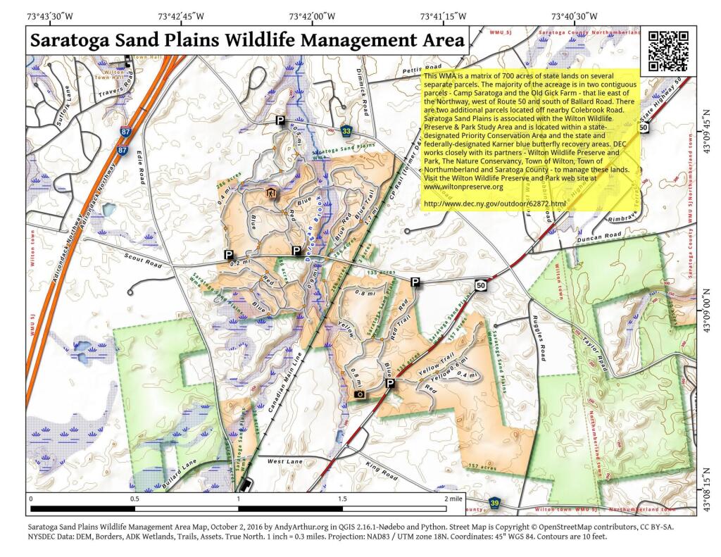
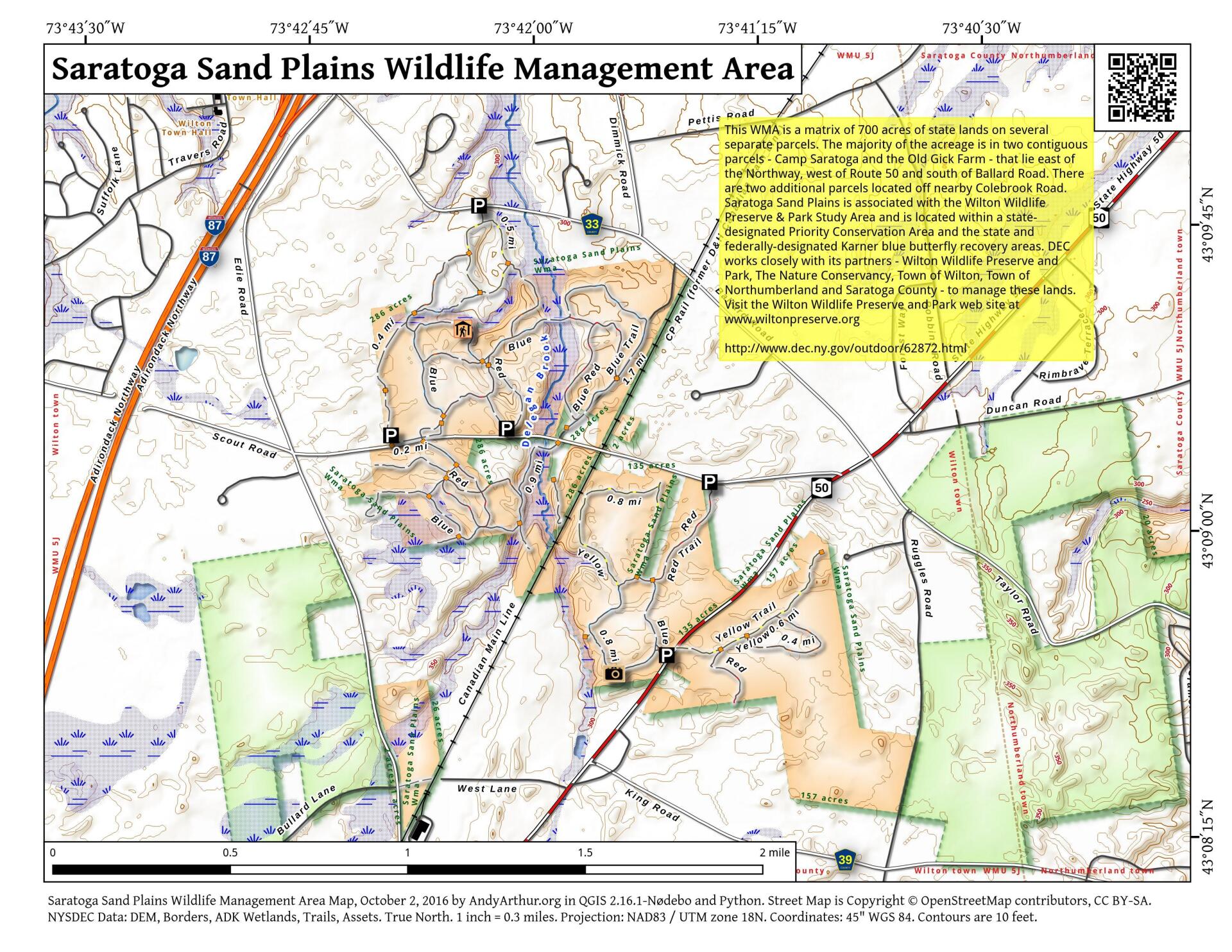
Saratoga Sand Plains Wildlife Management Area (WMA) The primary purposes of the Saratoga Sand Plains WMA is for wildlife management, wildlife habitat management, and wildlife-dependent recreation. This WMA is a matrix of 700 acres of state lands on several separate parcels. The majority of the acreage is in two contiguous parcels - Camp Saratoga and the Old Gick Farm - that lie east of the Northway, west of Route 50 and south of Ballard Road. There are two additional parcels located off nearby Colebrook Road. Saratoga Sand Plains is associated with the Wilton Wildlife Preserve & Park Study Area and is located within a state-designated Priority Conservation Area and the state and federally-designated Karner blue butterfly recovery areas. DEC works closely with its partners - Wilton Wildlife Preserve and Park, The Nature Conservancy, Town of Wilton, Town of Northumberland and Saratoga County - to manage these lands. Visit the Wilton Wildlife Preserve and Park web site at http://www.wiltonpreserve.org
http://www.dec.ny.gov/outdoor/62872.html
... photos, maps and other content from from Saratoga.