Picking Up
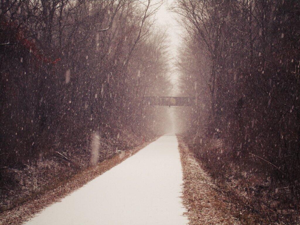
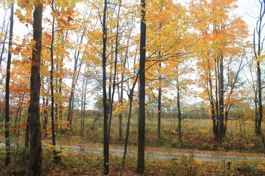
As I headed out to Voorheesville, the snow really started picking up, as I walked under the old highway bridge over the railroad tracks.
Taken on Sunday December 1, 2019 at Albany County Rail Trail.
As I headed out to Voorheesville, the snow really started picking up, as I walked under the old highway bridge over the railroad tracks.
Taken on Sunday December 1, 2019 at Albany County Rail Trail.
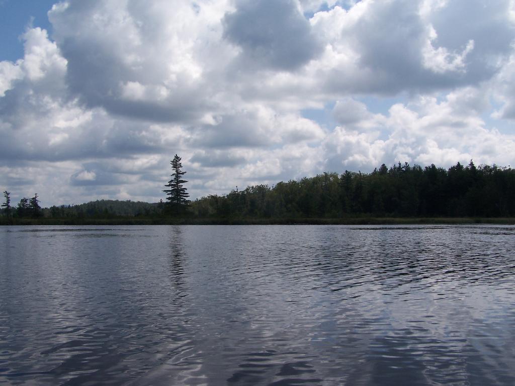
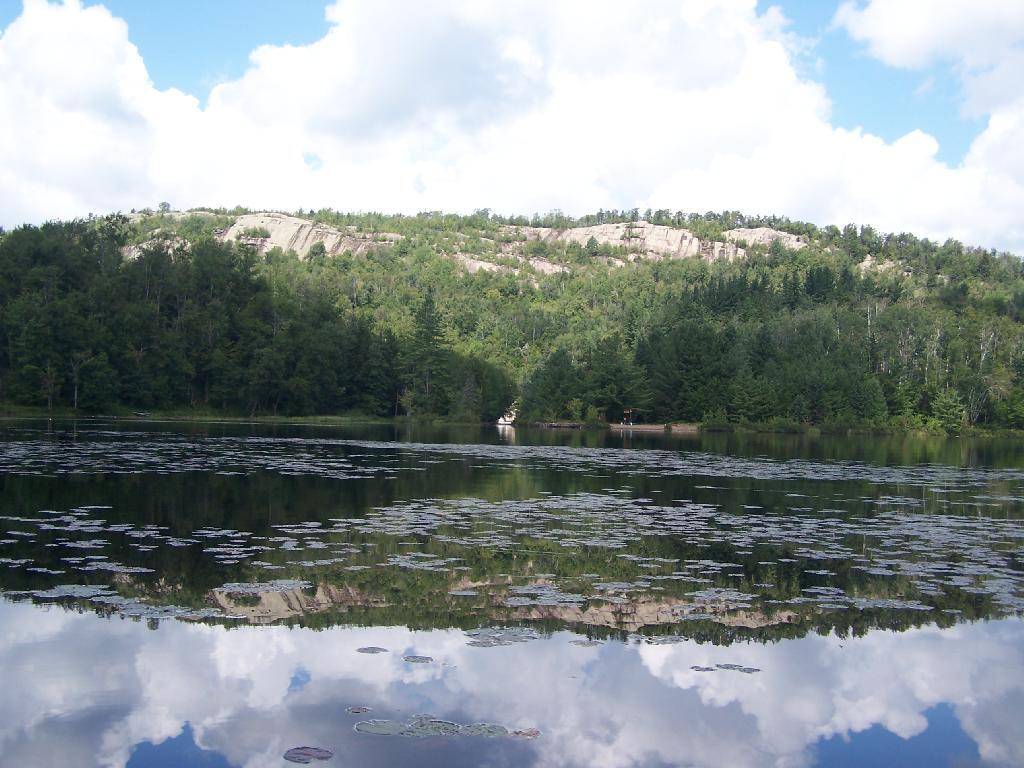
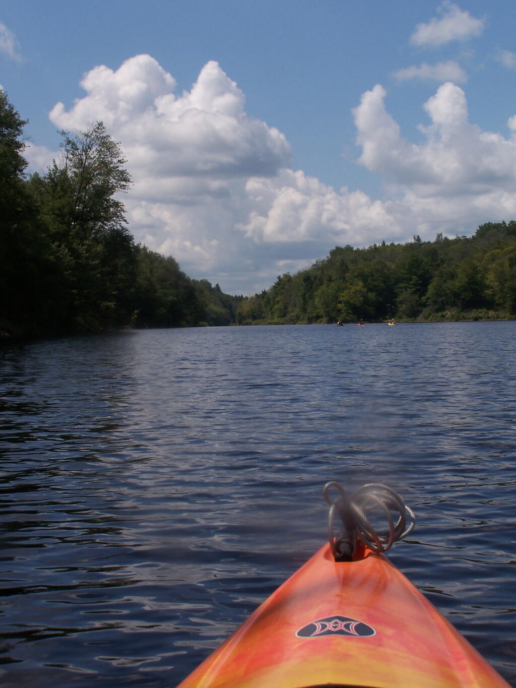
About two miles into Bog River Flow, you cross under a relatively low railroad bridge. It's actually about 5 or 6 feet above the flow, and doesn't feel at all cramped in a canoe or kayak.
Taken on Friday August 13, 2010 at Hitchens Pond.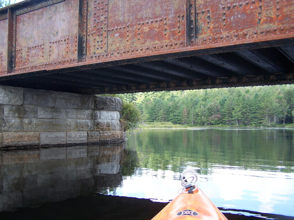
This shouldn't be too bad to clear.
Taken on Friday August 13, 2010 at Hitchens Pond.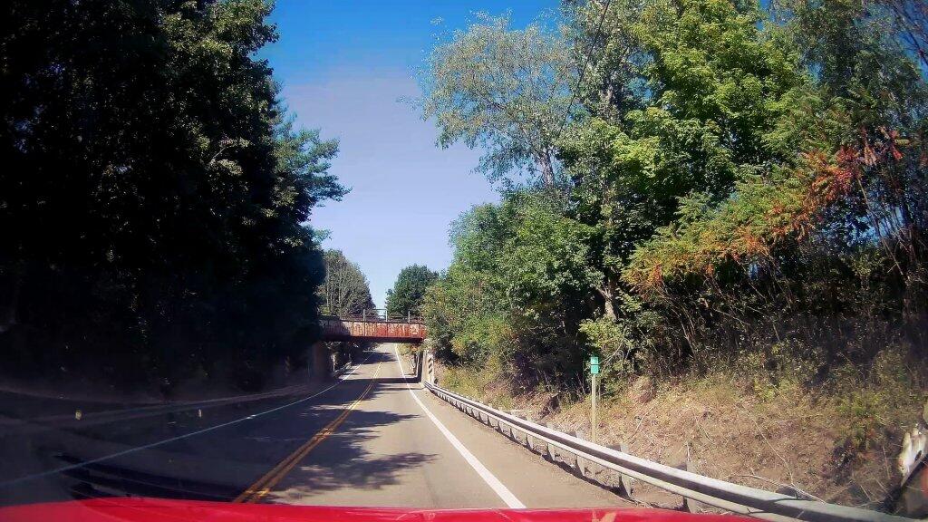
NY 414 is a pretty good road, but it has a modestly narrow rail underpass heaing from NY 14 up to Reading Center.
Taken on Friday August 14, 2020 at Schuyler County.I awoke for Day 2 of Gorging on Gorges, and it was a fairly warm morning, at least for the day before Columbus Day, in the back country of the Finger Lakes National Forest. I decided I wanted a full breakfast this morning, so I got some sausage frying up, the coffee peculator doing its thing, then scrambled some eggs with mushrooms and sweet peppers. It was a good breakfast. Packed up my gear, folded the flag, headed out on Potamac Road, and stopped grab a few pictures of the pastures along the road.
Driving along all these back-country roads, I was amazed during most of my trip in New York State, on how many anti-SAFE Act signs there were in front of houses and farms along the way. If there ever was an issue that galvinized the backwoods of Upstate NY, it has to be that stupid gun law. I would reminded of the opposition to the SAFE Act all week, until I finally crossed into Pennsylvania state-line – the last SAFE Act sign ended a ¼ mile before I left the state. I bet you that poor dairy farmer, was awful pissed to live on the wrong side of an imaginary line, so they had to be subjected to stupid laws, high taxes, and anti-farm regulations.
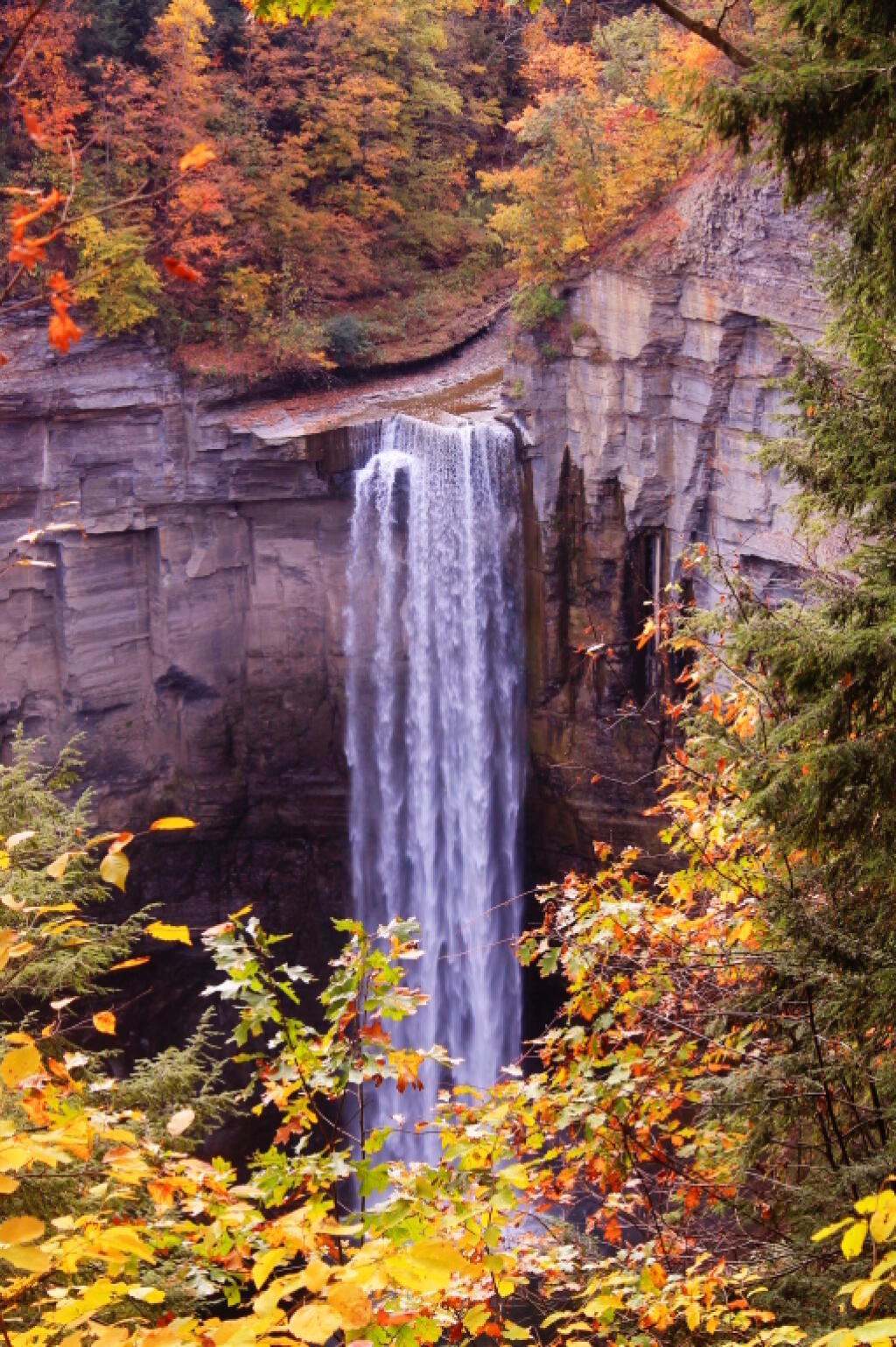
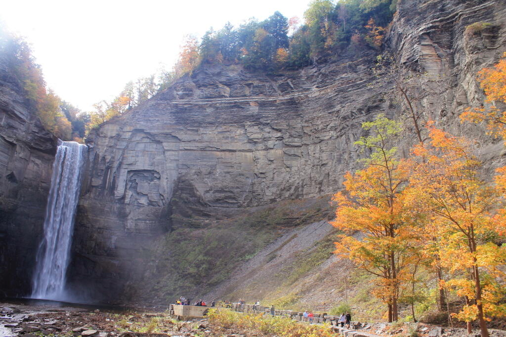
Drove down to Trumansburg and then to Taughannock Falls State Park’s Gorge Overlook. The main overlook, next to the parking lot was a complete tourist trap, with dozens of tourists, many obviously traveling a long ways to get there, crowded around the overlook deck, as everyone – myself included – scrambled to get that one trademark photo of the falls. I was glad to get away from that overlook.
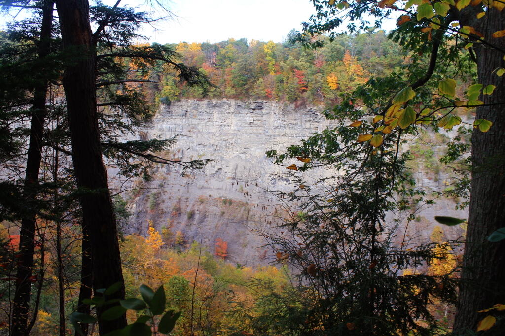
Started along the North Rim trail along the gorge. I was looking for secret places to find isolated, beautiful views of fall, and the hike did not disappoint. I found one perfectly shrouded in colorful fall leaves, but with a view of falls. I snapped a picture. I continued along, and found some good views in the gorge, showing the depth and width it below the falls. Then I ran into Robin Smith and his wife – Twitter and Facebook friend. Chatted for five minutes, then I proceeded on.
In part, I was in a bit of a rush, trying to find a place to take a piss. All that coffee plus maybe an eye-opener drink wasn’t great for the bladder. There also were a few to many people around to do it right on trail, especially being so close to the road most of way. But eventually I did it, and was on my way.
The North Rim trail runs into the Black Diamond Trail, which crosses an old railroad bridge, converted to a hiking trail via some concrete slaps and fence placed on it. The high, old railroad trestle provides views of a smaller, upper waterfalls and the little known, but quite impressive upper gorge. The upper gorge, above the falls, is a deep, narrow, but beautiful gorge where the Taughannock Creek runs, cutting deep into the valley. For the best views, you have to take the South Rim trail, which is what I took next.
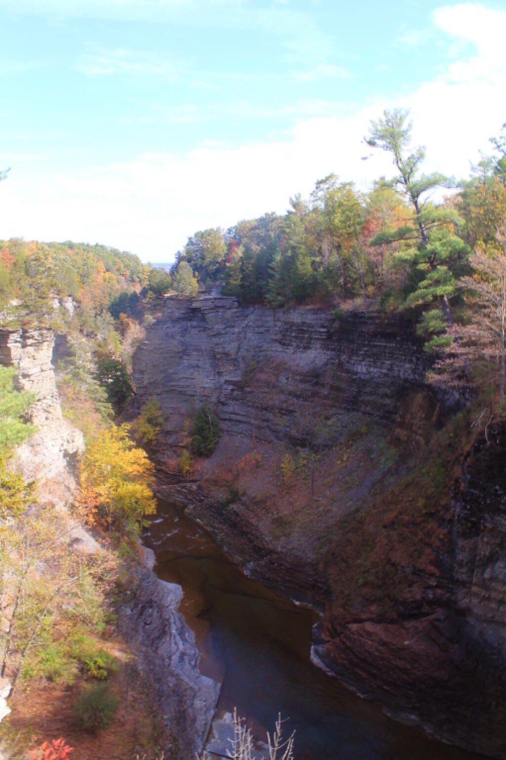
The South Rim trail is impressive. There is the big parking lot from the Gorge Overlook on Taughannock Road, or you can alternatively take Gorge Road, and halfway down it, park in the smallish pull-off. Don’t miss it though. If you follow the South Rim Trail, there are some views of the gorge below the falls, and one view of the gorge, extending out to Seneca Lake.
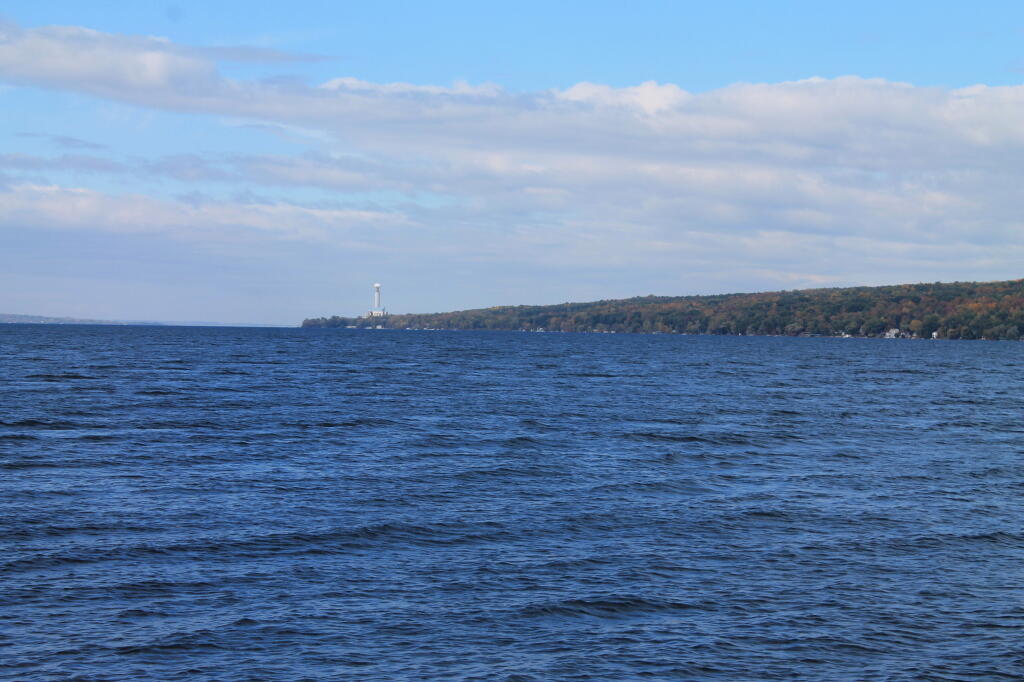
I hiked back to my pickup truck, and then drove down to the main part of Taughannock Falls State Park. I parked in main portion of the park, rather then the always crowded and tight to park in lot next to the trail to Gorge Trail, which runs inside the gorge to below the falls. Not wanting my truck damaged by an overly excited tourist, I figured it’s always safer to park in an empty lot. Walked down to Seneca Lake, and noticed how green the trees were still on the lake shore. This contrasts to sections of US 20, the previous day, where the colors were burnt out to say the least. I was also surprised to see the AES Cayuga in Lansing, across the lake, burning coal today. They must keep in standby for when the line frequency drops to low locally. Stopped in the bathrooms at Taughannock Falls State Park, which were just very gross – clean, but rusty and in old shape – like so many state facilities.
Then I hiked along the gorge trail to the fall, taking several moments to stop and take photos, and explore the river bed. I had previously been here, in mid-July, but it certainly was different now that fall was in full swing. The trail was popular, and in some places, downright crowded, but the riverbed, at least as far as one could hike, wasn’t nearly as crowded. The gorge walls were pretty with the fall leaves, although by the time I got the falls, the sun was right over the top of the waterfalls, so most of the pictures of the falls came out pretty poorly.
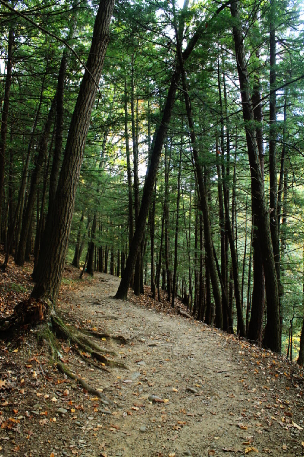
Headed back to the truck, then drove down to Ithaca. The traffic was as awful as always in that city. I had stop at the pharmacy, then it was off to Buttermilk Falls State Park. I was surprised they were still charging – the last day must be Columbus Day. By now, it was too late to keep Robert Treman State Park on my list; that will have to wait until tomorrow. This time, I intentionally hiked up the North Rim trail, up to West King Road, then down into the gorge. Last November, I hiked up the gorge, so I figured it would be interesting to go the other way this time.
Hiking down Buttermilk Falls was scenic, but not as a scenic as I remember it. Maybe after all this time hiking in gorges and exploring the gorges, they also start to look a bit alike – and we are only day two. It’s more scenic then most of other glens, besides Enfield Glen and Watkins Glen, but it’s still a step below them. The gorge swimming pool at the bottom of the gorge it was nice.
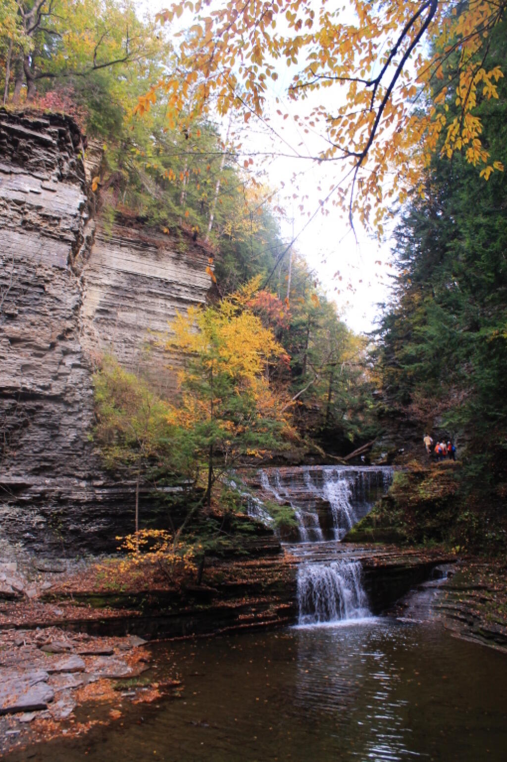
It was a good hike, until descending the slippery stairs, I slipped, and dropped my camera, and it fell like 20 feet, hitting a dozen of the stone stairs before coming to a rest. The fall did some serious damage to the camera, as one might expect. The protective UV filter was shattered, the case was cracked up the lens. I was not pleased, to say the least. There may have been a few cuss words. But so be it. The camera was under a drop warranty that I bought when I got it, but I was more worried that the fall would damage the camera, so I would be out of luck for taking more pictures for the rest of the trip.
I might have been pissed at myself for my careless handling and missteps, for a little while, cussed myself out. I was less pissed when I discovered the lens wasn’t destroyed, only the $5 UV filter. The camera seemed to continue to work well, although the flash doesn’t always pop up – a feature I almost never use at any rate. The camera seemed to work okay, and I picked up a second UV filter at Walmart later in the evening. Later in the week, I noticed the automatic focus was sticking – fortunately I have a drop warranty on the lens too. One of these days, I will get around to sending the camera back to the factory for warranty repairs or replacement.
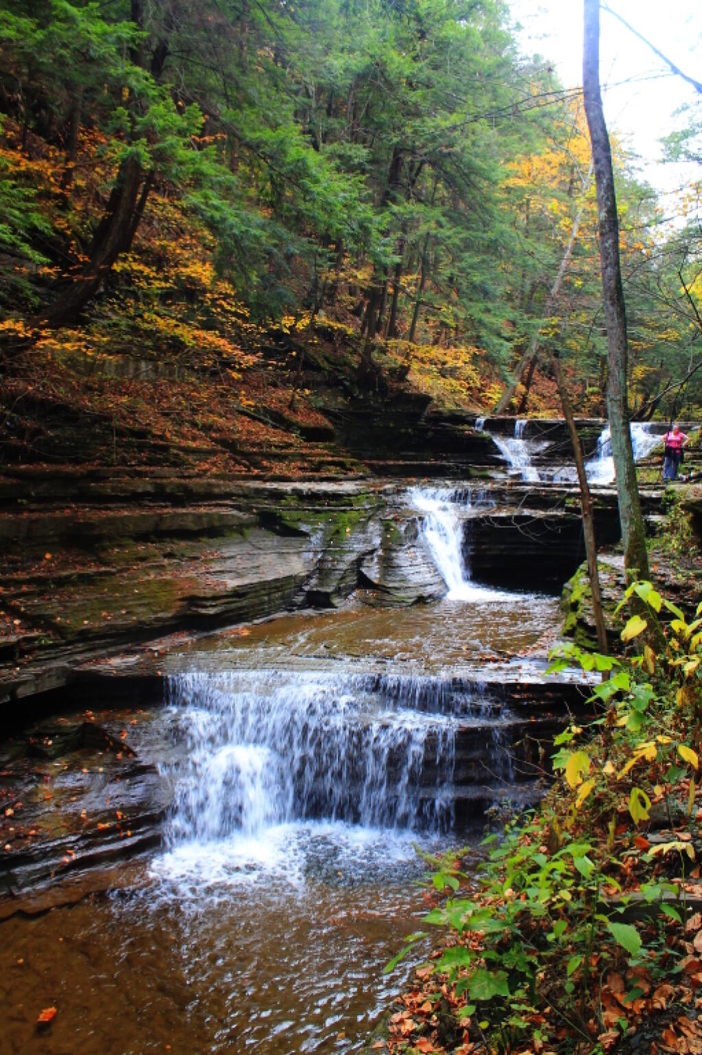
Once I got over the shock, anger, and amusement of smashing up my camera, and got the shattered UV filter off the camera – it took a little fiddling, as the impact of the fall bent the ring – I enjoyed the remaining hike and vistas of falls. Snapped several other quite nice pictures. Went to Walmart to pick up a few supplies, then back to Finger Lakes National Forest, for another evening at camp.
When I drove up to the campsites on Chicken Coop Road, I was pleasantly surprised to find out the campsite I like was vacant. Whoever was the night before packed up, and there was no mess left over. Hung the flag up, set up the table, hung lights up, and gathered wood. Started a campfire, cracked open a beer, had soup and sandwitches for dinner. The colors in the woods were about peak here. Around 6:15 PM, walked across the road, to take a closer look at the cows grazing in the pasture.
I stayed up until 8:15 PM, when it started to sprinkle, and quickly turned to a heavier rain, and decided it was time to seek shelter under the truck cap. Again a bit annoyed about the rain, and my stupidity about not setting up a tarp earlier in the evening. I listened to the radio for a bit, played on my cellphone, and retired for the night. The good news was that by morning, the rain would have passed, although the skies would be cloudy, damp, and the temperature only around 47 degrees.
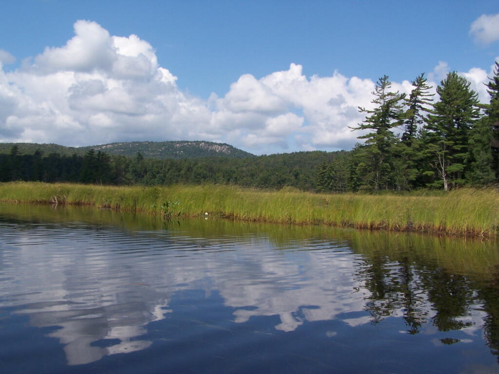
The Bog River Flow, also known as Lows Lake is a spectacular wilderness/primitive area located in South-East Saint Lawerence County. It consists of two dams, Lows Upper and Lows Lower, that create to massive man-made lakes. It is home to over 100 paddle in campsites along with some amazing views and wildlife.
Here is a downloadable map.
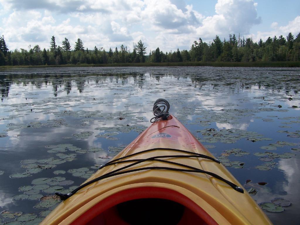
Above Lower Lows Dam. Paddling up the “flooded” Bog River, in the lower portion of Bog River flow, right above the Lower Lows Dam. If this area was not flooded by dams, it would be rapids, unaccessible by canoe or kayak.
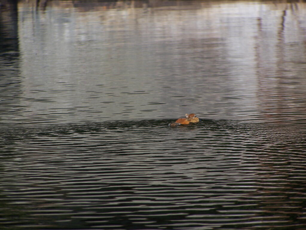
Chimpmunk Swims. This was taken about a mile above the Lower Lows Dam.
Bog River Flow Narrows. The Lower portion of the Bog River, is pretty narrow in part, due to the rocky terrain that it covers. You can easily bottom out a canoe or kayak in these parts, and other parts appear quite deep. There are a couple of paddle-in campsites along here.
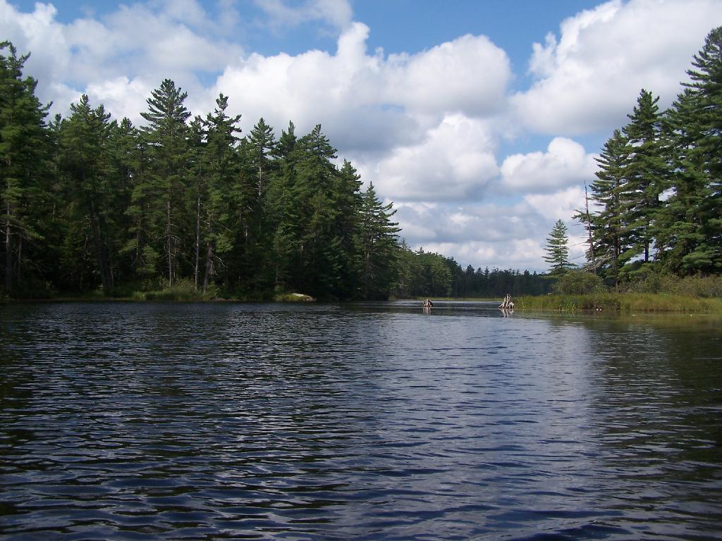
Bog River Open Up A Little Bit. The first mile or so of the Bog River Flow is mostly flooded stream. But as you get closer to Hitchens Pond, it starts to widen a bit.
Entering Hitchens Pond. Just past here, is a hairpin turn, as the flooded River, winds a bit, and becomes a much larger lake, in the form of a series of bays and marshes.
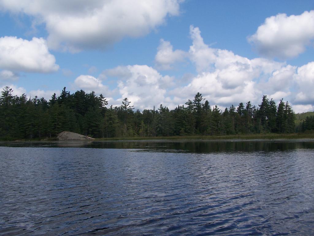
Hitchens Pond. Here things open up quite bit.
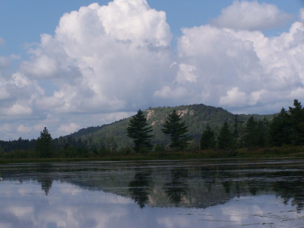
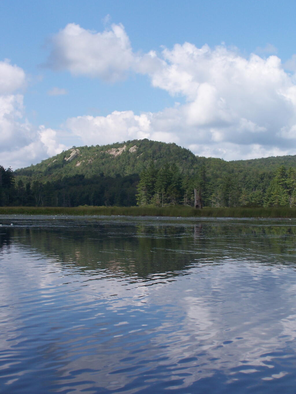
Lows Ledge. Here is Lows Ledge reflecting into Hitchins Pond. It’s much larger in person then it appears in this picture, unless you have a very big computer monitor.
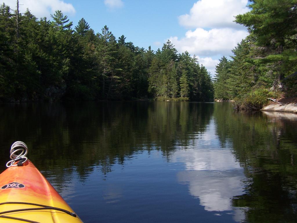
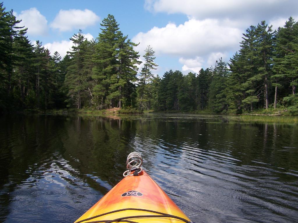
Railroad Bridge. About two miles into Bog River Flow, you cross under a relatively low railroad bridge. It’s actually about 5 or 6 feet above the flow, and doesn’t feel at all cramped in a canoe or kayak.
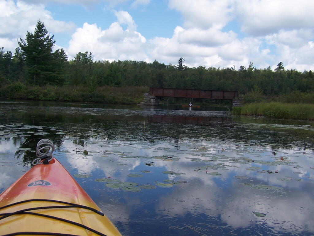
Under the Railroad Bridge. This shouldn’t be too bad to clear.

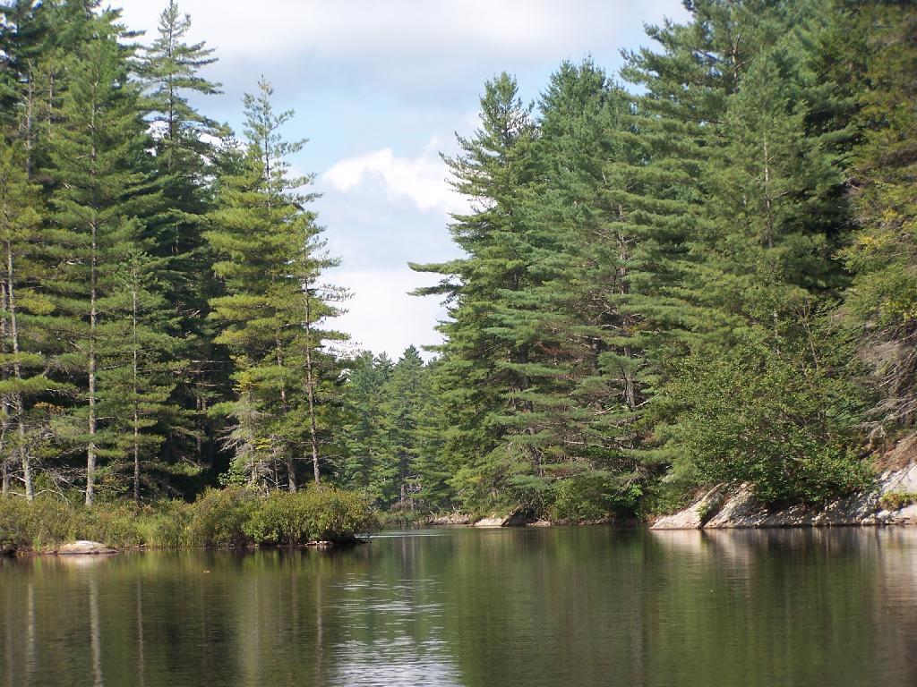
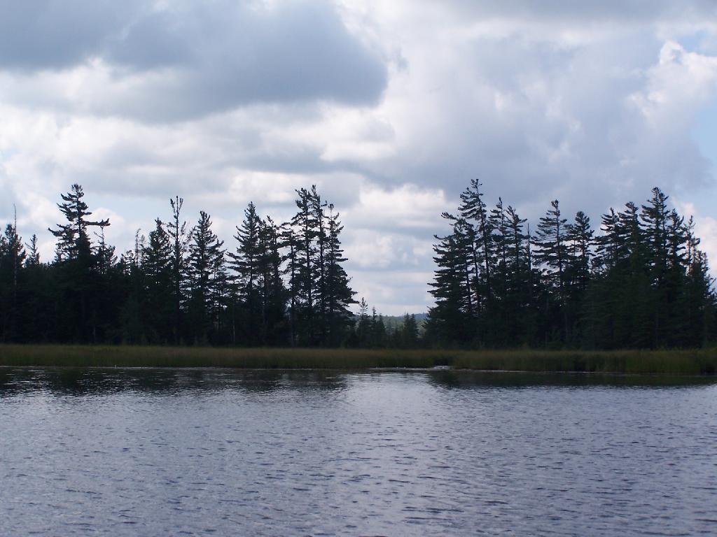
Trees Along Hitchens Pond. This picture can’t even reflect the beauty of this portion of Bog River Flow.
Break Time. Drinking all that beer, meant I had to find a place along the Flow to get out, stretch, and take a piss. Things being so boggy and soft in parts, meant there wasn’t a lot of open area to take a break.
Lows Ledge. I’m now about halfway between Lows Lower Dam and Lows Upper Dam, as the ledge reflects beautifully into the lake. It’s a very spiritual thing for sure, paddling along through this lake.
Clouds Rolling Out. To the south, it looked still quite cloudy. But there was something quiet spiritual about the area, and quiet vast. Something also spoke to me as being Saint Lawrence County, and as vast as one would expect the biggest county in the state to be.
The Channel. The lake turns once again, with beautiful marsh lands along the edge of the lake.
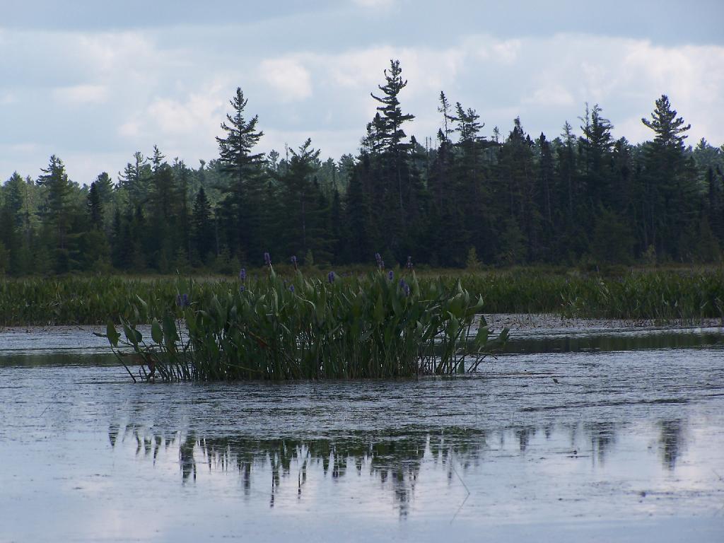
Marshy. Portions of Hitchens Pond are quite marshy, and can be tough going, especially if one gets out of the channel.
Trees. These trees line the last big turn at Hitchens Pond, where you finally get into the main bay, as you head towards the Upper Lows Dam.
Marshland. Along Hitchens Pond as we get closer to Lows Upper Dam.
Lows Ledge. Now we are almost up to the portage for Lows Upper Dam. Quite purty I must say.
Kayakers Pull Out. You have to pull your boat out of the water, and carry it over the Lows Lake Upper Dam, about a 10 feet elevation, and maybe a 50 foot portage.
Bog River Area Pull Off. A lot of people pull out here, for lunch. Or they can be fools, and not use the channel to bottom of the dam, and carry their canoes, an additional 1/4 mile for no real purpose, to get it over the Lows Upper Dam. Not like I would be that stupid, now right? Of course, I just covered my camera with beer, so I shouldn’t be opening my mouth.
Lows Upper Dam. This is the last picture I got for the day, because I dropped the camera in a pool of beer in kayak, and things go wet. Eventually the camera dried out and started to work fine, but for now, we have to go pictureless. From here, the bottom portion of Lows Lake proper, above the Upper Lows dam, is much like the bottom part of Hitchens Pond, narrow, deep channel, that widens up.
Above Upper Lows Dam. This is the channel above the Upper Lows Dam, which technically is Lows Lake now. About a mile up from here, the lake gets shallow, and you must portage up into the more open Lows Lake main section. Yes, the camera lens has beer in it, that now has to dry out before I can take any more pictures. Nothing until tomorrow. It’s my Friday the 13th luck and stupidity of leaving the camera in the kayak, not in it’s protective case, as I pull out, and spilled beer soaks everything.
East Branch of Sacanadaga River, NY 8 – Roughly 10 campsites along NY 8. These are easily accessed throughout the year, as the road is plowed except when the snow banks are high during the winter. East Branch is not good for fishing due to wide variance in water levels, however there are some nice pools in sections of river for summer swimming. Lots of road noise. Some of the sites have cell service. Nearby locations include Cod Pond, East Branch Trail and Kibby Pond Trail.
Edick Road – There are a handful of very hidden campsites off of Edick Road. This road may be closed to vehicles due to wash outs autumn 2019, but worth a walk to explore this area.
Fawn Lake – A 1/2 mile hike back to a scenic lake ringed by primitive campsites outside of Lake Pleasant. Two miles beyond it is the scenic Willis Vly, which doesn’t have developed campsites but it’s remote wilderness where you might see a Moose or other wildlife.
Garnet Lake – Tent sites, some with drive-up access along the lake. No cell service, much of the upper road here is not maintained in the winter. Popular in the summer, no cell service.
Good Luck Lake – Scenic lake off of the West Branch Sacanadaga River that is ringed with tent sites that can be walked in from the Good Luck Lake parking area area or paddled in.
Hope Falls Road – Two or three campsites along the end of Hope Falls Road, some are drive-in only tent sites. Near the Tenant Creek Falls Trail. No cell service. Open June to autumn snowfall.
Harrisburg Road – There is a set of very rustic designated campsites along the rough Harrisburg Road past Harrisburg Lake. Somewhat near Crane Mountain, a couple mile hike to and Wilcox Lake. No cell service.
Lester Flow and Cheney Pond – Scenic lake that is popular for paddling. The 1/2 mile road down from Boreas Road as of June 2020 is closed due to washouts. Tent sites exist along the lake, along with one drive-to site on the road down there.
Mason Lake – Small lake located about 10 miles north of Speculator and 5 miles south of Lewey Lake that has several tent and drive-in campsites along it’s shore. Good to fair cell service here. Nice to hear loons, one of the best bass ponds in the area.
North Lake Reservoir – There are roughly 15 campsites on the east shore of North Lake Reservoir. Popular place in the summer, regularly staffed by conservation students. Noise from motorboats. No cell service. Nice if you want to camp right on water, hear loons at night..
Northwood Club Road – In Minerva, this road crosses the Boreas River and has several roadside campsites, and passes by Huntley Pond, the NL Tahawus Railroad (which can be hiked to the Boreas River at Hudson River), and the Blue Ledges on the Hudson tailhead.
Perkins Clearing – Conservation easement lands. Good to fair cell service here. Great place for hunting and wildlife observation as it’s mixed timber country. Near Mason Lake, Speculator, Pillsbury Mountain and Cedar Lakes.
Piseco-Powley Road – A dozen campsites along a 13 mile road with short hikes including Big Alderbed, House Pond, Sand Lake and the popular Potholers/Brayhouse Brook waterfall for swimming. As of June 2020, road is closed in Stratford/Fulton County portion, road is open north of Potholers/Brayhouse Brook (access via Piseco). Very limited cell service here.
Pumpkin Hollow Road – Three campsites above Willis Lake. Remote country except for the site on Willis Lake, no cell service. On the Willis – Wilcox Lake Trail. Very quiet area. Open June to autumn snowfall. No cell service here.
Rockwood State Forest – Three campsites along the end of Church Road which can be accessed by driving past the cemetery in the hamlet. Scenic lake, good fishing. Cell service available, but bring a trash bucket and gloves as litter can be a problem. Nice trails to stroll around in the old Rockwood Estate.
Stewart Landing – There are four campsites on a rough road that loops off of Stewart Landing Road. Popular area in the summer, Canada Lake is great for paddling and informal swimming. Also consider hiking back to Hilderbrandt Vly and Glassgow Lake from here. Moderate to poor cell service here.
Vanderwhacker Road -Five or six campsites exist along Vanderwhacker Road, which can be muddy in the spring and icy in late autumn. Additional designates campsites exist near where NY 28N crosses the Vanderwhacker River. Near the trail to the Vanderwhacker Firetower, No cell service.
White House, Wells – A grouping of 5 or 6 campsites at the end of White House in West River Road. Scenic area, old camp, with fields and a chimney. Campsites are kind of close together, not a wilderness experience. Near the North Country Placid Trail, lots of blueberries in mid-summer. No cell service. Open June to autumn snowfall.
Woodhull Lake Reservoir – Off of NY 28 in McKeevers, about 10 miles south of Old Forge. Not only is this beautiful reservoir to paddle, there are some campsites along the shore, with drive-to campsites along Wolf Lake Landing Road which leads to it. Part of Wolf Lake Landing Road is erroded, but other parts are fresh stone-dust. It’s remote wilderness but there good cell service in mcuh of the area.