Search Results for: photo two state solution

Laws and Case Law

Highway Law Section 115-A:
Abandonment of County Highways.

Whenever a county road or part thereof constructed as part of the county road system deviates from the line of an existing town highway, or from the line of a former town highway within the limits of an incorporated village, as shown on the map of the county road system, the board of supervisors by resolution duly adopted upon the recommendation of the county superintendent of highways, and pursuant to a written agreement with the town board or village board of trustees, or in the event such an agreement cannot be reached with the approval of the commissioner of transportation, may abandon to the town or the incorporated village as the case may be for future maintenance, that part of the town highway or former town highway within the limits of an incorporated village not improved and modify the map of the county road system accordingly. The portion of any town highway or former town highway within the limits of an incorporated village excluded from the county road system shall be maintained by the town or village in which it is located.

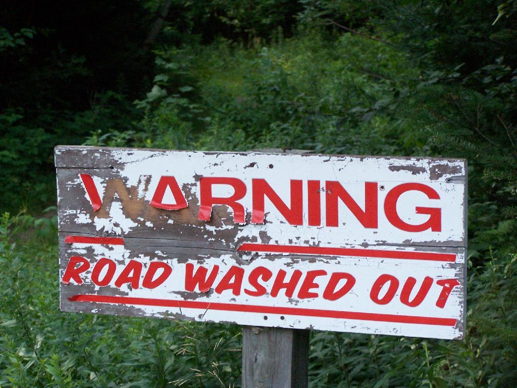
Warning! Road Washed Out

Highway Law Section 205:
Highways Abandoned By Local Governments.

1. Every highway that shall not have been opened and worked within six years from the time it shall have been dedicated to the use of the public, or laid out, shall cease to be a highway; but the period during which any action or proceeding shall have been, or shall be pending in regard to any such highway, shall form no part of such six years; and every highway that shall not have been traveled or used as a highway for six years, shall cease to be a highway, and every public right of way that shall not have been used for said period shall be deemed abandoned as a right-of-way. The town superintendent with the written consent of a majority of the town board shall file, and cause to be recorded in the town clerk’s office of the town a written description, signed by him, and by said town board of each highway and public right-of-way so abandoned, and the same shall thereupon be discontinued.

2. There may also be a qualified abandonment of a highway under the following conditions and for the following purposes, to wit: Where it appears to the town superintendent and said town board, at any time, that a highway has not become wholly disused as aforesaid, but that it has not for two years next previous thereto, been usually traveled along the greater part thereof, by more than two vehicles daily, in addition to pedestrians and persons on horseback, and it shall also appear to the superintendent of highways of the county in which such town is situate that a qualified abandonment of such highway is proper and will not cause injustice or hardship to the owner or occupant of any lands adjoining such highway after such superintendent shall have held a public hearing thereon upon giving at least twenty days’ written notice to such owners and occupants of such lands of the time and place of such hearing, they shall file and cause to be recorded in the town clerk’s office a certificate containing a description of that portion of the highway partly disused as aforesaid and declaring a qualified abandonment thereof. The effect of such qualified abandonment, with respect to the portion of said highway described in the certificate, shall be as follows: It shall no longer be worked at the public expense; it shall not cease to be a highway for purposes of the public easement, by reason of such suspension of work thereon; no persons shall impair its use as a highway nor obstruct it, except as hereinafter provided, but no persons shall be required to keep any part of it in repair; wherever an owner or lessee of adjoining lands has the right to possession of other lands wholly or partly on the directly opposite side of the highway therefrom, he may construct and maintain across said highway a fence at each end of the area of highway which adjoins both of said opposite pieces of land, provided that each said cross fence must have a gate in the middle thereof at least ten feet in length, which gate must at all times be kept unlocked and supplied with a sufficient hasp or latch for keeping the same closed; all persons owning or using opposite lands, connected by such gates and fences, may use the portion of highway thus enclosed for pasturage; any traveler or other person who intentionally, or by wilful neglect, leaves such gate unlatched, shall be guilty of a misdemeanor, and the fact of leaving it unlatched shall be prima facie evidence of such intent or wilful neglect. Excepting as herein abrogated, all other general laws relating to highways shall apply to such partially abandoned highway. This section shall not apply to highways less than two rods in width unless it shall appear to the town superintendent at any time that such a highway has not, during the months of June to September inclusive of the two years next previous thereto, been usually traveled along the greater part thereof by more than ten pedestrians daily.

Any action or proceeding involving the abandonment or qualified abandonment of a highway made pursuant to this section must, in the case of abandonment, be commenced within one year from the date of filing by the town superintendent as provided in subdivision one of this section.

Old NY 30 Signs

Matter of Smigel v. Town of Rennselaer.

As seen on Google Scholar.

MATTER OF SMIGEL v. TOWN OF RENSSELAERVILLE

283 A.D.2d 863 (2001)

725 N.Y.S.2d 138

In the Matter of HENRIETTA SMIGEL, Respondent, v.
TOWN OF RENSSELAERVILLE et al., Appellants.

Appellate Division of the Supreme Court of the State of New York, Third Department.

Decided May 24, 2001.

Mercure, J. P., Peters, Spain and Carpinello, JJ., concur. Lahtinen, J.

Petitioner is the owner of land bordering the Camp Winsocki Road (hereinafter the road) located in respondent Town of Rensselaerville in Albany County, having acquired title to the property in 1986. In December 1995, petitioner requested that respondents abandon a portion of the road which she had barricaded at both ends in 1986, and which respondent Town Supervisor admitted had not been maintained by respondents for at least 20 years. Her request was continued for further study by the Town Board of the Town of Rensselaerville. In October 1999, petitioner and another petitioned respondents “to abandon a portion of its present easement to [the road].” In January 2000, after a public hearing, respondents refused to abandon the road and passed a resolution finding that the road had not been abandoned through disuse, ordering petitioner to remove all of her barricades, and making the road a seasonal road to be maintained from April 1 to December 1.

In January 2000, petitioner commenced this combined CPLR article 78 proceeding and action for declaratory judgment seeking a judgment clearing her title “as to the portion of her property previously subjected to an easement for the highway,” injunctive relief prohibiting respondents from removing her barriers on the road and trespassing on her property and an order directing respondents to file a certification of abandonment. Respondents answered, asserting that the petition/ complaint failed to state a cause of action.

The parties submitted numerous affidavits and documentary evidence in support of their respective positions and, in April 2000, Supreme Court determined that because no photographs had been submitted by either party, the matter could not be summarily decided, and it therefore set a hearing date to determine whether recreational travel “follows the `lines of the ancient street.'” When the parties appeared on the scheduled hearing date, they were informed that the hearing had been canceled and were directed to leave any photographs that they had with the court for review. Both parties submitted photographs depicting the present condition of the road.* On May 26, 2000, Supreme Court granted the petition/complaint and declared the road to be abandoned. Respondents appeal and we reverse.

Highway Law § 205 (1) provides, in relevant part, that “every highway that shall not have been traveled or used as a highway for six years, shall cease to be a highway.” Once a highway exists, it is presumed to continue until the contrary is demonstrated and the presumption is in favor of continuance (see, City of Cohoes v Delaware & Hudson Canal Co., 134 N.Y. 397, 407; Matter of Van Aken v Town of Roxbury,211 A.D.2d 863, 865, lv denied 85 N.Y.2d 812). The burden of establishing abandonment is on the party claiming that the highway has been abandoned (see, Matter of Faigle v Macumber,169 A.D.2d 914, 915). In that regard, a municipality’s intention regarding a road is irrelevant (see, Daetsch v Taber,149 A.D.2d 864, 865) and its failure to maintain a road does not mean that the road ceases to be a highway (see, O’Leary v Town of Trenton,172 Misc.2d 447, 450). A determination of abandonment of a road by nonuse is a factual determination (see, e.g., Coleman v Village of Head of Harbor,163 A.D.2d 456, 458, lv denied76 N.Y.2d 768; Holland v Superintendent of Highways of Town of Smithtown,73 Misc.2d 851, 852).

It is undisputed that respondents never filed a certificate of abandonment to officially abandon the road. Likewise, it is clear that respondents did not maintain the road nor had the road been used by motor vehicles for more than the statutory six-year period. The narrow question left to be decided after submission of the photographs was framed by Supreme Court as follows: “[i]f the road entrance has been obstructed, and it is unpaved and overgrown with weeds, trees, bushes and shrubs, as claimed by petitioner, making travel along the `lines of the ancient street’ improbable, then even the most active recreational and seasonal use propounded by [respondents], that of snowmobilers, hikers, and bicyclists, would fall short of being highway use” (citing O’Leary v Town of Trenton, supra, at 451; Holland v Superintendent of Highways of Town of Smithtown, supra, at 853).

We find that Supreme Court correctly set forth the applicable law regarding abandonment of a highway through nonuse. After reviewing the photographs submitted by the parties, Supreme Court made the factual determination that the “photographs reveal many years of non-use as a highway” and “it is apparent that the road entrance has often been obstructed, preventing travel along the `lines of the ancient street,'” and summarily granted the relief sought by petitioner. We agree that the photographs show a number of barricades located at various points along the unpaved road, but they also show an ancient road, not overgrown with weeds, trees, bushes or shrubs, but clearly discernible, and not “virtually indistinguishable from the surrounding wooded area” (Matter of Faigle v Macumber, supra, at 916). Indeed, the pictures appear to depict a clearly defined, unpaved roadway through an area overgrown with brush and thick woods on both sides, precluding travel other than on the road, except with extreme difficulty. Our review of the photographs suggests to us that travel over this road by such disparate groups as snowmobilers, bicyclists, cross-country skiers and pedestrians would follow “along the lines of an existing street” (Town of Leray v New York Cent. R. R. Co., 226 N.Y. 109, 113). Moreover, respondents’ submissions reflect that although petitioner had barricaded the road on a number of occasions, those obstructions were either removed or knocked down so as to access its year-round recreational use. Therefore, the recreational uses found by Supreme Court may be sufficient to preclude a finding of abandonment of the road by nonuse. In our opinion, summary judgment should not have been granted in this matter in the absence of clarifying testimony as to the condition and use of the roadway.

Ordered that the judgment is reversed, on the law, without costs, and matter remitted to the Supreme Court for further proceedings not inconsistent with this Court’s decision.

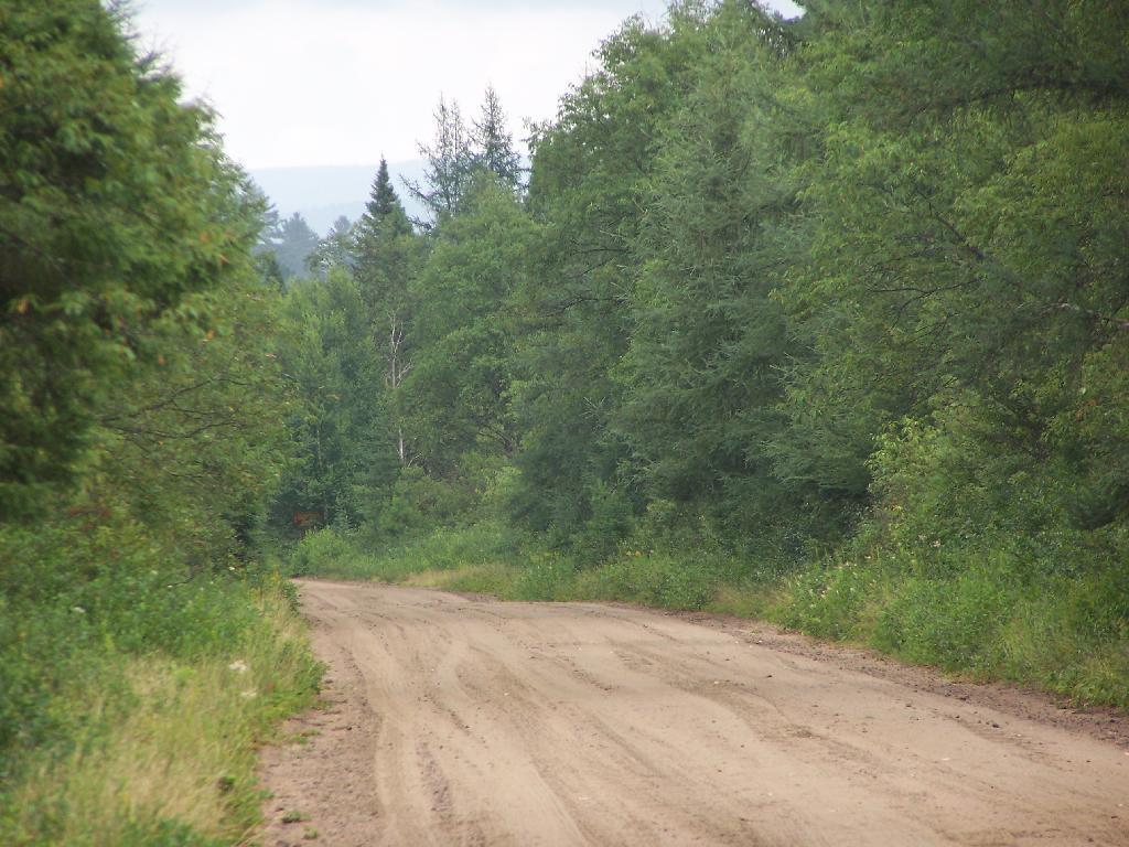
Red Dirt Road

MATTER OF VAN AKEN v. Town of Roxbury, 211 AD 2d 863.

As found on Google Scholar.

211 A.D.2d 863 (1995) 621 N.Y.S.2d 204 In the Matter of Millard Van Aken et al., Appellants, v. Town of Roxbury et al., Respondents

Appellate Division of the Supreme Court of the State of New York, Third Department.

January 5, 1995 Mikoll, Crew III, Yesawich Jr. and Peters, JJ., concur.

Cardona, P. J.

Petitioners are property owners with residences located in the Town of Roxbury, Delaware County, which extends beyond the roadway presently maintained by respondents as a Town road. On October 20, 1992, petitioners wrote to respondent Town of Roxbury requesting maintenance of the road segment at issue. On November 10, 1992, the Town Attorney responded by requesting evidence that the segment was a Town road. The attorney for petitioners wrote back indicating the reasons the particular segment was a Town highway. When no response was received, petitioner Millard Van Aken asked the Town Supervisor about the status of the request and was told that the Town Attorney was supposed to respond but had been delayed by other matters.

On March 4, 1993, the Town Attorney informed petitioners that if the segment was a Town road it had been abandoned. On July 1, 1993, petitioners commenced this CPLR article 78 proceeding seeking to compel the Town and respondent Town Superintendent of Highways to maintain the road segment pursuant to Highway Law § 140. In their answer, respondents asserted that the proceeding was barred by the four-month Statute of Limitations (see, CPLR 217 [1]). Supreme Court held that the Town was required to make a final binding determination on petitioners’ request before CPLR article 78 review was possible and the Town Attorney’s letter of March 4, 1993 did not constitute a binding determination. Unable to determine 864*864 if or when the Town had taken official action on petitioners’ request, Supreme Court dismissed the petition as either untimely or premature. By letter to the Town Board dated September 30, 1993, petitioners sought a formal vote on their request for maintenance. On October 11, 1993, the Town Board denied their request. Thereafter, petitioners moved for reconsideration, which Supreme Court denied.

Initially, we note that Supreme Court relied upon our decision in Treadway v Town Bd. (163 AD2d 637) in determining the Statute of Limitations issue. We treated the declaratory judgment action in Treadway as a mandamus to review for limitation purposes. However, the present proceeding is in the nature of mandamus to compel rather than mandamus to review. In mandamus to review, the court examines an administrative action involving the exercise of discretion for which no quasi-judicial hearing is required. On the other hand, in mandamus to compel an agency or officer’s performance of a ministerial act, the court examines whether the petitioner possesses a clear legal right to the relief sought and whether the agency or officer has a corresponding nondiscretionary duty to grant the relief requested (see, CPLR 7803 [1]; Matter of Scherbyn v Wayne-Finger Lakes Bd. of Coop. Educ. Servs., 77 N.Y.2d 753, 757; see also, Matter of Armstrong v Centerville Fire Co., 83 N.Y.2d 937, 939; Matter of Legal Aid Socy. v Scheinman, 53 N.Y.2d 12, 16).

In Treadway (supra), review was sought of an administrative action in the form of a declaration by the Town Board that the disputed road was not a public road. We held that the four-month Statute of Limitations began to run from that final binding determination. In this case, there is no question but that petitioners made a demand for maintenance to the Town on October 20, 1992. The March 4, 1993 letter from the Town Attorney[*] conveyed the Town’s refusal to perform its ministerial duty to maintain the road (see, Highway Law § 140). Accordingly, the four-month Statute of Limitations began to run at that time (see, CPLR 217 [1]; Matter of Waterside Assocs. v New York State Dept. of Envtl. Conservation, 72 N.Y.2d 1009, 1010; Matter of De Milio v Borghard, 55 N.Y.2d 216, 220; Matter of Pfingst v Levitt, 44 AD2d 157, 159, lv denied 34 N.Y.2d 518; see also, Siegel, NY Prac § 566, at 887 [2d ed]). Therefore, the petition filed on July 1, 1993 was 865*865 within the applicable period of limitations and the proceeding was timely commenced.

Having established that petitioners’ proceeding was timely commenced, we turn now to the merits of their petition. While it is clear that the Town has a legal duty to maintain Town roads (see, Highway Law § 140) and can be compelled to perform such a duty (see, People ex rel. Schau v McWilliams, 185 N.Y. 92, 100), the parties disagree on the fundamental question of whether the road segment at issue was abandoned by the Town and therefore no longer a Town highway. It is undisputed that no certificate of abandonment was ever filed by the Town, as provided for in Highway Law § 205. “Once a road becomes a highway, it remains such until the contrary is shown” (Matter of Shawangunk Holdings v Superintendent of Highways of Town of Shawangunk, 101 AD2d 905, 907; see, Matter of Flacke v Strack, 98 AD2d 881). A highway will be deemed abandoned if it is not traveled or used as a highway for six years (see, Highway Law § 205). The burden of proving such abandonment rests, in this case, with the Town (see, Matter of Shawangunk Holdings v Superintendent of Highways of Town of Shawangunk, supra, at 907).

Respondents have failed to meet their burden of proving that the road segment at issue was not traveled or used as a highway for six years. Although respondents argue that abandonment is shown because of a period of nonmaintenance in excess of 30 years, the law is clear that a highway does not cease to be a highway merely because the Town has failed to service it (see, Hewitt v Town of Scipio, 32 AD2d 734, affd 26 N.Y.2d 934). Nor is it relevant whether the Town intended an abandonment, as it is the substantive facts themselves which establish abandonment (see, Daetsch v Taber, 149 AD2d 864, 865). Petitioners have introduced uncontroverted cartographic and testimonial evidence to support their contention that the road has been and continues to be regularly used and traveled as a highway. We, therefore, find that no genuine issue of abandonment exists and that the contested road segment continues to be a Town road.

Ordered that the judgment and order are reversed, on the law, with costs, and petition granted.

Betty Brook Road

Holland v. SUPT. OF HIGHWAYS, 73 Misc. 2d 851

This case also from Google Scholar.

73 Misc.2d 851 (1973)

Eugene W. Holland, Plaintiff,
v.
Superintendent of Highways of the Town of Smithtown et al., Defendants.

Supreme Court, Special Term, Nassau County.

April 3, 1973 Donner, Fagelson & Hariton for plaintiff. H. Paul King for defendants.

BERTRAM HARNETT, J.

Eugene W. Holland owns property in Smithtown, New York, bordering to the east on a plot of land about 50 feet wide sometimes known as the “Old Smithtown to St. Johnsland Road”. In this declaratory judgment action brought against the Town of Smithtown and its Superintendent of Highways, Mr. Holland now seeks, by summary judgment motion, a declaration that he owns the westerly one half of the land by virtue of State and town abandonment of 852*852 it. Defendants move to dismiss pursuant to CPLR 3211 (subd. [a], par. 10).

Despite some minor disputation, the parties essentially agree that the subject land is not used as a public road for motor vehicular traffic. It is unpaved, blocked off on both ends, and substantially overgrown with trees and shrubbery. Pedestrians and bicyclers occasionally use it as a sort of pathway or shortcut. No material issue of fact appears to prevent a summary disposition. (Sachs v. Real Estate Capital Corp., 31 A D 2d 916; Law Research Serv. v. Honeywell, 31 A D 2d 900.)

Subdivision 1 of section 205 of the Highway Law provides in pertinent part: “Every highway that shall not have been traveled or used as a highway for six years, shall cease to be a highway * * * The town superintendent with the written consent of a majority of the town board shall file, and cause to be recorded in the town clerk’s office of the town a written description, signed by him, and by said town board of each highway and public right-of-way so abandoned, and the same shall thereupon be discontinued”.

The statute does not specify any procedures to be followed in town ascertainment of an abandoned highway, in contrast to the notice and hearing required for a “qualified abandonment” finding. (See Highway Law, § 205, subd. 2.) Any route once declared and used as a highway is presumed to continue as such until shown, by the party seeking a contrary declaration, to have been abandoned. (Hallenbeck v. State of New York, 59 Misc 2d 475, 480; Stupnicki v. Southern New York Fish & Game Assn., 41 Misc 2d 266, affd. 19 A D 2d 921.) The focal determination is essentially a factual one. And, nonuse of only a portion of a highway, while the rest continues to be utilized as a highway, does not result in abandonment, even of the unused portion. (Bovee v. State of New York, 28 A D 2d 1165.)

While at one time the Smithtown to St. Johnsland Road may have been heavily traveled, after its completion in 1917, the portion abutting Mr. Holland’s land has been in substantial disuse since a realignment of the Jericho Turnpike intersection in 1930. The evidence is overwhelming for much more than the past six years the land was not used as a highway. Petitioner and 16 residents in the surrounding neighborhood so attest in sworn statements and the photographs submitted clearly indicate lack of highway activity for many years. Indeed, the town itself uses the easterly half of the old road land as part of a park.

853*853While use as a highway upon appropriate circumstances may encompass less than contemporary expressway traffic of trailer trucks and high-speed automobiles, even the most active use posited by the town, that of pedestrian and bicycle passage, falls far short of being highway use. (Town of Leray v. New York Cent. R. R. Co., 226 N.Y. 109, 113.) Were this activity to create a public easement, the ownership rights of the adjoining fee owner would still remain unaffected. “It is the rule that where an easement only exists in the public that upon abandonment the fee is presumptively in the owners of the adjoining land.” (Stupnicki v. Southern New York Fish & Game Assn., 41 Misc 2d 266, 271, affd. 19 A D 2d 921, supra).

As Judge CARDOZO observed in Barnes v. Midland R. R. Term. Co. (218 N.Y. 91, 98): “If for six years the highway remains closed with the acquiescence of the public, there is an extinguishment of the public right”.

One peculiar wrinkle remains. After the State apparently realized that this portion of the “Old Smithtown to St. Johnsland Road” would be unused because of the mentioned realignment, the Commissioner of the Department of Works, Division of Highways, issued an official order dated July 19, 1932, substituting as part of the official State highway the realigned section for the abandoned section, stating that the unused portion was to be “TURNED OVER to the COUNTY OF SUFFOLK for future maintenance and repair”. The town asserts, in seeking dismissal, that this directive adversely affects Mr. Holland’s fee interest, and further requires the County of Suffolk to be joined as a necessary party.

Mr. Holland’s fee interest, clearly established by his surveyor’s title search of deeds going back over one hundred years, is not disturbed by the State’s order which relates solely to maintenance and care of the discontinued stretch of highway, not to the underlying ownership. Under the State highway system, created in 1908, the State does not own its roads unless prescribed condemnation procedures are first completed. (L. 1908, ch. 330; Highway Law, § 30.) Here, there is no indication of any prior State condemnation. When the Department of Works’ order was issued in 1932, the State’s interest was merely that of a public right of way, limited to its entitlement and obligation to maintain the roads. Accordingly, even if the Commissioner had conveyance power, all that could have been “turned over” to Suffolk County in 1932 was the State’s maintenance right. In this proceeding to determine ownership rights in the land, the county is not, therefore, a necessary or 854*854 indispensable party, particularly where, upon abandonment declaration, and resulting ownership and use vesting in the adjoining owner, he would then assume use, control and maintenance of the land.

Moreover, the purported deed from the county to the town dated July 28, 1930, transferring the 15 feet on each side of the subject parcel to the town only for use as a park or plaza, does not appear to affect the easterly side of the road, not owned at any time by the town. In any event, it could not convey a fee interest that the county did not have.

Finally, the lack of any formal application for a town certificate is not at this stage fatal. The abandonment exists, independent of the town certification, a purely ministerial act. (See People ex rel. De Groat v. Marlette, 94 App. Div. 592, 594.) There are no procedures set forth in the statute indicating who may obtain, and how, the “consent” to abandonment by the Town Board. (Highway Law, § 205, subd. 1.) No reason is suggested why a court, with the town and its Highway Department fully and fairly before it, may not declare the respective rights of the parties so as to resolve the controversy. Exhaustion of administrative remedies is not a prerequisite in an action for declaratory judgment. (Northern Operating Corp. v. Town of Ramapo, 31 A D 2d 822.) Moreover, the town, by fully appearing here and expressing its opposition on the merits in the many forms indicated, has demonstrated that a remand of Mr. Holland’s application to the town would be a futile and superfluous avenue, and has therefore rendered the dispute ripe for judicial determination.

Accordingly, defendants’ motion to dismiss is denied, the plaintiff’s motion for summary judgment is granted, and a declaratory judgment shall be issued declaring the road land abutting plaintiff’s property to be abandoned.

Settle judgment on notice.
A look at the various laws and a few cases relating to the abandonment of highways in NY State.

DEIS on 2013 Amendments to the Adirondack Park State Land Master Plan

July 15, 2013

James E. Connolly, Deputy Director, Planning
Adirondack Park Agency
Post Office Box 99
1133 State Route 86
Ray Brook, NY 12977

Dear Mr. Connolly:

ย RE:ย  DEIS on 2013 Amendments to the Adirondack Park State Land Master Plan

ย The Draft Supplemental Environmental Impact Statement fails to provide all โ€˜reasonable alternativesโ€™ in its review of possibilities, by failing to include the option of classifying the lands of Essex Chain Tract, Indian River Tract, OK Slip Tract, and Open Space Conservancy (OSC) Tracts as โ€˜Wild Forestโ€™ in their entirety.ย  A reasonable person could conclude that providing such a โ€˜Wild Forestโ€™ classification, as part of the review, is required under the analysis mandated by ECL 8-0109 (โ€œreasonable alternatives under SERQAโ€) and the Executive Law 816 (โ€œstate land plan for Adirondacksโ€).

While Alternative 4A (โ€œNew Land as Wild Forest with a Wilderness Corridor Along the Hudson Riverโ€) comes close to a pure โ€˜Wild Forestโ€™ option, I would strongly recommend that the agency consider creating an Alternative 4C, with a โ€˜Wild Forestโ€™ option, and ultimately adopt the Alternative 4C, pure โ€˜Wild Forestโ€™ option, to preserve access to existing roadways, as felt necessary and proper by the Department of Environmental Conservation.

A pure โ€˜Wild Forestโ€™ option would continue to allow use many of the existing roadways to provide access to the interior of these lands that exists today, under private ownership to existing camps and facilities. Nobody is proposing the construction of new roads or expanded motor vehicle access to this area, indeed such a provision would be violative of Article XIV of the stateโ€™s constitution, which states, โ€œ…nor shall the timber thereon be sold, removed or destroyed.โ€

East

The unique provisions of the stateโ€™s constitution will prevent excessive development and use of these lands. In Association for Protection of Adirondacks v MacDonald (253 N.Y. 234, affg 228 App Div 73, 1930), it was decided that most cutting of trees in the forest preserve by the DEC was prohibited. A state-owned bob sleigh run was prohibited from being built in state forest preserve.

ย โ€œThe Adirondack Park was to be preserved, not destroyed. Therefore, all things necessary were permitted, such as measures to prevent forest fires, the repairs to roads and proper inspection, or the erection and maintenance of proper facilities for the use by the public which did not call for the removal of the timber to any material degree. The Forest Preserve is preserved for the public; its benefits are for the people of the State as a whole.โ€ (emphasis added)

No new facilities on these lands may be constructed that require the cutting of timber, beyond a โ€œmaterial degreeโ€ as defined in MacDonald and subsequent decision in Balsam Anglers Club v. DEC (153 Misc. 2d 606, 1991), which continued to hold that DEC could not cut any material amount of timber, although a small amount of brush removed to conduct a hiking a trail would be permissive.

Further restrictions on public motor vehicle use in โ€˜Wild Forestโ€™ lands under 1935 opinion of Attorney General John J. Bennett, Jr., who stated it would be unlawful to create new public roads within forest preserve, without amending the state constitution. Mr. Bennettโ€™s opinion permitted the DEC to create new โ€œtruck trailsโ€ for administrative use and forest-fire prevention, however if such truck trails were to be built, the public would be banned from use of them.

Therefore, Adirondack Park Agency (APA) should not be concerned or fearful about an expansion of motorized transportation in this areas, but should continue to allow existing access roads where deemed necessary and proper by the Department of Environmental Conservation (DEC).

Sandy Plains

Moreover, the APA is not constrained, on their classification of these parcels. The controlling law is Executive Law 816, which simply requires the APA to create a plan, and for the DEC to follow it. The statue allows for the APA to amend their plan, at will, when acquiring new parcels or meet contemporary uses of land, as long as it is consistent with the state constitution’s prohibition on the removal of timber.

A โ€˜Wild Forestโ€™ classification, with the protections provided under state constitution is what is needed for these lands. This would keep most of the existing interior roads open for low-speed, controlled motor vehicle travel, for access to the Hudson River, campsites, and the many ponds and trail heads up mountains. Let the DEC then decide which existing interior roads to convert to hiking trails, based on terrain and sensitive environmental areas.

Additionally, a โ€˜Wild Forestโ€™ classification would keep existing interior roads open to snowmobiles in winter and ATV access in the summer and fall including hunting seasons. Again, exact routing of such corridors should be left to the DEC in their creation of the Unit Master Plan (UMP). Likewise, hiking trails should be designated in the UMP, and may be created either following existing routes, or new routes, under the authority granted by the court in Balsam Anglers Club.

To be clear, current precedence and practice allows roadside camping, with a small trailer or pickup truck with a camper top, is allowed in Wild Forest-area in designated areas. As such, I would call for an amendment to the APSLMP, as part of the plan to strike the road โ€œtentโ€ from the description of campsite, as designated under Wild Forest. All other provisions, including the ยผ mile separation should remain for campsites in Adirondack Park.

Units with existing, department-designed roadside campsites, and no prohibitions on small vehicular campers include the following Wild Forests: Aldrich Pond, Black River, Debar Mountain, Ferris Lake, Horsehoe Lake, Jessup River, Independence River, Moose River, Saranac Lake, Sargent Ponds, Taylor Pond, Vanderwhacker, and Wilcox Lake โ€“ all of largest wild forests. Roadside camping is popular activity on many back roads, and is not only allowed in many designated sites in New York State, but is common in National Forests in neighboring states, such as Pennsylvania and Vermont. The impact on existing ecosystems is minimal, as the land is already impacted by existing motor vehicle traffic traveling on these roads.

Finally, the Adirondack Park Agency should carefully review the resolution, โ€œResolution in Support of the Upper Hudson Recreational Hub Request for Maximum Access to Unclassified State Lands,โ€ by the Adirondack Association of Village and Towns in making their classification decision for these lands. Setting out a dramatic vision for these lands, they would protect the existing wild forest character of these lands, while maximizing the public use of these lands, which were ultimately paid for with our taxpayer dollars.

Thank you for reviewing these comments. I look forward to reviewing the revised DEIS.

Sincerely,

Andy Arthur

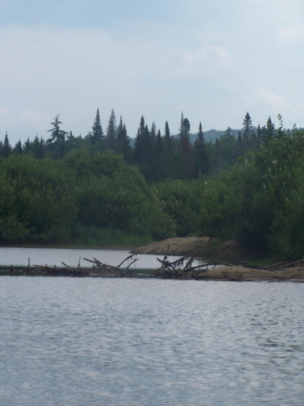
Beaver Dam


ย Resolution in Support of the Upper Hudson Recreational Hub

Request for Maximum Access to Unclassified State Lands


Resolution Date: 3 June 2013 at the Membership Meeting of the Adirondack Association of Towns and Villages

Moved By: Supervisor Farber, seconded by Supervisor Monroeย  CARRIED

WHEREAS, Governor Cuomo has announced the State’s acquisition of 69,000 acres of the former Finch Pruyn and other Nature Conservancy Lands; and

WHEREAS, Governor Cuomo has stated that this agreement will make the Adirondack Park one of the most sought after destinations for paddlers, hikers, hunters, sportspeople, and snowmobilers, and that opening these lands to public use and enjoyment for the first time in 150 years will provide extraordinary new outdoor recreational opportunities, increase the number of visitors to the North Country and generate additional tourism revenue; and

WHEREAS, the five Towns in the Adirondack Park most affected by this acquisition wish to realize the maximum benefit of increased tourism revenue; and

WHEREAS, the five Towns consisting of Indian Lake, Long Lake, Minerva, Newcomb, and North Hudson wish to work together to achieve the maximum economic benefit to the region from the increased tourism and have now formed the Upper Hudson Recreation Hub; and

WHEREAS, these tracts of land have an extensive network of maintained roads formerly used as logging and access roads; and

WHEREAS, the Upper Hudson Recreation Hub is in agreement that the only path to realize the maximum economic benefit of this land acquisition is to provide the utmost access to the public to the ponds, lakes, rivers, streams, and trails and that access should be provided to all citizens including the elderly, handicapped, disabled and physically challenged; and

WHEREAS, the Upper Hudson Recreation Hub is also in agreement that all forms of recreational activities to include, but not be limited to, hiking, canoeing, camping, skiing, snowmobiling, mountain biking, horseback riding, dog sledding, and the use of ATV’s be permitted; and

WHEREAS, the Upper Hudson Recreation Hub is of the opinion that the “Gooley Historical Society” be permitted to preserve and maintain the Outer Gooley Farmhouse, a building of historical significance that would be a learning tool for current and future generations and the loss of this valuable asset would be truly disrespectful to our Adirondack Ancestors; and ..

WHEREAS, the Upper Hudson Recreation Hub agrees that the proposal to surplus the Boreas Pond Lodge and support buildings would be a complete waste of a valuable asset that could be used for many purposes such as training and education, as an information center, an outpost, or as lodging; and

NOW, THEREFORE BE IT RESOLVED, that the Adirondack Association of Towns and Villages wholeheartedly supports the position of the Upper Hudson Recreation Hub, in its honorable efforts to achieve the greatest economic benefit from this purchase by requesting that the State classify these lands in away that promotes the maximum access to the ponds, lakes, rivers, streams, and trails by all citizens, including the elderly, handicapped, disabled and physically challenged; and

BE IT FURTHER RESOLVED, the Adirondack Association of Towns and Villages strongly oppose any land use and classification that does not allow for all forms of recreational activities to include, but not be limited to, hiking, canoeing, camping, snowmobiling, skiing, mountain biking, horseback riding, dog sledding, and the use of ATV’s; and

BE IT FURTHER RESOLVED, that the Adirondack Association of Towns and Villages fully supports the continued maintenance and preservation of the Outer Gooley Farm House, a place of historical significance where early settlers tried to farm and run a sporting camp; where there was a discovery of hand dugout canoes; where Heavyweight boxer Gene Tunney trained; and where Senator Bobby Kennedy launched his raft into the Hudson River, and, if not preserved, would be the loss of an invaluable asset that could be used as a learning center for present and future generations; and

BE IT FURTHER RESOLVED, that the Adirondack Association of Towns and Villages fully supports the continued use of Boreas Pond Lodge and support buildings that could be used for many purposes such as training and education, as an information center, an outpost, or as lodging; and

BE IT FURTHER RESOLVED, that copies of this resolution be sent to Governor Andrew Cuomo, Commissioner Joe Martens, Senator Elizabeth O’C Little, Senator Hugh T. Farley, Assemblyman Daniel G. Stec, Assemblyman Marc W. Butler, Adirondack Park Agency Chairwoman Leilani Ulrich, DEC Region 5 Regional Director Robert Steggeman and DEC Region 5 Regional Natural Resource Supervisor Thomas Martin.

Final Days of Winter ๐ŸŒจ๏ธ

Tomorrow officially starts spring on the calendar, but as usually is the case in New York State that doesn’t mean tulips and warm weather is right around the corner — though with El Nino and climate change in control I’m not convinced in a few days it won’t get real warm quickly. Remember, the record books are littered with 80 degrees over the years throughout March. No ninety degree days so far, but the climate is warming.

Good morning! Monday’s come back around again. Mostly sunny ๐ŸŒž and 32 degrees in Delmar, NY. There is a west breeze at 7 mph. ๐Ÿƒ.

Up and going a little after 5 AM โ˜•๏ธ after running to Stewart’s to get more of the moo juice for my coffee. ๐Ÿ„ Carrot pancakes this morning ๐Ÿฅ•๐Ÿฅž with fresh maple syrup and blueberries that were pretty damn good. It was a beautiful morning when I went out to Stewart’s, and now I’m sitting at my desk here in my apartment looking out the window. As usual, I am going to ride to work today. A bit cool of a day, but so be it. I will wear gloves and a winter jacket if necessary. ๐Ÿšด‍โ™‚๏ธ

Today will have increasing clouds โ˜, with a high of 45 degrees at 3pm. One degrees below normal, which is similar to a typical day around March 17th. West wind 7 to 14 mph, with gusts as high as 24 mph. A year ago, we had cloudy skies in the morning with a few breaks of sun the afternoon. The high last year was 44 degrees. The record high of 69 was set in 2012. 8.0 inches of snow fell back in 1977.โ„

I’m hoping to talk to my neighbor about the growing pile of garbage bags ๐Ÿ—‘๏ธ next to his apartment. I didn’t say anything last week, as I assumed on Saturday he’d be making a trip to the transfer station. โ™ป๏ธ I assume he doesn’t give a rats ass  ๐Ÿ€ about the landlord at this point because he’s moving out with the rent hike coming in search of greener pastures, but I don’t want rats in my apartment nor do I want the fire risk  ๐Ÿ”ฅ that piles of garbage bring. The new month-to-month agreement is pretty clear that not allowed — I had to ask for special permission to have my kayak outdoors. ๐Ÿšฃ If he doesn’t clean it up soon, I’m going to email the new landlord, and if he doesn’t take action, I’ll call the town. ๐Ÿ›๏ธ

It’s obnoxious to deal with, because I normally wouldn’t care, especially if the garbage was in cans, ๐Ÿ›ข๏ธ as sometimes it’s a while before I get it burnt up, taken to my parents trash pickup, or hauled to the transfer station, but I don’t leave it sitting out where animals can get to it. ๐Ÿฟ๏ธ Already I’ve seen some garbage strewn around. I need to get out of this dumpy apartment before it burns or I get evicted in pursuit of redevelopment of the land — but I want to buy myself whatever time I can, especially if I want to build my dream solar homestead. โณ๏ธ๐Ÿ ๏ธ That said, I won’t complain too much, as I’m kind of loud with my food processor and smoke alarm — to say nothing of cussing out the world when drop a pot on my foot, dirty and  generally obnoxious too. ๐Ÿคฌ Trust me I can be vulgar at times, sometimes even a bit downright racist.

Solar noon ๐ŸŒž is at 1:04 pm with sun having an altitude of 46.7° from the due south horizon (-24.2° vs. 6/21). A six foot person will cast a 5.7 foot shadow today compared to 2.2 feet on the first day of summer. The golden hour ๐Ÿ… starts at 6:29 pm with the sun in the west (264°). ๐Ÿ“ธ The sunset is in the west (270°) with the sun dropping below the horizon at 7:06 pm after setting for 2 minutes and 54 seconds with dusk around 7:33 pm, which is one minute and 10 seconds later than yesterday. ๐ŸŒ‡ At dusk you’ll see the Waxing Gibbous ๐ŸŒ” Moon in the southeast (136°) at an altitude of 70° from the horizon, 244,770 miles away. ๐Ÿš€ The best time to look at the stars is after 8:07 pm. At sunset, look out for snow showers ๐ŸŒจ and temperatures around 39 degrees. There will be a west-northwest breeze at 11 mph with gusts up to 21mph. Tomorrow will have 12 hours and 10 minutes of daytime, an increase of 2 minutes and 55 seconds over today.

I am coming to realize how abusive Rosa the substitute dental hygienist was on Friday.  ๐ŸฆทI am not going to pay somebody to get abused — even if my insurance covered the visit. I appreciate constructive criticism ๐Ÿชฅ and I’m thinking about getting an electric toothbrush for better cleaning, but Rosa was downright abusive. I get she had her new toy that showed how bad my teeth were in high-resolution colored pictures, but I did not deserve to be berated for a half hour about how bad my oral care is despite my attempts to each healthy ๐ŸŽ and floss regularly. ๐Ÿ˜ She scheduled with me for a follow up visit, but I am the customer so I have every right to cancel that appointment ๐Ÿ›‘ and find a hygienist who is professional.

Tonight will have a slight chance of snow showers before 3am. Mostly cloudy ๐ŸŒง, with a low of 29 degrees at 6am. Two degrees above normal, which is similar to a typical night around March 24th. Northwest wind 10 to 13 mph. Chance of precipitation is 20%. In 2023, we had mostly clear skies in the evening, which became mostly clear by the early hours of the morning. It got down to 22 degrees. The record low of -10 occurred back in 1967.

More reading and studying about building a house tonight. ๐Ÿ ๏ธ The usual of checking Zillow and Landwatch for new parcels and houses to come on them market, expanding my circle out a bit ๐Ÿ›ž looking at different acreage and locations to determine what would be the best place to live. I mean if I see a small house on acreage, I would be willing to consider it, it as it’s greener to reuse an existing structure and not develop new land, but the flip side is such a property would be likely very poorly insulated and grid-tied. ๐Ÿš๏ธPlus if at all possible, I want to avoid vinyl siding, which I despise to no end.

Right now, a split verdict on the weekend. ๐Ÿ˜• Maybe it’s too early to really determine for sure. Saturday, a chance of rain and snow showers. Mostly cloudy, with a high near 44. Chance of precipitation is 30%. Sunday, mostly sunny, with a high near 41. I have some other places I want to check out this weekend, plus find time for some hiking and fun, as I have to keep living while building my dream homestead. ๐Ÿƒ‍โ™‚๏ธ Typical average high for the weekend is 48 degrees. ๐ŸŒป There is hope for spring. The following weekend — Thursday evening through Easter Sunday I’m hoping to camp in the Adirondacks unless there is a shit ton of snow or rain is promised all weekend.

As previously noted, there are 2 weeks until April Fools Day ๐Ÿคก when the sun will be setting at 7:23 pm with dusk at 7:50 pm. On that day in 2023, we had rain and temperatures between 74 and 41 degrees. Typically, the high temperature is 52 degrees. We hit a record high of 77 back in 1986.

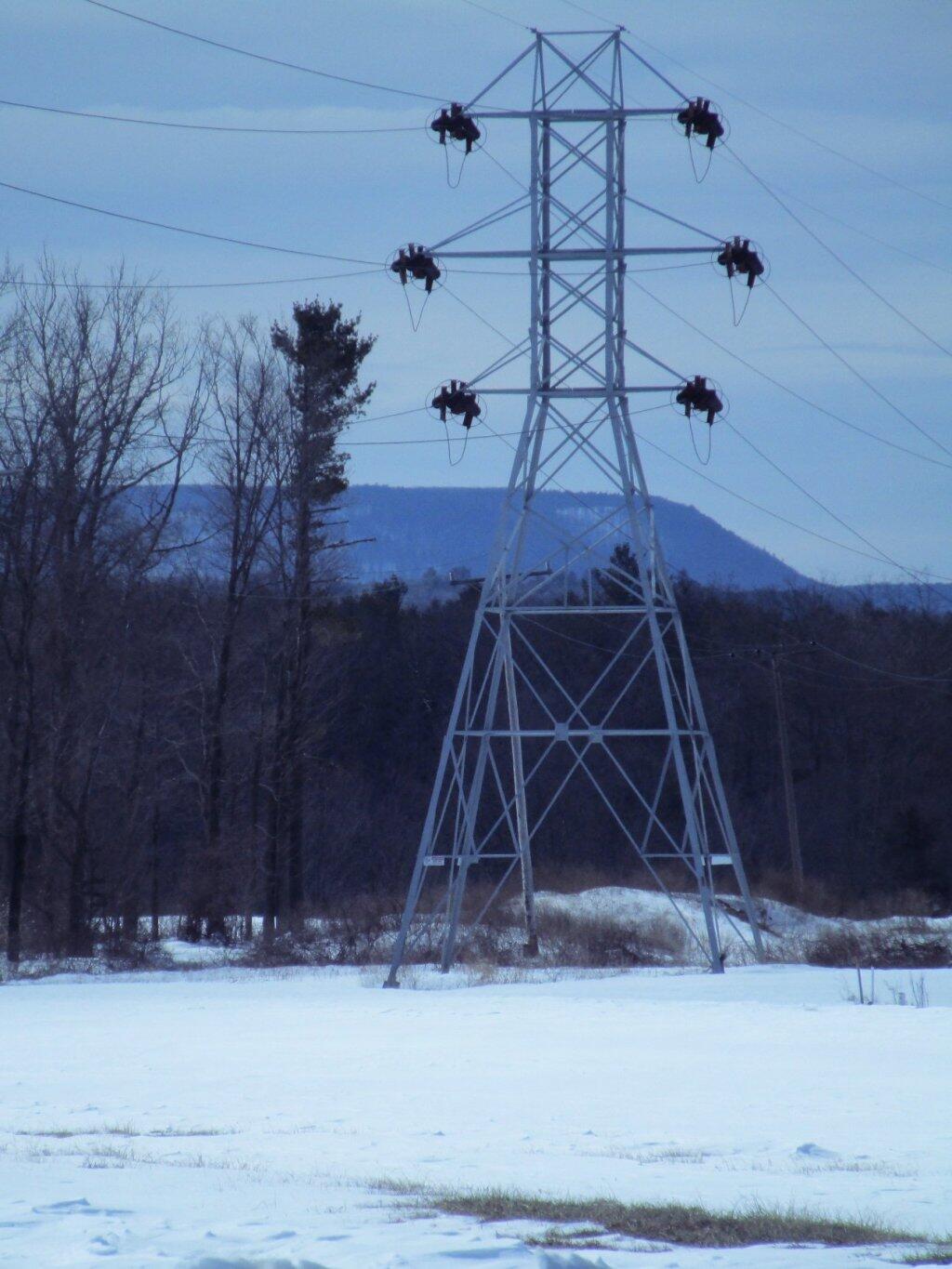
 Tower

Proponents are calling for closing off the public lands because of over use… ๐ŸŒฒ๐ŸŒฒ ๐Ÿž๐ŸŒณ๐Ÿฆ ๐Ÿ•Š ๐Ÿฆ† ๐ŸฆŒ

Proponents are calling for closing off the public lands because of over use… ๐ŸŒฒ๐ŸŒฒ ๐Ÿž๐ŸŒณ๐Ÿฆ ๐Ÿ•Š ๐Ÿฆ† ๐ŸฆŒ

I believe the radical environmentalists who want to destroy our country are the greatest threat to public lands. We must fight back against those who want to lock them up and close them down and ban public use. Public lands belong to the public not the radicals!

We need multiple use lands and managed forests supported with funding by timber sales, oil and gas production and leased grazing rights. The philosophy should be greatest good for the greatest number over time, as public lands belong to the public.. We should adopt the philosophy of the Gifford Pichot and the US Forest Service.

Lately, the ideology of the radicals has been to find every thing in the forest preserve that is broken, every mud puddle, every filled up parking lot and put it on an 8×11 photograph and post it on the internet and create these reports that they send to the politicians insisting that public lands be closed down and that public access to limited or completely banned. Ignoring the fact that most of the public land isn’t shown on the frame.

If there is a problem with litter, then state should hire more people to remove litter and put out more garbage cans. It used by most parks had garbage cans, and they dumped the garbage in a gravel pit. Not every garbage pit is Love Canal. Is it really necessary for the state to haul every piece of back country litter two hundred miles to a designated landfill when for generations old cans and wrappers were buried in nearby sand burrow pits?

If trails are being worn out, then they should have more staff repairing trails, bring in more gravel, more rock, and make more hardened repairs. The state owns thousands of acres of land which can be used to provide rock, dirt and timber for improving state facilities. Build new trails and parking areas to spread out impacts.

The solution shouldn’t be closing off, locking up and hiring more jack booted thugs every time an area gets heavy use compared to the under-sized, under built infrastructure when the state has so much in natural resources that could be exploited for public benefit.

I Can Help You Make a Map

Geographic Information Services (GIS)MapsCartography ๐Ÿ—บ

I am an amateur cartographer who designs maps and does a wide variety geospatial analysis using free and open-source geographic information software (GIS) and public sources of data to design quality maps, graphs, charts and datasets. I am looking for new and interesting projects to improve my skills, make connections and expand my portfolio.

Are you looking for my personal blog with it’s hiking, camping and outdoor recreation maps, along with a variety of charts, photos, and stories? Please visit andyarthur.org.

Mapping Avaliable

  • Tax/Property Mapping
  • High Resolution Aerial Photography
  • Recreational Maps – Hunting, Camping, Hiking
  • Georeference addresses using State Address Mapping service, plot them on a map
  • Wetlands, Topographic Contours, Land Cover
  • Compare historical aerial photos or maps to current photography
  • Web mapping using leaflet (HTML/Javascript file to embed on a website or use at home)

Example maps can found below.

Services Available

  • A list of property owners within 1,000 feet of a proposed development
  • How many cars per day pass a business?
  • How many people who live within 5 miles of a business or park?
  • How many African Americans and Hispanics live within 10 miles of Albany Pine Bush?
  • What are wealthiest election districts?
  • How many people ride public transit in a neighborhood?
  • How much of an area is wetland or farm field?
  • How big an interchange?
  • What is the average slope and elevation of an area or trail?

Example data can found below.

Pricing and Cost

For most projects, there is no fee. I am looking for experience, references, mentors and connections in the geospatial community.

If you have a large project, let’s talk about it. I might be willing to do it for free, if it’s something really interesting
or important like fighting suburban sprawl and pollution. I don’t a business or taxes set up, so I can’t really charge at this point.

How to get started?

Please send me an email describing the mapping or data project in as much detail as possible.

My email is andy@andyarthur.org

Data Avaliable

  • US Census – 2019 American Community Survey, 2020 US Census
  • NYS Tax and Assessment Rolls (2020)
  • NYSDOT Traffic Counts and Road Data
  • Historical Aerial Photography (primarily 1952, but earlier and later exist)
  • ArcGIS REST/Services and WMS Services from state and local agencies
  • LiDAR Elevation Profiles
  • USGS Topographic Maps, historic and modern – with overlays if requested
  • Data Repositories like CUGIR, DataNY.gov and NYSGIS
  • Recreation data from NYSDEC

Software Used

  • Quantum GIS (QGIS) including 3D Mapping
  • Geodata Abstraction Library (GDAL, ogr2ogr)
  • Python, including the data-science libraries PANDAS and GeoPANDAS
  • LeafletJS Web Mapping Services

Geographies Avaliable

  • Primary Capital Region and also much of New York State, also some for Pennsylvania, Vermont, West Virginia
  • State, county, municipal, school districts – Most data sets
  • Parks, highways, buffer (distance to) – Most data sets
  • Election districts – Roughly 75% of NYS counties
  • Census Tract or Blockgroup – 2019 American Community Survey
  • Tabulation Block – 2020 US Census

Are printed maps avaliable at this time?

Not currently. I can send you a file based on your specifications to print at your local print shop.

How long do mapping projects take?

Depends on complexity of the project. Many projects only take minutes, however if a project requires georeferencing, data cleaning, or custom shapes or layouts, it might take significantly longer. More revisions lead to better quality output.

Do you make maps professionally?

No! This is just a hobby. But I’m interested in expanding my skills. I do a lot of mapping for my blog and in support of community organizations like Save the Pine Bush.

Are my maps of good quality?

Thats for you to decide. I don’t have formal education in map making, and I don’t have professional tools. But do take a look at the work I’ve done below.

Examples of Maps


This shows a 3D rendering of the Buckville Canal north of Hamilton


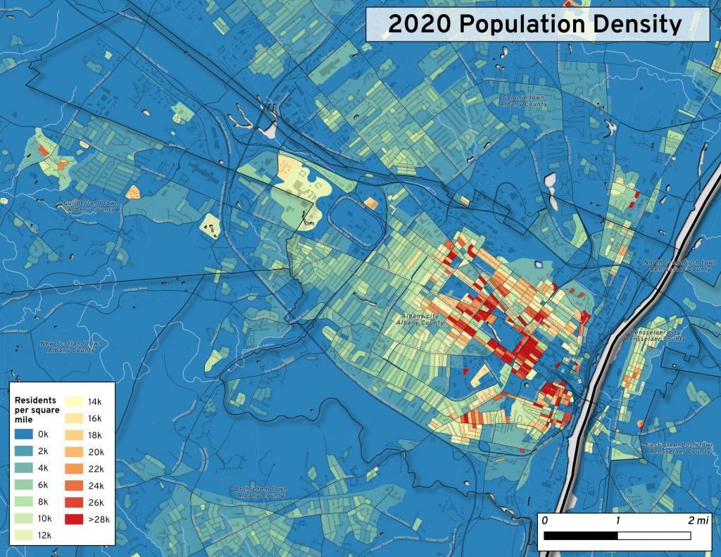
This map shows the use of 2020 PL 94-171 data to calculate population density in City of Albany.


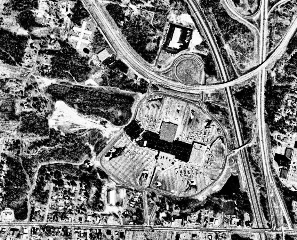
This 1985 aerial photo shows Crossgates Mall prior to it’s expansion.


This GIF image shows the change in unemployment during Coronavirus panademic.

This image shows hiking trails near Brooktrout, Falls Pond and Deep Lake.


Peebles Island, a Comparison 1952


3D Interactive of campsites at Moose River Plains.


Sample tax map in Albany.


Election results – 2020 Presidential Election, Onondoga County.


Map showing where sparklers are legally sold in New York.


Downtown Plattsburgh 1866 Beers (1866 Beers vs. 2020 OSM)


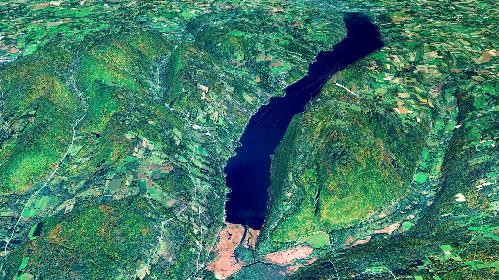
3D Rendering of Canandaigua Lake


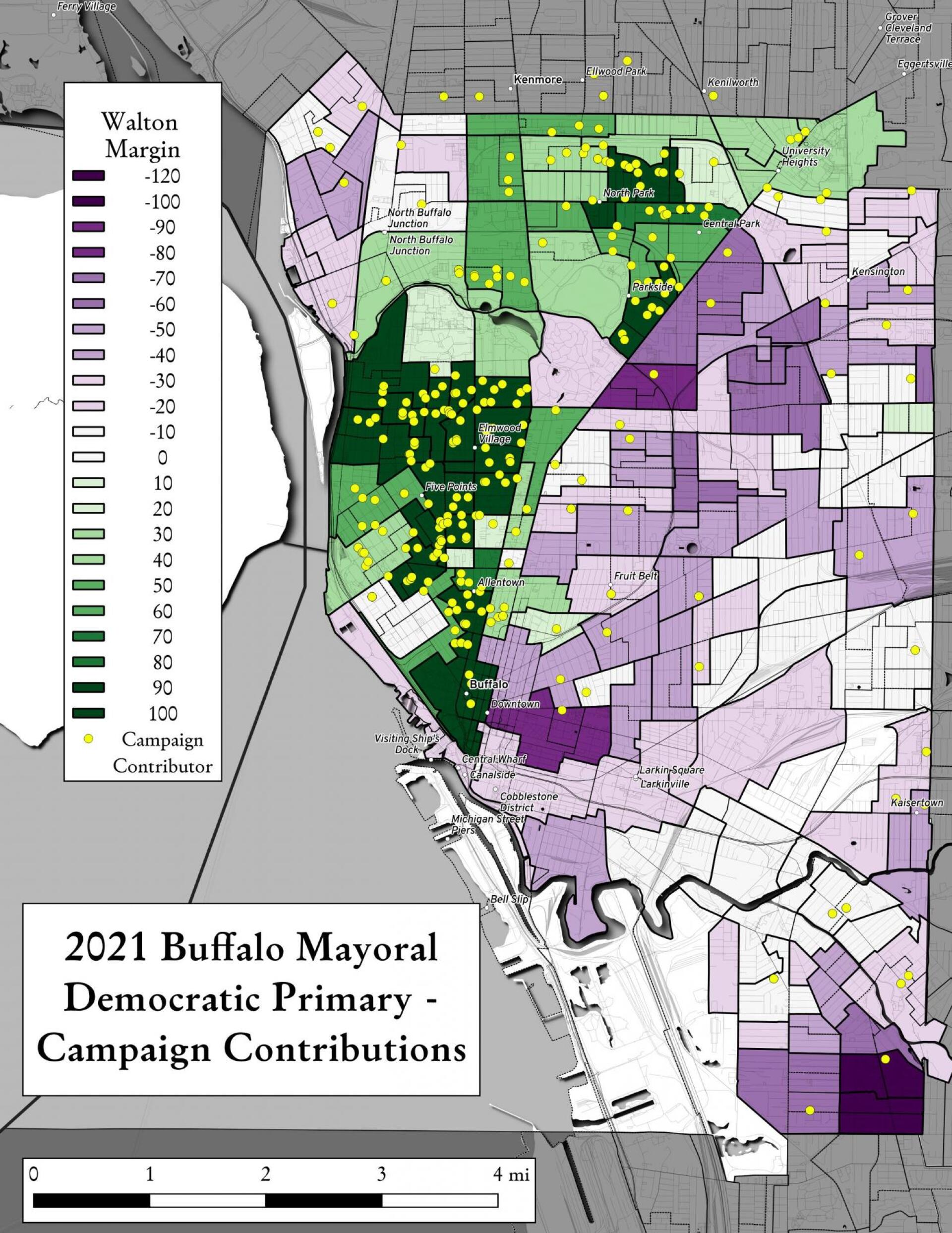
Map showing Buffalo Mayoral Primary results and campaign donors.


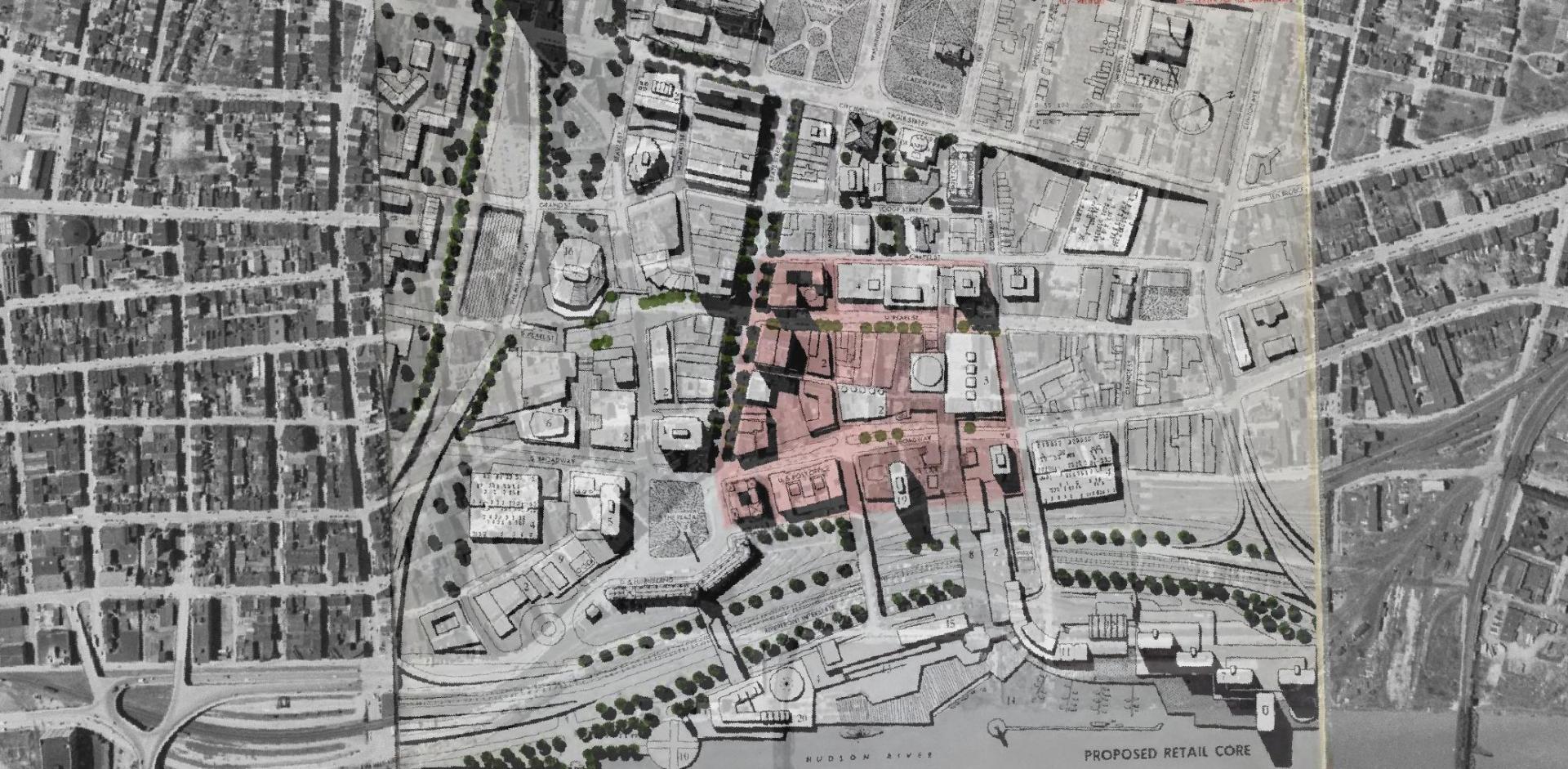
Overlay of Proposed Retail Core in 1963 Plan for the Capital City.


Map showing Local Area Unemployment Statistics – April 2020.


Interactive tax map in Delmar


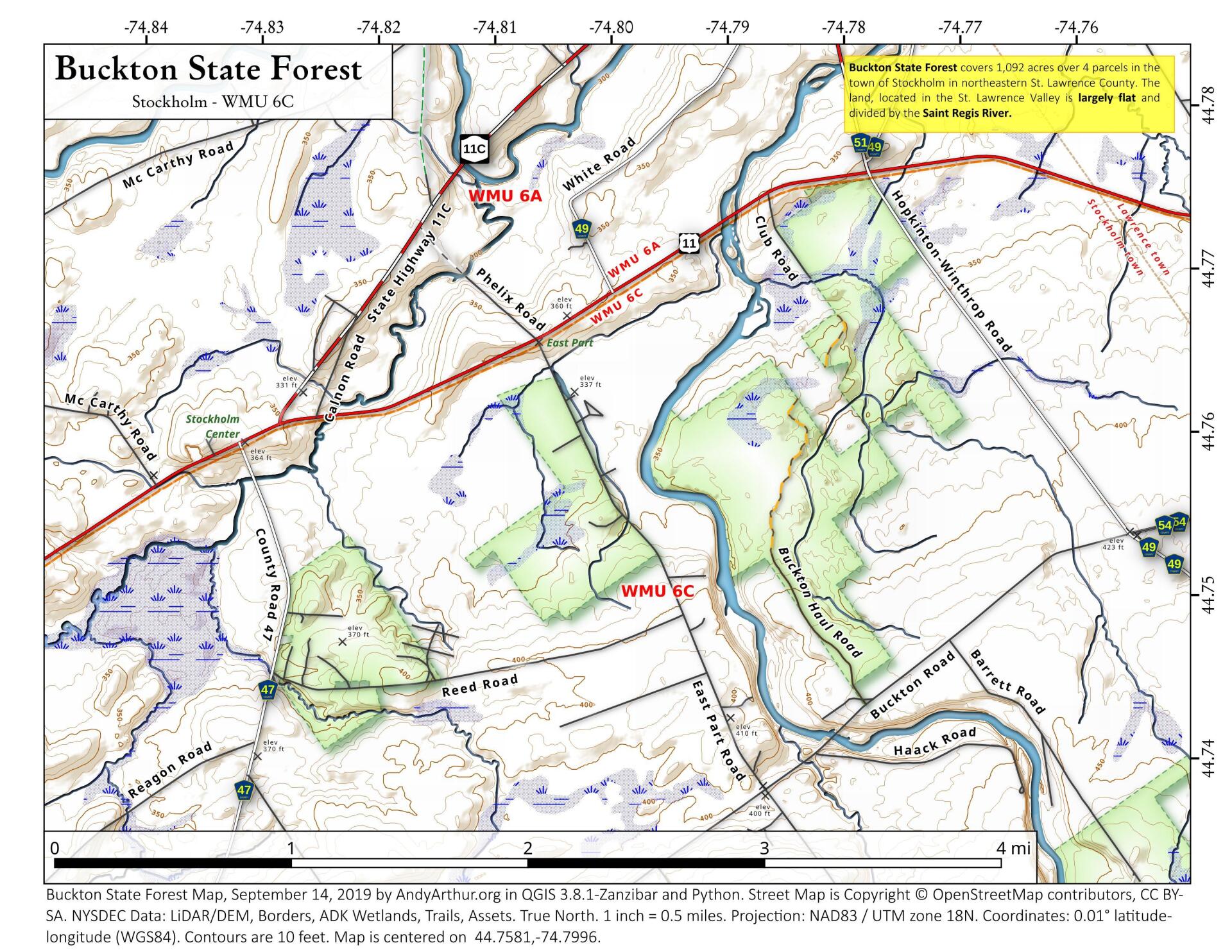
State Land in Stockholm, NY – Buckton State Forest.


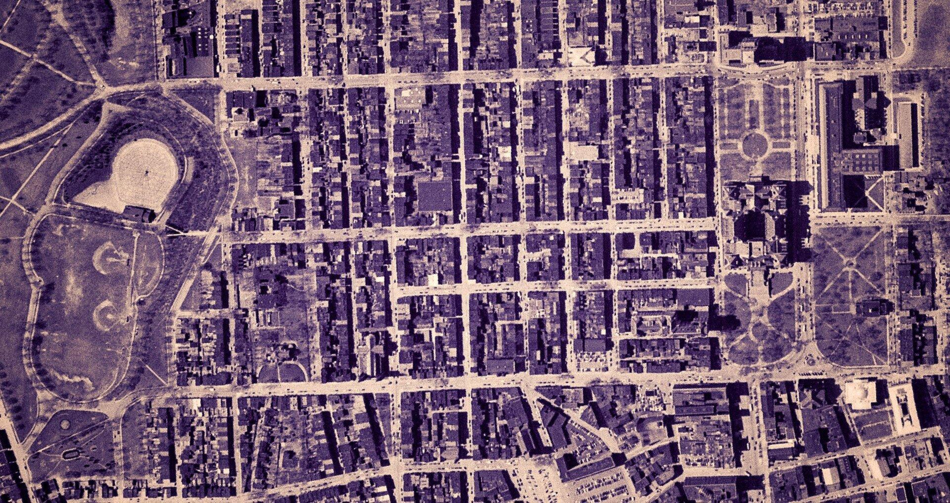
Empire State Plaza take area, 1952


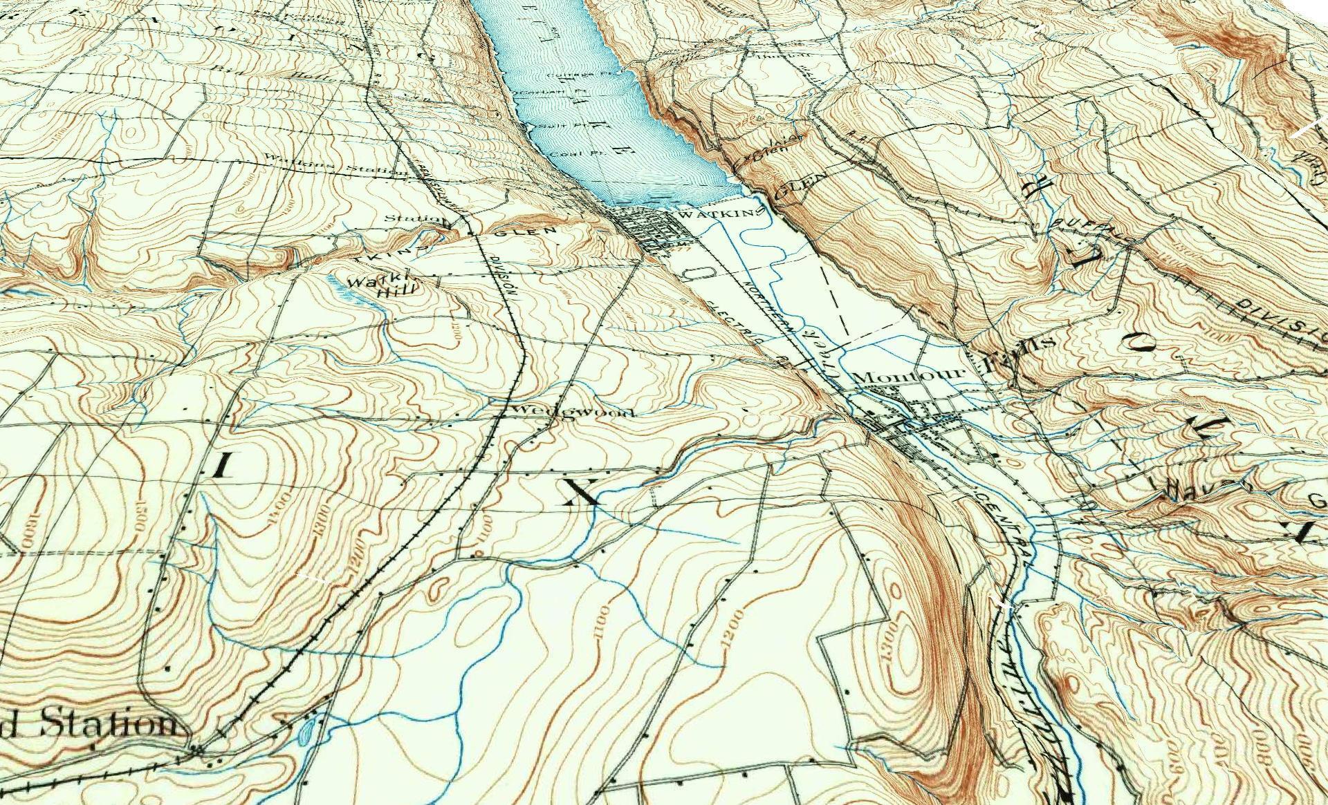
3D Rendering of the 1898 Watkins Glen Topographic Map

Examples of Data and Code

Properties in Albany Pine Bush Study Area,Excel Files: Various Tax Rolls,Find coordinates and political districts,Look Up State Tax Records and aScript for Processing RPTL 1520 PDFs.

Querying state property database, political enrollments, PL 94-171 Census files, calculating population statistics, what address is a district in, converting old districts to new districts.

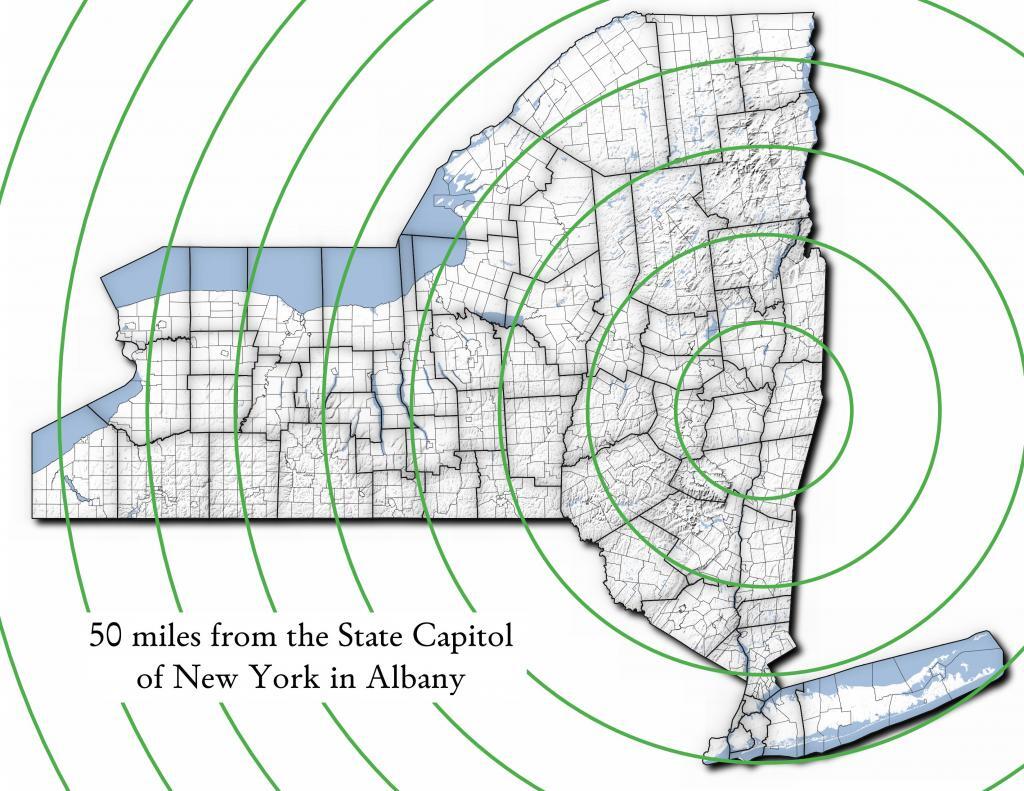
Miles from Albany millions population
50 1.002
100 1.750
150 3.511
200 17.102
250 17.725
300 18.699
350 19.411
400 20.187
450 20.201
import pandas as pd
import geopandas as gpd
 
# path to overlay shapefile
overlayshp = r'/tmp/dis_to_albany.gpkg'
 
# summary level -- 750 is tabulation block, 150 is blockgroup
# large areas over about 50 miles much faster to use bg
summaryLevel = 150
#summaryLevel = 750
 
# path to block or blockgroup file
if summaryLevel == 150:
    blockshp = r'/home/andy/Documents/GIS.Data/census.tiger/36_New_York/tl_2020_36_bg20.shp.gpkg'
else:
    blockshp = r'/home/andy/Documents/GIS.Data/census.tiger/36_New_York/tl_2020_36_tabblock20.shp.gpkg'
 
# path to PL 94-171 redistricting geoheader file
pl94171File = '/home/andy/Desktop/nygeo2020.pl'
 
# field to categorize on (such as Ward -- required!)
catField = 'Name'
 
# geo header contains 2020 census population in column 90 
# per PL 94-171 documentation, low memory chunking disabled 
# as it causes issues with the geoid column being mixed types
df=pd.read_csv(pl94171File,delimiter='|',header=None, low_memory=False )
 
# column 2 is summary level 
population=df[(df.iloc[:,2] == summaryLevel)][[9,90]]
 
# load overlay
overlay = gpd.read_file(overlayshp).to_crs(epsg='3857')
 
# shapefile of nys 2020 blocks, IMPORTANT (!) mask by output file for speed
blocks = gpd.read_file(blockshp,mask=overlay).to_crs(epsg='3857')
 
# geoid for linking to shapefile is column 9
joinedBlocks=blocks.set_index('GEOID20').join(population.set_index(9))
 
# store the size of unbroken blocks
# in case overlay lines break blocks into two
joinedBlocks['area']=joinedBlocks.area
 
# run union
unionBlocks=gpd.overlay(overlay, joinedBlocks, how='union')
 
# drop blocks outside of overlay
unionBlocks=unionBlocks.dropna(subset=[catField])
 
# create population projection when a block crosses
# an overlay line -- avoid double counting -- this isn't perfect
# as we loose a 0.15 percent due to floating point errors
unionBlocks['sublock']=unionBlocks[90]*(unionBlocks.area/unionBlocks['area'])
 
# sum blocks in category
unionBlocks=pd.DataFrame(unionBlocks.groupby(catField).sum()['sublock'])
 
# rename columns
unionBlocks=unionBlocks.rename({'sublock': '2020 Census Population'},axis=1)
 
# calculate cumulative sum as you go out each ring
unionBlocks['millions']=unionBlocks.cumsum(axis=0)['2020 Census Population']/1000000
 
# each ring is 50 miles
unionBlocks['miles']=unionBlocks.index*50
 
# output
unionBlocks

Land use in town of Berne (from 2016 National Land Cover Dataset)

Most highly assessed properties in Albany County …

from arcgis.features import FeatureLayer
lyr_url = 'https://gisservices.its.ny.gov/arcgis/rest/services/NYS_Tax_Parcel_Centroid_Points/MapServer/0'
layer = FeatureLayer(lyr_url)
query_result1 = layer.query(where="COUNTY_NAME='Albany' AND FULL_MARKET_VAL > 100000000", 
                                    out_fields='PARCEL_ADDR,CITYTOWN_NAME,FULL_MARKET_VAL,OWNER_TYPE', out_sr='4326')

df=query_result1.sdf.sort_values(by='FULL_MARKET_VAL', ascending=False)
df['Full Market Value'] = df['FULL_MARKET_VAL'].map('${:,.0f}'.format)

df
 OBJECTIDPARCEL_ADDRCITYTOWN_NAMEFULL_MARKET_VALOWNER_TYPESHAPEFull Market Value
112665264 Eagle StAlbany12042549252{โ€œxโ€: -73.75980312511581, โ€œyโ€: 42.650469918250โ€ฆ$1,204,254,925
391501200 Washington AveAlbany8862987152{โ€œxโ€: -73.81092293494828, โ€œyโ€: 42.679257168282โ€ฆ$886,298,715
4102081400 Washington AveAlbany6423982872{โ€œxโ€: -73.82369286130952, โ€œyโ€: 42.685845700657โ€ฆ$642,398,287
0885251 Fuller RdAlbany4400428272{โ€œxโ€: -73.83559002316825, โ€œyโ€: 42.690208093507โ€ฆ$440,042,827
518164632 New Scotland AveAlbany3775682018{โ€œxโ€: -73.80381341626146, โ€œyโ€: 42.655758957669โ€ฆ$377,568,201
1906141 Fuller RdAlbany3211991432{โ€œxโ€: -73.83323986150171, โ€œyโ€: 42.693189748928โ€ฆ$321,199,143
19108087See Card 1067Watervliet2808988761{โ€œxโ€: -73.70670724174552, โ€œyโ€: 42.719628647232โ€ฆ$280,898,876
1565380737 Alb Shaker RdColonie2639161003{โ€œxโ€: -73.80365248218001, โ€œyโ€: 42.747956678125โ€ฆ$263,916,100
921923304 Madison AveAlbany2342654182{โ€œxโ€: -73.76227373289564, โ€œyโ€: 42.648000674457โ€ฆ$234,265,418
2907201 Fuller RdAlbany2034261242{โ€œxโ€: -73.83362605353057, โ€œyโ€: 42.692609131686โ€ฆ$203,426,124
1669999515 Loudon RdColonie1660656008{โ€œxโ€: -73.74958475282632, โ€œyโ€: 42.719321807666โ€ฆ$166,065,600
72059247 New Scotland AveAlbany1622763388{โ€œxโ€: -73.77597163421673, โ€œyโ€: 42.653565689693โ€ฆ$162,276,338
620574132 S Lake AveAlbany1462963602{โ€œxโ€: -73.77970918544908, โ€œyโ€: 42.654390366929โ€ฆ$146,296,360
820597113 Holland AveAlbany1434985012{โ€œxโ€: -73.77306688593143, โ€œyโ€: 42.650762742870โ€ฆ$143,498,501
1778203MannsvilleColonie1425704001{โ€œxโ€: -73.71245452369443, โ€œyโ€: 42.718124477080โ€ฆ$142,570,400
18955091 Crossgates Mall RdGuilderland1305547008{โ€œxโ€: -73.84702700595471, โ€œyโ€: 42.687699053797โ€ฆ$130,554,700
102452186 S Swan StAlbany1284364032{โ€œxโ€: -73.75980563770365, โ€œyโ€: 42.653931892804โ€ฆ$128,436,403
13468831916 US 9WCoeymans1100000008{โ€œxโ€: -73.83388475575597, โ€œyโ€: 42.488730743021โ€ฆ$110,000,000
1235152380 River RdBethlehem1052631588{โ€œxโ€: -73.76445503554325, โ€œyโ€: 42.595925419330โ€ฆ$105,263,158
146509715 Wolf RdColonie1019672138{โ€œxโ€: -73.81423716588279, โ€œyโ€: 42.709939498581โ€ฆ$101,967,213
Categories:

January 8, 2021 Morning

Good morning! Happy Bubble Bath Day ๐Ÿงผ ! Never was into the bubble bath, but I do like the bubbly potholers on a hot summer day. ๐ŸŠ Three weeks to my 38th Birthday ๐ŸŽ‰ . 17 years until I will be 55. That said I’m not sure if I will stick around in Albany for another decade and a half. ๐Ÿ‘ด So many things to do before then. Cloudy and 21 degrees in Delmar, NY. โ˜ There is a north-northwest breeze at 7 mph. ๐Ÿƒ. There is a inch of snow on the ground. โ˜ƒ ๏ธThings will start to thaw out at around 2 pm. ๐ŸŒก๏ธ

Kind of a cold and gray morning. ๐ŸŒฅ I am rather disappointed with the weather. Fewer dog ๐Ÿถ walker to have to put the mask on for and step off the trail for on the era of THE COVID. Hopefully, we will have more sun later โ˜€ as I like looking at blue skies with the endless work zoom meetings of lately. โŒจ๏ธ Normally I mute ๐Ÿ”• myself but lately with too many Ferris Buehler moments I left the microphone on and then my typing got picked up and I got yelled at during the meeting. I just find the phone zoom app is incredibly hard to unmute I a hurry. So it’s back to staring out the window. โฌœ

I think today will be a work from home day, ๐Ÿ  that is after I go for my morning walk on this most cloudy start of day. โ˜ Yesterday was so nice with all that sun to get the morning started, but that’s definitely not to be today. But hopefully it will get nicer once that high level front passes through. But I was hoping for seven days of blue skies in the morning, but that was not to be.We can have hopes for nice weather, but that rarely comes to be. But still I enjoy my morning walks. ๐Ÿณ I had a good pan of eggs with a chopped up ham-steak, broccoli, cheese and lots of coffee โ˜• so I should have plenty of energy for the day. ๐Ÿ’ค Slept well last night.

Today will be cloudy through mid morning, then gradual clearing โ›…, with a high of 34 degrees at 3pm. I am surprised how cloudy it out this morning. I thought the week was supposed to be a lot more sunny. Debbie downer I guess. Geos-East shows a row of clouds pushing through. Four degrees above normal, which is similar to a typical day around February 11th. Northwest wind 7 to 9 mph. A year ago, we had mostly sunny skies in the morning, which became mostly clear by afternoon. The high last year was 39 degrees. The record high of 60 was set in 2008. 8.3 inches of snow fell back in 1923.โ„

Solar noon ๐ŸŒž is at 12:03 pm with sun having an altitude of 25.2ยฐ from the due south horizon (-45.6ยฐ vs. 6/21). A six foot person will cast a 12.8 foot shadow today compared to 2.2 feet on the first day of summer. The golden hour ๐Ÿ… starts at 3:55 pm with the sun in the southwest (232ยฐ). ๐Ÿ“ธ The sunset is in the west-southwest (240ยฐ) with the sun dropping below the horizon at 4:40 pm after setting for 3 minutes and 22 seconds with dusk around 5:11 pm, which is one minute and 2 seconds later than yesterday. ๐ŸŒ‡ The best time to look at the stars is after 5:47 pm. At sunset, look for mostly sunny skies ๐ŸŒƒ and temperatures around 32 degrees. There will be a north-northwest breeze at 7 mph. Today will have 9 hours and 14 minutes of daytime, an increase of one minute and 14 seconds over yesterday.

Tonight will be mostly clear ๐ŸŒƒ, with a low of 17 degrees at 6am. Two degrees above normal, which is similar to a typical night around February 11th. Maximum wind chill around 14 at 3am; Northwest wind 6 to 8 mph. In 2020, we had light snow in the evening, which tapered off and the skies become mostly clear and cold by the early hours of the morning. It got down to 13 degrees. The record low of -20 occurred back in 1968. But not 1968 cold, as it rarely gets that cold these days around here, but who knows with the polar vortex roaring around, although it seems unlikely to hit here in New York.

Tomorrow will be mostly sunny ๐ŸŒž, with a high of 33 degrees at 1pm. Three degrees above normal, which is similar to a typical day around February 6th. Northwest wind 7 to 10 mph. A year ago, we had mostly sunny skies in the morning, which became mostly clear by afternoon. The high last year was 30 degrees. The record high of 62 was set in 2008. 9.9 inches of snow fell back in 1953.โ„

I haven’t decided yet for sure but I might just walk ๐Ÿšถ๐Ÿป out to Five Rivers tomorrow ๐Ÿฆ to watch the birds rather than driving anywhere. ๐Ÿš˜ I just washed my truck yesterday and I don’t want to get it dirty plus the fuel tank โ›ฝ is getting low and I don’t want to have to get gas until next week and I’ll save money ๐Ÿ’ต by not visiting Aldi for even more groceries. Although I do also want to explore the Van Dyke Preserve which is near Meade’s Farm Road — never been there before, and it’s a short walk from the house. Maybe I’ll hike to the Van Dyke Preserve then out to Five Rivers. That will give me a full day of hiking and keep me busy if the weather is decent. I never trust the forecast these days.

Looking ahead to Sunday, mostly sunny, with a high near 34. ๐Ÿ˜ŽNorthwest wind around 7 mph. Typical average high for the weekend is 30 degrees.

I am thinking Sunday I will go for a walk ๐Ÿšถ๐Ÿปaround the Holt Preserve. Been a while since I was last there, and I don’t want to drive too far this weekend. ๐Ÿš˜ Close to home and it’s an easy drive out there without too many back roads to get my truck dirty with.

Finally got to the bank yesterday, ๐Ÿฆ and got the stack of checks I had been hoarding into the bank. I’ve gotten good at driving my big jacked up truck to the ATM. ๐Ÿง There was a big line at the bank drive through as all the interior banking facilities are closed due to the COVID, and I had trouble making the turn to get to the ATM but eventually traffic moved ahead, and with a little jumping of the curb with the back wheel of Big Red and some careful negotiation of the drive through, I made it there safely.

I wasn’t going to do the IRA thing this year in favor of a Roth, ๐Ÿ’ต but after looking at my tax situation, I’ll probably do some of a regular IRA for part of $6k. If I do move to a low tax state in my later years for my homestead it won’t be that big of a deal, and if I have my own land, I’ll probably not be spending that much money on any particular year so my income will be lower. Then when I max out the IRA, I’ll just do the CD or investment account. Should do the trick. And I’ll keep looking at properties in rural Missouri and Neberaska to tease myself in thinking about a better tomorrow.

I also got a bunch of groceries, ๐Ÿ›๏ธ and cleaning supplies. ๐Ÿงฝ I bought this big bottle of ammonium – lemon cleaning solution and it stunk to high hell, ๐Ÿฆจ but it did a good job cleaning the kitchen and bathroom. At first I thought I thought there had been a mixture of some of the old residual chemicals and the ammonium producing noxious chloramine but no, it just was a lot more pungent ๐Ÿ‘ƒ then the other knock-off Pine Sol I normally get. The stink quickly dissipated though, and it was very effective at cleaning the floors and countertops. I am trying to spend a few hours year week cleaning to keep things a bit nicer around here. โ˜  Probably toxic as hell but so be it. We live in a world of chemicals.

I haven’t seen any mice since the mouse I caught yesterday, ๐Ÿ so that’s a good thing. I thought this would be a mice free winter, and until January 6th, that was the case. Then that one made a riotest appearance. Despite the news from that hick town some 500 miles south of me, I thought Wednesday was a pretty quiet day except for that one mouse I caught. I also bought more peanut butter for traps or to use with lunch.

The peanut butter will be good for snacks.๐Ÿช I got kind of a sweet tooth when I got that big bag of Christmas cookies at Aldi’s two weeks ago, but I normally don’t have cookies or sweets at home, but a glob of peanut butter along with the frozen fruit in the freezer should help make up for it. I don’t like to have cookies at home, as they’re not healthy and there are a expense I can’t afford with my budget being as tight as it these days. ๐Ÿ’ธ๐Ÿšญ I’ll eat cookies and drink beer and maybe even drag on something when I’m camping but I refuse to do any of those vices at home.

I’ve been using less data then expected, ๐Ÿ“ถ so come April if I’m still working from home, I’ll probably switch back to the 10 GB hotspot plan and then back to the old, cheaper phone plan once I’m back to work again downtown. Right now, things are working out good, just spending one afternoon a week at the library parking lot when it’s not to cold to get the big files I need for mapping or other purposes. The extra $20 a month (or $10 if i go back to 10 GB) is reasonable these days with no or little bus fares to pay working from home. But I think I’d prefer to work down at the library or the park when the weather is nice and not have to be watching every megabyte on the gauge. ๐Ÿ”Œ Then I’ll be just watching the watt-hour gauge and resetting the undervoltage relay when it clouds up too much.

As previously noted, there are 3 weeks until 38th Birthday ๐ŸŽ‰ when the sun will be setting at 5:05 pm with dusk at 5:35 pm. On that day in 2020, we had partly cloudy skies ๐ŸŒฅ and temperatures between 35 and 19 degrees. Typically, the high temperature is 31 degrees. We hit a record high of 54 back in 2002.

๐ŸŒน๐ŸŒป๐ŸŒผOnly 71 days remain until the first day of calendar spring!๐ŸŒน๐ŸŒป๐ŸŒผ Tomorrow marks ten weeks until calendar spring. But sometimes we get nicer weather before then but who knows. It varies a lot from year to year, with sometimes the worse blizzards in late March, although that time of the year with average highs in the 40s, snow doesn’t last long.

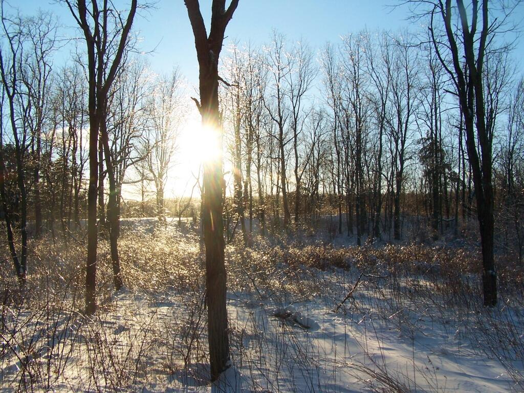
Ice Shimmers Through Trees

October 13, 2019 Morning

Good morning! Happy Average High is 60 ๐Ÿ‚! Final day in West Virginia. Got a late start as it was cold โ„ and I misplaced my camera. Three weeks to Daylight Savings Time Ends ๐Ÿ›ฅ๏ธ. Partly sunny and 37 degrees at the Monongahela National Forest. Calm wind.

I’m sad I’m leaving West Virginia ๐Ÿ˜ญ but time marches on. It wouldn’t be an adventure if you did it every day. ๐ŸI gotta go home and make money. ๐Ÿ’ต I’m sure I’ll camp โ›บ and hunt come November but much closer to home ๐Ÿก. Probably the Adirondacks.

Misplaced my camera on this morning, ๐Ÿ“ท which delayed my departure a bit from camp. I found it, just got knocked off the shelf and tied up with the sleeping bags on my truck. Glad I didn’t lose my camera or all my good resolution pictures from the trip.

Today will be mostly sunny ๐ŸŒž, with a high of 61 degrees at 3pm. Typical for today. Maximum dew point of 46 at 4pm. Calm wind becoming southwest 5 to 9 mph in the morning. A year ago, we had partly cloudy skies in the morning with some clearing in the afternoon. The high last year was 55 degrees. The record high of 81 was set in 1930. There was a dusting of snow in 1934.โ„

Today it’s off to Cannan Wildlife Refuge ๐Ÿฆ then a stop at Mount Storm Coal Plant and and then north to Keyser WV to get some supplies, Blue Knob State Park, Interstate 99 then a quick overnight at County Bridge Campground. Lots of driving ๐Ÿš˜ but a chance to see some nice country.

The sun will set at 6:42 pm with dusk around 7:09 pm, which is one minute and 29 seconds earlier than yesterday. ๐ŸŒ‡ At sunset, look for mostly clear skies ๐ŸŒ„ and temperatures around 55 degrees. It’s coming fast, better get going. There will be a west-southwest breeze at 7 mph. Tomorrow will have 11 hours and 14 minutes of daytime, an increase of 2 minutes and 29 seconds over today.

Totally wearing my Molon Labe t-shirt ๐Ÿ‘• today, the offensive second admendment shirt with two AR-15 on it that I probably can’t wear in Albany and certainly not anywhere near work. I probably fit in well in West Virginia though. ๐Ÿ”ซ I sure love ๐Ÿ˜ guns and burning things. So do most rednecks and country boys in Pennsylvania. ๐Ÿฎ

Tonight will be mostly clear ๐ŸŒƒ, with a low of 40 degrees at 6am. Typical for tonight. West wind 5 to 10 mph. In 2018, we had mostly clear skies in the evening, which became mostly clear by the early hours of the morning. It got down to 40 degrees. The record low of 21 occurred back in 1958.

As previously noted, there are 3 weeks until Daylight Savings Time Ends ๐Ÿ›ฅ๏ธ when the sun will be setting at 5:15 pm with dusk at 5:43 pm (Standard Time) in West Virginia. Much earlier – half hour earlier in Albany. On that day in 2018, we had rain and temperatures between 57 and 41 degrees. Typically, the high temperature is 53 degrees. We hit a record high of 75 back in 1990.

Heading Down to the Vlomans Kill