Search Results for: photo trail up pillsbury mountain

Jessup River Wild Forest

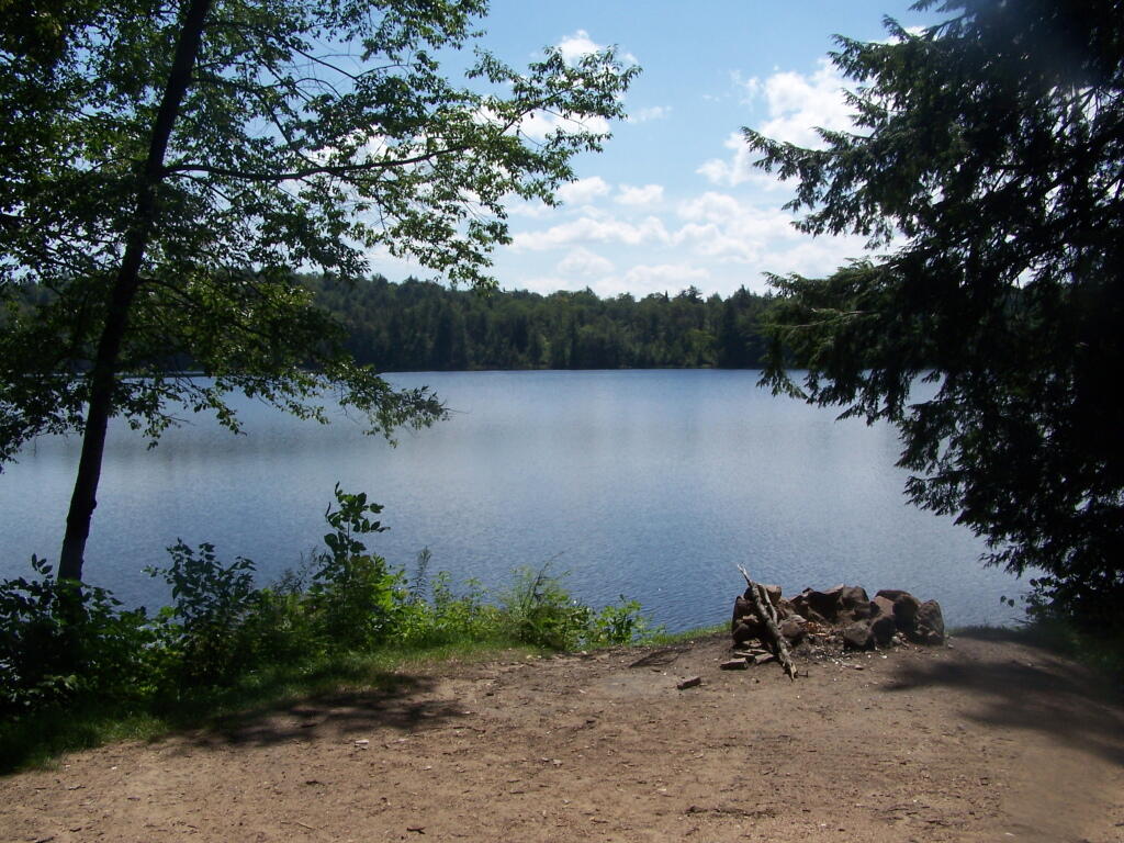
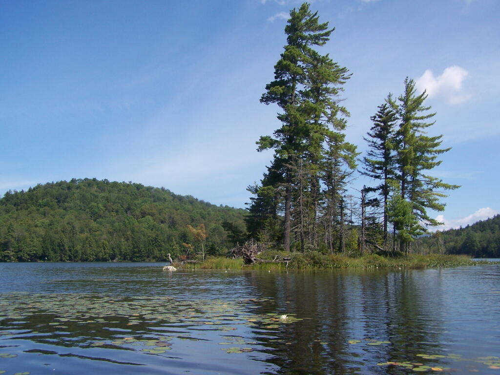
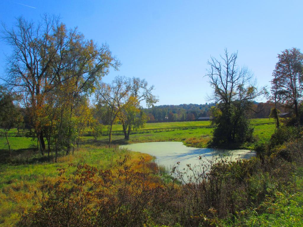
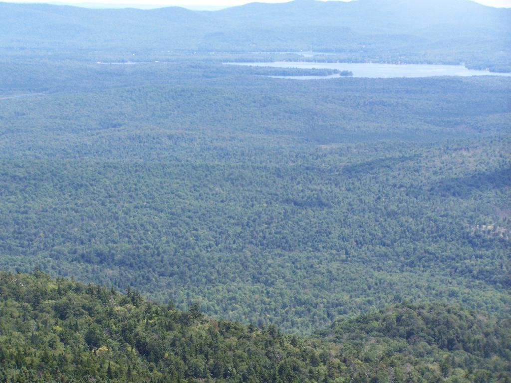
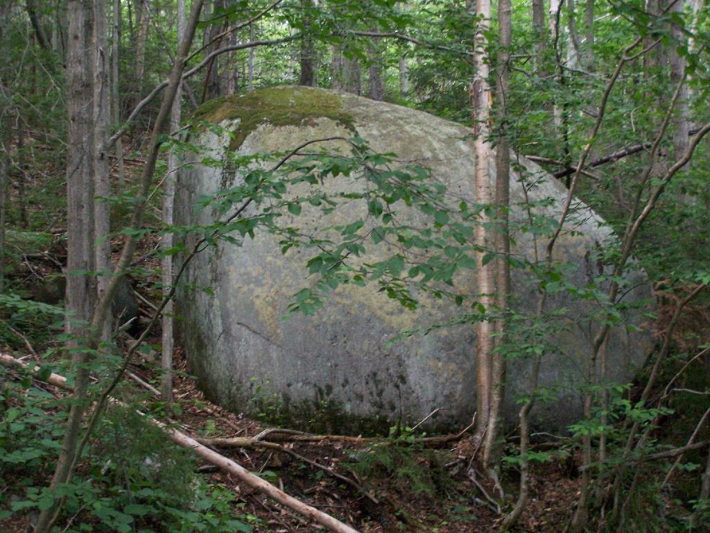
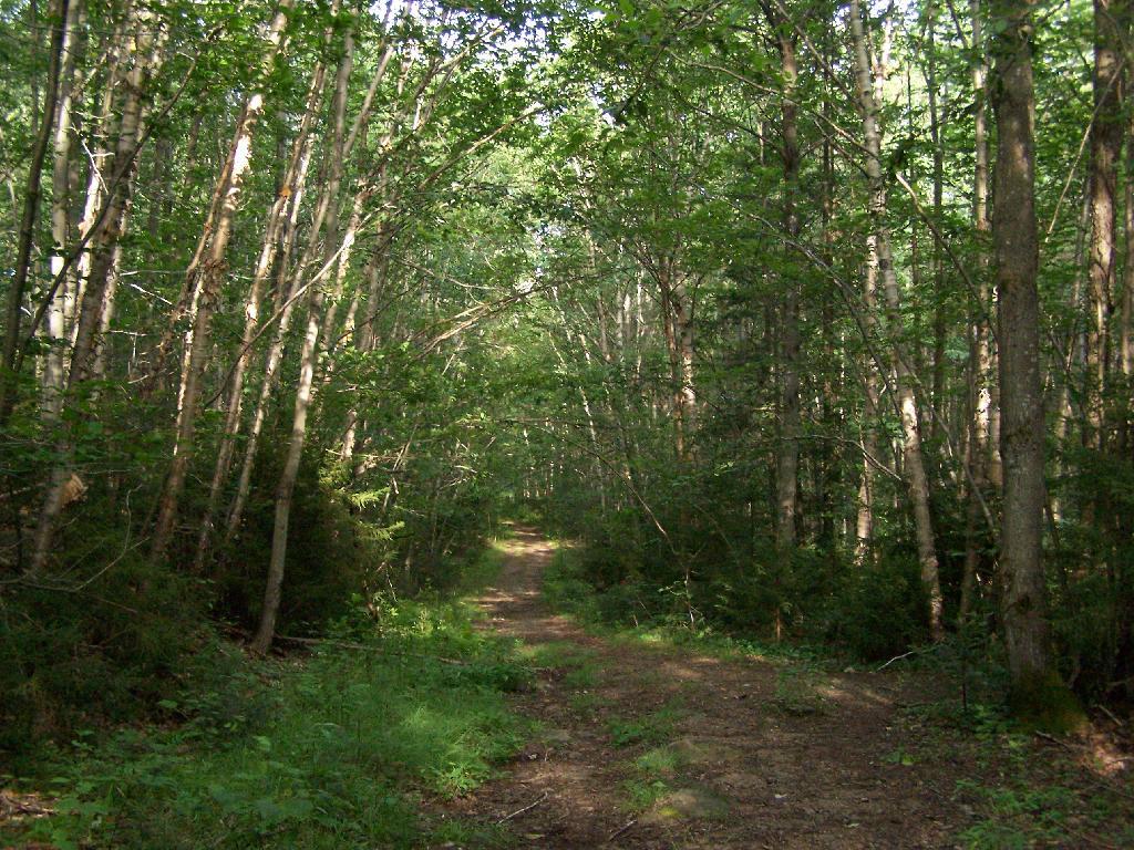
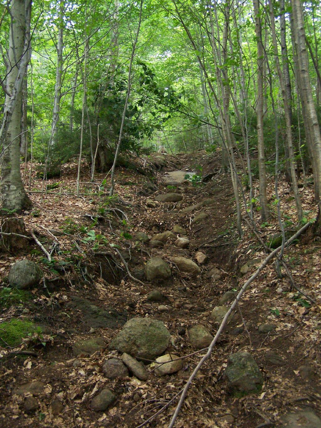
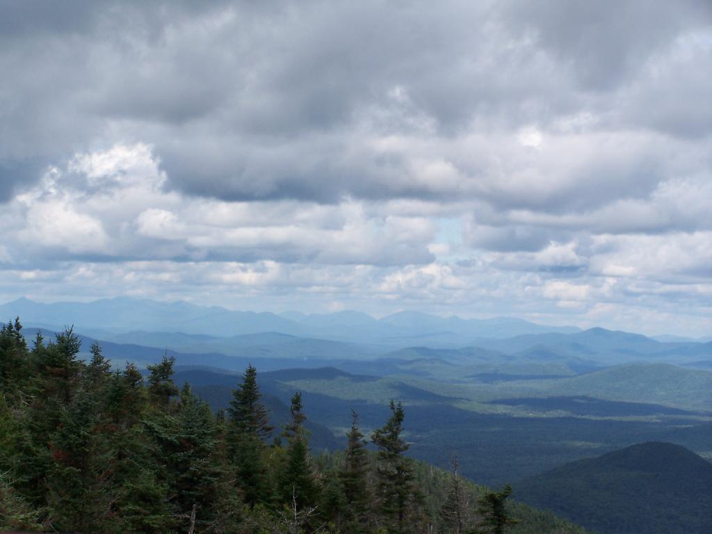
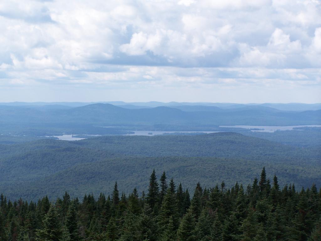
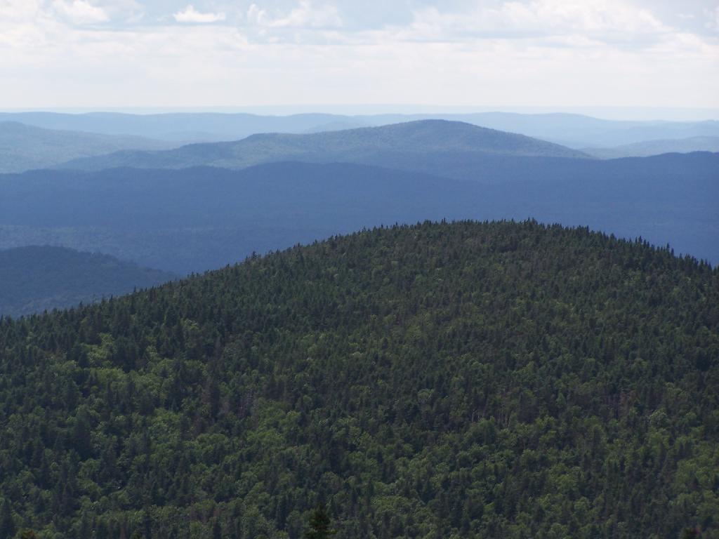
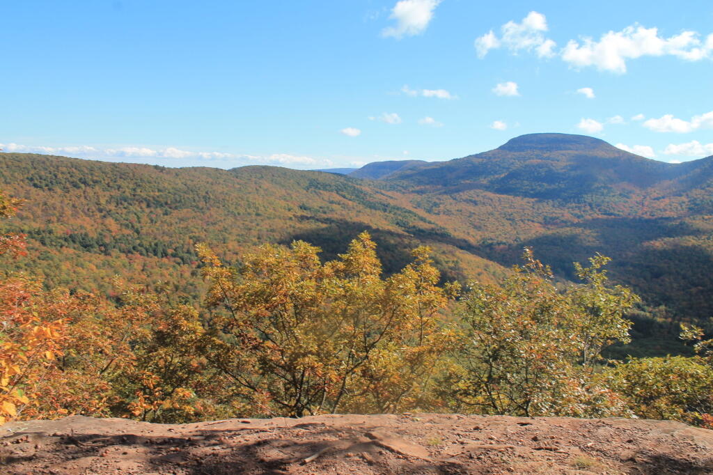
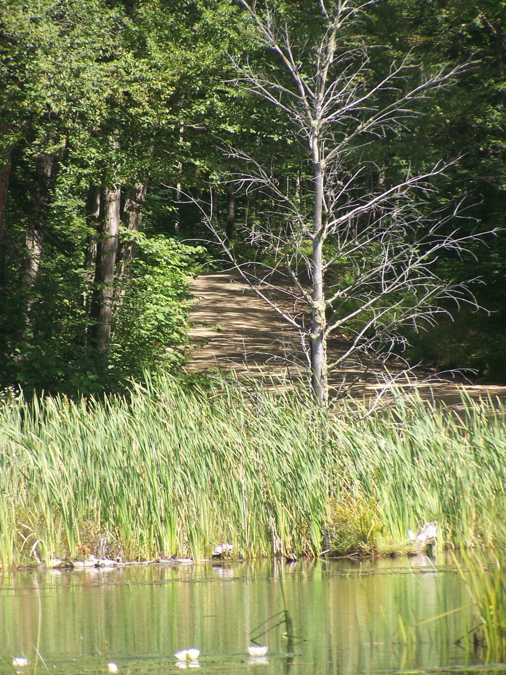
Jessup River Wild Forest is a parcel of lands surrounding the International Paper’s Perkins Clearing Timberlands and Speculator Tree Farm. There are about a dozen informal campsites along Mason Pond on Perkins Clearing Road that are popular, with about 6 of them with direct road access for a small vehicle like a pop-up trailer or a pickup truck with a cap. Only a few of the sites are clearly designated as such, but they all are very well used.

Cleaning Up Site

Significant noise pollution from NY 30 can be heard at some of the sites. There are no outhouses, although there are five gallon buckets people use for toilets. Besides the sites on Perkins Clearing Road in Jessup River Wild Forest, there are also eight designated road-side sites in International Paper Timberlands known as Perkins Clearing, just south of Jessup River Wild Forest.

Marsh and Pillsbury Mountain

The following changes are proposed in the Jessup River Wild Forest Unit Managemen Plan.

“Close Undesignated Campsites and /or Restrict Type of Camping. This alternative would propose the removal of user created primitive tent sites within 150 of water or road for environmental or social reasons. Camping structures would be restricted by regulation to “tents, tarps and lean-to’s as required by the APSLMP, thereby eliminating use of travel trailers, “pop-up” style campers, tent trailers, or structures of similar fashion. This option would eliminate opportunities for individuals seeking an easily accessible camping site close to a lake or road. Current regulations allow for camping anywhere in the JRWF as long as the 150 foot set back requirement is met. People would probably still park by the road and camp further in without any controls. This alternative would also restrict opportunities for mobility impaired individuals to access the lake and/or camp on JRWF lands. Therefore, this alternative will not be supported by this UMP.”

“The preferred alternative is to designate sites taking into consideration day use of the area, appropriate existing sites, APSLMP spacing guidelines, and terrain constraints. Because of their anticipated popularity, permits to stay for more than three nights will not be issued for sites in heavy demand during the core camping season. The camping areas at the northwest end of the lake will be closed due to conflicts with day users and environmental constraints. Other sites that are unsuitable or too close to the water will be closed and revegetated.”

“The closure of fourteen sites along with official designation of 10 suitable sites will reduce the amount of camping the area is currently experiencing. When all sites have been occupied, users will be directed to camp elsewhere. The opening of the adjacent IP lands to camping under the conservation easement will accommodate overflow camping. Use levels and site impacts will be closely monitored on the designated sites. If LAC standards are exceeded, the individual site will be closed and/or rehabilitated.”

β€” NYSDEC Jessup River Wild Forest UMP.

Confirmed Roadside Campsites.

Road Number of Campsites
Perkins Clearing Road
at Mason Lake
6 drive-in sites
4 tent sites

Maps.

Jessup River Road

Map of Jessup River Wild Forest. Inset is Perkins Clearing and Speculator Tree Farm Easements. Campsites do not appear on these maps, but they give a general overview of the area.

 Some Ice On The Hudson

Map of Perkins Clearing and Speculator Tree Farm. There are 10 campsites designated on these parcels, drive around to find them. Campsites do not appear on this map.

More Resources…

Campsite with a View

Another Island on Mason Lake

Pillsbury Mountain Firetower

Pillsbury Mountain Firetower is located at the edge of the Jessup River Wild Forest and the West Canada Wilderness. To reach there, you have to drive North of Spectulator, and take about 6 miles of fairly smooth logging roads through International Paper’s Perkins Clearing Easement.

Pillsbury Mountain Sign

Hiking Bridge Across Miami River. Not that th Miami River really deserves to be called a river, but on the trail up the Pillsbury Mountain, its particularly small.

Hiking Bridge Across Miami River

Taking the trail Up Pillsbury Mountain. It’s about two miles long, and not a difficult hike, although you do gain about 1200 in elevation.

Horse Farm Along the Trail

Broken Views Climbing Pillsbury

About a 1/4 mile before reaching the tower, reach marshy and thick boreal forest that the trail passes through, with some re-routes to avoid the muck kicked up over the years.

Often Muddy Trail Atop Pillsbury

Approaching Fire Tower.

Approaching Fire Tower

People Die Here. I kid you not, that’s what the cabin says when you first get here. Combined with the creepy fire tower top, it’s kind of neat.

People Die Here

Tower Cabin. That sure looks scary, doesn’t it? Now I understand why people die up here, probably with a secret DEC Forest Ranger, who hides up there, shooting at people he or she doesn’t like. Or maybe not.

Tower Cabin

Pillsbury Mountain Firetower

The tower is pretty conventional with normal looking landings, a rangers cabin, and a clearing for a helicopter to land in an emergency.

Landings

Fire Place and Clearing for Helicopter Landing

Old Rangers' Cabin

The views from the tower are quite great. Looking east thru the Jessup River Wild Forest.

East

Snowy Mountain to the North. If you look carefully, you can see the tower up top of it.

Snowy Mountain

South towards Lake Pleasant and Spectulator.

Lake Pleasant

Moose River Plans and West Canada Creek Wilderness from Pillsbury Mountain Fire Tower.

Moose River Plans and West Canada Creek Wilderness

North towards Cedar River Flow and Wakely Mountain. If you look carefully, you should be able to see the Wakely Mountain Firetower from here.

Towards Cedar River Flow

Map of the hike.


View Pillsbury Mountain in a larger map

Wakely Mountain Firetower

On the afternoon of Thursday July 22nd I hiked up to the Wakley Mountain Firetower. The weather wasn’t perfect, but it was still quite popular, passing several hikers and families visting this tower. The views are pretty good, but probably not as good as Pillsbury Mountain or Snowy Mountain to the south. The nice thing is it’s a 5 minute drive from Cedar River Flow and pretty close from Moose River Plans too, and provides a great overview of the Plains.

Camp Fire

You can print the above map, by clicking it, to be taken to a high resolution (500 DPI) that will print nicely on a laser or inkjet printer.

When you first start up the mountain, you pass a “Warning! Road Washed Out” sign. This sign is at the parking area for Wakely Mountain, to warn drivers that they won’t get very far on Wakely Mountain Road, since the DEC has basically abandoned it.

Warning! Road Washed Out

Washed Out Road to Wakely Mountain. I honestly don’t expect the DEC to fix this road, but instead will make people walk the entire 3 miles up the mountain, because that keeps the eco-facists happy.

Washed Out Road to Wakely Mountain

Washout on Wakely Road

The End of Wakely Road. That said, you’d be hard press to get a vehicle this far, due to the wash out at the earlier marsh.

The End of Wakely Road

As you climb, you pass this big boulder On side of Wakely.

Big Boulder On Side of Wakely

The first two miles of the trail are pretty flat, a small incline that increases above 400 feet in elevation over two miles.

Flatter Two Miles of Wakely Trail

Marsh Along Wakely Mountain Trail. That’s Payne Mountain, not Wakely Mountain in the background.

Marsh Along Wakely Mountain Trail

The Final Mile. You might think the previous two miles of the Wakely Mountain trail where easy, rising maybe 300 feet, until you hit the last mile, as indicated by this sign. It’s another 1200 feet on up for that last mile.

The Final Mile

The trail up Wakely Mountain is badly eroded due to heavy use and neglect by the DEC.

Badly Eroded Wakley Mountain Trail

The last mile up Wakely Mountain is a long one, especially if you start late in the afternoon as I did. You are treated with some limited views while climbing Wakely Mountain, but all and all, there isn’t a lot to see except steep trail (but no open rock face!).

Broken Views Climbing Wakely

Once you almost reach the top of the mountain, you come to the Wakely Mountain Helipad. This is used by emergency responders, providing quick access to the top of mountain, to either access the tower for observation, or to help those injured on top of the mountain.

Next to helipad is a trash pile. I was wondering how this trash ended up top of the mountain, but after thinking about it a bit, it probably was trash from the ranger’s cabin, that was dumped here some time in the past, and was dug up in the re-construction of the helipad.

Trash Pile Next to Helipad

Eventually you reach the fire tower, about a 500 feet from the Helipad. The Wakely Fire Tower is an interesting Aeromotor LS 25 tower, that originally lacked a staircase, but was added in the form of an internal ladder, for the convience of hikers and the fire warden alike. Prior to the 1919 addition of the “stairs tower within the fire tower”, you had to climb a ladder on the side of the tower, to get all 60 feet to the top of the tower.

Wakely Fire Tower Stairs Inside Tower

Here is the original ladder you had to climb. They removed the lower flights to discourage people from trying to use the ladder, although the stairs themselves also lack any safety fencing, so it’s a bit scary if your not used to climbing towers.

Tower within a Tower

A close up over the tower within the tower.

Wakely Fire Tower Stairs Inside Tower

The firetower presents one with spectular views of the upper Moose River Plains, from the marshy end of Cedar River Flow to the Lost Ponds area, to around Wakely Dam and Wakely Pond.

Plains from Firetower

To the east is the Blue Ridge Wilderness and Blue Mountain.

Blue Ridge and Blue Mountain

Looking down towards Indian Lake from the Fire Tower. There are many beautiful peaks to the south east.

Towards Indian Lake

You can also see the High Peaks from Wakley Mountain.

High Peaks from Wakley Mountain

And the Fulton Chain of Lakes.

Fulton Chain of Lakes

Cellar Mountain somewhat blocks the views to the west, as you look down to the plains, towards the ridges that follow along the NY 28 Corridor.

Cellar Mountain

The tower’s foundation sadly is in bad shape and needs work. The cabin of the tower is also only accessible via ladder, if your crazy enough to do that. It lacks safety fences on the various landings. Hopefully the state will find the funds and resources to restore this beautiful and popular tower, even though it’s likely to be expensive due to the need to use to Helicopter in supplies and possibly ironworkers to restore it.

Cracked Firetower Foundation

A Google Map of the hike…


View Wakely Mountain Firetower in a larger map

Peaks Over 3,000 Feet Elevation in New York State

There are 229 summits in New York State greater then 3,000 feet elevation.

Tallest Peak Summit Name Elevation County USGS Topo Map Name State Land Trail Location
1 Mount Marcy 5,344 Essex Mount Marcy High Peaks Wilderness NA 44.112733,
-73.9237833
2 Algonquin Peak 5,105 Essex North Elba High Peaks Wilderness Algonquin Trail 44.1436636,
-73.9865357
3 Mount Haystack 4,924 Essex Mount Marcy High Peaks Wilderness Haystack Trail Via Barklet Ridge 44.1056093,
-73.9004196
4 Mount Skylight 4,908 Essex Mount Marcy High Peaks Wilderness Skylight Trail 44.0994987,
-73.9306986
5 Basin Mountain 4,852 Essex Mount Marcy High Peaks Wilderness State Range Trail 44.1211639,
-73.8862527
6 Iroquois Peak 4,829 Essex North Elba High Peaks Wilderness Iroquois Herd Path Via Boundary Peak 44.1369973,
-73.9982027
7 Boundary Peak 4,826 Essex North Elba High Peaks Wilderness Iroquois Herd Path Via Boundary Peak 44.1397749,
-73.9937582
8 Whiteface Mountain 4,816 Essex Lake Placid Whiteface Mountain Ski Center Whiteface Landing To Whiteface Mtn. Trail 44.3658804,
-73.9026456
9 Dix Mountain 4,813 Essex Dix Mountain High Peaks Wilderness Elk Lake To Dix Mountain Trail 44.0822756,
-73.7862471
10 Gray Peak 4,800 Essex Mount Marcy High Peaks Wilderness Mount Marcy Trail Via Opalescent River 44.1114427,
-73.9348658
11 Schofield Cobble 4,744 Essex Mount Marcy High Peaks Wilderness NA 44.1089427,
-73.9270876
12 Little Marcy 4,728 Essex Mount Marcy High Peaks Wilderness Van Hoevenberg Trail To Marcy 44.1197753,
-73.910976
13 Gothics 4,724 Essex Keene Valley High Peaks Wilderness Beaver Meadow Falls Trail 44.1281079,
-73.8570849
14 Mount Colden 4,708 Essex North Elba High Peaks Wilderness Mount Colden Via Lake Arnold 44.1269976,
-73.9598674
15 Beck-horn 4,695 Essex Dix Mountain High Peaks Wilderness Elk Lake To Dix Mountain Trail 44.0800534,
-73.7845802
16 Little Haystack 4,678 Essex Mount Marcy High Peaks Wilderness Haystack Trail Via Slant Rock 44.1103313,
-73.9004197
17 Giant Mountain 4,623 Essex Rocky Peak Ridge Giant Mountain Wilderness North Trail To Giant Mtn. 44.161165,
-73.720279
18 Mount Redfield 4,603 Essex Mount Marcy High Peaks Wilderness Mt Redfield Trail 44.094777,
-73.949866
19 Santanoni Peak 4,596 Essex Santanoni Peak High Peaks Wilderness Bradley Pond Trail 44.0822811,
-74.1309855
20 Wright Peak 4,564 Essex North Elba High Peaks Wilderness Wright Peak Spur Trail 44.1517187,
-73.9801468
21 Nippletop 4,554 Essex Dix Mountain High Peaks Wilderness Nipple Top Trail 44.0892202,
-73.8159708
22 Saddleback Mountain 4,534 Essex North Elba High Peaks Wilderness State Range Trail 44.1264414,
-73.8748634
23 Panther Peak 4,455 Essex Santanoni Peak High Peaks Wilderness Bradley Pond Trail 44.0983915,
-74.132097
24 Rocky Peak 4,403 Essex Rocky Peak Ridge Giant Mountain Wilderness East Trail To Giant Mtn. Via Rocky Peak Ridge 44.1542177,
-73.7051718
25 Macomb Mountain 4,396 Essex Dix Mountain High Peaks Wilderness Macomb-E. Dix Trail 44.0517211,
-73.7801349
26 Hough Peak 4,393 Essex Dix Mountain High Peaks Wilderness S. Dix-Hough Trail 44.0694981,
-73.7776352
27 Mount Marshall 4,380 Essex Street Mountain High Peaks Wilderness Mt Marshall Trail 44.1275538,
-74.0118142
28 Armstrong Mountain 4,360 Essex Keene Valley High Peaks Wilderness Adk Range Trail 44.1347741,
-73.8490291
29 Seward Mountain 4,327 Franklin Ampersand Lake High Peaks Wilderness Seymour Mountain Herd Path 44.1597799,
-74.1993239
30 Allen Mountain 4,321 Essex Mount Marcy High Peaks Wilderness Mt Redfield Trail 44.0708892,
-73.9395871
31 Table Top Mountain 4,295 Essex North Elba High Peaks Wilderness Table Top Mountain Trail 44.143663,
-73.9070876
32 Big Slide Mountain 4,232 Essex Keene Valley High Peaks Wilderness Big Slide Trail 44.1822721,
-73.8704202
33 Esther Mountain 4,232 Essex Franklin Falls Wilmington Wild Forest Esther Mt Trail 44.3869916,
-73.8898673
34 MacIntyre Mountains 4,193 Essex Street Mountain High Peaks Wilderness Mt Marshall Trail 44.1308868,
-74.008203
35 Lower Wolfjaw Mountain 4,190 Essex Keene Valley High Peaks Wilderness W.a. White Trail 44.1483845,
-73.8326399
36 Upper Wolfjaw Mountain 4,190 Essex Keene Valley High Peaks Wilderness Adk Range Trail 44.1406072,
-73.8451402
37 Slide Mountain 4,167 Ulster Peekamoose Mountain Slide Mountain Wilderness Burroughs Range Trail-Wittenberg-Cornell 41.9987034,
-74.3862617
38 Phelps Mountain 4,137 Essex North Elba High Peaks Wilderness Phelps Mtn. Trail 44.1569957,
-73.9209775
39 Cascade Mountain 4,094 Essex Keene Valley High Peaks Wilderness Casade Mountain Trail 44.2186594,
-73.860143
40 South Dix 4,088 Essex Dix Mountain High Peaks Wilderness Macomb-E. Dix Trail 44.060054,
-73.7743014
41 Lookout Mountain 4,078 Essex Franklin Falls Whiteface Mountain Ski Center Esther Mt Trail 44.3778249,
-73.887645
42 Donaldson Mountain 4,062 Franklin Ampersand Lake High Peaks Wilderness Seymour Mountain Herd Path 44.1539471,
-74.210991
43 Seymour Mountain 4,055 Franklin Ampersand Lake High Peaks Wilderness Seymour Mountain Herd Path 44.1578347,
-74.1721003
44 Colvin Range 4,049 Essex Dix Mountain High Peaks Wilderness Colvin Trail 44.0939424,
-73.8345829
45 Mount Colvin 4,049 Essex Dix Mountain High Peaks Wilderness Colvin Trail 44.0939424,
-73.8345829
46 Hunter Mountain 4,045 Greene Hunter Hunter-West Kill Wilderness Spruceton Trail 42.1778662,
-74.2304216
47 Mount Emmons 4,022 Franklin Ampersand Lake High Peaks Wilderness Northville-Placid Trail 44.1436698,
-74.2140464
48 Street Mountain 4,022 Essex Street Mountain High Peaks Wilderness Street Mountain Trail 44.1797741,
-74.0437616
49 Grace Peak 4,006 Essex Dix Mountain High Peaks Wilderness Macomb-E. Dix Trail 44.0653314,
-73.7573564
50 Yard Mountain 3,999 Essex North Elba High Peaks Wilderness Big Slide Trail Via Yard Mtn. 44.1747725,
-73.8845874
51 MacNaughton Mountain 3,983 Essex Street Mountain High Peaks Wilderness Wall Face Ponds Trail 44.1397768,
-74.064317
52 Dial Mountain 3,980 Essex Dix Mountain High Peaks Wilderness Leach Trail 44.1058859,
-73.7959703
53 Blake Peak 3,976 Essex Dix Mountain High Peaks Wilderness Pinnacle Trail 44.081443,
-73.844583
54 Green Mountain 3,976 Essex Rocky Peak Ridge Giant Mountain Wilderness North Trail To Giant Mtn. 44.182272,
-73.714858
55 Black Dome 3,973 Greene Freehold Windham-Blackhead Range Wilderness Blackhead Range Trail 42.2700864,
-74.1226382
56 Thomas Cole Mountain 3,944 Greene Hensonville Windham-Blackhead Range Wilderness Blackhead Range Trail 42.2709196,
-74.1365275
57 Cliff Mountain 3,940 Essex Mount Marcy High Peaks Wilderness Mount Marcy Trail Via Opalescent River 44.1031102,
-73.9751452
58 McDonnel Mountain 3,940 Essex Mount Marcy High Peaks Wilderness Mt Redfield Trail 44.0803332,
-73.9340315
59 Blackhead 3,930 Greene Freehold Windham-Blackhead Range Wilderness Blackhead Mountain Spur Trail 42.2678644,
-74.1045818
60 West Kill Mountain 3,891 Greene Lexington Hunter-West Kill Wilderness Devil’s Path 42.1678663,
-74.2895904
61 Doubletop Mountain 3,875 Ulster Seager NA Seager Big Indian Trail 42.0275913,
-74.5282095
62 Nye Mountain 3,871 Essex Street Mountain High Peaks Wilderness Nye Mountain Trail 44.1931062,
-74.0240387
63 Kilburn Mountain 3,868 Essex Lake Placid Sentinel Range Wilderness Copperas Owen Pond Trl 44.3028247,
-73.8818114
64 Moose Mountain 3,868 Essex McKenzie Mountain Mckenzie Mountain Wilderness Mckenzie Mtn. Trail 44.3506029,
-74.0032049
65 Howard Mountain 3,852 Essex North Elba High Peaks Wilderness Klondike Notch Trail 44.1583844,
-73.8912539
66 Cornell Mountain 3,848 Ulster Phoenicia Slide Mountain Wilderness Burroughs Range Trail-Wittenberg-Cornell 42.0014812,
-74.3568163
67 Graham Mountain 3,848 Ulster Seager NA Seager Big Indian Trail 42.0392576,
-74.5495986
68 Plateau Mountain 3,845 Greene Hunter Indian Head Wilderness Devil’s Path 42.1378671,
-74.1743088
69 McKenzie Mountain 3,842 Essex McKenzie Mountain Mckenzie Mountain Wilderness Mckenzie Mtn. Trail 44.3361593,
-74.0320951
70 Rist Mountain 3,839 Essex Mount Marcy High Peaks Wilderness Boreas Road 44.027559,
-73.987366
71 Sentinel Mountain 3,835 Essex Keene Sentinel Range Wilderness Winch Pond 44.3061581,
-73.8523658
72 Lyon Mountain 3,829 Clinton Moffitsville Chazy Highlands Wild Forest New Lyon Mountain Trail 44.7036537,
-73.8645877
73 T R Mountain 3,829 Essex North Elba High Peaks Wilderness Lake Arnold Crossover 44.143941,
-73.9354222
74 Snowy Mountain 3,825 Hamilton Snowy Mountain NA Snowy Mt 43.7003432,
-74.3859856
75 Table Mountain 3,819 Ulster Peekamoose Mountain Slide Mountain Wilderness Peekamoose-Table Trail 41.9587036,
-74.4048739
76 Peekamoose Mountain 3,812 Ulster Peekamoose Mountain Slide Mountain Wilderness Peekamoose-Table Trail 41.9531481,
-74.398207
77 Avalanche Mountain 3,809 Essex North Elba High Peaks Wilderness Avalanche Pass Trail 44.1361639,
-73.9695903
78 Averill Peak 3,806 Clinton Lyon Mountain Chazy Highlands Wild Forest New Lyon Mountain Trail 44.6928208,
-73.8809768
79 Sugarloaf Mountain 3,806 Greene Hunter Indian Head Wilderness Devil’s Path 42.1312006,
-74.1501414
80 Couchsachraga Peak 3,793 Essex Santanoni Peak High Peaks Wilderness Cold River Horse Trail 44.0956146,
-74.1601539
81 Boreas Mountain 3,779 Essex Mount Marcy NA Gulf Brook Road 44.0031138,
-73.8806937
82 Wittenberg Mountain 3,766 Ulster Phoenicia Slide Mountain Wilderness Burroughs Range Trail-Wittenberg-Cornell 42.0081478,
-74.3473716
83 Panther Mountain 3,763 Hamilton Snowy Mountain NA Snowy Mt 43.7367317,
-74.3907093
84 Burroughs Range 3,760 Ulster Phoenicia Slide Mountain Wilderness Burroughs Range Trail-Wittenberg-Cornell 42.0084255,
-74.3476494
85 Blue Mountain 3,750 Hamilton Blue Mountain Lake Blue Mountain Wild Forest Blue Mountain Trail 43.8725634,
-74.4009917
86 Porter Mountain 3,750 Essex Keene Valley High Peaks Wilderness Porter Mountain Trail Via Marcy Field 44.2153262,
-73.8434754
87 Wakely Mountain 3,750 Hamilton Wakely Mountain Wakely Mountain Primitive Area Wakely Mountain Trail 43.7358986,
-74.5151595
88 Little Nippletop 3,720 Essex Mount Marcy High Peaks Wilderness Elk Lake To Marcy Trail 44.0853327,
-73.9201422
89 Wallface Mountain 3,720 Essex Street Mountain High Peaks Wilderness Indian Pass Trail 44.1378317,
-74.0365378
90 Panther Mountain 3,714 Ulster Shandaken Slide Mountain Wilderness Giant Ledge-Panther Mountian-Fox Hollow Trail 42.0564799,
-74.3945946
91 Balsam Lake Mountain 3,707 Ulster Seager Balsam Lake Mountain Wild Forest Balsam Lake Mountain Trail 42.0459236,
-74.5940438
92 Henderson Mountain 3,707 Essex Mount Adams High Peaks Wilderness Bradley Pond Trail 44.0978353,
-74.0976509
93 Hoffman Mountain 3,701 Essex Blue Ridge Hoffman Notch Wilderness Hoffman Notch Trail 43.9114489,
-73.8168
94 Lone Mountain 3,697 Ulster Peekamoose Mountain Slide Mountain Wilderness Peekamoose-Table Trail 41.9692592,
-74.3893177
95 Big Indian Mountain 3,694 Ulster Shandaken Big Indian Wilderness Pine Hill West Branch Trail 42.0350915,
-74.4965421
96 Hurricane Mountain 3,688 Essex Rocky Peak Ridge Hurricane Mountain Wilderness East Hurricane Mtn Trial 44.235326,
-73.7106926
97 Friday Mountain 3,681 Ulster West Shokan Slide Mountain Wilderness Burroughs Range Trail-Wittenberg-Cornell 41.9875924,
-74.3620944
98 Rusk Mountain 3,678 Greene Lexington Rusk Mountain Wild Forest Spruceton Trail 42.2006434,
-74.2770897
99 Cheney Cobble 3,674 Essex Mount Marcy High Peaks Wilderness East River Trail 44.0445021,
-73.9648654
100 Lewey Mountain 3,665 Hamilton Snowy Mountain West Canada Lake Wilderness Sucker Brook Trail 43.6642328,
-74.4412649
101 Seward Mountains 3,665 Franklin Ampersand Lake High Peaks Wilderness Calkins Creek Truck Trail 44.1561694,
-74.2148801
102 Santanoni Mountains 3,661 Essex Santanoni Peak High Peaks Wilderness Bradley Pond Trail 44.0881144,
-74.138486
103 Buell Mountain 3,652 Hamilton Snowy Mountain NA Snowy Mt 43.7161764,
-74.4065426
104 High Peak 3,645 Greene Kaaterskill Clove Kaaterskill Wild Forest Kaaterskill High Peak Trail 42.1620334,
-74.0801381
105 Little Whiteface Mountain 3,638 Essex Lake Placid Whiteface Mountain Ski Center Whiteface Landing To Whiteface Mtn. Trail 44.3558804,
-73.891534
106 Burtons Peak 3,632 Essex Keene Valley NA The Brothers Trail 44.1925,
-73.8586111
107 Fir Mountain 3,629 Ulster Shandaken Big Indian Wilderness Pine Hill West Branch Trail 42.0275916,
-74.4690414
108 Twin Mountain 3,629 Greene Hunter Indian Head Wilderness Devil’s Path 42.1256453,
-74.1290294
109 Little Moose Mountain 3,609 Hamilton Wakely Mountain Little Moose Wilderness Otter Brook Trail 43.6700663,
-74.5707151
110 Balsam Mountain 3,606 Ulster Shandaken Big Indian Wilderness Pine Hill West Branch Trail 42.0909235,
-74.4882082
111 Calamity Mountain 3,606 Essex Mount Adams High Peaks Wilderness Calamity Brook Trail 44.1028328,
-74.0043132
112 Sunrise Mountain 3,606 Essex Dix Mountain High Peaks Wilderness Elk Lake To Dix Mountain Trail 44.0247778,
-73.7904124
113 Balsam Cap 3,602 Ulster West Shokan Slide Mountain Wilderness Burroughs Range Trail-Wittenberg-Cornell 41.9770369,
-74.3573722
114 Stewart Mountain 3,602 Essex Keene Sentinel Range Wilderness Winch Pond 44.3261581,
-73.8562549
115 North Dome 3,596 Greene Lexington Hunter-West Kill Wilderness Devil’s Path 42.1734217,
-74.3490366
116 Pillsbury Mountain 3,589 Hamilton Spruce Lake West Canada Lake Wilderness Pillsbury Mountain Trail 43.580901,
-74.5120992
117 Slide Mountain 3,586 Essex Lake Placid Sentinel Range Wilderness Barkeater Cliffs Campsite Trail 44.2767136,
-73.8862561
118 Eagle Mountain 3,573 Ulster Seager Big Indian Wilderness Pine Hill West Branch Trail 42.0620352,
-74.50932
119 Dun Brook Mountain 3,563 Hamilton Dun Brook Mountain NA Deer Pond Road 43.890897,
-74.3187666
120 Saddleback Mountain 3,560 Essex Jay Mountain Jay Mountain Wilderness Jay Mountain Trail 44.2953258,
-73.6676367
121 Indian Head Mountain 3,553 Greene Woodstock Indian Head Wilderness Devil’s Path 42.116201,
-74.1145846
122 Fishing Brook Mountain 3,550 Essex Dun Brook Mountain Blue Mountain Wild Forest Deer Pond Road 43.9342303,
-74.2946002
123 Mount Sherrill 3,550 Greene Lexington Hunter-West Kill Wilderness Devil’s Path 42.1756439,
-74.3729262
124 Gooseberry Mountain 3,540 Essex Keene Valley High Peaks Wilderness Orebed Brook Trail 44.1367187,
-73.8731969
125 Bearpen Mountain 3,530 Delaware Prattsville Bearpen Mountain State Forest Access Trail 42.2734189,
-74.4840396
126 Vly Mountain 3,530 Greene West Kill Bearpen Mountain State Forest Snowmobile Trail 42.2453645,
-74.4459834
127 Windham High Peak 3,527 Greene Hensonville Windham-Blackhead Range Wilderness Escarpment Trail 42.3148069,
-74.1434718
128 Halcott Mountain 3,524 Greene West Kill Halcott Mountain Wild Forest Condon Hollow Rd. 42.1800882,
-74.4379281
129 Mount Adams 3,520 Essex Mount Adams High Peaks Wilderness Mt Adams Trail 44.0867231,
-74.0257027
130 Pitchoff Mountain 3,501 Essex North Elba Sentinel Range Wilderness Pitchoff Mountain Trail 44.2375474,
-73.8776443
131 Noonmark Mountain 3,491 Essex Keene Valley High Peaks Wilderness Stimson Trail 44.1289404,
-73.7720809
132 Rocky Mountain 3,478 Ulster West Shokan Slide Mountain Wilderness Peekamoose-Table Trail 41.9728703,
-74.3726505
133 Little Santanoni Mountain 3,471 Essex Santanoni Peak High Peaks Wilderness Moose Pond Horse Trail 44.0731156,
-74.1670981
134 Spotted Mountain 3,461 Essex Underwood High Peaks Wilderness Macomb-E. Dix Trail 44.0769975,
-73.7440228
135 Manbury Mountain 3,455 Hamilton Wakely Mountain Little Moose Wilderness Otter Brook Trail 43.6653442,
-74.5532143
136 Blue Ridge Mountain 3,451 Essex Blue Ridge Hoffman Notch Wilderness Hoffman Notch Trail 43.9247817,
-73.8148558
137 Roundtop 3,451 Delaware Prattsville Bearpen Mountain State Forest Ski Run Road 42.2939737,
-74.4904283
138 Roundtop Mountain 3,451 Greene Kaaterskill Clove Kaaterskill Wild Forest Kaaterskill High Peak Trail 42.1684222,
-74.094583
139 Olderbark Mountain 3,438 Greene Bearsville Indian Head Wilderness Mink Hollow Trail 42.1142565,
-74.1909765
140 Puffer Mountain 3,438 Hamilton Bullhead Mountain Siamese Ponds Wilderness Puffer Pond Brook Trail 43.6617318,
-74.1993082
141 Morgan Mountain 3,432 Essex Wilmington Wilmington Wild Forest Cooper Kill Trail 44.4186582,
-73.8593108
142 Wolf Pond Mountain 3,425 Essex Cheney Pond NA Gulf Brook Road 43.9892253,
-73.8781933
143 Stoppel Point 3,422 Greene Kaaterskill Clove Windham-Blackhead Range Wilderness Escarpment Trail 42.2250879,
-74.0651364
144 Huntersfield Mountain 3,419 Greene Ashland Huntersfield State Forest Huntersfield Access Trail #8/Long Path Access 42.355638,
-74.3465339
145 Cellar Mountain 3,405 Hamilton Wakely Mountain Moose River Plains Wild Forest Cellar Pond Trail 43.7122879,
-74.5429375
146 Haynes Mountain 3,405 Ulster Seager Big Indian Wilderness Pine Hill West Branch Trail 42.0792571,
-74.5079309
147 Sawtooth Mountains 3,402 Franklin Street Mountain High Peaks Wilderness Northville-Placid Trail 44.1928314,
-74.1134874
148 Bear Den Mountain 3,389 Essex Dix Mountain High Peaks Wilderness Leach Trail 44.1194964,
-73.792915
149 Pinnacle 3,389 Essex Dix Mountain High Peaks Wilderness Pinnacle Trail Spur To Summit 44.0583887,
-73.8640277
150 Vanderwhacker Mountain 3,389 Essex Vanderwhacker Mountain Vanderwhacker Mountain Wild Forest Vanderwhacker Firetower Trail 43.8983963,
-74.0959781
151 Jay Mountain 3,379 Essex Jay Mountain Jay Mountain Wilderness Jay Mountain Trail 44.3125477,
-73.685693
152 Spruce Top 3,379 Greene Hunter NA Devil’s Path 42.1506447,
-74.1679195
153 Spruce Mountain 3,376 Ulster Shandaken Big Indian Wilderness Phoenicia East Branch Trail 42.0175919,
-74.4498744
154 Belle Ayr Mountain 3,373 Ulster Shandaken Belleayre Mountain Ski Center NA 42.1159229,
-74.4979304
155 Evergreen Mountain 3,369 Greene Lexington Rusk Mountain Wild Forest Devil’s Path 42.2117542,
-74.3079238
156 Hedgehog Mountain 3,366 Essex Keene Valley High Peaks Wilderness Rooster Comb And Hedgehog Trail 44.159495,
-73.8109724
157 Balsam Mountain 3,353 Greene West Kill Hunter-West Kill Wilderness Condon Hollow Rd. 42.1836992,
-74.387371
158 Kempshall Mountain 3,350 Hamilton Kempshall Mountain High Peaks Wilderness Northville-Placid Trail 44.0236734,
-74.3271041
159 Buck Mountain 3,346 Hamilton Snowy Mountain West Canada Lake Wilderness Snowy Mt 43.6947879,
-74.4368212
160 Mount Pisgah 3,340 Delaware Margaretville NA Mountain Brook Road 42.2211973,
-74.7357125
161 MacDonough Mountain 3,320 Essex Jay Mountain Jay Mountain Wilderness Jay Mountain Trail 44.3050482,
-73.644025
162 Debar Mountain 3,317 Franklin Debar Mountain Debar Mountain Wild Forest Debar Mountain Trail 44.6033852,
-74.2204351
163 Bullhead Mountain 3,314 Warren Bullhead Mountain Siamese Ponds Wilderness John Pond Crossover Trail 43.7017316,
-74.1804199
164 Laramore Mountain 3,314 Essex Keene Valley High Peaks Wilderness Casade Mountain Trail 44.2258813,
-73.8501427
165 Tripod Mountain 3,307 Essex Rocky Peak Ridge Giant Mountain Wilderness Hopkin Via Direct Trail 44.1983824,
-73.736248
166 Metcalf Mountain 3,304 Hamilton Blue Mountain Lake Blue Ridge Wilderness Gould Road 43.7522873,
-74.4957146
167 Wyman Mountain 3,304 Essex Underwood High Peaks Wilderness Macomb-E. Dix Trail 44.0581093,
-73.7445779
168 Jay Mountains 3,297 Essex Jay Mountain Jay Mountain Wilderness Jay Mountain Trail 44.308659,
-73.6704147
169 Eleventh Mountain 3,294 Warren Bakers Mills Siamese Ponds Wilderness Bog Meadow Trail 43.6142322,
-74.0720783
170 Schultice Mountain 3,284 Delaware Roxbury NA Ski Run Road 42.3186948,
-74.5157062
171 Cellar Mountain 3,281 Hamilton Snowy Mountain West Canada Lake Wilderness Sucker Brook Trail 43.6411776,
-74.4443199
172 Plattekill Mountain 3,268 Delaware Hobart Plattekill State Forest Mountain Brook/ Harold Roberts Access Trail 42.2667522,
-74.6482102
173 South Pond Mountain 3,258 Hamilton South Pond Mountain Siamese Ponds Wilderness County Line Brook Trail 43.5900656,
-74.2204175
174 Hemlock Mountain 3,248 Ulster Shandaken Big Indian Wilderness Phoenicia East Branch Trail 42.0128698,
-74.4390407
175 Peaked Mountain 3,235 Essex Jay Mountain Hurricane Mountain Wilderness Soda Range Trail 44.2656034,
-73.6993039
176 Onteora Mountain 3,232 Greene Hunter NA Blackhead Range Trail 42.2223098,
-74.1679184
177 Kitty Cobble 3,225 Hamilton Wakely Mountain West Canada Lake Wilderness Otter Brook Trail 43.6295111,
-74.6229377
178 Baldwin Hill 3,218 Essex Franklin Falls Mckenzie Mountain Wilderness Esther Mt Trail 44.3847694,
-73.9195905
179 Richmond Mountain 3,218 Greene Ashland Mount Pisgah State Forest Long Path Hiking Trail 42.367582,
-74.270976
180 Squaw Mountain 3,218 Hamilton Indian Lake NA Snowy Mt 43.7270094,
-74.3420956
181 Dug Mountain 3,215 Hamilton Kunjamuk River NA Long Pond Trail 43.583122,
-74.345146
182 Hamilton Mountain 3,215 Hamilton Wells Silver Lake Wilderness West River Road 43.412013,
-74.3673645
183 Mount Alton 3,212 Essex Lake Placid Mckenzie Mountain Wilderness Whiteface Mountain Trail 44.3717139,
-73.9662589
184 Utsayantha Mountain 3,209 Delaware Stamford NA Ward Allen Road 42.3992472,
-74.5895953
185 Van Wyck Mountain 3,202 Ulster Peekamoose Mountain Slide Mountain Wilderness Phoenicia East Branch Trail 41.9523147,
-74.4354304
186 Colonels Chair 3,199 Greene Hunter NA Colonel’s Chair Trail 42.2006434,
-74.2306991
187 Gore Mountain 3,199 Warren Gore Mountain Gore Mountain Ski Center Schaefer Trail 43.6764539,
-74.035134
188 Chase Mountain 3,192 Essex Rocky Peak Ridge Hurricane Mountain Wilderness North Hurricane Trail 44.2417145,
-73.7248599
189 Knob Lock Mountain 3,192 Essex Rocky Peak Ridge Giant Mountain Wilderness Hurricane Trail From 9n 44.2003271,
-73.7073583
190 McGregor Mountain 3,192 Delaware Stamford Stamford Fp Detached Parcel Relay Public Forest Access Road 42.3900808,
-74.5790396
191 Weston Mountain 3,192 Essex Jay Mountain Hurricane Mountain Wilderness Soda Range Trail 44.2642144,
-73.7079152
192 Burnt Knob 3,189 Greene Freehold Windham-Blackhead Range Wilderness Escarpment Trail 42.3020297,
-74.1190264
193 Burgess Mountain 3,189 Hamilton Rock Lake NA Bear Trap Brook Trail 43.7520092,
-74.3565416
194 North Mountain 3,186 Greene Kaaterskill Clove Windham-Blackhead Range Wilderness Escarpment Trail 42.2175881,
-74.0487469
195 Payne Mountain 3,182 Hamilton Snowy Mountain Moose River Plains Wild Forest Northville-Placid Trail 43.7231211,
-74.4951582
196 Hopkins Mountain 3,169 Essex Rocky Peak Ridge Giant Mountain Wilderness Hopkins Mtn. Via Spread Eagle Mtn. 44.1833828,
-73.7490257
197 Spruce Lake Mountain 3,163 Hamilton Spruce Lake Mountain West Canada Lake Wilderness Northville-Placid Trail 43.5120126,
-74.6532121
198 Tongue Mountain 3,159 Hamilton Dun Brook Mountain NA Northville-Placid Trail 43.9114522,
-74.3454349
199 Catamount Mountain 3,153 Clinton Wilmington Taylor Pond Wild Forest Catamount Trail 44.459214,
-73.8723668
200 Wildcat Mountain 3,153 Ulster Peekamoose Mountain Slide Mountain Wilderness Pine Hill West Branch Trail 41.9775924,
-74.4759867
201 White Man Mountain 3,146 Delaware Roxbury NA Access Trail 42.2845295,
-74.5340406
202 Bradley Mountain 3,140 Hamilton Wakely Mountain Blue Ridge Wilderness Cellar Pond Trail 43.7378431,
-74.5546055
203 Overlook Mountain 3,136 Ulster Woodstock Overlook Mountain Wild Forest Firetower Spur 42.0850905,
-74.0931954
204 Mount Tamarac 3,127 Essex McKenzie Mountain Mckenzie Mountain Wilderness Jackrabbit Trail 44.3267144,
-74.0204281
205 Mount Morris 3,117 Franklin Tupper Lake NA Goodman Mountain Trail 44.1595046,
-74.475168
206 Acra Point 3,110 Greene Freehold Windham-Blackhead Range Wilderness Escarpment Trail 42.2964745,
-74.0998591
207 Round Mountain 3,107 Essex Keene Valley High Peaks Wilderness Weston Trail Spur To Round Mt 44.1317179,
-73.7515245
208 Cave Mountain 3,104 Greene Hensonville Elm Ridge Wild Forest North Face Trail 42.2859185,
-74.2462543
209 Pete Gay Mountain 3,097 Warren Gore Mountain NA Schaefer Trail 43.6903427,
-74.0443015
210 Plattekill Mountain 3,091 Greene Woodstock Indian Head Wilderness Overlook Trail 42.1073123,
-74.0865281
211 Mount Andrew 3,081 Essex Mount Adams High Peaks Wilderness Bradley Pond Trail 44.0564482,
-74.093483
212 County Line Mountain 3,081 Hamilton South Pond Mountain Siamese Ponds Wilderness Siamese Ponds Trail 43.6114543,
-74.2006952
213 High Point 3,074 Ulster West Shokan Sundown Wild Forest Ashokan High Point 41.9248149,
-74.2879263
214 Rose Mountain 3,074 Ulster West Kill NA Rochester Hollow 42.1506445,
-74.4379284
215 Cowan Mountain 3,068 Delaware Hobart NA Relay Public Forest Access Road 42.3450825,
-74.6498756
216 Round Top 3,068 Delaware Hobart Plattekill State Forest Mountain Brook/ Harold Roberts Access Trail 42.2714741,
-74.6832109
217 Churchill Mountain 3,064 Delaware Stamford NA Relay Public Forest Access Road 42.388692,
-74.6098738
218 Irish Mountain 3,064 Delaware Roxbury NA Ski Run Road 42.3356386,
-74.5262617
219 Swart Mountain 3,061 Hamilton Lake Pleasant Silver Lake Wilderness West River Road 43.3967355,
-74.3815314
220 Scarface Mountain 3,058 Essex McKenzie Mountain Saranac Lakes Wild Forest Scarface Mountain Trail 44.2647717,
-74.0737646
221 T Lake Mountain 3,058 Hamilton Piseco Lake West Canada Lake Wilderness T Lake Trail 43.4470133,
-74.5770967
222 Bailey Hill 3,054 Essex Cheney Pond Hoffman Notch Wilderness Hoffman Notch Trail 43.9108943,
-73.9026366
223 Bald Peak 3,054 Essex Rocky Peak Ridge Giant Mountain Wilderness East Trail To Giant Mtn. Via Rocky Peak Ridge 44.1597731,
-73.6654114
224 Little Rocky Mountain 3,051 Greene Bearsville Indian Head Wilderness Warner Creek Trail 42.1150898,
-74.2040325
225 Denman Mountain 3,048 Sullivan Claryville NA Denman Mountain Snowmobile Trail 41.90287,
-74.5396005
226 Woodhull Mountain 3,045 Ulster Peekamoose Mountain NA Phoenicia East Branch Trail 41.9459259,
-74.4637647
227 Barkaboom Mountain 3,005 Delaware Arena Dry Brook Ridge Wild Forest Touch-Me-Not-Trail 42.0717554,
-74.7201571
228 Stony Creek Mountain 3,002 Franklin Stony Creek Mountain High Peaks Wilderness Ampersand Mountain Trail 44.222002,
-74.2659949
229 Van Dorrien Mountain 3,002 Franklin Ampersand Lake High Peaks Wilderness Ampersand Mountain Trail 44.2222766,
-74.1704351

Burnt Knob Overlook

An interactive map and listing of the 280 peaks over 3,000 feet elevation listed in the Open Street Map database for New York State.

Locations and Maps of Lean-Tos in NYS

Interactive Map of Lean-Tos

You can get a downloadable, more detailed map with campsites, lean-tos, scenic vistas and trails.

Note: This list is sorted from North to South, and West to East in New York, therefore the farthest North Lean-To in NY State is in the Debar Mountain Wild Forest, and the farthest south one is in David A. Sarnoff Pine Barrens Preserve in Long Island. Location links take you to aerial photos of the Lean-Tos on the free ACME Mapper.

Download or View this Chart on Google Sheets

State Forest LandNameTypeDescriptionLocation
Debar Mtn. Wild ForestDebar Mountian Lean-ToLean-To 44.598926, -74.228592
Debar Mtn. Wild ForestGrass Pond Lean-ToLean-To 44.493389, -74.251194
Taylor Pond Wild ForestNorth Shore Taylor Pond Lean-ToLean-ToManaged By Operations44.4897, -73.861427
Taylor Pond Wild ForestSouth East Taylor Pond Lean-ToLean-ToManaged By Operations44.482888, -73.853777
Taylor Pond Wild ForestNorthwest Shore Taylor Pond Lean-ToLean-ToManaged By Operations44.477689, -73.881283
Taylor Pond Wild ForestPoke-O-Moonshine Summit Lean-ToLean-To 44.399797, -73.514557
Saint Regis Canoe AreaFish Pond Campsite 2Lean-To 44.396133, -74.370421
Saint Regis Canoe AreaFish Pond Campsite 5Lean-To 44.391301, -74.365807
Saint Regis Canoe AreaSt. Regis Pond South Shore Lean-ToLean-ToWithin The Adopt A Lean-To System44.380642, -74.320299
Saint Regis Canoe AreaSt. Regis Pond Campsite 19Lean-To 44.380626, -74.320423
Wolf Lake State ForestBeaver Flow Lean-ToLean-To 44.357822, -75.316001
Mckenzie Mtn. WildernessLoch Bonnie Lean-ToLean-To 44.347347, -73.995669
Mckenzie Mtn. WildernessWhite Face Brook Lean-ToLean-To 44.344217, -73.928647
Wolf Lake State ForestWolf Lake Lean-ToLean-To 44.336323, -75.313886
Saranac Lakes Wild ForestLake Placid Campsite 3Lean-To 44.332595, -73.95668
Saranac Lakes Wild ForestLake Placid Campsite 2Lean-To 44.332296, -73.956626
Wolf Lake State ForestMoon Pond Lean-ToLean-To 44.332276, -75.321172
Saranac Lakes Wild ForestFollensby ClearLean-To 44.325095, -74.349897
Wolf Lake State ForestHuckleberry Lake Lean-ToLean-To 44.324272, -75.333738
Mckenzie Mtn. WildernessPlacid Lean-ToLean-To 44.321456, -74.030786
Saranac Lakes Wild Forest Lean-To 44.309124, -74.18053
Saranac Lakes Wild Forest Lean-To 44.302887, -74.302634
Saranac Lakes Wild Forest Lean-To 44.289835, -74.216869
Saranac Lakes Wild Forest Lean-To 44.286942, -74.289775
Saranac Lakes Wild Forest Lean-To 44.286657, -74.162602
Saranac Lakes Wild Forest Lean-To 44.271712, -74.273283
Saranac Lakes Wild Forest Lean-To 44.265599, -74.24293
Hurricane Mountain Primitive AreaLost Pond/BiesemeyerLean-To 44.26073, -73.710011
Hurricane Mountain Primitive AreaGulf Brook Lean-ToLean-To 44.253097, -73.71796
Saranac Lakes Wild Forest Lean-To 44.228772, -74.375533
High Peaks Wilderness Lean-To 44.198805, -74.31831
Horseshoe Lake Wild ForestEagle Landing Lean-ToLean-To 44.19683, -74.512309
High Peaks Wilderness Lean-To 44.177317, -74.321808
Giant Mountain WildernessGiant Mtn. Lean-ToLean-To 44.175641, -73.722171
Horseshoe Lake Wild Forest Lean-To 44.158907, -74.560725
High Peaks Wilderness Lean-To 44.15683, -74.313308
Cranberry Lake Wild Forest Lean-To 44.1534, -74.884029
High Peaks Wilderness Lean-To 44.147236, -74.318105
Dix Mountain WildernessBouquet Lean-ToLean-To 44.110904, -73.774043
High Peaks Wilderness Lean-To 44.105829, -74.312037
Sargent Ponds Wild Forest Lean-To 44.102744, -74.321863
Sargent Ponds Wild Forest Lean-To 44.082504, -74.333915
Sargent Ponds Wild Forest Lean-To 44.081407, -74.335829
High Peaks Wilderness Lean-To 44.065927, -74.326697
Dix Mountain WildernessLilian Brook Lean-ToLean-To 44.058989, -73.806533
Dix Mountain WildernessSlide Brook Lean-ToLean-To 44.044126, -73.805858
High Peaks Wilderness Lean-To 44.042977, -74.349335
High Peaks Wilderness Lean-To 44.041409, -74.350149
High Peaks Wilderness Lean-To 44.02862, -74.366763
High Peaks Wilderness Lean-To 44.002655, -74.38648
William C. Whitney WildernessLake Lila # 7Lean-To 44.002145, -74.775682
High Peaks Wilderness Lean-To 43.998164, -74.392741
Independence River Wild ForestTrout Pond Lean ToLean-To 43.928489, -74.94487
Sargent Ponds Wild ForestDeerland Carry Lean-To 2Lean-ToFair Condition43.926218, -74.475396
Sargent Ponds Wild ForestDeerland Carry Lean-To 1Lean-ToFair Condition43.925781, -74.475846
Sargent Ponds Wild ForestPinebrook Lean-ToLean-ToFair Condition43.906646, -74.50259
Sargent Ponds Wild Forest Lean-To 43.902847, -74.548063
Blue Mountain Wild ForestNorth End Tirrel Pond Lean-ToLean-To 43.887378, -74.377739
Sargent Ponds Wild Forest Lean-To 43.879414, -74.606052
Blue Mountain Wild ForestO’neil Lean-ToLean-To 43.875096, -74.367316
Sargent Ponds Wild Forest Lean-To 43.871006, -74.628108
Sargent Ponds Wild Forest Lean-To 43.870772, -74.628507
Sargent Ponds Wild Forest Lean-To 43.87072, -74.629172
Sargent Ponds Wild ForestLower Sargents Pond Lean-ToLean-ToFair Condition43.859331, -74.562695
Blue Ridge WildernessBoulderLean-To 43.841564, -74.472689
Sargent Ponds Wild Forest Lean-To 43.836898, -74.535266
Moose River Plains Wild Forest Lean-To 43.831671, -74.661756
Moose River Plains Wild Forest Lean-To 43.831605, -74.661511
Moose River Plains Wild Forest Lean-To 43.831434, -74.660902
Blue Ridge WildernessCascade Pond Lean-ToLean-To 43.829744, -74.436618
Independence River Wild ForestPanther Pond Lean-ToLean-To 43.823535, -75.169312
Blue Ridge WildernessWilson PondLean-To 43.820192, -74.46868
Blue Ridge WildernessStephens PondLean-To 43.818674, -74.420524
Blue Ridge WildernessStephens PondLean-To 43.818674, -74.420525
Sargent Ponds Wild Forest Lean-To 43.817134, -74.64378
Sargent Ponds Wild Forest Lean-To 43.81709, -74.643251
Sargent Ponds Wild Forest Lean-To 43.8162, -74.644668
Blue Ridge WildernessBlue Ridge Lean-ToLean-To 43.80014, -74.610139
Moose River Plains Wild Forest8thlake East Shore Lean-ToLean-To 43.789783, -74.698592
Moose River Plains Wild Forest8th Lake North Shore Lean-ToLean-To 43.780115, -74.704439
Moose River Plains Wild Forest8th Lake Island Lean-ToLean-To 43.779025, -74.704429
Moose River Plains Wild Forest Lean-To 43.75639, -74.717817
Moose River Plains Wild Forest Lean-To 43.750767, -74.734643
Moose River Plains Wild Forest Lean-To 43.747805, -74.744199
Independence River Wild ForestPine Lake Lean-ToLean-To 43.708394, -75.146453
HaderondahMiddle Branch LakeLean-To 43.702926, -75.096002
Siamese Ponds WildernessHour Pond Lean-ToLean-To 43.70112, -74.158221
HaderondahCedar Pond Lean ToLean-To 43.69597, -75.082602
HaderondahMiddle Settlement LakeLean-To 43.685949, -75.098614
West Canada Lakes WildernessColvin Brook Lean-ToLean-To 43.652414, -74.49038
Lake George Wild ForestFive Mile Mountain Lean-ToLean-ToLean-To W/ Privy And Firering43.647336, -73.574534
Black River Wild ForestRemsen Falls Lean-ToLean-To 43.629925, -75.036288
Lake George Wild ForestFifth Peak Lean-ToLean-ToLean-To W/ Privy And Firering43.619313, -73.584112
Black River Wild ForestWoodhull Lake Lean-ToLean-To 43.599885, -75.020382
Lake George Wild ForestBlack Mountain Ponds Lean-ToLean-ToLean-To With Privy And Firering43.59966, -73.533064
West Canada Lakes WildernessPillsbury Lake Lean-ToLean-To 43.596898, -74.531665
Lake George Wild Forest Lean-ToCampsite With Lean-To 13-2743.595821, -73.517951
Lake George Wild Forest Lean-ToCampsite With Lean-To 5-1043.587168, -73.527759
Lake George Wild ForestGreenland Pond LeantoLean-ToLeanto With Privy, Picnic Table And Fire Ring43.577804, -73.51684
Lake George Wild ForestFishbrook Pond North LeantoLean-ToLeanto With Privy, Picnic Table And Fire Ring43.576039, -73.536103
Lake George Wild ForestFishbrook Pond South LeantoLean-ToLeanto With Privy, Picnic Table And Fire Ring43.573872, -73.538477
Black River Wild ForestSand Lake Falls Lean-ToLean-To 43.558914, -75.003058
Black River Wild ForestGull Lake Lean-ToLean-To 43.553747, -75.059378
Black River Wild ForestChub Pond Lean-To #2Lean-To 43.529823, -75.042494
Black River Wild ForestChub Pond Lean-To #1Lean-To 43.524598, -75.043801
West Canada Lakes WildernessT Lake Leant-ToLean-To 43.452718, -74.582282
Silver Lake WildernessHamilton Lake Stream Lean-To 1Lean-To 43.39716, -74.455046
Silver Lake WildernessHamilton Lake Stream Lean-To 2Lean-To 43.397156, -74.455065
Cobb Brook State ForestLeantoLean-To 43.344545, -75.67222
Silver Lake WildernessMud Lake Lean-ToLean-To 43.342671, -74.456291
Deruyter State ForestDeruyter Lean-ToLean-To 42.820185, -75.859105
Morgan Hill State ForestMorgan Hill Lean-ToLean-To 42.767202, -76.011256
Perkins Pond State ForestFlt Lean-ToLean-To 42.642307, -75.743766
Dutch Settlement State ForestLean-ToLean-To 42.629438, -74.267543
Whaupaunaucau StateLeantoLean-To 42.606063, -75.467114
Burnt-Rossman Hills State ForestEminence Lean-ToLean-To 42.543304, -74.488595
Clapper Hollow State ForestClapper Hollow Lean-ToLean-To 42.528201, -74.642004
Tuller Hill State ForestTuller Hill Lean-T0Lean-ToRebuilt In 2002 From Local State Forest Red Pine, Built By Volunteers From Suny Cortland42.512201, -76.120824
Kennedy State ForestFoxfire LeantoLean-To 42.472853, -76.178732
Ludlow Creek State ForestLudlow Creek Lean-ToLean-To8′ X 10′42.445802, -75.701507
Genegantslet State ForestTop Ten Lean-ToLean-To20′ X 20′42.422887, -75.767435
Robinson Hollow State ForestKimme Lean-ToLean-To 42.390596, -76.271801
Sugar Hill State ForestVanzandt Lean-ToLean-To 42.389935, -76.972601
Sugar Hill State ForestThe Twin Lean-To’sLean-ToTwo Lean-To At This Location42.382253, -77.00268
Sugar Hill State ForestTemplar Rd Lean-ToLean-To 42.373082, -76.95548
Sugar Hill State ForestParks Hollow Lean-ToLean-To 42.369463, -77.012608
Huntersfield State ForestLean-ToLean-To 42.355041, -74.346067
Beebe Hill State ForestBeebe Hill Lean-ToLean-To 42.335425, -73.484181
Shindagin Hollow State ForestShindagin Lean-T0Lean-ToScheduled For Replacement In 200442.327644, -76.329036
Danby State ForestBald Hill Lean-ToLean-To 42.327042, -76.490061
Danby State ForestTravor Rd Lean-ToLean-To 42.317642, -76.422544
Harvey Mountain State ForestHarvey Mountain Lean-ToLean-To 42.313988, -73.441495
Burt Hill State ForestOn Finger Lake Trail Lean-ToLean-To 42.313213, -77.566373
Elm Ridge Wild ForestOn Elm Ridge Trail Lean-ToLean-To 42.306134, -74.173598
South Bradford State ForestMoss Hill Lean-ToLean-To 42.289116, -77.118881
Windham Blackhead Range WildernessBatavia Kill Lean-ToLean-To 42.278839, -74.102579
Rusk Mountain Wild ForestJohn Robb Leanto Lean-ToLean-To 42.189374, -74.238696
Rusk Mountain Wild ForestDiamond Notch Lean-ToLean-To 42.16917, -74.256848
Hunter-West Kill Mountain WildernessDevil’s Acre Lean-ToLean-ToGood Condition42.165955, -74.229624
Arctic China State ForestA-40 Lean-ToLean-To 42.158491, -75.362027
Barbour Brook State ForestA-41 Lean ToLean-To 42.152807, -75.31021
  Lean-To 42.135655, -74.16269
Dry Brook Ridge Wild ForestGerman Hollow Road Lean-ToLean-To 42.134527, -74.616198
  Lean-To 42.119518, -74.086575
  Lean-To 42.117719, -74.503199
  Lean-To 42.115031, -74.49075
  Lean-To 42.102787, -74.394826
  Lean-To 42.098467, -74.09079
Big Indian Wildernes AreaRider Hollow Lean-ToLean-To 42.092012, -74.505713
  Lean-To 42.082185, -74.586611
Big Indian Wildernes AreaMckinly Hollow Lean-ToLean-To 42.075339, -74.485857
  Lean-To 42.071935, -74.28035
  Lean-To 42.069751, -74.287449
  Lean-To 42.067368, -74.586988
  Lean-To 42.066913, -74.654635
Big Indian Wildernes AreaShandaken Brook Lean-ToLean-To 42.050274, -74.5106
Delaware Wild ForestCampbell Mountain Trail Lean-ToLean-To 42.048989, -74.927363
  Lean-To 42.048641, -74.645056
  Lean-To 42.039437, -74.594017
  Lean-To 42.027316, -74.335645
Delaware Wild ForestTrout Pond Trail North Lean-ToLean-ToBuilt For Ada42.012942, -74.946392
Delaware Wild ForestTrout Pond Trail South Lean-ToLean-ToBuilt For Ada42.011758, -74.947566
Big Indian Wildernes AreaBiscuit Brook Lean-ToLean-To 42.009105, -74.483852
Delaware Wild ForestPelnor Hollow Trail Lean-ToLean-To 42.005744, -74.867403
Big Indian Wildernes AreaFall Brook Lean-ToLean-To 41.998075, -74.560392
  Lean-To 41.959182, -74.406877
  Lean-To 41.94006, -74.632055
David A. Sarnoff Pine Barrens PreserveInterior Lean- ToLean-To 40.89774, -72.660615

Lean-To Side

Map and Coordinates List for NYS DEC Firetowers πŸ—Ό

Discover a wealth of information on this page about fire towers situated on state lands, accessible through invigorating hikes that lead to panoramic vistas. Interactive maps guide your exploration, offering insights into the locations and trails leading to these towering viewpoints. Additionally, find convenient links to other pages that delve deeper into fire towers across the entirety of New York State. Embark on a journey that combines outdoor adventure with breathtaking scenery, as you navigate the trails and pathways leading to these historic landmarks that have stood as guardians of the landscape. This resource opens doors to captivating experiences that allow you to savor the beauty of nature from elevated perspectives while providing avenues for further exploration of New York’s fire tower heritage.

Here is a list of Fire Towers on NYS DEC lands. You can get this also on Google Sheets. Does not include the Dickinson Hill Fire Tower in Grafton, which is part of the Grafton Lakes State Park. You might also be interested in nearby camping opportunities.

TowerState LandNotesCoordinates
Azure Mtn. Fire TowerDebar Mountain Wild ForestRelatively short hike.44.5412601955876,
-74.5007131438668
Balsam Lake MountainBalsam Lake Mountain Wild ForestLonger hike along old road.42.0453530369935,
-74.5943882522534
Belfry Mountain Fire TowerHammond Pond Wild ForestVery short hike up dirt road.44.0977783227959,
-73.5480575565177
Berry Hill FiretowerMcdonough State ForestOnly up to second level is open, no upper level access.42.5498033738312,
-75.6903147862666
Black Mountain Fire TowerLake George Wild ForestLonger hike up a snowmobile trail.43.6068253423597,
-73.5315598873687
Blue Mountain Fire TowerBlue Mountain Wild ForestVery popular, worn-down trail.43.8722986188442,
-74.4007350580445
Lowville Demostration Area
Fire Tower
Lowville Demonstration AreaNo access to tower, part of demonstration forest.43.8093267984132,
-75.4730800808841
Goodnow Mountain Fire TowerSuny Esf LandsOpen to public, SUNY ESF Lands43.9598725064095,
-74.2096091339017
Hadley Mountain Fire TowerWilcox Lake Wild ForestPopular hike in Southern Adirondacks.43.3769100935034,
-73.9709647959219
Hunter Mountain Fire TowerHunter-West Kill WildernessMultiple approaches to this fire tower offer different hikes with different amounts of work.42.1779299997605,
-74.2297619994181
Hurricane Mountain FiretowerHurricane Mountain Primitive AreaThe only fire tower remaining in the Adirondack High Peaks.44.2352949729449,
-73.7101070215222
Kane MountainShaker Mountain Wild ForestShort hike near Caroga Lake.43.1810788942093,
-74.5151618559196
Beebe Hill Fire TowerBeebe Hill State ForestShorter hike near Austerlitz and Massachussetts border.42.3361525194561,
-73.4862760091067
Leonard Hill Fire TowerLeonard Hill State ForestYou can drive to this tower. Bottom floors removed, no access to tower.42.4510039574136,
-74.3529141572996
Lyon Mountain Fire TowerChazy Highlands Wild ForestLonger hike, new trail avoids severely erroded old trail44.7048354583899,
-73.8627762019644
Mount Adam Fire TowerHigh Peaks WildernessJust south of main high peaks area.44.0874829962416,
-74.0228637207712
Mount Nimham Fire TowerNimham Mountain MuaNear Beacon41.4611546516545,
-73.72510657899
Mount TremperPhoenicia – Mt. Tobias Wild ForestFollow an old woods road to summit.42.0739476727477,
-74.2781528438603
Mt Arab Fire TowerHorseshoe Lake Wild ForestRelatively short hike outside of Tupper Lake.44.2046152316571,
-74.5879293129745
Overlook MountainOverlook Mountain Wild ForestPopular hike outside of Woodstock, follows a gated road.42.085023587202,
-74.0933592964641
Owls Head FiretowerSargent Ponds Wild ForestModerate hike outside of Long Lake.43.9542904615568,
-74.4984616500416
Pillsbury Mountain Fire TowerJessup River Wild ForestMile long hike to a firetower with views over Perkins Clearing and areas around Spectulator43.5807556043109,
-74.5118079500206
Poke-O-Moonshine Fire TowerTaylor Pond Wild ForestNew trail is less steep and follows old woods road.44.4019104158425,
-73.5130620065356
Red Hill Fire TowerSundown Wild Forest1 mile hike to a fairly remote firetower.41.9238122519417,
-74.5170620256067
Rondaxe Fire TowerFulton Chain Wild ForestQuick hike outside of Old Forge that is very popular.43.7385880495938,
-74.9129188420394
Roosa Gap FiretowerRoosa Gap State ForestFiretower on the Long Path in the Shawgunks.41.6176280752519,
-74.4267422878805
Snowy MtJessup River Wild ForestPopular hike, one of the more difficult towers to access.43.7003213769888,
-74.3866001142199
Spruce Mountain Fire TowerWilcox Lake Wild ForestTrail crosses private land, closed during hunting season.43.2163188109202,
-73.9061192265182
St. Regis Mtn. Fire TowerSaint Regis Canoe AreaCurrently closed to public use.44.4085838385311,
-74.3296128971506
Stillwater Mountain Fire TowerIndependence River Wild ForestNear the Stillwater Reservior.43.8618343053993,
-75.033327606033
Sugar Hill Fire TowerSugar Hill State ForestObservation tower in Finger Lakes, during summer months you can drive to it, part of Six Nations Horse Cap.42.3871467022238,
-77.0025364212371
Vanderwhacker Mountain Fire TowerVanderwhacker Mountain Wild ForestRough seasonal road then 2 Β½ mile hike.43.8982271055416,
-74.0959123515681
Wakely Mountain Fire TowerWakely Mountain Primitive AreaNear Cedar River Flow at Moose River Plains. Seasonal use road to access.43.7358887903725,
-74.515229327937
Woodhull Mountain Fire TowerBlack River Wild ForestOne of the longer hikes, part of the trail is an old railroad grade until you climb the peak.43.6230161401271,
-74.9615452951445

Fire Tower