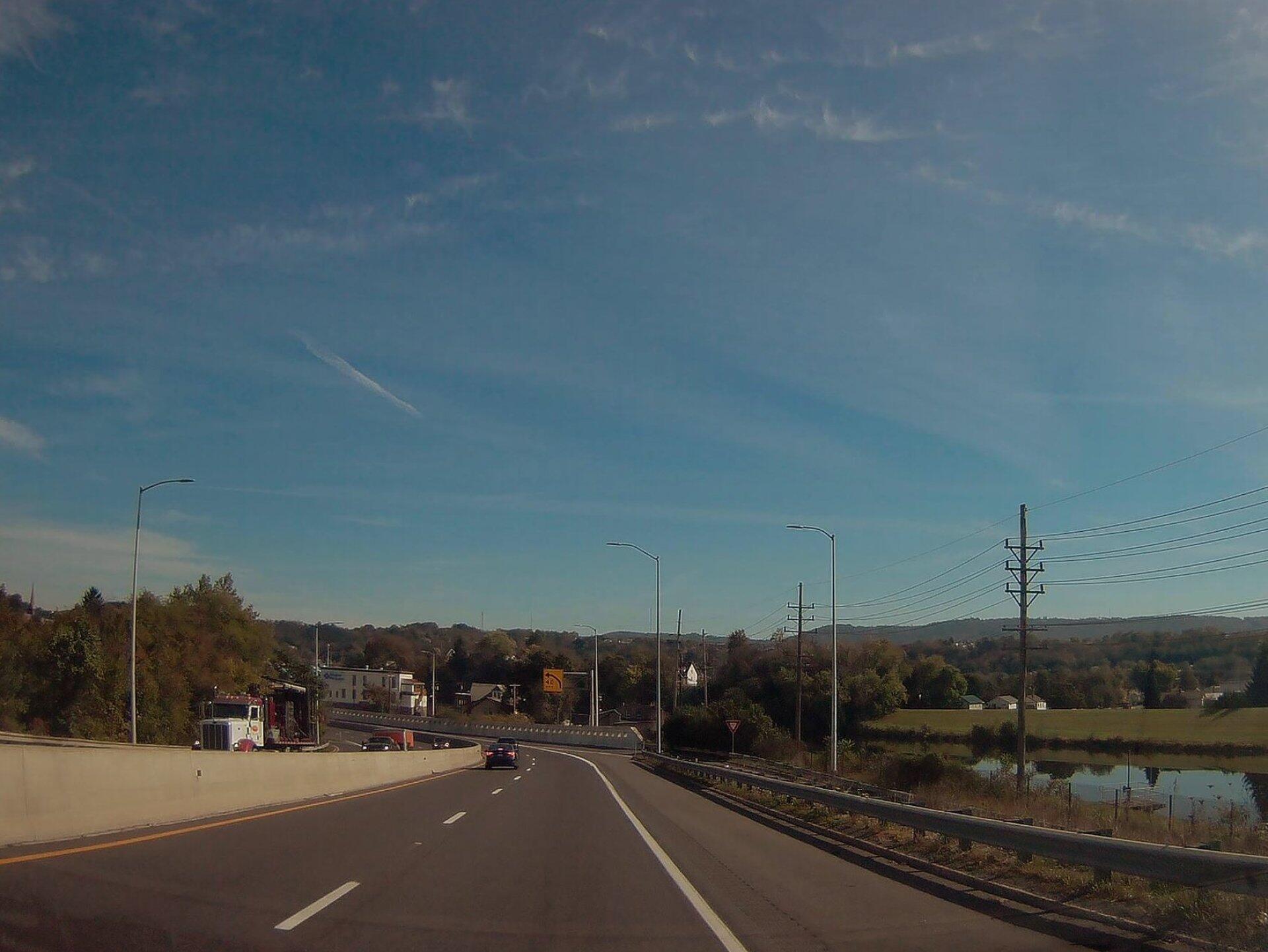
Photo: Tight Turn
Download a High Resolution JPEG Image of the Tight Turn or an Adobe Acrobat Printable PDF of the Tight Turn.
Tight Turn ...
Interstate 68 aka the National Freeway has a 70 MPH speed limit until you reach a steep 6% descent and head down to Cumberland from Allegany Grove and then it makes a very sharp left turn to avoid the North Branch of Potamac River and downtown Cumberland on an narrow elevated highway, which was built to replace the old US 48 through Maryland. The speed limit is reduced to 40 MPH, and to a driver unfamiliar with this stretch, even 40 MPH seems fast, with 15 MPH exits that dump directly onto city streets.
This section of highway is quite infamous for serious crashes, including one that burned part of the downtown. On June 1, 1991, a gasoline tanker descending into downtown Cumberland from the east attempted to exit the freeway at exit 43D, Maryland Avenue. The tanker went out of control and overturned as the driver tried to go around the sharp turn at the exit. Gasoline began to leak from the damaged tanker, forcing the evacuation of a three-block area of Cumberland. Approximately 30 minutes later, the tanker exploded, setting eight houses on fire. The fire caused an estimated $250,000 in damages (equivalent to $590,000 in 2016), and prompted MDSHA to place signs prohibiting hazardous materials trucks from exiting at the Maryland Avenue exit.
Taken on Saturday October 21, 2017 at Cumberland, MD.
More about Cumberland, MD...
Cumberland, officially the City of Cumberland, is a western gateway city and seat of Allegany County, Maryland, United States and the primary city of the Cumberland, MD-WV Metropolitan Statistical Area. At the 2010 census, the city had a population of 20,859, and the metropolitan area had a population of 103,299. Cumberland is a regional business and commercial center for Western Maryland and the Potomac Highlands of West Virginia. Cumberland is commonly referred to as "Where The South Begins," as official United States Census Bureau records place it below the Mason Dixon line.
https://en.wikipedia.org/wiki/Cumberland,_Maryland
Maps and Interactives
The Fabled Curve on National Freeway
Paw Paw, West Virginia
Paw Paw – C&O Canal Tunnel
Cumberland Narrows
Cumberland and Allegany Grove, Maryland
Canal Place in Cumberland
... photos, maps and other content from from Cumberland, MD.