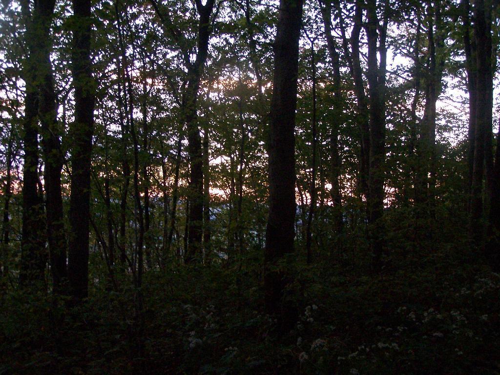
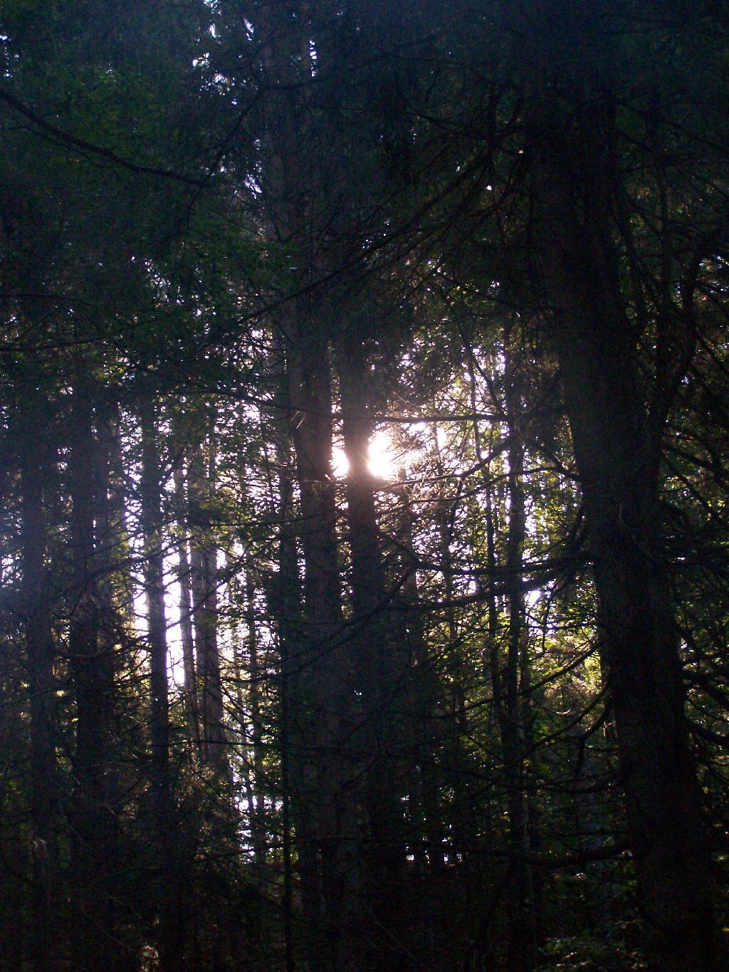
Sunset Thru The Trees
This is hiking back after the sun has set for the night.
Taken on Sunday September 19, 2010 at Labrador Hollow Unique Area.
This is hiking back after the sun has set for the night.
Taken on Sunday September 19, 2010 at Labrador Hollow Unique Area.
The text of today’s fodder is based on the Catskill Park State Lands Master Plan, as revised in 2008. Maps were rendered by myself, using Quantum GIS and DEC Lands and Forests data.
(Formerly Big Indian – Beaverkill Range Wilderness Area)
This wilderness is located in the Towns of Hardenburgh, Denning and Shandaken in Ulster County. It lies generally west of Oliverea and the Frost Valley Road, south of Belleayre Ski Center, east of Seager and Hardenburgh and north of Willowemoc and Claryville. The area ranges in width from 1 to 5 miles, is about 19 miles long and contains approximately 33,500 acres of land. Elevations range from 1,500 feet in McKenley Hollow to 3,840 feet where the state boundary crosses Doubletop Mountain. The mountains in the northeastern portion of the area are quite rugged, while those to the south and west are more characteristic of high hills. Water from the area flows into three New York City water supply reservoirs and the Delaware River Basin. Nine mountains or ridges with elevations of over 3000 feet make up the area.
Peaks
Doubletop* 3,860′
Haynes 3,420′
Big Indian 3,700′
Spruce 3,380′
Fir 3,620′
Eagle 3,600′
Hemlock 3,240′
Balsam* 3,600′
Beaver Kill Range 3,377′
* Maximum elevations given are not necessarily located within the Wilderness Area.
The forest cover is predominantly hardwood mixtures in various associations. Spruce and fir, while present at some of the higher elevations, are less noticeable here than in other Catskill wilderness areas.
Interior facilities consisting of foot trails and lean-tos are generally considered adequate.
Area statistics:
Approximate Area 33,500 Acres
Roads (non conforming) 1.4 Miles
Foot Trails 29.4 Miles
Lean-tos 6
Designated Campsites 5
Parking Lots 5
Public Use (visitors/year) 4,500
Exterior Boundary Line 67 Miles
Minimum Elevation 1,500′
Maximum Elevation 3,840′
Non-conforming uses:
Motor vehicle use of Black Bear Road from the wilderness boundary to Fall Brook Lean-to.
A UMP for this area was completed in June of 1993.
(Formerly West Kill – North Dome Wilderness, Ox Clove Wild Forest, and a portion of the former Hunter Mountain Wild Forest)
The unit generally lies within the following boundaries: New York State Route 42 on the west, the Shandakan Wild Forest and NYS Route 28 to the south, and NYS Route 214 on the east. The northern extent of the unit is County Route 6, and continues along a line 100′ parallel to, and south or east of, the edge of Spruceton trailhead parking area and the centerline of the Spruceton Truck Trail, to the junction of the Colonel’s Chair Trail. A corridor, 100 feet either side of the center line of the Spruceton Truck Trail, from the Colonel’s Chair Trail to the summit of Hunter Mountain, culminating in a circle 175′ in radius from the center of the chimney on the observer’s cabin shall be within the Rusk Mountain Wild Forest.
The unit contains approximately 27,000 acres of land, and inside it’s boundaries are found the named mountain peaks of Balsam, Sherrill, North Dome, West Kill, Sheridan, Hunter and Southwest Hunter. Hunter Mountain is the second highest peak in the Catskills at 4,040 feet, and portions of it’s summit, along with a fairly extensive area on the summits of West Kill, North Dome and Sherrill Mountains are within the Catskill High Peaks Bird Conservation Area, and are of special significance in that they provide habitat for high elevation spruce-fir inhabitants such as Bicknell’s Thrush and the Blackpoll Warbler, among others.
There are currently two lean-to’s on the unit, the Diamond Notch lean-to located just off the Diamond Notch Trail, and the Devil’s Acre Lean-to off of the Devil’s Path Trail. Waters from this unit drain into Schoharie and Esopus Creeks and then into the Schoharie and Ashokan Reservoirs, which are in the New York City water supply system.
Area statistics:
Approximate Area 27,000 Acres
Foot Trails 18 Miles
Lean-to’s 2
Parking Lots 5
Minimum Elevation 920′ Maximum Elevation 4,040′
(Formerly Plateau Mountain – Indian Head Mountain Wilderness Area)
This wilderness is located in the Town of Hunter, Greene County and the Towns of Saugerties and Woodstock, Ulster County. It lies generally west of the east boundary of the Catskill Park, south of Platte Clove, east of Devil’s Tombstone Campground and north of Lake Hill and Shady. The area ranges from 1 ½ miles to 3 ½ miles in width, is eight miles long and contains approximately 16,800 acres.
Elevations range from 900 to 3840 feet and the four major mountains in the area are visible against the skyline from all directions. Echo Lake, the only natural lake in a Catskill wilderness, is located in the east-central portion of the area. Water from this eastern section flows into the Kingston and Saugerties water supply reservoirs, while drainage from the central and western section flows into two New York City water supply reservoirs. Six named mountain peaks over 3,000 feet in elevation dominate the area.
Peaks
Plateau 3,840′
Indian Head 3,573′
Sugarloaf 3,800′
Olderbark 3,440′
Twin 3,640′
Plattekill 3,100′
The forest cover varies from extensive oak stands on the eastern most slopes to mature spruce-fir on top of Plateau Mountain. An excellent mature stand of northern hardwood and hemlock occupies the slopes south of the Saw Kill.
Echo Lake, unique to the Catskill wilderness, is very popular for undeveloped camping. A small number of scattered primitive tent sites with fire rings have been established and public camping is limited to their capacities.
Public access is provided by several foot trails entering the area, including the old road from Meads to Overlook Mountain.
Area statistics:
Approximate Area 16,800 Acres
Roads 6.6 Miles
Foot Trails 24.1 Miles
Cross-country Ski Trails 5.6
Lean-tos 3
Designated Campsites 10
Parking Lots 1
Public Use (visitors/year) 8,000
Length of Boundary 33 Miles
Minimum Elevation 900′
Maximum Elevation 3,840′
A UMP for this area was completed in October of 1992.
(Formerly Slide Mountain – Panther Mountain Wilderness Area)
This wilderness is located in the towns of Shandaken, Denning and Olive in Ulster County. It lies generally south of NYS Route 28, west of West Shokan, north of the Peekamoose Road (County Route 42) and east of the Frost Valley Road (County Route 47). It surrounds the Woodland Valley Campground and abuts the Sundown Wild Forest to its south. This area ranges from 1 to 10 miles in width, is about 13 miles long, and contains approximately 47,500 acres of land. The wilderness boundary is 118 miles long.
The terrain is rugged and steep with elevations ranging from 1,100 to 4,180 feet. All water draining from the area eventually reaches three New York City water supply reservoirs by way of the East and West Branches of the Neversink River, Rondout Creek and Esopus Creek. Twelve named mountain peaks with elevations over 3000 feet exist in the area. Of these, six may still be considered trail-less to the extent that they have no marked and maintained trails.
Peaks with Trails
Slide 4,180′
Peekamoose 3,843′
Cornell 3,860′
Wittenberg 3,780′
Table 3,847′
Panther 3,720′
Trail-less Peaks
Lone 3,721′
Rocky 3,508′
Friday 3,694′
Van Wyck 3,206′
Wildcat 3,340′
Balsam Cap 3,623′
The forest cover consists of nearly every possible mixture and association of hardwood and softwood trees native to the mountain region. While hardwoods predominate higher elevations are often covered with red spruce and balsam fir.
This area receives more public use than any other Catskill wilderness. Superb vistas are found on Slide, Wittenberg, Cornell, Giant Ledge and Panther Mountains. Access via foot trails is available from the north, south, east and west.
Area statistics:
Approximate Area 47,500 Acres
Foot Trails 35.3 Miles
Lean-tos 3
Parking Lots 10
Designated Campsites 29
Public Use (visitors/year) 23,000
Length of Boundary 118 Miles
Minimum Elevation 1,100′
Maximum Elevation 4,180′
A UMP for this area was completed in March of 1987 and revised in October of 1998.
(Formerly Blackhead Range, and North Mountain Wild Forests, and portions of Windham High Peak, and Black Dome Valley Wild Forests)
The combination of these Wild Forest areas creates the Windham – Blackhead Range Wilderness Area, which lies within the Greene County towns of Cairo, Hunter, Jewett, Windham and Durham. The classification of these former Wild Forest areas was changed to Wilderness because their combined area comprises approximately 17,100 acres and contains rugged, high elevation land that clearly exhibits wilderness character. This newly classified area has seven named mountain peaks over 3,000 feet in elevation.
They are:
Peaks Black Dome 3,980′
Windham High Pk 3,520′
Blackhead 3,940′
Stoppel Point 3,420′
Thomas Cole 3,940′
Burnt Knob 3,180′
Acra Point 3,100′
The unit also contains six unnamed peaks over 3,000 feet, which range from 3,040 feet to 3,540 feet in elevation. Of the five highest peaks in the Catskills, three – Black Dome, Thomas Cole and Blackhead – are in this unit. This concentration of 13 peaks over 3,000 feet, within an area of approximately 28 square miles, with limited access, structures and improvements (30 miles of maintained foot trails and two lean-to’s) make the Windham – Blackhead Range Unit an area with excellent wilderness character.
A fairly extensive area of old growth forest can be found on this unit at the higher elevations, along the ridge stretching from an area west of Thomas Cole Mountain to Blackhead Mountain, and on Windham High Peak. The presence of this old growth forest, with its distinctive flora and fauna, add to the wilderness character of the unit. The unit also includes the headwaters of the Batavia Kill and, to the south over the Blackhead Range, the headwaters of the East Kill. Both of these rivers flow into Schoharie Creek, and are an integral part of the New York City Watershed system.
The western boundary of this unit shall be the east side of the Elm Ridge Trail, Black Dome Trail leaving it within the Elm Ridge Wild Forest, continuing north along the drainage to the Catskill Park boundary. The southern boundary of the unit shall be the Escarpment Trail approximately one half mile south of Stoppel Point to a point on the Escarpment Trail where it comes closest to the eastern Forest Preserve boundary. Both North Point and Stoppel Point will be within the Wilderness area. Lands to the south of the south edge of the Escarpment Trail in this area, will be in the Kaaterskill Wild Forest.
Because the Windham – Blackhead Range Wilderness surrounds the smaller Colgate Lake Wild Forest Unit, and because they are linked together by public use, the Unit Management Plans for the two units shall be contained in one document.
Area statistics:
Approximate Area 18,0000 Acres
Foot Trails 30 Miles
Lean-tos 2
Parking Lots 1
Minimum Elevation 980′
Maximum Elevation 3,980′
This past long independence Day Weekend I went up to Moose River Plains. Some observations and notable things from the weekend that was — I’m going to post additional pictures and stories later.
Good evening. A chilly evening with temperatures around 36 degrees with a stiff northerly breeze. The low for tonight is 30 degrees but at least in Finger Lakes, that breeze will make it feel much cooler.
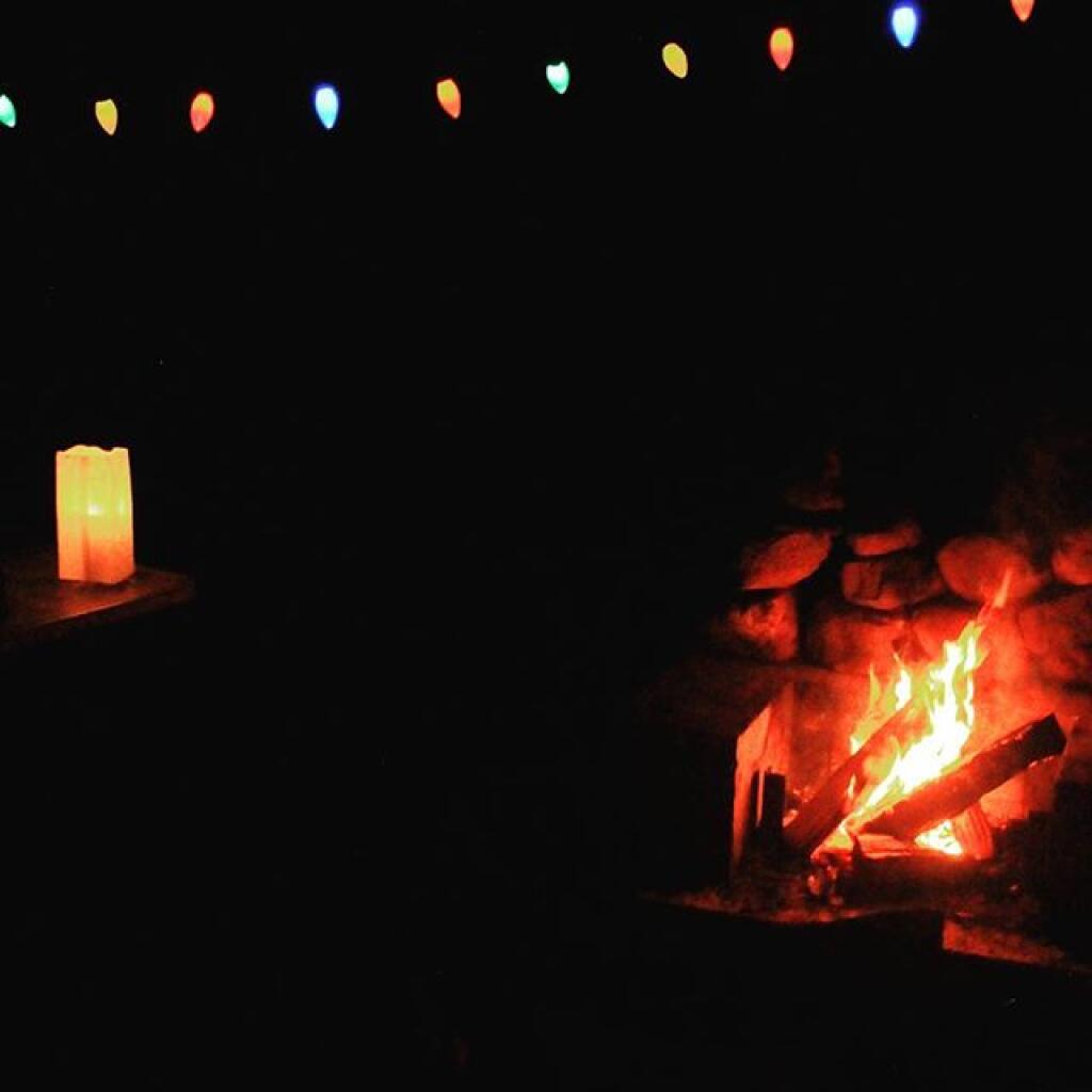
I got the propane tank refilled today in Auburn today and I’m damn happy about it. It a cool night. Wish I almost had warmer clothes with me but the heater is helping. I have a small campfire but it’s very small because with the breeze I’m concerned of a fire risk. I’m overly cautious with fire. Stupid mistakes mean more restrictions on our freedom. I will drown and cover the fire with mud to make sure it’s fully out by bed time. They got rain here yesterday and things are muddy but still not greened up. The campsite is free of leaves and grass around the fire pit but the pasture across the road is still mostly brown. Needless to say, the cows aren’t out yet. Always is entertaining when the herd comes over to visit on the summer.
Didn’t have any luck fishing today. I think it was two dang cold for the bullhead and other fish to be biting in Nelson Swamp. The spot I fished in Cazenovia, the new public fishing area in NY 96, looked like it had some good trout holes but the two or three times I’ve fished there, never had much luck.
Those hills just past Cazenovia on US 20 are pretty steep. I forgot how much a climb they are. Burned some serious gas climbing them with the kayak on the roof and the truck loaded down. But it’s vacation. Still a lot less energy then taking an airplane down south.
My smartphone was great for finding a place for refilling the propane tank. Just did a Google Search and it took me right to a U-Haul place to fill the tank. I was happy with the result and didn’t freeze tonight.
Checked out Montezuma. I was surprised how Montezuma is only like 15 minutes from Auburn. It was nice but the main federal refuge is kind of divided by the roar of the Thruway. I also checked out the Audubon Center and some of the state land know as the Northern Montezuma WMA. The northern parcels are a lot quiter although the state land is mostly leased farm land with some muck marshes in between. It’s kind of interesting that the best farm land is also the best land for wildlife. Indeed, the best corn regions in America are the best places for high deer populations and monster bucks. I’m not really a birder but it still was interesting to explore and visit some of rural Wayne County, including the hamlet of Savana and the muck country and farm land around there. My heart is with the rural poor, they have the best toys and the most fun.
Drove through Seneca Falls but did not stop. The country between Seneca Falls and Ovid is pretty flat dairy country, high on the hills between Seneca and Cayuga Lakes. Somewhat boring but still interesting.
After a while I started to disagree with Waze and started taking my own way to the National Forest, taking Lodi Center Road South. Eventually I remember where I was. Got to the National Forest, and set up camp. Gathered a small amount of wood and waited to dusk to start the fire.
Nice evening but cold. Dusk wasn’t until 8:35 pm in the Finger Lakes. Nice starry evening, that 3 watt LED bulb lights up the flag just perfectly with a nice warm color. My old flag bulb would have a colder color when the air temperature was colder. Also, while you can’t see it in the photos, the flag light always lights up the trees, which looks beautiful as the stars sit in between the tree branches, especially in the winter.
While I wish it was warmer out, still a pleasant evening next to the heater. It seems like the heater burns a lot of propane, but in my experience I burn through a 20 lb tank full every 6-7 nights camping. I’ve gone through two tank fulls since November, or about 20 nights camping. It costs about $18 to fill which means about $2.50 a night. I wouldn’t have done so much winter camping without the heater. I expect my fuel use will drop when I’m using propane for light and cooking food throughout the summer – and leaving the heater home.
Tomorrow starts out sunny with clouds creeping in later. Cool with a high around 52 degrees. Might be good for trout fishing tomorrow. I got to get some photos uploaded. Showers possible tomorrow evening, so I may hang up the tarp. Usually the tarp keeps the rain away.
I’m going to retire soon for the night. Sleep well. Dawn is at 5:33 am with sunrise is at 6:04. That’s only like seven hours away, so I probably won’t awake right away for dawn unlike today. But I do have the coffee pot ready for tomorrow, so once I get up, I’ll have coffee within 5 minutes thanks to how fast the stove brings the water to a boil in the percolator. Nice breakfast of eggs and sausage tomorrow. No rush to get going tomorrow.
I will get photos uploaded tomorrow, especially once I have a better Internet connection in Watkins Glen. Really, I should get to bed because the sun will be in my eyes before you know it.
Roadside: 9, Tent: 1, Leanto: 0 nights …
| Date | Campsite | Where | Type | Notes |
|---|---|---|---|---|
| 06/19/11 | Campsite On Forest Road 70 Near Lye Wilderness | Forest Road 70, Green Mountains NF, Kelley Stand, VT | Roadside camping (in pickup truck): no charge | Hiked towards Big Alder, but couldn’t cross stream. Rainy day, did a little paddling in Powley Place. Nicer day on Memorial Day |
| 06/04/11 | Campsite On Back Side of Stockmans Island | Stockmans Island, Hudson River State Park, NY | Tent camping after paddling in on kayak | Put in at Coxscakie Boat Launch, camped on an island in Hudson River. |
| 05/29/11 | Powley Place (Campsite 9) | Piseco-Powley Road, Ferris Lake Wild Forest, Stratford, NY | Roadside camping (in pickup truck): no charge | Hiked towards Big Alder, but couldn’t cross stream. Rainy day, did a little paddling in Powley Place. Nicer day on Memorial Day. |
| 05/28/11 | Powley Place (Campsite 9) | Piseco-Powley Road, Ferris Lake Wild Forest, Stratford, NY | Roadside camping (in pickup truck): no charge | Rainy day. Hiked around Powley Place. |
| 05/27/11 | Powley Place (Campsite 9) | Piseco-Powley Road, Ferris Lake Wild Forest, Stratford, NY | Roadside camping (in pickup truck): no charge | Left work early, drove up there. Nice evening before the rain. |
| 05/21/11 | Cheney Pond | Cheney Pond, Vanderwhacker Wild Forest, Newcomb, NY | Roadside camping (in pickup truck): no charge | Explored Vanderwhacker Wild Forest. Kayaked around Cheney Pond couple of times, explored Tawandus Ruins. |
| 05/20/11 | Fox Lair Campsite | NY Route 8, Wilcox Lake Wild Forest, Bakers Mills, Adirondacks, NY | Roadside camping (in pickup truck): no charge | Much nicer this time, a little rain, things greened up. Got a little rain, very damp. |
| 04/22/11 | Fox Lair Campsite | NY Route 8, Wilcox Lake Wild Forest, Bakers Mills, Adirondacks, NY | Roadside camping (in pickup truck): no charge | Woke up to 3” of cold wet snow and rain, decided to go home and abandon trip. |
| 04/21/11 | Gravel Pit Campsite | NY Route 8, Wilcox Lake Wild Forest, Griffin, Adirondacks, NY | Roadside camping (in pickup truck): no charge | Cold morning, trees covered with ice. Hike up around part of 13th Lake near North Creek, NY |
| 04/09/11 | Moscow Hill Horse Camp | Brookfield State Forest aka Charles Baker State Forest, Brookfield, NY | Roadside camping (in pickup truck): no charge | One other camper here, no equestrians this time of year. Wanted to camp on Cherry Ridge, however too much snow there. |

Roadside: 28, Tent: 2, Leanto: 1 nights …
| Date | Campsite | Where | Type | Notes |
|---|---|---|---|---|
| 12/4/10 | Old NY 8 | Wilcox Lake Wild Forest, Griffin, NY | Roadside camping (in pickup truck): no charge | Very cold. Ice and snow on truck in morning. Kind of close to NY 8, but all the best campsites taken by hunters. |
| 11/12/10 | Lower Assembly Area | Sugar Hill State Forest, Watkins Glen, NY | Roadside camping (in pickup truck): no charge | Woke up surrounded by Horse Trailers and equestrians in morning. Assembly area was closed this time of year, but horse trails still widely used. |
| 11/11/10 | Informal campsite on Forest Road 151 | Allegheny National Forest, Near Sayre, PA | Roadside camping (in pickup truck): no charge | Second night at Allegheny National Forest. I liked the site I stayed in the previous day a lot, and the days where too short (sunset at 4:45 PM), so no time to waste searching for a site. |
| 11/10/10 | Informal campsite on Forest Road 151 | Allegheny National Forest, Near Bradford, PA | Roadside camping (in pickup truck): no charge | Many sites in Allegheny National Forest. This one I particularly liked, so I decided to stay there. |
| 11/09/10 | Aspah Run Camping Area | Aspah, near Wellsboro, PA | Roadside camping (in pickup truck): paid primitive area | Decided due to a lack of a time due to early sunset, would have done roadside/back country camping, but for $10, and being alone, it was fine. |
| 11/08/10 | Aspah Run Camping Area | Aspah, near Wellsboro, PA | Roadside camping (in pickup truck): paid primitive area | Camped here, because I didn’t want to camp back country, and didn’t know the area well enough. |
| 11/07/10 | Lower Assembly Area | Sugar Hill State Forest, Watkins Glen, NY | Roadside camping (in pickup truck): no charge | Originally wanted to camp at Birds Eye Lake or something like that, but the map I had got me lost, and I couldn’t find the road campsite up there. |
| 11/06/10 | Campsite 7 | Stoney Pond State Forest, Madison, NY | Roadside camping (in pickup truck): no charge | Frost/ice on puddles in morning. Some snow in some places. |
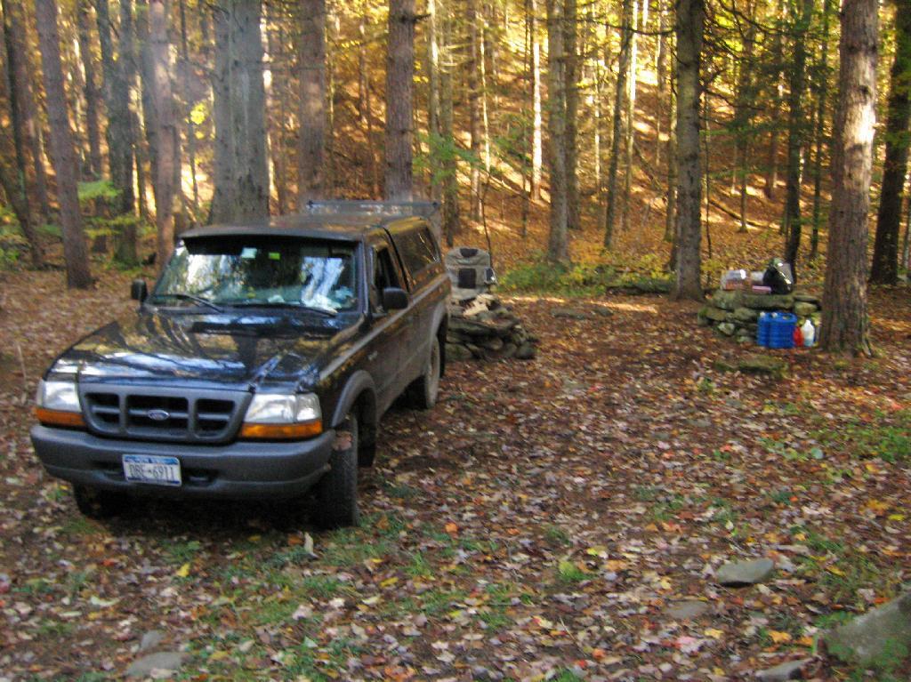
| 09/05/10 | Campsite 56 | Moose River Plains, Inlet, Adirondacks, NY | Roadside camping (in pickup truck): no charge | Rain showers, enjoyed staying in a very private and quite campsite up in the sandy plains. |
| 09/04/10 | Campsite 56 | Moose River Plains, Inlet, Adirondacks, NY | Roadside camping (in pickup truck): no charge | Hiked to Mitchells Pond. More rain. It was kind of wet and cold. |
| 09/03/10 | Campsite 56 | Moose River Plains, Inlet, Adirondacks, NY | Roadside camping (in pickup truck): no charge | Kind of wet and rainy, hung out in camp, did a little exploring of the plains. Also, paddled in Cedar River Flow for a while. Enjoyed the very private drive in site here. |
| 09/02/10 | Campsite 2 | Moose River Plains, Inlet, Adirondacks, NY | Roadside camping (in pickup truck): no charge | I left work at 5 PM…. but with traffic, and wanting to get a pizza to eat on the way up, didn’t get to Moose River Plains until after 9 PM. Very dark, very tired, just wanted a place to collapse. |
| 08/28/10 | An Designated Campsite | Big Pond, near Margretville, NY | Kayak in Primitive Campsite: no charge | Did a little hiking an exploring around Ashfield Pinnacle, then drove south to Big Pond. Lantern did not work, a very dark night. |
| 08/27/10 | Betty Brook Campsite | Burnt-Rossman Hill State Forest, Schoharie, NY | Roadside camping (in pickup truck): no charge | Nice night after work…. drove around Mallet Pond State Forest, looking for campsites and interesting places to explore. |
| 08/14/10 | Mountain Pond Campsite 4 | Mountain Pond, Paul Smiths, NY | Roadside camping (in pickup truck): no charge | Last day of NY 30 Kayak vacation. Mountain Pon was nice, very remote, just off of NY 30. |
| 08/13/10 | Floodwood Road Campsite 3 | Floodwood Road, Fish Creek Ponds, NY | Roadside camping (in pickup truck): no charge | Crowded, stayed down by Poliwog Pond… wouldn’t go there again. |
| 08/12/10 | Horseshoe Lake Campsite 8 (about a ½ mile from lake) | NY 421, Horseshoe Lake, NY | Roadside camping (in pickup truck): no charge | Couldn’t get a site right on Horseshoe Lake. Discovered Lows Lake – amazing. |
| 08/11/10 | Wakely Pond Campsite 7 | Moose River Plains, Inlet, Adirondacks, NY | Roadside camping (in pickup truck): no charge | Wanted to paddle Cedar River Flow and enjoy camping up near water … |
| 08/10/10 | Undesigned Campsite, west side of road | Mason Lake, Spectulator, NY | Roadside camping (in pickup truck): no charge | First day of kayak vacation, as I drove up from work, decided to go somewheres not too far away … |
| 07/31/10 | Undesigned Campsite, west side of road | Mason Lake, Spectulator, NY | Roadside camping (in pickup truck): no charge | Hiked to Pillsbury Mountain Firetower, then camped down at Mason Lake. |
| 07/18/10 | Otter Brook Campsite (MRP Number 110) | Moose River Plains, Inlet, Adirondacks, NY | Roadside camping (in pickup truck): no charge | Camped by the Otter Brook Bridge, at a rather large campsite. Not my favorite campsite, and it poured out. |
| 07/17/10 | Wakely Pond Campsite 8 | Moose River Plains, Inlet, Adirondacks, NY | Roadside camping (in pickup truck): no charge | Camped down by Cedar River Flow, in a drive in site, a short way from the Flow, but also pretty private. |
| 07/16/10 | Wakely Pond Campsite 8 | Moose River Plains, Inlet, Adirondacks, NY | Roadside camping (in pickup truck): no charge | Camped down by Cedar River Flow, in a drive in site, a short way from the Flow, but also pretty private. |
| 07/15/10 | Wakely Pond Campsite 8 | Moose River Plains, Inlet, Adirondacks, NY | Roadside camping (in pickup truck): no charge | Camped down by Cedar River Flow, in a drive in site, a short way from the Flow, but also pretty private. |
| 06/27/10 | Balsam Swamp Camping Area Site 3 | Balsam Pond, East East Pharsalia, NY | Roadside camping (in pickup truck): no charge | Came back to here, after exploring Labrador Hollow. |
| 06/26/10 | Balsam Swamp Camping Area Site 3 | Balsam Pond, East East Pharsalia, NY | Roadside camping (in pickup truck): no charge | Stop over between Burnt-Rossman and Labrador Hollow. Liked camping here in the past. |
| 06/25/10 | Duck Pond Campsite | Burnt-Rossman Hill State Forest, Summit, NY | Roadside camping (in pickup truck): no charge | Camped up a Duck Pond for a change, after driving out here after work. |
| 06/05/10 | Leonard Hill Informal Overlook and Campsite | Leonard Hill, Broome Center, NY | Roadside camping (in pickup truck): no charge | Camped up by the Firetower at an informal campsite, watched sun set, weather turned to rain by morning … |
| 06/04/10 | Betty Brook Campsite | Burnt-Rossman Hill State Forest, Schoharie, NY | Roadside camping (in pickup truck): no charge | Camped at Betty Brook, very humid, drove down to Utsaythana Firetower. |
| 05/15/10 | Alder Pond Campsite 2 | Alder Pond, Balsam Lake Wild Forest, Margretville, NY | Tent campsite…. short backpack in: no charge | Camped at one of the campsites around Alder Pond. |
| 04/03/10 | Betty Brook Campsite | Burnt-Rossman Hill State Forest, Schoharie, NY | Roadside camping, in a tent | Didn’t have the cap on my truck yet, but wanted to roadside camp. |
| 03/21/10 | Cotton Hill Lean To | Cotton Hill, Middleburgh | Short backpack into a leanto | There was about a foot of snow up by Cotton Hill Leanto on first day of spring, but due to abnormally warm weather, wasn’t all that cold until late into the night. |
Roadside: 3, Tent: 0, Leanto: 0 (thru August 2009) …
| Date | Campsite | Where | Type | Notes |
|---|---|---|---|---|
| 10/11/09 | Betty Brook Campsite | Burnt-Rossman Hill State Forest, Schoharie, NY | Roadside camping (in pickup truck): no charge | First really cold evening of the year, very much fall like. I didn’t bring my warm coat with me. |
| 10/10/09 | Betty Brook Campsite | Burnt-Rossman Hill State Forest, Schoharie, NY | Roadside camping (in pickup truck): no charge | Fairly cold night, but not as bad as one might have thought. On way out, stopped at Leonard Hill to take some pictures. |
| 08/08/09 | Betty Brook – informal campsite along road | Burnt-Rossman Hill State Forest, Schoharie, NY | Roadside camping (in pickup truck): no charge | After hiking Slide Mountain and Balsam Lake Firetower. Dead tired … |
The Betty Brook Campsite remains one of my favorite in NY State, especially because it’s a quick hour drive from downtown Albany out there, over the Thruway and the Warren Andersen Expressway. It almost never disappoints, and it was a great night.
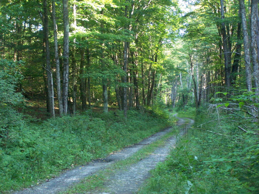
Morning Sun. The valley being so deep around Betty Brook the sun sets early, and rises late this time of year. Looking at the sun through the trees, a little after 9 AM.
Betty Brook Road. Just looking at this road brings me home, back to my favorite camping area.
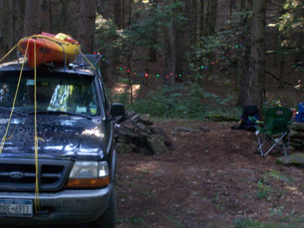
The Campsite. And yes, I of course have my trademark Christmas lights that I always use for ambiance.
I headed from here, in my truck, up to explore the Mallet Pond State Forest-area just to the north. I probably will camp up at Rossman Pond the next time I am here, because the pond is so pretty and I can paddle around with my kayak there.
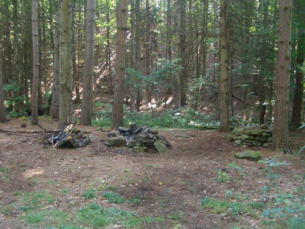
Here is a map of the Betty Brook Campsites. There is a larger one to the south, but I generally prefer the one to the north, as its smaller and the firepit and stone table is much nicer.