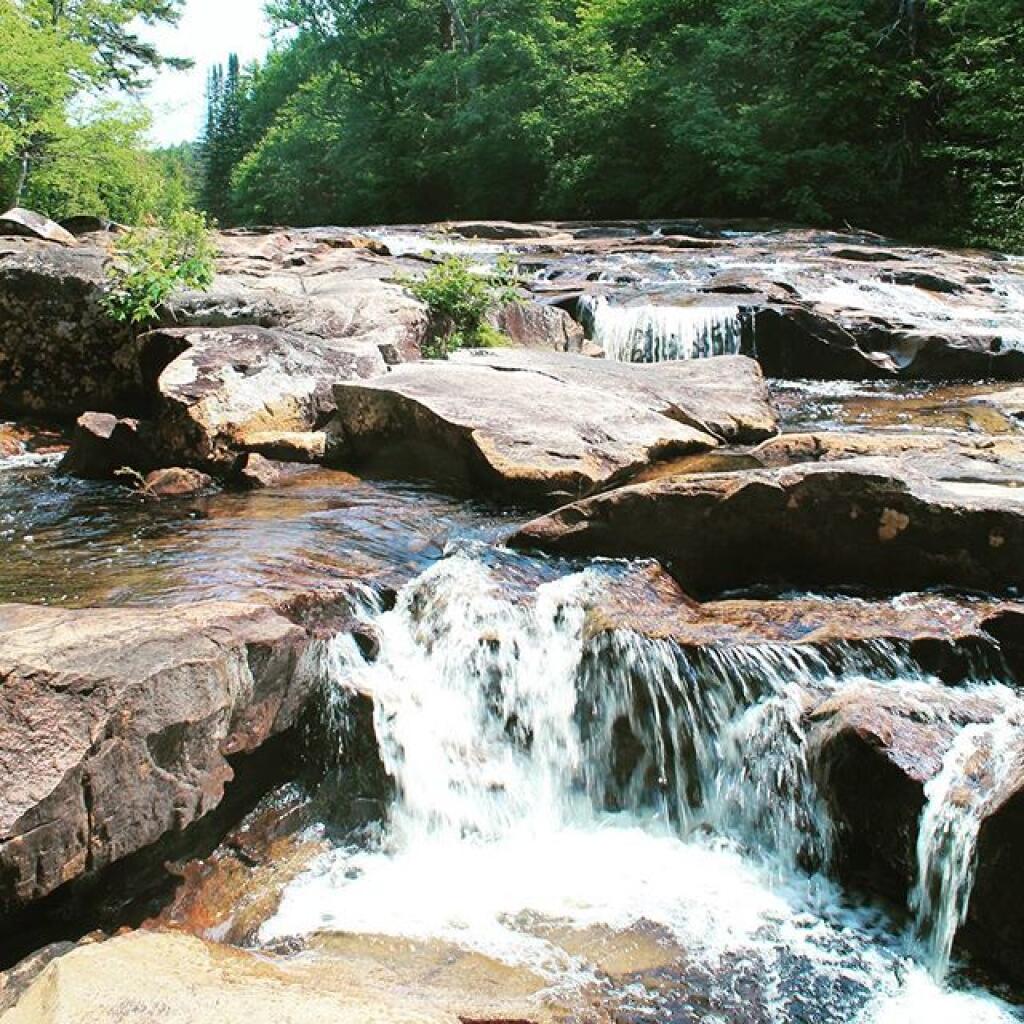
Photo: Potholers, just about perfect
Download a JPEG Image of the Potholers, just about perfect.
Potholers, just about perfect ...
Taken on Tuesday June 28, 2016 at Piseco-Powley Road.
More about Piseco-Powley Road...
Stretching from Stratford to Piseco, Piseco-Powley Road winds along the western edge of one of the last remaining old Adirondack dirt roads. Lined with venerable spruce trees, some nearly brushing against the road, it offers a glimpse of nature's untouched beauty. The tranquil West Branch of the East Canada Creek intersects Powley Road at Powley Place. This spot is positioned 8 miles southwest of Piseco Outlet, where NY 10 crosses, and approximately 7.5 miles from the point Piseco-Powley Road branches off from NY 10. When approached from the south, Powley Place is found 10.5 miles northeast from Stratford via Piseco Road. Notably, this area hosts four campsites, forming part of the 22 designated camping spots along Piseco-Powley Road, enhancing the allure of this picturesque route.
http://www.dec.ny.gov/lands/28339.html
Get maps of campsites and destinations as a single-page PDF here: https://www.scribd.com/document/640949248/Piseco-Powley-Road-Campsite-Map-Pack
Maps and Interactives
The Swimming Hole Off Old Edick Road
Sand Lake
Powley Place
Potholers
Big Alderbed
Juneteenth 2022 Weekend
Edick Road Swimming Hole
Powley Road
Sugarbush Mountain to Clockmill Corners
Sand Lake Trail
Overview Map Piseco-Powley Road
Meco Lake Trail (Piseco-Powley Road)
Lower Powley Bridge to Sugarbush Mountain
Clockmill Corners to NY 10
Big Alderbed Lake Trail
... photos, maps and other content from from Piseco-Powley Road.
No Comments
Hi there! Where along the Piseco-Powley road is this beautiful section of the river? Planning some (car) camping and the kiddo enjoys river walking as much as her momma.
Ten miles driving southwest on Piseco Powley Road from NY 10 in Piseco (near Big Bay). Current end of road at Hamilton County line. Or walk across closed bridge from Stratford end of Piseco Road three miles to the parking area. Potholers are at the end of the currently open road.