The Growth of Sprawl in Wilton, 1995-2021
The build out of new developments in Wilton over the past 25 years as seen through 8 aerial photos of the area taken over time.
The build out of new developments in Wilton over the past 25 years as seen through 8 aerial photos of the area taken over time.
Feeling kind of sick this morning, but I’m doing okay, dragging myself to work. I figure after a good pan of eggs and maybe some grapes, I should be good to go. I think I’m just a bit sleepless looking forward to my vacation, or maybe I’m coming down with a minor cold. But I’m hoping to power through it and leave in about 24 hours to start heading south to Pennsylvania.
Good morning! Happy Friday Before October Vacation! Clouds, fog and 54 degrees in Delmar, NY. ☔ There is a south-southeast breeze at 9 mph. 🍃. The dew point is 51 degrees. The skies will clear Monday around 4 am.
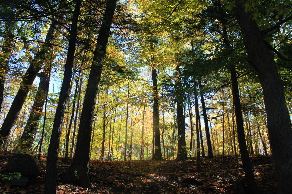
Not sure why suddenly this morning I felt so sick 🤢 though I wasn’t feeling great yesterday afternoon either. Started out like a cold with some congestion, achiness, exhaustion and now it’s progressed to more of a stomach bug. A few frequent visits to the toilet it would seem. 🚽 I really shouldn’t be in the office this morning, but it’s hard to call in sick the day before your vacation. I’ll wash my hands well, wear a muzzle and suck it up. Maybe it’s because I was up too late last night kneading bread and up to early to start cooking down the 15-bean soup 🍵, butternut squash 🍆 and two loaves of bread. 🍞 Need to have a lot of bread ready to go as it’s not going to be easy to cook quality bread when I go down to West Virigina.
I got to the store last night an bought another pair of 34″ inch jeans. 👖 I am amazed that I regularly fit into 34×32 inch jeans comfortably when at the beginning of the year I was regularly wearing 40×32 jeans and even they were tight. I don’t feel like I’ve lost a lot of weight but looking at photos I realize I have lost quite a bit of wait. Kind of weird how that sneaks up with you after healthy eating. I also got a bunch of supplies for camping and around the apartment, including flour to make up the bread last night. 🍞
Today will have showers likely, then showers and possibly a thunderstorm after 2pm. 🌦 High of 61 degrees at 2pm. Two degrees above normal, which is similar to a typical day around October 16th. Maximum dew point of 57 at 2pm. 🏖️ Southeast wind 9 to 11 mph. Chance of precipitation is 80%. New rainfall amounts between a quarter and half of an inch possible. A year ago, we had mostly sunny skies. The high last year was 57 degrees. The record high of 80 was set in 1965. There was a dusting of snow in 1952.❄
This evening I need to run to the laundromat 👕 to ensure I have sufficient clothing plus a pair of clothes to wear the following Monday to work when I come back from vacation. Then just a lot of packing. I just wasn’t feeling up to that last night, plus I needed to get some groceries, and needed a lot of the spices and supplies for cooking. I’ll do the best I can do tonight, but it might be raining out hard, so I might end up getting everything ready to pack come the morning. I do want to leave around 9 AM tomorrow, which I will go to the bank first, then maybe down to For the Love of Bacon, then Oneonta for Annutto’s Farm Stand then down to PA. Not a rush though as it’s going to be a rainy day.
Solar noon 🌞 is at 12:41 pm with sun having an altitude of 37.1° from the due south horizon (-33.7° vs. 6/21). A six foot person will cast a 7.9 foot shadow today compared to 2.2 feet on the first day of summer. The golden hour 🏅 starts at 5:28 pm with the sun in the west-southwest (250°). 📸 The sunset is in the west-southwest (257°) with the sun dropping below the horizon at 6:07 pm after setting for 2 minutes and 59 seconds with dusk around 6:34 pm, which is one minute and 33 seconds earlier than yesterday. 🌇 At dusk you’ll see the First Quarter 🌓 Moon in the south (189°) at an altitude of 19° from the horizon, 230,138 miles away. 🚀 The best time to look at the stars is after 7:09 pm. At sunset, look for rain 🌧 and thunderstorms 🌩 and temperatures around 60 degrees. The dew point will be 57 degrees. There will be a south-southeast breeze at 9 mph. Today will have 10 hours and 54 minutes of daytime, a decrease of 2 minutes and 45 seconds over yesterday.
I forgot to get Five Hour Energy Shots yesterday ☕ so I figure I’ll just put a single cup of coffee in my refigerator overnight, and leave it at that. I don’t need that much caffeine, if I’m truly desperate I’ll stop somewhere and get coffee. 🥚 Then hard boiled and bananas to snack on my trip down to Pennsylvania tomorrow. I might get energy shots though for Sunday’s trip to West Virigina, as there is even fewer places to pee on that leg of the trip and I don’t want to do much cooking but instead break camp early so I can go riding as time allows at
Tonight will rain and possibly a thunderstorm. 🌧 Low of 55 degrees at 5am. 15 degrees above normal, which is similar to a typical night around September 13th. Maximum dew point of 57 at 6pm. 🏖️ Southeast wind 5 to 8 mph. Chance of precipitation is 80%. New rainfall amounts between a quarter and half of an inch possible. In 2022, we had mostly clear skies in the evening, which became mostly clear by the early hours of the morning. It got down to 31 degrees. The record low of 17 occurred back in 1972.
I am looking forward to participating in some of those Udemy Courses now that the local library is offering them for free. 📚
Tomorrow will rain. 🌧 High of 58 degrees at 12pm. One degrees below normal, which is similar to a typical day around October 22nd. Maximum dew point of 55 at 6am. 🏖️ Northwest wind 6 to 14 mph. Chance of precipitation is 90%. New precipitation amounts between a tenth and quarter of an inch possible. A year ago, we had mostly sunny skies. The high last year was 61 degrees. The record high of 81 was set in 1979. 0.2 inches of snow fell back in 1926.❄
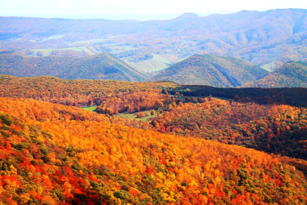
Looking ahead to Sunday, showers likely, mainly after 2pm. Mostly cloudy, with a high near 51. ⛅ West wind 15 to 18 mph, with gusts as high as 33 mph. Chance of precipitation is 60%. New precipitation amounts of less than a tenth of an inch possible. Going to also be windy in West Virginia but more sun. Kind of a cold night to start out my first night at West Virigina but I’ll have my propane tank topped off in Keyser and I might hot tent if necessary. ♨️ Figure going to be down there for nights, so I should pitch a tent, if onylt to store gear. ⛺ Typical average high for the weekend is 60 degrees.
Looking ahead, there are 5 weeks until Buy Nothing Day 🛍️ when the sun will be setting at 4:27 pm with dusk at 4:57 pm (Standard Time). On that day in 2022, we had partly sunny and temperatures between 49 and 24 degrees. Typically, the high temperature is 46 degrees. We hit a record high of 70 back in 2014.
There are 229 summits in New York State greater then 3,000 feet elevation.
| Tallest Peak | Summit Name | Elevation | County | USGS Topo Map Name | State Land | Trail | Location |
|---|---|---|---|---|---|---|---|
| 1 | Mount Marcy | 5,344 | Essex | Mount Marcy | High Peaks Wilderness | NA | 44.112733, -73.9237833 |
| 2 | Algonquin Peak | 5,105 | Essex | North Elba | High Peaks Wilderness | Algonquin Trail | 44.1436636, -73.9865357 |
| 3 | Mount Haystack | 4,924 | Essex | Mount Marcy | High Peaks Wilderness | Haystack Trail Via Barklet Ridge | 44.1056093, -73.9004196 |
| 4 | Mount Skylight | 4,908 | Essex | Mount Marcy | High Peaks Wilderness | Skylight Trail | 44.0994987, -73.9306986 |
| 5 | Basin Mountain | 4,852 | Essex | Mount Marcy | High Peaks Wilderness | State Range Trail | 44.1211639, -73.8862527 |
| 6 | Iroquois Peak | 4,829 | Essex | North Elba | High Peaks Wilderness | Iroquois Herd Path Via Boundary Peak | 44.1369973, -73.9982027 |
| 7 | Boundary Peak | 4,826 | Essex | North Elba | High Peaks Wilderness | Iroquois Herd Path Via Boundary Peak | 44.1397749, -73.9937582 |
| 8 | Whiteface Mountain | 4,816 | Essex | Lake Placid | Whiteface Mountain Ski Center | Whiteface Landing To Whiteface Mtn. Trail | 44.3658804, -73.9026456 |
| 9 | Dix Mountain | 4,813 | Essex | Dix Mountain | High Peaks Wilderness | Elk Lake To Dix Mountain Trail | 44.0822756, -73.7862471 |
| 10 | Gray Peak | 4,800 | Essex | Mount Marcy | High Peaks Wilderness | Mount Marcy Trail Via Opalescent River | 44.1114427, -73.9348658 |
| 11 | Schofield Cobble | 4,744 | Essex | Mount Marcy | High Peaks Wilderness | NA | 44.1089427, -73.9270876 |
| 12 | Little Marcy | 4,728 | Essex | Mount Marcy | High Peaks Wilderness | Van Hoevenberg Trail To Marcy | 44.1197753, -73.910976 |
| 13 | Gothics | 4,724 | Essex | Keene Valley | High Peaks Wilderness | Beaver Meadow Falls Trail | 44.1281079, -73.8570849 |
| 14 | Mount Colden | 4,708 | Essex | North Elba | High Peaks Wilderness | Mount Colden Via Lake Arnold | 44.1269976, -73.9598674 |
| 15 | Beck-horn | 4,695 | Essex | Dix Mountain | High Peaks Wilderness | Elk Lake To Dix Mountain Trail | 44.0800534, -73.7845802 |
| 16 | Little Haystack | 4,678 | Essex | Mount Marcy | High Peaks Wilderness | Haystack Trail Via Slant Rock | 44.1103313, -73.9004197 |
| 17 | Giant Mountain | 4,623 | Essex | Rocky Peak Ridge | Giant Mountain Wilderness | North Trail To Giant Mtn. | 44.161165, -73.720279 |
| 18 | Mount Redfield | 4,603 | Essex | Mount Marcy | High Peaks Wilderness | Mt Redfield Trail | 44.094777, -73.949866 |
| 19 | Santanoni Peak | 4,596 | Essex | Santanoni Peak | High Peaks Wilderness | Bradley Pond Trail | 44.0822811, -74.1309855 |
| 20 | Wright Peak | 4,564 | Essex | North Elba | High Peaks Wilderness | Wright Peak Spur Trail | 44.1517187, -73.9801468 |
| 21 | Nippletop | 4,554 | Essex | Dix Mountain | High Peaks Wilderness | Nipple Top Trail | 44.0892202, -73.8159708 |
| 22 | Saddleback Mountain | 4,534 | Essex | North Elba | High Peaks Wilderness | State Range Trail | 44.1264414, -73.8748634 |
| 23 | Panther Peak | 4,455 | Essex | Santanoni Peak | High Peaks Wilderness | Bradley Pond Trail | 44.0983915, -74.132097 |
| 24 | Rocky Peak | 4,403 | Essex | Rocky Peak Ridge | Giant Mountain Wilderness | East Trail To Giant Mtn. Via Rocky Peak Ridge | 44.1542177, -73.7051718 |
| 25 | Macomb Mountain | 4,396 | Essex | Dix Mountain | High Peaks Wilderness | Macomb-E. Dix Trail | 44.0517211, -73.7801349 |
| 26 | Hough Peak | 4,393 | Essex | Dix Mountain | High Peaks Wilderness | S. Dix-Hough Trail | 44.0694981, -73.7776352 |
| 27 | Mount Marshall | 4,380 | Essex | Street Mountain | High Peaks Wilderness | Mt Marshall Trail | 44.1275538, -74.0118142 |
| 28 | Armstrong Mountain | 4,360 | Essex | Keene Valley | High Peaks Wilderness | Adk Range Trail | 44.1347741, -73.8490291 |
| 29 | Seward Mountain | 4,327 | Franklin | Ampersand Lake | High Peaks Wilderness | Seymour Mountain Herd Path | 44.1597799, -74.1993239 |
| 30 | Allen Mountain | 4,321 | Essex | Mount Marcy | High Peaks Wilderness | Mt Redfield Trail | 44.0708892, -73.9395871 |
| 31 | Table Top Mountain | 4,295 | Essex | North Elba | High Peaks Wilderness | Table Top Mountain Trail | 44.143663, -73.9070876 |
| 32 | Big Slide Mountain | 4,232 | Essex | Keene Valley | High Peaks Wilderness | Big Slide Trail | 44.1822721, -73.8704202 |
| 33 | Esther Mountain | 4,232 | Essex | Franklin Falls | Wilmington Wild Forest | Esther Mt Trail | 44.3869916, -73.8898673 |
| 34 | MacIntyre Mountains | 4,193 | Essex | Street Mountain | High Peaks Wilderness | Mt Marshall Trail | 44.1308868, -74.008203 |
| 35 | Lower Wolfjaw Mountain | 4,190 | Essex | Keene Valley | High Peaks Wilderness | W.a. White Trail | 44.1483845, -73.8326399 |
| 36 | Upper Wolfjaw Mountain | 4,190 | Essex | Keene Valley | High Peaks Wilderness | Adk Range Trail | 44.1406072, -73.8451402 |
| 37 | Slide Mountain | 4,167 | Ulster | Peekamoose Mountain | Slide Mountain Wilderness | Burroughs Range Trail-Wittenberg-Cornell | 41.9987034, -74.3862617 |
| 38 | Phelps Mountain | 4,137 | Essex | North Elba | High Peaks Wilderness | Phelps Mtn. Trail | 44.1569957, -73.9209775 |
| 39 | Cascade Mountain | 4,094 | Essex | Keene Valley | High Peaks Wilderness | Casade Mountain Trail | 44.2186594, -73.860143 |
| 40 | South Dix | 4,088 | Essex | Dix Mountain | High Peaks Wilderness | Macomb-E. Dix Trail | 44.060054, -73.7743014 |
| 41 | Lookout Mountain | 4,078 | Essex | Franklin Falls | Whiteface Mountain Ski Center | Esther Mt Trail | 44.3778249, -73.887645 |
| 42 | Donaldson Mountain | 4,062 | Franklin | Ampersand Lake | High Peaks Wilderness | Seymour Mountain Herd Path | 44.1539471, -74.210991 |
| 43 | Seymour Mountain | 4,055 | Franklin | Ampersand Lake | High Peaks Wilderness | Seymour Mountain Herd Path | 44.1578347, -74.1721003 |
| 44 | Colvin Range | 4,049 | Essex | Dix Mountain | High Peaks Wilderness | Colvin Trail | 44.0939424, -73.8345829 |
| 45 | Mount Colvin | 4,049 | Essex | Dix Mountain | High Peaks Wilderness | Colvin Trail | 44.0939424, -73.8345829 |
| 46 | Hunter Mountain | 4,045 | Greene | Hunter | Hunter-West Kill Wilderness | Spruceton Trail | 42.1778662, -74.2304216 |
| 47 | Mount Emmons | 4,022 | Franklin | Ampersand Lake | High Peaks Wilderness | Northville-Placid Trail | 44.1436698, -74.2140464 |
| 48 | Street Mountain | 4,022 | Essex | Street Mountain | High Peaks Wilderness | Street Mountain Trail | 44.1797741, -74.0437616 |
| 49 | Grace Peak | 4,006 | Essex | Dix Mountain | High Peaks Wilderness | Macomb-E. Dix Trail | 44.0653314, -73.7573564 |
| 50 | Yard Mountain | 3,999 | Essex | North Elba | High Peaks Wilderness | Big Slide Trail Via Yard Mtn. | 44.1747725, -73.8845874 |
| 51 | MacNaughton Mountain | 3,983 | Essex | Street Mountain | High Peaks Wilderness | Wall Face Ponds Trail | 44.1397768, -74.064317 |
| 52 | Dial Mountain | 3,980 | Essex | Dix Mountain | High Peaks Wilderness | Leach Trail | 44.1058859, -73.7959703 |
| 53 | Blake Peak | 3,976 | Essex | Dix Mountain | High Peaks Wilderness | Pinnacle Trail | 44.081443, -73.844583 |
| 54 | Green Mountain | 3,976 | Essex | Rocky Peak Ridge | Giant Mountain Wilderness | North Trail To Giant Mtn. | 44.182272, -73.714858 |
| 55 | Black Dome | 3,973 | Greene | Freehold | Windham-Blackhead Range Wilderness | Blackhead Range Trail | 42.2700864, -74.1226382 |
| 56 | Thomas Cole Mountain | 3,944 | Greene | Hensonville | Windham-Blackhead Range Wilderness | Blackhead Range Trail | 42.2709196, -74.1365275 |
| 57 | Cliff Mountain | 3,940 | Essex | Mount Marcy | High Peaks Wilderness | Mount Marcy Trail Via Opalescent River | 44.1031102, -73.9751452 |
| 58 | McDonnel Mountain | 3,940 | Essex | Mount Marcy | High Peaks Wilderness | Mt Redfield Trail | 44.0803332, -73.9340315 |
| 59 | Blackhead | 3,930 | Greene | Freehold | Windham-Blackhead Range Wilderness | Blackhead Mountain Spur Trail | 42.2678644, -74.1045818 |
| 60 | West Kill Mountain | 3,891 | Greene | Lexington | Hunter-West Kill Wilderness | Devil’s Path | 42.1678663, -74.2895904 |
| 61 | Doubletop Mountain | 3,875 | Ulster | Seager | NA | Seager Big Indian Trail | 42.0275913, -74.5282095 |
| 62 | Nye Mountain | 3,871 | Essex | Street Mountain | High Peaks Wilderness | Nye Mountain Trail | 44.1931062, -74.0240387 |
| 63 | Kilburn Mountain | 3,868 | Essex | Lake Placid | Sentinel Range Wilderness | Copperas Owen Pond Trl | 44.3028247, -73.8818114 |
| 64 | Moose Mountain | 3,868 | Essex | McKenzie Mountain | Mckenzie Mountain Wilderness | Mckenzie Mtn. Trail | 44.3506029, -74.0032049 |
| 65 | Howard Mountain | 3,852 | Essex | North Elba | High Peaks Wilderness | Klondike Notch Trail | 44.1583844, -73.8912539 |
| 66 | Cornell Mountain | 3,848 | Ulster | Phoenicia | Slide Mountain Wilderness | Burroughs Range Trail-Wittenberg-Cornell | 42.0014812, -74.3568163 |
| 67 | Graham Mountain | 3,848 | Ulster | Seager | NA | Seager Big Indian Trail | 42.0392576, -74.5495986 |
| 68 | Plateau Mountain | 3,845 | Greene | Hunter | Indian Head Wilderness | Devil’s Path | 42.1378671, -74.1743088 |
| 69 | McKenzie Mountain | 3,842 | Essex | McKenzie Mountain | Mckenzie Mountain Wilderness | Mckenzie Mtn. Trail | 44.3361593, -74.0320951 |
| 70 | Rist Mountain | 3,839 | Essex | Mount Marcy | High Peaks Wilderness | Boreas Road | 44.027559, -73.987366 |
| 71 | Sentinel Mountain | 3,835 | Essex | Keene | Sentinel Range Wilderness | Winch Pond | 44.3061581, -73.8523658 |
| 72 | Lyon Mountain | 3,829 | Clinton | Moffitsville | Chazy Highlands Wild Forest | New Lyon Mountain Trail | 44.7036537, -73.8645877 |
| 73 | T R Mountain | 3,829 | Essex | North Elba | High Peaks Wilderness | Lake Arnold Crossover | 44.143941, -73.9354222 |
| 74 | Snowy Mountain | 3,825 | Hamilton | Snowy Mountain | NA | Snowy Mt | 43.7003432, -74.3859856 |
| 75 | Table Mountain | 3,819 | Ulster | Peekamoose Mountain | Slide Mountain Wilderness | Peekamoose-Table Trail | 41.9587036, -74.4048739 |
| 76 | Peekamoose Mountain | 3,812 | Ulster | Peekamoose Mountain | Slide Mountain Wilderness | Peekamoose-Table Trail | 41.9531481, -74.398207 |
| 77 | Avalanche Mountain | 3,809 | Essex | North Elba | High Peaks Wilderness | Avalanche Pass Trail | 44.1361639, -73.9695903 |
| 78 | Averill Peak | 3,806 | Clinton | Lyon Mountain | Chazy Highlands Wild Forest | New Lyon Mountain Trail | 44.6928208, -73.8809768 |
| 79 | Sugarloaf Mountain | 3,806 | Greene | Hunter | Indian Head Wilderness | Devil’s Path | 42.1312006, -74.1501414 |
| 80 | Couchsachraga Peak | 3,793 | Essex | Santanoni Peak | High Peaks Wilderness | Cold River Horse Trail | 44.0956146, -74.1601539 |
| 81 | Boreas Mountain | 3,779 | Essex | Mount Marcy | NA | Gulf Brook Road | 44.0031138, -73.8806937 |
| 82 | Wittenberg Mountain | 3,766 | Ulster | Phoenicia | Slide Mountain Wilderness | Burroughs Range Trail-Wittenberg-Cornell | 42.0081478, -74.3473716 |
| 83 | Panther Mountain | 3,763 | Hamilton | Snowy Mountain | NA | Snowy Mt | 43.7367317, -74.3907093 |
| 84 | Burroughs Range | 3,760 | Ulster | Phoenicia | Slide Mountain Wilderness | Burroughs Range Trail-Wittenberg-Cornell | 42.0084255, -74.3476494 |
| 85 | Blue Mountain | 3,750 | Hamilton | Blue Mountain Lake | Blue Mountain Wild Forest | Blue Mountain Trail | 43.8725634, -74.4009917 |
| 86 | Porter Mountain | 3,750 | Essex | Keene Valley | High Peaks Wilderness | Porter Mountain Trail Via Marcy Field | 44.2153262, -73.8434754 |
| 87 | Wakely Mountain | 3,750 | Hamilton | Wakely Mountain | Wakely Mountain Primitive Area | Wakely Mountain Trail | 43.7358986, -74.5151595 |
| 88 | Little Nippletop | 3,720 | Essex | Mount Marcy | High Peaks Wilderness | Elk Lake To Marcy Trail | 44.0853327, -73.9201422 |
| 89 | Wallface Mountain | 3,720 | Essex | Street Mountain | High Peaks Wilderness | Indian Pass Trail | 44.1378317, -74.0365378 |
| 90 | Panther Mountain | 3,714 | Ulster | Shandaken | Slide Mountain Wilderness | Giant Ledge-Panther Mountian-Fox Hollow Trail | 42.0564799, -74.3945946 |
| 91 | Balsam Lake Mountain | 3,707 | Ulster | Seager | Balsam Lake Mountain Wild Forest | Balsam Lake Mountain Trail | 42.0459236, -74.5940438 |
| 92 | Henderson Mountain | 3,707 | Essex | Mount Adams | High Peaks Wilderness | Bradley Pond Trail | 44.0978353, -74.0976509 |
| 93 | Hoffman Mountain | 3,701 | Essex | Blue Ridge | Hoffman Notch Wilderness | Hoffman Notch Trail | 43.9114489, -73.8168 |
| 94 | Lone Mountain | 3,697 | Ulster | Peekamoose Mountain | Slide Mountain Wilderness | Peekamoose-Table Trail | 41.9692592, -74.3893177 |
| 95 | Big Indian Mountain | 3,694 | Ulster | Shandaken | Big Indian Wilderness | Pine Hill West Branch Trail | 42.0350915, -74.4965421 |
| 96 | Hurricane Mountain | 3,688 | Essex | Rocky Peak Ridge | Hurricane Mountain Wilderness | East Hurricane Mtn Trial | 44.235326, -73.7106926 |
| 97 | Friday Mountain | 3,681 | Ulster | West Shokan | Slide Mountain Wilderness | Burroughs Range Trail-Wittenberg-Cornell | 41.9875924, -74.3620944 |
| 98 | Rusk Mountain | 3,678 | Greene | Lexington | Rusk Mountain Wild Forest | Spruceton Trail | 42.2006434, -74.2770897 |
| 99 | Cheney Cobble | 3,674 | Essex | Mount Marcy | High Peaks Wilderness | East River Trail | 44.0445021, -73.9648654 |
| 100 | Lewey Mountain | 3,665 | Hamilton | Snowy Mountain | West Canada Lake Wilderness | Sucker Brook Trail | 43.6642328, -74.4412649 |
| 101 | Seward Mountains | 3,665 | Franklin | Ampersand Lake | High Peaks Wilderness | Calkins Creek Truck Trail | 44.1561694, -74.2148801 |
| 102 | Santanoni Mountains | 3,661 | Essex | Santanoni Peak | High Peaks Wilderness | Bradley Pond Trail | 44.0881144, -74.138486 |
| 103 | Buell Mountain | 3,652 | Hamilton | Snowy Mountain | NA | Snowy Mt | 43.7161764, -74.4065426 |
| 104 | High Peak | 3,645 | Greene | Kaaterskill Clove | Kaaterskill Wild Forest | Kaaterskill High Peak Trail | 42.1620334, -74.0801381 |
| 105 | Little Whiteface Mountain | 3,638 | Essex | Lake Placid | Whiteface Mountain Ski Center | Whiteface Landing To Whiteface Mtn. Trail | 44.3558804, -73.891534 |
| 106 | Burtons Peak | 3,632 | Essex | Keene Valley | NA | The Brothers Trail | 44.1925, -73.8586111 |
| 107 | Fir Mountain | 3,629 | Ulster | Shandaken | Big Indian Wilderness | Pine Hill West Branch Trail | 42.0275916, -74.4690414 |
| 108 | Twin Mountain | 3,629 | Greene | Hunter | Indian Head Wilderness | Devil’s Path | 42.1256453, -74.1290294 |
| 109 | Little Moose Mountain | 3,609 | Hamilton | Wakely Mountain | Little Moose Wilderness | Otter Brook Trail | 43.6700663, -74.5707151 |
| 110 | Balsam Mountain | 3,606 | Ulster | Shandaken | Big Indian Wilderness | Pine Hill West Branch Trail | 42.0909235, -74.4882082 |
| 111 | Calamity Mountain | 3,606 | Essex | Mount Adams | High Peaks Wilderness | Calamity Brook Trail | 44.1028328, -74.0043132 |
| 112 | Sunrise Mountain | 3,606 | Essex | Dix Mountain | High Peaks Wilderness | Elk Lake To Dix Mountain Trail | 44.0247778, -73.7904124 |
| 113 | Balsam Cap | 3,602 | Ulster | West Shokan | Slide Mountain Wilderness | Burroughs Range Trail-Wittenberg-Cornell | 41.9770369, -74.3573722 |
| 114 | Stewart Mountain | 3,602 | Essex | Keene | Sentinel Range Wilderness | Winch Pond | 44.3261581, -73.8562549 |
| 115 | North Dome | 3,596 | Greene | Lexington | Hunter-West Kill Wilderness | Devil’s Path | 42.1734217, -74.3490366 |
| 116 | Pillsbury Mountain | 3,589 | Hamilton | Spruce Lake | West Canada Lake Wilderness | Pillsbury Mountain Trail | 43.580901, -74.5120992 |
| 117 | Slide Mountain | 3,586 | Essex | Lake Placid | Sentinel Range Wilderness | Barkeater Cliffs Campsite Trail | 44.2767136, -73.8862561 |
| 118 | Eagle Mountain | 3,573 | Ulster | Seager | Big Indian Wilderness | Pine Hill West Branch Trail | 42.0620352, -74.50932 |
| 119 | Dun Brook Mountain | 3,563 | Hamilton | Dun Brook Mountain | NA | Deer Pond Road | 43.890897, -74.3187666 |
| 120 | Saddleback Mountain | 3,560 | Essex | Jay Mountain | Jay Mountain Wilderness | Jay Mountain Trail | 44.2953258, -73.6676367 |
| 121 | Indian Head Mountain | 3,553 | Greene | Woodstock | Indian Head Wilderness | Devil’s Path | 42.116201, -74.1145846 |
| 122 | Fishing Brook Mountain | 3,550 | Essex | Dun Brook Mountain | Blue Mountain Wild Forest | Deer Pond Road | 43.9342303, -74.2946002 |
| 123 | Mount Sherrill | 3,550 | Greene | Lexington | Hunter-West Kill Wilderness | Devil’s Path | 42.1756439, -74.3729262 |
| 124 | Gooseberry Mountain | 3,540 | Essex | Keene Valley | High Peaks Wilderness | Orebed Brook Trail | 44.1367187, -73.8731969 |
| 125 | Bearpen Mountain | 3,530 | Delaware | Prattsville | Bearpen Mountain State Forest | Access Trail | 42.2734189, -74.4840396 |
| 126 | Vly Mountain | 3,530 | Greene | West Kill | Bearpen Mountain State Forest | Snowmobile Trail | 42.2453645, -74.4459834 |
| 127 | Windham High Peak | 3,527 | Greene | Hensonville | Windham-Blackhead Range Wilderness | Escarpment Trail | 42.3148069, -74.1434718 |
| 128 | Halcott Mountain | 3,524 | Greene | West Kill | Halcott Mountain Wild Forest | Condon Hollow Rd. | 42.1800882, -74.4379281 |
| 129 | Mount Adams | 3,520 | Essex | Mount Adams | High Peaks Wilderness | Mt Adams Trail | 44.0867231, -74.0257027 |
| 130 | Pitchoff Mountain | 3,501 | Essex | North Elba | Sentinel Range Wilderness | Pitchoff Mountain Trail | 44.2375474, -73.8776443 |
| 131 | Noonmark Mountain | 3,491 | Essex | Keene Valley | High Peaks Wilderness | Stimson Trail | 44.1289404, -73.7720809 |
| 132 | Rocky Mountain | 3,478 | Ulster | West Shokan | Slide Mountain Wilderness | Peekamoose-Table Trail | 41.9728703, -74.3726505 |
| 133 | Little Santanoni Mountain | 3,471 | Essex | Santanoni Peak | High Peaks Wilderness | Moose Pond Horse Trail | 44.0731156, -74.1670981 |
| 134 | Spotted Mountain | 3,461 | Essex | Underwood | High Peaks Wilderness | Macomb-E. Dix Trail | 44.0769975, -73.7440228 |
| 135 | Manbury Mountain | 3,455 | Hamilton | Wakely Mountain | Little Moose Wilderness | Otter Brook Trail | 43.6653442, -74.5532143 |
| 136 | Blue Ridge Mountain | 3,451 | Essex | Blue Ridge | Hoffman Notch Wilderness | Hoffman Notch Trail | 43.9247817, -73.8148558 |
| 137 | Roundtop | 3,451 | Delaware | Prattsville | Bearpen Mountain State Forest | Ski Run Road | 42.2939737, -74.4904283 |
| 138 | Roundtop Mountain | 3,451 | Greene | Kaaterskill Clove | Kaaterskill Wild Forest | Kaaterskill High Peak Trail | 42.1684222, -74.094583 |
| 139 | Olderbark Mountain | 3,438 | Greene | Bearsville | Indian Head Wilderness | Mink Hollow Trail | 42.1142565, -74.1909765 |
| 140 | Puffer Mountain | 3,438 | Hamilton | Bullhead Mountain | Siamese Ponds Wilderness | Puffer Pond Brook Trail | 43.6617318, -74.1993082 |
| 141 | Morgan Mountain | 3,432 | Essex | Wilmington | Wilmington Wild Forest | Cooper Kill Trail | 44.4186582, -73.8593108 |
| 142 | Wolf Pond Mountain | 3,425 | Essex | Cheney Pond | NA | Gulf Brook Road | 43.9892253, -73.8781933 |
| 143 | Stoppel Point | 3,422 | Greene | Kaaterskill Clove | Windham-Blackhead Range Wilderness | Escarpment Trail | 42.2250879, -74.0651364 |
| 144 | Huntersfield Mountain | 3,419 | Greene | Ashland | Huntersfield State Forest | Huntersfield Access Trail #8/Long Path Access | 42.355638, -74.3465339 |
| 145 | Cellar Mountain | 3,405 | Hamilton | Wakely Mountain | Moose River Plains Wild Forest | Cellar Pond Trail | 43.7122879, -74.5429375 |
| 146 | Haynes Mountain | 3,405 | Ulster | Seager | Big Indian Wilderness | Pine Hill West Branch Trail | 42.0792571, -74.5079309 |
| 147 | Sawtooth Mountains | 3,402 | Franklin | Street Mountain | High Peaks Wilderness | Northville-Placid Trail | 44.1928314, -74.1134874 |
| 148 | Bear Den Mountain | 3,389 | Essex | Dix Mountain | High Peaks Wilderness | Leach Trail | 44.1194964, -73.792915 |
| 149 | Pinnacle | 3,389 | Essex | Dix Mountain | High Peaks Wilderness | Pinnacle Trail Spur To Summit | 44.0583887, -73.8640277 |
| 150 | Vanderwhacker Mountain | 3,389 | Essex | Vanderwhacker Mountain | Vanderwhacker Mountain Wild Forest | Vanderwhacker Firetower Trail | 43.8983963, -74.0959781 |
| 151 | Jay Mountain | 3,379 | Essex | Jay Mountain | Jay Mountain Wilderness | Jay Mountain Trail | 44.3125477, -73.685693 |
| 152 | Spruce Top | 3,379 | Greene | Hunter | NA | Devil’s Path | 42.1506447, -74.1679195 |
| 153 | Spruce Mountain | 3,376 | Ulster | Shandaken | Big Indian Wilderness | Phoenicia East Branch Trail | 42.0175919, -74.4498744 |
| 154 | Belle Ayr Mountain | 3,373 | Ulster | Shandaken | Belleayre Mountain Ski Center | NA | 42.1159229, -74.4979304 |
| 155 | Evergreen Mountain | 3,369 | Greene | Lexington | Rusk Mountain Wild Forest | Devil’s Path | 42.2117542, -74.3079238 |
| 156 | Hedgehog Mountain | 3,366 | Essex | Keene Valley | High Peaks Wilderness | Rooster Comb And Hedgehog Trail | 44.159495, -73.8109724 |
| 157 | Balsam Mountain | 3,353 | Greene | West Kill | Hunter-West Kill Wilderness | Condon Hollow Rd. | 42.1836992, -74.387371 |
| 158 | Kempshall Mountain | 3,350 | Hamilton | Kempshall Mountain | High Peaks Wilderness | Northville-Placid Trail | 44.0236734, -74.3271041 |
| 159 | Buck Mountain | 3,346 | Hamilton | Snowy Mountain | West Canada Lake Wilderness | Snowy Mt | 43.6947879, -74.4368212 |
| 160 | Mount Pisgah | 3,340 | Delaware | Margaretville | NA | Mountain Brook Road | 42.2211973, -74.7357125 |
| 161 | MacDonough Mountain | 3,320 | Essex | Jay Mountain | Jay Mountain Wilderness | Jay Mountain Trail | 44.3050482, -73.644025 |
| 162 | Debar Mountain | 3,317 | Franklin | Debar Mountain | Debar Mountain Wild Forest | Debar Mountain Trail | 44.6033852, -74.2204351 |
| 163 | Bullhead Mountain | 3,314 | Warren | Bullhead Mountain | Siamese Ponds Wilderness | John Pond Crossover Trail | 43.7017316, -74.1804199 |
| 164 | Laramore Mountain | 3,314 | Essex | Keene Valley | High Peaks Wilderness | Casade Mountain Trail | 44.2258813, -73.8501427 |
| 165 | Tripod Mountain | 3,307 | Essex | Rocky Peak Ridge | Giant Mountain Wilderness | Hopkin Via Direct Trail | 44.1983824, -73.736248 |
| 166 | Metcalf Mountain | 3,304 | Hamilton | Blue Mountain Lake | Blue Ridge Wilderness | Gould Road | 43.7522873, -74.4957146 |
| 167 | Wyman Mountain | 3,304 | Essex | Underwood | High Peaks Wilderness | Macomb-E. Dix Trail | 44.0581093, -73.7445779 |
| 168 | Jay Mountains | 3,297 | Essex | Jay Mountain | Jay Mountain Wilderness | Jay Mountain Trail | 44.308659, -73.6704147 |
| 169 | Eleventh Mountain | 3,294 | Warren | Bakers Mills | Siamese Ponds Wilderness | Bog Meadow Trail | 43.6142322, -74.0720783 |
| 170 | Schultice Mountain | 3,284 | Delaware | Roxbury | NA | Ski Run Road | 42.3186948, -74.5157062 |
| 171 | Cellar Mountain | 3,281 | Hamilton | Snowy Mountain | West Canada Lake Wilderness | Sucker Brook Trail | 43.6411776, -74.4443199 |
| 172 | Plattekill Mountain | 3,268 | Delaware | Hobart | Plattekill State Forest | Mountain Brook/ Harold Roberts Access Trail | 42.2667522, -74.6482102 |
| 173 | South Pond Mountain | 3,258 | Hamilton | South Pond Mountain | Siamese Ponds Wilderness | County Line Brook Trail | 43.5900656, -74.2204175 |
| 174 | Hemlock Mountain | 3,248 | Ulster | Shandaken | Big Indian Wilderness | Phoenicia East Branch Trail | 42.0128698, -74.4390407 |
| 175 | Peaked Mountain | 3,235 | Essex | Jay Mountain | Hurricane Mountain Wilderness | Soda Range Trail | 44.2656034, -73.6993039 |
| 176 | Onteora Mountain | 3,232 | Greene | Hunter | NA | Blackhead Range Trail | 42.2223098, -74.1679184 |
| 177 | Kitty Cobble | 3,225 | Hamilton | Wakely Mountain | West Canada Lake Wilderness | Otter Brook Trail | 43.6295111, -74.6229377 |
| 178 | Baldwin Hill | 3,218 | Essex | Franklin Falls | Mckenzie Mountain Wilderness | Esther Mt Trail | 44.3847694, -73.9195905 |
| 179 | Richmond Mountain | 3,218 | Greene | Ashland | Mount Pisgah State Forest | Long Path Hiking Trail | 42.367582, -74.270976 |
| 180 | Squaw Mountain | 3,218 | Hamilton | Indian Lake | NA | Snowy Mt | 43.7270094, -74.3420956 |
| 181 | Dug Mountain | 3,215 | Hamilton | Kunjamuk River | NA | Long Pond Trail | 43.583122, -74.345146 |
| 182 | Hamilton Mountain | 3,215 | Hamilton | Wells | Silver Lake Wilderness | West River Road | 43.412013, -74.3673645 |
| 183 | Mount Alton | 3,212 | Essex | Lake Placid | Mckenzie Mountain Wilderness | Whiteface Mountain Trail | 44.3717139, -73.9662589 |
| 184 | Utsayantha Mountain | 3,209 | Delaware | Stamford | NA | Ward Allen Road | 42.3992472, -74.5895953 |
| 185 | Van Wyck Mountain | 3,202 | Ulster | Peekamoose Mountain | Slide Mountain Wilderness | Phoenicia East Branch Trail | 41.9523147, -74.4354304 |
| 186 | Colonels Chair | 3,199 | Greene | Hunter | NA | Colonel’s Chair Trail | 42.2006434, -74.2306991 |
| 187 | Gore Mountain | 3,199 | Warren | Gore Mountain | Gore Mountain Ski Center | Schaefer Trail | 43.6764539, -74.035134 |
| 188 | Chase Mountain | 3,192 | Essex | Rocky Peak Ridge | Hurricane Mountain Wilderness | North Hurricane Trail | 44.2417145, -73.7248599 |
| 189 | Knob Lock Mountain | 3,192 | Essex | Rocky Peak Ridge | Giant Mountain Wilderness | Hurricane Trail From 9n | 44.2003271, -73.7073583 |
| 190 | McGregor Mountain | 3,192 | Delaware | Stamford | Stamford Fp Detached Parcel | Relay Public Forest Access Road | 42.3900808, -74.5790396 |
| 191 | Weston Mountain | 3,192 | Essex | Jay Mountain | Hurricane Mountain Wilderness | Soda Range Trail | 44.2642144, -73.7079152 |
| 192 | Burnt Knob | 3,189 | Greene | Freehold | Windham-Blackhead Range Wilderness | Escarpment Trail | 42.3020297, -74.1190264 |
| 193 | Burgess Mountain | 3,189 | Hamilton | Rock Lake | NA | Bear Trap Brook Trail | 43.7520092, -74.3565416 |
| 194 | North Mountain | 3,186 | Greene | Kaaterskill Clove | Windham-Blackhead Range Wilderness | Escarpment Trail | 42.2175881, -74.0487469 |
| 195 | Payne Mountain | 3,182 | Hamilton | Snowy Mountain | Moose River Plains Wild Forest | Northville-Placid Trail | 43.7231211, -74.4951582 |
| 196 | Hopkins Mountain | 3,169 | Essex | Rocky Peak Ridge | Giant Mountain Wilderness | Hopkins Mtn. Via Spread Eagle Mtn. | 44.1833828, -73.7490257 |
| 197 | Spruce Lake Mountain | 3,163 | Hamilton | Spruce Lake Mountain | West Canada Lake Wilderness | Northville-Placid Trail | 43.5120126, -74.6532121 |
| 198 | Tongue Mountain | 3,159 | Hamilton | Dun Brook Mountain | NA | Northville-Placid Trail | 43.9114522, -74.3454349 |
| 199 | Catamount Mountain | 3,153 | Clinton | Wilmington | Taylor Pond Wild Forest | Catamount Trail | 44.459214, -73.8723668 |
| 200 | Wildcat Mountain | 3,153 | Ulster | Peekamoose Mountain | Slide Mountain Wilderness | Pine Hill West Branch Trail | 41.9775924, -74.4759867 |
| 201 | White Man Mountain | 3,146 | Delaware | Roxbury | NA | Access Trail | 42.2845295, -74.5340406 |
| 202 | Bradley Mountain | 3,140 | Hamilton | Wakely Mountain | Blue Ridge Wilderness | Cellar Pond Trail | 43.7378431, -74.5546055 |
| 203 | Overlook Mountain | 3,136 | Ulster | Woodstock | Overlook Mountain Wild Forest | Firetower Spur | 42.0850905, -74.0931954 |
| 204 | Mount Tamarac | 3,127 | Essex | McKenzie Mountain | Mckenzie Mountain Wilderness | Jackrabbit Trail | 44.3267144, -74.0204281 |
| 205 | Mount Morris | 3,117 | Franklin | Tupper Lake | NA | Goodman Mountain Trail | 44.1595046, -74.475168 |
| 206 | Acra Point | 3,110 | Greene | Freehold | Windham-Blackhead Range Wilderness | Escarpment Trail | 42.2964745, -74.0998591 |
| 207 | Round Mountain | 3,107 | Essex | Keene Valley | High Peaks Wilderness | Weston Trail Spur To Round Mt | 44.1317179, -73.7515245 |
| 208 | Cave Mountain | 3,104 | Greene | Hensonville | Elm Ridge Wild Forest | North Face Trail | 42.2859185, -74.2462543 |
| 209 | Pete Gay Mountain | 3,097 | Warren | Gore Mountain | NA | Schaefer Trail | 43.6903427, -74.0443015 |
| 210 | Plattekill Mountain | 3,091 | Greene | Woodstock | Indian Head Wilderness | Overlook Trail | 42.1073123, -74.0865281 |
| 211 | Mount Andrew | 3,081 | Essex | Mount Adams | High Peaks Wilderness | Bradley Pond Trail | 44.0564482, -74.093483 |
| 212 | County Line Mountain | 3,081 | Hamilton | South Pond Mountain | Siamese Ponds Wilderness | Siamese Ponds Trail | 43.6114543, -74.2006952 |
| 213 | High Point | 3,074 | Ulster | West Shokan | Sundown Wild Forest | Ashokan High Point | 41.9248149, -74.2879263 |
| 214 | Rose Mountain | 3,074 | Ulster | West Kill | NA | Rochester Hollow | 42.1506445, -74.4379284 |
| 215 | Cowan Mountain | 3,068 | Delaware | Hobart | NA | Relay Public Forest Access Road | 42.3450825, -74.6498756 |
| 216 | Round Top | 3,068 | Delaware | Hobart | Plattekill State Forest | Mountain Brook/ Harold Roberts Access Trail | 42.2714741, -74.6832109 |
| 217 | Churchill Mountain | 3,064 | Delaware | Stamford | NA | Relay Public Forest Access Road | 42.388692, -74.6098738 |
| 218 | Irish Mountain | 3,064 | Delaware | Roxbury | NA | Ski Run Road | 42.3356386, -74.5262617 |
| 219 | Swart Mountain | 3,061 | Hamilton | Lake Pleasant | Silver Lake Wilderness | West River Road | 43.3967355, -74.3815314 |
| 220 | Scarface Mountain | 3,058 | Essex | McKenzie Mountain | Saranac Lakes Wild Forest | Scarface Mountain Trail | 44.2647717, -74.0737646 |
| 221 | T Lake Mountain | 3,058 | Hamilton | Piseco Lake | West Canada Lake Wilderness | T Lake Trail | 43.4470133, -74.5770967 |
| 222 | Bailey Hill | 3,054 | Essex | Cheney Pond | Hoffman Notch Wilderness | Hoffman Notch Trail | 43.9108943, -73.9026366 |
| 223 | Bald Peak | 3,054 | Essex | Rocky Peak Ridge | Giant Mountain Wilderness | East Trail To Giant Mtn. Via Rocky Peak Ridge | 44.1597731, -73.6654114 |
| 224 | Little Rocky Mountain | 3,051 | Greene | Bearsville | Indian Head Wilderness | Warner Creek Trail | 42.1150898, -74.2040325 |
| 225 | Denman Mountain | 3,048 | Sullivan | Claryville | NA | Denman Mountain Snowmobile Trail | 41.90287, -74.5396005 |
| 226 | Woodhull Mountain | 3,045 | Ulster | Peekamoose Mountain | NA | Phoenicia East Branch Trail | 41.9459259, -74.4637647 |
| 227 | Barkaboom Mountain | 3,005 | Delaware | Arena | Dry Brook Ridge Wild Forest | Touch-Me-Not-Trail | 42.0717554, -74.7201571 |
| 228 | Stony Creek Mountain | 3,002 | Franklin | Stony Creek Mountain | High Peaks Wilderness | Ampersand Mountain Trail | 44.222002, -74.2659949 |
| 229 | Van Dorrien Mountain | 3,002 | Franklin | Ampersand Lake | High Peaks Wilderness | Ampersand Mountain Trail | 44.2222766, -74.1704351 |
An interactive map and listing of the 280 peaks over 3,000 feet elevation listed in the Open Street Map database for New York State.
If you don’t believe autumn is coming take a look at this chart.
| Week | Date | Dawn | Sun- rise |
Sun- set |
Dusk | Day | Noon Sun Angle | Avg High | Avg Low | Record Hi | Record Low |
|---|---|---|---|---|---|---|---|---|---|---|---|
| 0 | Aug 18 | 5:36 am | 6:06 am | 7:52 pm | 8:22 pm | 13:46 | 60.3° | 80 | 60 | 95 (1913) | 40 (1981) |
| 1 | Aug 25 | 5:44 am | 6:13 am | 7:41 pm | 8:10 pm | 13:27 | 57.9° | 79 | 59 | 99 (1947) | 35 (1940) |
| 2 | Sep 1 | 5:52 am | 6:21 am | 7:29 pm | 7:58 pm | 13:08 | 55.4° | 77 | 57 | 96 (1953) | 41 (1967) |
| 3 | Sep 8 | 6:00 am | 6:28 am | 7:17 pm | 7:45 pm | 12:48 | 52.9° | 75 | 55 | 94 (2015) | 34 (1978) |
| 4 | Sep 15 | 6:07 am | 6:35 am | 7:04 pm | 7:32 pm | 12:28 | 50.2° | 73 | 52 | 92 (1915) | 33 (1975) |
| 5 | Sep 22 | 6:15 am | 6:43 am | 6:52 pm | 7:20 pm | 12:08 | 47.5° | 70 | 49 | 95 (1895) | 31 (1962) |
| 6 | Sep 29 | 6:23 am | 6:51 am | 6:39 pm | 7:07 pm | 11:48 | 44.7° | 67 | 46 | 86 (1921) | 29 (2000) |
| 7 | Oct 6 | 6:30 am | 6:58 am | 6:27 pm | 6:55 pm | 11:28 | 42° | 64 | 43 | 90 (1900) | 24 (1965) |
| 8 | Oct 13 | 6:38 am | 7:06 am | 6:15 pm | 6:44 pm | 11:09 | 39.4° | 61 | 40 | 81 (1930) | 24 (1981) |
| 9 | Oct 20 | 6:46 am | 7:15 am | 6:04 pm | 6:33 pm | 10:49 | 36.8° | 58 | 38 | 80 (1965) | 18 (1972) |
| 10 | Oct 27 | 6:54 am | 7:23 am | 5:54 pm | 6:23 pm | 10:30 | 34.4° | 56 | 36 | 79 (1963) | 21 (1950) |
| 11 | Nov 3 | 6:03 am | 6:32 am | 4:45 pm | 5:14 pm | 10:12 | 32.1° | 53 | 35 | 75 (1990) | 20 (1980) |
| 12 | Nov 10 | 6:11 am | 6:41 am | 4:37 pm | 5:07 pm | 9:56 | 30.1° | 50 | 33 | 72 (1931) | 16 (1965) |
| 13 | Nov 17 | 6:19 am | 6:50 am | 4:30 pm | 5:01 pm | 9:40 | 28.3° | 47 | 31 | 73 (1928) | 7 (1972) |
| 14 | Nov 24 | 6:27 am | 6:58 am | 4:26 pm | 4:56 pm | 9:27 | 26.7° | 44 | 29 | 70 (2014) | 7 (2000) |
| 15 | Dec 1 | 6:34 am | 7:06 am | 4:23 pm | 4:54 pm | 9:16 | 25.5° | 41 | 27 | 67 (1934) | -5 (1875) |
| 16 | Dec 8 | 6:41 am | 7:13 am | 4:21 pm | 4:53 pm | 9:08 | 24.6° | 38 | 24 | 58 (1927) | -3 (1902) |
Below is a list of peaks within the Catskill Park that are on state land. This is based on the OpenStreetMap data combined with the DEC property data. Click location for a map of the property, or click State Land to get more information about the land the peak is located on.
Good morning! What day is it? Day After Trump’s Final State of the Union Address or so we hope, of course. 👴 The president is such an jerk. I’m fairly conservative but I respect economists and scientists. Amazing that it took me nearly four years to figure that out but I did vote for Jill Stein. 🌎 Two weeks to February Save the Pine Dinner 🦋. Lasagna is always good. Its cloudy and dirty-dee and one third degrees as the Albany Web Blog’s Dan Van Riper would say taking the 18 bus 🚍 downtown in Delmar, NY. ☁ There is a north-northwest breeze at 9 mph. 🍃. Temperatures will drop below freezing at around 9 am. ☃️
The message may not move me or mean a great deal to me but it feels so groovy to say… And so goes I Dig Rock and Roll Music 🎶. I honestly don’t have to say much on this mid week. Bathroom sink is still slow so I dumped more drain solvent down it, had to spend a fair amount of time ironing my shirt 👚 and pants 👖 but that’s pretty common on dress up days. People say that I look so much nicer when I’m dressed up. That’s probably true. Lately it seems like the 8:10 bus is quite crowded, I don’t remember it being so busy weeks ago.
Today will be partly sunny 🌞, with a high of 37 degrees at 12pm. Five degrees above normal, which is similar to a typical day around February 23rd. Northwest wind 6 to 9 mph. I’ll believe it if I see sun when I emerge from the dungeon at lunch time. A year ago, we had mostly sunny skies. The high last year was 57 degrees. The record high of 59 was set in 1890. 10.4 inches of snow fell back in 2014.❄
Solar noon 🌞 is at 12:10 pm with sun having an altitude of 31.4° from the due south horizon (-39.5° vs. 6/21). The golden hour 🏅 starts at 4:33 pm with the sun in the west-southwest (242°). 📸 The sunset is in the west-southwest (249°) starting at 5:11 pm and lasts for 3 minutes and 7 seconds with dusk around 5:42 pm, which is one minute and 19 seconds later than yesterday. 🌇 At dusk you’ll see the Waxing Gibbous 🌔 Moon in the east (98°) at an altitude of 44° from the horizon, 237,504 miles away. 🚀 The best time to look at the stars is after 6:17 pm. At sunset, look for partly clear skies 🌄 and temperatures around 31 degrees. There will be a north-northwest breeze at 5 mph. Today will have 10 hours and 8 minutes of daytime, an increase of 2 minutes and 27 seconds over yesterday.
Tonight will snow before 5am, then snow and sleet. 🌨 Low of 26 degrees at 9pm. Eight degrees above normal, which is similar to a typical night around March 11th. Calm wind becoming east around 6 mph after midnight. Chance of precipitation is 90%. New snow and sleet accumulation of 1 to 2 inches possible. In 2019, we had mostly clear skies in the evening, which became mostly clear by the early hours of the morning. It got down to 25 degrees. The record low of -20 occurred back in 1948.
Cool but now sunny based on the latest forecast. 😎 Saturday, mostly sunny, with a high near 27. Sunday, partly sunny, with a high near 34. Typical average high for the weekend is 33 degrees.
While it’s going to be quite cold this weekend after the fresh snow I might go out to the wilderness for a night camping. ⛺ It will depend a lot on the snow depth and how windy it will be. I’m going to watch the snow over the next few days.
🌹🌻🌼Only 43 days remain until the first day of calendar spring!🌹🌻🌼
As previously noted, there are 2 weeks until February Save the Pine Dinner 🦋 when the sun will be setting at 5:31 pm with dusk at 6:00 pm. On that day in 2019, we had cold, mostly sunny and temperatures between 24 and 4 degrees. Typically, the high temperature is 36 degrees. We hit a record high of 66 back in 1981.
Good evening! Cloudy and 37 degrees in Delmar, NY. ☁ There is a northwest breeze at 9 mph. 🍃. There is a dusting of snow on the ground. ☃ Temperatures will drop below freezing around 3 am. ☃️
I went over to John Wolcott house for a few hours after work 🔎and continued working on his files. 📂 It’s been well over a year, one night most weeks. Learned a lot. I’ve started to tape record the audio 🔉 to capture some of our conversations. Now to just finish up the labels 🔖.
That bus really was smoking 💨 bad this evening. 🚍 I wonder if it’s an issue with the particle trap, I didn’t see it smoking downtown when I got one but I swear I’ve seen that bus smoking before but not all of the time. I was hoping to catch a glimpse of it at the end of my walk but no such luck.
Mild evening, I went for my evening walk 🚶. Not too cold out which is nice. I listened to a bit of President’s State of the Union address before turning it off. Honestly I’m hoping it’s Trump’s final state of the union and we will have a new president giving an inauguration address next year. 📝 I think the delayed results of the democratic caucus in Iowa kind of took all of the air out of the news cycle for the president. I’m sure he will be acquitted of the removal process later this week and hopefully we’ll have a new president soon.
Tonight will be cloudy ☁, with a low of 29 degrees at 6am. 14 degrees above normal, which is similar to a typical night around March 24th. Northwest wind around 10 mph. In 2019, we had mostly clear skies in the evening, which became mostly clear by the early hours of the morning. It got down to 32 degrees. The record low of -15 occurred back in 1918.
Tonight will have a Waxing Gibbous 🌔 Moon with 79% illuminated. At 9 PM, the moon was in the south-southwest (205°) at an altitude of 68° from the horizon, some 240,057 miles away from where you are looking up from the earth. 🚀 At the state speed limit of 55 mph, you’ll make it there by August 4th. Buckle up for safety! 💺 The Snow ❄ Moon is on Sunday, February 9. The darkest hour is at 12:10 am, followed by dawn at 6:38 am, and sun starting to rise at 7:08 am in the east-southeast (112°) and last for 3 minutes and 8 seconds. Sunrise is one minute and 7 seconds earlier than yesterday. 🌄 The golden hour ends at 7:49 am with sun in the east-southeast (119°). Tonight will have 13 hours and 53 minutes of darkness, a decrease of 2 minutes and 27 seconds over last night.
Tomorrow will be partly sunny 🌞, with a high of 33 degrees at 2pm. One degree above normal, which is similar to a typical day around February 6th. Northwest wind 6 to 9 mph. A year ago, we had mostly sunny skies. The high last year was 57 degrees. The record high of 59 was set in 1890. 10.4 inches of snow fell back in 2014.❄
In four weeks on March 3 the sun will be setting in the west (262°) at 5:47 pm,🌄 which is 35 minutes and 50 seconds later then tonight. In 2019 on that day, we had partly cloudy, snow showers and temperatures between 39 and 29 degrees. Typically, you have temperatures between 39 and 21 degrees. The record high of 64 degrees was set back in 2002.
Looking ahead, Don’t Cry over Spilled Milk Day 🥛 is in 1 week, National Drink Wine Day 🍷 is in 2 weeks, Average High is 40 ☀️ is a month away, St. Patrick’s Day 🍀 is in 6 weeks, 7:30 PM Sunset 🌇 is in 9 weeks, 8 PM Sunset 🌇 is in 3 months, Cinco de Mayo 🤠 is in 13 weeks, Primary Day 🗳️ is in 20 weeks, Election Day 2020 🗳️ is in 39 weeks and Election Day 2020 🗳️ is in 39 weeks.
🇺🇸🦅Only 107 days remain until the start of Memorial Day Weekend!🦅🇺🇸