Search Results for: photo photo 2013 11 16 15 18 59

Hoping for a smoother Tuesday today 🧑‍🚒🧯

I did not appreciate missing the express bus home yesterday or the smoke alarm repeatedly tripping off after cooking dinner. Or repeatedly hitting the wrong keys in VIM at work yesterday, half awake on a Monday. But the salmon and frozen asparagus was good for dinner as was the larger paycheck with my new job.

Good morning! Happy Tuesday. Clouds and 28 degrees in Delmar, NY. ☁ Calm wind.There are 3 inches of snow on the ground. ☃ ️Things will start to thaw out at around 1 pm. 🌡️

Made it through my birthday 🎂 without anybody saying anything besides my mom= and a few people at work. I keep my birthday locked down on Facebook as I get tired of all the fake happy birthdays you get on Facebook. I really don’t appreciate all the unwarranted attention to myself and my age, I’d rather tell my story but otherwise he ignored. Maybe that’s why I don’t do the social media.

Yesterday was a Monday and kind of a shitty one but it was always silly stuff. 💩 The kind of things that you can hit escape and then u in vim and undo. I just wasn’t feeling Monday, even if was my forty first time around the sun ☀. The smoke detector that kept going off time and time again from cooking smoke and moisture 🧑‍🚒 really set me off as did having to ride the local home. 🏡 Then I had to piss and crap so badly that I barely made the toilet 🚽 and had to clean up the seat but fortunately not my pants 👖 this time. 🤯 All that fiber and water from eating lots of fruits and vegetables can be tough at times. Especially spaghetti squash 🍆 which I find hard not to overeat but can he very lubricating of the gut and everything connected. Gawd, I’m getting old 👴🏼.

I got this enormous glass 🍸 at work as a Christmas gift that I love and when it’s full of water 💦 and ice 🧊 it’s so easy to overdo it and I was busy at the end of the day with work 📄 and didn’t have time to run to the bathroom before catching the shuttle 🚀 back to the Plaza. And then missing the express bus 🚍. Yeap. Forgot my fork 🍽 at lunch yesterday and didn’t have a spare one in my new office 🏢 so the cooked part of lunch with peas, corn, peppers and tofu got skipped for lunch as that ain’t finger 🖕 food. The milk 🥛 I had in the mason jar for my coffee ☕ at work went rancid. That was a Monday, my birthday. 🎂

I’m thinking today won’t be such a shit show 🤔 or so I tell myself. 🥞 Woke up at five o’clock like usual with no alarm ⏰ and made some good oatmeal banana 🍌 pancakes. I’ve finally mastered a good recipe that is absolutely delicious 😋 topped with mango and blueberries with real maple 🍁 syrup. The real stuff is so much better even if it’s slightly more calories. It’s not like I eat much meat or milk high in saturated fats these days or processed foods or added sugars so I figured I can use a little bit of natural sweetness occasionally like honey 🍯 or pure maple syrup.

Went for a five mile bike ride this morning after breakfast before showering and catching the express bus downtown. 🚲 Not so cold this morning for a change. My hands 👐 weren’t cold nor was my face. The cows 🐮 on Meads Road were up and around chewing their cud not all huddled together. 🚜 It was nice for a change. I probably would have gone for a longer ride, but time was tight as it was close to 6:50 AM when I got out riding. One thing is nice is that the mornings are a lot brighter then they were.

Today will have patchy freezing drizzle before 10am. Mostly cloudy 🌥, with a high of 33 degrees at 2pm. Typical for today. Calm wind becoming south 5 to 7 mph in the afternoon. A year ago, we had mostly sunny skies in the morning, which became light snow by afternoon. The high last year was 41 degrees. The record high of 56 was set in 2013. 11.0 inches of snow fell back in 1966.❄

After all of it, dinner last night was good, 🐟 even if the fire alarm problem was annoying. 👩‍🚒 I am not sure why it’s been such a problem with the smoke detectors this winter. I got a new smoke detector hoping it would stop false alarms, 🔕 without much luck. Fresh asparagus are hard to get this time of year, but the frozen ones weren’t bad. 🎍 Looking forward to spring 🐰 when the fresh ones are more available for a reasonable price, like around Easter. 👣 Evening walk was good too. I need to get back in the habit, if my fingers are cold all of the time, 🧤 I should learn to toughen up and get better gloves. It’s not like I have as much of an opportunity to get steps in working in the suburban office, though come nicer weather when I don’t have to dress up as much, I’ll probably be back to riding back in and home from the office. I figure after President’s Day, there will be enough daylight in the evening to ride home, and that’s where the real calorie burning takes place. 🌧 With the rain and cold, I’ve really gotten out of the habit, and my stomach and face are starting to show it.

Solar noon 🌞 is at 12:09 pm with sun having an altitude of 29.6° from the due south horizon (-41.2° vs. 6/21). A six foot person will cast a 10.6 foot shadow today compared to 2.2 feet on the first day of summer. The golden hour 🏅 starts at 4:24 pm with the sun in the west-southwest (239°). 📸 The sunset is in the west-southwest (247°) with the sun dropping below the horizon at 5:06 pm after setting for 3 minutes and 10 seconds with dusk around 5:35 pm, which is one minute and 18 seconds later than yesterday. 🌇 The best time to look at the stars is after 6:10 pm. At sunset, look for mostly cloudy skies ☁ and temperatures around 32 degrees. There will be a south-southeast breeze at 7 mph. Tomorrow will have 9 hours and 59 minutes of daytime, an increase of 2 minutes and 18 seconds over today.

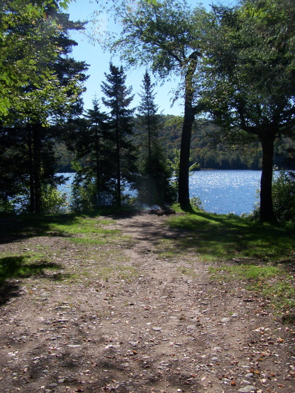
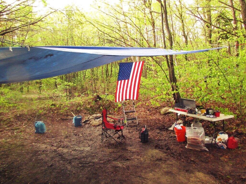
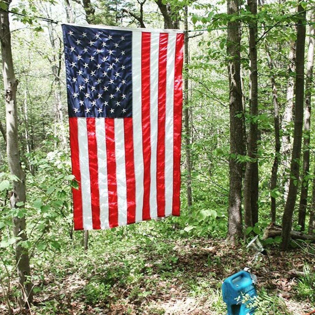
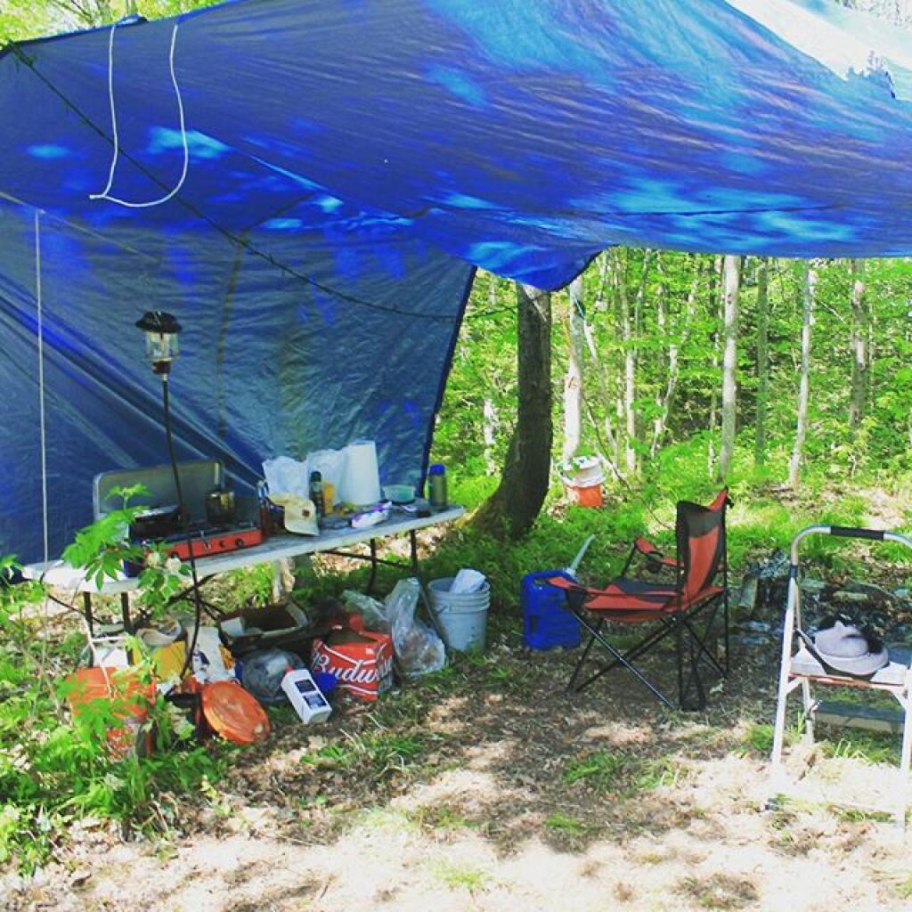
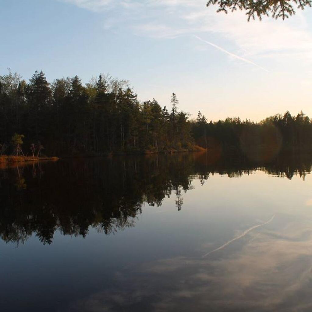
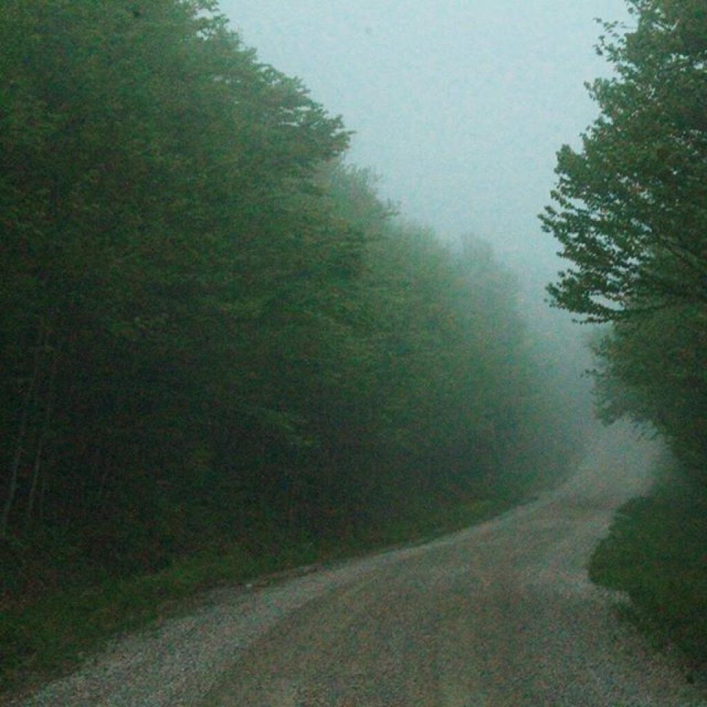
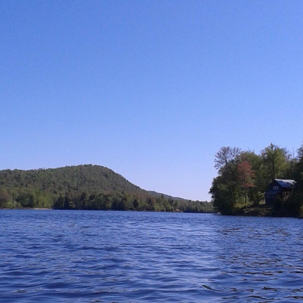
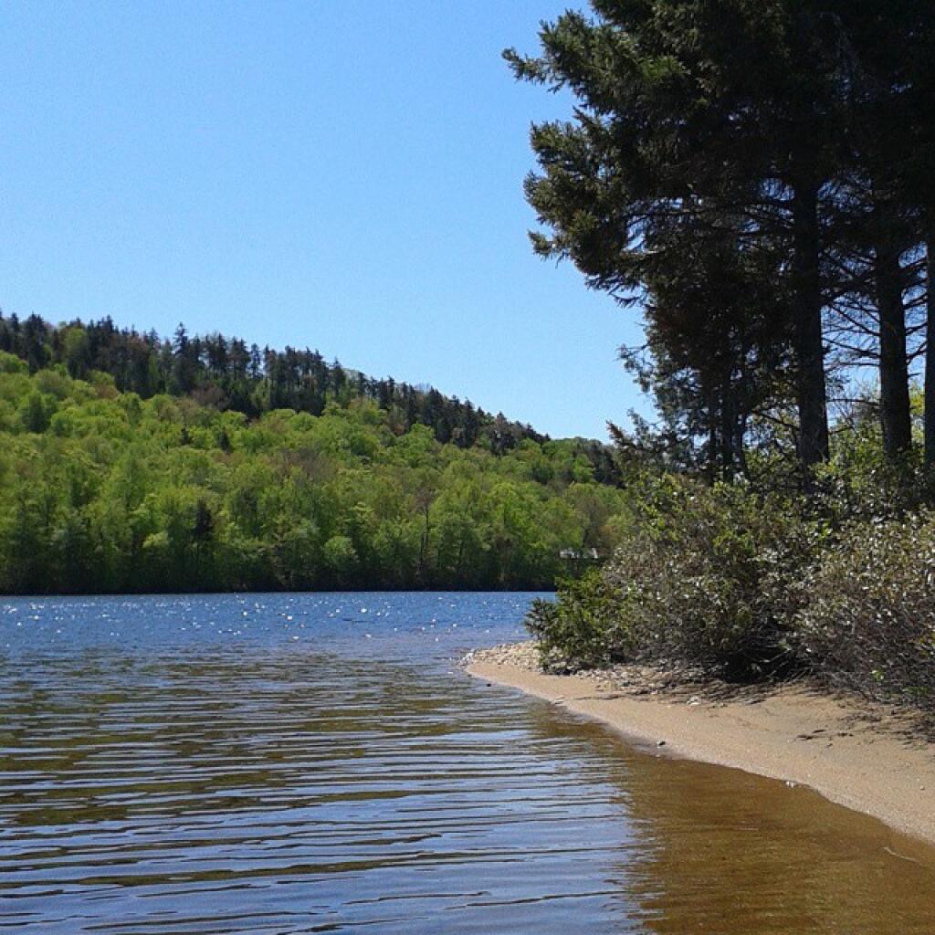
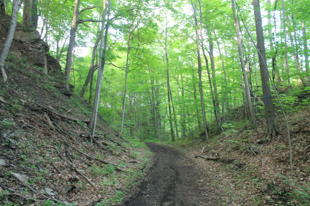
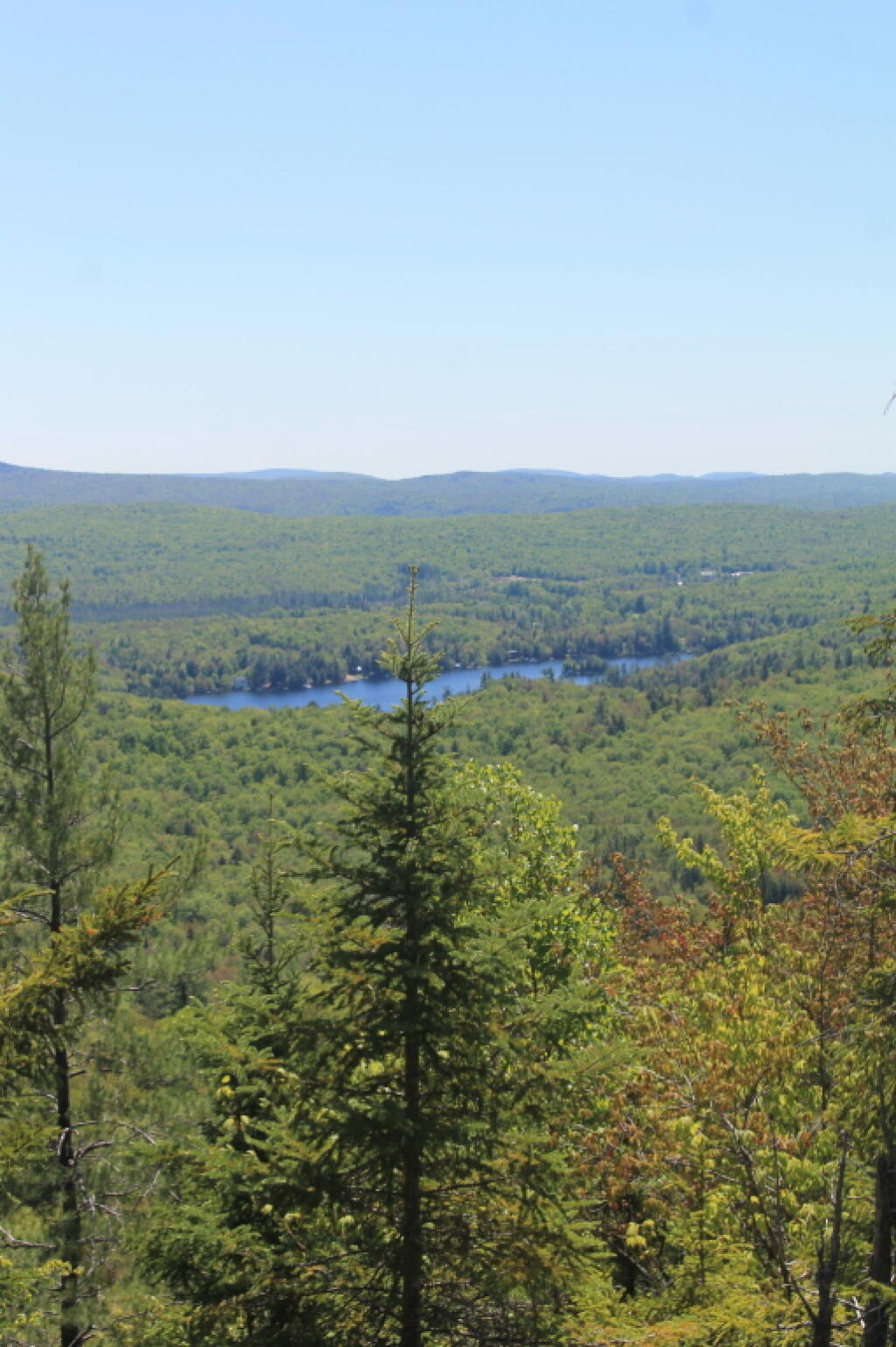
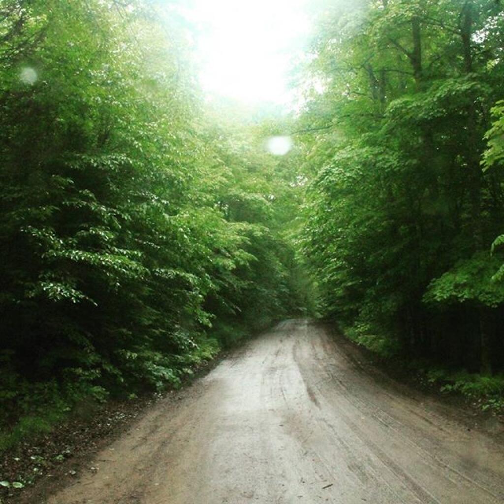
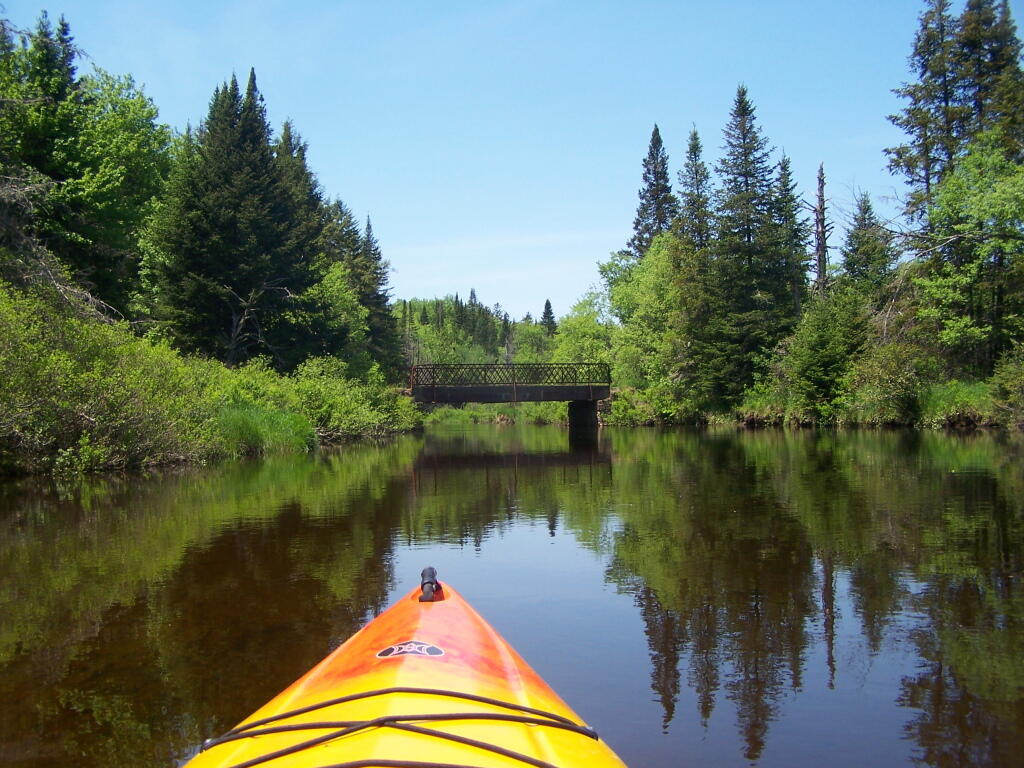
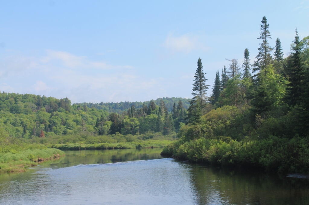
Maybe I’ve been overly cranky, but the smoke detector thing in particularly really set me off yesterday, 👩‍🚒 especially after such a long and difficult birthday. I am so done with winter, ready for nicer weather and longer days. At least the mornings and evenings aren’t as dark we move into February. I have a lot to look forward to once we get over the hump of winter. ⛄ I think what I really need is just more time in the wilderness. 🏕 Maybe this weekend.

Tonight will be mostly cloudy 🌥, with a low of 25 degrees at 4am. 10 degrees above normal, which is similar to a typical night around March 11th. South wind around 7 mph. In 2023, we had light snow in the evening, which became mostly clear by the early hours of the morning. It got down to 18 degrees. The record low of -26 occurred back in 1948.

It’s always nice to see a bit of money in bank account 💰 before the money goes into retirement, investments, and my landlord’s slice. 🏘 My apartment is a dump but it’s affordable.

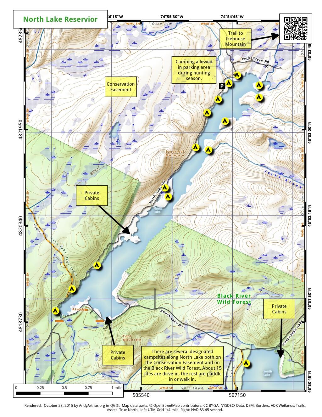
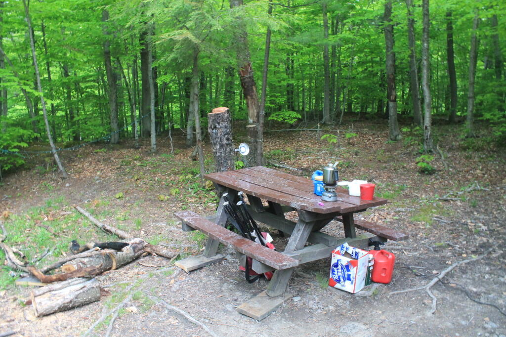
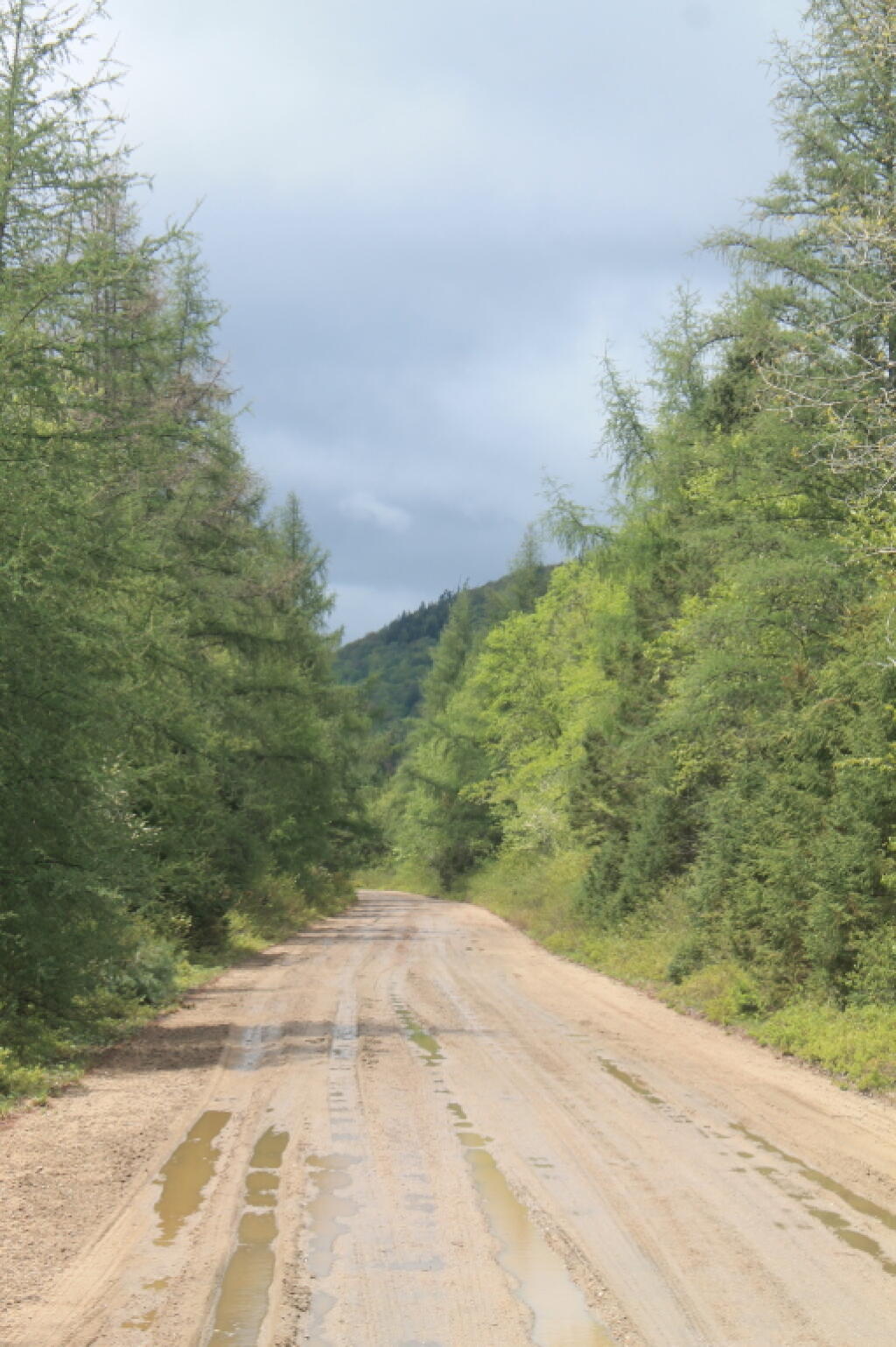
A picture perfect weekend on tap. 😎 Saturday, sunny, with a high near 35. Sunday, sunny, with a high near 35. Typical average high for the weekend is 33 degrees. I am thinking of doing an overnight in the woods this weekend, though I wish I had skis ⛷ but I should be able to ride roads if the trails have too much which they might. Kind of a birthday weekend camping adventure. ⛺ But a week late. Probably won’t head too far out of town for that. President’s Day Weekend, depending on how much snow there is, I might head up to the Adirondacks or Madison County.

As previously noted, next Tuesday is Save the Pine Bush Turns 43 🦋 when the sun will be setting at 5:16 pm with dusk at 5:44 pm. On that day in 2023, we had partly sunny and temperatures between 41 and 21 degrees. Typically, the high temperature is 34 degrees. We hit a record high of 55 back in 1991.

Open Water

Peaks Over 3,000 Feet Elevation in New York State

There are 229 summits in New York State greater then 3,000 feet elevation.

Tallest Peak Summit Name Elevation County USGS Topo Map Name State Land Trail Location
1 Mount Marcy 5,344 Essex Mount Marcy High Peaks Wilderness NA 44.112733,
-73.9237833
2 Algonquin Peak 5,105 Essex North Elba High Peaks Wilderness Algonquin Trail 44.1436636,
-73.9865357
3 Mount Haystack 4,924 Essex Mount Marcy High Peaks Wilderness Haystack Trail Via Barklet Ridge 44.1056093,
-73.9004196
4 Mount Skylight 4,908 Essex Mount Marcy High Peaks Wilderness Skylight Trail 44.0994987,
-73.9306986
5 Basin Mountain 4,852 Essex Mount Marcy High Peaks Wilderness State Range Trail 44.1211639,
-73.8862527
6 Iroquois Peak 4,829 Essex North Elba High Peaks Wilderness Iroquois Herd Path Via Boundary Peak 44.1369973,
-73.9982027
7 Boundary Peak 4,826 Essex North Elba High Peaks Wilderness Iroquois Herd Path Via Boundary Peak 44.1397749,
-73.9937582
8 Whiteface Mountain 4,816 Essex Lake Placid Whiteface Mountain Ski Center Whiteface Landing To Whiteface Mtn. Trail 44.3658804,
-73.9026456
9 Dix Mountain 4,813 Essex Dix Mountain High Peaks Wilderness Elk Lake To Dix Mountain Trail 44.0822756,
-73.7862471
10 Gray Peak 4,800 Essex Mount Marcy High Peaks Wilderness Mount Marcy Trail Via Opalescent River 44.1114427,
-73.9348658
11 Schofield Cobble 4,744 Essex Mount Marcy High Peaks Wilderness NA 44.1089427,
-73.9270876
12 Little Marcy 4,728 Essex Mount Marcy High Peaks Wilderness Van Hoevenberg Trail To Marcy 44.1197753,
-73.910976
13 Gothics 4,724 Essex Keene Valley High Peaks Wilderness Beaver Meadow Falls Trail 44.1281079,
-73.8570849
14 Mount Colden 4,708 Essex North Elba High Peaks Wilderness Mount Colden Via Lake Arnold 44.1269976,
-73.9598674
15 Beck-horn 4,695 Essex Dix Mountain High Peaks Wilderness Elk Lake To Dix Mountain Trail 44.0800534,
-73.7845802
16 Little Haystack 4,678 Essex Mount Marcy High Peaks Wilderness Haystack Trail Via Slant Rock 44.1103313,
-73.9004197
17 Giant Mountain 4,623 Essex Rocky Peak Ridge Giant Mountain Wilderness North Trail To Giant Mtn. 44.161165,
-73.720279
18 Mount Redfield 4,603 Essex Mount Marcy High Peaks Wilderness Mt Redfield Trail 44.094777,
-73.949866
19 Santanoni Peak 4,596 Essex Santanoni Peak High Peaks Wilderness Bradley Pond Trail 44.0822811,
-74.1309855
20 Wright Peak 4,564 Essex North Elba High Peaks Wilderness Wright Peak Spur Trail 44.1517187,
-73.9801468
21 Nippletop 4,554 Essex Dix Mountain High Peaks Wilderness Nipple Top Trail 44.0892202,
-73.8159708
22 Saddleback Mountain 4,534 Essex North Elba High Peaks Wilderness State Range Trail 44.1264414,
-73.8748634
23 Panther Peak 4,455 Essex Santanoni Peak High Peaks Wilderness Bradley Pond Trail 44.0983915,
-74.132097
24 Rocky Peak 4,403 Essex Rocky Peak Ridge Giant Mountain Wilderness East Trail To Giant Mtn. Via Rocky Peak Ridge 44.1542177,
-73.7051718
25 Macomb Mountain 4,396 Essex Dix Mountain High Peaks Wilderness Macomb-E. Dix Trail 44.0517211,
-73.7801349
26 Hough Peak 4,393 Essex Dix Mountain High Peaks Wilderness S. Dix-Hough Trail 44.0694981,
-73.7776352
27 Mount Marshall 4,380 Essex Street Mountain High Peaks Wilderness Mt Marshall Trail 44.1275538,
-74.0118142
28 Armstrong Mountain 4,360 Essex Keene Valley High Peaks Wilderness Adk Range Trail 44.1347741,
-73.8490291
29 Seward Mountain 4,327 Franklin Ampersand Lake High Peaks Wilderness Seymour Mountain Herd Path 44.1597799,
-74.1993239
30 Allen Mountain 4,321 Essex Mount Marcy High Peaks Wilderness Mt Redfield Trail 44.0708892,
-73.9395871
31 Table Top Mountain 4,295 Essex North Elba High Peaks Wilderness Table Top Mountain Trail 44.143663,
-73.9070876
32 Big Slide Mountain 4,232 Essex Keene Valley High Peaks Wilderness Big Slide Trail 44.1822721,
-73.8704202
33 Esther Mountain 4,232 Essex Franklin Falls Wilmington Wild Forest Esther Mt Trail 44.3869916,
-73.8898673
34 MacIntyre Mountains 4,193 Essex Street Mountain High Peaks Wilderness Mt Marshall Trail 44.1308868,
-74.008203
35 Lower Wolfjaw Mountain 4,190 Essex Keene Valley High Peaks Wilderness W.a. White Trail 44.1483845,
-73.8326399
36 Upper Wolfjaw Mountain 4,190 Essex Keene Valley High Peaks Wilderness Adk Range Trail 44.1406072,
-73.8451402
37 Slide Mountain 4,167 Ulster Peekamoose Mountain Slide Mountain Wilderness Burroughs Range Trail-Wittenberg-Cornell 41.9987034,
-74.3862617
38 Phelps Mountain 4,137 Essex North Elba High Peaks Wilderness Phelps Mtn. Trail 44.1569957,
-73.9209775
39 Cascade Mountain 4,094 Essex Keene Valley High Peaks Wilderness Casade Mountain Trail 44.2186594,
-73.860143
40 South Dix 4,088 Essex Dix Mountain High Peaks Wilderness Macomb-E. Dix Trail 44.060054,
-73.7743014
41 Lookout Mountain 4,078 Essex Franklin Falls Whiteface Mountain Ski Center Esther Mt Trail 44.3778249,
-73.887645
42 Donaldson Mountain 4,062 Franklin Ampersand Lake High Peaks Wilderness Seymour Mountain Herd Path 44.1539471,
-74.210991
43 Seymour Mountain 4,055 Franklin Ampersand Lake High Peaks Wilderness Seymour Mountain Herd Path 44.1578347,
-74.1721003
44 Colvin Range 4,049 Essex Dix Mountain High Peaks Wilderness Colvin Trail 44.0939424,
-73.8345829
45 Mount Colvin 4,049 Essex Dix Mountain High Peaks Wilderness Colvin Trail 44.0939424,
-73.8345829
46 Hunter Mountain 4,045 Greene Hunter Hunter-West Kill Wilderness Spruceton Trail 42.1778662,
-74.2304216
47 Mount Emmons 4,022 Franklin Ampersand Lake High Peaks Wilderness Northville-Placid Trail 44.1436698,
-74.2140464
48 Street Mountain 4,022 Essex Street Mountain High Peaks Wilderness Street Mountain Trail 44.1797741,
-74.0437616
49 Grace Peak 4,006 Essex Dix Mountain High Peaks Wilderness Macomb-E. Dix Trail 44.0653314,
-73.7573564
50 Yard Mountain 3,999 Essex North Elba High Peaks Wilderness Big Slide Trail Via Yard Mtn. 44.1747725,
-73.8845874
51 MacNaughton Mountain 3,983 Essex Street Mountain High Peaks Wilderness Wall Face Ponds Trail 44.1397768,
-74.064317
52 Dial Mountain 3,980 Essex Dix Mountain High Peaks Wilderness Leach Trail 44.1058859,
-73.7959703
53 Blake Peak 3,976 Essex Dix Mountain High Peaks Wilderness Pinnacle Trail 44.081443,
-73.844583
54 Green Mountain 3,976 Essex Rocky Peak Ridge Giant Mountain Wilderness North Trail To Giant Mtn. 44.182272,
-73.714858
55 Black Dome 3,973 Greene Freehold Windham-Blackhead Range Wilderness Blackhead Range Trail 42.2700864,
-74.1226382
56 Thomas Cole Mountain 3,944 Greene Hensonville Windham-Blackhead Range Wilderness Blackhead Range Trail 42.2709196,
-74.1365275
57 Cliff Mountain 3,940 Essex Mount Marcy High Peaks Wilderness Mount Marcy Trail Via Opalescent River 44.1031102,
-73.9751452
58 McDonnel Mountain 3,940 Essex Mount Marcy High Peaks Wilderness Mt Redfield Trail 44.0803332,
-73.9340315
59 Blackhead 3,930 Greene Freehold Windham-Blackhead Range Wilderness Blackhead Mountain Spur Trail 42.2678644,
-74.1045818
60 West Kill Mountain 3,891 Greene Lexington Hunter-West Kill Wilderness Devil’s Path 42.1678663,
-74.2895904
61 Doubletop Mountain 3,875 Ulster Seager NA Seager Big Indian Trail 42.0275913,
-74.5282095
62 Nye Mountain 3,871 Essex Street Mountain High Peaks Wilderness Nye Mountain Trail 44.1931062,
-74.0240387
63 Kilburn Mountain 3,868 Essex Lake Placid Sentinel Range Wilderness Copperas Owen Pond Trl 44.3028247,
-73.8818114
64 Moose Mountain 3,868 Essex McKenzie Mountain Mckenzie Mountain Wilderness Mckenzie Mtn. Trail 44.3506029,
-74.0032049
65 Howard Mountain 3,852 Essex North Elba High Peaks Wilderness Klondike Notch Trail 44.1583844,
-73.8912539
66 Cornell Mountain 3,848 Ulster Phoenicia Slide Mountain Wilderness Burroughs Range Trail-Wittenberg-Cornell 42.0014812,
-74.3568163
67 Graham Mountain 3,848 Ulster Seager NA Seager Big Indian Trail 42.0392576,
-74.5495986
68 Plateau Mountain 3,845 Greene Hunter Indian Head Wilderness Devil’s Path 42.1378671,
-74.1743088
69 McKenzie Mountain 3,842 Essex McKenzie Mountain Mckenzie Mountain Wilderness Mckenzie Mtn. Trail 44.3361593,
-74.0320951
70 Rist Mountain 3,839 Essex Mount Marcy High Peaks Wilderness Boreas Road 44.027559,
-73.987366
71 Sentinel Mountain 3,835 Essex Keene Sentinel Range Wilderness Winch Pond 44.3061581,
-73.8523658
72 Lyon Mountain 3,829 Clinton Moffitsville Chazy Highlands Wild Forest New Lyon Mountain Trail 44.7036537,
-73.8645877
73 T R Mountain 3,829 Essex North Elba High Peaks Wilderness Lake Arnold Crossover 44.143941,
-73.9354222
74 Snowy Mountain 3,825 Hamilton Snowy Mountain NA Snowy Mt 43.7003432,
-74.3859856
75 Table Mountain 3,819 Ulster Peekamoose Mountain Slide Mountain Wilderness Peekamoose-Table Trail 41.9587036,
-74.4048739
76 Peekamoose Mountain 3,812 Ulster Peekamoose Mountain Slide Mountain Wilderness Peekamoose-Table Trail 41.9531481,
-74.398207
77 Avalanche Mountain 3,809 Essex North Elba High Peaks Wilderness Avalanche Pass Trail 44.1361639,
-73.9695903
78 Averill Peak 3,806 Clinton Lyon Mountain Chazy Highlands Wild Forest New Lyon Mountain Trail 44.6928208,
-73.8809768
79 Sugarloaf Mountain 3,806 Greene Hunter Indian Head Wilderness Devil’s Path 42.1312006,
-74.1501414
80 Couchsachraga Peak 3,793 Essex Santanoni Peak High Peaks Wilderness Cold River Horse Trail 44.0956146,
-74.1601539
81 Boreas Mountain 3,779 Essex Mount Marcy NA Gulf Brook Road 44.0031138,
-73.8806937
82 Wittenberg Mountain 3,766 Ulster Phoenicia Slide Mountain Wilderness Burroughs Range Trail-Wittenberg-Cornell 42.0081478,
-74.3473716
83 Panther Mountain 3,763 Hamilton Snowy Mountain NA Snowy Mt 43.7367317,
-74.3907093
84 Burroughs Range 3,760 Ulster Phoenicia Slide Mountain Wilderness Burroughs Range Trail-Wittenberg-Cornell 42.0084255,
-74.3476494
85 Blue Mountain 3,750 Hamilton Blue Mountain Lake Blue Mountain Wild Forest Blue Mountain Trail 43.8725634,
-74.4009917
86 Porter Mountain 3,750 Essex Keene Valley High Peaks Wilderness Porter Mountain Trail Via Marcy Field 44.2153262,
-73.8434754
87 Wakely Mountain 3,750 Hamilton Wakely Mountain Wakely Mountain Primitive Area Wakely Mountain Trail 43.7358986,
-74.5151595
88 Little Nippletop 3,720 Essex Mount Marcy High Peaks Wilderness Elk Lake To Marcy Trail 44.0853327,
-73.9201422
89 Wallface Mountain 3,720 Essex Street Mountain High Peaks Wilderness Indian Pass Trail 44.1378317,
-74.0365378
90 Panther Mountain 3,714 Ulster Shandaken Slide Mountain Wilderness Giant Ledge-Panther Mountian-Fox Hollow Trail 42.0564799,
-74.3945946
91 Balsam Lake Mountain 3,707 Ulster Seager Balsam Lake Mountain Wild Forest Balsam Lake Mountain Trail 42.0459236,
-74.5940438
92 Henderson Mountain 3,707 Essex Mount Adams High Peaks Wilderness Bradley Pond Trail 44.0978353,
-74.0976509
93 Hoffman Mountain 3,701 Essex Blue Ridge Hoffman Notch Wilderness Hoffman Notch Trail 43.9114489,
-73.8168
94 Lone Mountain 3,697 Ulster Peekamoose Mountain Slide Mountain Wilderness Peekamoose-Table Trail 41.9692592,
-74.3893177
95 Big Indian Mountain 3,694 Ulster Shandaken Big Indian Wilderness Pine Hill West Branch Trail 42.0350915,
-74.4965421
96 Hurricane Mountain 3,688 Essex Rocky Peak Ridge Hurricane Mountain Wilderness East Hurricane Mtn Trial 44.235326,
-73.7106926
97 Friday Mountain 3,681 Ulster West Shokan Slide Mountain Wilderness Burroughs Range Trail-Wittenberg-Cornell 41.9875924,
-74.3620944
98 Rusk Mountain 3,678 Greene Lexington Rusk Mountain Wild Forest Spruceton Trail 42.2006434,
-74.2770897
99 Cheney Cobble 3,674 Essex Mount Marcy High Peaks Wilderness East River Trail 44.0445021,
-73.9648654
100 Lewey Mountain 3,665 Hamilton Snowy Mountain West Canada Lake Wilderness Sucker Brook Trail 43.6642328,
-74.4412649
101 Seward Mountains 3,665 Franklin Ampersand Lake High Peaks Wilderness Calkins Creek Truck Trail 44.1561694,
-74.2148801
102 Santanoni Mountains 3,661 Essex Santanoni Peak High Peaks Wilderness Bradley Pond Trail 44.0881144,
-74.138486
103 Buell Mountain 3,652 Hamilton Snowy Mountain NA Snowy Mt 43.7161764,
-74.4065426
104 High Peak 3,645 Greene Kaaterskill Clove Kaaterskill Wild Forest Kaaterskill High Peak Trail 42.1620334,
-74.0801381
105 Little Whiteface Mountain 3,638 Essex Lake Placid Whiteface Mountain Ski Center Whiteface Landing To Whiteface Mtn. Trail 44.3558804,
-73.891534
106 Burtons Peak 3,632 Essex Keene Valley NA The Brothers Trail 44.1925,
-73.8586111
107 Fir Mountain 3,629 Ulster Shandaken Big Indian Wilderness Pine Hill West Branch Trail 42.0275916,
-74.4690414
108 Twin Mountain 3,629 Greene Hunter Indian Head Wilderness Devil’s Path 42.1256453,
-74.1290294
109 Little Moose Mountain 3,609 Hamilton Wakely Mountain Little Moose Wilderness Otter Brook Trail 43.6700663,
-74.5707151
110 Balsam Mountain 3,606 Ulster Shandaken Big Indian Wilderness Pine Hill West Branch Trail 42.0909235,
-74.4882082
111 Calamity Mountain 3,606 Essex Mount Adams High Peaks Wilderness Calamity Brook Trail 44.1028328,
-74.0043132
112 Sunrise Mountain 3,606 Essex Dix Mountain High Peaks Wilderness Elk Lake To Dix Mountain Trail 44.0247778,
-73.7904124
113 Balsam Cap 3,602 Ulster West Shokan Slide Mountain Wilderness Burroughs Range Trail-Wittenberg-Cornell 41.9770369,
-74.3573722
114 Stewart Mountain 3,602 Essex Keene Sentinel Range Wilderness Winch Pond 44.3261581,
-73.8562549
115 North Dome 3,596 Greene Lexington Hunter-West Kill Wilderness Devil’s Path 42.1734217,
-74.3490366
116 Pillsbury Mountain 3,589 Hamilton Spruce Lake West Canada Lake Wilderness Pillsbury Mountain Trail 43.580901,
-74.5120992
117 Slide Mountain 3,586 Essex Lake Placid Sentinel Range Wilderness Barkeater Cliffs Campsite Trail 44.2767136,
-73.8862561
118 Eagle Mountain 3,573 Ulster Seager Big Indian Wilderness Pine Hill West Branch Trail 42.0620352,
-74.50932
119 Dun Brook Mountain 3,563 Hamilton Dun Brook Mountain NA Deer Pond Road 43.890897,
-74.3187666
120 Saddleback Mountain 3,560 Essex Jay Mountain Jay Mountain Wilderness Jay Mountain Trail 44.2953258,
-73.6676367
121 Indian Head Mountain 3,553 Greene Woodstock Indian Head Wilderness Devil’s Path 42.116201,
-74.1145846
122 Fishing Brook Mountain 3,550 Essex Dun Brook Mountain Blue Mountain Wild Forest Deer Pond Road 43.9342303,
-74.2946002
123 Mount Sherrill 3,550 Greene Lexington Hunter-West Kill Wilderness Devil’s Path 42.1756439,
-74.3729262
124 Gooseberry Mountain 3,540 Essex Keene Valley High Peaks Wilderness Orebed Brook Trail 44.1367187,
-73.8731969
125 Bearpen Mountain 3,530 Delaware Prattsville Bearpen Mountain State Forest Access Trail 42.2734189,
-74.4840396
126 Vly Mountain 3,530 Greene West Kill Bearpen Mountain State Forest Snowmobile Trail 42.2453645,
-74.4459834
127 Windham High Peak 3,527 Greene Hensonville Windham-Blackhead Range Wilderness Escarpment Trail 42.3148069,
-74.1434718
128 Halcott Mountain 3,524 Greene West Kill Halcott Mountain Wild Forest Condon Hollow Rd. 42.1800882,
-74.4379281
129 Mount Adams 3,520 Essex Mount Adams High Peaks Wilderness Mt Adams Trail 44.0867231,
-74.0257027
130 Pitchoff Mountain 3,501 Essex North Elba Sentinel Range Wilderness Pitchoff Mountain Trail 44.2375474,
-73.8776443
131 Noonmark Mountain 3,491 Essex Keene Valley High Peaks Wilderness Stimson Trail 44.1289404,
-73.7720809
132 Rocky Mountain 3,478 Ulster West Shokan Slide Mountain Wilderness Peekamoose-Table Trail 41.9728703,
-74.3726505
133 Little Santanoni Mountain 3,471 Essex Santanoni Peak High Peaks Wilderness Moose Pond Horse Trail 44.0731156,
-74.1670981
134 Spotted Mountain 3,461 Essex Underwood High Peaks Wilderness Macomb-E. Dix Trail 44.0769975,
-73.7440228
135 Manbury Mountain 3,455 Hamilton Wakely Mountain Little Moose Wilderness Otter Brook Trail 43.6653442,
-74.5532143
136 Blue Ridge Mountain 3,451 Essex Blue Ridge Hoffman Notch Wilderness Hoffman Notch Trail 43.9247817,
-73.8148558
137 Roundtop 3,451 Delaware Prattsville Bearpen Mountain State Forest Ski Run Road 42.2939737,
-74.4904283
138 Roundtop Mountain 3,451 Greene Kaaterskill Clove Kaaterskill Wild Forest Kaaterskill High Peak Trail 42.1684222,
-74.094583
139 Olderbark Mountain 3,438 Greene Bearsville Indian Head Wilderness Mink Hollow Trail 42.1142565,
-74.1909765
140 Puffer Mountain 3,438 Hamilton Bullhead Mountain Siamese Ponds Wilderness Puffer Pond Brook Trail 43.6617318,
-74.1993082
141 Morgan Mountain 3,432 Essex Wilmington Wilmington Wild Forest Cooper Kill Trail 44.4186582,
-73.8593108
142 Wolf Pond Mountain 3,425 Essex Cheney Pond NA Gulf Brook Road 43.9892253,
-73.8781933
143 Stoppel Point 3,422 Greene Kaaterskill Clove Windham-Blackhead Range Wilderness Escarpment Trail 42.2250879,
-74.0651364
144 Huntersfield Mountain 3,419 Greene Ashland Huntersfield State Forest Huntersfield Access Trail #8/Long Path Access 42.355638,
-74.3465339
145 Cellar Mountain 3,405 Hamilton Wakely Mountain Moose River Plains Wild Forest Cellar Pond Trail 43.7122879,
-74.5429375
146 Haynes Mountain 3,405 Ulster Seager Big Indian Wilderness Pine Hill West Branch Trail 42.0792571,
-74.5079309
147 Sawtooth Mountains 3,402 Franklin Street Mountain High Peaks Wilderness Northville-Placid Trail 44.1928314,
-74.1134874
148 Bear Den Mountain 3,389 Essex Dix Mountain High Peaks Wilderness Leach Trail 44.1194964,
-73.792915
149 Pinnacle 3,389 Essex Dix Mountain High Peaks Wilderness Pinnacle Trail Spur To Summit 44.0583887,
-73.8640277
150 Vanderwhacker Mountain 3,389 Essex Vanderwhacker Mountain Vanderwhacker Mountain Wild Forest Vanderwhacker Firetower Trail 43.8983963,
-74.0959781
151 Jay Mountain 3,379 Essex Jay Mountain Jay Mountain Wilderness Jay Mountain Trail 44.3125477,
-73.685693
152 Spruce Top 3,379 Greene Hunter NA Devil’s Path 42.1506447,
-74.1679195
153 Spruce Mountain 3,376 Ulster Shandaken Big Indian Wilderness Phoenicia East Branch Trail 42.0175919,
-74.4498744
154 Belle Ayr Mountain 3,373 Ulster Shandaken Belleayre Mountain Ski Center NA 42.1159229,
-74.4979304
155 Evergreen Mountain 3,369 Greene Lexington Rusk Mountain Wild Forest Devil’s Path 42.2117542,
-74.3079238
156 Hedgehog Mountain 3,366 Essex Keene Valley High Peaks Wilderness Rooster Comb And Hedgehog Trail 44.159495,
-73.8109724
157 Balsam Mountain 3,353 Greene West Kill Hunter-West Kill Wilderness Condon Hollow Rd. 42.1836992,
-74.387371
158 Kempshall Mountain 3,350 Hamilton Kempshall Mountain High Peaks Wilderness Northville-Placid Trail 44.0236734,
-74.3271041
159 Buck Mountain 3,346 Hamilton Snowy Mountain West Canada Lake Wilderness Snowy Mt 43.6947879,
-74.4368212
160 Mount Pisgah 3,340 Delaware Margaretville NA Mountain Brook Road 42.2211973,
-74.7357125
161 MacDonough Mountain 3,320 Essex Jay Mountain Jay Mountain Wilderness Jay Mountain Trail 44.3050482,
-73.644025
162 Debar Mountain 3,317 Franklin Debar Mountain Debar Mountain Wild Forest Debar Mountain Trail 44.6033852,
-74.2204351
163 Bullhead Mountain 3,314 Warren Bullhead Mountain Siamese Ponds Wilderness John Pond Crossover Trail 43.7017316,
-74.1804199
164 Laramore Mountain 3,314 Essex Keene Valley High Peaks Wilderness Casade Mountain Trail 44.2258813,
-73.8501427
165 Tripod Mountain 3,307 Essex Rocky Peak Ridge Giant Mountain Wilderness Hopkin Via Direct Trail 44.1983824,
-73.736248
166 Metcalf Mountain 3,304 Hamilton Blue Mountain Lake Blue Ridge Wilderness Gould Road 43.7522873,
-74.4957146
167 Wyman Mountain 3,304 Essex Underwood High Peaks Wilderness Macomb-E. Dix Trail 44.0581093,
-73.7445779
168 Jay Mountains 3,297 Essex Jay Mountain Jay Mountain Wilderness Jay Mountain Trail 44.308659,
-73.6704147
169 Eleventh Mountain 3,294 Warren Bakers Mills Siamese Ponds Wilderness Bog Meadow Trail 43.6142322,
-74.0720783
170 Schultice Mountain 3,284 Delaware Roxbury NA Ski Run Road 42.3186948,
-74.5157062
171 Cellar Mountain 3,281 Hamilton Snowy Mountain West Canada Lake Wilderness Sucker Brook Trail 43.6411776,
-74.4443199
172 Plattekill Mountain 3,268 Delaware Hobart Plattekill State Forest Mountain Brook/ Harold Roberts Access Trail 42.2667522,
-74.6482102
173 South Pond Mountain 3,258 Hamilton South Pond Mountain Siamese Ponds Wilderness County Line Brook Trail 43.5900656,
-74.2204175
174 Hemlock Mountain 3,248 Ulster Shandaken Big Indian Wilderness Phoenicia East Branch Trail 42.0128698,
-74.4390407
175 Peaked Mountain 3,235 Essex Jay Mountain Hurricane Mountain Wilderness Soda Range Trail 44.2656034,
-73.6993039
176 Onteora Mountain 3,232 Greene Hunter NA Blackhead Range Trail 42.2223098,
-74.1679184
177 Kitty Cobble 3,225 Hamilton Wakely Mountain West Canada Lake Wilderness Otter Brook Trail 43.6295111,
-74.6229377
178 Baldwin Hill 3,218 Essex Franklin Falls Mckenzie Mountain Wilderness Esther Mt Trail 44.3847694,
-73.9195905
179 Richmond Mountain 3,218 Greene Ashland Mount Pisgah State Forest Long Path Hiking Trail 42.367582,
-74.270976
180 Squaw Mountain 3,218 Hamilton Indian Lake NA Snowy Mt 43.7270094,
-74.3420956
181 Dug Mountain 3,215 Hamilton Kunjamuk River NA Long Pond Trail 43.583122,
-74.345146
182 Hamilton Mountain 3,215 Hamilton Wells Silver Lake Wilderness West River Road 43.412013,
-74.3673645
183 Mount Alton 3,212 Essex Lake Placid Mckenzie Mountain Wilderness Whiteface Mountain Trail 44.3717139,
-73.9662589
184 Utsayantha Mountain 3,209 Delaware Stamford NA Ward Allen Road 42.3992472,
-74.5895953
185 Van Wyck Mountain 3,202 Ulster Peekamoose Mountain Slide Mountain Wilderness Phoenicia East Branch Trail 41.9523147,
-74.4354304
186 Colonels Chair 3,199 Greene Hunter NA Colonel’s Chair Trail 42.2006434,
-74.2306991
187 Gore Mountain 3,199 Warren Gore Mountain Gore Mountain Ski Center Schaefer Trail 43.6764539,
-74.035134
188 Chase Mountain 3,192 Essex Rocky Peak Ridge Hurricane Mountain Wilderness North Hurricane Trail 44.2417145,
-73.7248599
189 Knob Lock Mountain 3,192 Essex Rocky Peak Ridge Giant Mountain Wilderness Hurricane Trail From 9n 44.2003271,
-73.7073583
190 McGregor Mountain 3,192 Delaware Stamford Stamford Fp Detached Parcel Relay Public Forest Access Road 42.3900808,
-74.5790396
191 Weston Mountain 3,192 Essex Jay Mountain Hurricane Mountain Wilderness Soda Range Trail 44.2642144,
-73.7079152
192 Burnt Knob 3,189 Greene Freehold Windham-Blackhead Range Wilderness Escarpment Trail 42.3020297,
-74.1190264
193 Burgess Mountain 3,189 Hamilton Rock Lake NA Bear Trap Brook Trail 43.7520092,
-74.3565416
194 North Mountain 3,186 Greene Kaaterskill Clove Windham-Blackhead Range Wilderness Escarpment Trail 42.2175881,
-74.0487469
195 Payne Mountain 3,182 Hamilton Snowy Mountain Moose River Plains Wild Forest Northville-Placid Trail 43.7231211,
-74.4951582
196 Hopkins Mountain 3,169 Essex Rocky Peak Ridge Giant Mountain Wilderness Hopkins Mtn. Via Spread Eagle Mtn. 44.1833828,
-73.7490257
197 Spruce Lake Mountain 3,163 Hamilton Spruce Lake Mountain West Canada Lake Wilderness Northville-Placid Trail 43.5120126,
-74.6532121
198 Tongue Mountain 3,159 Hamilton Dun Brook Mountain NA Northville-Placid Trail 43.9114522,
-74.3454349
199 Catamount Mountain 3,153 Clinton Wilmington Taylor Pond Wild Forest Catamount Trail 44.459214,
-73.8723668
200 Wildcat Mountain 3,153 Ulster Peekamoose Mountain Slide Mountain Wilderness Pine Hill West Branch Trail 41.9775924,
-74.4759867
201 White Man Mountain 3,146 Delaware Roxbury NA Access Trail 42.2845295,
-74.5340406
202 Bradley Mountain 3,140 Hamilton Wakely Mountain Blue Ridge Wilderness Cellar Pond Trail 43.7378431,
-74.5546055
203 Overlook Mountain 3,136 Ulster Woodstock Overlook Mountain Wild Forest Firetower Spur 42.0850905,
-74.0931954
204 Mount Tamarac 3,127 Essex McKenzie Mountain Mckenzie Mountain Wilderness Jackrabbit Trail 44.3267144,
-74.0204281
205 Mount Morris 3,117 Franklin Tupper Lake NA Goodman Mountain Trail 44.1595046,
-74.475168
206 Acra Point 3,110 Greene Freehold Windham-Blackhead Range Wilderness Escarpment Trail 42.2964745,
-74.0998591
207 Round Mountain 3,107 Essex Keene Valley High Peaks Wilderness Weston Trail Spur To Round Mt 44.1317179,
-73.7515245
208 Cave Mountain 3,104 Greene Hensonville Elm Ridge Wild Forest North Face Trail 42.2859185,
-74.2462543
209 Pete Gay Mountain 3,097 Warren Gore Mountain NA Schaefer Trail 43.6903427,
-74.0443015
210 Plattekill Mountain 3,091 Greene Woodstock Indian Head Wilderness Overlook Trail 42.1073123,
-74.0865281
211 Mount Andrew 3,081 Essex Mount Adams High Peaks Wilderness Bradley Pond Trail 44.0564482,
-74.093483
212 County Line Mountain 3,081 Hamilton South Pond Mountain Siamese Ponds Wilderness Siamese Ponds Trail 43.6114543,
-74.2006952
213 High Point 3,074 Ulster West Shokan Sundown Wild Forest Ashokan High Point 41.9248149,
-74.2879263
214 Rose Mountain 3,074 Ulster West Kill NA Rochester Hollow 42.1506445,
-74.4379284
215 Cowan Mountain 3,068 Delaware Hobart NA Relay Public Forest Access Road 42.3450825,
-74.6498756
216 Round Top 3,068 Delaware Hobart Plattekill State Forest Mountain Brook/ Harold Roberts Access Trail 42.2714741,
-74.6832109
217 Churchill Mountain 3,064 Delaware Stamford NA Relay Public Forest Access Road 42.388692,
-74.6098738
218 Irish Mountain 3,064 Delaware Roxbury NA Ski Run Road 42.3356386,
-74.5262617
219 Swart Mountain 3,061 Hamilton Lake Pleasant Silver Lake Wilderness West River Road 43.3967355,
-74.3815314
220 Scarface Mountain 3,058 Essex McKenzie Mountain Saranac Lakes Wild Forest Scarface Mountain Trail 44.2647717,
-74.0737646
221 T Lake Mountain 3,058 Hamilton Piseco Lake West Canada Lake Wilderness T Lake Trail 43.4470133,
-74.5770967
222 Bailey Hill 3,054 Essex Cheney Pond Hoffman Notch Wilderness Hoffman Notch Trail 43.9108943,
-73.9026366
223 Bald Peak 3,054 Essex Rocky Peak Ridge Giant Mountain Wilderness East Trail To Giant Mtn. Via Rocky Peak Ridge 44.1597731,
-73.6654114
224 Little Rocky Mountain 3,051 Greene Bearsville Indian Head Wilderness Warner Creek Trail 42.1150898,
-74.2040325
225 Denman Mountain 3,048 Sullivan Claryville NA Denman Mountain Snowmobile Trail 41.90287,
-74.5396005
226 Woodhull Mountain 3,045 Ulster Peekamoose Mountain NA Phoenicia East Branch Trail 41.9459259,
-74.4637647
227 Barkaboom Mountain 3,005 Delaware Arena Dry Brook Ridge Wild Forest Touch-Me-Not-Trail 42.0717554,
-74.7201571
228 Stony Creek Mountain 3,002 Franklin Stony Creek Mountain High Peaks Wilderness Ampersand Mountain Trail 44.222002,
-74.2659949
229 Van Dorrien Mountain 3,002 Franklin Ampersand Lake High Peaks Wilderness Ampersand Mountain Trail 44.2222766,
-74.1704351

Burnt Knob Overlook

An interactive map and listing of the 280 peaks over 3,000 feet elevation listed in the Open Street Map database for New York State.

North Lake Reservoir Camping 🏕

North Lake Reservoir Camping 🏕

16 1/2 miles and 30 miles north of Forestport, the North Lake Reservoir serves as the headwaters to the Black River in a large reservoir maintained by the NYS Canal Authority for supplying a steady supply of water to Black River and Erie Canal via the former Black River Canal. Half of sites are on Black River Wild Forest, while most of the northernly sites are on a conservation easement. There is a sign-on booth for these campsites, permits are needed for stays over three nights. These are primitive campsites, though some of the sites along the eastern side, are accessible by a vehicle with a smaller camper on top. Boats with motors are allowed on this lake, so in summer months it may be not a quiet water. Most sites are on the water.

Interactive Map of North Lake Reservoir

Printable Map of North Lake Reservoir

 North Lake Reservior

Coordinates of North Lake Reservoir Campsites

Easement campsites are based on memory and were hand-drawn so they may be somewhat inaccurate.

Name Latitude Longitude
North Lake Designated Campsite #2 43.52293019 -74.94933889
North Lake Designated Campsite #3 43.52335381 -74.94934207
North Lake Designated Campsite #4 43.52506095 -74.94695943
North Lake Designated Campsite #6 43.52569387 -74.94579628
North Lake Designated Campsite #7 43.52600551 -74.94534407
North Lake Designated Campsite #8 43.52775406 -74.94410338
North Lake Designated Campsite #9 43.52800073 -74.94327684
North Lake Designated Campsite #10 43.52898888 -74.94247143
North Lake Designated Campsite #11 43.52977988 -74.9403576
Easement Campsite 43.61254681 -75.05263918
Easement Campsite 43.51529059 -74.90967
Easement Campsite 43.48088879 -75.01092893
Easement Campsite 43.54038222 -74.92580987
Easement Campsite 43.61805247 -75.03272826
Easement Campsite 43.61368033 -75.09087559
Easement Campsite 43.61053007 -75.02701572
Easement Campsite 43.58885404 -74.999126
Easement Campsite 43.59254977 -75.0887635
Easement Campsite 43.59171534 -75.00692959

Campsite on Pensuila


Loon with Chicks

Indian Lake Campground / Lewey Lake Campground Coordinates and Map 🏕

Indian Lake Campground / Lewey Lake Campground Coordinates and Map 🏕

Here is a list of coordinates for the Indian Lake Islands Campground (Fee) and Lewey Lake Campground (Fee). More details from the DEC website.

CampgroundSiteDrivewayShadeLatitudeLongitude
Indian Lake Islands1(None)(Partial )43.7304748395054-74.2877932167853
Indian Lake Islands2(None)(Partial )43.7224530757475-74.2907624839568
Indian Lake Islands3(None)(Partial )43.7190491138668-74.2940872824686
Indian Lake Islands4(None)(Partial )43.7171199750046-74.2951363500399
Indian Lake Islands5(None)(Partial )43.7159390292911-74.296792430288
Indian Lake Islands6(None)(Partial )43.7137209154048-74.2992816338604
Indian Lake Islands7(None)(Partial )43.7086902361217-74.3044716184849
Indian Lake Islands8(None)(Partial )43.7066170967467-74.3063428212781
Indian Lake Islands9(None)(Partial )43.706484373826-74.309012568379
Indian Lake Islands10(None)(Partial )43.7041133917479-74.3108869570744
Indian Lake Islands11(None)(Partial )43.697346802679-74.3247139479059
Indian Lake Islands12(None)(Partial )43.6934233534827-74.315934250817
Indian Lake Islands13(None)(Partial )43.6938317599398-74.3095682765959
Indian Lake Islands14(None)(Partial )43.6913056913982-74.3104180397371
Indian Lake Islands15(None)(Partial )43.6877472510145-74.3207508140818
Indian Lake Islands16(None)(Partial )43.6879799999189-74.3198289615071
Indian Lake Islands17(None)(Partial )43.6872673095493-74.3201653062021
Indian Lake Islands18(None)(Partial )43.6868443760804-74.3211549484078
Indian Lake Islands19(None)(Partial )43.6800228460593-74.3197875603731
Indian Lake Islands20(None)(Partial )43.6793373937581-74.3247190213537
Indian Lake Islands21(None)(Partial )43.6810192238513-74.3271292597841
Indian Lake Islands22(None)(Partial )43.6805443385533-74.3273971705849
Indian Lake Islands23(None)(Partial )43.6800709967613-74.3279276612134
Indian Lake Islands24(None)(Partial )43.6775663157946-74.3314349429213
Indian Lake Islands25(None)(Partial )43.6771809454088-74.3307171030939
Indian Lake Islands26(None)(Partial )43.6600950542325-74.3339914761212
Indian Lake Islands27(None)(Partial )43.6623719767926-74.3322598972669
Indian Lake Islands28(None)(Partial )43.6575398626981-74.337038506508
Indian Lake Islands29(None)(Partial )43.6566182393285-74.3342267801279
Indian Lake Islands30(None)(Partial )43.6539829236887-74.3316966403176
Indian Lake Islands31(None)(Partial )43.6522937620085-74.3361775393021
Indian Lake Islands32(None)(Partial )43.6668538380581-74.341005433188
Indian Lake Islands33(None)(Partial )43.6641596734641-74.3447759888232
Indian Lake Islands34(None)(Partial )43.6744752460176-74.3406594587518
Indian Lake Islands35(None)(Partial )43.6763325751765-74.3405078298866
Indian Lake Islands36(None)(Partial )43.6751048173184-74.3424249794205
Indian Lake Islands37(None)(Partial )43.6726882040652-74.3447488483478
Indian Lake Islands38(None)(Partial )43.671219530231-74.3462089234796
Indian Lake Islands39(None)(Partial )43.6658110160362-74.3502713526553
Indian Lake Islands40(None)(Partial )43.6668806076464-74.3456652959817
Indian Lake Islands41(None)(Partial )43.6589425226124-74.3489672499976
Indian Lake Islands42(None)(Partial )43.6461754070921-74.3577661306475
Indian Lake Islands43(None)(Partial )43.6435487359423-74.3566787343966
Indian Lake Islands44(None)(Partial )43.6420329888729-74.3582695228578
Indian Lake Islands45(None)(Partial )43.6426696252334-74.3613463998048
Indian Lake Islands46(None)(Partial )43.6398608445525-74.36176979162
Indian Lake Islands47(None)(Partial )43.6383868178017-74.3623102353059
Indian Lake Islands48(None)(Partial )43.6343029677954-74.3647806409216
Indian Lake Islands49(None)(Partial )43.6243422964902-74.3729530691659
Indian Lake Islands50(None)(Partial )43.6190266118137-74.3767465989883
Indian Lake Islands51(None)(Partial )43.6138131801135-74.3818499714923
Indian Lake Islands52(None)(Partial )43.6562041049367-74.3704560068939
Indian Lake Islands53(None)(Partial )43.6494681775961-74.3846914479894
Indian Lake Islands54(None)(Partial )43.6514550856348-74.3831537190584
Indian Lake Islands55(None)(Partial )43.651176948613-74.3868066171873
Lewey Lake1(None)(Partial )43.6562024310996-74.3859352040697
Lewey Lake2(None)(Partial )43.6560080429272-74.386114371147
Lewey Lake3(None)(Partial )43.6555994338734-74.3863285289305
Lewey Lake4(None)(Partial )43.6553409492017-74.3869939588461
Lewey Lake5(Back-In )(Partial )43.6549944505377-74.3872402889378
Lewey Lake6(None)(Partial )43.6547358088616-74.3875232167508
Lewey Lake7(None)(Partial )43.6555627626506-74.3883763623652
Lewey Lake8(None)(Partial )43.6553264387608-74.3887331268337
Lewey Lake9(None)(Partial )43.6551699020518-74.3884978054947
Lewey Lake10(Back-In )(Partial )43.6554939292582-74.3888692371441
Lewey Lake11(Back-In )(Partial )43.6556169965957-74.3887170551251
Lewey Lake12(Back-In )(Partial )43.6545401285823-74.3878158251703
Lewey Lake13(Back-In )(Partial )43.6543208717219-74.3879588081455
Lewey Lake14(Back-In )(Partial )43.6541063200042-74.3882028588317
Lewey Lake16(Back-In )(Partial )43.6533270463703-74.3890618274419
Lewey Lake17(Back-In )(Partial )43.6536643355513-74.3888746674892
Lewey Lake18(Back-In )(Partial )43.6538492339655-74.3887021752128
Lewey Lake19(Back-In )(Partial )43.653681673951-74.388552945847
Lewey Lake20(Back-In )(Partial )43.653456870117-74.3883911731743
Lewey Lake21(Back-In )(Partial )43.653222432248-74.388209813196
Lewey Lake23(Back-In )(Partial )43.6531357242574-74.388033516963
Lewey Lake24(Back-In )(Partial )43.6528033447699-74.3887803769451
Lewey Lake25(Back-In )(Partial )43.6532196336188-74.388577320074
Lewey Lake27(Back-In )(Partial )43.6529120186575-74.3889676038093
Lewey Lake29(Back-In )(Partial )43.6527997073202-74.3893493421477
Lewey Lake30(Back-In )(Partial )43.6525419392994-74.3892600860596
Lewey Lake31(Back-In )(Partial )43.6523132664271-74.3902070762933
Lewey Lake33(Back-In )(Partial )43.6525673731442-74.3895616820917
Lewey Lake34(Back-In )(Partial )43.6492545820769-74.3893065206245
Lewey Lake35(Back-In )(Partial )43.6508892227624-74.3893752618756
Lewey Lake36(Back-In )(Partial )43.6507135666242-74.3886027442071
Lewey Lake37(Back-In )(Partial )43.6509786873957-74.388285084342
Lewey Lake38(Back-In )(Partial )43.6507288662767-74.3879004711796
Lewey Lake39(Back-In )(Partial )43.6508545527112-74.3873479998761
Lewey Lake40(Back-In )(Partial )43.6505376052044-74.3868853324626
Lewey Lake41(Back-In )(Partial )43.6505965848651-74.3863335387737
Lewey Lake42(Back-In )(Partial )43.6503928785904-74.3865521520601
Lewey Lake43(Back-In )(Partial )43.6509805975001-74.3859752872169
Lewey Lake44(Back-In )(Partial )43.6507507080316-74.3857545266411
Lewey Lake45(Back-In )(Partial )43.6502700695766-74.3858644139635
Lewey Lake46(Back-In )(Partial )43.6502911704183-74.3862447827049
Lewey Lake47(Back-In )(Partial )43.6499932410208-74.385775369415
Lewey Lake48(Back-In )(Partial )43.6501671207898-74.3862132375143
Lewey Lake49(Back-In )(Partial )43.649549553744-74.3856683424932
Lewey Lake50(Back-In )(Partial )43.649966522813-74.386123415084
Lewey Lake51(Back-In )(Partial )43.64926880754-74.385736821138
Lewey Lake52(Back-In )(Partial )43.6495131664191-74.3859902369415
Lewey Lake53(Back-In )(Partial )43.6490594925732-74.3857980091705
Lewey Lake54(Back-In )(Partial )43.6492327723884-74.3861243275344
Lewey Lake55(Back-In )(Partial )43.648899195221-74.3861146008927
Lewey Lake56(Back-In )(Partial )43.6487871388043-74.3865422481799
Lewey Lake57(Back-In )(Partial )43.6490827420732-74.3865786094433
Lewey Lake58(Back-In )(Partial )43.6487509249503-74.3868969451581
Lewey Lake59(Back-In )(Partial )43.6489757309761-74.3870586997987
Lewey Lake60(Back-In )(Partial )43.648661597741-74.3871209487514
Lewey Lake61(Back-In )(Partial )43.6487070089981-74.3875929241082
Lewey Lake62(Back-In )(Partial )43.6484255936806-74.3875367291766
Lewey Lake63(Back-In )(Partial )43.6484749247307-74.3878511839453
Lewey Lake64(Back-In )(Partial )43.6482309213949-74.387663376046
Lewey Lake65(Back-In )(Partial )43.6479052355313-74.3882375383448
Lewey Lake67(Back-In )(Partial )43.6480674354201-74.3882752613386
Lewey Lake68(Back-In )(Partial )43.6482636181653-74.3884307490016
Lewey Lake69(Back-In )(Partial )43.6483329508238-74.3889221631754
Lewey Lake70(Back-In )(Partial )43.6484214744842-74.3885472557372
Lewey Lake71(Back-In )(Partial )43.6485923320595-74.3893132305463
Lewey Lake72(Back-In )(Partial )43.6486609923734-74.3887876057122
Lewey Lake73(Back-In )(Partial )43.6488249806771-74.3891599552364
Lewey Lake74(Back-In )(Partial )43.6489020524226-74.3893166545299
Lewey Lake75(Back-In )(Partial )43.6488364719736-74.3895272905218
Lewey Lake76(Back-In )(Partial )43.6487225473048-74.3896071849629
Lewey Lake77(Back-In )(Partial )43.6484114953114-74.389354432209
Lewey Lake78(Back-In )(Partial )43.6486135264653-74.3897132737756
Lewey Lake79(Back-In )(Partial )43.6484114953114-74.389354432209
Lewey Lake80(Back-In )(Partial )43.6484316600153-74.3897837495296
Lewey Lake81(Back-In )(Partial )43.6482493658706-74.3893298280977
Lewey Lake82(Back-In )(Partial )43.6483274184154-74.3896702405063
Lewey Lake83(Back-In )(Partial )43.6480393118859-74.3892532177941
Lewey Lake84(Back-In )(Partial )43.6481460210081-74.3896064613976
Lewey Lake85(Back-In )(Partial )43.6478770421904-74.3892023702674
Lewey Lake86(Back-In )(Partial )43.6479599999346-74.3895689760199
Lewey Lake87(Back-In )(Partial )43.6478547627806-74.3894913035924
Lewey Lake88(Back-In )(Partial )43.6476653559151-74.3894694543108
Lewey Lake89(Back-In )(Partial )43.6465796420994-74.3878830951514
Lewey Lake90(Back-In )(Partial )43.6464166547287-74.3886220941953
Lewey Lake91(Back-In )(Partial )43.6461264370569-74.3879362333827
Lewey Lake92(Back-In )(Partial )43.6460700944218-74.3886830317875
Lewey Lake93(Back-In )(Partial )43.6457783052293-74.3887307535881
Lewey Lake94(Back-In )(Partial )43.6457941322989-74.3881887576526
Lewey Lake95(Back-In )(Partial )43.6453738976443-74.3887716912407
Lewey Lake96(Back-In )(Partial )43.6451383323739-74.3885836944366
Lewey Lake97(Back-In )(Partial )43.6450937957173-74.3890731028571
Lewey Lake98(Back-In )(Partial )43.6447522634829-74.3888885258902
Lewey Lake99(Back-In )(Partial )43.6448758257383-74.3892983928306
Lewey Lake100(Back-In )(Partial )43.6444766060049-74.3891889997801
Lewey Lake101(Back-In )(Partial )43.6447155884519-74.3896280744818
Lewey Lake102(Back-In )(Partial )43.6443911413052-74.3894648954895
Lewey Lake103(Back-In )(Partial )43.644640969072-74.3899306453455
Lewey Lake104(Back-In )(Partial )43.6443100466916-74.3896792682778
Lewey Lake105(Back-In )(Partial )43.6445450573364-74.3903673156228
Lewey Lake106(Back-In )(Partial )43.6442218430019-74.3899611305922
Lewey Lake107(Back-In )(Partial )43.6442819553248-74.3905116582544
Lewey Lake108(Back-In )(Partial )43.6440041511869-74.3902389008548
Lewey Lake109(Back-In )(Partial )43.6440072993199-74.3908293690613
Lewey Lake110(Back-In )(Partial )43.6436722524392-74.3905440671692
Lewey Lake111(Back-In )(Partial )43.6436941772484-74.391081853163
Lewey Lake112(Back-In )(Partial )43.6435213310838-74.3908342797345
Lewey Lake113(Back-In )(Partial )43.643533725148-74.3913721607107
Lewey Lake114(Back-In )(Partial )43.6433223445442-74.3910462427773
Lewey Lake115(Back-In )(Partial )43.643411177599-74.391622718015
Lewey Lake116(Back-In )(Partial )43.6431418564056-74.3911530423907
Lewey Lake117(Back-In )(Partial )43.6430981942098-74.3919014384763
Lewey Lake118(Back-In )(Partial )43.6429436385439-74.3915093385338
Lewey Lake119(Back-In )(Partial )43.6425954007563-74.3923264121497
Lewey Lake120(Back-In )(Partial )43.642753691304-74.3916293530442
Lewey Lake121(Back-In )(Partial )43.6423561343236-74.3921319950852
Lewey Lake122(Back-In )(Partial )43.6426687003843-74.3917745520774
Lewey Lake123(Back-In )(Partial )43.6424692234731-74.3918946613195
Lewey Lake124(Back-In )(Partial )43.6525381902482-74.3903428596814
Lewey Lake125(Back-In )(Partial )43.6527107575593-74.3905379765597
Lewey Lake126(Back-In )(Partial )43.6525936063472-74.3909066359603
Lewey Lake128(Back-In )(Partial )43.652435146533-74.3915710018658
Lewey Lake130(Back-In )(Partial )43.6522428085308-74.3921372760075
Lewey Lake131(Back-In )(Partial )43.65262218037-74.3917987856947
Lewey Lake132(Back-In )(Partial )43.6519884616328-74.3926910478604
Lewey Lake133(Back-In )(Partial )43.6524064144964-74.3923537012364
Lewey Lake134(Back-In )(Partial )43.6516698395068-74.3928058122598
Lewey Lake135(Back-In )(Partial )43.6522611334302-74.3927183145996
Lewey Lake136(Back-In )(Partial )43.6515362971243-74.3927809096067
Lewey Lake137(Back-In )(Partial )43.6520427514414-74.3930448485546
Lewey Lake138(Back-In )(Partial )43.6513837326685-74.3927627610359
Lewey Lake139(Back-In )(Partial )43.651771321095-74.393073830334
Lewey Lake140(Back-In )(Partial )43.6512450072755-74.3926591681817
Lewey Lake141(Back-In )(Partial )43.6514806578101-74.3930701951291
Lewey Lake142(Back-In )(Partial )43.6511588649176-74.3925878560293
Lewey Lake143(Back-In )(Partial )43.6512942546345-74.3929605193171
Lewey Lake144(Back-In )(Partial )43.651034885811-74.3925694199481
Lewey Lake145(Back-In )(Partial )43.6511985134041-74.3928761800213
Lewey Lake146(Back-In )(Partial )43.6509110819315-74.3925837910083
Lewey Lake147(Back-In )(Partial )43.6510744306825-74.3928380575372
Lewey Lake148(Back-In )(Partial )43.6507249563543-74.3925266103811
Lewey Lake149(Back-In )(Partial )43.6510075196288-74.3927993604525
Lewey Lake150(Back-In )(Partial )43.6505764581427-74.3923771846
Lewey Lake151(Back-In )(Partial )43.6508931396266-74.3927939517889
Lewey Lake152(Back-In )(Partial )43.6501539712455-74.3928139724822
Lewey Lake153(Back-In )(Partial )43.6506453217752-74.3927833240434
Lewey Lake154(Back-In )(Partial )43.6504826701999-74.392660288079
Lewey Lake155(Back-In )(Partial )43.6503944701246-74.3922018509199
Lewey Lake156(Back-In )(Partial )43.6502670517585-74.3924327989789
Lewey Lake157(Back-In )(Partial )43.6502171749186-74.3920133465799
Lewey Lake158(Back-In )(Partial )43.6500655524662-74.3921723595017
Lewey Lake159(Back-In )(Partial )43.65010220154-74.3918963946763
Lewey Lake160(Back-In )(Partial )43.6498801593201-74.3922529700147
Lewey Lake161(Back-In )(Partial )43.6499783628321-74.3919042063052
Lewey Lake162(Back-In )(Partial )43.6498642959964-74.3919578506314
Lewey Lake163(Back-In )(Partial )43.6497365301035-74.3921231830361
Lewey Lake164(Back-In )(Partial )43.6496799855084-74.3922418642017
Lewey Lake165(Back-In )(Partial )43.6496332482681-74.3924129407801
Lewey Lake166(Back-In )(Partial )43.6497576807574-74.3925166743979
Lewey Lake167(Back-In )(Partial )43.6495349395156-74.3927420176198
Lewey Lake168(Back-In )(Partial )43.649783733219-74.3929363627442
Lewey Lake169(Back-In )(Partial )43.6495607821443-74.3931223364114
Lewey Lake170(Back-In )(Partial )43.6499420039304-74.3931316221761
Lewey Lake171(Back-In )(Partial )43.6496759293245-74.3932720972688
Lewey Lake172(Back-In )(Partial )43.6501760859221-74.3932473770535
Lewey Lake173(Back-In )(Partial )43.649848004272-74.3933753532189
Lewey Lake174(Back-In )(Partial )43.6504723139811-74.3934018781128
Lewey Lake175(Back-In )(Partial )43.6500105506526-74.3934787044013
Lewey Lake176(Pull-Through )(Partial )43.6506729402757-74.393498286223
Lewey Lake177(Pull-Through )(Partial )43.6503306000313-74.393632967762
Lewey Lake178(Pull-Through )(Partial )43.6508973193824-74.3935813326933
Lewey Lake179(Pull-Through )(Partial )43.6509749070501-74.3938364644253
Lewey Lake180(Pull-Through )(Partial )43.6511403385758-74.3935854497481
Lewey Lake182(Back-In )(Partial )43.651440355387-74.3935561829589
Lewey Lake183(Back-In )(Partial )43.6516291202832-74.3932130628545
Lewey Lake184(Back-In )(Partial )43.6501834954987-74.3937459974257
Lewey Lake185(Back-In )(Partial )43.6504412950105-74.3938418312205
Lewey Lake186(Back-In )(Partial )43.6505096309504-74.3941495496478
Lewey Lake187(Back-In )(Partial )43.6505108131118-74.3943726395853
Lewey Lake188(Back-In )(Partial )43.6502945381307-74.3940204765682
Lewey Lake189(Back-In )(Partial )43.6504361127886-74.3946621101528
Lewey Lake190(Back-In )(Partial )43.6503160298583-74.3944795858391
Lewey Lake191(Back-In )(Partial )43.6504046722823-74.395023325048
Lewey Lake192(Back-In )(Partial )43.650237709888-74.3949856303055
Lewey Lake193(Back-In )(Partial )43.6503107727246-74.3952867393724
Lewey Lake194(Back-In )(Partial )43.6505389086426-74.3951794622762
Lewey Lake195(Back-In )(Partial )43.6504598223622-74.3955411553674
Lewey Lake196(Back-In )(Partial )43.650711537203-74.3953877079922
Lewey Lake197(Back-In )(Partial )43.6506604477948-74.3956375705903
Lewey Lake198(Back-In )(Partial )43.6508644839223-74.3954780403089
Lewey Lake199(Back-In )(Partial )43.6511071204696-74.3954099874409
Lewey Lake200(Back-In )(Partial )43.6509038476415-74.39571387204
Lewey Lake201(Back-In )(Partial )43.6512421888644-74.3957236030087
Lewey Lake202(Back-In )(Partial )43.6510374934892-74.3957584655006
Lewey Lake203(Back-In )(Partial )43.6512159603347-74.3961700748559
Lewey Lake204(Back-In )(Partial )43.6514019455146-74.396201021807
Lewey Lake205(Back-In )(Partial )43.6513460550165-74.3964443723559
Lewey Lake206(Back-In )(Partial )43.6515135356203-74.3965804953413
Lewey Lake207(Back-In )(Partial )43.6509386316873-74.395083584175
Lewey Lake208(Back-In )(Partial )43.6511057320134-74.3951475261183
Lewey Lake209(Back-In )(Partial )43.6509513619453-74.3947881729673
Lewey Lake210(Back-In )(Partial )43.6511135597002-74.3948259154299
Lewey Lake211(Back-In )(Partial )43.6509965733823-74.3943283871773
Lewey Lake212(Back-In )(Partial )43.6511304274238-74.3944123467805
Lewey Lake213(Back-In )(Partial )43.6507444735048-74.3938370645823
Lewey Lake214(Back-In )(Partial )43.6511862101655-74.3941493106687
Lewey Lake215(Back-In )(Partial )43.6512797582196-74.3938202749566

Lewey Lake

Building Shadow Analysis Program

Building Shadow Analysis Program

Earlier this week I wrote a small PHP script for analysis of the shadow cast by buildings on the surrounding landscape. To obtain sun position and altitude, it relies on SunCalc PHP which must be included in the script. It goes throughout the year, churning out how much of a shadow a building will produce each hour, in feet and direction. Additionally, the script will calculate the maximum point the shadow will be cast as a set of coordinates.

<?php
// The current values entered into this script currently are for the Empire Plaza.
$latitude =  42.64915; 
$longitude = -73.75950; 
$height =  610;

$start = strtotime("January 1, 2020 12 AM");
$end = strtotime("December 31, 2020 11 PM");

include("suncalc.php");

// Compass as a Reference
$compass = array(
			'north', 'north-northeast', 'northeast',
			'east-northeast', 'east', 'east-southeast',
			'southeast', 'south-southeast', 'south',
			'south-southwest', 'southwest',
			'west-southwest', 'west', 'west-northwest',
			'northwest', 'north-northwest');

function newPos($lat, $lng, $dist, $dir) {
    // Earth Radius in KM
    $R = 6378.14;
    
    // distance in feet to KM
    $d = (($dist * 0.3048) / 1000);

    // Degree to Radian
    $lat1 = $lat * (M_PI/180);
    $lng1 = $lng * (M_PI/180);
    $brng = $dir * (M_PI/180);

    // Really Complicated Math (TM) that works based on the HAVERSINE formula from 
    // https://stackoverflow.com/questions/7222382/get-lat-long-given-current-point-distance-and-bearing
    $lat2 = asin(sin($lat1)*cos($d/$R) + cos($lat1)*sin($d/$R)*cos($brng));
    $lng2 = $lng1 + atan2(sin($brng)*sin($d/$R)*cos($lat1),cos($d/$R)-sin($lat1)*sin($lat2));

    # back to degrees
    $lat2 = $lat2 * (180/M_PI);
    $lng2 = $lng2 * (180/M_PI);

  return "$lat2,$lng2";
}

$output = "Month,Day,Hour,Sun Angle,Sun Position,Sun Pos Name,Shadow Length,Shadow Direction,Shadow Dir Name,Orginal Lat, Original Lng, Maximum Shadow Lat, Maximum Shadow Lng\n";
for ($time = $start; $time &amp;lt; $end; $time += 60*60) { // get sun position for time $timeObj = new DateTime(); $timeObj-&amp;gt;setTimestamp($time);
	
	$sc = new AurorasLive\SunCalc($timeObj, $latitude, $longitude);
	$sunPos = $sc-&amp;gt;getSunPosition($timeObj);

	// don't include any time when sun is below the horizon
	if ($sunPos-&amp;gt;altitude*(180/M_PI) &amp;lt; 0) continue; // add month, day, hour $output .= date('n,j,G,',$time); // get sun altitude $output .= $sunPos-&amp;gt;altitude*(180/M_PI).',';
	
	// get sun position
	$output .= 180+$sunPos-&amp;gt;azimuth*(180/M_PI).',';
	$output .= $compass[round((180+$sunPos-&amp;gt;azimuth*(180/M_PI))/ 22.5) % 16].',';	
	
	// shadow length
	$output .= $height/tan(deg2rad($sunPos-&amp;gt;altitude*(180/M_PI))).',';
	
	// shadow direction
	$shadowDir = $sunPos-&amp;gt;azimuth*(180/M_PI) + 360;
	if ($shadowDir &amp;gt; 360) $shadowDir -= 360;
	
	$output .= $shadowDir.',';
	$output .= $compass[round($shadowDir/ 22.5) % 16].',';

	// building latitude and longitude
	$output .= "$latitude, $longitude,";
	
	// maximum extent of shadow
	$output .= newPos($latitude, $longitude, $height/tan(deg2rad($sunPos-&amp;gt;altitude*(180/M_PI))), $shadowDir).",";	
	
	$output .= "\n";	
}

echo $output;

Here is an example output:

Month,Day,Hour,Sun Angle,Sun Position,Sun Pos Name,Shadow Length,Shadow Direction,Shadow Dir Name,Orginal Lat, Original Lng, Maximum Shadow Lat, Maximum Shadow Lng
1,1,8,4.370562595888,127.16997476055,southeast,7981.2630997694,307.16997476055,northwest,42.64915, -73.7595,42.662350867593,-73.783180446551,
1,1,9,12.464234785715,138.47001937172,southeast,2759.6833421566,318.47001937172,northwest,42.64915, -73.7595,42.654806428356,-73.766311948646,
1,1,10,18.826346377511,151.18871989968,south-southeast,1789.1660233981,331.18871989968,north-northwest,42.64915, -73.7595,42.653442385927,-73.762710054908,
1,1,11,22.92597731207,165.29270254371,south-southeast,1442.2476816852,345.29270254371,north-northwest,42.64915, -73.7595,42.652969571748,-73.76086316453,
1,1,12,24.317973645092,180.27827074558,south,1349.8710413416,0.27827074557518,north,42.64915, -73.7595,42.652845989302,-73.7594755931,
1,1,13,22.827705402895,195.24737437252,south-southwest,1449.1706789769,15.247374372522,north-northeast,42.64915, -73.7595,42.652978239559,-73.758081165062,
1,1,14,18.641667869753,209.31025239405,south-southwest,1808.2272087538,29.310252394054,north-northeast,42.64915, -73.7595,42.653467170112,-73.756204500047,
1,1,15,12.211118961179,221.98033545934,southwest,2818.7133569306,41.980335459338,northeast,42.64915, -73.7595,42.654887013398,-73.752480800429,
1,1,16,4.0670753820534,233.23837174035,southwest,8579.0650125467,53.238371740354,northeast,42.64915, -73.7595,42.663205632648,-73.733908619093,
1,2,8,4.3645441749857,127.03353849744,southeast,7992.3115188513,307.03353849744,northwest,42.64915, -73.7595,42.662327567958,-73.783255965565,
1,2,9,12.476443037614,138.33095911417,southeast,2756.8958218911,318.33095911417,northwest,42.64915, -73.7595,42.654788550435,-73.766323694576,
1,2,10,18.860737296743,151.04916237459,south-southeast,1785.6561891219,331.04916237459,north-northwest,42.64915, -73.7595,42.653428213262,-73.762717935368,
1,2,11,22.985140372821,165.15894624042,south-southeast,1438.1068136859,345.15894624042,north-northwest,42.64915, -73.7595,42.652956261035,-73.760871335783,
1,2,12,24.401639825801,180.15947237405,south,1344.6352402431,0.15947237405339,north,42.64915, -73.7595,42.652831682677,-73.759486067027,
1,2,13,22.932215921968,195.15131682951,south-southwest,1441.810083379,15.151316829514,north-northeast,42.64915, -73.7595,42.652960530629,-73.7580970562,
1,2,14,18.761308368827,209.23956034287,south-southwest,1795.8375075952,29.239560342872,north-northeast,42.64915, -73.7595,42.653440556697,-73.756234277101,
1,2,15,12.340240887742,221.93268535805,southwest,2788.302504508,41.932685358049,northeast,42.64915, -73.7595,42.654829364851,-73.752562956502,
1,2,16,4.2013827926665,233.20922777897,southwest,8303.8756666826,53.209227778967,northeast,42.64915, -73.7595,42.662764126188,-73.734739101558,

Egg Highlighted

January 30, 2019 Morning

Good morning! What day is it? A sunny and fresh snow on a Hump Day, of course. Six weeks to 7 PM Sunset 🌆. Partly sunny and 16 degrees in Delmar. Calm wind. Doesn’t feel that cold out with the sun plus I left the heat turned up in my apartment in preparation for the couple of days of cold weather to come. After last night’s snow storm are 9 inches of snow on the ground. ☃ Things will start to thaw out at Sunday around 11 am. 🌡️ Going to be really nice then.

I took the local bus to work this morning 🚌 as I slept in a bit later than normal because I did not sleep well. 😩As expected, yesterday was an awful day at work but I made it through it. Roads are pretty good this morning and the bus is running relatively close to on schedule though. I’ll make it through today with toothpicks holding my eyes open and move forward to tomorrow. At least there should be a lot of sun and blue light in my office, for the first part of the day.

Today will have increasing clouds 🌞➡☁, with a high of 22 degrees at 1pm. Nine degrees below normal. Maximum wind chill around -9 at 6pm; Breezy, with a light west wind increasing to 18 to 23 mph in the morning. Winds could gust as high as 36 mph. Watch for snow showers between 3pm and 5pm. The snow could be heavy at times. Areas of blowing snow after noon. Chance of precipitation is 60%. Total daytime snow accumulation of less than one inch possible but still could impact our evening commutes. A year ago, we had light snow. The high last year was 28 degrees. The record high of 56 was set in 2013. 11.0 inches of snow fell back in 1966.❄

The sun will set at 5:06 pm with dusk around 5:36 pm, which is one minute and 19 seconds later than yesterday. 🌇 At sunset, look for mostly cloudy skies ☁ and temperatures around 12 degrees. The wind chill around sunset will be -7. ☃️ Breezy, 21 mph breeze ⛅ from the west with gusts up to 34mph. Yuck. Today will have 9 hours and 56 minutes of daytime, an increase of 2 minutes and 19 seconds over yesterday.

Tonight will be mostly clear 🌃, with a low of -5 degrees at 5am. 20 degrees below normal. Maximum wind chill around -16 at 11pm; West wind 7 to 15 mph. I’ll definitely have to leave the cabinets open and the heat up tonight if I want a warm shower come the morning. 🚿 In 2018, we had light snow in the evening, which became mostly sunny by the early hours of the morning. It got down to 15 degrees. The record low of -26 occurred back in 1948.

Tomorrow will be sunny 🌞, with a high of 12 degrees at 1pm. 20 degrees below normal. Maximum wind chill around -15 at 6am; West wind 7 to 14 mph. A year ago, we had light snow. The high last year was 30 degrees. The record high of 58 was set in 1913. 6.9 inches of snow fell back in 2000.❄

Yesterday was a tough and crazy day at work. I got 53 work emails in one day, responding back to 33 of them.📨 I had to run over to the Capitol a few times, write many memos and postage requisitions. Some days at work are less pleasant than others. Hopefully I’ll get caught up on work sooner than later. Maybe I should have stayed late last night, but I was so tired after the insanity around the place yesterday.🤪

Despite the crazy day at work, I left at 5:10 and got home a little before six which wasn’t so bad with the snow. The bus was running a little bit late but I still got home earlier than I expected.😁 Normally, it’s closer to 5:40 – 5:45 PM with regular traffic. And despite the snow last night, this mornings commute wasn’t too bad at all, as the roads were pretty good.

My birthday dinner was fish sticks and corn. 🐟 I even cracked open a beer. I could have gone out but I was really tired. I’m not complaining, I got the super-sized bag a few weeks ago do its very economical. This morning I had waffles. Cleaned the counter up well but I still have a problem with ants. I got to get some ant bait, probably tomorrow when I go out to John Wolcott’s house. I hope I can get Big Red out of park in the cold. I think the next time I have Big Red in the shop for his oil change that I no longer do myself I will see if they can replace it at least get working the sensor again.🅿 It’s fine when it’s a bit warmer, so I don’t know.

I mounted the old hard drive in the DVD slot on my laptop. 💾 Worked great although I think I might have gave cracked some of the bezel clips when I removed the bezel from the DVD drive. I know they do sell them on eBay for not that much money so if I decide to get one — I’ve seen them listed for as low as $5 including shipping. I don’t necessary need a new one, just one without broken clips to replace the broken one, and also one to put on the DVD drive for when I swap them — although I can’t remember the last time I actually used the DVD drive.💿

I had a nice evening walk, lots of snow outside for sure. I was really surprised how much snow was on the ground when I went for my evening walk last night around 8:30 PM, ❄ almost 6 inches at that point. Didn’t get much more snow though late into the night, maybe a another two inches. It was deep walking through the snow, especially the sections of the sidewalk out past Adams Station Apartment Complex later in the night. 👢

Looking ahead, there are 6 weeks until 7 PM Sunset 🌆 when the sun will be setting at 6:59 pm with dusk at 7:27 pm (Daylight Savings Time). On that day in 2018, we had snow and temperatures between 34 and 30 degrees. Typically, the high temperature is 43 degrees. We hit a record high of 70 back in 2012.

Lots of sun this weekend, and actually relatively nice and warm on Sunday for a change. 😎 Saturday, mostly sunny, with a high near 27. Sunday, partly sunny, with a high near 37. Typical average high for the weekend is 32 degrees. I want to get some glue so I can fix my ski boots and skis again before heading out on Sunday to maybe do some cross country skiing, maybe in the backcountry of Partridge Run. ⛷Should be a great time skiing, assuming the snow isn’t too sloppy with the warmer weather although in the hill-towns I can’t imagine it will be that high above freezing.

In four weeks on February 27 the sun will be setting at 5:42 pm,🌄 which is 36 minutes and 12 seconds later then today. The later sunset will be nice, especially as dusk is much later. In 2018 on that day, we had sunny and mild day with temperatures between 56 and 28 degrees.  An early taste of spring. I do remember that last year, I walked outside to the Capitol. Typically, you have temperatures between 38 and 20 degrees. The record high of 61 degrees was set back in 1997.

Looking ahead, 7 PM Sunset 🌆 is in 6 weeks, May 🕊 is in 13 weeks, 8:30 PM Sunset ⛱️ is in 18 weeks and Inauguration Day 2021 👴🏻 is in 103 weeks. I am almost looking forward to the black flies at this point.

Setting Sun

A Look Back to Past Memorial Day Weekends

With only three weekends left to Memorial Day Weekend, I have to think about where I want to go camping during that long weekend. In recent years I’ve not gone so far from home, just because the black flies are often intense during Memorial Day Weekend, and it can be quite cold and rainy. Here is where I’ve gone in recent years.

2017 – Green Mountain National Forest

This year, I camped at Green Mountain National Forest. I ended up heading home on Sunday because it was increadibly wet and humid, 🌧 and the black flies were atrocious. 🐛 Went for a paddle on Grout Pond on Sunday.🐜

 Flags

 Hmm

 Stratton Mountain From Grout Pond

 Camp

2016 – Green Mountain National Forest

Hot but sunny this year. One morning was foggy. Did a fair bit of swimming at the beach on Grout Pond.😅 Bugs were bad but overall it was a pretty good trip, quiet because at this point Kelley Stand Road was still closed so I had to go via back way up to this campsite.🇺🇸

America

Camp. Not as messy as appears

Down by the Pond

Sure was foggy yesterday

2015 – North Lake in Atwell (Black River Wild Forest)

Camped on the North Lake Reservior this year.🛥 It was a bit crowded and hot, and the motor boats on the lake were a bit annoying at time. Met some interesting people from outside of Lowville, drunk beer with them late one evening.🍺

Towards Sugar Loaf

Sandy Beach

Flag

2014 – Cherry Ridge Campground in Brookfield

In 2014 I spent Memorial Day Weekend out in Madison County. 🎣I camped at the Cherry Ridge Campground at Charles Baker State Forest, hiked part of the Cazenovia-Canastota Trailway, and did some fishing down at Nelson swamp.🏕

Campsite 1 in the Morning

Old Railway Bed Cuts Through Gorge

Making Coffee

2013 – Moose River Plains

The first two days at Moose River Plains in Memorial Day Weekend 2013 was a frigid, cold rain. 👢It got better for the last two days, one of which I hiked up Black Bear Mountain and the other I hiked out to Ferg’s Bog. I also did some fishing in the Moose River.🏔

The Rain Lets Up

Cascade Lake

Wet

2012 – Piseco-Powley Road

In 2012, I spent Memorial Day Weekend camping at Piseco-Powley Road. 🌞 It was a nice weekend, not particularly muddy although hiking back to Big Alder Bed I decided to turn around, as it looked like a torrent trying to cross the East Branch right at the outflow of the Sacanadaga River.🦋

Powley Place Bridge on a Sunny Day

West Branch of East Canada Creek