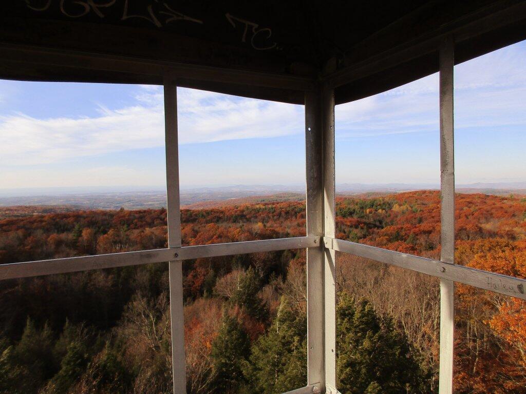
Old NY 30 North
[nycpseries postID=”10043″]
[nycpseries postID=”10477″]
Link to an Interactive Map of the Northville Placid Trail.
| Type | Name | Description | Coordinates |
| Hand Launch | Ceder River Flow Boat Ramp | Hand Carry Launch, Ramp | 43.725826369700904, -74.47289916126694 |
| Lean-To | Beaver Pond (Aka Cedar Lakes Lean-To #2) | 43.625969396804386, -74.54927150370021 | |
| Lean-To | Carry Lean-To | 43.67874488347091, -74.49549821879448 | |
| Lean-To | Catlin Bay #1 Lean-To | 43.99801269269887, -74.39278456108421 | |
| Lean-To | Cedar Lakes #1 Lean-To | 43.628125665037935, -74.54047323992656 | |
| Lean-To | Cold River #2 Lean-To | 44.14251664317184, -74.13035824291548 | |
| Lean-To | Cold River #3 Lean-To | 44.091459278051204, -74.25764175084498 | |
| Lean-To | Cold River #4 Lean-To | 44.09139025333258, -74.25573480252505 | |
| Lean-To | Cold River Lean-To #1 Lean-To | 44.14272737628489, -74.12984021065587 | |
| Lean-To | Duck Hole #1 Lean-To | 44.14162687400988, -74.10693734676616 | |
| Lean-To | Duck Hole #2 Lean-To | 44.14167686466829, -74.10654354672256 | |
| Lean-To | Hamilton Lake Stream #1 Lean-To | 43.39741359517532, -74.45529759002217 | |
| Lean-To | Hidden Cove Lean-To | 44.00265528819394, -74.38648026325164 | |
| Lean-To | Kelly Point #1 Lean-To | 44.02880023617087, -74.36730798599064 | |
| Lean-To | Kelly Point #2 Lean-To | 44.02870256717196, -74.36713034867948 | |
| Lean-To | Moose Pond Lean-To | 44.182843382402666, -74.07364102375995 | |
| Lean-To | Mud Lake Lean-To | 43.342671073157994, -74.45629078563864 | |
| Lean-To | O’neill Flow Lean-To | 43.875596840936154, -74.36642623697053 | |
| Lean-To | Ouluska Pass Brook Lean-To | 44.120221281603584, -74.18744717390932 | |
| Lean-To | Plumley Point #2 Lean-To | 44.06559891610762, -74.32761224546002 | |
| Lean-To | Rodney Point #1 Lean-To | 44.04140938489936, -74.35014909639557 | |
| Lean-To | Rodney Point #2 Lean-To | 44.042976745412616, -74.34933464753136 | |
| Lean-To | Seward Lean-To | 44.106244137686204, -74.2091536427719 | |
| Lean-To | Silver Lake Lean-To | 43.29193545679836, -74.4237351676776 | |
| Lean-To | South Lake Lean-To | 43.58724480971, -74.62157883837274 | |
| Lean-To | Spruce Lake #1 Lean-To | 43.52728411257782, -74.6099246975027 | |
| Lean-To | Spruce Lake #2 Lean-To | 43.53463062983387, -74.60808580306896 | |
| Lean-To | Spruce Lake #3 Lean-To | 43.53712972792447, -74.60820962802477 | |
| Lean-To | Stephens Pond Lean-To | 43.818673668554965, -74.42052487172707 | |
| Lean-To | Tirrel Pond North Lean-To | 43.887344477557306, -74.37880062606054 | |
| Lean-To | West Canada Creek Lean-To | 43.58698761405157, -74.61399797100106 | |
| Lean-To | West Lake #1 Lean-To | 43.59316222884976, -74.62688668431306 | |
| Lean-To | West Stony Creek Lean-To | 43.22474428954461, -74.26933345717664 | |
| Paved Parking Lot | Lake Durant Northville Placid Trail Parking Lot | Paved, 12 Vehicle Capacity | 43.84219550506574, -74.3862742856788 |
| Paved Parking Lot | Northville Lake Placid Trail Parking Lot | Paved, Good Condition | 43.84213270187873, -74.38656792328511 |
| Primitive Tent Site | Canary Pond Campsite | 43.30513256312245, -74.4472062440692 | |
| Primitive Tent Site | Cedar Lake Dam 1 | 43.62894580965635, -74.53639939387939 | |
| Primitive Tent Site | Cedar Lake Dam Tentsite | 43.62937624507422, -74.53679785644344 | |
| Primitive Tent Site | Cedar River Flow Tentsite | 43.70292480315104, -74.48713041165333 | |
| Primitive Tent Site | Fall Stream Tentsites | 43.49661052800474, -74.53713112743992 | |
| Primitive Tent Site | Jessup River Tentsites | 43.51246207852797, -74.57229710138834 | |
| Primitive Tent Site | Kelly Point Tentsites | 44.02910364406153, -74.36670207204214 | |
| Primitive Tent Site | Moose Pond Tentsites | 44.18274441156179, -74.07408240028583 | |
| Primitive Tent Site | Moose River Plains Campsite 01 | Live | 43.72667672123972, -74.47410026642402 |
| Primitive Tent Site | Moose River Plains Campsite 02 | Live | 43.72665150100841, -74.47331107300782 |
| Primitive Tent Site | Moose River Plains Campsite 03 | Live | 43.725959512295866, -74.47389996564202 |
| Primitive Tent Site | Moose River Plains Campsite 04 | Live | 43.726067692208126, -74.47423264719026 |
| Primitive Tent Site | Moose River Plains Campsite 05 | Live | 43.725563790898704, -74.47417512282912 |
| Primitive Tent Site | Moose River Plains Campsite 06 | Live | 43.72522313374867, -74.47458303719159 |
| Primitive Tent Site | Mud Lake Tentsites | 43.59647433847274, -74.61354076182431 | |
| Primitive Tent Site | O’neill Flow Tentsite | 43.87567135918534, -74.3666467203306 | |
| Primitive Tent Site | Rock Lake Campsite | 43.265591839994535, -74.41543516012669 | |
| Primitive Tent Site | Salmon River Tentsites | 43.907925071619914, -74.38530801916977 | |
| Primitive Tent Site | Shattuck Clearing Tentsites | 44.08679657756681, -74.26368397541134 | |
| Primitive Tent Site | Silver Lake Tent Site | 43.29112770008321, -74.4240469986026 | |
| Primitive Tent Site | Spruce Lake Tentsite | 43.53695545329776, -74.60818912022354 | |
| Primitive Tent Site | Tirrell Pond North Tentsites | 43.88594343639596, -74.37834897628142 | |
| Primitive Tent Site | Trailside Campsite | 43.2716741112023, -74.43107546264162 | |
| Primitive Tent Site | Wanika Falls Tentsites | 44.19944690357389, -74.05663862305364 | |
| Primitive Tent Site | West Lake Former Caretaker Clearing Tentsites | 43.59389874347195, -74.62560220247346 | |
| Primitive Tent Site | Whitehouse Campsite | 43.373430193527696, -74.43578942968477 | |
| Primitive Tent Site | Whitehouse Campsite | 43.37406302094423, -74.43516794694158 | |
| Primitive Tent Site | Woods Lake Campsite #2 | Fire Pit, Water Front Campsite | 43.25071034607129, -74.31177480398298 |
| Primitive Tent Site | Woods Lake Campsite #3 | Fire Ring, Water Front Tentsite, Scenic View | 43.250888826581715, -74.31104030228295 |
| Primitive Tent Site | Woods Lake Campsite #4 | Fire Place, Water Front Campsite, Nice View | 43.251811433787196, -74.3092782205918 |
| Unpaved Parking Lot | Benson Road Parking Area | 8 Vehicle Capacity | 43.24745928673895, -74.31187044250609 |
| Unpaved Parking Lot | Chubb River Bridge | 44.2628824981147, -74.01364844250504 | |
| Unpaved Parking Lot | Moose River Recrieation Area | Northville-Placid And Cedar River Trails | 43.726457025366315, -74.47386984656715 |
| Unpaved Parking Lot | Norhtville Placid Parking-Haskells Rd | 43.45841038153893, -74.52201705350714 | |
| Unpaved Parking Lot | Northville Placid Trail Parking Area | 6 Car Interior Parking Area | 43.21330828950083, -74.2083824784703 |
| Unpaved Parking Lot | Northville Placid Trail Route 28n Parking Lot | 43.97584466308438, -74.39296138679799 | |
| Unpaved Parking Lot | Tarbell Road Shoulder Parking Lot | 43.984346733793245, -74.39813014848872 | |
| Unpaved Parking Lot | Wakely Dam | 43.72640808237045, -74.47425964611213 | |
| Unpaved Parking Lot | Wakely Mountain Trailhead Parking Lot | 1250 Sq Feet | 43.732197733217824, -74.47253968128065 |
| Unpaved Parking Lot | Wakely Pond Accessible Fishing Dock | 43.737643556916666, -74.46542853470272 | |
| Unpaved Parking Lot | Wakely Pond Accessible Launch | 43.738042554833534, -74.46399313053813 |
Below is the listing of the snowfall that has fallen in various locations of the Adirondacks and North Country, according National Weather Service.
Plattsburgh city – Plattsburgh 1 S (PLBN6)
None 12pm
North Elba town – Lake Placid 2 S (LPLN6)
None 1pm
Wilmington town – Wilmington 2W (WHFN6)
One inch ❄️ 1pm
Malone town – Malone (MALN6)
Dusting 🌨 12pm
Tupper Lake town – Tupper Lake Sunmount (TOPN6)
None 12pm
Indian Lake town – Indian Lake (INDN6)
3 inches ❄️❄️❄️❄ 1pm
Watson town – Chase Lake (GFDN6)
None 11am
West Turin town – Highmarket (HGHN6)
None 11am
Boonville town – Boonville 4 SSW (BOON6)
Dusting 🌨 12pm
Lee town – Point Rock 0.6 SE (NY-OD-2)
Dusting 🌨 12pm
New Hartford town – New Hartford 0.8 S (NY-OD-19)
None 12pm
Westmoreland town – Rome 4.8 SSE (NY-OD-21)
None 12pm
Westmoreland town – Westmoreland 4 N (WSTN6)
None 12pm
Saratoga Springs city – Saratoga Springs 0.5 S (NY-SR-4)
4 inches ❄️❄️❄️❄️❄ 11am
Gouverneur town – Gouverneur 3 NW (GOVN6)
None 12pm
Warrensburg town – Warrensburg 2.1 Wnw (NY-WR-10)
5 inches ☃☃☃☃☃☃ 1pm
Good morning! Happy Saturday. Today I Head North! Cloudy ⛅ and 67 degrees in Canaan Heights, WV. Super mild! There is a south-southeast breeze at 13 mph with gusts up to 25 mph. 🌬️ That wind is roaring around, unstable weather coming. But I’m heading off the Appalachian Front shortly.
Up at six o’clock taking camp down. 🕔 Still quite dark out. To get a jump start on the day and limit pee breaks, 🚽 I hard boiled eggs 🥚 last night and will have two eggs for protein with a banana 🍌 for sugar and some peppers maybe later on. ☕ If I decide I really need coffee I can get some in Keyser this morning. Took the tent down last night ⛺ and packed and organized as much as I could last night, including writing much of this blog post last night. 📝
Today will likely rain ☔ , mainly after 3pm. Mostly cloudy, with a high near 67 at six AM. Southwest wind 5 to 7 mph. Chance of precipitation is 60%. New precipitation amounts of less than a tenth of an inch possible. A year ago, we had cloudy skies in the morning with more sun in the afternoon. The high last year was 55 degrees. The record high of 78 was set in 1971. 2.0 inches of snow fell back in 1952.❄
Today it’s off to Paw Paw Tunnel and ultimately Maryland then onward Pennsylvania. 🚲 The tunnel, part of the C – I Canal National Park Trailway looks neat, it’s a canal through a mountain. Sunday’s forecast looks very wet, so I don’t know if I’ll bother to go to Asaph Run in hoping to bike the Pine Creek Rail Trail after a quick overnight camp. ⛺
It’s possible that I’ll decide to either do my overnight at County Bridge Campground or maybe if time allows, Long Pond State Forest in New York State. 🛣️ The later is free 🆓 and probably more on the route home, plus come Sunday it’s less than 2 hours home from there. If I do the later, I would probably take Interstate 80 from I 99 to I 81.
Or I could possibly overnight at the Paw Paw Campground, I’m just worried about of the drive in one day. 🚘 We’ll over six hours driving Interstate 81 which goes through several big cities like Harrisburg and Scranton versus the relatively quiet I-99. Really don’t want to drive more than four hours a day, with one hour play time and four hours to hike, bicycle or visit parks. 🏞
Solar noon 🌞 is at 12:40 pm with sun having an altitude of 34.3° from the due south horizon (-36.5° vs. 6/21). A six foot person will cast a 8.8 foot shadow today compared to 2.2 feet on the first day of summer. The golden hour 🏅 starts at 5:16 pm with the sun in the west-southwest (246°). 📸 The sunset is in the west-southwest (253°) with the sun dropping below the horizon at 5:55 pm after setting for 3 minutes and 2 seconds with dusk around 6:23 pm, which is one minute and 24 seconds earlier than yesterday. 🌇 At dusk you’ll see the Full 🌝 Moon in the east-northeast (75°) at an altitude of 6° from the horizon, 232,615 miles away. 🚀 The best time to look at the stars is after 6:58 pm. At sunset, look for mostly clear skies 🌄 and temperatures around 63 degrees. The dew point will be 51 degrees. There will be a northwest breeze at 13 mph. Tomorrow will have 10 hours and 30 minutes of daytime, a decrease of 2 minutes and 37 seconds over today.
Yesterday, I hiked 15 miles in Dolly Sods. 🚶 Not a bad day but most of the day was grayer then I would have hoped. 🌥 Lot of haze too. Hiked in from the Canaan Valley Wildlife Refuge and along much of the ridge overlooking the wildlife refuge. It was good, I visited some of the more remote places in the wilderness, though still a lot of people exploring there. Sort of hoped to make it across to the top of the Allegheny Front and maybe Bears Rocks 🐻 but time was tight with the early sunset 🌇, no overnight parking 🅿 signs where I was parked and simply the trail I planned to cross the Red Creek with – Dobbins Grade is low water crossng not the case this week. 🐸 Plus the beaver dam. In the evening around sunset walked the new boardwalk in the wildlife refuge off Freeman Drive. Headed back to camp, had a nice dinner and some beer 🍻, took down the tent and organized my gear.
I haven’t posted many pictures 📸 to either Facebook or the blog due to connection issues here but also because I’m trying to maximize my remaining time here in West Virginia. Time is precious. ⌛ I figure all next week I can go through my photos and start sharing them, bringing back memories of what was on my trip.
Tonight will have mostly cloudy ☁, with a low of 41 degrees at 6am. Six degrees above normal, which is similar to a typical night around October 11th. Northwest wind 8 to 13 mph. In 2022, we had cloudy skies in the evening, which became mostly clear by the early hours of the morning. It got down to 29 degrees. The record low of 19 occurred back in 1969.
Sunday will rain starting around dawn. 🌧️High near 45. Northeast wind around 5 mph. Chance of precipitation is 100%. New precipitation amounts between a quarter and half of an inch possible.
I’m expecting a wet ending to my vacation both Saturday night and definitely Sunday for the last leg of the trip home. 🏡 It’s fine, it rained ☔ on the way down here too at least through New York. The colors probably are pretty much gone for the return trip home I would assume. Then it looks to be cold next week once I’m home. Hoping to ride to work a few more times both ways before the time change but I’m not holding out my breath for too many days next week. 🚲 Might even need to turn the heat back on in my apartment. In contrast, it’s been so warm in West Virginia that I only used the propane heater on Sunday evening and Monday morning ♨️, the rest of the week it’s been shut off and locked 🔒 up.
In 1956, Elvis Presley receives a polio vaccination on national TV. 💉This single event is credited with raising immunization levels in the United States from 0.6% to over 80% in just six months.
Then next Saturday is Daylight Savings Time Ends 🛥️ when the sun will be setting at 5:46 pm with dusk at 6:14 pm. On that day in 2022, we had sunny, warm and temperatures between 71 and 46 degrees. Typically, the high temperature is 54 degrees. We hit a record high of 76 back in 1994.
Already thinking next week about potentially a four day trip out to Madison County. 🐮 Probably Stoney Pond and peddle around Cazenovia and the Cazenovia – Chittenango Rail Trail and possibly some of the single track mountain bike trails at Alfred Woodford and Tassel Hill. 🚲 Maybe take off the Monday before Election Day for a four day weekend as far away from politics as possible. Or the following Friday is Armstice Day aka Veterans Day Observed, so if I took off either Thursday or the following Monday, it’s another four day weekend. I want to get away one more time before rifle season 🦌.