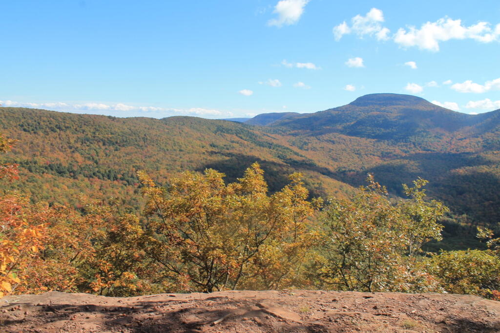
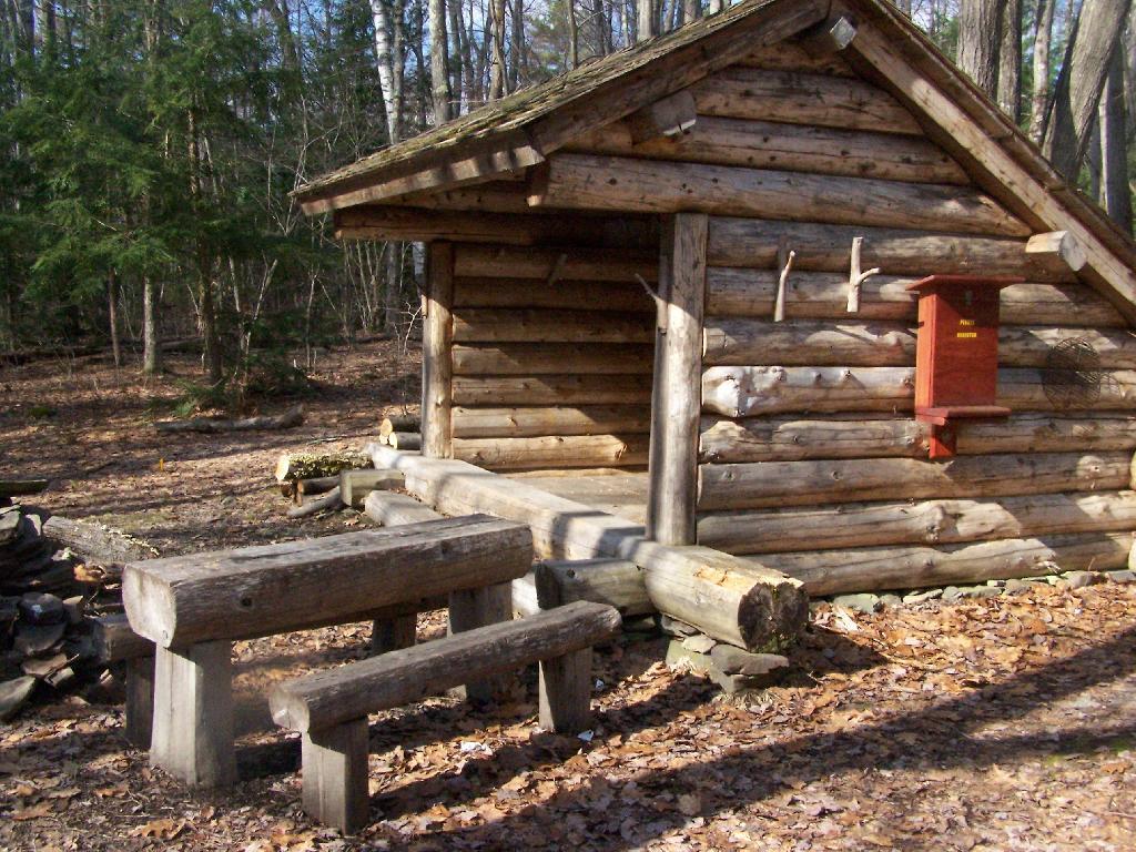
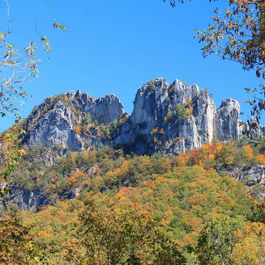
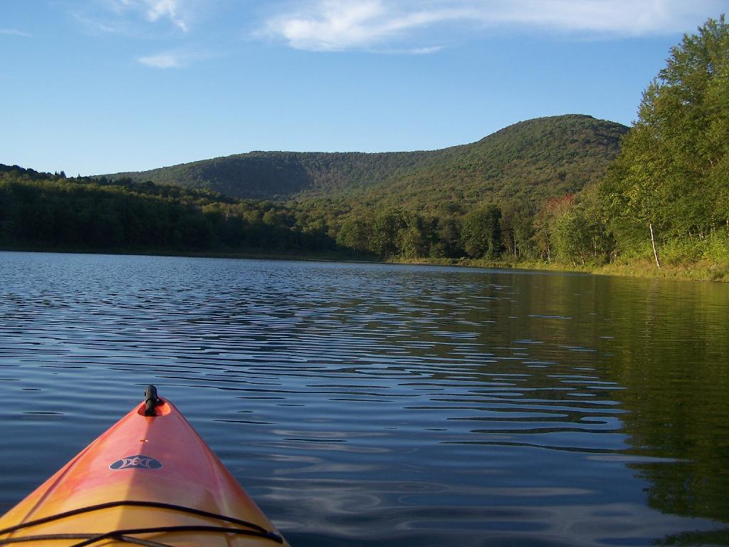
Search Results for: photo middle mountain from campsite

Weekend at Bear Springs Mountain, Delaware Wild Forest, Warren Highlands

Based on the forecast for the long weekend, I decided to head down to the Western Catskills rather then Moose River Plains. It certainly was a bit sunnier, drier, and less snowy then it looks like they got up at Moose Plains. I simply did not another Memorial Day Weekend at Moose Plains, sitting in rain and snow showers.

I ended up heading down to the Western Catskills. Didn’t leave home until after 10 AM, because I was putzing around. So be it. I also had to stop at Walmart to buy another blaze orange hat, for hiking, because I lost mine. I knew it would be hunting season down there, and figured better safe then sorry. The previous night, they didn’t have one at Glenmont Walmart, so had to visit the Decided to head out the Warren Anderson Expressway (I-88) down to NY 10, and take that all the way south to Walton.

Fire Tower

Driving down NY 10, as soon as I reached Summit, you could see a dusting of snow on the summits around. Stopped in Stamford, drove up to Mount Utsaythana. There was a dusting of snow there too, in parts it looked like a winter wonderland. Then it was down to Walton, following NY 10 and the East Branch of Delaware River. Drove through Delhi, a small rural college town. I had been through Delhi years ago, meandering around Stamford, but not in years. Then I went down to Walton, climbed an enormous hill in the truck, and was at the Bear Spring Mountain Wildlife Management Area (aka Public Hunting Grounds).

At Bear Spring Mountain WMA there is a state DEC campground known as Bear Spring Mountain Campground. It consists of two parts, a fully developed campground with hot showers that is open during the summer months near Launt Pond, and the Spring Brook area with stud pends and a pit privy, similar to Charles Baker State Forest. Both areas are a $18 a night in summer, but from October to the end of hunting season, the lower area is free, but the water is shut-off down there. The designated campsites there are crunched together, and there is no privacy, so I can’t imagine it’s much fun camping there, especially with the smell of horses on a hot summer’s afternoon.

By the time I got down there, it was fairly early, so decided to explore a bit. Drove up to Corbett, explored the Corbett Suspension Bridge, and an old chimney from the β€œacid factory”, which made an acid from tree bark for smokelesss gunpowder. Decided to head back and explore Bear Spring Mountain WMA a bit more, and drove up West Trout Brook Road, past several hunters. There are some limited views from end of East Trout Brook Road, namely at the summit Bear Spring Mountain. There are better views from NY 206, climbing up from Walton, but with few view points. Also explored Beers Brook Road, which had some limited but nice views into the valley below, and Russ Gray Pond.

Bridge Tower

Bear Spring WMA, being a federally-funded public hunting grounds, does not allow camping. The only camping there is those tiny, smashed together developed campgrounds known as the Bear Spring State Campground, operated by the DEC. I decided it was getting late, and I would camp there tonight, especially because it looked like one of campers had packed up, and the only other person around, was a female bow hunter, on far end of the campground. I wasn’t thrilled, as it meant I would have to keep the music down, but at least the campground was deep in the valley, protected from the wind.

It wasn’t a bad night though. The pit privies were kind of gross, but probably not worst then most of the outhouses in the woods. There was surprisingly a lot of wood in woods near the campground. The truck worked well with keeping the lights on, since switching the truck’s radio back to the starting battery and evenly discharging both batteries. The radio shuts off automatically when the starting battery is starting to get a bit low, and Big Red’s DIC says β€œBattery Low: Start Engine Low”. Previously, with the starting battery at full charge, hooked up to the discharged auxiliary battery, the alternator wouldn’t kick up to full charge, so the auxiliary battery would fail to get fully charged. Now, with the starting battery slightly discharged – but with enough charge to crank the engine, things kept working well all night long. There was a little bit of sleet in the evening, but nothing major.

Russ Grey Pond

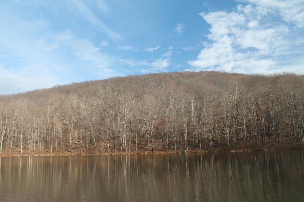
The next morning, I got a slow start. It was drizzling, and I kind of slept in. I didn’t have a tarp set up, which didn’t help. I probably didn’t break camp until 10:30 AM..I was thinking of hiking the NYC DEP trail that overlooks the Pepacton Reservoir, but I ended up turning off onto Holiday Brook Road, and deciding to check out Huggins Lake. Hugging Lake was a nice hike back, following an old woods road back there. There is a campsite down by the lake. Apparently on the ridge above Huggins Lake, there is an old growth forest, but I never got back there.

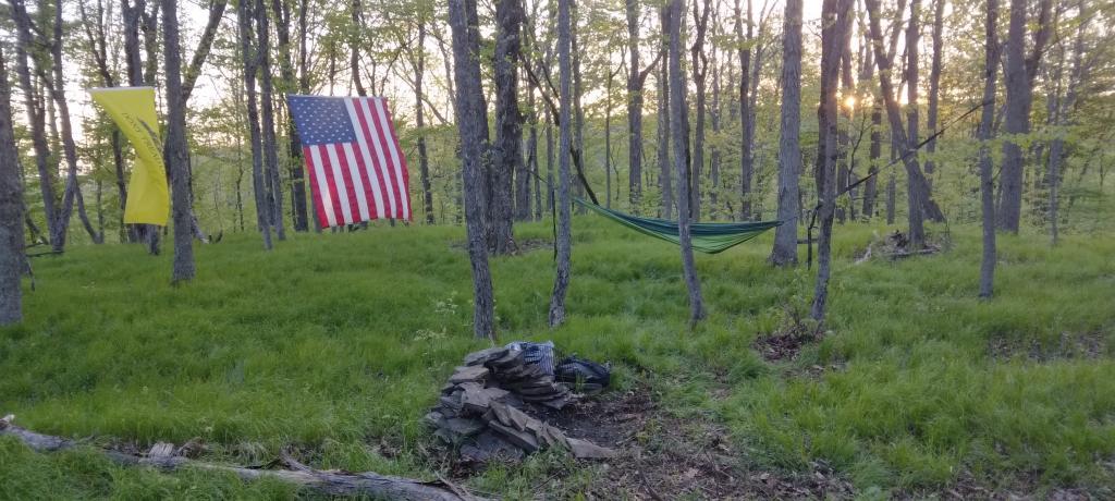
Then it was off to Mary Smith Road. On Campground Road, one of the cut-over roads, I got to a cover bridge, which had a clearance of 6’6”, which is about an inch too low for my pickup truck with the cap and racks on. So I had to turn around, and back track for about 5 miles. That sucked. Stopped and grabed a few pictures. When I got on Mary Smith Road, and back in forest preserve, I was pleasantly surprised to find three roadside campsites on it. I ended up camping at the most used of the sites – as witnessed by vegetation – along the Finger Lakes Trail/Mary Smith Trail/Middle Mountain Trail. It was a pretty nice roadside campsite.

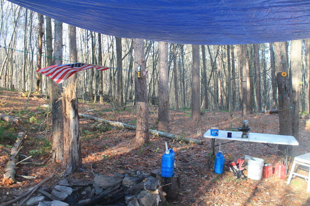
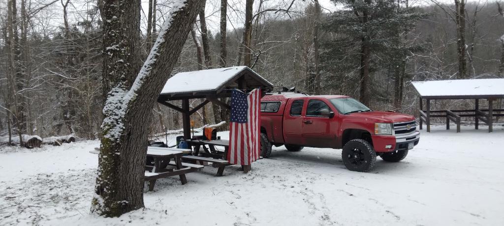
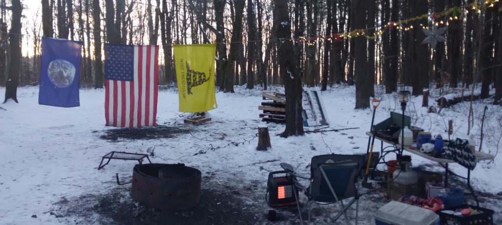
About as soon as I scoped out the campsite, I realized it would be a pretty night up there. Despite the mountains on both sides, the north wind was whipping along the col. But I liked the campsite, and there was plenty of trees to hang a tarp up. I starting setting up camp at 2:30 PM – which was kind of early – but I figured it was too late to hike Mary Smith Hill (which wasn’t true), but it did start to rain/sleet a bit. Got the tarp up, then the lights strung up and flag up. A heavy sleet squall pounded the col, for a while bad enough I hid out in the cab of the truck. Then I went out, built a fire, and spent sometime listening to a podcast and reading a book about the 1964 World Fair in New York.

The new 60-watt equivalent LED bulb I bought worked real well in the cold, which got down below freezing that night.. But with the bulb focused on the book, it was easy reading and plenty bright. In the cold, the 60-watt equivalent LED bulb was actually brighter then the 100-watt florescent bulb I had at camp, even after fully warming up, because the cold wind made it impossible for the florescent tube to get warm enough to fully atomize the mercury in the fixture.

At times the wind picked up, and it was pretty darn cold, to say the least. I end up putting the fire out cold before bed, to reduce the risk of the fire spreading, and because the tarp partially covered the fire pit, I was afraid it could fall into the fire, and possibly set the truck on fire or cause dripping plastic to fall on it. The fire was out cold, and I went to bed around 10:30 PM. No nightmares.

Mary Smith Hill Roadside Campsite 1

After bedding down, the wind started to whip around. It literally was howling, and the tarp was snapping up and down, making quite a bit of noise. Morning came, and it was beautiful blue skies, but very cold. That was when I first saw car actually pass by on Mary Smith Hill Road – despite being a through-road, and not a super remote road at that. Had another slow breakfast, and built a small fire to burn up some camp garbage. Usually I don’t start fires in the morning, but I was chilly, and knowing that it may be a while until I got out camping again, I wanted to have a fire.

Once I finally got going, I hiked up Mary Smith Hill to the overlook. It really was a lot less further then I expected, and ha+d some interesting views to the north. Nothing totally breathtaking, but still an interesting short hike of maybe 20 minutes each way. Then I drove over to Russell Brook Falls, making a wrong turn and ending up going through Livingston Manor and the world famous fly fishing town, Roscoe. My impression of Roscoe, was it was a very a long and pokey 30 MPH zone, but with more stores then one would expect in such a rural, small town. I probably should have stopped, but I was burning daylight.

Finally made it to Morton Hill Road, and passed a Game Warden in a unmarked green suburbanite-style Jeep. The only reason I know that, was I saw him outside of the car talking to somebody in full uniform. Morton Hill Road climbs a lot from Roscoe out to where it hits Russell Brook Road. There are three campsites along Russell Brook Road, although in all of them there is a boulder barrier between the campsite and fire pit. One might still be able to use them for a pickup with a camper on them, I guess.

Russell Brook Falls 2

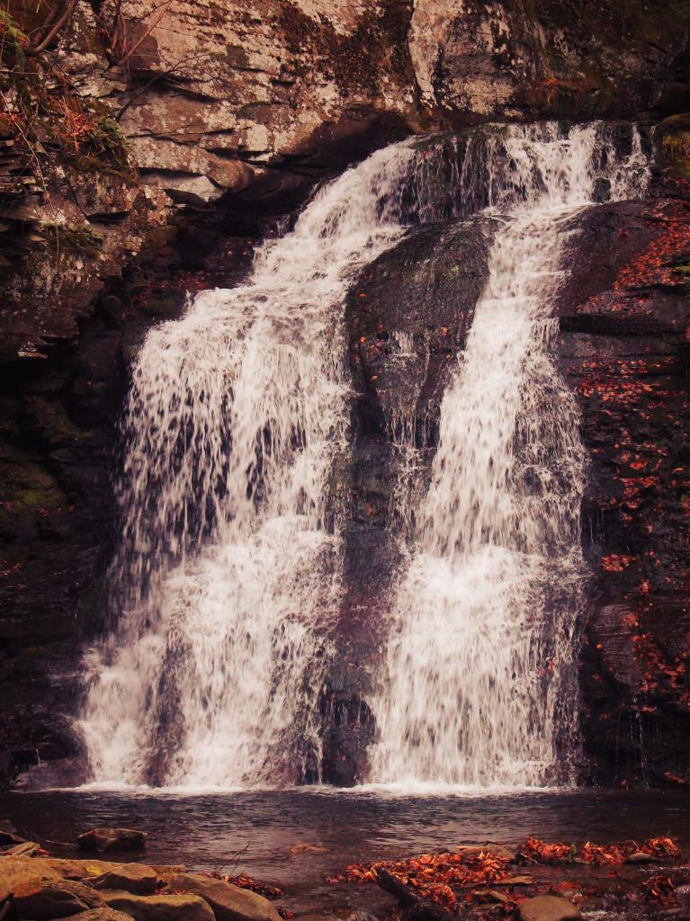
I hiked back to Russell Brook Falls – a beautiful but relatively unknown set of falls – at least to non-regulars to that part of state. They are less then quarter mile from the Russell Brook Falls parking area. I stopped and grabbed some pictures. Then, it’s easy hike back to back to Trout Pond, following a gated road 9/10th of a mile from the parking area. There is a slight incline on the road, but nothing to make one break a sweat, even a fat out of shape dude like me, who spends too much time sipping cold buds in the woods. The road is a designated route for people with disabilities – somebody very strong with a wheel chair could theoretically get back there, or maybe with a CP-4 disabled with an ATV permit.

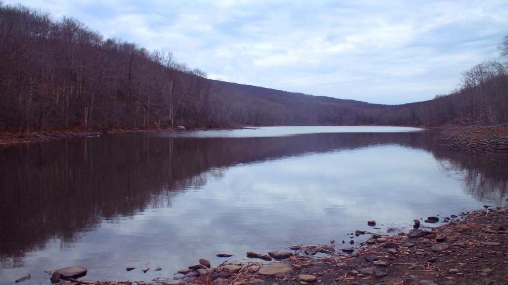
Back at Trout Pond, there is a campsite on the easterly end, and the gated road continues to the west end of lake. On the west end of the lake, there are two other campsites, spaced a ΒΌ mile apart, along with two lean-tos. All are designed for those with disabilities. There is also a trout spawning shelter on one of the creeks leading into lake. One of the lean-tos was well equipped – somebody left behind some nice pots and pans, all cleaned up, and a selection of perfectly good adult beverages and soda along the back wall of the lean-to. Talk about paying it forward to the next person who will use that lean-to – most certainly a hunter this time of year.

It’s small game hunting season, heard several small game bullets ring out, while hiking back there. No hunters nearby, as far as I could see, but I did wear plenty of blaze orange. I am sure next week, there will be a lot more hunters back there. Wish them luck. Hiked back to my truck and explored Campbell Mountain Road and Campbell Brook Road, looking for additional roadside campsites, preferably the kind you can back a pickup all the way back to. No such luck. Oh, well.

Trout Pond

Then I drove down NY 30, through the hamlet of Harvard, then East Branch. Took Old Route 17 to Hancock, then poked around the Poconos and the Warren Highlands in Pennsyltucky, before eventually ending up in Susquehanna and Great Bend. The area around Hancock is very mountainous and beautiful. The Warren Highlands were rough, mostly hunting and rural landscape country, with a relatively small amount of farming going on. Lots of open burning going on too – I love Pennsylvania..

I love that wild country, and everything Pennsylvania. Fueled up, picked up certain Pennsylvania products not legal in New York and/or cheaper then New York, then hopped on I-88/Warren Anderson Expressway, and made a bee-line back to Delmar, stopping only momentarily at the rest stop on I-88. That place was creepy as all hell after dark, and not well lit either. I seriously thought of just taking a piss in some farm

I made it back to Delmar around 7 PM. It was a good adventure. Burned through more gasoline, then I had planned, although on the trip back along I-88, I average 19.9 mpg in my Big Red Silverado pickup, so not complaining.
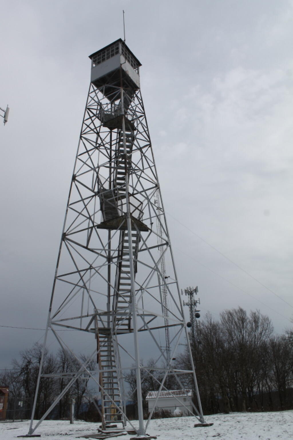
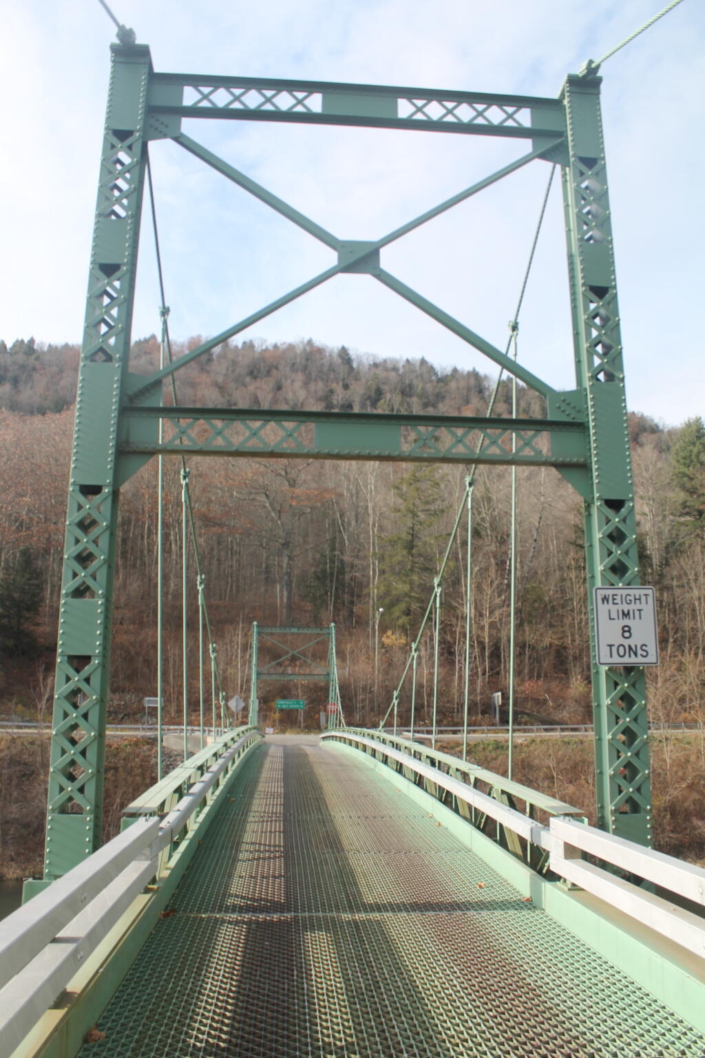
A long-weekend trip in early November to explore the the Western Catskills.

New Theme for the Blog. Central Vermont/Green Mountains This Extended Weekend. Lift Kits vs Other Toys. Getting off the Grid.

Good Morning! Happy Wednesday.Β Yes, folks it’s Wednesday. I think this is the first note I’ve done in a few months, but so be it. It really isn’t that hard to do notes, especially now that I’ve switched WordPress, and everything is pretty much standardized and easy to use. It’s a long one, jotted down over the past week,w with lots of things to talk about.

Working on a New WordPress Theme for the Blog. When I brought the blog over to WordPress, my intent was not to create another generic looking WordPress blog, although in many ways that’s how it ended up. I also messed up some of the code, and didn’t build a proper client theme, instead relying on an adapted theme.

The result was a kind of bland mess. The good news is I am now learning how to build a proper client theme on top of an existing, much nicer WordPress theme — that doesn’t look so much like a generic WordPress theme. One of the reasons I avoided for so long going with WordPress, as I didn’t want to end up with a very generic theme. But somehow it all ended up that way. I think the new theme I am going to — based on the popular Pinboard theme is much nicer.

Hopefully it will be up by the start of September, if all goes well. New maps up are on the blog today.

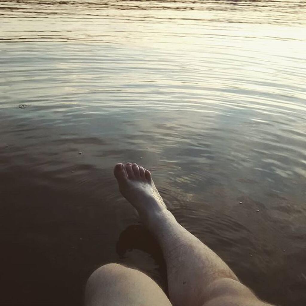
Sitting in the river until it get really dark

Heading Up to the Northern Half of Green Mountains this Weekend.Β Probably leave Friday after work, first camp in the Southern Green Mountains near Somerset Reservior, then head North on Vermont 100. Β There looks to be a lot of neat places to see in the northern Green Mountains, Β and some spectular scenery.

Plan to stay for a long weekend, by also taking off Monday and Tuesday, which promise to be pretty nice weather. As I don’t really know the area, a lot of the trip will be about seeing what is up there, and going from there to figure out what to do. I will bring the kayak and camera, and certainly are keeping my mind open to taking a nice hike somewheres. They are talking about a continuation of the recent low-humidity, temperate climate weather over the weekend, especially as we head into Monday and Tuesday. Supposed to be some good meteor showers.

I’ve decided to do more of these long weekends, rather then take any full weeks off this summer. I guess you could say the July 4th week was technically a week off, although actually July 4th and July 5th were holidays at the office, so they didn’t really count.

I might take a week-long trip in October to Western NY and Pennsylvania during peak foliage season. That said, I also want to do an extended weekend trip to Moose River Plains and also Lake Kushaqua/Jones Pond and recently re-opened Loon Mountain firetower.

Going to Put Off Getting the Lift-Kit Installed Until at Least March.Β Originally the plan was to have a lift-kit installed on my truck in October. But after giving it more thought, and carefully reviewing the options, I’ve decided the best option is to wait another six months or so. For one, I want to wear down the stock tires more, so I’m not wasting them as much, and also so I’m a bit closer to end of the factory warranty — the lift kit isn’t covered by the truck’s factory warranty, and while it wouldn’t invalidate the whole warranty, certainly any damage (as unlikely as it is) it could cause wouldn’t be warrantied.

But the other part of the rational is partly money-wise, and because I’m not totally sold on the lift-kit idea. I’ve thought about getting Β a snowmobile instead this winter, and have been looking at Want Ad Digest. That said, the more I look at it, the more I am not in a rush to get a snowmobile. As much fun as it would be to get deep in the back country in winter — assuming there are groomed trails back there — I worry about break downs and the alike. Not to mention, snowmobiles use a lot of gas, and really aren’t much more efficient then automobiles, because the snow drags them down.

The money-wise issue comes in that things are more expensive then I first estimated a year ago. I think I am going to go with 35s and a 6″ lift kit from a good brand like BDS. Any bigger then that isn’t cost-effective, and non-pratical. That will get me up high enough. The final increase in the height of the truck will be something like 8 inches, because the 35s are 4 inches larger in diameter then factory 31s, and a six-inch lift is half foot higher.

31626460002_large

I also think I will go for full-leaf replacements in the back rather then add-a-leafs, to ensure the weight of the camper shell and equipment in the back won’t cause the nose to be pointing in the air, etc. Going to have it re-geared to save fuel, add some more power, not kill the engine or tranny. And there are some other things like the narrower brake lines that are recommended, among other parts, I would probably spring for when it comes to lift-kit. Plus all that labor cost, which will easily be a grand on it’s own.

I want to ride up higher. I am a tall guy. It also will give me a chance to “freshen” up the look of my truck, which after 2 1/2 years will be getting kind of boring and old. I want something I can get 10 years or more out of without getting totally bored with. After I do the lift kit, there are other projects for future years, such as getting the rocker panels Line-X’d, and replacing the bumpers with those awesome Ranch bumpers, that can actually be used for parallel parking without being damaged.

Or maybe I’ll find other toys to spend my money on. It’s good having some extra disposable money kicking around, as I’m sure future jobs won’t nearly pay as much.

Been Reading and Watching More Videos About Getting Off the Grid. Being somebody who camps most weekends from April to November in the back of my pickup truck, and relies heavily on my inverter and the deep cycle battery to keep things lighted up all evening long. I cook my own food in the woods, clean dishes using bottled water, burn my garbage, and dig a whole in Β woods when I need to go to the bathroom. Heck, with my laptop and the wireless card, I can be up in woods and surfing the web, doing work, and even fielding calls over my cellphone.

I have a pretty decent working understanding of electricity, and how all the off-the-grid thing too. I grew up in the country, are comfortable in woods, and know how to build a good fire in woodstove. I am fascinated to learn more about some of the relatively inexpensive and simplistic living arrangement many-off-the-griders live with, without all costs and hassles of an on-grid house.

My grandfather had one of those absorption-cooler refigerators/freezers in his RV at his campsite in Warrensburg. They’re neat, as one needs more then just a cooler when you live somewhere permanently, rather then wondering the wilderness in your pickup truck. They burn like 5-10 gallons of propane a month. But there also is these high-efficiency refrigerators that are electric and have a lot of insulation, so they don’t strain batteries in a PV/micro-hydro/wind system as much.

But a bigger issue for me is the ability to take showers and get cleaned up properly wherever I live. For that purpose, there are amazingly small tankless-water heaters that use a small amount of propane, but can get water very hot quickly. If you think small, you don’t really need that much flow, compared to a full-scale modern house with a massive-tanked water heater. Hot showers, and hot water for dishes is a necessity to keep clean. If I can get away with it from the code inspectors, I’d be fine with composting toilets or even just a plain old outhouse. That’s a luxury in woods.

Woodstoves, radiant flooring, and other familiar technology is self-explanatory. Having good insulation is a must in this part of the country. I don’t want to have trash pickup — I’m happy enough burning what can be burnt, and taking the glass and metals for proper recycling in the normal industrial fashion.

I like small houses. Smaller is better. I would rather spend my money on land, that could not only be used for recreation like riding quads, shooting guns, and hunting, but also for money by grazing livestock and timber. I am not a greeny, I don’t got a problem with using styrofoam plates for dinner and disposing them in an open fire. I just hate the whole upper-middle class, fancy house living style in the suburbs.

All this reading library books gots me thinking …

But for now I’m fine. As a transition though, I think I would next like to live in a small, handsome, downtown, one that is walkable to a bar and a store, but also provides ample-off-street parking. I think it would be a lot of fun to have an apartment on the second or third floor, above a shop, and be able to sit out and look at my window and watch the traffic go by.

Anywhere I live, I want to be near a National Forest or State Forest that allows free, primitive camping, in a remote-roadside fashion. Not to mention scenic vistas, places to hunt, fish, hike, and spend time outdoors. But I really want to get out of New York, at least eventually. I think it would be fun to own an AR-15, and eventually get a concealed carry permit from a must-issue state, without any pesky questions about whatever stupid things I did decades ago back in college — that hurt nothing but folks egos. To say nothing of not being in a state that’s totally anti-rural and not into the philosophical nature thing.

Far off I guess. Things aren’t that bad right now.

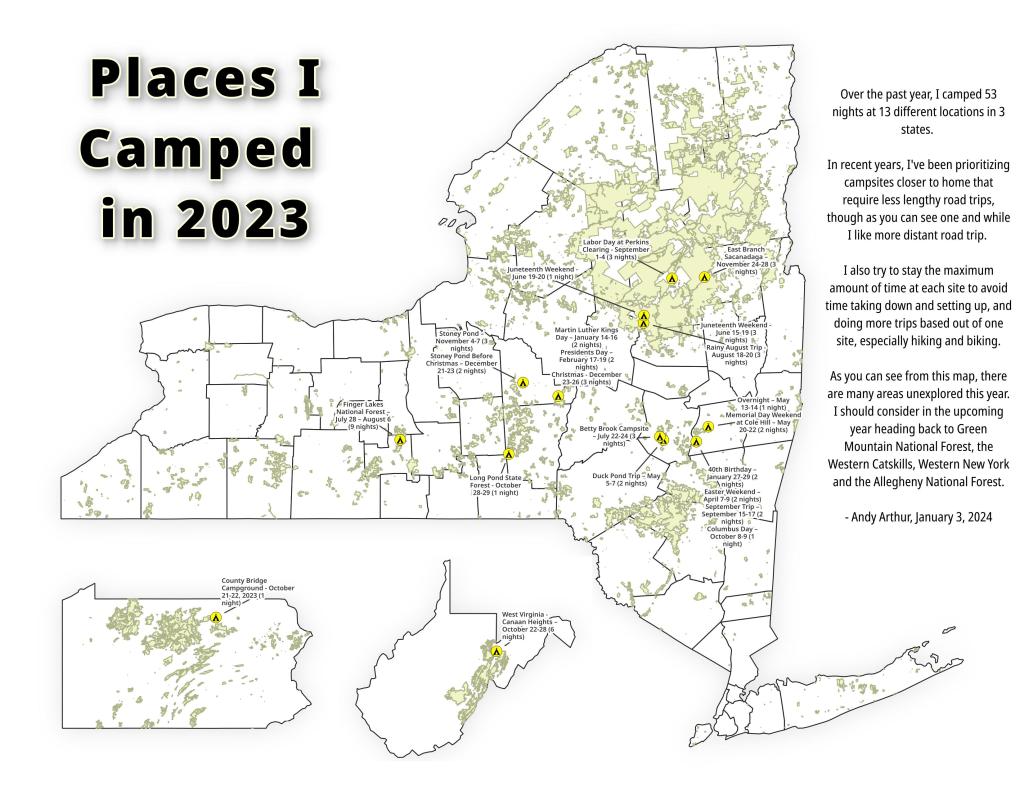
Places I Camped in 2023

While this year was a rainy one, and it rained during many of my trips, I was able to get out for 53 nights in the wilderness — mostly fairly close to home but I also did a trip down to West Virginia in late October with several trips to the Adirondacks, Central New York and summer vacation in the Finger Lakes.

Places I Camped in 2023

Martin Luther Kings Day – January 14-16 (2 nights)

To start out my camping adventures in 2023, I drove out to Charles Baker State Forest and Brookfield Horse Camp. There wasn’t a lot of snow — just a dusting but it was a fun weekend, topped off by a beautiful sun-full glittery hike up Tassell Hill after a hoar frost. Explored Lost Pond and several of the trails in the middle of state forest.

Home for the weekend

40th Birthday – January 27-29 (2 nights)

For my fortieth birthday, I took off the Friday leading up to my 40th birthday to cross country ski and winter camp at Rensselaerville State Forest. It was a beautiful weekend with lots of blue skies, sufficient snow for skiing but not so much that was a ton of snowmobiles out on the trails.

Beautiful Day of Skiing

Presidents Day – February 17-19 (2 nights)

I decided for Presidents Day Weekend to do another trip out to Charles Baker State Forest and Brookfield Horse Camp. Slightly more snow then last time but again largely a snow-less winter, with some nice days for hikes through the various truck and horse trails. I hiked around much of state forest, especially the more southern part of the forest.

Evening on Truck Trail 13

Easter Weekend – April 7-9 (2 nights)

On Good Friday through Easter I camped at at Rensselaerville State Forest. The snow was gone and it was fairly mild though at times it was a bit cool. Spent a fair amount of time walking around and exploring the new OSI Parcel that has been recently added to state forest and is still largely open fields with sweeping views of the Catskill Mountains.

Hillcross Farm Pond

Duck Pond Trip – May 5-7 (2 nights)

The first Friday in May I took a half day from work and headed out to Schoharie County to camp at Duck Pond at Burnt-Rossman Hills State Forest. Originally the plan was to camp two nights at Duck Pond, hiking along the Long Path and exploring the state forest and then on Sunday hiking the Catskill Scenic Trail. That part of the trip changed when driving along Duck Pond Road the low tire pressure light came on I found a pallet nail in my truck tire. I was able to top off the truck tire and then change the tire when I got home and got the nail pulled and plugged. But it wasn’t the best way ever to end a trip early.

Spring

Overnight at Cole Hill – May 13-14 (1 night)

After visiting the folks on Mother’s Day Weekend, I decided to do a quick overnight hammock camp on Cole Hill State Forest in Berne. Nothing fancy or formal, it was as much a way to test out sleeping in my hammock with the bug screen. Kind of a chilly night, I took camp down fairly and headed home early in the morning.

Hammock Camping on Cole Hill

Memorial Day Weekend at Cole Hill – May 20-22 (2 nights)

This year I decided to eschew the Adirondacks and Greene Mountains for Memorial Day Weekend due to the black flies, my desire to look at bicycles, and work I had to do on the Saturday morning leading up to the holiday weekend. I decided to hammock camp again Cole Hill State Forest in Berne. This was a three-day two night trip, so it it gave me a chance to bring more gear up the mountain, set up a more formal camp. Cooked on the fire, hiked around the forest. It was a warm weekend, but I enjoy the solitude, along with having good cell service for listening to podcasts and watching videos.

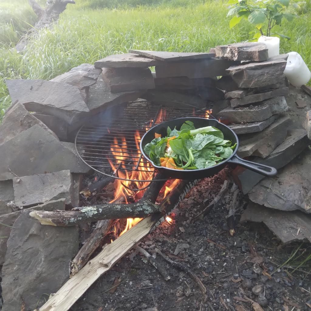
Cooking down dinner

Juneteenth Weekend on Piseco-Powley – June 15-20 (4 nights)

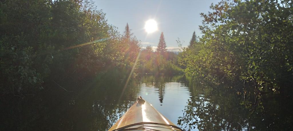
To kick off summer, I did my usual Juneteenth weekend camping trip, tacking on some days on the Juneteenth Holiday Weekend. It was a bit of a cool and rainy weekend to kick off summer, one that would actually be followed by many cool and rainy weekends where I would stay home. Camped at House Pond for the first three nights, spending time down floating in the tube on East Branch while the final night I camped up at Powley Bridge site and kayaked along the East Branch. Really, like often is the case, the best weather was the day I took down camp.

Evening on East Canada Creek

Catskill Scenic Trail Trip – July 22-24 (3 nights)

After several months of researching and visiting various bike shops, I finally got a mountain bike. I decided it would be fun to do as much of the Catskill Scenic Trail as I could before my summer vacation got underway. Actually did quite a bit of riding and hiking that weekend — started out hiking Pratts Rock’s then riding from Grand George to Hobart. Sunday, I rode from Fultonham to Middleburgh on NY 30, doing a quick climb up Vromans Nose, then stopping at the farm market then going to Mine Kill State Park to swim. Monday I rode from Hobart down to Bloomville, getting caught in a major thunderstorm and downpour a few miles north of Bloomville with no shelter in sight. The trail became super boggy, then I went to Mine Kill State Park for one more swim, and then out to folks house for Sunday dinner a day later then usual.

After the rain showers

Finger Lakes National Forest – July 28 – August 6 (9 nights)

Every year for nearly a decade and a half I’ve been doing summer vacation out in the Finger Lakes — camping in the National Forest and exploring as much as possible during my days there. The past few years I’ve been driving there on a Friday, to get a better campsite before they’re taken by the weekend campers. This year was no exception. With Blackie, my mountain bike, I did nearly all of the bike trails in the near vicinity, from the Black Diamond Trail to the Cayuta Valley Trail to Dresden – Penn Yan Canal Trail. Kayaked on both Cayuga and Scenic Lakes, swam many days at Watkins Glen State Park and Taughannock State Park, explored the Cornell Campus and Botanical Gardens on my bike. Got some good ice cream at the Spotted Duck, explored the Geneva Waterfront along with the Cayuga-Seneca Canalway. Some rain but compared to the wet summer that was, this was a pretty good week.

Morning on Searsburg Road

Piseco-Powley – House Pond Campsite – August 18-20 (3 nights)

The next few weeks for rainy and by the time I got away for one more long weekend, it promised to be fairly nice weekend but turned out to be fairly cool and cloudy with some rain. Back at the House Pond Campsite, did some swimming in East Branch, but with the mercury in the 60s most of the weekend, I didn’t spend a lot of time in the water. Hardly what I had dreamed when the I planned the weekend. Rode Blackie up to Goldmine Stream Falls and relaxed down by the falls for a bit, also sat down by the swimming hole off of the Old Edick Road Snowmobile Trail, watching the rain fall, bemoaning the wet and cold weather. Still it was good to get away for a bit, and I did do a fair amount of reading in hammock, under the protection of the bug net, as the bugs were bad after such a wet summer.

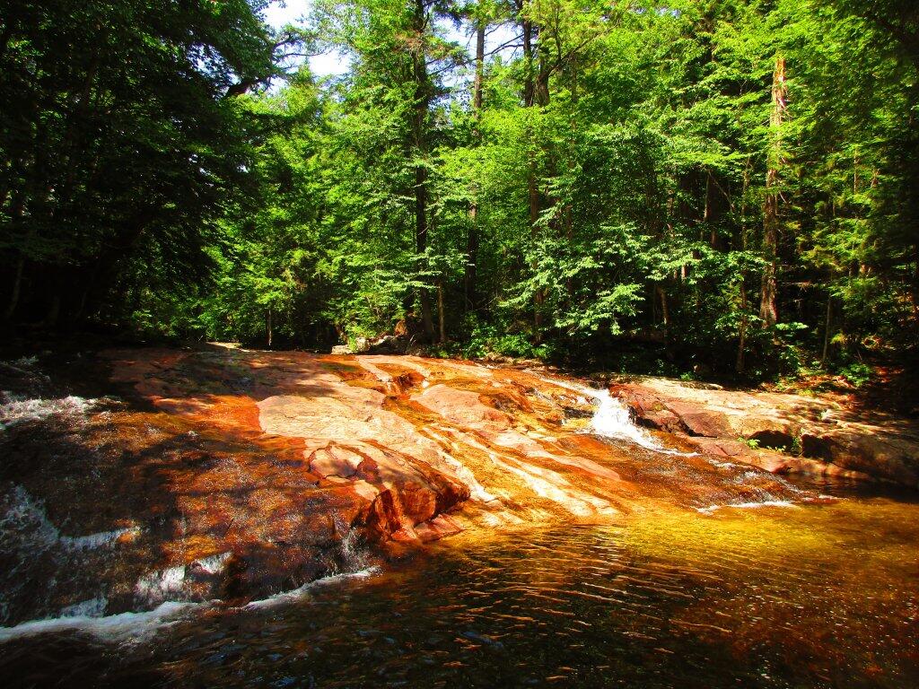
Gentle Drop Into A Golden Pool

Labor Day at Perkins Clearing – September 1-4 (3 nights)

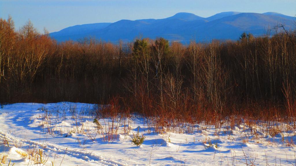
I took the Friday off before Labor Day to get a jump on the holiday season travel, and set up camp at the site I really enjoy up at Perkins Clearing overlooking the mountains. Did a fair amount of riding along the various dirt roads of Perkins Clearing, including over to Mason Lake and on Sunday rode most of the way to the Spruce Lake Trailhead, though didn’t make it there in time as I got a bit of a late start as I spent the balance of the day reading and swimming in the Jessup River Bridge swimming hole. Labor Day, I rode around the Spectulator Tree Farm, doing a large loop, through the tree farm, past the north end of Elm Lake, then down to Austin Falls and Old Route 8B. I had hoped to get ice cream, but by the time I got to the ice cream shop they were out of soft-ice cream, and there was a long line. Summer was dragging to a close.

Kunjamunk River from Long Level Bridge

September Trip to Rensselearville State Forest – September 15-17 (2 nights)

With time being fairly tight and the weather only so-so I decided to do a two night trip close to home out in Rennselearville to ride some of the gravel trails, explore the OSI Parcel further and just enjoy an early autumn weekend camping.

Evening

Columbus Day at Rensselearville State Forest – October 8-9 (1 night)

Columbus Day Weekend was cold and rainy for the first half of the weekend, but the Sunday heading into Columbus Day was nice, so I decided to head out to Rensselaerville for a quick overnight at the campsite on CCC Road. Leaves were late this year, so not a lot of color, but it still was nice to get away for a night and ride some of the trails around.

Leonard Hill

West Virginia Trip – October 21-29 (8 nights)

The banner trip of the year was my trip down to West Virigina. While it started and ended in rain, it was a very enjoyable trip with lots of new adventures this year. Camped the balance of the week — 6 nights in Canaan Heights — doing day trips from that area. Overnighted one night driving down at County Bridge Campground in Pennsylvania, and a on the way back camped overnight at Long Pond State Forest in New York. Adventures in West Virginia included hiking at Dolly Sods, mountain biking at night in the sods of Canaan Heights, riding up and hiking to Table Rock, exploring Blackwater Falls State Park on the mountain bike, MonPower Mountain Bike Park, Thomas Rail Grade and the Olson Firetower. Rode part of the Great Allegheny Trail through the Cumberland Passage, and the two sections of the Chesapeake and Ohio Canalway, including the Paw Paw Tunnel.

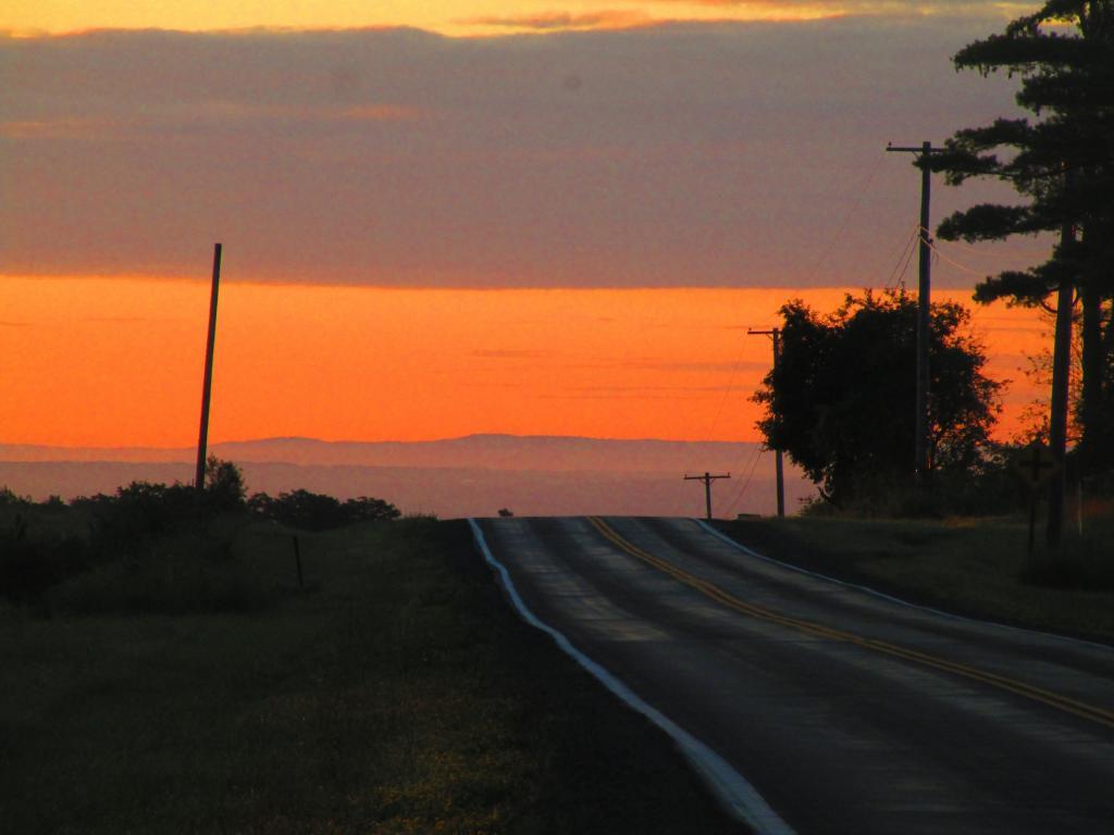
Sunrise

Stoney Pond – November 4-7 (3 nights)

A little over a week back from West Virginia, I headed out to Madison County to ride the Tassel Hill Mountain Bike Trails at Alfred Woodford, the Chenango Canal Trail in Hamilton and Erie Canalway from Chittenango to Green Lakes State Park and then to Canastota and Wampsville. The first night was cold at Stoney Pond but the subsequent nights were quite pleasant and mild.

Old Canal Warehouse in Chittenango  [Expires November 19 2023]

Prospect Mountain – East Branch Sacanadaga – Buttermilk Falls/Hudson Special Management Area – November 24-28 (3 nights)

Strangely enough, I had never been up Prospect Mountain. So I decided the day after Thanksgiving (Black Friday) to hike up Prospect Mountain, and then spend the next two nights camping on East Branch of the Sacandaga River. The Saturday and Sunday was fairly cold, so I ended up spending the bulk of day hanging around camp, doing a bit of hiking around Fox Lair. Sunday, evening around 8 PM it started to sleet, then snow, then rain, Monday morning, it turned into a white globby snow, and I ended up taking down camp fairly early after discovering I was out of propane and then spent much of the day exploring the Hudson River Special Management Area – Buttermilk Falls.

Icy River Road

Stoney Pond – Charles Baker – December 21-26 (5 nights)

On the days leading up to Christmas I decided to take a second trip to Madison County. I was originally planning to camp two nights at Stoney Pond then two nights at the Charles Baker Horse Camp but my family’s holiday plans were cancelled due to illness in my family, so I ended up staying an extra night at the horse camp, through the day after Christmas. On Friday, I rode the Erie Canalway from Canastota to East Verona, nearly to Rome. On Christmas Day I rode around many of truck trails at Charles Baker with my mountain bike, leaving my face splattered with mud. Many of the days were fairly cold and cloudy, but that’s too be expected in late December. Still it was a special way to spend Christmas.

Camp on this cold but still morning ?

Finally a beautiful Saturday out in Schoharie and Delaware County after so many crappy weekends πŸš΅πŸŠπŸ•οΈ

After such a run of wet and bad weather we finally got a break and I got away from town. Awesome, although I will say that the pool is cold with the low dew point and the breeze. But it was great for hiking Platts Rocks then riding 26 miles round trip or the Catskill Scenic Trail. That said, I’m beat after all that bicycling, I barely want to hit the pool. But it’s fine, I got a shower and some pool time in and it will be closing for a bit and then be time to head up to camp.

Good evening! It’s been a pleasant day. Mostly sunny and 78 degrees at the Mine Kill State Park. There is a northwest breeze at 9 mph. πŸƒ. The dew point is 55 degrees.

Lol where to start! πŸ˜‚ Last night turned out much better than forecasted so I ended up deciding to ride out to the Bender Mellon Preserve πŸ‰ and hiking around that for nearly an hour, exploring the outside parameter trail and taking a bunch of pictures after deciding πŸ“Έ the trail wasn’t so wet yesterday and the skies were interesting. Then I decided to ride out to Voorheesville, down Main Street then out past the Voorheesville High School and library then down the rail trail to Adams Place then snaked through the subdivisions back home. 🐍 By then it was late for packing for camp but I got some done like filling the water container and some other things but won’t say that I didn’t stay up late sitting out back and still had a bunch to do in the morning contributing to me not leaving until 9:30 am.

On my way out I realized I forgot toilet paper 🚽 and paper towels. Both are good for camping. What I ended up doing was going to Tops in Greenville and buying paper towels for both purposes. They’ll be good for both. Then I took NY 81 out to Oak Hill which is still closed west of there.

With the detour I ended up deciding to head over to Prattville and checking out Pratts Rock. What a beautiful day. 🏞 Finally got to the Catskill Scenic Trail in Grand Gorge at 12 noon, rode until 1:45 when I got to Hobart at 1:40 pm when I stopped at the park for a while 🚲 and headed south almost to South Kortwright but turned back as I wanted to be back to my truck as close as possible to 4 pm so I could shower 🚿 and cool down in the pool. πŸŠβ€β™‚οΈ Then off to camp at Betty Brook most likely though if the campsite on West Kill Road is open I might stay there.

Tonight will be mostly clear πŸŒƒ, with a low of 54 degrees at 5am. Nine degrees below normal, which is similar to a typical night around September 12th. Maximum dew point of 56 at 7pm. Northwest wind 5 to 8 mph becoming calm in the evening. Going to be a cool evening especially here in the mountains. In 2022, we had partly cloudy skies in the evening, which became mostly clear by the early hours of the morning. It was somewhat humid. It got down to 65 degrees. The record low of 45 occurred back in 1981.

Tonight will have a Waxing Crescent πŸŒ’ Moon with 22% illuminated. At 5 PM, the moon was in the south (185Β°) at an altitude of 51Β° from the horizon, some 249,518 miles away from where you are looking up from the earth. πŸš€ At the state speed limit of 55 mph, you’ll make it there by January 28th. Buckle up for safety! πŸ’Ί The moon will set in the west (273Β°) at 11:05 pm. The Strugeon 🐑 Moon is on Tuesday, August 1. The darkest hour is at 1:05 am, followed by dawn at 5:08 am, and sun starting to rise at 5:41 am in the east-northeast (61Β°) and last for 3 minutes and 17 seconds. Sunrise is 56 seconds later than yesterday. πŸŒ„ The golden hour ends at 6:22 am with sun in the east-northeast (68Β°). Tonight will have 9 hours and 9 minutes of darkness, an increase of one minute and 48 seconds over last night.

Tomorrow will be sunny 🌞, with a high of 83 degrees at 5pm. One degrees below normal, which is similar to a typical day around August 3rd. Maximum dew point of 60 at 5pm. Calm wind. A year ago, we had partly cloudy skies in the morning with some clearing in the afternoon. It was humid. The high last year was 97 degrees. The record high of 96 was set in 1955.

I’m undecided about my plans for tomorrow. πŸ’­ I still want to get to the farm stands of the Schoharie Valley 🌽 πŸ… but I also kind of want to set up camp β›Ί and not have to secure it or take it down tomorrow. Plus I don’t love driving that rough Betty Brook Road, it’s tough on Big Reds aging suspension. 🚲 That said it could be a fun filled day. I might cycle from the Rest Area to Middleburgh, then poke around the village, get ice cream 🍦 then hike Vromans Nose πŸ‘ƒ and turn hit up the farm stands, head back to Mine Kill Pool and swim some more before camp. Monday I will park in Stamford, ride down to Bloomfield and maybe hike not drive Utsaythana followed by a swim at Mine Kill before going out to see the folks before vacation which starts Friday.

In four weeks on August 19 the sun will be setting in the west-northwest (288Β°) at 7:55 pm,πŸŒ„ which is 34 minutes and 33 seconds earlier then today. In 2022 on that day, we had hot, mostly sunny and temperatures between 89 and 58 degrees. Typically, you have temperatures between 82 and 61 degrees. The record high of 92 degrees was set back in 1899.

Looking ahead, Work Like a Dog Day 🐩 is Next Saturday (not likely to happen on vacation), Last Sunset After 8 PM πŸŒ† is in 3 weeks, National Dog Day 🐩 is in 5 weeks, Autumn πŸ‚ is in 2 months, Daylight Savings Time Ends πŸ›₯️ is in 15 weeks, Veterans Day πŸ‡ΊπŸ‡Έ is in 16 weeks, Regular Deer Season in Southern Zone 🦌 is in 17 weeks, Small Business Saturday πŸ›οΈ is in 18 weeks, Average High is 40 🌨 is in 20 weeks, Earliest Sunset of the Year βŒ›οΈ is in 20 weeks, Tea Party Day 🐍 is in 21 weeks, Days are Getting Longer β˜€οΈ is in 5 months, Festivus πŸ– is in 22 weeks, Bacon Day πŸ₯“ is in 23 weeks and Bacon Day πŸ₯“ is in 23 weeks.

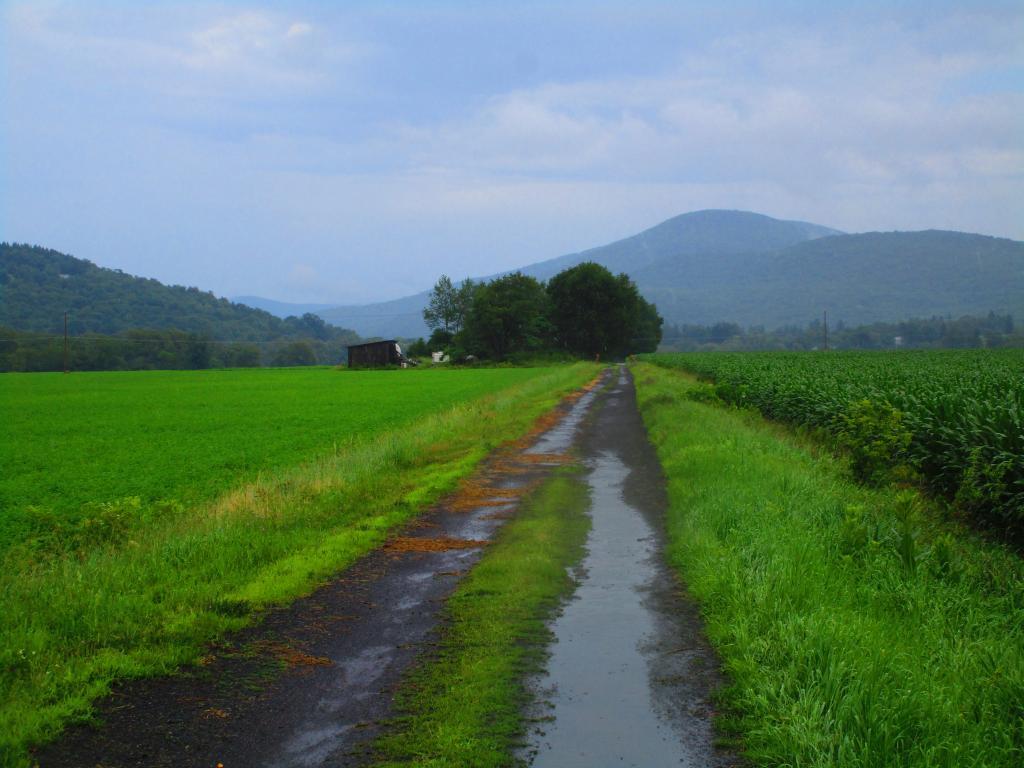
Fields

Peaks Over 3,000 Feet Elevation in New York State

There are 229 summits in New York State greater then 3,000 feet elevation.

Tallest Peak Summit Name Elevation County USGS Topo Map Name State Land Trail Location
1 Mount Marcy 5,344 Essex Mount Marcy High Peaks Wilderness NA 44.112733,
-73.9237833
2 Algonquin Peak 5,105 Essex North Elba High Peaks Wilderness Algonquin Trail 44.1436636,
-73.9865357
3 Mount Haystack 4,924 Essex Mount Marcy High Peaks Wilderness Haystack Trail Via Barklet Ridge 44.1056093,
-73.9004196
4 Mount Skylight 4,908 Essex Mount Marcy High Peaks Wilderness Skylight Trail 44.0994987,
-73.9306986
5 Basin Mountain 4,852 Essex Mount Marcy High Peaks Wilderness State Range Trail 44.1211639,
-73.8862527
6 Iroquois Peak 4,829 Essex North Elba High Peaks Wilderness Iroquois Herd Path Via Boundary Peak 44.1369973,
-73.9982027
7 Boundary Peak 4,826 Essex North Elba High Peaks Wilderness Iroquois Herd Path Via Boundary Peak 44.1397749,
-73.9937582
8 Whiteface Mountain 4,816 Essex Lake Placid Whiteface Mountain Ski Center Whiteface Landing To Whiteface Mtn. Trail 44.3658804,
-73.9026456
9 Dix Mountain 4,813 Essex Dix Mountain High Peaks Wilderness Elk Lake To Dix Mountain Trail 44.0822756,
-73.7862471
10 Gray Peak 4,800 Essex Mount Marcy High Peaks Wilderness Mount Marcy Trail Via Opalescent River 44.1114427,
-73.9348658
11 Schofield Cobble 4,744 Essex Mount Marcy High Peaks Wilderness NA 44.1089427,
-73.9270876
12 Little Marcy 4,728 Essex Mount Marcy High Peaks Wilderness Van Hoevenberg Trail To Marcy 44.1197753,
-73.910976
13 Gothics 4,724 Essex Keene Valley High Peaks Wilderness Beaver Meadow Falls Trail 44.1281079,
-73.8570849
14 Mount Colden 4,708 Essex North Elba High Peaks Wilderness Mount Colden Via Lake Arnold 44.1269976,
-73.9598674
15 Beck-horn 4,695 Essex Dix Mountain High Peaks Wilderness Elk Lake To Dix Mountain Trail 44.0800534,
-73.7845802
16 Little Haystack 4,678 Essex Mount Marcy High Peaks Wilderness Haystack Trail Via Slant Rock 44.1103313,
-73.9004197
17 Giant Mountain 4,623 Essex Rocky Peak Ridge Giant Mountain Wilderness North Trail To Giant Mtn. 44.161165,
-73.720279
18 Mount Redfield 4,603 Essex Mount Marcy High Peaks Wilderness Mt Redfield Trail 44.094777,
-73.949866
19 Santanoni Peak 4,596 Essex Santanoni Peak High Peaks Wilderness Bradley Pond Trail 44.0822811,
-74.1309855
20 Wright Peak 4,564 Essex North Elba High Peaks Wilderness Wright Peak Spur Trail 44.1517187,
-73.9801468
21 Nippletop 4,554 Essex Dix Mountain High Peaks Wilderness Nipple Top Trail 44.0892202,
-73.8159708
22 Saddleback Mountain 4,534 Essex North Elba High Peaks Wilderness State Range Trail 44.1264414,
-73.8748634
23 Panther Peak 4,455 Essex Santanoni Peak High Peaks Wilderness Bradley Pond Trail 44.0983915,
-74.132097
24 Rocky Peak 4,403 Essex Rocky Peak Ridge Giant Mountain Wilderness East Trail To Giant Mtn. Via Rocky Peak Ridge 44.1542177,
-73.7051718
25 Macomb Mountain 4,396 Essex Dix Mountain High Peaks Wilderness Macomb-E. Dix Trail 44.0517211,
-73.7801349
26 Hough Peak 4,393 Essex Dix Mountain High Peaks Wilderness S. Dix-Hough Trail 44.0694981,
-73.7776352
27 Mount Marshall 4,380 Essex Street Mountain High Peaks Wilderness Mt Marshall Trail 44.1275538,
-74.0118142
28 Armstrong Mountain 4,360 Essex Keene Valley High Peaks Wilderness Adk Range Trail 44.1347741,
-73.8490291
29 Seward Mountain 4,327 Franklin Ampersand Lake High Peaks Wilderness Seymour Mountain Herd Path 44.1597799,
-74.1993239
30 Allen Mountain 4,321 Essex Mount Marcy High Peaks Wilderness Mt Redfield Trail 44.0708892,
-73.9395871
31 Table Top Mountain 4,295 Essex North Elba High Peaks Wilderness Table Top Mountain Trail 44.143663,
-73.9070876
32 Big Slide Mountain 4,232 Essex Keene Valley High Peaks Wilderness Big Slide Trail 44.1822721,
-73.8704202
33 Esther Mountain 4,232 Essex Franklin Falls Wilmington Wild Forest Esther Mt Trail 44.3869916,
-73.8898673
34 MacIntyre Mountains 4,193 Essex Street Mountain High Peaks Wilderness Mt Marshall Trail 44.1308868,
-74.008203
35 Lower Wolfjaw Mountain 4,190 Essex Keene Valley High Peaks Wilderness W.a. White Trail 44.1483845,
-73.8326399
36 Upper Wolfjaw Mountain 4,190 Essex Keene Valley High Peaks Wilderness Adk Range Trail 44.1406072,
-73.8451402
37 Slide Mountain 4,167 Ulster Peekamoose Mountain Slide Mountain Wilderness Burroughs Range Trail-Wittenberg-Cornell 41.9987034,
-74.3862617
38 Phelps Mountain 4,137 Essex North Elba High Peaks Wilderness Phelps Mtn. Trail 44.1569957,
-73.9209775
39 Cascade Mountain 4,094 Essex Keene Valley High Peaks Wilderness Casade Mountain Trail 44.2186594,
-73.860143
40 South Dix 4,088 Essex Dix Mountain High Peaks Wilderness Macomb-E. Dix Trail 44.060054,
-73.7743014
41 Lookout Mountain 4,078 Essex Franklin Falls Whiteface Mountain Ski Center Esther Mt Trail 44.3778249,
-73.887645
42 Donaldson Mountain 4,062 Franklin Ampersand Lake High Peaks Wilderness Seymour Mountain Herd Path 44.1539471,
-74.210991
43 Seymour Mountain 4,055 Franklin Ampersand Lake High Peaks Wilderness Seymour Mountain Herd Path 44.1578347,
-74.1721003
44 Colvin Range 4,049 Essex Dix Mountain High Peaks Wilderness Colvin Trail 44.0939424,
-73.8345829
45 Mount Colvin 4,049 Essex Dix Mountain High Peaks Wilderness Colvin Trail 44.0939424,
-73.8345829
46 Hunter Mountain 4,045 Greene Hunter Hunter-West Kill Wilderness Spruceton Trail 42.1778662,
-74.2304216
47 Mount Emmons 4,022 Franklin Ampersand Lake High Peaks Wilderness Northville-Placid Trail 44.1436698,
-74.2140464
48 Street Mountain 4,022 Essex Street Mountain High Peaks Wilderness Street Mountain Trail 44.1797741,
-74.0437616
49 Grace Peak 4,006 Essex Dix Mountain High Peaks Wilderness Macomb-E. Dix Trail 44.0653314,
-73.7573564
50 Yard Mountain 3,999 Essex North Elba High Peaks Wilderness Big Slide Trail Via Yard Mtn. 44.1747725,
-73.8845874
51 MacNaughton Mountain 3,983 Essex Street Mountain High Peaks Wilderness Wall Face Ponds Trail 44.1397768,
-74.064317
52 Dial Mountain 3,980 Essex Dix Mountain High Peaks Wilderness Leach Trail 44.1058859,
-73.7959703
53 Blake Peak 3,976 Essex Dix Mountain High Peaks Wilderness Pinnacle Trail 44.081443,
-73.844583
54 Green Mountain 3,976 Essex Rocky Peak Ridge Giant Mountain Wilderness North Trail To Giant Mtn. 44.182272,
-73.714858
55 Black Dome 3,973 Greene Freehold Windham-Blackhead Range Wilderness Blackhead Range Trail 42.2700864,
-74.1226382
56 Thomas Cole Mountain 3,944 Greene Hensonville Windham-Blackhead Range Wilderness Blackhead Range Trail 42.2709196,
-74.1365275
57 Cliff Mountain 3,940 Essex Mount Marcy High Peaks Wilderness Mount Marcy Trail Via Opalescent River 44.1031102,
-73.9751452
58 McDonnel Mountain 3,940 Essex Mount Marcy High Peaks Wilderness Mt Redfield Trail 44.0803332,
-73.9340315
59 Blackhead 3,930 Greene Freehold Windham-Blackhead Range Wilderness Blackhead Mountain Spur Trail 42.2678644,
-74.1045818
60 West Kill Mountain 3,891 Greene Lexington Hunter-West Kill Wilderness Devil’s Path 42.1678663,
-74.2895904
61 Doubletop Mountain 3,875 Ulster Seager NA Seager Big Indian Trail 42.0275913,
-74.5282095
62 Nye Mountain 3,871 Essex Street Mountain High Peaks Wilderness Nye Mountain Trail 44.1931062,
-74.0240387
63 Kilburn Mountain 3,868 Essex Lake Placid Sentinel Range Wilderness Copperas Owen Pond Trl 44.3028247,
-73.8818114
64 Moose Mountain 3,868 Essex McKenzie Mountain Mckenzie Mountain Wilderness Mckenzie Mtn. Trail 44.3506029,
-74.0032049
65 Howard Mountain 3,852 Essex North Elba High Peaks Wilderness Klondike Notch Trail 44.1583844,
-73.8912539
66 Cornell Mountain 3,848 Ulster Phoenicia Slide Mountain Wilderness Burroughs Range Trail-Wittenberg-Cornell 42.0014812,
-74.3568163
67 Graham Mountain 3,848 Ulster Seager NA Seager Big Indian Trail 42.0392576,
-74.5495986
68 Plateau Mountain 3,845 Greene Hunter Indian Head Wilderness Devil’s Path 42.1378671,
-74.1743088
69 McKenzie Mountain 3,842 Essex McKenzie Mountain Mckenzie Mountain Wilderness Mckenzie Mtn. Trail 44.3361593,
-74.0320951
70 Rist Mountain 3,839 Essex Mount Marcy High Peaks Wilderness Boreas Road 44.027559,
-73.987366
71 Sentinel Mountain 3,835 Essex Keene Sentinel Range Wilderness Winch Pond 44.3061581,
-73.8523658
72 Lyon Mountain 3,829 Clinton Moffitsville Chazy Highlands Wild Forest New Lyon Mountain Trail 44.7036537,
-73.8645877
73 T R Mountain 3,829 Essex North Elba High Peaks Wilderness Lake Arnold Crossover 44.143941,
-73.9354222
74 Snowy Mountain 3,825 Hamilton Snowy Mountain NA Snowy Mt 43.7003432,
-74.3859856
75 Table Mountain 3,819 Ulster Peekamoose Mountain Slide Mountain Wilderness Peekamoose-Table Trail 41.9587036,
-74.4048739
76 Peekamoose Mountain 3,812 Ulster Peekamoose Mountain Slide Mountain Wilderness Peekamoose-Table Trail 41.9531481,
-74.398207
77 Avalanche Mountain 3,809 Essex North Elba High Peaks Wilderness Avalanche Pass Trail 44.1361639,
-73.9695903
78 Averill Peak 3,806 Clinton Lyon Mountain Chazy Highlands Wild Forest New Lyon Mountain Trail 44.6928208,
-73.8809768
79 Sugarloaf Mountain 3,806 Greene Hunter Indian Head Wilderness Devil’s Path 42.1312006,
-74.1501414
80 Couchsachraga Peak 3,793 Essex Santanoni Peak High Peaks Wilderness Cold River Horse Trail 44.0956146,
-74.1601539
81 Boreas Mountain 3,779 Essex Mount Marcy NA Gulf Brook Road 44.0031138,
-73.8806937
82 Wittenberg Mountain 3,766 Ulster Phoenicia Slide Mountain Wilderness Burroughs Range Trail-Wittenberg-Cornell 42.0081478,
-74.3473716
83 Panther Mountain 3,763 Hamilton Snowy Mountain NA Snowy Mt 43.7367317,
-74.3907093
84 Burroughs Range 3,760 Ulster Phoenicia Slide Mountain Wilderness Burroughs Range Trail-Wittenberg-Cornell 42.0084255,
-74.3476494
85 Blue Mountain 3,750 Hamilton Blue Mountain Lake Blue Mountain Wild Forest Blue Mountain Trail 43.8725634,
-74.4009917
86 Porter Mountain 3,750 Essex Keene Valley High Peaks Wilderness Porter Mountain Trail Via Marcy Field 44.2153262,
-73.8434754
87 Wakely Mountain 3,750 Hamilton Wakely Mountain Wakely Mountain Primitive Area Wakely Mountain Trail 43.7358986,
-74.5151595
88 Little Nippletop 3,720 Essex Mount Marcy High Peaks Wilderness Elk Lake To Marcy Trail 44.0853327,
-73.9201422
89 Wallface Mountain 3,720 Essex Street Mountain High Peaks Wilderness Indian Pass Trail 44.1378317,
-74.0365378
90 Panther Mountain 3,714 Ulster Shandaken Slide Mountain Wilderness Giant Ledge-Panther Mountian-Fox Hollow Trail 42.0564799,
-74.3945946
91 Balsam Lake Mountain 3,707 Ulster Seager Balsam Lake Mountain Wild Forest Balsam Lake Mountain Trail 42.0459236,
-74.5940438
92 Henderson Mountain 3,707 Essex Mount Adams High Peaks Wilderness Bradley Pond Trail 44.0978353,
-74.0976509
93 Hoffman Mountain 3,701 Essex Blue Ridge Hoffman Notch Wilderness Hoffman Notch Trail 43.9114489,
-73.8168
94 Lone Mountain 3,697 Ulster Peekamoose Mountain Slide Mountain Wilderness Peekamoose-Table Trail 41.9692592,
-74.3893177
95 Big Indian Mountain 3,694 Ulster Shandaken Big Indian Wilderness Pine Hill West Branch Trail 42.0350915,
-74.4965421
96 Hurricane Mountain 3,688 Essex Rocky Peak Ridge Hurricane Mountain Wilderness East Hurricane Mtn Trial 44.235326,
-73.7106926
97 Friday Mountain 3,681 Ulster West Shokan Slide Mountain Wilderness Burroughs Range Trail-Wittenberg-Cornell 41.9875924,
-74.3620944
98 Rusk Mountain 3,678 Greene Lexington Rusk Mountain Wild Forest Spruceton Trail 42.2006434,
-74.2770897
99 Cheney Cobble 3,674 Essex Mount Marcy High Peaks Wilderness East River Trail 44.0445021,
-73.9648654
100 Lewey Mountain 3,665 Hamilton Snowy Mountain West Canada Lake Wilderness Sucker Brook Trail 43.6642328,
-74.4412649
101 Seward Mountains 3,665 Franklin Ampersand Lake High Peaks Wilderness Calkins Creek Truck Trail 44.1561694,
-74.2148801
102 Santanoni Mountains 3,661 Essex Santanoni Peak High Peaks Wilderness Bradley Pond Trail 44.0881144,
-74.138486
103 Buell Mountain 3,652 Hamilton Snowy Mountain NA Snowy Mt 43.7161764,
-74.4065426
104 High Peak 3,645 Greene Kaaterskill Clove Kaaterskill Wild Forest Kaaterskill High Peak Trail 42.1620334,
-74.0801381
105 Little Whiteface Mountain 3,638 Essex Lake Placid Whiteface Mountain Ski Center Whiteface Landing To Whiteface Mtn. Trail 44.3558804,
-73.891534
106 Burtons Peak 3,632 Essex Keene Valley NA The Brothers Trail 44.1925,
-73.8586111
107 Fir Mountain 3,629 Ulster Shandaken Big Indian Wilderness Pine Hill West Branch Trail 42.0275916,
-74.4690414
108 Twin Mountain 3,629 Greene Hunter Indian Head Wilderness Devil’s Path 42.1256453,
-74.1290294
109 Little Moose Mountain 3,609 Hamilton Wakely Mountain Little Moose Wilderness Otter Brook Trail 43.6700663,
-74.5707151
110 Balsam Mountain 3,606 Ulster Shandaken Big Indian Wilderness Pine Hill West Branch Trail 42.0909235,
-74.4882082
111 Calamity Mountain 3,606 Essex Mount Adams High Peaks Wilderness Calamity Brook Trail 44.1028328,
-74.0043132
112 Sunrise Mountain 3,606 Essex Dix Mountain High Peaks Wilderness Elk Lake To Dix Mountain Trail 44.0247778,
-73.7904124
113 Balsam Cap 3,602 Ulster West Shokan Slide Mountain Wilderness Burroughs Range Trail-Wittenberg-Cornell 41.9770369,
-74.3573722
114 Stewart Mountain 3,602 Essex Keene Sentinel Range Wilderness Winch Pond 44.3261581,
-73.8562549
115 North Dome 3,596 Greene Lexington Hunter-West Kill Wilderness Devil’s Path 42.1734217,
-74.3490366
116 Pillsbury Mountain 3,589 Hamilton Spruce Lake West Canada Lake Wilderness Pillsbury Mountain Trail 43.580901,
-74.5120992
117 Slide Mountain 3,586 Essex Lake Placid Sentinel Range Wilderness Barkeater Cliffs Campsite Trail 44.2767136,
-73.8862561
118 Eagle Mountain 3,573 Ulster Seager Big Indian Wilderness Pine Hill West Branch Trail 42.0620352,
-74.50932
119 Dun Brook Mountain 3,563 Hamilton Dun Brook Mountain NA Deer Pond Road 43.890897,
-74.3187666
120 Saddleback Mountain 3,560 Essex Jay Mountain Jay Mountain Wilderness Jay Mountain Trail 44.2953258,
-73.6676367
121 Indian Head Mountain 3,553 Greene Woodstock Indian Head Wilderness Devil’s Path 42.116201,
-74.1145846
122 Fishing Brook Mountain 3,550 Essex Dun Brook Mountain Blue Mountain Wild Forest Deer Pond Road 43.9342303,
-74.2946002
123 Mount Sherrill 3,550 Greene Lexington Hunter-West Kill Wilderness Devil’s Path 42.1756439,
-74.3729262
124 Gooseberry Mountain 3,540 Essex Keene Valley High Peaks Wilderness Orebed Brook Trail 44.1367187,
-73.8731969
125 Bearpen Mountain 3,530 Delaware Prattsville Bearpen Mountain State Forest Access Trail 42.2734189,
-74.4840396
126 Vly Mountain 3,530 Greene West Kill Bearpen Mountain State Forest Snowmobile Trail 42.2453645,
-74.4459834
127 Windham High Peak 3,527 Greene Hensonville Windham-Blackhead Range Wilderness Escarpment Trail 42.3148069,
-74.1434718
128 Halcott Mountain 3,524 Greene West Kill Halcott Mountain Wild Forest Condon Hollow Rd. 42.1800882,
-74.4379281
129 Mount Adams 3,520 Essex Mount Adams High Peaks Wilderness Mt Adams Trail 44.0867231,
-74.0257027
130 Pitchoff Mountain 3,501 Essex North Elba Sentinel Range Wilderness Pitchoff Mountain Trail 44.2375474,
-73.8776443
131 Noonmark Mountain 3,491 Essex Keene Valley High Peaks Wilderness Stimson Trail 44.1289404,
-73.7720809
132 Rocky Mountain 3,478 Ulster West Shokan Slide Mountain Wilderness Peekamoose-Table Trail 41.9728703,
-74.3726505
133 Little Santanoni Mountain 3,471 Essex Santanoni Peak High Peaks Wilderness Moose Pond Horse Trail 44.0731156,
-74.1670981
134 Spotted Mountain 3,461 Essex Underwood High Peaks Wilderness Macomb-E. Dix Trail 44.0769975,
-73.7440228
135 Manbury Mountain 3,455 Hamilton Wakely Mountain Little Moose Wilderness Otter Brook Trail 43.6653442,
-74.5532143
136 Blue Ridge Mountain 3,451 Essex Blue Ridge Hoffman Notch Wilderness Hoffman Notch Trail 43.9247817,
-73.8148558
137 Roundtop 3,451 Delaware Prattsville Bearpen Mountain State Forest Ski Run Road 42.2939737,
-74.4904283
138 Roundtop Mountain 3,451 Greene Kaaterskill Clove Kaaterskill Wild Forest Kaaterskill High Peak Trail 42.1684222,
-74.094583
139 Olderbark Mountain 3,438 Greene Bearsville Indian Head Wilderness Mink Hollow Trail 42.1142565,
-74.1909765
140 Puffer Mountain 3,438 Hamilton Bullhead Mountain Siamese Ponds Wilderness Puffer Pond Brook Trail 43.6617318,
-74.1993082
141 Morgan Mountain 3,432 Essex Wilmington Wilmington Wild Forest Cooper Kill Trail 44.4186582,
-73.8593108
142 Wolf Pond Mountain 3,425 Essex Cheney Pond NA Gulf Brook Road 43.9892253,
-73.8781933
143 Stoppel Point 3,422 Greene Kaaterskill Clove Windham-Blackhead Range Wilderness Escarpment Trail 42.2250879,
-74.0651364
144 Huntersfield Mountain 3,419 Greene Ashland Huntersfield State Forest Huntersfield Access Trail #8/Long Path Access 42.355638,
-74.3465339
145 Cellar Mountain 3,405 Hamilton Wakely Mountain Moose River Plains Wild Forest Cellar Pond Trail 43.7122879,
-74.5429375
146 Haynes Mountain 3,405 Ulster Seager Big Indian Wilderness Pine Hill West Branch Trail 42.0792571,
-74.5079309
147 Sawtooth Mountains 3,402 Franklin Street Mountain High Peaks Wilderness Northville-Placid Trail 44.1928314,
-74.1134874
148 Bear Den Mountain 3,389 Essex Dix Mountain High Peaks Wilderness Leach Trail 44.1194964,
-73.792915
149 Pinnacle 3,389 Essex Dix Mountain High Peaks Wilderness Pinnacle Trail Spur To Summit 44.0583887,
-73.8640277
150 Vanderwhacker Mountain 3,389 Essex Vanderwhacker Mountain Vanderwhacker Mountain Wild Forest Vanderwhacker Firetower Trail 43.8983963,
-74.0959781
151 Jay Mountain 3,379 Essex Jay Mountain Jay Mountain Wilderness Jay Mountain Trail 44.3125477,
-73.685693
152 Spruce Top 3,379 Greene Hunter NA Devil’s Path 42.1506447,
-74.1679195
153 Spruce Mountain 3,376 Ulster Shandaken Big Indian Wilderness Phoenicia East Branch Trail 42.0175919,
-74.4498744
154 Belle Ayr Mountain 3,373 Ulster Shandaken Belleayre Mountain Ski Center NA 42.1159229,
-74.4979304
155 Evergreen Mountain 3,369 Greene Lexington Rusk Mountain Wild Forest Devil’s Path 42.2117542,
-74.3079238
156 Hedgehog Mountain 3,366 Essex Keene Valley High Peaks Wilderness Rooster Comb And Hedgehog Trail 44.159495,
-73.8109724
157 Balsam Mountain 3,353 Greene West Kill Hunter-West Kill Wilderness Condon Hollow Rd. 42.1836992,
-74.387371
158 Kempshall Mountain 3,350 Hamilton Kempshall Mountain High Peaks Wilderness Northville-Placid Trail 44.0236734,
-74.3271041
159 Buck Mountain 3,346 Hamilton Snowy Mountain West Canada Lake Wilderness Snowy Mt 43.6947879,
-74.4368212
160 Mount Pisgah 3,340 Delaware Margaretville NA Mountain Brook Road 42.2211973,
-74.7357125
161 MacDonough Mountain 3,320 Essex Jay Mountain Jay Mountain Wilderness Jay Mountain Trail 44.3050482,
-73.644025
162 Debar Mountain 3,317 Franklin Debar Mountain Debar Mountain Wild Forest Debar Mountain Trail 44.6033852,
-74.2204351
163 Bullhead Mountain 3,314 Warren Bullhead Mountain Siamese Ponds Wilderness John Pond Crossover Trail 43.7017316,
-74.1804199
164 Laramore Mountain 3,314 Essex Keene Valley High Peaks Wilderness Casade Mountain Trail 44.2258813,
-73.8501427
165 Tripod Mountain 3,307 Essex Rocky Peak Ridge Giant Mountain Wilderness Hopkin Via Direct Trail 44.1983824,
-73.736248
166 Metcalf Mountain 3,304 Hamilton Blue Mountain Lake Blue Ridge Wilderness Gould Road 43.7522873,
-74.4957146
167 Wyman Mountain 3,304 Essex Underwood High Peaks Wilderness Macomb-E. Dix Trail 44.0581093,
-73.7445779
168 Jay Mountains 3,297 Essex Jay Mountain Jay Mountain Wilderness Jay Mountain Trail 44.308659,
-73.6704147
169 Eleventh Mountain 3,294 Warren Bakers Mills Siamese Ponds Wilderness Bog Meadow Trail 43.6142322,
-74.0720783
170 Schultice Mountain 3,284 Delaware Roxbury NA Ski Run Road 42.3186948,
-74.5157062
171 Cellar Mountain 3,281 Hamilton Snowy Mountain West Canada Lake Wilderness Sucker Brook Trail 43.6411776,
-74.4443199
172 Plattekill Mountain 3,268 Delaware Hobart Plattekill State Forest Mountain Brook/ Harold Roberts Access Trail 42.2667522,
-74.6482102
173 South Pond Mountain 3,258 Hamilton South Pond Mountain Siamese Ponds Wilderness County Line Brook Trail 43.5900656,
-74.2204175
174 Hemlock Mountain 3,248 Ulster Shandaken Big Indian Wilderness Phoenicia East Branch Trail 42.0128698,
-74.4390407
175 Peaked Mountain 3,235 Essex Jay Mountain Hurricane Mountain Wilderness Soda Range Trail 44.2656034,
-73.6993039
176 Onteora Mountain 3,232 Greene Hunter NA Blackhead Range Trail 42.2223098,
-74.1679184
177 Kitty Cobble 3,225 Hamilton Wakely Mountain West Canada Lake Wilderness Otter Brook Trail 43.6295111,
-74.6229377
178 Baldwin Hill 3,218 Essex Franklin Falls Mckenzie Mountain Wilderness Esther Mt Trail 44.3847694,
-73.9195905
179 Richmond Mountain 3,218 Greene Ashland Mount Pisgah State Forest Long Path Hiking Trail 42.367582,
-74.270976
180 Squaw Mountain 3,218 Hamilton Indian Lake NA Snowy Mt 43.7270094,
-74.3420956
181 Dug Mountain 3,215 Hamilton Kunjamuk River NA Long Pond Trail 43.583122,
-74.345146
182 Hamilton Mountain 3,215 Hamilton Wells Silver Lake Wilderness West River Road 43.412013,
-74.3673645
183 Mount Alton 3,212 Essex Lake Placid Mckenzie Mountain Wilderness Whiteface Mountain Trail 44.3717139,
-73.9662589
184 Utsayantha Mountain 3,209 Delaware Stamford NA Ward Allen Road 42.3992472,
-74.5895953
185 Van Wyck Mountain 3,202 Ulster Peekamoose Mountain Slide Mountain Wilderness Phoenicia East Branch Trail 41.9523147,
-74.4354304
186 Colonels Chair 3,199 Greene Hunter NA Colonel’s Chair Trail 42.2006434,
-74.2306991
187 Gore Mountain 3,199 Warren Gore Mountain Gore Mountain Ski Center Schaefer Trail 43.6764539,
-74.035134
188 Chase Mountain 3,192 Essex Rocky Peak Ridge Hurricane Mountain Wilderness North Hurricane Trail 44.2417145,
-73.7248599
189 Knob Lock Mountain 3,192 Essex Rocky Peak Ridge Giant Mountain Wilderness Hurricane Trail From 9n 44.2003271,
-73.7073583
190 McGregor Mountain 3,192 Delaware Stamford Stamford Fp Detached Parcel Relay Public Forest Access Road 42.3900808,
-74.5790396
191 Weston Mountain 3,192 Essex Jay Mountain Hurricane Mountain Wilderness Soda Range Trail 44.2642144,
-73.7079152
192 Burnt Knob 3,189 Greene Freehold Windham-Blackhead Range Wilderness Escarpment Trail 42.3020297,
-74.1190264
193 Burgess Mountain 3,189 Hamilton Rock Lake NA Bear Trap Brook Trail 43.7520092,
-74.3565416
194 North Mountain 3,186 Greene Kaaterskill Clove Windham-Blackhead Range Wilderness Escarpment Trail 42.2175881,
-74.0487469
195 Payne Mountain 3,182 Hamilton Snowy Mountain Moose River Plains Wild Forest Northville-Placid Trail 43.7231211,
-74.4951582
196 Hopkins Mountain 3,169 Essex Rocky Peak Ridge Giant Mountain Wilderness Hopkins Mtn. Via Spread Eagle Mtn. 44.1833828,
-73.7490257
197 Spruce Lake Mountain 3,163 Hamilton Spruce Lake Mountain West Canada Lake Wilderness Northville-Placid Trail 43.5120126,
-74.6532121
198 Tongue Mountain 3,159 Hamilton Dun Brook Mountain NA Northville-Placid Trail 43.9114522,
-74.3454349
199 Catamount Mountain 3,153 Clinton Wilmington Taylor Pond Wild Forest Catamount Trail 44.459214,
-73.8723668
200 Wildcat Mountain 3,153 Ulster Peekamoose Mountain Slide Mountain Wilderness Pine Hill West Branch Trail 41.9775924,
-74.4759867
201 White Man Mountain 3,146 Delaware Roxbury NA Access Trail 42.2845295,
-74.5340406
202 Bradley Mountain 3,140 Hamilton Wakely Mountain Blue Ridge Wilderness Cellar Pond Trail 43.7378431,
-74.5546055
203 Overlook Mountain 3,136 Ulster Woodstock Overlook Mountain Wild Forest Firetower Spur 42.0850905,
-74.0931954
204 Mount Tamarac 3,127 Essex McKenzie Mountain Mckenzie Mountain Wilderness Jackrabbit Trail 44.3267144,
-74.0204281
205 Mount Morris 3,117 Franklin Tupper Lake NA Goodman Mountain Trail 44.1595046,
-74.475168
206 Acra Point 3,110 Greene Freehold Windham-Blackhead Range Wilderness Escarpment Trail 42.2964745,
-74.0998591
207 Round Mountain 3,107 Essex Keene Valley High Peaks Wilderness Weston Trail Spur To Round Mt 44.1317179,
-73.7515245
208 Cave Mountain 3,104 Greene Hensonville Elm Ridge Wild Forest North Face Trail 42.2859185,
-74.2462543
209 Pete Gay Mountain 3,097 Warren Gore Mountain NA Schaefer Trail 43.6903427,
-74.0443015
210 Plattekill Mountain 3,091 Greene Woodstock Indian Head Wilderness Overlook Trail 42.1073123,
-74.0865281
211 Mount Andrew 3,081 Essex Mount Adams High Peaks Wilderness Bradley Pond Trail 44.0564482,
-74.093483
212 County Line Mountain 3,081 Hamilton South Pond Mountain Siamese Ponds Wilderness Siamese Ponds Trail 43.6114543,
-74.2006952
213 High Point 3,074 Ulster West Shokan Sundown Wild Forest Ashokan High Point 41.9248149,
-74.2879263
214 Rose Mountain 3,074 Ulster West Kill NA Rochester Hollow 42.1506445,
-74.4379284
215 Cowan Mountain 3,068 Delaware Hobart NA Relay Public Forest Access Road 42.3450825,
-74.6498756
216 Round Top 3,068 Delaware Hobart Plattekill State Forest Mountain Brook/ Harold Roberts Access Trail 42.2714741,
-74.6832109
217 Churchill Mountain 3,064 Delaware Stamford NA Relay Public Forest Access Road 42.388692,
-74.6098738
218 Irish Mountain 3,064 Delaware Roxbury NA Ski Run Road 42.3356386,
-74.5262617
219 Swart Mountain 3,061 Hamilton Lake Pleasant Silver Lake Wilderness West River Road 43.3967355,
-74.3815314
220 Scarface Mountain 3,058 Essex McKenzie Mountain Saranac Lakes Wild Forest Scarface Mountain Trail 44.2647717,
-74.0737646
221 T Lake Mountain 3,058 Hamilton Piseco Lake West Canada Lake Wilderness T Lake Trail 43.4470133,
-74.5770967
222 Bailey Hill 3,054 Essex Cheney Pond Hoffman Notch Wilderness Hoffman Notch Trail 43.9108943,
-73.9026366
223 Bald Peak 3,054 Essex Rocky Peak Ridge Giant Mountain Wilderness East Trail To Giant Mtn. Via Rocky Peak Ridge 44.1597731,
-73.6654114
224 Little Rocky Mountain 3,051 Greene Bearsville Indian Head Wilderness Warner Creek Trail 42.1150898,
-74.2040325
225 Denman Mountain 3,048 Sullivan Claryville NA Denman Mountain Snowmobile Trail 41.90287,
-74.5396005
226 Woodhull Mountain 3,045 Ulster Peekamoose Mountain NA Phoenicia East Branch Trail 41.9459259,
-74.4637647
227 Barkaboom Mountain 3,005 Delaware Arena Dry Brook Ridge Wild Forest Touch-Me-Not-Trail 42.0717554,
-74.7201571
228 Stony Creek Mountain 3,002 Franklin Stony Creek Mountain High Peaks Wilderness Ampersand Mountain Trail 44.222002,
-74.2659949
229 Van Dorrien Mountain 3,002 Franklin Ampersand Lake High Peaks Wilderness Ampersand Mountain Trail 44.2222766,
-74.1704351

Burnt Knob Overlook

An interactive map and listing of the 280 peaks over 3,000 feet elevation listed in the Open Street Map database for New York State.

Locations and Maps of Lean-Tos in NYS

Interactive Map of Lean-Tos

You can get a downloadable, more detailed map with campsites, lean-tos, scenic vistas and trails.

Note: This list is sorted from North to South, and West to East in New York, therefore the farthest North Lean-To in NY State is in the Debar Mountain Wild Forest, and the farthest south one is in David A. Sarnoff Pine Barrens Preserve in Long Island. Location links take you to aerial photos of the Lean-Tos on the free ACME Mapper.

Download or View this Chart on Google Sheets

State Forest LandNameTypeDescriptionLocation
Debar Mtn. Wild ForestDebar Mountian Lean-ToLean-To 44.598926, -74.228592
Debar Mtn. Wild ForestGrass Pond Lean-ToLean-To 44.493389, -74.251194
Taylor Pond Wild ForestNorth Shore Taylor Pond Lean-ToLean-ToManaged By Operations44.4897, -73.861427
Taylor Pond Wild ForestSouth East Taylor Pond Lean-ToLean-ToManaged By Operations44.482888, -73.853777
Taylor Pond Wild ForestNorthwest Shore Taylor Pond Lean-ToLean-ToManaged By Operations44.477689, -73.881283
Taylor Pond Wild ForestPoke-O-Moonshine Summit Lean-ToLean-To 44.399797, -73.514557
Saint Regis Canoe AreaFish Pond Campsite 2Lean-To 44.396133, -74.370421
Saint Regis Canoe AreaFish Pond Campsite 5Lean-To 44.391301, -74.365807
Saint Regis Canoe AreaSt. Regis Pond South Shore Lean-ToLean-ToWithin The Adopt A Lean-To System44.380642, -74.320299
Saint Regis Canoe AreaSt. Regis Pond Campsite 19Lean-To 44.380626, -74.320423
Wolf Lake State ForestBeaver Flow Lean-ToLean-To 44.357822, -75.316001
Mckenzie Mtn. WildernessLoch Bonnie Lean-ToLean-To 44.347347, -73.995669
Mckenzie Mtn. WildernessWhite Face Brook Lean-ToLean-To 44.344217, -73.928647
Wolf Lake State ForestWolf Lake Lean-ToLean-To 44.336323, -75.313886
Saranac Lakes Wild ForestLake Placid Campsite 3Lean-To 44.332595, -73.95668
Saranac Lakes Wild ForestLake Placid Campsite 2Lean-To 44.332296, -73.956626
Wolf Lake State ForestMoon Pond Lean-ToLean-To 44.332276, -75.321172
Saranac Lakes Wild ForestFollensby ClearLean-To 44.325095, -74.349897
Wolf Lake State ForestHuckleberry Lake Lean-ToLean-To 44.324272, -75.333738
Mckenzie Mtn. WildernessPlacid Lean-ToLean-To 44.321456, -74.030786
Saranac Lakes Wild Forest Lean-To 44.309124, -74.18053
Saranac Lakes Wild Forest Lean-To 44.302887, -74.302634
Saranac Lakes Wild Forest Lean-To 44.289835, -74.216869
Saranac Lakes Wild Forest Lean-To 44.286942, -74.289775
Saranac Lakes Wild Forest Lean-To 44.286657, -74.162602
Saranac Lakes Wild Forest Lean-To 44.271712, -74.273283
Saranac Lakes Wild Forest Lean-To 44.265599, -74.24293
Hurricane Mountain Primitive AreaLost Pond/BiesemeyerLean-To 44.26073, -73.710011
Hurricane Mountain Primitive AreaGulf Brook Lean-ToLean-To 44.253097, -73.71796
Saranac Lakes Wild Forest Lean-To 44.228772, -74.375533
High Peaks Wilderness Lean-To 44.198805, -74.31831
Horseshoe Lake Wild ForestEagle Landing Lean-ToLean-To 44.19683, -74.512309
High Peaks Wilderness Lean-To 44.177317, -74.321808
Giant Mountain WildernessGiant Mtn. Lean-ToLean-To 44.175641, -73.722171
Horseshoe Lake Wild Forest Lean-To 44.158907, -74.560725
High Peaks Wilderness Lean-To 44.15683, -74.313308
Cranberry Lake Wild Forest Lean-To 44.1534, -74.884029
High Peaks Wilderness Lean-To 44.147236, -74.318105
Dix Mountain WildernessBouquet Lean-ToLean-To 44.110904, -73.774043
High Peaks Wilderness Lean-To 44.105829, -74.312037
Sargent Ponds Wild Forest Lean-To 44.102744, -74.321863
Sargent Ponds Wild Forest Lean-To 44.082504, -74.333915
Sargent Ponds Wild Forest Lean-To 44.081407, -74.335829
High Peaks Wilderness Lean-To 44.065927, -74.326697
Dix Mountain WildernessLilian Brook Lean-ToLean-To 44.058989, -73.806533
Dix Mountain WildernessSlide Brook Lean-ToLean-To 44.044126, -73.805858
High Peaks Wilderness Lean-To 44.042977, -74.349335
High Peaks Wilderness Lean-To 44.041409, -74.350149
High Peaks Wilderness Lean-To 44.02862, -74.366763
High Peaks Wilderness Lean-To 44.002655, -74.38648
William C. Whitney WildernessLake Lila # 7Lean-To 44.002145, -74.775682
High Peaks Wilderness Lean-To 43.998164, -74.392741
Independence River Wild ForestTrout Pond Lean ToLean-To 43.928489, -74.94487
Sargent Ponds Wild ForestDeerland Carry Lean-To 2Lean-ToFair Condition43.926218, -74.475396
Sargent Ponds Wild ForestDeerland Carry Lean-To 1Lean-ToFair Condition43.925781, -74.475846
Sargent Ponds Wild ForestPinebrook Lean-ToLean-ToFair Condition43.906646, -74.50259
Sargent Ponds Wild Forest Lean-To 43.902847, -74.548063
Blue Mountain Wild ForestNorth End Tirrel Pond Lean-ToLean-To 43.887378, -74.377739
Sargent Ponds Wild Forest Lean-To 43.879414, -74.606052
Blue Mountain Wild ForestO’neil Lean-ToLean-To 43.875096, -74.367316
Sargent Ponds Wild Forest Lean-To 43.871006, -74.628108
Sargent Ponds Wild Forest Lean-To 43.870772, -74.628507
Sargent Ponds Wild Forest Lean-To 43.87072, -74.629172
Sargent Ponds Wild ForestLower Sargents Pond Lean-ToLean-ToFair Condition43.859331, -74.562695
Blue Ridge WildernessBoulderLean-To 43.841564, -74.472689
Sargent Ponds Wild Forest Lean-To 43.836898, -74.535266
Moose River Plains Wild Forest Lean-To 43.831671, -74.661756
Moose River Plains Wild Forest Lean-To 43.831605, -74.661511
Moose River Plains Wild Forest Lean-To 43.831434, -74.660902
Blue Ridge WildernessCascade Pond Lean-ToLean-To 43.829744, -74.436618
Independence River Wild ForestPanther Pond Lean-ToLean-To 43.823535, -75.169312
Blue Ridge WildernessWilson PondLean-To 43.820192, -74.46868
Blue Ridge WildernessStephens PondLean-To 43.818674, -74.420524
Blue Ridge WildernessStephens PondLean-To 43.818674, -74.420525
Sargent Ponds Wild Forest Lean-To 43.817134, -74.64378
Sargent Ponds Wild Forest Lean-To 43.81709, -74.643251
Sargent Ponds Wild Forest Lean-To 43.8162, -74.644668
Blue Ridge WildernessBlue Ridge Lean-ToLean-To 43.80014, -74.610139
Moose River Plains Wild Forest8thlake East Shore Lean-ToLean-To 43.789783, -74.698592
Moose River Plains Wild Forest8th Lake North Shore Lean-ToLean-To 43.780115, -74.704439
Moose River Plains Wild Forest8th Lake Island Lean-ToLean-To 43.779025, -74.704429
Moose River Plains Wild Forest Lean-To 43.75639, -74.717817
Moose River Plains Wild Forest Lean-To 43.750767, -74.734643
Moose River Plains Wild Forest Lean-To 43.747805, -74.744199
Independence River Wild ForestPine Lake Lean-ToLean-To 43.708394, -75.146453
HaderondahMiddle Branch LakeLean-To 43.702926, -75.096002
Siamese Ponds WildernessHour Pond Lean-ToLean-To 43.70112, -74.158221
HaderondahCedar Pond Lean ToLean-To 43.69597, -75.082602
HaderondahMiddle Settlement LakeLean-To 43.685949, -75.098614
West Canada Lakes WildernessColvin Brook Lean-ToLean-To 43.652414, -74.49038
Lake George Wild ForestFive Mile Mountain Lean-ToLean-ToLean-To W/ Privy And Firering43.647336, -73.574534
Black River Wild ForestRemsen Falls Lean-ToLean-To 43.629925, -75.036288
Lake George Wild ForestFifth Peak Lean-ToLean-ToLean-To W/ Privy And Firering43.619313, -73.584112
Black River Wild ForestWoodhull Lake Lean-ToLean-To 43.599885, -75.020382
Lake George Wild ForestBlack Mountain Ponds Lean-ToLean-ToLean-To With Privy And Firering43.59966, -73.533064
West Canada Lakes WildernessPillsbury Lake Lean-ToLean-To 43.596898, -74.531665
Lake George Wild Forest Lean-ToCampsite With Lean-To 13-2743.595821, -73.517951
Lake George Wild Forest Lean-ToCampsite With Lean-To 5-1043.587168, -73.527759
Lake George Wild ForestGreenland Pond LeantoLean-ToLeanto With Privy, Picnic Table And Fire Ring43.577804, -73.51684
Lake George Wild ForestFishbrook Pond North LeantoLean-ToLeanto With Privy, Picnic Table And Fire Ring43.576039, -73.536103
Lake George Wild ForestFishbrook Pond South LeantoLean-ToLeanto With Privy, Picnic Table And Fire Ring43.573872, -73.538477
Black River Wild ForestSand Lake Falls Lean-ToLean-To 43.558914, -75.003058
Black River Wild ForestGull Lake Lean-ToLean-To 43.553747, -75.059378
Black River Wild ForestChub Pond Lean-To #2Lean-To 43.529823, -75.042494
Black River Wild ForestChub Pond Lean-To #1Lean-To 43.524598, -75.043801
West Canada Lakes WildernessT Lake Leant-ToLean-To 43.452718, -74.582282
Silver Lake WildernessHamilton Lake Stream Lean-To 1Lean-To 43.39716, -74.455046
Silver Lake WildernessHamilton Lake Stream Lean-To 2Lean-To 43.397156, -74.455065
Cobb Brook State ForestLeantoLean-To 43.344545, -75.67222
Silver Lake WildernessMud Lake Lean-ToLean-To 43.342671, -74.456291
Deruyter State ForestDeruyter Lean-ToLean-To 42.820185, -75.859105
Morgan Hill State ForestMorgan Hill Lean-ToLean-To 42.767202, -76.011256
Perkins Pond State ForestFlt Lean-ToLean-To 42.642307, -75.743766
Dutch Settlement State ForestLean-ToLean-To 42.629438, -74.267543
Whaupaunaucau StateLeantoLean-To 42.606063, -75.467114
Burnt-Rossman Hills State ForestEminence Lean-ToLean-To 42.543304, -74.488595
Clapper Hollow State ForestClapper Hollow Lean-ToLean-To 42.528201, -74.642004
Tuller Hill State ForestTuller Hill Lean-T0Lean-ToRebuilt In 2002 From Local State Forest Red Pine, Built By Volunteers From Suny Cortland42.512201, -76.120824
Kennedy State ForestFoxfire LeantoLean-To 42.472853, -76.178732
Ludlow Creek State ForestLudlow Creek Lean-ToLean-To8′ X 10′42.445802, -75.701507
Genegantslet State ForestTop Ten Lean-ToLean-To20′ X 20′42.422887, -75.767435
Robinson Hollow State ForestKimme Lean-ToLean-To 42.390596, -76.271801
Sugar Hill State ForestVanzandt Lean-ToLean-To 42.389935, -76.972601
Sugar Hill State ForestThe Twin Lean-To’sLean-ToTwo Lean-To At This Location42.382253, -77.00268
Sugar Hill State ForestTemplar Rd Lean-ToLean-To 42.373082, -76.95548
Sugar Hill State ForestParks Hollow Lean-ToLean-To 42.369463, -77.012608
Huntersfield State ForestLean-ToLean-To 42.355041, -74.346067
Beebe Hill State ForestBeebe Hill Lean-ToLean-To 42.335425, -73.484181
Shindagin Hollow State ForestShindagin Lean-T0Lean-ToScheduled For Replacement In 200442.327644, -76.329036
Danby State ForestBald Hill Lean-ToLean-To 42.327042, -76.490061
Danby State ForestTravor Rd Lean-ToLean-To 42.317642, -76.422544
Harvey Mountain State ForestHarvey Mountain Lean-ToLean-To 42.313988, -73.441495
Burt Hill State ForestOn Finger Lake Trail Lean-ToLean-To 42.313213, -77.566373
Elm Ridge Wild ForestOn Elm Ridge Trail Lean-ToLean-To 42.306134, -74.173598
South Bradford State ForestMoss Hill Lean-ToLean-To 42.289116, -77.118881
Windham Blackhead Range WildernessBatavia Kill Lean-ToLean-To 42.278839, -74.102579
Rusk Mountain Wild ForestJohn Robb Leanto Lean-ToLean-To 42.189374, -74.238696
Rusk Mountain Wild ForestDiamond Notch Lean-ToLean-To 42.16917, -74.256848
Hunter-West Kill Mountain WildernessDevil’s Acre Lean-ToLean-ToGood Condition42.165955, -74.229624
Arctic China State ForestA-40 Lean-ToLean-To 42.158491, -75.362027
Barbour Brook State ForestA-41 Lean ToLean-To 42.152807, -75.31021
  Lean-To 42.135655, -74.16269
Dry Brook Ridge Wild ForestGerman Hollow Road Lean-ToLean-To 42.134527, -74.616198
  Lean-To 42.119518, -74.086575
  Lean-To 42.117719, -74.503199
  Lean-To 42.115031, -74.49075
  Lean-To 42.102787, -74.394826
  Lean-To 42.098467, -74.09079
Big Indian Wildernes AreaRider Hollow Lean-ToLean-To 42.092012, -74.505713
  Lean-To 42.082185, -74.586611
Big Indian Wildernes AreaMckinly Hollow Lean-ToLean-To 42.075339, -74.485857
  Lean-To 42.071935, -74.28035
  Lean-To 42.069751, -74.287449
  Lean-To 42.067368, -74.586988
  Lean-To 42.066913, -74.654635
Big Indian Wildernes AreaShandaken Brook Lean-ToLean-To 42.050274, -74.5106
Delaware Wild ForestCampbell Mountain Trail Lean-ToLean-To 42.048989, -74.927363
  Lean-To 42.048641, -74.645056
  Lean-To 42.039437, -74.594017
  Lean-To 42.027316, -74.335645
Delaware Wild ForestTrout Pond Trail North Lean-ToLean-ToBuilt For Ada42.012942, -74.946392
Delaware Wild ForestTrout Pond Trail South Lean-ToLean-ToBuilt For Ada42.011758, -74.947566
Big Indian Wildernes AreaBiscuit Brook Lean-ToLean-To 42.009105, -74.483852
Delaware Wild ForestPelnor Hollow Trail Lean-ToLean-To 42.005744, -74.867403
Big Indian Wildernes AreaFall Brook Lean-ToLean-To 41.998075, -74.560392
  Lean-To 41.959182, -74.406877
  Lean-To 41.94006, -74.632055
David A. Sarnoff Pine Barrens PreserveInterior Lean- ToLean-To 40.89774, -72.660615

Lean-To Side

Kayaking Big Pond

Big Pond is one of the two larger ponds in the Catskills accessible to the public. Located in the Western Catskills, near Alder Pond, it has eight paddle in or hike in tent sites, and some pretty views.

Seneca Rocks, WV

I paddled in on August 17, 2010. These are the pictures I took paddling around the lake.

Paddling

Night is Creeping Up on Me. I didn’t realize how quickly it got late at Big Pond, and I had even started dinner. To make matters worst, my white-gas lantern wouldn’t start, so I had to do everything by flash light.

Night is Creeping Up on Me

Towards the Dam. On this valley fog morning.

Towards the Dam

Barkaboom Mountain Before Dawn. The early rays of sun have yet to hit it on this beautiful morning.

Barkaboom Mountain Before Dawn

Fishermen. Out before the crack of dawn, dropping their line and testing their luck on Big Pond.

Fishermen

Light Hits Bank. The first rays hit the western bank of the lake, providing some of the greens of the day once again.

Light Hits Bank

Sunrises. Through the fog as I’m paddling around the lake.

Sunrises

Fog is Burning Off. Along the Western Edge of the lake towards Barkaboom Mountain.

Fog is Burning Off

Rays of Sun. Sparkle down on the lake as it continues to clear on out.

Rays of Sun

Fishing. Man covers his eyes as he looks out across the water.

Fishing

South. Looking down and across the lake as morning arrives.

South

Sunlight sparkles through the trees. Good Morning on Big Pond.

Sunlight

Barkaboom Mountain Reflects On the Lake.

Barkaboom Mountain Reflects On the Lake

Across the Lake. As I am making breakfast on this Sunday morning in the Catskills.

Across the Lake

Inholding. While most of Big Pond is part of the Middle Mountain Wild Forest, about 200 feet of shore line is privately owned. The folks in the cabin where really friendly when they stopped by in their electric pontoon boat, but it did kind of wreck the scenic view especially from where I was camping.

Inholding

Dogs Swimming in Big Pond. This is at one of the other campsites at Big Pond.

Dogs Swimming in Big Pond

Big Pond, as seen from the Parking Area.

Big Pond from Parking Area

Here is a map of Big Pond. The inholding is not shown on this map, and the DEC land boundaries are incorrect, extending farther north then the map shows.