Search Results for: photo guard rails

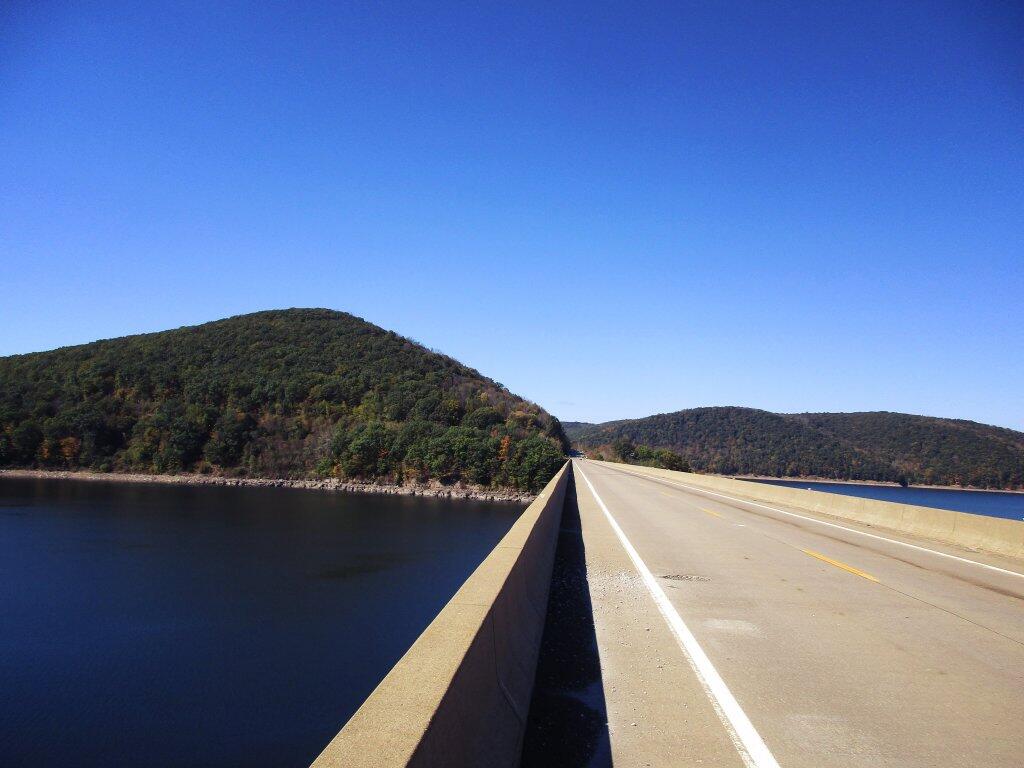
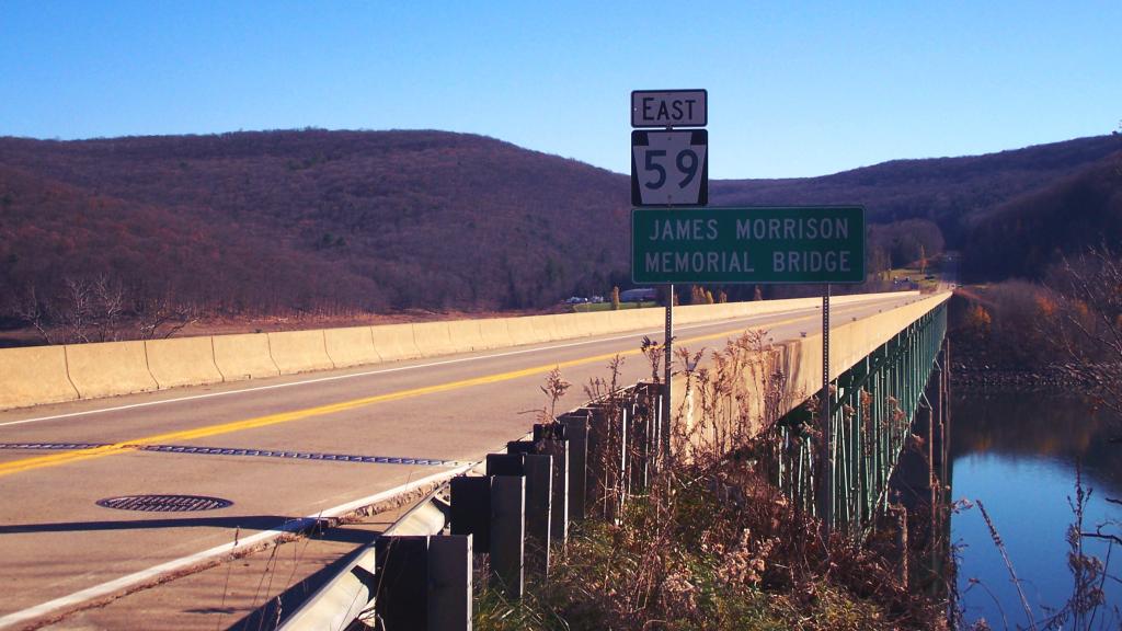
James Morrison Memorial Bridge

The James Morrison bridge is sometimes called the Cornplanter Bridge on USFS maps, though the Seneca's reject the term as they consider it to be an insult as they were flooded out of their land once promised to be their own for eternity under eminent domain. The bridge has narrow shoulders and low guard rails, though one time I walked out on it, and the public not prohibited from walking on it by sign or other measure.

Taken on Thursday November 11, 2010 at Allegheny National Forest.

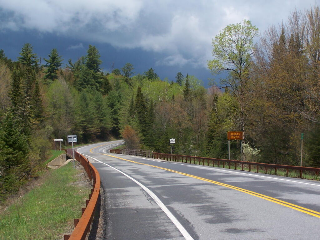
NY 28N Over Boreas River

Those clouds look scary, although we got no more rain for the rest of the day. Also, notice the beautiful COR-TEN guard rail, which is rapidly becoming an endangered species, as the DOT is going back to stainless. Maybe at specifically scenic locations, like here, they will choose painted stainless guard rail, as used on the bridge rails here (but not the guardrail).

Taken on Saturday May 21, 2011 at Vanderwhacker Mountain Wild Forest.

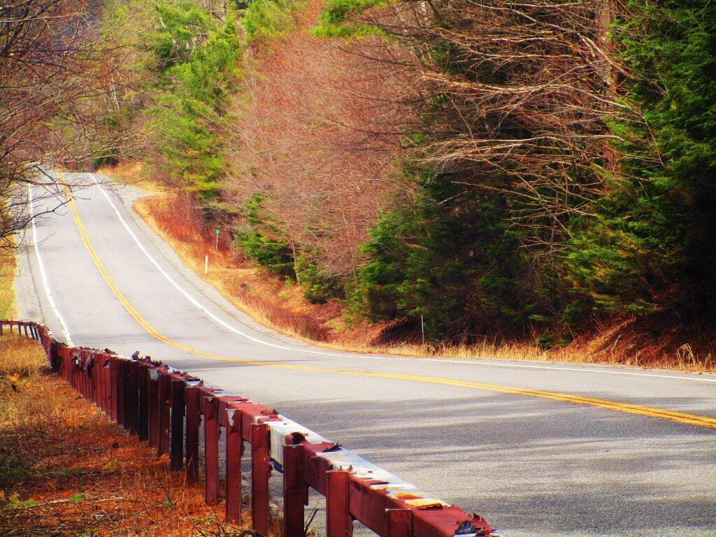
Pealing Paint

Part of NY 8 has stainless steel guardrails that were painted brown when they were installed but have a lot of paint pealing off them. Most of the COR-TEN guard rails that once were common in the Adirondacks have been removed due to premature rusting.

Taken on Saturday May 2, 2020 at East Branch Sacandaga River.

More Gluten Monday 🍞

What can I say. Adding that vital wheat gluten to my whole wheat bread added some extra fluff and it really made things less crumbly with much better texature. I’ll see how it holds up over the next few days, as I slowly slice off slices to dip in soup, make french toast and enjoy dipped in olive oil and balsamic vinegar.

Good morning! Monday’s come back around again. β˜” Hope you know where your umbrella is and your windshield wipers work during this dire emergency winter storm, comma lol. Rain and 36 degrees in Delmar, NY. 🌧️ There is a northwest breeze at 11 mph. πŸƒ. Temperatures will drop below freezing at around 9 pm. β˜ƒοΈ

Taking the express bus 🚍 in on this rainy β˜” morning. Not the early one either, as by the time I was done cooking πŸ§‘πŸ»‍🍳 and getting ready it was a no go for the earlier express. I’m not super excited about doing a lot of walking 🚢 this morning, though I’ll try to get in my steps πŸ‘£ for the day, maybe even if that means bundling up and going for the evening walk. Going to be cold by evening especially with the wind. 🌬️

There is a closure through the Empire State Plaza tunnels due to a water πŸ’¦ main β›‘ break which might cause delays but I don’t care I’m not driving 🚘 and it’s not a big deal if I’m a few minutes late. Looks like the driver is taking an alternative route through the city to avoid traffic. It’s not like next year when I’ll be transferring to the shuttle πŸš€ bus out to the suburban office. I do miss riding in on my bike but not with the cold and wet rain. 🚲 Tomorrow I’ll be back riding to work. January is going to be tough on the biking, due to the cold and inevitable snow on the trail, not to mention it’s not safe to be riding Water Street after dark in the evening.

Today will rain and snow before 11am, then a slight chance of rain between 11am and noon. 🌞 High of 41 degrees at 12pm. One degree above normal, which is similar to a typical day around December 8th. Breezy, with a northwest wind 11 to 16 mph increasing to 17 to 22 mph in the afternoon. Winds could gust as high as 39 mph. Chance of precipitation is 80%. Little or no snow accumulation expected. I’m sure at some point we’ll have snow. 🌨 A year ago, we had light snow throughout the day. The high last year was 30 degrees. The record high of 61 was set in 1952. 4.3 inches of snow fell back in 1970.❄

Adding the vital wheat 🌾 gluten to my 100% whole wheat bread added a tad bit more fluff to the bread but it didn’t make it as light as white bread. 🍞 Did make things stick together a lot better though for better slicing and texture. I bet it will hold up better in my bean soup.πŸ› I’ll have to experiment with different amounts of yeast again but ultimately whole wheat is going to whole wheat. I wouldn’t say though it’s a flat bread as it was much more fluffy then what I had. White bread might be a lot more fluffy but it’s less healthy. I guess a reasonable compromise might be whole-white wheat, which is whole grain but the white wheat rather then the slightly more protein rich red wheat.

Solar noon 🌞 is at 11:49 am with sun having an altitude of 24.4° from the due south horizon (-46.4° vs. 6/21). A six foot person will cast a 13.2 foot shadow today compared to 2.2 feet on the first day of summer. The golden hour πŸ… starts at 3:38 pm with the sun in the southwest (231°). πŸ“Έ The sunset is in the west-southwest (239°) with the sun dropping below the horizon at 4:23 pm after setting for 3 minutes and 24 seconds with dusk around 4:53 pm, which is 4 seconds later than yesterday. πŸŒ‡ The best time to look at the stars is after 5:30 pm. At sunset, look for partly cloudy skies πŸŒƒ and temperatures around 37 degrees. The wind chill around sunset will be 26. β˜ƒοΈ Breezy, 22 mph breeze β›… from the west-northwest with gusts up to 38mph. Tomorrow will have 9 hours and 9 minutes of daytime, a decrease of 42 seconds over today.

Looking forward to tonight with the bean soup and bread. 🍞 🍲 It should be a good evening, but cold with the wind. But I want to walk at any rate, I’ll bundle up. 🚢‍♀️ Then settle back down home under the heated blanket. Not super cold tonight, but it will be windy. But it could be a lot colder — look at the record low of negative 12.

Tonight will be mostly cloudy πŸŒ₯, with a low of 28 degrees at 5am. Four degrees above normal, which is similar to a typical night around November 29th. Maximum wind chill around 22 at 5am; Northwest wind 7 to 15 mph becoming south after midnight. In 2022, we had light snow in the evening, which became partly cloudy by the early hours of the morning. It got down to 20 degrees. The record low of -12 occurred back in 1988.

I was noticing that Price Chopper has raw walnuts for sale 🌰 πŸŽ… which might be a lot of fun when I go camping next week to roast over an open fire. I am still thinking of heading out to Madison County in the lead-up to the Christmas Holiday but it really depends on how much snow there is. ❄️ Right now there is quite a bit of snow but I think much of it might melt by next weekend. I could do Stoney Pond or the Charles Baker Horse Camp. I know the mountain bike trails are closed but I can hike or ride the roads. 🚴‍♀️

Today in 1997, The Kyoto Protocol opens for signature. 🌎 The US would never ratify the agreement, and while some countries would participate, it was a lot of talk and not a lot of action. Every year the earth gets a little bit warmer and it ain’t because I drive a big jacked up truck πŸ›» or burn those Styrofoam egg cartons I stuff in my trash and ultimately the fire. πŸ”₯ Seriously though we are making some technological progress but things are still going in the wrong direction as the population increases and every year we burn more fossil fuel.

A picture perfect weekend on tap. 😎 Saturday, partly sunny, with a high near 44. I am thinking Saturday of doing a bicycle ride out to the Albany Pine Bush — and maybe taking the bus back home after dark, after doing some maul walking or similar activities, just to see how crazy it is. I think I can go past the Industrial Depot and the Guilderland National Guard Rifle Range to Willow Street and out from there. Then mountain bike 🚡‍♀️ around the Pine Bush. Sunday, partly sunny, with a high near 44. 🌞 Sunday, I am going to a family event watching the Nutcracker πŸ‘ͺ and then out to dinner. Not too bad for the weekend before Christmas 🀢. Typical average high for the weekend is 38 degrees.

Looking ahead, next Monday is Bake Cookies Day πŸͺ when the sun will be setting at 4:25 pm with dusk at 4:55 pm. I got to bake cookies actually on Wednesday for the Cookie Share Day in the office on Thursday. I am thinking homemade cranberry-sugar cookies, going to try making with whole-wheat flour and stevia along with butter, so they aren’t quite as much junk food. On that day in 2022, we had partly cloudy and temperatures between 35 and 25 degrees. Typically, the high temperature is 37 degrees. We hit a record high of 60 back in 1921.
Gorge

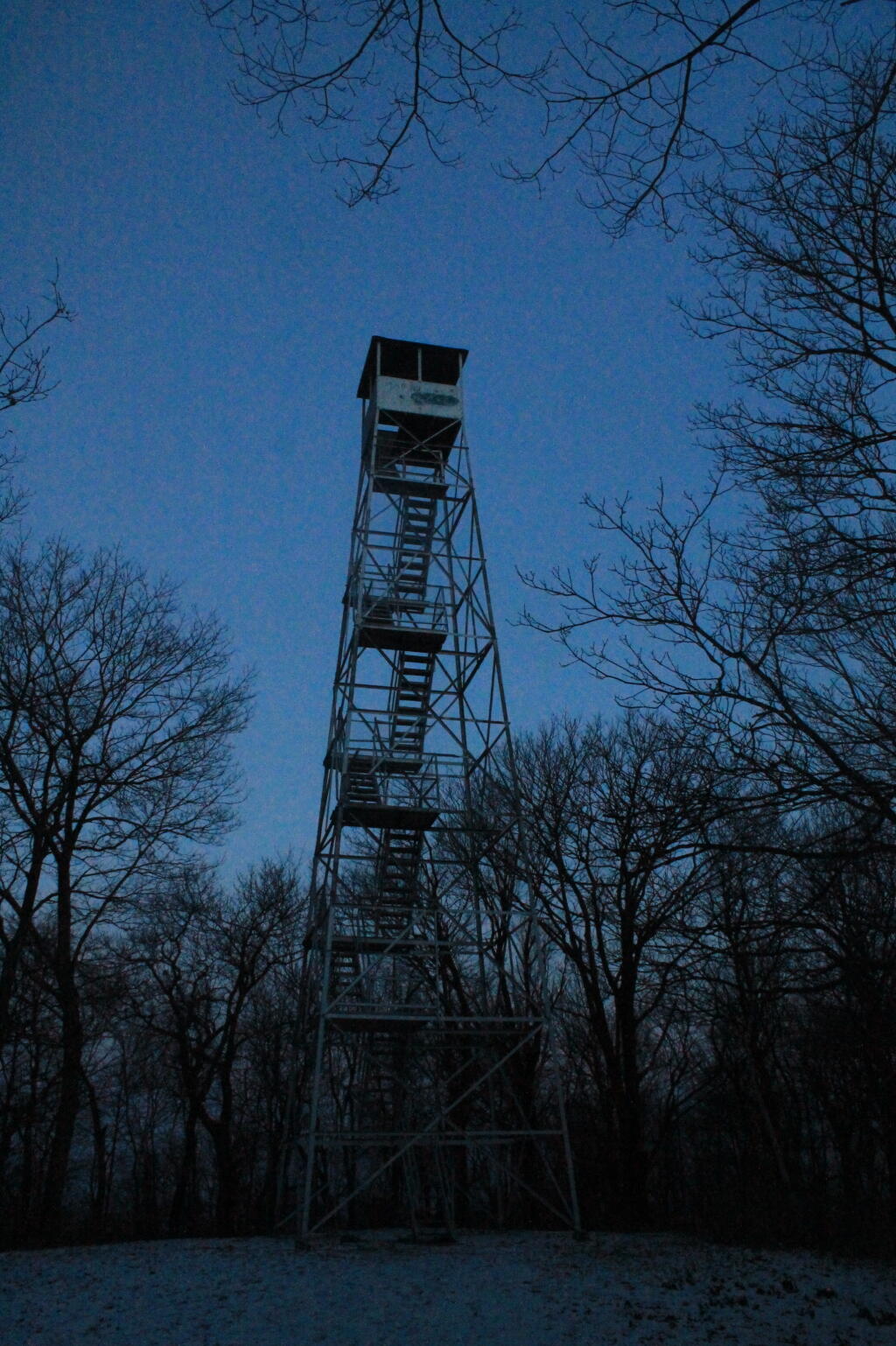
Map and Coordinates List for NYS DEC Firetowers πŸ—Ό

Discover a wealth of information on this page about fire towers situated on state lands, accessible through invigorating hikes that lead to panoramic vistas. Interactive maps guide your exploration, offering insights into the locations and trails leading to these towering viewpoints. Additionally, find convenient links to other pages that delve deeper into fire towers across the entirety of New York State. Embark on a journey that combines outdoor adventure with breathtaking scenery, as you navigate the trails and pathways leading to these historic landmarks that have stood as guardians of the landscape. This resource opens doors to captivating experiences that allow you to savor the beauty of nature from elevated perspectives while providing avenues for further exploration of New York’s fire tower heritage.

Here is a list of Fire Towers on NYS DEC lands. You can get this also on Google Sheets. Does not include the Dickinson Hill Fire Tower in Grafton, which is part of the Grafton Lakes State Park. You might also be interested in nearby camping opportunities.

TowerState LandNotesCoordinates
Azure Mtn. Fire TowerDebar Mountain Wild ForestRelatively short hike.44.5412601955876,
-74.5007131438668
Balsam Lake MountainBalsam Lake Mountain Wild ForestLonger hike along old road.42.0453530369935,
-74.5943882522534
Belfry Mountain Fire TowerHammond Pond Wild ForestVery short hike up dirt road.44.0977783227959,
-73.5480575565177
Berry Hill FiretowerMcdonough State ForestOnly up to second level is open, no upper level access.42.5498033738312,
-75.6903147862666
Black Mountain Fire TowerLake George Wild ForestLonger hike up a snowmobile trail.43.6068253423597,
-73.5315598873687
Blue Mountain Fire TowerBlue Mountain Wild ForestVery popular, worn-down trail.43.8722986188442,
-74.4007350580445
Lowville Demostration Area
Fire Tower
Lowville Demonstration AreaNo access to tower, part of demonstration forest.43.8093267984132,
-75.4730800808841
Goodnow Mountain Fire TowerSuny Esf LandsOpen to public, SUNY ESF Lands43.9598725064095,
-74.2096091339017
Hadley Mountain Fire TowerWilcox Lake Wild ForestPopular hike in Southern Adirondacks.43.3769100935034,
-73.9709647959219
Hunter Mountain Fire TowerHunter-West Kill WildernessMultiple approaches to this fire tower offer different hikes with different amounts of work.42.1779299997605,
-74.2297619994181
Hurricane Mountain FiretowerHurricane Mountain Primitive AreaThe only fire tower remaining in the Adirondack High Peaks.44.2352949729449,
-73.7101070215222
Kane MountainShaker Mountain Wild ForestShort hike near Caroga Lake.43.1810788942093,
-74.5151618559196
Beebe Hill Fire TowerBeebe Hill State ForestShorter hike near Austerlitz and Massachussetts border.42.3361525194561,
-73.4862760091067
Leonard Hill Fire TowerLeonard Hill State ForestYou can drive to this tower. Bottom floors removed, no access to tower.42.4510039574136,
-74.3529141572996
Lyon Mountain Fire TowerChazy Highlands Wild ForestLonger hike, new trail avoids severely erroded old trail44.7048354583899,
-73.8627762019644
Mount Adam Fire TowerHigh Peaks WildernessJust south of main high peaks area.44.0874829962416,
-74.0228637207712
Mount Nimham Fire TowerNimham Mountain MuaNear Beacon41.4611546516545,
-73.72510657899
Mount TremperPhoenicia – Mt. Tobias Wild ForestFollow an old woods road to summit.42.0739476727477,
-74.2781528438603
Mt Arab Fire TowerHorseshoe Lake Wild ForestRelatively short hike outside of Tupper Lake.44.2046152316571,
-74.5879293129745
Overlook MountainOverlook Mountain Wild ForestPopular hike outside of Woodstock, follows a gated road.42.085023587202,
-74.0933592964641
Owls Head FiretowerSargent Ponds Wild ForestModerate hike outside of Long Lake.43.9542904615568,
-74.4984616500416
Pillsbury Mountain Fire TowerJessup River Wild ForestMile long hike to a firetower with views over Perkins Clearing and areas around Spectulator43.5807556043109,
-74.5118079500206
Poke-O-Moonshine Fire TowerTaylor Pond Wild ForestNew trail is less steep and follows old woods road.44.4019104158425,
-73.5130620065356
Red Hill Fire TowerSundown Wild Forest1 mile hike to a fairly remote firetower.41.9238122519417,
-74.5170620256067
Rondaxe Fire TowerFulton Chain Wild ForestQuick hike outside of Old Forge that is very popular.43.7385880495938,
-74.9129188420394
Roosa Gap FiretowerRoosa Gap State ForestFiretower on the Long Path in the Shawgunks.41.6176280752519,
-74.4267422878805
Snowy MtJessup River Wild ForestPopular hike, one of the more difficult towers to access.43.7003213769888,
-74.3866001142199
Spruce Mountain Fire TowerWilcox Lake Wild ForestTrail crosses private land, closed during hunting season.43.2163188109202,
-73.9061192265182
St. Regis Mtn. Fire TowerSaint Regis Canoe AreaCurrently closed to public use.44.4085838385311,
-74.3296128971506
Stillwater Mountain Fire TowerIndependence River Wild ForestNear the Stillwater Reservior.43.8618343053993,
-75.033327606033
Sugar Hill Fire TowerSugar Hill State ForestObservation tower in Finger Lakes, during summer months you can drive to it, part of Six Nations Horse Cap.42.3871467022238,
-77.0025364212371
Vanderwhacker Mountain Fire TowerVanderwhacker Mountain Wild ForestRough seasonal road then 2 Β½ mile hike.43.8982271055416,
-74.0959123515681
Wakely Mountain Fire TowerWakely Mountain Primitive AreaNear Cedar River Flow at Moose River Plains. Seasonal use road to access.43.7358887903725,
-74.515229327937
Woodhull Mountain Fire TowerBlack River Wild ForestOne of the longer hikes, part of the trail is an old railroad grade until you climb the peak.43.6230161401271,
-74.9615452951445

Fire Tower