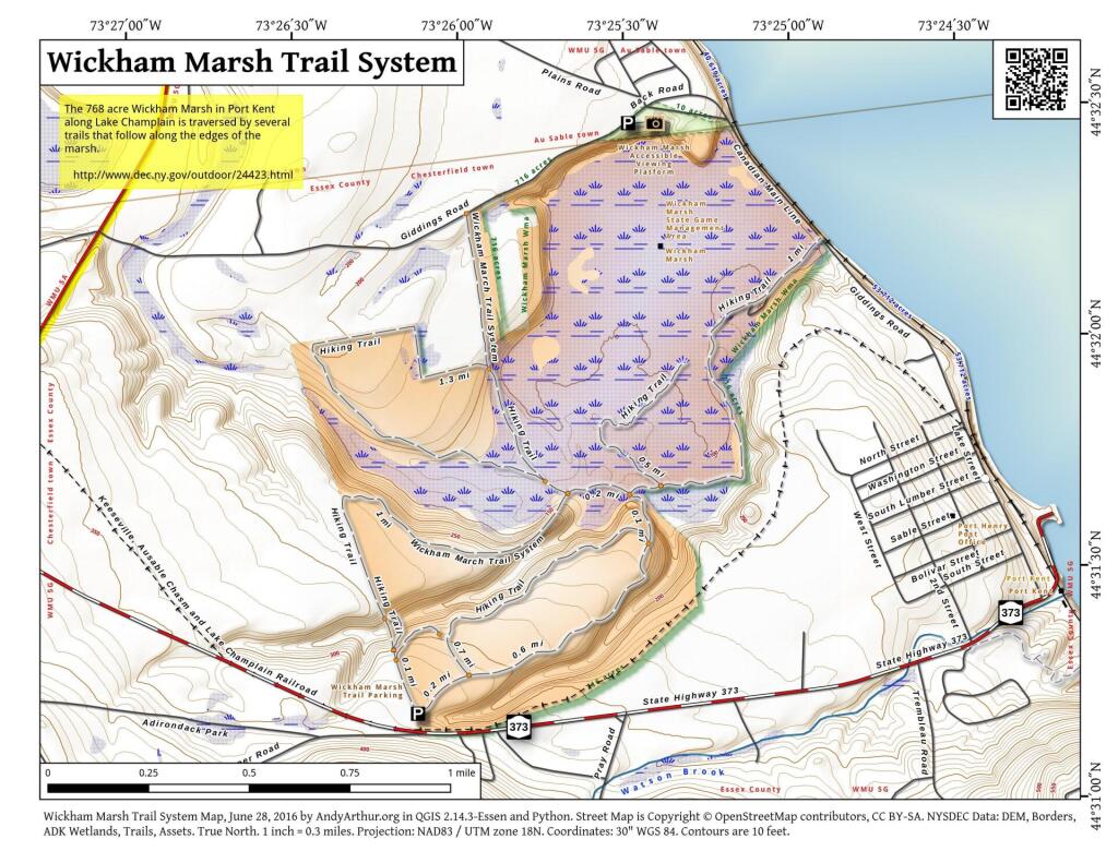
Map: Wickham Marsh Trail System
Download a High Resolution JPEG Image of the Wickham Marsh Trail System or an Adobe Acrobat Printable PDF of the Wickham Marsh Trail System.

Bookmark my free Interactive GPS Map for your phone:
https://andyarthur.org/ny
... shows your location as a blue dot in relationship to campsites, trails, state land. This online map requires cell service, won't work in remote country, so also bring a paper map.
Free Download of New & Historical USGS 1:24k Topograpic Maps
Interactive maps with backcountry and roadside camping: New York, Pennsylvania, West Virginia & Vermont. List of NYS DEC Lean-Tos and Firetowers.
Google Spreadsheet with Roadside, Primitive and Pay Campsites
More about Wickham Marsh...
The primary purposes of the Wickham Marsh Wildlife Management (WMA) are for wildlife management, wildlife habitat management, and wildlife-dependent recreation. The area encompasses 862 acres. Land purchases for this management area commenced in 1950 with the acquisition of 176 acres from the Watson Estate and were completed in 1970 with the additions of 136 acres from Loyola Villa and 370 acres from the Mattig Corporation. The habitat presently includes a remnant of the Pine Barrens ecosystem of pitch pine, scrub oak, sweet fern, and blueberry, as well as invading white pine, grey birch, hazelnut, aspen, cinquefoil and bracken fern.
http://www.dec.ny.gov/outdoor/24423.html
Maps and Interactives
Wickham Marsh Trail System
Whickam Marsh
... photos, maps and other content from from Wickham Marsh.