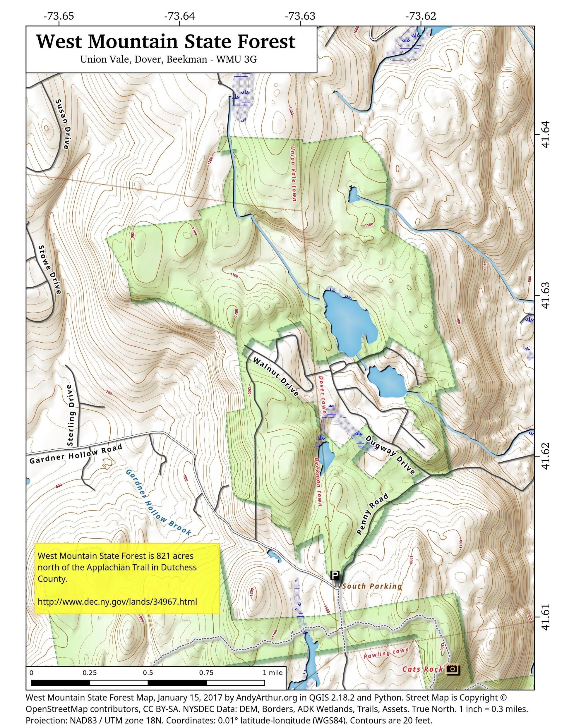
Map: West Mountain State Forest

Download a High Resolution JPEG Image of the West Mountain State Forest or an Adobe Acrobat Printable PDF of the West Mountain State Forest.

Bookmark my free Interactive GPS Map for your phone:
https://andyarthur.org/ny
... shows your location as a blue dot in relationship to campsites, trails, state land. This online map requires cell service, won't work in remote country, so also bring a paper map.
Free Download of New & Historical USGS 1:24k Topograpic Maps
Interactive maps with backcountry and roadside camping: New York, Pennsylvania, West Virginia & Vermont. List of NYS DEC Lean-Tos and Firetowers.
Google Spreadsheet with Roadside, Primitive and Pay Campsites
More about Notes...
Aerial Photos
August 23, 2016 10 AM Update
Dunham Reservior
Forgotten Jaite Ohio’s Abandoned Paper Mill, Railroad, and Town
Maps and Interactives
Woodlawn Preserve
VIIRS – February 27, 2024
US 220 – Interstate 99 – National Freeway Interchange
Traffic Counts – Renssearville and Westerlo
Thruway – Interstate 90 – US 9 Interchange
The snow storm pulls away
Taconic Parkway Over Croton Reservoir in 1960
Syracuse 1895
Sunday, February 21, 2021
South Swan Street – North Swan Street
South Buffalo 1994
Snow today
Restoration of the Fire Suppressed Pitch Pine on Blodgett Hill
Rennselearville State Forest – New Hillcross Farm Parcel
Radar
Oswego Harbor ⚓ Generating Station
Oil City, Penna.
Nice clear night in Western New York
New Zealand
New Exit 3 Northway Connector
Nassau Interstate 90 Interchange
MODIS Terra – May 18, 2023
MODIS Terra – March 16, 2022
MODIS Terra – April 8, 2024
MODIS Terra – April 15, 2024 [Expires May 1 2024]
... photos, maps and other content from from Notes.