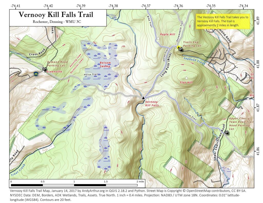
Map: Vernooy Kill Falls Trail
Download a High Resolution JPEG Image of the Vernooy Kill Falls Trail or an Adobe Acrobat Printable PDF of the Vernooy Kill Falls Trail.

Bookmark my free Interactive GPS Map for your phone:
https://andyarthur.org/ny
... shows your location as a blue dot in relationship to campsites, trails, state land. This online map requires cell service, won't work in remote country, so also bring a paper map.
Free Download of New & Historical USGS 1:24k Topograpic Maps
Interactive maps with backcountry and roadside camping: New York, Pennsylvania, West Virginia & Vermont. List of NYS DEC Lean-Tos and Firetowers.
Google Spreadsheet with Roadside, Primitive and Pay Campsites
More about Sundown Wild Forest...
The 30,100-acre Sundown Wild Forest in the Sullivan County Town of Neversink and the Ulster County Towns of Denning, Rochester, Wawarsing and Olive, covers a large swath of the southeast Catskills, including several ridges and 10 mountains over 2,000 feet. The area has a varied topography and an impressive mix of natural features - mountains, waterfalls, valleys and rivers - rich with fishable trout streams, hiking destinations, hunting opportunities and snowmobile trails. Sundown is accessible from many county and town roads. Key places to visit in the Wild Forest are the Kanape Valley and Ashokan High Point, Vernooy Kill Falls, Denman Mountain, Red Hill Fire Tower and the Peekamoose Valley.
http://www.dec.ny.gov/lands/75346.html
Maps and Interactives
Mongaup Pond State Campgrouund
Vernooy Kill Falls Trail
... photos, maps and other content from from Sundown Wild Forest.