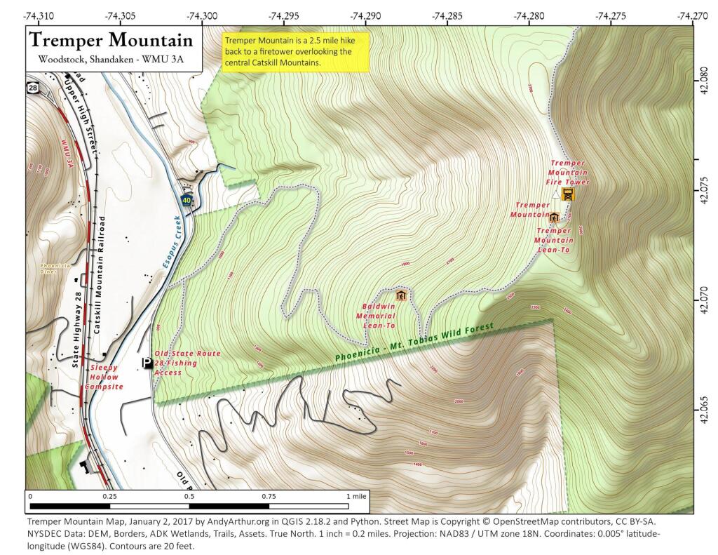
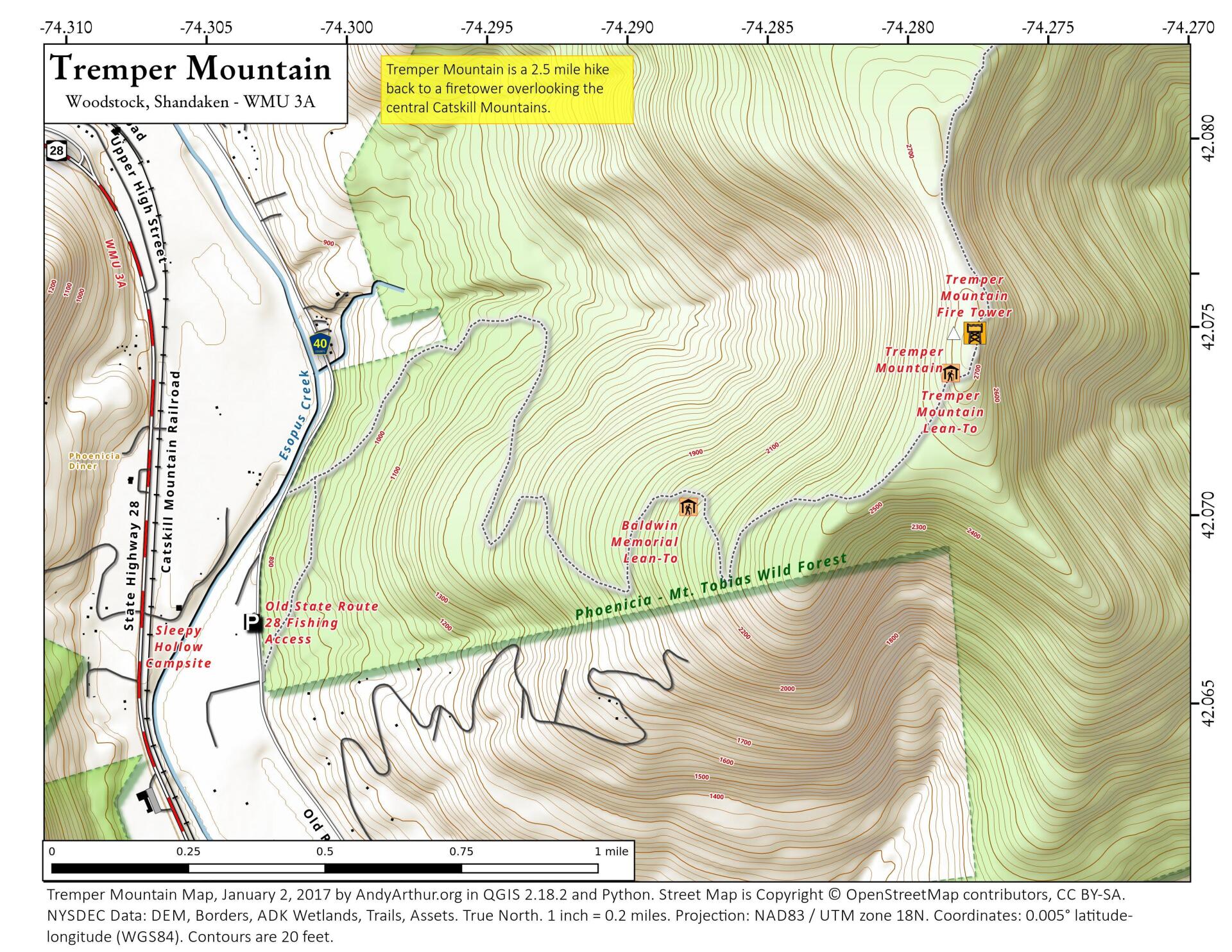
Map: Tremper Mountain
Download a High Resolution JPEG Image of the Tremper Mountain or an Adobe Acrobat Printable PDF of the Tremper Mountain.

Bookmark my free Interactive GPS Map for your phone:
https://andyarthur.org/ny
... shows your location as a blue dot in relationship to campsites, trails, state land. This online map requires cell service, won't work in remote country, so also bring a paper map.
Free Download of New & Historical USGS 1:24k Topograpic Maps
Interactive maps with backcountry and roadside camping: New York, Pennsylvania, West Virginia & Vermont. List of NYS DEC Lean-Tos and Firetowers.
Google Spreadsheet with Roadside, Primitive and Pay Campsites
More about Mount Tremper Fire Tower...
Mount Tremper, officially known as Tremper Mountain and originally called Timothyberg, is one of the Catskill Mountains in the U.S. state of New York. It is located near the hamlet of Phoenicia, in the valley of Esopus Creek.
At 2,740 feet (840 m) in elevation, it is well below the higher peaks of the region. Its slopes were a source of two major local products during the 19th century: hemlock bark, a source of tannin, and bluestone used in construction. Later it was the site of Tremper House, one of the Catskills' earliest railroad resorts. Henry Ward Beecher and Oscar Wilde were among the guests there.
In the 20th century it was acquired by the state and became part of the Catskill Park Forest Preserve. Its location in the Esopus Valley between the northern and southern Catskills made it an ideal place for a fire lookout tower, which still stands on the mountain's summit. The Mount Tremper Fire Observation Station has been restored and listed on the National Register of Historic Places. Hikers often follow the old road to it from Phoenicia, also a section of the Long Path long-distance trail, to enjoy the views from the tower.
http://en.wikipedia.org/wiki/Mount_Tremper
Maps and Interactives
... photos, maps and other content from from Mount Tremper Fire Tower.