Percent of Area Covered by Trees in the City of Albany
Tree cover percentage, from the 2016 MRLC data. An interactive map.
Tree cover percentage, from the 2016 MRLC data. An interactive map.
| Class | Description | Acres | Percent |
| 82 | Cultivated Crops -areas used for the production of annual crops, such as corn, soybeans, vegetables, tobacco, and cotton, and also perennial woody crops such as orchards and vineyards. Crop vegetation accounts for greater than 20% of total vegetation. This class also includes all land being actively tilled. | 3 | 0.0% |
| 52 | Shrub/Scrub- areas dominated by shrubs; less than 5 meters tall with shrub canopy typically greater than 20% of total vegetation. This class includes true shrubs, young trees in an early successional stage or trees stunted from environmental conditions. | 14 | 0.1% |
| 95 | Emergent Herbaceous Wetlands- Areas where perennial herbaceous vegetation accounts for greater than 80% of vegetative cover and the soil or substrate is periodically saturated with or covered with water. | 26 | 0.2% |
| 31 | Barren Land (Rock/Sand/Clay) – areas of bedrock, desert pavement, scarps, talus, slides, volcanic material, glacial debris, sand dunes, strip mines, gravel pits and other accumulations of earthen material. Generally, vegetation accounts for less than 15% of total cover. | 110 | 0.8% |
| 90 | Woody Wetlands- areas where forest or shrubland vegetation accounts for greater than 20% of vegetative cover and the soil or substrate is periodically saturated with or covered with water. | 158 | 1.1% |
| 42 | Evergreen Forest- areas dominated by trees generally greater than 5 meters tall, and greater than 20% of total vegetation cover. More than 75% of the tree species maintain their leaves all year. Canopy is never without green foliage. | 215 | 1.5% |
| 71 | Sedge/Herbaceous- Alaska only areas dominated by sedges and forbs, generally greater than 80% of total vegetation. This type can occur with significant other grasses or other grass like plants, and includes sedge tundra, and sedge tussock tundra. | 267 | 1.9% |
| 11 | Open Water- areas of open water, generally with less than 25% cover of vegetation or soil. | 270 | 1.9% |
| 81 | Pasture/Hay-areas of grasses, legumes, or grass-legume mixtures planted for livestock grazing or the production of seed or hay crops, typically on a perennial cycle. Pasture/hay vegetation accounts for greater than 20% of total vegetation. | 344 | 2.5% |
| 41 | Deciduous Forest- areas dominated by trees generally greater than 5 meters tall, and greater than 20% of total vegetation cover. More than 75% of the tree species shed foliage simultaneously in response to seasonal change. | 628 | 4.5% |
| 43 | Mixed Forest- areas dominated by trees generally greater than 5 meters tall, and greater than 20% of total vegetation cover. Neither deciduous nor evergreen species are greater than 75% of total tree cover. | 1,031 | 7.3% |
| 24 | Developed High Intensity-highly developed areas where people reside or work in high numbers. Examples include apartment complexes, row houses and commercial/industrial. Impervious surfaces account for 80% to 100% of the total cover. | 2,093 | 14.9% |
| 21 | Developed, Open Space- areas with a mixture of some constructed materials, but mostly vegetation in the form of lawn grasses. Impervious surfaces account for less than 20% of total cover. These areas most commonly include large-lot single-family housing units, parks, golf courses, and vegetation planted in developed settings for recreation, erosion control, or aesthetic purposes. | 2,206 | 15.7% |
| 22 | Developed, Low Intensity- areas with a mixture of constructed materials and vegetation. Impervious surfaces account for 20% to 49% percent of total cover. These areas most commonly include single-family housing units. | 3,148 | 22.4% |
| 23 | Developed, Medium Intensity -areas with a mixture of constructed materials and vegetation. Impervious surfaces account for 50% to 79% of the total cover. These areas most commonly include single-family housing units. | 3,522 | 25.1% |
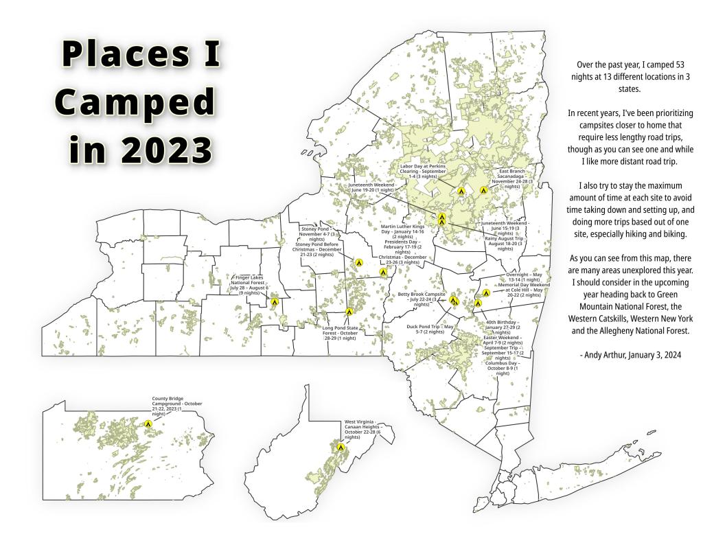
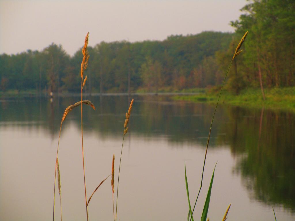
While this year was a rainy one, and it rained during many of my trips, I was able to get out for 53 nights in the wilderness — mostly fairly close to home but I also did a trip down to West Virginia in late October with several trips to the Adirondacks, Central New York and summer vacation in the Finger Lakes.
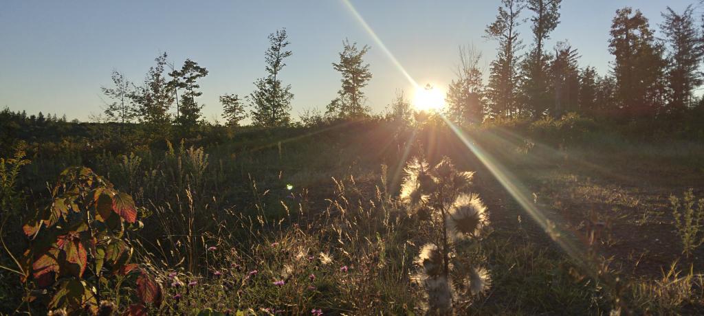
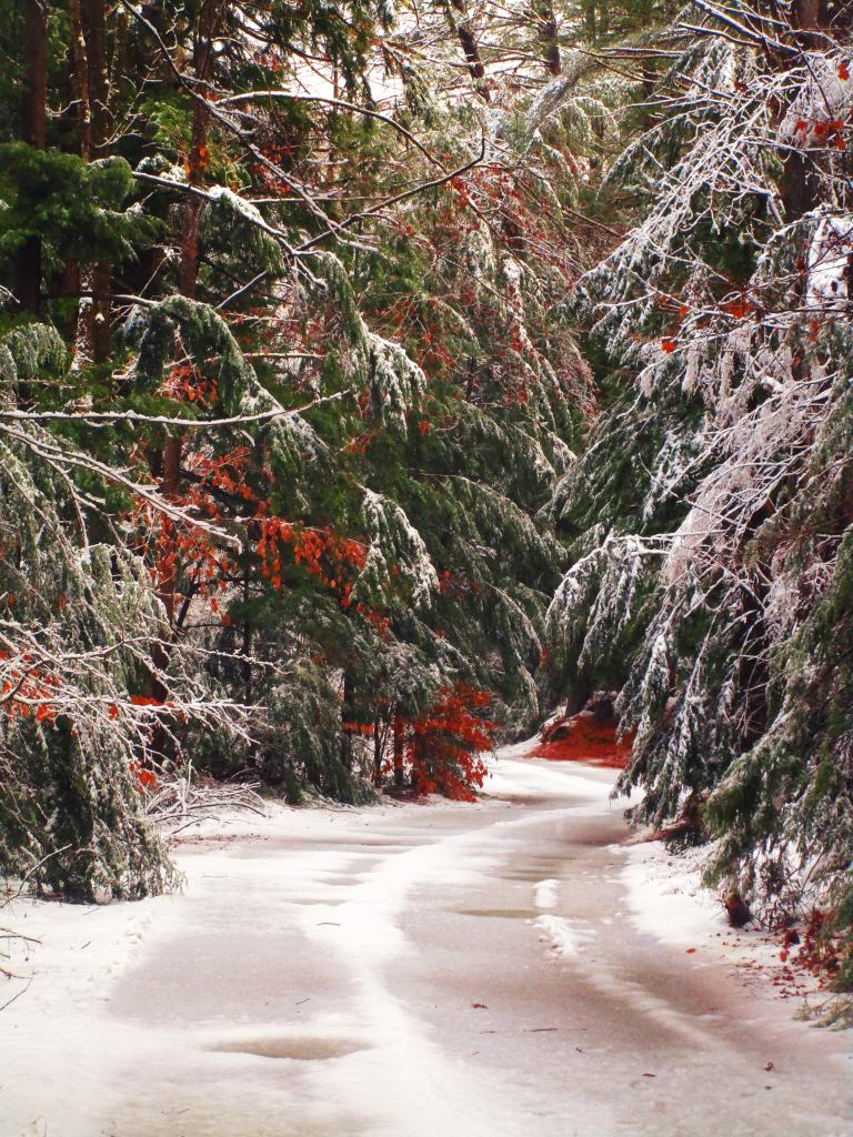
To start out my camping adventures in 2023, I drove out to Charles Baker State Forest and Brookfield Horse Camp. There wasn’t a lot of snow — just a dusting but it was a fun weekend, topped off by a beautiful sun-full glittery hike up Tassell Hill after a hoar frost. Explored Lost Pond and several of the trails in the middle of state forest.
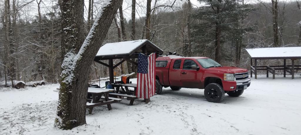
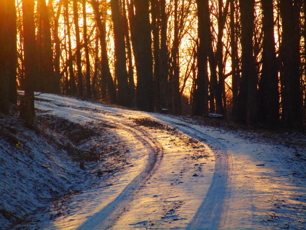
For my fortieth birthday, I took off the Friday leading up to my 40th birthday to cross country ski and winter camp at Rensselaerville State Forest. It was a beautiful weekend with lots of blue skies, sufficient snow for skiing but not so much that was a ton of snowmobiles out on the trails.
I decided for Presidents Day Weekend to do another trip out to Charles Baker State Forest and Brookfield Horse Camp. Slightly more snow then last time but again largely a snow-less winter, with some nice days for hikes through the various truck and horse trails. I hiked around much of state forest, especially the more southern part of the forest.
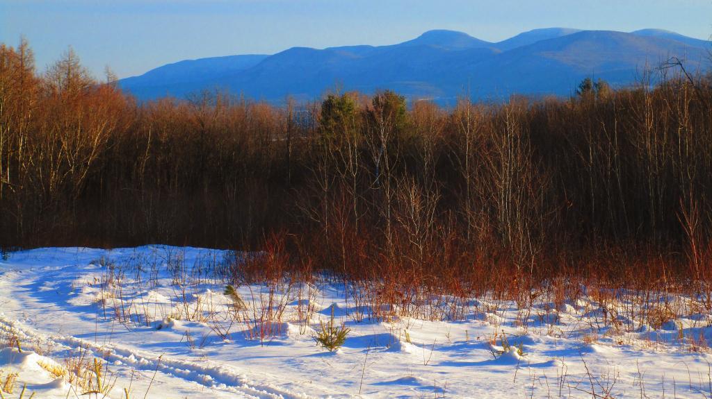
On Good Friday through Easter I camped at at Rensselaerville State Forest. The snow was gone and it was fairly mild though at times it was a bit cool. Spent a fair amount of time walking around and exploring the new OSI Parcel that has been recently added to state forest and is still largely open fields with sweeping views of the Catskill Mountains.
The first Friday in May I took a half day from work and headed out to Schoharie County to camp at Duck Pond at Burnt-Rossman Hills State Forest. Originally the plan was to camp two nights at Duck Pond, hiking along the Long Path and exploring the state forest and then on Sunday hiking the Catskill Scenic Trail. That part of the trip changed when driving along Duck Pond Road the low tire pressure light came on I found a pallet nail in my truck tire. I was able to top off the truck tire and then change the tire when I got home and got the nail pulled and plugged. But it wasn’t the best way ever to end a trip early.
After visiting the folks on Mother’s Day Weekend, I decided to do a quick overnight hammock camp on Cole Hill State Forest in Berne. Nothing fancy or formal, it was as much a way to test out sleeping in my hammock with the bug screen. Kind of a chilly night, I took camp down fairly and headed home early in the morning.
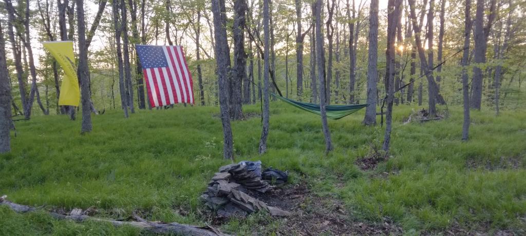
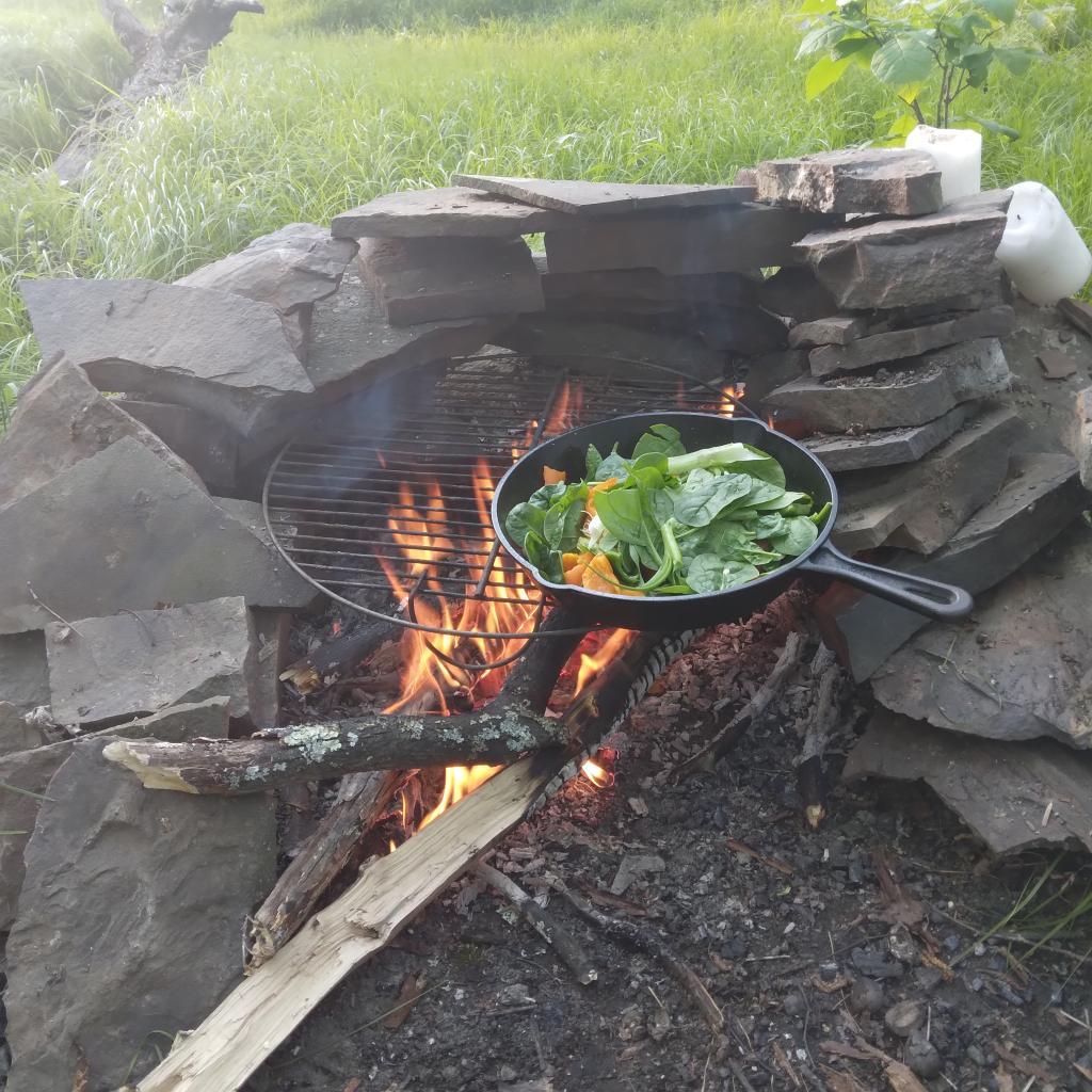
This year I decided to eschew the Adirondacks and Greene Mountains for Memorial Day Weekend due to the black flies, my desire to look at bicycles, and work I had to do on the Saturday morning leading up to the holiday weekend. I decided to hammock camp again Cole Hill State Forest in Berne. This was a three-day two night trip, so it it gave me a chance to bring more gear up the mountain, set up a more formal camp. Cooked on the fire, hiked around the forest. It was a warm weekend, but I enjoy the solitude, along with having good cell service for listening to podcasts and watching videos.
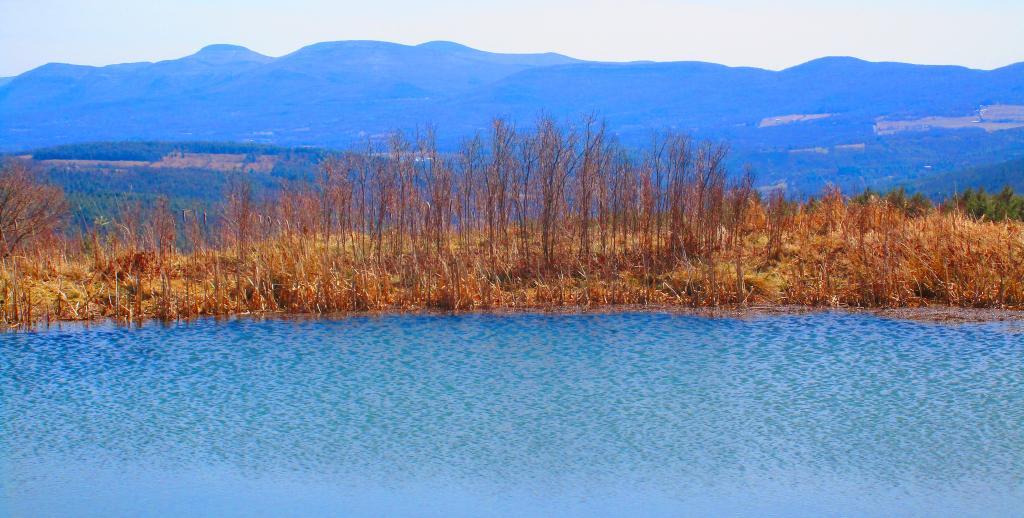
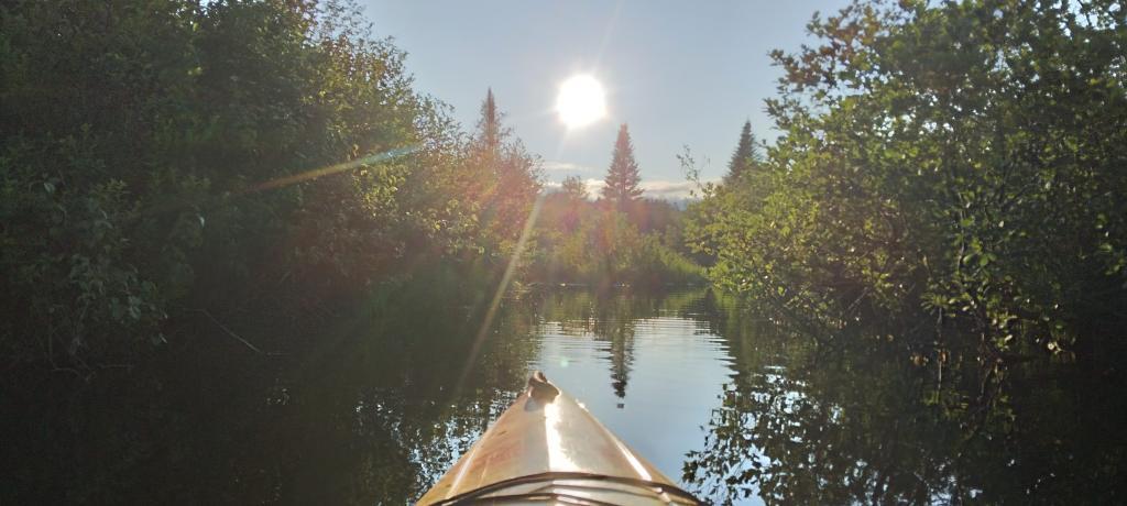
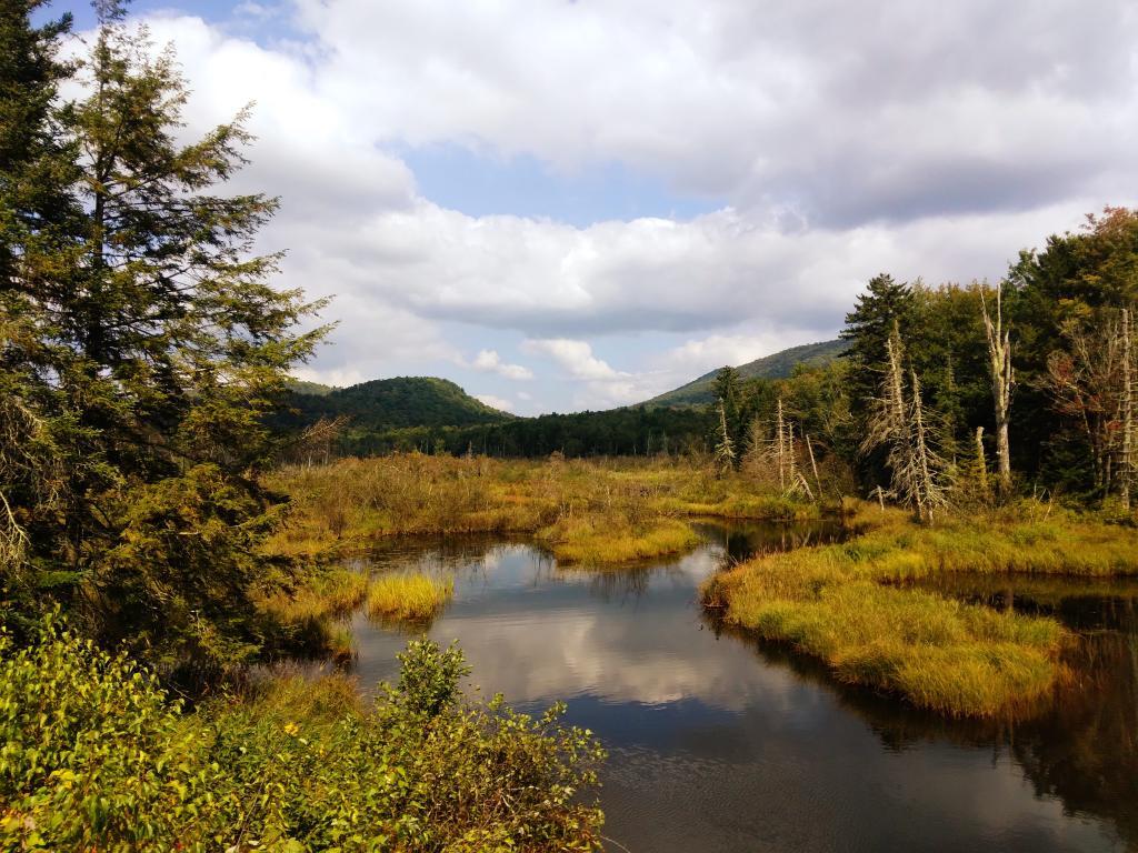
To kick off summer, I did my usual Juneteenth weekend camping trip, tacking on some days on the Juneteenth Holiday Weekend. It was a bit of a cool and rainy weekend to kick off summer, one that would actually be followed by many cool and rainy weekends where I would stay home. Camped at House Pond for the first three nights, spending time down floating in the tube on East Branch while the final night I camped up at Powley Bridge site and kayaked along the East Branch. Really, like often is the case, the best weather was the day I took down camp.
After several months of researching and visiting various bike shops, I finally got a mountain bike. I decided it would be fun to do as much of the Catskill Scenic Trail as I could before my summer vacation got underway. Actually did quite a bit of riding and hiking that weekend — started out hiking Pratts Rock’s then riding from Grand George to Hobart. Sunday, I rode from Fultonham to Middleburgh on NY 30, doing a quick climb up Vromans Nose, then stopping at the farm market then going to Mine Kill State Park to swim. Monday I rode from Hobart down to Bloomville, getting caught in a major thunderstorm and downpour a few miles north of Bloomville with no shelter in sight. The trail became super boggy, then I went to Mine Kill State Park for one more swim, and then out to folks house for Sunday dinner a day later then usual.
Every year for nearly a decade and a half I’ve been doing summer vacation out in the Finger Lakes — camping in the National Forest and exploring as much as possible during my days there. The past few years I’ve been driving there on a Friday, to get a better campsite before they’re taken by the weekend campers. This year was no exception. With Blackie, my mountain bike, I did nearly all of the bike trails in the near vicinity, from the Black Diamond Trail to the Cayuta Valley Trail to Dresden – Penn Yan Canal Trail. Kayaked on both Cayuga and Scenic Lakes, swam many days at Watkins Glen State Park and Taughannock State Park, explored the Cornell Campus and Botanical Gardens on my bike. Got some good ice cream at the Spotted Duck, explored the Geneva Waterfront along with the Cayuga-Seneca Canalway. Some rain but compared to the wet summer that was, this was a pretty good week.
The next few weeks for rainy and by the time I got away for one more long weekend, it promised to be fairly nice weekend but turned out to be fairly cool and cloudy with some rain. Back at the House Pond Campsite, did some swimming in East Branch, but with the mercury in the 60s most of the weekend, I didn’t spend a lot of time in the water. Hardly what I had dreamed when the I planned the weekend. Rode Blackie up to Goldmine Stream Falls and relaxed down by the falls for a bit, also sat down by the swimming hole off of the Old Edick Road Snowmobile Trail, watching the rain fall, bemoaning the wet and cold weather. Still it was good to get away for a bit, and I did do a fair amount of reading in hammock, under the protection of the bug net, as the bugs were bad after such a wet summer.
I took the Friday off before Labor Day to get a jump on the holiday season travel, and set up camp at the site I really enjoy up at Perkins Clearing overlooking the mountains. Did a fair amount of riding along the various dirt roads of Perkins Clearing, including over to Mason Lake and on Sunday rode most of the way to the Spruce Lake Trailhead, though didn’t make it there in time as I got a bit of a late start as I spent the balance of the day reading and swimming in the Jessup River Bridge swimming hole. Labor Day, I rode around the Spectulator Tree Farm, doing a large loop, through the tree farm, past the north end of Elm Lake, then down to Austin Falls and Old Route 8B. I had hoped to get ice cream, but by the time I got to the ice cream shop they were out of soft-ice cream, and there was a long line. Summer was dragging to a close.
With time being fairly tight and the weather only so-so I decided to do a two night trip close to home out in Rennselearville to ride some of the gravel trails, explore the OSI Parcel further and just enjoy an early autumn weekend camping.
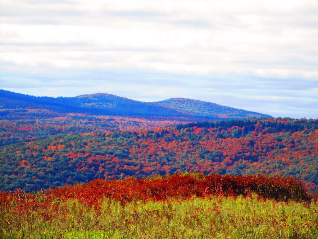
Columbus Day Weekend was cold and rainy for the first half of the weekend, but the Sunday heading into Columbus Day was nice, so I decided to head out to Rensselaerville for a quick overnight at the campsite on CCC Road. Leaves were late this year, so not a lot of color, but it still was nice to get away for a night and ride some of the trails around.
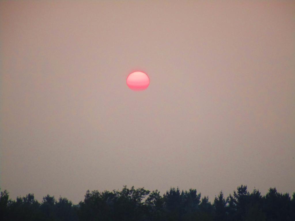
The banner trip of the year was my trip down to West Virigina. While it started and ended in rain, it was a very enjoyable trip with lots of new adventures this year. Camped the balance of the week — 6 nights in Canaan Heights — doing day trips from that area. Overnighted one night driving down at County Bridge Campground in Pennsylvania, and a on the way back camped overnight at Long Pond State Forest in New York. Adventures in West Virginia included hiking at Dolly Sods, mountain biking at night in the sods of Canaan Heights, riding up and hiking to Table Rock, exploring Blackwater Falls State Park on the mountain bike, MonPower Mountain Bike Park, Thomas Rail Grade and the Olson Firetower. Rode part of the Great Allegheny Trail through the Cumberland Passage, and the two sections of the Chesapeake and Ohio Canalway, including the Paw Paw Tunnel.
A little over a week back from West Virginia, I headed out to Madison County to ride the Tassel Hill Mountain Bike Trails at Alfred Woodford, the Chenango Canal Trail in Hamilton and Erie Canalway from Chittenango to Green Lakes State Park and then to Canastota and Wampsville. The first night was cold at Stoney Pond but the subsequent nights were quite pleasant and mild.
![Old Canal Warehouse in Chittenango [Expires November 19 2023]](https://andyarthur.org//data/photo_005914_large.jpg)
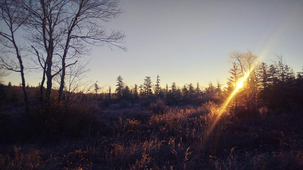
Strangely enough, I had never been up Prospect Mountain. So I decided the day after Thanksgiving (Black Friday) to hike up Prospect Mountain, and then spend the next two nights camping on East Branch of the Sacandaga River. The Saturday and Sunday was fairly cold, so I ended up spending the bulk of day hanging around camp, doing a bit of hiking around Fox Lair. Sunday, evening around 8 PM it started to sleet, then snow, then rain, Monday morning, it turned into a white globby snow, and I ended up taking down camp fairly early after discovering I was out of propane and then spent much of the day exploring the Hudson River Special Management Area – Buttermilk Falls.
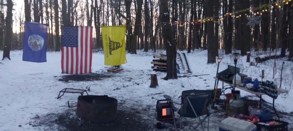
On the days leading up to Christmas I decided to take a second trip to Madison County. I was originally planning to camp two nights at Stoney Pond then two nights at the Charles Baker Horse Camp but my family’s holiday plans were cancelled due to illness in my family, so I ended up staying an extra night at the horse camp, through the day after Christmas. On Friday, I rode the Erie Canalway from Canastota to East Verona, nearly to Rome. On Christmas Day I rode around many of truck trails at Charles Baker with my mountain bike, leaving my face splattered with mud. Many of the days were fairly cold and cloudy, but that’s too be expected in late December. Still it was a special way to spend Christmas.
Today’s essay is from the Bulletin of the Atomic Scientists in December 1969, penned by Mayor Erastus Corning in 1969. I share this simply for the convenience of reading it online, I can claim no copyright except to point out it should be in the public domain due to being a speech given by a public figure to a public body.
When city officials meet with highway engineers, there is a familiar theme. Where is the automobile leading us? Here is the way one official of a metropolitan center looks at the problem of autos and more autos. Mr. Corning is the mayor of Albany, New York. His comments are adapted from an address to New York Highway Department engineers, April 17, 1969.
For something over half a century, few people gave even the slight thought to the question: Is the automobile here to stay? In the sixties, however there have more and more haunting doubts–more and more question raises. Have we the necessary space for all the automobiles we are buying, using and discarding so freely? Have we the space for the great scotch-tape kind of ribbons of concrete and blacktop that we are pasting on the land? Have we the space to congest and clog up our city streets so that they can neither be cleaned properly in the summer nor have the snow removed in the winter? Have we the space for monumental parking garages and vast parking lots of in prime areas in our cities?
While I have used the word “space” and not spoken of the cost or economics, the relationship between space and economics and becomes and more intimate each year that our earth becomes more and more crowded. When one can reflect that total number of people on the earth today is greater than the number of all members of human race that have walked the earth before us since the dawn of history, we can see dramatically that we are getting pretty crowded.
Speaking of being crowded — brings to mind a number of pretty dramatic statistics. The vastness of the oceans of the world is no longer limitless. Pesticides, hydrocarbons, lead, to mention but a few, are becoming cause for serious alarm as to the universal polluting affect they are already having on our oceans. On a more local scale two-thirds of downtown Los Angeles is devoted to either — highways, arterials, or parking lots. One-half of all the air pollution that exists in the entire world comes from automobiles, carbon monoxide amounting in just the United States alone to some 230,000 tons each and every day.
It sad thing to have to take comfort from the fact while the amount of carbon dioxide that is going into the atmosphere increases the tendency of the atmosphere to act as an a greenhouse trapping the heat of the sunlight and raising the world’s temperature, this balanced by other forms of air pollution that come between us and the sun, cutting down on the amount of actual solar heat that reaches the earth and reducing the temperature to back where it was.
While the medical advances in the last quarter of a century are greater than all such advances that have occurred throughout human history, a less pleasant fact is that in the last 30 years we have used up more minerals and fuels than in all of history, and that use will double again in the next 25 years. It is another sad fact that in half a century we will have increased our per capita use of water in this country twenty-five fold.
In addition to the population explosion, everything else is exploding too. Our use of water, minerals, and fuels has increased even more than our population. Our manufacture of automobiles, packaging materials, bottles, tin cans — these too have increased by geometric proportions.
We are getting crowded; air and water and land becoming more and more at a premium.
You may very well wonder what in the world all this has to do with highways and highway engineering. The plain fact is that we are in a competitive race for space and land and haven’t come even remotely close to realizing it as yet. The hue and cry that we hear on all sides on the disposal of solid wastes is an indication of the start of that realization. The almost complete about-face on the question of thermal pollution resulting from the operation of atomic power plants is but a few months old. The popular appeal of bond issues and vast spending program to combat air and water pollution is a further step along the road realization of the conditions around us.
The day of laying out the basis of pure engineering and plain economics is gone. Today your problems are infinitely more complex than they were ten years ago. I do not know much of what is in store for us in the future, but I do know this for certain. If our population continues to climb at its present rate we are not going to have room for both people and automobiles as we know them today. Looking at the State Campus office complex in Albany, one is overwhelmed by the vast sea of automobiles covering a far greater area then all the office buildings. When you come from the Thruway and the Northway to go to this same State office complex, the amount of land covered and surrounded by curliques and cloverleafs seems greater again than all the campus office buildings. There just isn’t going to be enough space for this kind of a thing to continue. The competition is going to be too great, and the automobile, I hope and believe, is going to lose the fight to just plain people.
What can be done about? What can you who are so closely associated with the automobile and where it goes and where it sits quietly most of the time, what can you do? I don’t know but I do have a few suggestions.
The amount of space that automobiles take up just waiting to be used is tremendously wasteful. In our cities, waiting automobiles make it impossible to clean our streets of dirt in the summer and snow and ice in the winter. Perhaps private ownerships of automobiles will become a thing of the past in our cities. We may end up with a fleet of mini-autos, self-driven taxis, owned by the city, autos without keys that can be driven by anyone to anywhere he wants to go and then left for the next person who wants to go someplace else. This would eliminate much of the waste of autos just sitting in one at least 90 per cent of the time.
Certainly mass transportation is going to become more and more important. Our passenger carrying railroads to contrary notwithstanding, the possibilities of innovations and great break-thoughts in mass transportation are infinite and must be found, monorails, moving sidewalks, mini-buses, high speed trains. These are all with us now, but we cannot stop there. We must have a great variety of new ideas in the field of mass transportation. Our locations for bus stations, and what services are provided in these bus stations must be new, must be treated both with imagination and that we have a long, long, way to go in this field.
Multiple uses of our highway properties, particularly in and around our cities are already with us, but here again it must be expanded. Every highway planned from now on must be designed with multiple uses in mind. The use of air rights will become more and commonplace, and highways will have all the features built into them at the outset that will make it easy to use the air rights. Every cloverleaf eventually will be designed so that its interior land can be used for surface parking and, to go one step further, will be designed for two- and three-deck parking garages either over or under, and perhaps both.
Chemical engineering is going to be more and more important. The air over our highways our highways can no longer continue to be filled to suffocation with the wastes from our automobiles.
Note: The rest of the speech was not printed in the article.
Erastus Corning's classic 1969 essay from the Bulletin of Atomic Scientists on the many problems urban communities face across the nation. This essay may be a half century old, but few things have changed in the past 50 years.
Good Morning! As I now have cellphone service, here is a brief update from Sunday. More updates latef.
As soon as I got into Maryland then West Virgina I lost cellphone service. I am surprised, as except for the Adirondacks and a few valleys in Western NY or the Catskills, I usually have good cell service. The same thing is true with the Northern Tier of Pennsylvania, and heck I had good service most of the way down through Pennsylvania on US 219 until I entered Maryland. Then there was no service in Maryland and West Virgina, anywhere I went along US 219 and down through WV Route 32. This is why I haven’t posted a update since yesterday morning.
Saturday night was a pleasant night up on Loleta Grade Road at the Allegheny National Forest. I had previously camped on Loleta Grade Road, but never took the part of Loleta Grade beyond where it leaves the East Branch of the Millstone Creek. Loleta Grade Road (FR 133) gets a lot narrower and somewhat narrower past the Millstone Creek and passes several marshlands and has a handful of campsites on it. It turns out the portion of Loleta Grade Road by East Millstone Creek is closed for reconstruction. They have a done such a nice job at building and improving roadside campsites throughout the Allegheny National Forest, while adding earthen barriers or rock barriers to protect forest resources from people driving past the campsites. Each campsite has a natural stone fire ring and many of them hardened with gravel. Loleta Grade was pretty with the fall colors. I took several pictures and will be uploading them as Internet or cellphone data service becomes available. The sun didn’t rise above the horizon of the forest until well after 8 AM this morning, although first light came a little before 7 AM. The campsite I was at was Forest Road 777, which I knew was a sign of good luck for the day.
Drove Along PA 3002 along the Clarion River to Ridgeway. That’s another part of the Allegheny National Forest I had never explored before. The Clarion River was pretty with the leaves turning, and looks like a lot of fun to paddle at least downstream. It has a good current but is deep and flat enough that it’s not white water by any means. I stopped along one of the State Game Lands where a creek – which I don’t know the name of – cross through a hollow in peak colors. It was beautiful. Eventually I made it to Ridgeway, and much like you would expect from that town, the approach into the city was a steep drive down. Ridgeway stunk of the hydrogen sulfide from paper manufacturing.
Then it was down US 219 all the way down to West Virigina. It’s a beautiful drive, but oh my gosh, does US 219 wind and have some steep descents and climbs. It also hits a lot of hick towns – some quite pretty and others dying coal mining towns – that are mostly sustained these days by government services and healthcare. Some nice farm lands and great sweeping vistas along the way, but not a lot of places to pull over and take pictures. To make matters worst I drank a lot of coffee this morning, and after a piss break at McDonalds bought more coffee and spent have the afternoon looking for places to take piss breaks. US 219 certainly winds a lot. The locals were blowing past me whenever they could pass me or whenever I would pull over. I don’t consider myself to be a slow driver, but with those narrow lanes and windy roads, I certainly had to hold back my speed a bit especially with my big lifted truck.
US 219 becomes an expressway after Clariton and the first ten miles of it is spectacularly beautiful. It reminds me a lot of the Taconic Parkway, only more modern and wider but with many of the same sweeping views of farm country and color packed hills. Some of the steepest hills I’ve ever driven on an expressway. Eventually the terrain becomes more rolling, with some larger farms. I ended up getting off a few different exits looking for a place to piss, and then got back on not finding one. I didn’t stop for a badly needed piss break until I reached a fast-food place just over the line in Maryland, where US 219 joins I-69 for a brief concurrency. The clerk at Burger King in Maryland there had a strong Southern Accent, but strangely enough when I got into West Virgina, the clerk at the gas station sounded modestly Appalachian but without much of a noticeable accent – even less then the Midwestern/Appalachian accent what I heard in Northern Pennsylvania. Being that I was in a hurry to get to West Virgina to figure out where I would camp and realizing that the Flight 92 memorial was 9 miles from US 219, I decided against visiting the memorial. It’s possible it was closed on Sunday. I got off US 219 at this one exit and drove through this large, old coal mining town with narrow roads and houses on the edge of a cliff, facing a mountain whose top had been blown off years ago to produce bituminous coal. At the bottom of the mountain was a vast tank that was being used to collect and treat acid mining discharge. Kind of sad to be driving past a place that time in many ways had left behind with nothing but a toxic legacy. Pennsylvania has a lot of old, small towns that were heavily built up during the industrializing era of America but seem to have little purpose today besides cheap housing and traditional communities.
South of the Pennsylvania Turnpike US 219 suddenly becomes a two lane road. You have to exit the expressway and then drive on another pokey local part of US 219 then you get diverted on a completed section of US 219. It’s obvious from the construction that Pennsylvania plans to continue the US 219 expressway all the way to Maryland border – a project that is requiring the blasting away of whole mountains and building massive bridges through the steep terrain of the Laurel Highlands. After driving a few miles on the congested highway, you get back on the expressway for a few miles before it drops back down two lanes, and your in Maryland.
It’s pretty wild driving I-69 in Maryland with it’s steep hills and the 70 MPH speed limit. At times I was pushing Big Red almost to the floor climbing over the mountains at the speed. I-69 is very twisty and steep. By interstate standards it seems to be sub-prime in design, but that may have to do more with the steep Appalachian terrain then the engineering that had to blast a 70 MPH expressway through. Heading west on I-69 traffic was fairly light. Stopped at a nice overlook on US 219 just after getting off of I-69.
I don’t have much good to say about Garnet County, Maryland or the state of Maryland more generally. US 219 crosses more of Western Maryland then most other roads, cutting through the widest portion of Maryland between Pennsylvania and West Virgina. A lot of farms in this part of the state, perched up on hills. Evidence of coal mining was all over, and honestly the terrain didn’t differ that much from the Laurel Highlands of Pennsylvania. Farther south of I-69, past a town named Accident, the terrain became more rolling and you could see to the east the Blue Ridge Mountains. A lot of wind turbines on the mountains. Unlike Pennsylvania, no burn barrels in Maryland. Apparently they don’t like the smell of burnt plastic as much as Pennsyltuckians. A lot of traffic on US 219 near Silver Lake in Maryland and the city of Oakland was pokey. People must come from Baltimore to vacation in Western Marlyand. But then it opened up to farm country, and I was in West Virgina without warning except for a brief county sign and a very stern sounding sign warning against littering – a $25,000 fine, lost of license, and jail for littering. Didn’t stop people from leaving litter on the road though as seen driving down US 219.
Maryland is probably a state best known for Spiro Agnew, our country’s only Grecian Vice President. Too bad he had to resign as Nixon’s Vice President for graft as Governor of Maryland and failing to pay on taxes on that graft. Also Martin O’Mallary, the former Democratic Governor best known for his unpopular gun control laws. Of course the whole time driving through the commonwealth, I drove carefully with an eye for cops, because I vaguely remember that Maryland is a state where they are really strict about their fender law, and are known to ticket people driving jacked up pickup trucks with tires sticking out past the fenders, as is the case with my truck. Lot of people have lifted trucks in Western Maryland, but that may be a southern thing too. People in Western Maryland may be relatively wealthy, with money from Baltimore and Washington suburbs to pay for their jacked up truck addiction. Most had fenders but not all did. I am also not an expert on Maryland gun laws, but I figured I was probably okay just driving through the state with a cased, locked, and unloaded shotgun and 22 in back of my truck. I made it through the state, and took a deep breath once I realized I was in West Virigina. I have nothing good to say about Maryland, the state that is dominated by shitty Baltimore and Washington suburbs, with a neck following the Potomac River quite a ways out west. On the way back I will probably take US 220 through Maryland, which cuts through a lot narrower section of Western Maryland just to cover my fears of that god awful state that sticks between a lot of Pennsylvania and Virgina and West Virgina.
US 219 returns to being steep, windy, and narrow as you head into West Virigina and start climbing through the Blue Ridge Mountains. Actually, it gets narrow with sharp turns in Maryland before you quietly cross – almost unannounced in West Virgina. The road is incredibly narrow, curvey, and steep climbing through the mountains. You think you’d never make it there, and eventually your in Thomas, WV. It seems like Thomas was a really hoping touristy place this Columbus Day Weekend, but as far as I could tell it lacked most of the chain stores. They probably are in a more populated place. Just down the road is Davis, WV. Davis has a bit more of a main street, it reminds me a lot of Lake Placid minus of course the Olympic tracks. Bought gas in Davis, one of those stations you have to go inside. I was hoping to hear the clerk’s strong West Virgina accent, but she didn’t have much of one. One of the older people in the store certainly had a classic West Virgina/Southern accent though. From there I took West Virgina 32 to the first major forest road I saw on map – FR 13 which runs along the top of Canaan Mountain. It was farthest north forest road of significance along the way, so I figured it was worth a try.
Forest Road 13, besides the unlucky number is astoundingly beautiful with marshlands and the kind of marshy forest you would associate with Dolly Sods Wilderness to the east of this area. Not a lot of maples of deciduous trees up on the top of the Canaan Mountain, but as you head down Forest Road 13, it descends into a deep hollow, following along a creek. Lots of colors from the hardwoods in this valley. This portion of Forest Road 13 is a bit scary to drive, because it’s only one lane wide, and difficult if not impossible in many portion for two cars to pass. Get too far off the road, and you could roll your truck, and assuming you don’t hit a tree, fall 100 feet or more into the hollow. A good gravel road, but so narrow once you down by the stream.
Put the truck in 4×4 low on the way back up the hill in case I had to crawl past a car on the way back up. Fortunately, I did not. Of course, when I got to camp I wanted to take the truck out of 4×4 low. Almost had a heart attack when I couldn’t get the transfer case to switch back to high. I forgot to go from 4×4 low to 4×4 high (and two-wheel drive), you have to have the truck in neutral when you hit the lever, otherwise nothing happens. I thought I was going to get stuck only being able to crawl somewheres, and have to find out what kind of services I could get by flagging down some random person. Literally had to get out the manual to find the answer – I knew there was a procedure, and they recommended you have the truck rolling when you switched – but forgot you had to be in neutral before shifting the case.
A few miles up Forest Road 13 from where I was camping was a big military encampment – there are like 50 brown Silverado pickups with brushguards parked up there. I thought it was Forest Service personal trucks – a big group for sure – but the rear plates said US Army. The guys I saw appeared to be military too. I don’t know if it’s military training or maybe it’s one of the groups that comes up here searching for old unexploded bombs that are occassionally found in the forest (the US Army used this area for war games and testing bombs during World War II). They are tent camping. I guess this must be part of wilderness training of some sort. Not something you would think you would find in the forest for sure.
On the way down into the valley, I spotted two campsites that were definite possibility for camping. I ended up camping for the night at one of the campsites, under starry skies. I don’t think the stars are quite as good here as the southern Allegheny National Forest, because we get some light pollution from the Washington DC metro area out here, but still much better then most of Upstate NY. A fairly big open campsite, but that was fine as I had extension cords to reach the lights where they needed to be on the trees. Reheated pork roast from a previous trip on the grill then started a fire. It was delicous and a nice evening. The sunset here is similar to that of the Allegheny National Forest – while I am 250 miles farther south, on the whole I’m jut as far west. Before dusk, somebody from Virgina stopped by to ask for directions to an overlook. I was shocked somebody would ask me, a New Yorker for directions. I guess like I must look like I’m from West Virgina with my big jacked up truck.
Sorry this is a long post, but it was a long day with a lot of adventures and stories to tell. I’m sure I will have more for tomorrow. At least I don’t have to drive any long distances tomorrow, as that US 219 got tiring with all the winding narrow road. I won’t be taking US 219 back north to Pennsylvania. It’s one of these roads you want to take once to see what the countryside is like, then avoid it because it’s so pokey, narrow, twisty, and steep. I probably will take US 220 up to I-99 and then overnight next Saturday night in Wellsboro in Grand Canyon Country, assuming the weather is good. I guess I could drive all the way back in Albany via I-81 / I-88 but that’s a hell of a trip in one day. I want to stay over somewheres in Pennsylvania on the way back, and I’d prefer to avoid the cities that I-81 runs through (Harrisburg, Scranton, among others).
Today we look at land use in the Mohawk Valley. Here a series of maps along the Mohawk River, showing land use as a quad color image, based on NASS/Landstat data from the region. The images below use the following colors:
These images should pick up detail up to about 300 feet in any particular direction.
Overwhelmingly, the Mohawk Valley is about agriculture, although as elevation increases and farming is no longer profitable, then farm fields revert to tree cover. And while their are certainly single family homes and other rural residents under the tree cover, by no means is development the overwhelming use of the land.
Most of the farming in the Utica-area, occurs south of the city, due to the sandy soils, short growing season, and elevation making farming unprofitable north of city. This map may actually distort how much land north of city is actually farmed, as many of farm fields shown on this map have been abandoned and are slowly reverting to brush and ultimately tree cover.
As you get around Canajoharie the amount of farming activity picks up dramatically, and except for a small section right next to the Mohawk Valley, most of this area is not developed.
Heading towards Albany-Schenectady, you see more development, but notice how you don’t have to get far from the city for forest cover to be dominant feature, and not agriculture. A lot of this is rural residents, with acreage, and hobby farms around here. Farming stops when you get up on the Rensselear Plateau, although the farm lands right around Brunswick are quite profitable, until you start heading towards Grafton where almost all farming stops.
How much of the Mohawk Valley is developed, how much is farmed, and how much is forested? These images give you a clear overview, with all agricultural cropland and pasture colored yellow, all forest lands colored green, waterways colored blue, and developed areas are red. This is based on LANDSTAT and USDA NASS Croplayer data.
Overwhelmingly, the Mohawk Valley is about agriculture, although as elevation increases and farming is no longer profitable, then farm fields revert to tree cover. And while their are certainly single family homes and other rural residents under the tree cover, by no means is development the overwhelming use of the land.
Most of the farming in the Utica-area, occurs south of the city, due to the sandy soils, short growing season, and elevation making farming unprofitable north of city. This map may actually distort how much land north of city is actually farmed, as many of farm fields shown on this map have been abandoned and are slowly reverting to brush and ultimately tree cover.
As you get around Canajoharie the amount of farming activity picks up dramatically, and except for a small section right next to the Mohawk Valley, most of this area is not developed.
Heading towards Albany-Schenectady, you see more development, but notice how you don’t have to get far from the city for forest cover to be dominant feature, and not agriculture. A lot of this is rural residents, with acreage, and hobby farms around here. Farming stops when you get up on the Rensselear Plateau, although the farm lands right around Brunswick are quite profitable, until you start heading towards Grafton where almost all farming stops.