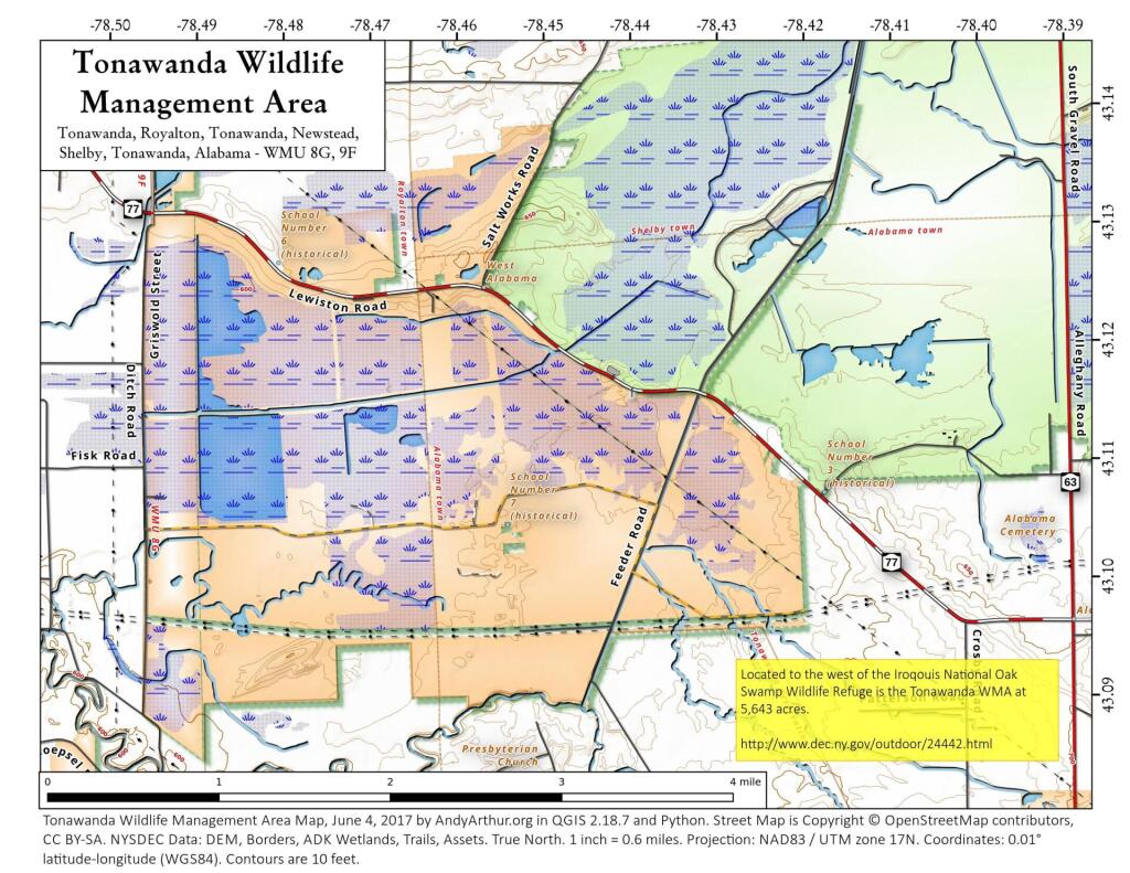
Map: Tonawanda Wildlife Management Area
Download a High Resolution JPEG Image of the Tonawanda Wildlife Management Area or an Adobe Acrobat Printable PDF of the Tonawanda Wildlife Management Area.

Bookmark my free Interactive GPS Map for your phone:
https://andyarthur.org/ny
... shows your location as a blue dot in relationship to campsites, trails, state land. This online map requires cell service, won't work in remote country, so also bring a paper map.
Free Download of New & Historical USGS 1:24k Topograpic Maps
Interactive maps with backcountry and roadside camping: New York, Pennsylvania, West Virginia & Vermont. List of NYS DEC Lean-Tos and Firetowers.
Google Spreadsheet with Roadside, Primitive and Pay Campsites
More about Oak Orchard and Tonawanda Wildlife Management Areas...
The primary purposes of the Oak Orchard and Tonawanda Wildlife Management Areas (WMAs) are wildlife management, wildlife habitat management, and wildlife-dependent recreation. This 5,600-acre wetland tract is the western most of the two State waterfowl areas. Oak Orchard WMA is located in a historic wetland, the "Oak Orchard Swamp," created by a natural barrier across Oak Orchard Creek. This restriction is an outcropping of dolomitic limestone located at Shelby Center that resisted the cutting action of the creek and created a huge wetland upstream. The Tonawanda area is located in the Tonawanda Creek flood plain situated to the southwest of the Oak Orchard Swamp. Historically, spring flooding by Oak Orchard and Tonawanda Creeks provided temporary water areas for migrating waterfowl, but by late spring water levels would drop, leaving only scant nesting habitat. After the WMAs were acquired, water levels were stabilized by constructing several miles of dike and 60 water level control structures. To date, approximately 3,000 acres of permanent marsh have been developed which is used extensively by waterfowl for nesting and as a resting and feeding area during the spring and fall migrations.
http://www.dec.ny.gov/outdoor/24442.html
Maps and Interactives
Tonawanda Wildlife Management Area
John White Wildlife Management Area
... photos, maps and other content from from Oak Orchard and Tonawanda Wildlife Management Areas.