Map: Three Rivers Wildlife Management Area
Download a High Resolution JPEG Image of the Three Rivers Wildlife Management Area or an Adobe Acrobat Printable PDF of the Three Rivers Wildlife Management Area.

Bookmark my free Interactive GPS Map for your phone:
https://andyarthur.org/ny
... shows your location as a blue dot in relationship to campsites, trails, state land. This online map requires cell service, won't work in remote country, so also bring a paper map.
Free Download of New & Historical USGS 1:24k Topograpic Maps
Interactive maps with backcountry and roadside camping: New York, Pennsylvania, West Virginia & Vermont. List of NYS DEC Lean-Tos and Firetowers.
Google Spreadsheet with Roadside, Primitive and Pay Campsites
More about Three Rivers WMA...
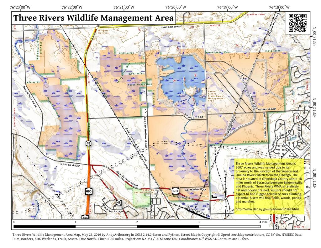
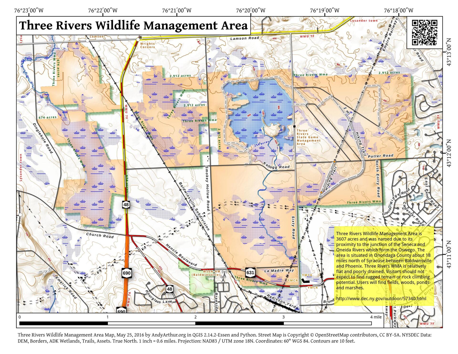
The Three Rivers Wildlife Management Area (WMA) was christened "Three Rivers" because of its proximity to the junction of the Seneca and Oneida Rivers which form the Oswego. The area is situated in Onondaga County about 18 miles north of Syracuse between Baldwinsville and Phoenix. Interstate 690 and NYS Route 48 provide easy access to the area.
The primary goals and objectives of the Three Rivers Area are to provide habitat for a variety of wildlife and to permit compatible public uses of the land. Considerable management and development work has been carried out since the 1940's. Twenty-nine water units totaling over 250 acres have been constructed. These include potholes and small marshes ranging in size from ½ to 5 acres and one large marsh over 100 acres. Water level manipulation and draw downs are accomplished to encourage certain aquatic vegetation. Over 50,000 evergreens and shrubs have been planted to improve the diversity of habitat and to provide food and cover for wildlife. An annual system of prescribed burning is utilized to keep open fields from reverting to brush and trees. Development and management activities are carried out with monies derived mainly from hunting license fees and federal taxes on sporting arms and ammunition.
Maps and Interactives
Pond
Three Rivers Wildlife Management Area
... photos, maps and other content from from Three Rivers WMA.