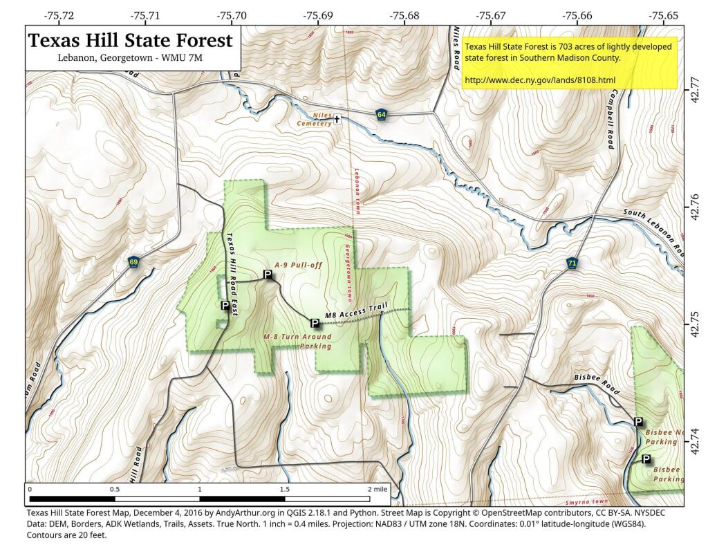
Map: Texas Hill State Forest
Download a High Resolution JPEG Image of the Texas Hill State Forest or an Adobe Acrobat Printable PDF of the Texas Hill State Forest.

Bookmark my free Interactive GPS Map for your phone:
https://andyarthur.org/ny
... shows your location as a blue dot in relationship to campsites, trails, state land. This online map requires cell service, won't work in remote country, so also bring a paper map.
Free Download of New & Historical USGS 1:24k Topograpic Maps
Interactive maps with backcountry and roadside camping: New York, Pennsylvania, West Virginia & Vermont. List of NYS DEC Lean-Tos and Firetowers.
Google Spreadsheet with Roadside, Primitive and Pay Campsites
More about Texas Hill State Forest...
Texas Hill State Forest, is a 704-acre forest characterized by gentle and rolling terrain. There are no formal recreational trails or facilities on this state forest. A single public forest access road can be used to enter the forest.
The forest is located mostly at an elevation of almost 2,000 feet and is about two and a half miles east of the village of Georgetown. Though there are no ponds or trout streams, a tributary stream to Pleasant Brook begins here. The forest offers good hunting for deer, grouse, turkey and woodcock. Winter access is poor.
At-large primitive camping is allowed.
http://www.dec.ny.gov/lands/8108.html
... photos, maps and other content from from Madison County, NY.