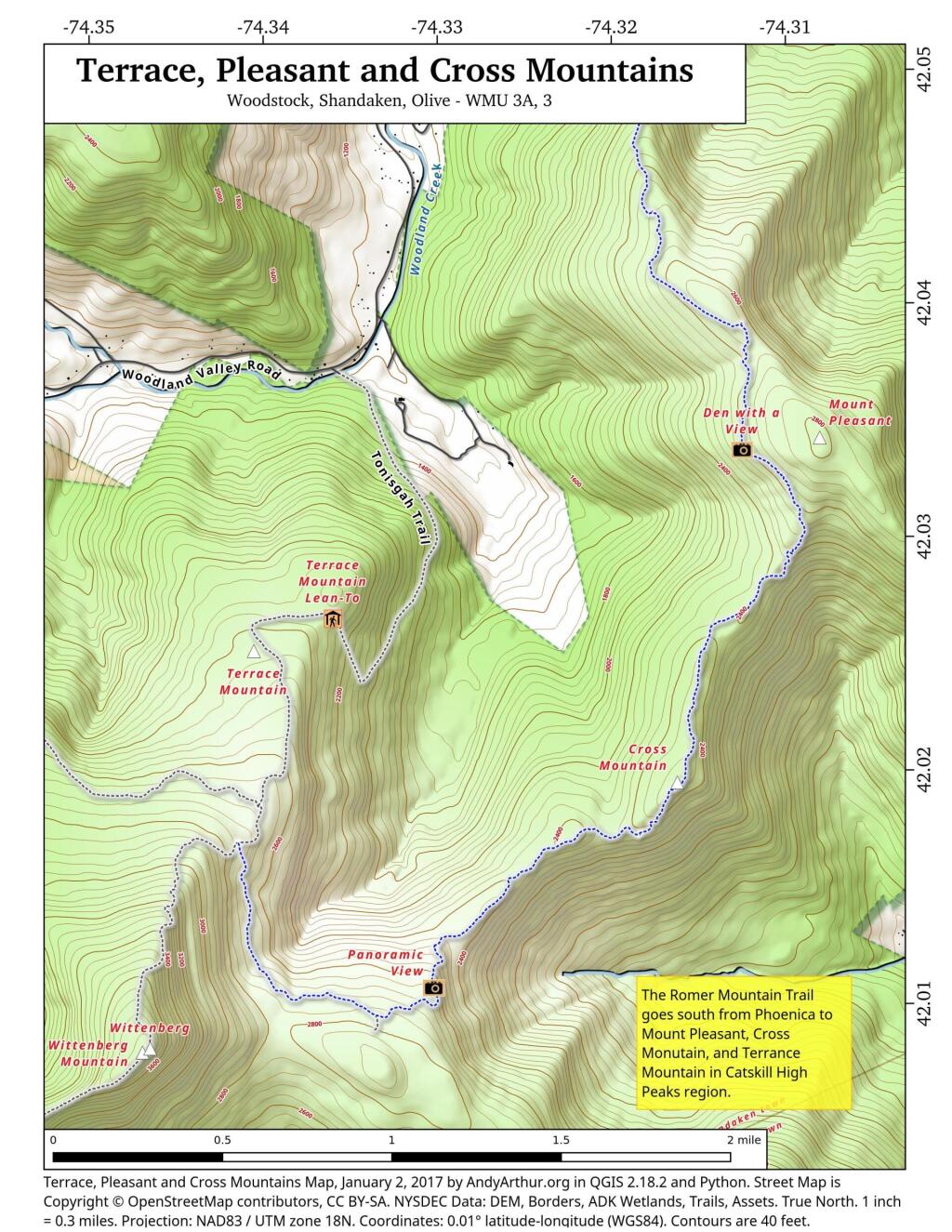
Map: Terrace, Pleasant And Cross Mountains
Download a High Resolution JPEG Image of the Terrace, Pleasant And Cross Mountains or an Adobe Acrobat Printable PDF of the Terrace, Pleasant And Cross Mountains.

Bookmark my free Interactive GPS Map for your phone:
https://andyarthur.org/ny
... shows your location as a blue dot in relationship to campsites, trails, state land. This online map requires cell service, won't work in remote country, so also bring a paper map.
Free Download of New & Historical USGS 1:24k Topograpic Maps
Interactive maps with backcountry and roadside camping: New York, Pennsylvania, West Virginia & Vermont. List of NYS DEC Lean-Tos and Firetowers.
Google Spreadsheet with Roadside, Primitive and Pay Campsites
More about Terrace Mountain...
Accessed from the Burroughs Range Trail, the Terrace Mountain Trail is a short and easy hike with a very gradual descent, ending at the Terrace Mountain Lean-to. Bare rock outcroppings and low blueberry bushes best characterize the open "meadows" interspersed along the trail. NOTE: there is no water source at the Terrace Mountain Lean-to.
http://www.dec.ny.gov/lands/9150.html
... photos, maps and other content from from Ulster County.